Pondering the Past at Pondicherry Park

Before today’s deluge began, I slipped into Pondicherry Park in Bridgton, Maine, to fill the innermost recesses of my lungs with November air, and at the same time my brain with memories of so many people who have traveled these trails with me from Ned Allen, former executive director of Bridgton Historical Society, to Loon Echo’s Jon Evans, and Lakes Environmental Association’s Alanna Yanelli and Mary Jewett, and friends and friends and friends, including the late JoAnne Diller, Sue Black, and Jinny Mae. But today’s journey also included memories of one I took two years ago with Becky Cook, who shared her remembrances of growing up along South High Street and romping through these trails as they were part of her backyard. If anyone ever had a sense of this place, it is Becky.

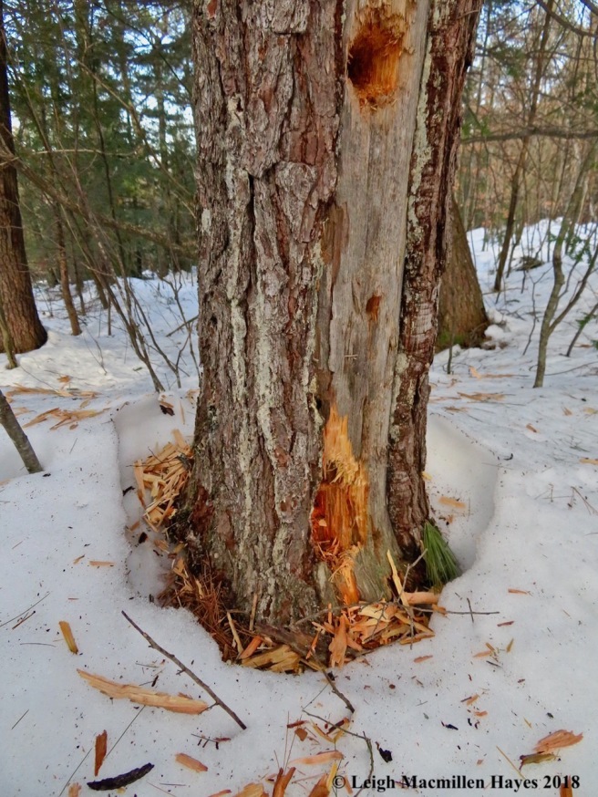
My journey began at the Bob Dunning Memorial Bridge, the main entryway into the park if you approach from the town parking lot on Depot Street behind Reny’s Department Store.

Bob Dunning, who died suddenly in November 2007, was a builder, an artist, and among other things, a teacher–sharing his craft with students young and old. To honor Bob, who treasured traditional building techniques, his friends and fellow craftspeople designed and built this bridge in a true barn-raising fashion. To learn more about the bridge, check out this previous wondermyway post: Barking Up A Bridge.

The bridge spans Stevens Brook, the source of power when Bridgton was first founded and for many years thereafter.

But today’s tale is about the the land beyond the bridge.

And the three properties I tried to circle on this 1871 map.

They are the same properties circled above to give a sense of place. Well, I may be off a wee bit in my drawing techniques, but it provides an idea of the land that was first owned by Thomas Cleaves, Dr. Nathaniel Pease, and Osborn Foster.

According to the 1870 census, Mr. Cleaves had 20 acres of improved land. His farm was worth $2,500 and equipment $75. For animals, he had 2 horses, 3 cows, 2 oxen, and 1 swine. His crops included wheat, corn and oats.

Dr. Pease had 20 acres of improved land and 50 acres of unimproved land. The value of his farm was $2,000, while his equipment was worth $75. Likewise he had 2 horses, but only 1 cow, plus 2 oxen, and 1 swine. Corn and oats were his crops.

Mr, Foster owned 40 acres of improved land, and his farm’s value was also $2,000, with the equipment at the going rate of $75. He had 1 horse, 2 oxen, and 1 swine. He also produced corn and oats. (One might note that there was a corn canning shop on the eastern side of Stevens Brook)

As time went on, Henry Moxcey acquired the Cleaves house. His occupation was farming and traveling according to the 1930 census. He lived in the house valued at $10,000 with his wife, Hattie, and daughter Hazel.

Next door, Charles Kneeland had taken ownership of the Pease property in 1881. In 1919, it became the property of his daughter Florence, wife of Alfred Keene. They lived there with their young children, Adria and Maurice. I couldn’t read the value of their home on the census, but Alfred owned a radio set. The 1930 census reflected the emerging values of early twentieth-century America, in particular the growing influence of consumerism and mass culture, thus it included a question about radio sets.

I’m not sure of the exact year, but Osborn Foster’s house was sold to Edward Carman. Charles Hermann Cook then purchased the home valued at $5,000. Herman was overseer in the finishing room at Pondicherry Mill (wondermyway: Milling About Stevens Brook). He lived with his wife Lula, son Enoch, and Edith Foster, who was their housekeeper (she was 43 and widowed).

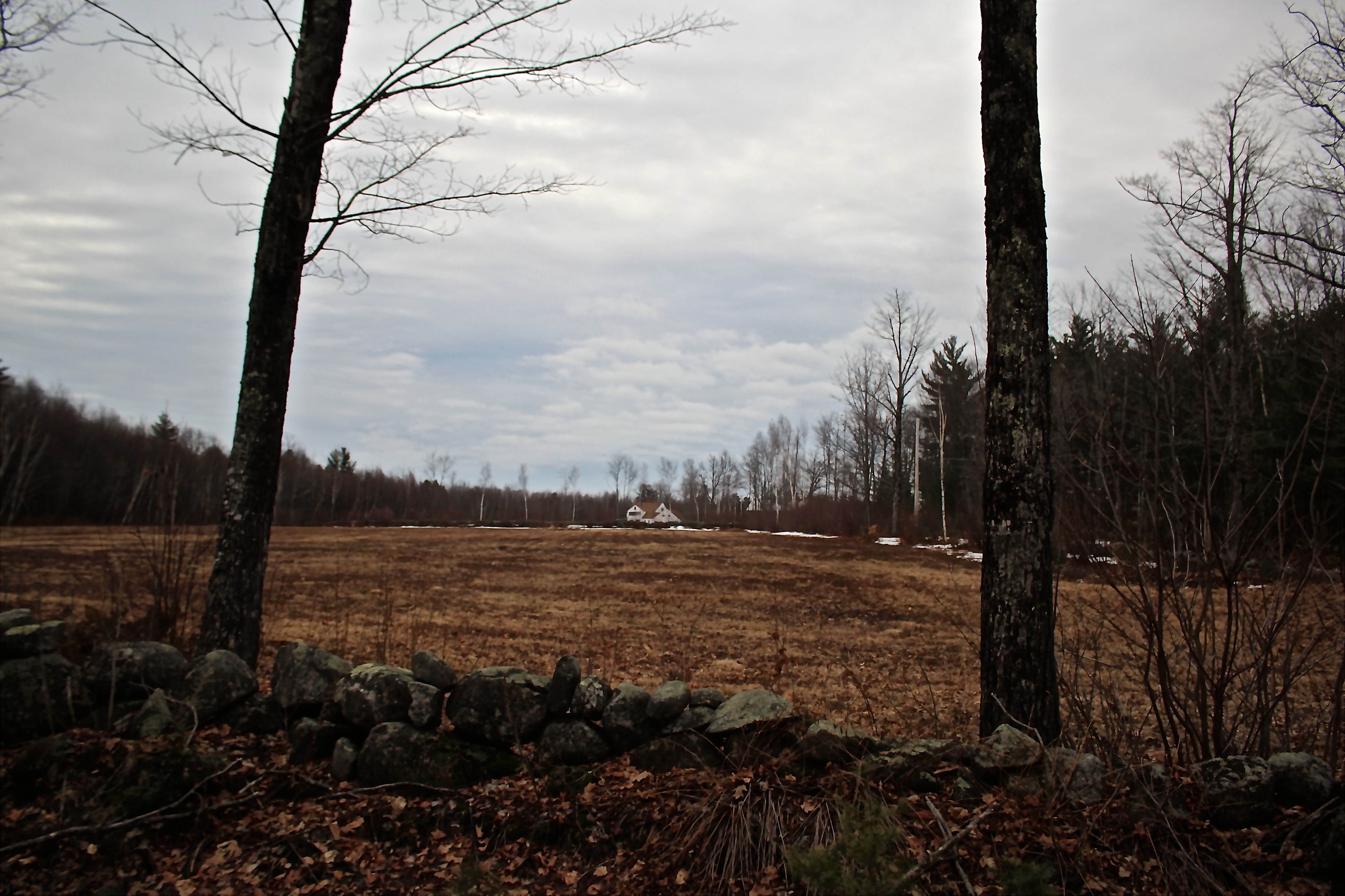
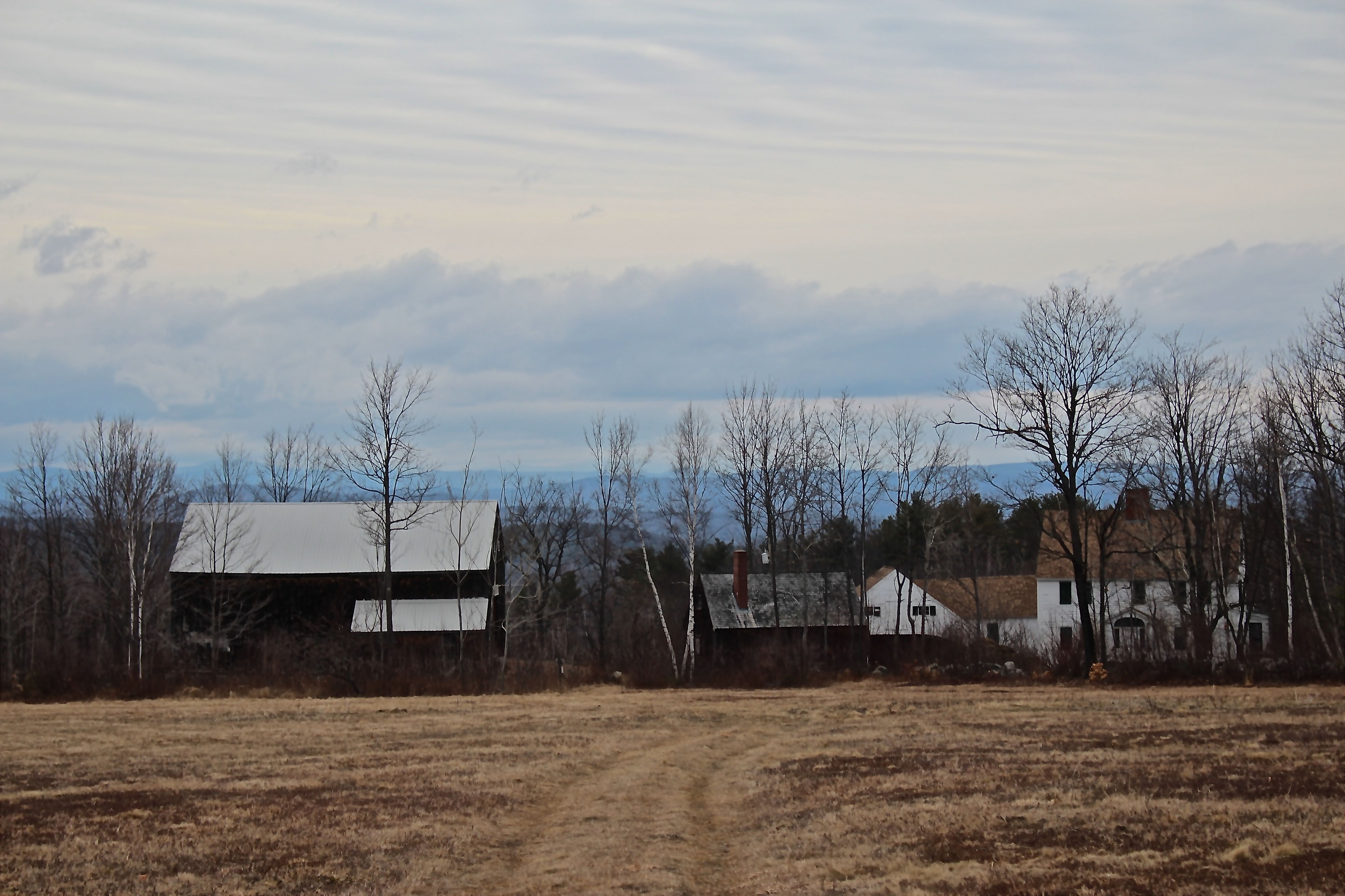
Looking a the open field in the park, the houses/field to the west are the subject of the journey. While the homes remain private, the land that became the park was purchased in a collaborative fashion by Loon Echo Land Trust and Lakes Environmental Association through the generosity of many donors, as well as grant monies. After placing it under conservation easement with LELT, constructing entry points and trails, it was gifted to the town of Bridgton in 2012. The park consists of 66 acres of quiet woodland and 3,200 feet of stream shore in the heart of downtown Bridgton, making it one special place.

If you’ve stayed with me, this is the point where Becky’s story will enhance the tale. She is the daughter of the late Enoch and Hazel Cook, and granddaughter of C. Hermann Cook. My guy had the privilege, like so many others, of being taught by Mrs. Cook and still loves to talk about her. She passed away a few years ago, or maybe it was a few years before that, but he last visited her on her 102nd birthday and listened as she shared stories of her classroom and students as if she had only stepped out of school yesterday.

One of the first stops Becky and I made two years ago was at Kneeland Spring, pictured above. The water bubbles through the sandy bottom and so the spring never freezes. Even in July, Becky said, she remembered the water being ice cold. Notice the moss-covered split granite–I didn’t take a photo of it today, but just above there are several rock samples that may have been the source as they feature drill holes a farmer would have created to split the stone. Pin and feathering was a technique that required a person to drill holes along the grain of the stone, fill each hole with two semi-cylindrical pieces of iron, and drive a steel wedge between them.

To Becky, standing by the spring and looking west (uphill toward South High Street) brought back memories of running through fields as a kid. Below the spring she recalled there being woods and a boggy area.

She told me that Mr. Kneeland had livery stables beside his house for his horses and cows. The Keenes, who inherited the land, didn’t have any horses or cows. But Bob Dineen, who lived across South High Street, used the pastures for his work horses and cows. “You could ride them,” said Becky. “And I wasn’t particular. I could ride a cow just as easily as a horse.”

For many years I thought it was local lore that Hannaford Brothers purchased water from the spring, but Ned Allen shared this document with me. Apparently, this was coveted water.

Throughout the park one might spot numbered Roosters. By using either the Bridgton Historical Society’s free app, or picking up a brochure at the kiosk, you can key in on descriptions of historic locations in the park. I’d spent a few years feeling that the info for #4 wasn’t accurate, but Becky set me right.

You see, according to the description, #4 states this: Barway, This gap was left in the stonewall to provide an opening to pass through. A log would be placed across the gap so it could be closed up again and continue to keep the livestock contained.

In my brain, the stones had been moved to create the gap so the park trail could pass through it.

According to Becky, this was the wall that formed the boundary between the Keene/Kneeland property and the Cook property. She remembered a much smaller gap, but still there was one.

Off trail there used to be an old rail on the ground that referenced the Narrow Gauge Train that ran beside what is now the park. After the train stopped running in 1941, either Becky’s father or grandfather or both took advantage of the old rails and used them when necessary, such as for the ties of bridges, this one having been located along what was a rough road from the Cooks’ home on South High Street down to their camp on Willet Brook, which meets Stevens Brook in the park.

Before going to the site of the camp, I traveled along a spur trail, which I often do because I love the reflection it offers . . .

in any season.

When I traveled the trails with Becky, I was so grateful because she opened my mind to some of what had come before, including the family camp, this photo from the Bridgton Historical Society’s collection.

In its day, it was a single family camp at 1360 Willet Brook Shore owned by C. Hermann Cook and his family. Becky recalled it having a couple of bedrooms on the western side, which you see here, a kitchen, and a long living room spanning the front. French doors opened from the living room onto the porch. And she remembered evenings when her parents would wind up the Victrola and people danced out one door, across the porch, and back into the living room through another porch.

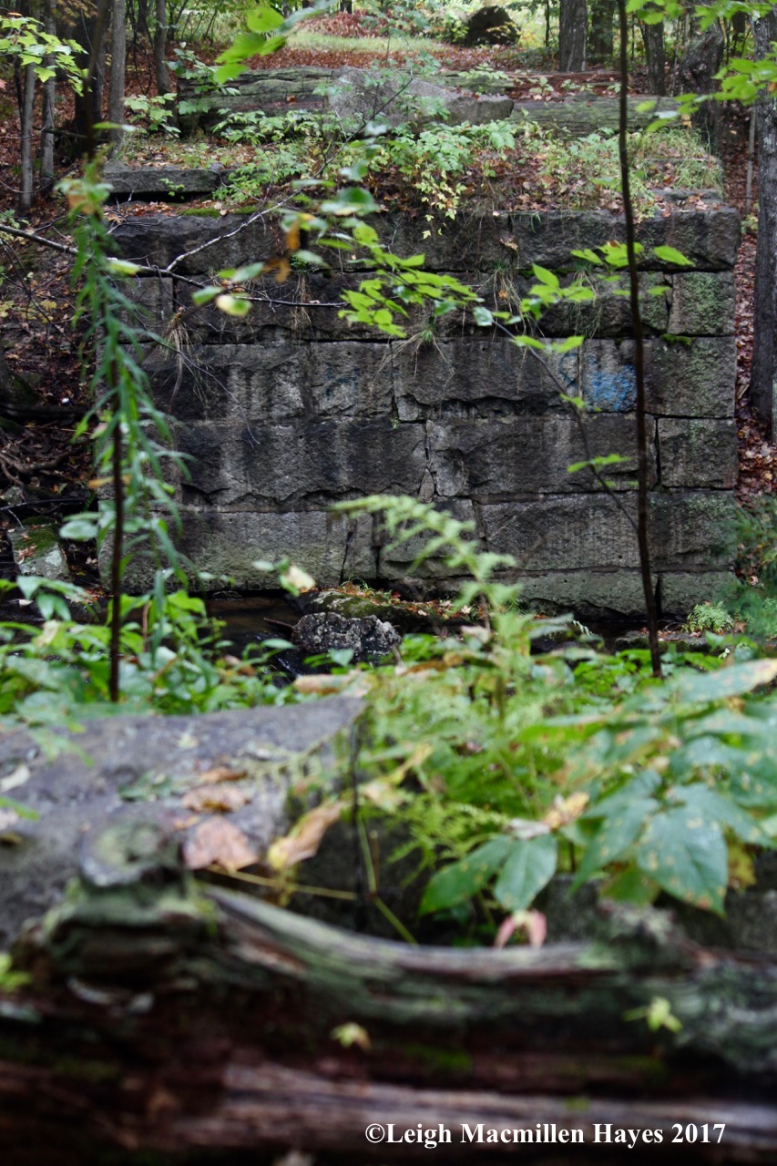
All that’s left of the camp, sadly, is the chimney and a foundation wall. In 1968, some kids began to make a habit of partying in the camp. According to Becky, they figured if they created a fire in the fireplace someone might spot the smoke rising from the chimney. Instead, they created a campfire in the middle of the living room floor. Several time, apparently, this happened. Their frivolity ended, however, when they accidentally burned the camp to the ground on what became the final party.

Becky was sad to lose this beautiful place. She did recall with humor, however, the adventures she and her brother, Tim, shared as it was their responsibility to clean snow off the roof. With Tim at the helm, and Becky holding on for dear life, they’d zoom through the fields and woods on a snowmobile to reach the camp.

Standing with my back to the chimney, I tried to imagine another scene Becky painted for me: this once was a cove filled with water. Her grandfather Hermann kept a boat here and often fished.

It began to make sense because at that time the mills were in use and they would have dammed the water in various locations in order to have power to run turbines.

Looking west from the chimeny, one gets a sense of the camp road. Though it looks rather level now, roots were often an issue. Becky told me that the vehicles of yore were high-wheeled and high-bottomed so it wasn’t really a bother.

Continuing up the “road,” a visit to the park doesn’t feel complete with stopping by to say hello to the Yellow Birch growing on a pine nurse stump where life is richer than we can imagine. It turned out that Becky was also a frequent stopper at this statue. Some tree species, especially those with small seeds, cannot germinate on leaf litter and need high-porosity seedbeds. Yellow Birch is such a species that requires mineral soil or deadwood to germinate. Hemlock is the same.

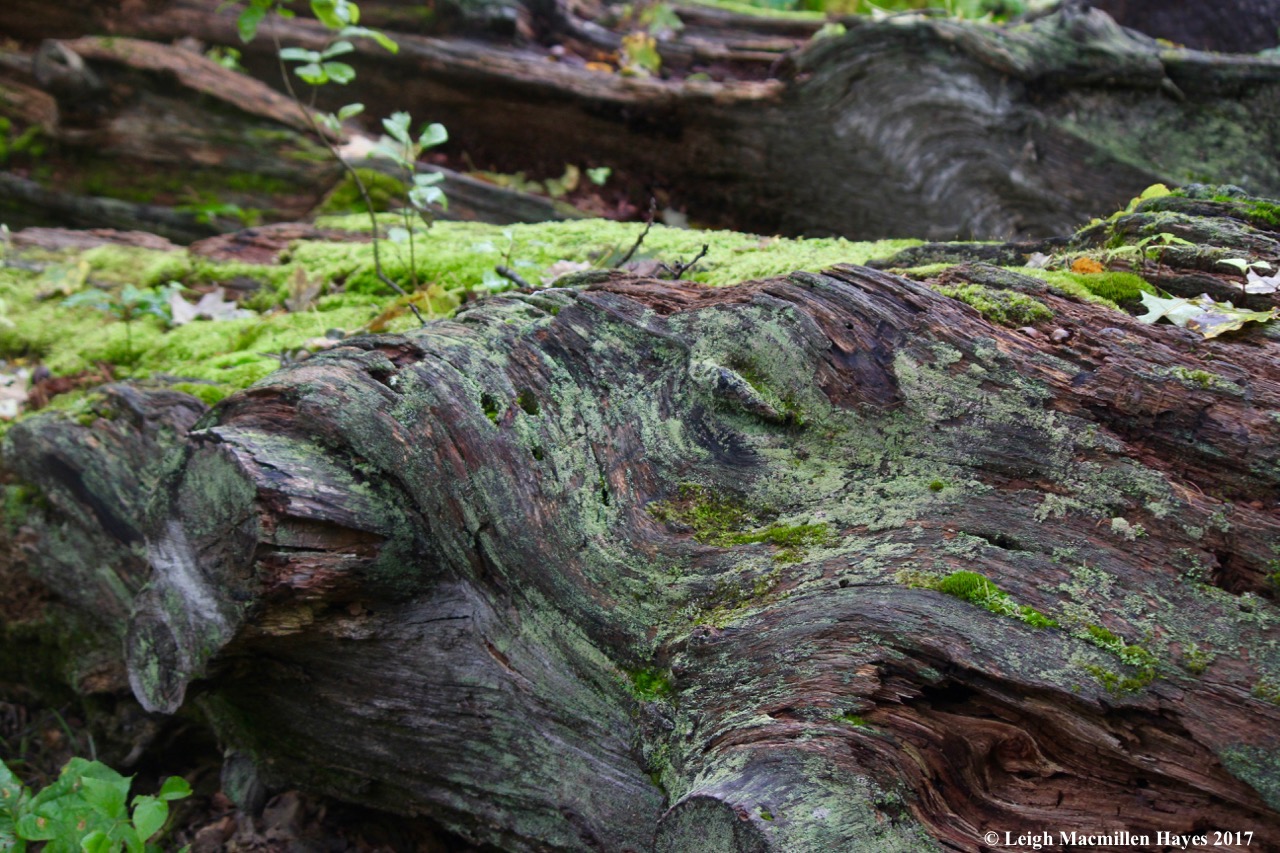
A bit farther along, the stonewalls begin to state their presence. They are powerful reminders that land that is now forested was once cleared and cultivated. Somer are single walls, such as this, built with large stones, where the land below is much lower than the land above, suggesting that the “short” side was plowed regularly and much more frequently than the tall side. Plowing tends to push soil against a wall. I don’t know when these walls were constructed, but some intense wall building occurred between 1775 and 1850. The majority of New England walls were dry built, meaning the stones were kept in place by skillful arrangement and balance.

A short distance above is a different type of wall. It’s a double-wide wall with larger stones on the outside and smaller filling in between. These were indicative of a garden wall. They weren’t high so as to keep livestock in or out. Instead, they became the place to toss all the stones that pushed to the field’s surface with the annual freezing and thawing. The smaller stones would likely have been the spring “crop” over the course of many years that were removed from the field by women and children. Remember, these farmers were growing their own grains. From Becky I learned that her grandfather had a commercial strawberry field. Usually such fields were between 2 – 4 acres, thus being the optimal size for moving stones from the center to the edges.

What grows best here now is the invasive Norway Maple. It’s not native to Maine and is aggressive in nature. This type of maple was planted along roadsides as a shade tree after the demise of elm trees. The leaf is similar to a Sugar Maple, but much more rectangular (boxier) in shape. And . . . while the Sugar Maples have lost their leaves by now, the Norway Maples hold on to them for a much longer time period.

Because it had started raining in earnest and I could barely see through my glasses, I knew it was time to draw today’s journey to a close. But, there was one last place to pause–in a pasture with a small opening in the boundary. The Kneeland/Keene homestead can be seen through the opening. If I turned around, which I didn’t, I knew that I could follow another old “road” down to Kneeland Spring. And to my left as I looked up at the house, would have been the Cooks’ property (eventually they moved across the street), and to my right the Cram/Cleaves/Moxcey property now owned by the Russos, which actually serves as a farm today, albeit on a much smaller scale. (All have passed through one or two or more hands of ownership.)

One final note (or maybe two): It has been said that Pondicherry was the name of Bridgton before Moody Bridges surveyed the land for the proprietors. The source of the name has been questioned–was it so called for a union territory in India or for the cherry trees that grew by the ponds?

Perhaps there’s another choice to ponder–was it named by indigenous people before people of European descent thought the land was theirs to occupy and own? That’s another story that needs to be researched.

As for today, I’m so glad the rain didn’t keep me home and I once again made time to ponder the past in Pondicherry Park.

Lake Living: Fall/Winter 2020

Since 2006 I’ve had the extreme pleasure of working with editor and publisher Laurie LaMountain and graphic designer Dianne Lewis to produce Lake Living, Southern Maine’s Lifestyle Magazine.

As any issue is, this one is chock full of information about interesting people and places that make western Maine so special. Before I plug my own articles, I highly encourage you to read Laurie’s “Marking Time”–about a Veterinarian turned Clock Doc. Yup. And then there’s Perri’s “Full of Beans,” which is full of recipes, but also her inheritance. You have to read it to understand what I mean. There are also three articles about local interior designers, though I’m still biased and stand by Melissa, whom we used for our kitchen redo. And then there are the book reviews from Pam and Justin, Perri, and Sue at Bridgton Books. All worth a read.

I kinda think my articles are also worth a read. The first, “Before Suitcases,” is about a local woman named Connie, a former national sales manager at a footwear company who gives old trunks a new life.

“Every trunk is my baby,” says Connie.

“I take pride in what I do, and I love the end result.”

She treats each one as if it is going into her own home, which of course it can’t because there’s not enough room.

Have an old trunk hanging around that you’d like Connie to refurbish so you may use it as a decorative piece of furniture? You’ll have to read the article to get her contact info. Oh, and she ships around the globe so distance isn’t a hardship. 😉

And then there’s “A Partnered Project,” about Bridgton Historical Society and Loon Echo Land Trust and the newly created graded gravel walking trail that the two non-profit organizations have built.

The trail crosses by BHS’s Narramissic homestead and winds its way through LELT’s Peabody-Fitch woods. It’s a delight to walk and I hope a delight to read about because it also includes a wee bit of history.

For the wee bit more adventurous, there’s another trail that heads up to and circles through five old quarries.

The impetus behind the collaborative effort was this man who spends his free time mowing the fields at Narramissic: Jon Evans, LELT’s Stewardship Manager, and BHS’s vice president.

And the two guys who pushed forward through grants and other fundraising efforts to make it all happen, Ned of BHS and Matt of LELT, each organization’s executive director.

The overlap between the cultural and natural history brought these two organizations together in this partnered project and the end result is something everyone can benefit from whether young or old, agile or frail.

Please know that though the trails are open, this is a work in progress for both organizations and your financial support is needed.

But for me the crème de la crème of my articles is “Ready for Business,” about a local family who found a way around a babysitting issue during the current pandemic. Just as the Peabody-Fitch families operated a farm that included the children’s help at Narramissic in the late 1700s – early 1900s, the Warrens are currently doing the same. Bruce and Kyle Warren, the father/son team of Warren Excavation, were hired by BHS/LELT to build the gravel trail, and Kyle’s kids helped. Six-year-old Tillie and her younger sister quickly adapted to driving small trucks filled with dirt and gravel.

The pedals were adjusted so Hazel and Tillie could reach them. While at work they were all business. Though there were plenty of moments to play in the dirt and even a few special treats thrown into the mix.

Their two-year-old brother, Archer, was part of the management team, not saying much, but keeping an eye on all the action.

I had the pleasure of seeing the girls in action and walking beside them on the trail they’d help build. This place will always be a part of them, and that’s mighty special.

Lake Living Fall/Winter 2020

In my (un)biased opinion, the entire issue is mighty special. I do hope you’ll take time to savor it. And then support the local businesses that support the magazine (even if you are “from away,” you can still access some of them online) so we can continue to bring it to you for free. Remember to tell the business owners where you saw their ads.

Happy Reading.

Bear to Beer: Peabody-Fitch to Bear Trap

Our bear to beer tour was supposed to last a year, but here it is February 18, and we’ve already completed three of the treks. I think my guy really likes this Christmas present.

If you aren’t aware, for Christmas I gave him a small box I’d decorated with hiking stickers. Inside were thirteen pieces of paper (actually bobcat prints post-its) upon which I’d written the name of a trail where I thought we might find what we call bear trees for they are trees with bear claw marks, plus a place to grab a pint after the hike.

Because it was snowing today, we decided to stay closer to home and visit a property we hope Loon Echo Land Trust will soon own. It surrounds the Bridgton Historical Society’s Narramissic Farm and is one of our favorite places to wander in any season.

Rather than cross through the field as we usually do, I suggested that we follow the former road (current snowmobile trail) behind the barn. At the first stone wall, we passed from the Narramissic property on to what we hope will become the 252-acre Peabody-Fitch Woods that Loon Echo will own once they reach enough dollars to make the purchase.

Another part of my guy’s Christmas present was a donation toward said purchase, which an anonymous foundation will match. It seemed like a win-win deal when I sat down with Thom Perkins, former executive director of LELT to discuss the property proposal. And then last month I co-led a walk along part of the route we followed today and had the joy of learning more about it from Jon Evans, Loon Echo’s Stewardship Manager, and Matt Markot, LELT’s new executive director.

Not far down the snowmobile trail, we turned left at a stone wall, the same as we had during the LELT walk in late January. I was sure this was a route new to my guy, but it turns out it used the be the snowmobile trail and so he knew it. Right away, as we hobbled over and pulled up some downed trees, we began to see a variety of mammal prints muffled by the morning’s snow. Both prey and predator make their homes there and the property’s importance as part of the animal corridor was obvious.

Eventually, the trail swung around and rejoined the snowmobile trail. We followed it for a bit, then turned off at the blue arrow for that was our chosen way for today. It appeared that someone had an eye on my snowshoes.

We’d no sooner started along the trail when I heard the rat-a-tat drumming of a male hairy woodpecker. Of course, I needed to pause and watch him for a few minutes. And wonder about the purpose of his drumming. Was he establishing territory? Trying to get a date?

My guy was patient with me, but our mission was about more than the birds, and so we journeyed on. Mind you, we kept looking at the trees along the way, but suspected we’d find bear evidence on our return trip when we planned to go off trail. In the moment, we were eager to get to the quarry and find lunch rock.

It was buried, but my guy in his chivalrous manner, wiped the snow off and we each ate a slice of cold, homemade pizza and drank some water.

Behind lunch rock, plug and feather holes served as reminders of an earlier time–much earlier than either of us remembered. The quarry was the source of the stone foundations for Narramissic, the Peabody-Fitch Farm, which dates back to 1797.

With lunch under our belts, onward and upward we hiked until we reached a certain stone pile.

Mind you, it’s located a tad from the proposed Peabody-Fitch Woods, but still, we love to visit bear trap and imagine the past.

I’ve quoted this before, but it’s worth sharing again.

How did the bear trap come to be? According to an August 17, 1963 article in the Bridgton News, “Enoch Perley, early settler of South Bridgton, built his first house in 1777 and brought his bride to their new home in 1778. [I believe this was at Five Fields Farm.]

As Enoch acquired livestock, he was much troubled by depredations from bears. He built a bear trap on the hill back of his first home . . .

Tradition says that four bears were caught in this trap–not enough! So Mr. Perley later had an iron bear trap made which took care of eight bears. Without a doubt, many were disposed of by him personally. A story is told that in an unarmed encounter with a bear and two cubs beside a wood road at dusk, Mr. Perley allegedly strangled the mother bear with his garters . . .”

The article continues, “The bear trap is built of stone. A large stone door is suspended and as the bear takes the bait, he trips the lever and is caught in the stone enclosure.”

In a December 1954 issue of the Bridgton News, a brief article states: “The old stone bear trap on the mountain in South Bridgton known as ‘Fitch’s Hill,’ unused for more than one hundred years, has been reactivated by Dr. Fred G. Noble and Gerald Palmer and put in readiness to capture a bear.” As the story goes, they never did succeed.

In honor of the Perleys, Peabodys, Fitches, and the bears, we’d brought along a growler, a Valentine’s Day present from my guy to me.

We each enjoyed a few sips and then peered inside the trap to see if anyone had taken up residence. Perhaps we should have done that first! Thankfully, no one was home.

Eventually, we headed back to the trail, but didn’t spend long on it.

Instead, we began looking for bear trees. To test your visual acuity, can you spot my guy?

I couldn’t always see him for we split up for about an hour and zigzagged our way from one beech tree to another. I found one that gave itself a hug.

There were those with false lines. Well, they weren’t really false, but they weren’t caused by a bear either. Instead, surrounding saplings blowing in the wind had scratched them.

Then there was the tree that seemed to have stitch marks on the outside of its wound. Unfortunately, the stitches didn’t help.

One of my favorites was the beech that made me think it was a deer bending over as if to take a bow.

That made perfect sense in these woods where the deer did dine.

And at least one rubbed its antlers.

Suddenly, from a distance I heard my guy call to me. He thought he’d found what we sought. A bear tree. The growth at the top certainly leant itself to that assumption.

I’m not one hundred percent sure that he was right, but there were some marks that looked consistent with bear activity–a bear with a very big hand.

Closer to the trail, we did find another tree with bear sign–left behind by Teddy Bear and K.F., whoever that might be.

About three hours after crossing through the stone wall behind the barn to enter the future Peabody-Fitch Woods, we did the same at the far end of the farm field.

And in the end, even if our bear tree wasn’t exactly that, we’d still had a bear sighting–in the form of the trap. Today’s brew was Double C.R.E.A.M. Ale from Bear Bones Beer Brewery. Bear to beer possibilities: Peabody-Fitch to Bear Trap.

Babe in the Woods

This morning dawned bright and brisk and offered a brilliant background for a journey through the almost Peabody-Fitch Woods that Loon Echo Land Trust hopes to add to their holdings. The 252 acres of the proposed project surrounds Bridgton Historical Society‘s Narramissic Farm.

Jon Evans, Loon Echo’s Stewardship Manager and board member of the historical society had asked me to join the walk that would highlight the Peabody-Fitch Homestead built in 1797 and introduce Loon Echo’s new executive director Matt Markot. In the morning light, we circled the house as Jon shared some of the farm’s story.

On the northern side of the house, we paused to enjoy the view, including Pleasant Mountain just beyond the trees to the left of the field. The land trust also owns and protects over 2,000 acres of the mountain that defines this area of western Maine.

Measuring the effect of the cold on the hike’s participants, Jon chose his stop points, where he shared his keen knowledge of the farm and the lands that surround it. For me, it’s always a joy to tramp with him because his connection to the land is personal, and this particular piece even more than most for Jon’s family long ago farmed an adjacent acreage and he grew up traipsing through the very woods we snowshoed today. (And this photo includes Margaret Lindsay Sanborn, mother of Matt Markot, LELT’s new ED who stands to his mom’s right.)

As we circled behind the barn I shared with Jon a bit of knowledge that adds to the lore of what’s always been known as the Temperance Barn, supposedly constructed during prohibition without the usual swigs of rum for all who helped in the building process. Following a blog post I wrote in December 2018 about this very property, a granddaughter of Margaret Monroe who gifted the property to the historical society in 1987 wrote the following message: Hi – I am glad you enjoy my grandmother’s property. A heads up that there is no written documentation from the period re: the barn actually being built without alcohol. My grandmother was prone to making up history. I want to give respect to hardy native Mainers: Monroes were largely summer people. My grandmother also said sherry wasn’t alcoholic and would drink a big glass of it every night before dinner, Lark cigarette in her other hand. Happy Holidays! Rebecca Monroe

It turns out that wasn’t the only story that had more to offer than I’d originally thought to be true. As we were about to pass through a stonewall behind the barn, my eyes cued in on debris below some trees. Certainly it was the work of woodpeckers and I stepped onto the wall in search of scat. Nada.

Looking up at the pin cherry tree, I found not pileated works, but the incisors of another that gave a clue.

And below, pigeon-toed tracks. Between the incisor marks and tracks I knew the creator, but it didn’t make sense to me, for though I find hemlock twigs below such a tree when a porcupine has clipped them, I couldn’t recall ever seeing bark chips below a porky tree. In my brain, the rodent ate the bark as it sought the cambium layer within. I dismissed it as a lesson to be considered and we moved on.

Jon led us along a colonial road from the historical society’s property to a stonewall that delineated the Peabody-Fitch Woods. We turned onto a trail I’d never traveled before and made our way along another farm road. Periodically, Jon, Matt, and I bounced off of each other as we shared our knowledge about the trees and forest succession that had occurred since the farm was last a working land. We also spied a few mammal tracks, including those of a bobcat.

At last, we circled around and found our way back toward the border between the P-F Woods and farm.

Close to the Temperance Barn again, porcupine tracks crisscrossed to the stonewall where we’d seen their activity at the start of our journey.

Near the parking lot and Blacksmith Shop, more porcupine works made themselves evident–by their tracks and the debarked trees.

Incredibly debarked trees. I’m always amazed by the fact that porcupines, given their size, can find support on trees and limbs that seem so flimsy. I’ve been told that they’re known to have many broken bones and it makes sense given the precarious choices they make to seek winter nutrients.

Once again, there was bark debris. In the past I’ve always said that beavers leave wood chips, but porcupines eat the bark and cambium layer.

The evidence was obvious given the prints and comma-shaped scat. But the bark debris proved me wrong today.

And I loved that. When Jon first introduced me as a Maine Master Naturalist, he asked how long I’ve been such. “Six years,” I said. And though I’ve spent my sixty years wandering and wondering in the woods and along the coast of southern and northern New England, it was the Master Naturalist class that taught me how to take a closer look.

Do you see the green of the cambium layer? And those incisor marks–how they are at opposing angles? Those I recognized.

But . . . the porcupines taught me something new today.

Six years–I’m still a babe in the woods.

Merry Christmas from Narramissic

With Christmas rapidly approaching I decided to visit Narramissic, the Peabody-Fitch Farm gifted to the Bridgton Historical Society in 1987 by Mrs. Margaret Monroe of Providence, Rhode Island.

I had the honor of knowing Mrs. Monroe’s daughter, Peg Norman, who essentially grew up in the house having spent all of her summers there. Her mother purchased the house in 1938 after the death of her father. In Peg’s words as recorded in an essay entitled “Narramissic – Hard to Find” that she wrote when the deed was transferred from her mother’s estate to the historical society, she said, “[Mother] was searching for a refuge, a place to heal.” 

Peg continued, “Inside the house I remember only clothes hung everywhere and an unmade bed in the upstairs sitting room. My mother saw beyond. She saw the fans over the doorways, 

the granite hearthed fireplaces, Nancy Fitch’s name engraved in the wavey glass window pane, the sweeping arch of the carriage house entrance . . .

and the mountains, purple massifs unfolding out of the sky. She felt the history and eternity and peace.”

Peg went on to mention that her family spent “many Christmas holidays and ski weekends up there throughout the years — just the way the Peabodys and Fitches had (the original owners of the farm), heated by the kitchen stove and blazing fireplaces — and an old Franklin stove my mother finally allowed to be set in the living room fireplace ‘just for winter.'” 

Peg’s mention of the outbuildings included the barn, “the huge barn with the biggest horse I had ever seen munching contentedly in the front stall.”

Still standing, though its had some help recently to that end, the barn was erected by the Fitches and has come to be known as the Temperance Barn; historical records claim it to be so named “because it was raised without the traditional barrel of rum.”

I chose to explore on this delightfully warm day(45˚ feels like summer given the recent temps), but also to gain a better understanding of the collaboration between the historical society and Loon Echo Land Trust as they raise funds to purchase the 252-acre Peabody-Fitch Woods from the Norman family and place it under conservation easement while adding to a contiguous forest with other protected properties both adjacent and nearby. As I crossed the field, I kept turning back–to admire the farm and the mountains, including the ridge-line of our beloved Pleasant Mountain. Between Loon Echo and The Nature Conservancy, almost 3,000 acres of the mountain is protected and LELT maintains the 10 miles of trails that we frequent. 

It occurred to me that I didn’t realize the blue trail that crossed the field and continued into the woods, as designed by Adam Jones for his Eagle Scout Project in 1999, wasn’t part of the historical society’s property. 

And yet, it’s just as important for many species depend on it. Should the property be developed, the historical and natural features might diminish.

Should it be developed, I won’t be able to return in the future to figure out why the squirrel condominium featured a muddy carpet between doorways. 

Should it be developed, I’d miss out on ice formations along the trail such as this miniature pony — saddle and rider included. 

Should it be developed, new understandings would bypass me, such as the fact that white oaks do indeed grow in Bridgton. Well, at least in South Bridgton. This one was speckled with spring tails on this warm day. 

Should it be developed, the pileated woodpeckers will have fewer trees upon which to excavate. 

And selfishly, I’ll have fewer opportunities to search for their scat — filled with insect body parts. 

Should it be developed, there will be fewer toadskin lichens to admire. Thanks to the melting snow, many of the examples I found today were bright green, making the black-beaded apothecia where its spores are produced stand out in contrast. Toadskin lichen may be indestructible, but should the property be developed I wondered about the lichen’s immortality. 

Should the property be developed, where would the snowshoe hare scat? 

And the same for the ruffed grouse? 

Should it be developed, what would happen to K.F. and T.B.? 

Should the property be developed, would I see sights such as this and come to another new understanding?

I was actually searching for bear claw marks that alluded me (and I know they are there for I’ve seen them before) and instead saw this red bloom decorating some beech bark. It was quite pretty and festive given the season. 

At first look, I thought it was the apothecia of a crustose lichen, but do you see the tiny white spots mingled occasionally among it? Those white dots are the minute beech scale insect. The holes the tiny insect makes in the bark create a perfect entry point for nectria pathogen to make its way into the tree. The pathogen, a type of fungus, kills some areas of the tree at the point of entry. In reaction, the tree develops a canker as a defensive attempt to ward off the invader, but by doing so the canker blocks the vascular tissue of the infected beech by stopping nutrient flow in that one area.

And those red spots, as pretty as they appear, are actually tarry spots which ooze out of the cracks in the bark caused by the canker. Essentially, it appeared the tree was bleeding. 

Should the property be developed, what would become of the quarry and bear trap? 

This is the spot from which the foundations for the buildings were split so long ago.

Should the property be developed, would the plug and feather holes left behind as reminders of an earlier time disappear from the landscape?

The land already has been developed around Bear Trap, which is located at the end of the trail. We used to be able to hike or drive there; now one can only hike and you kinda, sorta need to know where it is.

How did the bear trap come to be? According to an August 17, 1963 article in the Bridgton News, “Enoch Perley, early settler of South Bridgton, built his first house in 1777 and brought his bride to their new home in 1778. [I believe this was at Five Fields Farm.]

As Enoch acquired livestock, he was much troubled by depredations from bears. He built a bear trap on the hill back of his first home . . .

Tradition says that four bears were caught in this trap–not enough! So Mr. Perley later had an iron bear trap made which took care of eight bears. Without a doubt, many were disposed of by him personally. A story is told that in an unarmed encounter with a bear and two cubs beside a wood road at dusk, Mr. Perley allegedly strangled the mother bear with his garters . . .”

The article continues, “The bear trap is built of stone. A large stone door is suspended and as the bear takes the bait, he trips the lever and is caught in the stone enclosure.”

In a December 1954 issue of the Bridgton News, a brief article states: “The old stone bear trap on the mountain in South Bridgton known as ‘Fitch’s Hill,’ unused for more than one hundred years, has been reactivated by Dr. Fred G. Noble and Gerald Palmer and put in readiness to capture a bear.” As the story goes, they never did succeed.

Should the Peabody-Fitch Woods be developed, all of this will be lost.

My hope is that the Bridgton Historical Society and Loon Echo Land Trust will experience a Merry Christmas as they finish out their fund-raising drive to purchase the land.

I think I walked beyond the boundary they are considering, but Bear Trap is one of my favorite historical sites. And with today’s walk I came to the realization of how important it is to protect the land around the farm.

Before I finish, I have one final historical piece of writing to share. In his memoirs, “Ninety Years of Living,” Edwin Peabody Fitch (1840-1931) who grew up in the farmhouse wrote, “Holidays were not much in evidence in those days. Christmas was so far in the shade, we didn’t think much about it. In fact, we felt that it was just a Catholic holiday and not be be observed by us. We went to school on that day and the only notice we took of it was to shout “Merry Christmas!” to the classmates. 

Merry Christmas from and to Narramissic! 

Remembering Sue

Our greater community has lost a remarkable woman with the sudden passing of fiber artist and historian Sue Black. Though we didn’t tramp together as often as we would have liked, when we did my journey was enriched as Sue added an historical observation to the context. And she was just plain down-to-earth and fun.

For years, she chuckled when she saw me in the audience of her talks about the mills along Stevens Brook that she gave each summer at Lakes Environmental Association. The talk was always the same, but each time I came away with a new understanding. And then I’d join her guided walk beside the brook the next morning.

As time passed, Sue couldn’t always lead the walk and so I had the honor of trying to fill her shoes. I was humbled by the experience, and though I could hear her whispering facts into my ears, I couldn’t add the personal touch that made Sue’s walks so enjoyable for she’d raised sheep and as she often demonstrated at various fairs and fests, she’d processed the wool, creating her own fiber.

At the mill sites, Sue brought the former activity to life again–albeit in our minds–with her detailed descriptions.Once or twice a year, Jinny Mae, Sue and I tramped together along other routes than the brook, always a journey that included stonewalls, dam sites and cellar holes left behind. Our mission, which we delightfully accepted, was to become sleuths and interpret the various scenes, looking for evidence of those who had come before.

I last saw Sue and her husband, Sam, two weeks ago and she and I started chatting about our next adventure with Jinny Mae. We knew the location, but hadn’t yet set the date.

Jinny Mae and I will continue to tramp, and will take Sue along in spirit, our lives forever imprinted with her smile and voice and love for the next adventure.

Two years ago I posted this blog about the mills along Stevens Brook and here it is again:

For Sue . . .

Milling About Stevens Brook

I must begin with a thank you to fiber artist, historian and friend, Sue Black. Sue has led numerous walks along the very trail I followed today and I’ve often been in her presence–usually with notebook in hand so I could jot information down and gain a better understanding of this place.

s-trail sign

Though she wasn’t with me today, I could hear Sue as I mosied along examining the old mill sites of the Stevens Brook Trail in Bridgton. And many of the words that follow are probably hers. I also gleaned info from the Bridgton Historical Society several years ago, when Sue couldn’t lead the walk and asked me to fill in. So I guess, really, what follows is like the confluence of the Stevens and Willet Brooks–two streams that meet to form one.

s-boardwalk under water

Bridgton was once a thriving mill town and Stevens Brook its source of power. Of course, to do this properly, I should begin at Highland Lake, the source of the brook, but  I’m not a proper-sort-of gal and you’ll have to bear with me. I didn’t begin at Pondicherry Park either–for the boardwalk was under water.

s-below Pondicherry

Instead, I slipped onto the trail at Depot Street, beside the Bridgton Community Center. By this point, Willet Brook has joined forces with Stevens, thus increasing the power of the water. I was backtracking, and again didn’t get far because of water flowing over the trail, but along the way I made a discovery. Those beautiful trees that lean over the brook–silver maples (Acer saccharinum). It never occurred to me that they grew here, but made perfect sense.

s-silver maple leaf

The backside of the deeply-lobed leaves are silvery gray in old age and silvery white during their prime.

I should have taken a photo of the old Memorial School because that was the sight of the train depot (Depot Street) for the Bridgton and Saco River Railroad that was built in 1883–a narrow gauge operating from Hiram, but didn’t think of it at the time. Instead, I followed the stone steps down, walked beside the brook as it ran below the deep bank by Stevens Brook Elementary School and came up behind a few old buildings, back on Depot.

s-food city bridge

And then I stood on the bridge overlooking Food City. I should note that this is power site #4. Yup, I’ve skipped the first three for now. Stick with me. We’ll get there. In 1822, this area of town wasn’t part of the main village–that was confined to Main Hill. A water-powered carding mill equipped to prepare wool for spinning, thus replacing the tedious hand work of disentangling, cleaning and intermixing the fibers was in operation in this area at the time. By 1825, James Flint and Aaron Littlefield built a sawmill, which they operated for 15 years. In 1840, this was the site of the Walker Saw Mill and Grist Mill. And then things changed. The Pondicherry Mill was built in 1865 to manufacture woolen goods. It was one of the most extensive manufacturing plants in Maine at that time and employed 50 operators. Standing where I was on the bridge, I could see the stones related to the mill and dam. The dam disintegrated in the 1960s.

s-coal trestle

s-trestle 2

In 1898, the neighboring town of Harrison wanted to be joined to the railroad and the RR owners obliged. From this spur, a trestle was built that carried coal in dump carts to the Pondicherry Mill. The structure has deteriorated immensely, but still stands as a monument to this moment in history. So wait, think about this coal situation. The mill had grown to employ 225 people and water power from the brook was no longer dependable. An immense coal-burning chimney about 100 feet in height had been added to the mill. Sixty looms produced 18,000 yards of cloth weekly. Though the building stood until the mid-sixties, the industry moved south long before that. The stones by the brook and trestle are all that are left to tell the story. A now-deceased resident, Reg Fadden, used to tell the story of knowing what color they were dying the wool on any particular day–he’d see the color in the water as he walked to school.

s-former millpond:5th site

Above power site #5, the land was flat and indicative of a former mill pond.

s-5th site

A stone dam and some other foundation work is all that’s now left. The first mill to be located here was a sawmill built in 1868. By 1871, a shovel factory was built on the west side, which was the side I stood upon. By 1899, the Bridgton Lumber Company had located to this power site, with two mills operating–one for boxes and house furnishings; the other for lumber. This apparently was a successful site because in 1911 it became the Burnham and Newcomb Sawmill, which was purchased by Harry Bisbee in 1920. He used a turbine since the water power wasn’t dependable. Though it gushed over the rocks today, in the summertime, this is the perfect place to sit on the flat rocks and dangle ones feet. I can’t remember if Sue told me this or I read it, but apparently there was a treacherous footwalk that crossed the brook in this area and even at age 90, Mr Bisbee would walk across. The sawmill eventually burned, with only the office remaining. This time using a diesel engine, Mr. Bisbee started a smaller sawmill. In 1953, the dam washed out with a flood and local lore has it that Mr. Bisbee walked out one day, leaving it all behind. He died a couple of years later, gifting the mill to the public library.

Charles Fadden and his son, Reg, bought the mill at auction and operated a box mill, using a turbine for power. The office was still standing until about ten years ago, when it collapsed.

s-narrow 1

By the mill, the Harrison Narrow Gauge crossed over a trestle; today only the stone stanchions remain. A sixth power site was never developed.

s-locust bark

It was here that I recognized another tree I don’t always encounter–a black locust (Robinia pseudoacacia). The bark appears almost braided.

s-locust pod

And below it, an old flat pod that contains bean-like seeds.

s-7th site, Johnson Falls

I followed a new trail (possibly private, but it wasn’t posted) and was delighted to get a better view of what I believe was power site #7.

s-lower johnson falls site 7

If I’m correct in my thinking, this is Lower Johnson Falls, and was the possible 1859 site of the Milliken Bedstead Factory.

s-remnants by Johnson falls

A foundation is still visible on the eastern side of the brook.

s-7th site, smith sash 1

Below power site #7, I came to the coffin shop. Hey, somebody had to build them. Lewis Smith built the two-story building with a basement in the late 1860s. It was a sash and blind factory, but he also built furniture, and yes, coffins. More local lore: he was the town’s first undertaker. While the building has had several owners since then who have tried to restore it, it still needs some (way more than some) tender loving care so it doesn’t go the way of all the other mills.

s-turbine rig

All that remains of a water-powered turbine still reaches over the brook. Originally, all the water wheels along the brook were overshot wheels. While an overshot wheel had horizontal axils, a turbine wheel had vertical axils, thus making it smaller, more efficient and more dependable given the rise and fall of the water.

s-turbine

And on the front lawn of the coffin shop, the real deal–a Perry Turbine Water Wheel. In 1877, Richard Bailey and Samuel Miller operated an iron factory and machine shop built by William Perry and George Taylor across the road from the Smith factory. When they sold their business to Forest Mills owed by William  Fessenden Perry, it was renamed the Bridgton Machine Company with George and Frank Burnham taking over as managers. In 1887, the Perry turbine was invented and it received nation-wide popularity for use in mills along small streams.

s-forest mill a

Power site #8 is one of my favorites. This is where Perry and Taylor erected a mill in 1862 to manufacture woolen goods. The dam was built to provide a fifteen-foot fall with a mill pond above.

s-Forest Woolen Mill 2

s-forest sluice

Today the sluiceway is dry, but I can imagine the water pouring through here.

s-forest woolen mill 3

With the advent of Kansas Road in 1865, the woolen mill expanded to 200 feet by 45 feet and stood two stories tall. With more looms than any mill in the area, outerwear was produced here and shipped to Boston. During the Civil War, attention turned to creating war materials.

s-9th site, Kennard Dam

Across the street, I ventured down the wrong trail at first and found myself on the upper side of the dam built at power site #9. The 13′ dam built by Boothby and Chadwick in 1864 was near Kennards Stocking Mill. It was originally intended that Kansas Road would cross the dam, but the turn would have been too sharp and too steep.

s-vp by Kennards, 9th site

Today, a vernal pool sits below the former dam. I checked it and several others along the way. No signs of life. I’ve yet to hear spring peepers.

Anyway, Taylor and Perry purchased this site in 1865 and built a three-story carding mill with an overhead walkway that crossed Kansas Road and connected their two mills: Forest Mill #1 and Forest Mill #2.  By 1879, Mr. Taylor had died and Mr. Perry re-organized as the Forest Mills Company, which employed 130 workers and produced cashmere. As Sue has told me, this was not from cashmere goats but rather a lightweight fabric consisting of wool fiber that had either a plain or twill weave.

s-power 9

A railroad spur and trestle were built in 1900 to unload coal and other supplies for the Forest Mills Company. The American Wool Company purchased the mill, which was large for Bridgton, but small compared to those south of Maine. Eventually, business moved south. In 1925, a shoe shop moved in, but it wasn’t successful either. The building was torn down in 1962.

s-powerline trail

The scene changed briefly when I followed the trail onto the present day power line.

s-powerline boardwalk

Typically, this boardwalk is under water in March and April. But this year is far from typical.

s-cmp pond

And then I reached power site #10. This is the most modern of them all, but again, it has a history. It’s possible that this was the site of Jacob Stevens’s first sawmill built in 1768.

s-cmp dam 1

Mr. Stevens would have built a boulder and gravel dam, not one of cement certainly. He lived nearby and raised eight children; the four oldest worked beside him. Mr. Stevens was a ranking member of the survey crew that came to what is now called Bridgton in 1766 from Andover, Massachusetts. He returned in 1768 under contract with the Proprietors to develop water power and make it serve the early settlers by creating mills that provided building materials and grain for food. Stevens was the one who identified twelve power sites along the almost two-mile brook with a drop of 156 feet from its source at Highland Lake (known originally as Crotched Pond) to its outlet at Long Lake (Long Pond). It made sense for him to build a site here for both a saw mill and grist mill, as this is near the mouth of the stream and would have provided him with easy access to the main thoroughfare of Long Pond and beyond. The proprietors required that the saw mill operate for fifteen years and the grist mill for twenty.

s-cmp dam 4

I don’t know what happened between 1768 and 1896 when the Bridgton Water and Electric Company took over as the first source of electricity and water for the village. The concrete dam was built in 1931 by Central Maine Power after several transfers of ownership. The greatest power could be found between this site and power site #11, where the brook drops 25-30 feet.

s-penstock start

A 790-foot penstock was built to regulate the flow of the water.

s-penstock channel

s-penstock support

Evidence remains of its position and actually, it’s easiest to see right now before the summer foliage obscures so much.

s-1

Somewhere in this area was power site #11. The Hart Tannery may have been built on an island in the middle of the brook.

s-water drops below CMP

The exact location of power site #12 is also elusive, but rumor has it that a shingle factory was located between site #11 and the outlet.

s-1922 brick

Early on, a wooden structure was used as a power house. That was replaced by a brick building built in 1922 by the Western Maine Power Company. Notice where the penstock entered. And above it, a turbine generator.

s-Long lake 2

All was calm by the time Stevens Brook emptied into Long Lake today.

s-beaver 1

Though it’s easy to miss, this area still offers a source of dams and industry.

s-beaver lodge and dams

Beaver style.

s-3

I walked back up Main Street and headed to the first three power sites, which I present in backwards order at the risk of confusing my tired readers. Power site #3 has a storied past: 1813-fulling mill (put weaving on hot water and beat it to close fibers); 1822-saw and grist mill; 1830-saw, grist and plaster mill; 1845-mill burned; 1857-rebuilt two stories; 1877-never rebuilt. Yet this was long known as the Dam Site and a Dam Site Restaurant stood here for years. Across the street was a tannery, which didn’t need water for power, but did need water to fill the 140 vats. Using hemlock bark, 10,000 hides were tanned each year.

s-shorey park dam 1

I’m only just realizing that I missed power site #2. I looked at it as I walked by, but must have been tired. Anyway, it’s below this split stone dam and served as a grist mill in 1798 and a sash and blind mill in 1835.

s-sp 3rd power site

Power site #1 was originally a saw mill built by Asa Kimball at the head of Stevens Brook. The lay of the land has changed since roads were constructed and Highland Lake (Crotched Pond) had a different configuration and lower depth. The pond served as Mr. Kimball’s mill pond, where he floated logs from Sweden (Sweden, Maine, that is). The split stone dam was erected in 1849-50 by Rufus Gibbs and others, thus providing power for the first big mill in the village that stood four stories tall, employed 50 workers, ran 20 looms and made blankets for the Civil War. By 1941, is was demolished.

s-sp millpond

This is the mill pond as we see it today, but if my vision is clear, before Highland Road intercepted it, this was part of Crotched Pond.

s-highland

And the start of it all, the thing that got me milling about today, Highland Lake and the source of Stevens Brook.

Dear reader, if you are with me still, thank you. It was a long journey and I appreciate that you came along.

P.S. Addendum, June 24, 2018. Thanks for all of your contributions to our greater western Maine community, Sue. May you rest in peace.


The Amazing Race–Our Style

I’m sure when we said our wedding vows back in 1990, there was something in there about only riding a snowmobile once. And I did that once two years or so ago–mostly because I knew it would please my guy. Certain memories remain from that experience: I felt like a bobblehead inside the helmet; I lacked control as I sat behind him and couldn’t see; when I did peek around, I was sure my head was going to strike a tree so narrow was the trail; and I didn’t like the speed. Oh yeah, and at a road crossing, I do believe I jumped off and walked to the other side. With all of that in mind, I’m not sure what I was thinking when I created a Valentine’s gift for him–our very own Amazing Race. My rationale was that we enjoy the show, but know that while there are certain stunts one or both of us could handle with ease, there are others that would certainly cause us to be last to the mat–and lose. So, why not create an Amazing Race that we have a 99.9% chance of winning. If we lose, we’re in big trouble. All that being said, our race includes twelve events, one for each month. And this month’s activity meant a snowmobile ride for two. Oy vey. I created this so I could only blame me.

a1-selfie

We awoke to five inches of snow this morning and knew that today was the day. After an early lunch, I tried to delay the inevitable. The dishes needed to be washed. And dried (I never dry the dishes). Toilet cleaned. I even thought about vacuuming, but my guy stopped me. And presented me with a black helmet. It was much too big and kept shifting around. He gave me a second helmet to try on. I felt claustrophobic and couldn’t take it off fast enough. “We have another,” he said as he headed to the barn. Darn. And the third one fit just right. Double darn.

a3-the chariott of choice

Our mode of transportation was ready and waiting. No long lines of others vying for a seat. No being put off until a later time. Our race had begun.

a2-double selfies

We hopped aboard and headed off down the trail. At first it was sort of okay and I almost relaxed, until that is, we took a sharp corner and I clenched my hand rails while leaning away. Sometimes, I felt like I was a kid again in the back of the school bus and jumping up and down as we went over the bumps on Valley Road in my hometown.

I was glad my guy couldn’t hear me unless I leaned close and spoke up–I kept my own running commentary for the first twenty minutes, which occasionally included an expletive not worth repeating.

a4-tunnel vision

At last we reached the Narrow Gauge trail, where my guy picked up the speed, but given it’s a fairly flat old railbed, I chose not to complain. And as good as his word, he stopped whenever I asked. One of my favorite spots along the trail is what we refer to as the tunnel, for in that section only, the walls are high on both sides and hemlock trees tower over.

a6-icicle

One of the things about riding on the machine is that you don’t get to really see anything. He loves it because it takes him places he wouldn’t ordinarily go. Yeah, there’s that. But . . . I prefer a slo-mo approach. And so today, we melded our ways–full speed ahead (although he thinks he took it slow) and complete stops every once in a while to take a look at things like sap forming an icicle,

a7-hemlock and rocks

hemlock roots and rocks intertwined,

a8-elephant

and an elephant.

a9-looking back

At last I walked back to him and we continued on our way. We were only going to go the length of the Narrow Gauge, but I was surviving and my guy smiling.

a9-Hancock Pond

Our next destination–Hancock Pond in Denmark.

a11-Hancock Pond

I asked him to stop by this camp intentionally, for I wanted to show its owners, Faith and Ben, the midwinter view–and lack of snow mainly because of its orientation to the sun.

a13-rock tripe

Despite the fact that most of last night’s snow had already melted, rock tripe along their shoreline had turned green–photosynthesis in action.

a14-Bear Trap

As we walked back to the chariot, we noted the houses on top of Bear Trap. My guy suggested that we turn around and head in that direction next. From the start, I suspected our plan of an out and back trip wouldn’t occur for he loves to return via a different route, while I don’t mind following the same path back because I usually see something I missed previously. But . . . I agreed with him.

a15-Perley Pond

We did have to travel a wee bit back on the Narrow Gauge to reach the turn toward Narramissic, located just below Bear Trap. Since we were passing by for a second time, I asked to stop at Perley Pond for a quick look.

a16-edges melting

Around the edges, the melt down was beginning.

a19-Peabody-Fitch House

And then onward and upward we rode to Narramissic, the Peabody-Fitch Homestead erected in 1797 by William Peabody, one of Bridgton’s first settlers. Today, the property is owned and managed by the Bridgton Historical Society.

a18a-Pleasant Mountain

Our main mountain wasn’t part of today’s journey, but the view of the ridgeline was spectacular from the farm’s field.

a20-map between Holt and Otter Ponds

From there, we passed by the spur to the bear trap, and continued on toward Holt Pond. For a while, I felt lost in a daze as we flew through woods in varying degrees of succession due to logging events over the years. I tried to look for bear trees for I knew there should be some, but didn’t spy any. And hardly recognized our place when we suddenly arrived at the emerald field near Holt Pond.

a21-Stone House

I also completely missed the quarry from which the Stonehouse was built. The house had an interesting history. In the early 1800s, John Mead built a primitive house in South Bridgton. Like the big bad wolf of fairy tales, wind huffed and puffed and blew the house down. Mr Mead was quoted as saying, “I can and will build a house that will stand the winds and weather.” And so he did–using the plug and feather method to cut the stone from the nearby quarry and transporting it a half mile via a stone boat or sledge. The stone treasure rose from the hillside, where Mead had situated it out of the wind. The field was certainly windy and we didn’t pause for long.

a22-Otter Pond

Our next stop was to a place I’d never visited before and I was impressed by its size–Otter Pond. Today, I felt like we were the otters as we slid across the snow-covered ice.

a23-wetland at Otter Pond

At the far edge, I found a spot I hope to return to for it looked like an interesting wetland.

a24-cattail

For today, the cattails, their seeds blowing in the breeze, were enough to whet my appetite.

a25-Hayes Hardware

And then in a few more zigs and zags, we found ourselves in familiar territory as we passed by my guy’s store.

a26-mat--home sweet home

Two more road crossings and a few more bends in the trail–and finally the mat welcomed us home after a successful finish to the first leg of The Amazing Race–our style.


Poking Along Beside Stevens Brook

Raincoat? √

Notecards? √

Camera? √

Alanna Doughty? √

This morning I donned my raincoat, slipped my camera strap over my head, and met up with LEA’s Education Director Alanna Doughty for our reconnaissance mission along Stevens Brook in downtown Bridgton. Our plan was to refresh our memories about the mill sites long ago identified and used beside the brook.

Lakes Environmental Association maintains a trail from Highland Lake to Long Lake, which follows Stevens Brook’s twists and turns and passes by twelve power sites originally surveyed by Jacob Stevens in 1766.

s1-5th power site 1

We skipped the first mile of the trail and slipped onto it from the Route 302 entrance by the Black Horse Tavern, knowing that that will be our entry point for a walk we’ll lead with Bridgton Historical Society‘s Executive Director Ned Allen later this month. Alanna suggested I not pull out my notecards, and rather rely on my memory. Oh my.

As we made our way past the old trestle that once carried coal from the Narrow Gauge railroad to the Pondicherry Woolen Mill at the fourth power site (the other three are located between Highland Lake and the 302/117 intersection), we recalled that the now deceased Reg Fadden used to claim he knew the color of dye because as he walked to school each day he noted the color of the water. Scary thought.

At the fifth power site, we went off trail to look around a bit. The water flowed over the rocks with such force that sometimes we couldn’t hear each other.

s2-5th site-Narrow Gauge trestle bridge

Before us was another former trestle spot–this one being part of the track that carried the train across the brook and on toward Harrison as part of a spur from the main line.

s3-5th site, nurse log

In front of it, large trees placed years ago to prevent anyone from crossing the now gone trestle, served as a nursery to many species. But it wasn’t just what grew there that gave us pause–it was also the textures and lines that seemed to reflect the water below.

s-poison ivy 1

As we walked, we looked at the lay of the land and wondered about mill ponds and berms. We also noted the one plant we wanted to avoid–poison ivy.

s-poison ivy 2

It grows in various forms, but the safe thing to know is that the two opposite leaves have short petioles that attach to the main stem, while the third and leading leaf has a longer petiole. As the saying goes, “Leaves of three, leave them be.”

s7-6th site water power

Site number six is one that we’re not sure we’ll share on our public walk. It’s a wee bit of a challenge to get to and was apparently never developed–though we did note the drop and some stonework on the far bank.

s8-blue-stemmed goldenrod 1

Before we stepped onto Smith Avenue for the next site, a goldenrod shouted for attention. We tried to figure out how many rays it had, but as it turns out, that number can vary from three to five. The flowerhead formed a ladder that climbed up the stem and this is one that we should recognize going forth for its display struck us as being different than other goldenrods. We’ll see if we actually do remember it the next time we meet.

s9-7th site, Lower Johnson Falls 1

As is often the case, it took us about an hour to walk a half mile. At last we emerged onto Smith Ave, by Lower Johnson Falls. The curious thing would be to note which was faster–the water or us. I have a feeling the water might win, but perhaps another time we should test that theory.

s11-coffin shop

For a few minutes we watched and listened and took in the view of the only mill still standing. I suspect this building was constructed in the 1860s as a sash and blind factory. Eventually it became the coffin shop, where Lewis Smith, the town’s first undertaker, built furniture and coffins.

s13-8th site, sluiceway different view

For about a tenth of a mile we walked down Kansas Road and then slipped into the woods again. I think this site is my favorite–site 8 and former home of the Forest Woolen Mill. There were actually two Forest Mills, one on either side of the road and connected by an overhead walkway.

s15-8th site, sluice way from above 2

Today it was the sluiceway that drew most of our attention. First we looked down.

s12-8th site, sluiceway1

And then we climbed down–paying attention to stones, bricks, cement and rebar, all necessary to build a foundation that still stands today.

s17-piece dangling

Well, most of it still stands. We were awed by a piece that appeared to dangle at the edge of the sluiceway.

s16-tree root in sluiceway

And a root that wound its way around the same cement stanchion . . .

s14-hemlock atop cement

which happened to provide the perfect growing conditions for a hemlock.

s18-false Solomon's-seal berries

Crossing Kansas Road again, we ventured on. In a section under the current power lines we found flowers a many. The fruits of the false Solomon’s-seal looked like miniature strawberry and cherry-vanilla candies.

s19-winterberries

As we stepped onto a boardwalk across a wet area, winterberries glowed red and reminded us that the cold season isn’t all that far off.

s20-virgin's bower fruit, feathery plumes

It was there that we spied the feathery-fruited plumes of virgin’s bower,

s21-red-stemmed dogwood

red-osier dogwood berries,

s24-cat-in-nine-tails

and cat-in-nine-tails.

s22-cardinal flower

But our favorites: a cardinal flower still in bloom and . . .

s23-Northern beggar-ticks

northern beggars-tick.

s28-10th site, CMP above

We passed by the tenth power site, knowing we’d return to it on our way back. Instead, we stood below and looked up at the water flowing over the improved dam.

s27-water below 10th site

It was in this section that the brook dropped 25-30 feet and created the greatest power at one time. It was also here that the eleventh site was located and where a penstock once provided a way to get water to a powerhouse in order to furnish local homes with electricity.

s31-Alanna laughing by skunk cabbage

For us, it was a place to make more discoveries and share a laugh as we looked at the huge leaves of skunk cabbage.

s32-first witch hazel bloom

We also spied the first witch hazel flower of the season . . .

s33-maple-leaf viburnum

and a maple-leaved viburnum showing off its subtle fall colors.

s34-milkweed pods

In a spot just above the Central Maine Power substation, we found a garden of wildflowers including milkweed seed pods and . . .

s37-New England aster 2

New England asters offering a deep shade of purple.

s27-chicken of the woods

We also found some chicken of the woods.

s38-honey mushrooms?

And fruiting on the same stump, what I think was honey mushrooms (Armillaria mellea). I know a few fungi experts who occasionally read this, so I know they’ll correct me if I’m wrong with my ID.

s39-Stevens Brook outlet into Long Lake

The second half mile took us just as long as the first, and at last we reached the outlet into Long Lake.

s40-10th site, CMP dam

And then we made our way back, crossing over the bridge at power site 10, which was possibly the spot where Jacob Stevens, for whom the brook was named, built the first sawmill in 1768. We do know that in 1896, the Bridgton Water and Electric Company acquired the site and improved the dam. Eventually it passed on to the Western Maine Power Company and then Central Maine Power. In 1955, it was transferred to the Bridgton Water District. Through all the time, we could only imagine how the reflections changed.

s42-milkweed tussock moth caterpillar

To save time, we decided to walk along Lower Main Street as we made our way back. And to that end, our discoveries continued, for on a milkweed, Alanna first saw the chewed leaf and knew to look for the milkweed tussock moth caterpillar that was filling its belly.

s43-common snowberry

We also saw what I’ve always referred to as popcorn shrub because it reminds me of such, especially when I’m hungry for lunch. But really, it’s common snowberry. And not edible.

s46-northern white cedar bark

And then we found a tree that I didn’t know grew there–and I can’t tell you how many times I’ve run or walked by it: a northern white cedar with its scraggly striped bark.

s44-Northern white cedar 1

As much as the bark, I like the overlapping scale-like blue-green leaves.

All in all, our one mile journey took us just over two hours and we did recall some of the info about the mills without referring to my notecards. But what was even more fun was our wonder and awe as we made new discoveries while poking along beside Stevens Brook.

If you care to join us, the talk by historian Sue Black will be on Wed, September 27 from 5-7pm at LEA’s Maine Lake Science Center and the walk will be the next morning from 9-11. We’ll meet at Bridgton Historical Society on Gibbs Avenue for that. Be sure to register for either or both by contacting Alanna at the following address: alanna@leamaine.org.


A Blue Bird Kind of Good Friday

When Jinnie Mae picked me up this morning, our destination was the Narrow Gauge Trail. But somewhere between here and there, she pulled a U-turn and drove to Narramissic Farm owned by the Bridgton Historical Society.

It had been just over a year since I last visited and I wanted to show her the shagbark hickory buds. And maybe even the bear trap.

n-Pleasant Mtn to Narramissic1

We crossed the field behind the house and started off on the path to the quarry and bear trap, but snow and water in the woods resulted in another U-turn. We’d been talking so much, we’d hardly noticed our surroundings, but the view stopped us in our tracks.

n-Pleasant Mountain

To the left, the long ridge line of Pleasant Mountain, where the ski trails of Shawnee Peak Ski Area made themselves known.

n-Narramissic

And in front of us, the Temperance Barn and Peabody-Fitch homestead, built in 1797. We had the place to ourselves and reveled in the quiet of the day–when we weren’t talking, that is.

n-shop and flagpole

Heading to the road for our tree bud search, we passed by the blacksmith shop where horseshoes were probably made in the day.

n-temperance barn

And at the Temperance Barn, so named “because it was raised without the traditional barrel of rum,” I can never resist admiring the structure even though it’s in great need of repair.

n-ash tags

And then we were stumped by a flowering tree. It sure looked like an ash as Jinnie Mae suggested, but what were those lacy tips? What came to my mind first were the tags on red oaks that I didn’t understand a few years ago until a friend helped me realize that they were leaf stems left behind when the wind finally claimed the dried leaves. Was this the same?

n-double-wide stonewall

Climbing onto the double-wide wall, I took a closer look.

n-white ash danglers 1

Turns out Jinnie Mae was right. But my question still remains. Were these the stems of the ash samaras or compound leaves?* For some reason I’ve never before seen them left behind. Ah, there are so many things to discover in this world.

n-black walnut 3

We continued down the road, noting budding pussy willows and flowering red maples. And then I spied the bulbous buds I wanted to show her. Only, it turns out that we hadn’t reached the hickory trees yet.

b-black walnut leaf scar 2

The monkey face leaf scar should have been a clue. But my brain was stuck in hickory mode and I completely forgot that black walnut leaves leave such a formation. At home, I pulled out Forest Trees of Maine and then seesawed between black walnut and butternut (aka white walnut). Both feature leaf scars shaped like a monkey’s face. But the top of the leaf scar serves as the give away–this one did not have thick fuzzy eyebrows like a butternut, so I’m going out on a limb and declaring this a black walnut.

n-shagbark bud hairy 1

A bit further down the road we spotted more bulbous buds. These were definitely the ones I was looking for–shagbark hickory. In the moment and because the two trees weren’t close together, we thought they were all one in the same. But hindsight being 20/20 as it is, the photographs tell the story.

n-shagbark bud 6

The subtle colors and fuzziness wowed us and we both took numerous photos.

n-shagbark leaf scar1

Then there were the leaf scars–definitely more heart-shaped than the previous trees.  And lacking that smiling face. We smiled for them.

n-Long Lake below

It wasn’t enough to find the small saplings beside the road and so we crossed another field in search of the mother tree.

n-grasshopper 1

Along the way, Jinnie Mae spotted a wee grasshopper–the first of the season for us.

n-shagbark bark from distance

And then her newly trained shagbark hickory eyes keyed in on the momma.

n-shagbark bark 3

If you go, it’s located behind the barn.

n-shagbark bark 5

And shouts its name in presentation.

n-shagbark bark 4

Looking upward, we could see the bulbous buds on the twig tips contrasted against the bright blue sky.

n-bluebird

Happiness is a blue bird kind of day–sweetened by time spent exploring with Jinnie Mae, making discoveries and watching bluebirds move between the field and the trees. Indeed it was a Good Friday.

Now we need to return and find the mother black walnut.

*Thanks for Maine Master Naturalist Pam Davis for IDing the ash strand as the rachis of the compound leaf. She reminded me that I have seen these on the ground in the fall. But–to be still dangling from the tree was new to my eyes and mind.


To Bear Trap and Back

A change of plans today meant I had time for a trek to Narramissic Farm and the historic bear trap in South Bridgton before the rain began.

N-view from road

From Ingalls Road, where I decided to park, I took in the view of the front fields and house.

N-Narramissic Road

Narramissic Road is passable, but I wanted to slow down and soak it all in.

N-pussy willow 1

From pussy willows to

N-staghorn

fuzzy staghorn sumac, I was thankful I’d taken time for the noticing.

N-house & attached barn

The Bridgton Historical Society acquired the 20-acre property in 1987 when it was bequeathed by Mrs. Margaret Monroe.

N-house

Turning the clock back to 1797, William Peabody, one of Bridgton’s first settlers, built the main part of the house.

Peabody sold the farm to his daughter Mary and her husband, George Fitch, in 1830 and they did some updating while adding an ell.

N-barn front

The Fitches had a barn erected that has come to be known as the Temperance Barn; historical records claim it to be so named “because it was raised without the traditional barrel of rum.”

N- barn face

Both the barn and the house are in need of repair, but I couldn’t help but wonder about what mighty fine structures they were in their day. While today, a visit to the farm feels like you’re in the middle of nowhere, during its heyday it was located in the center of somewhere–at the junction of two roads that have since been abandoned.

When Mrs. Monroe purchased the property in 1938, she named it Narramissic, apparently an Abenaki word for “hard to find” because it reflected her long search for just the right piece of real estate.

N-blacksmith shop

A blacksmith shop is located between the house and Temperance Barn, and beside the trail I chose to follow through another field and off into the woods.

N-garden wall 1a

Massive stone walls indicate the fields had been plowed.

N-rock uplifting

Even today, “stone potatoes” continue to “rise” from the ground, making them one of the farmer’s best crops.

N-pearly 2

My destination was two-fold: the quarry and bear trap. But along the trail, I stopped to smell the roses. Or at least admire the beauty of pearly everlasting in its winter form.

N-gray birch litter

Several trees had snapped in the season’s wind, including a gray birch that scattered scales and seeds as it crashed to the ground.

N-gray fruit seeds

But . . . because the top of the tree was no longer in the wind zone, a surprising number of catkins continued to dangle–all the better for me to see. Notice the shiny seeds attached to the scales.

N-gray birch generations

The tree speaks of generations past and into the future.

N-jelly 2

Further along, I found a wavy and rubbery jelly ear (Auricularia auricla) beside a gray birch seed.

N-sign 2

Finally, I reached my turn-off.

N-quarry 1

N-feather 2

This is the spot from which the foundations for the buildings were quarried so long ago, using the plug and feather technique that was common in that time.

N-common toadskin 2

Life of a different sort has overtaken some of the stones–common toadskin lichen covers their faces.

N-common toadskin 3

In its dry form, it looks perhaps like the surface of a foreign planet, but this is another lichen that turns green when wet–allowing the “toad” to become visible.

N-bishop's face in ice

Speaking of becoming visible, I noticed the bishop’s face topped with a mitre as water dripped off the rocks and froze. My thoughts turned to my sister–she doesn’t always see what I see, but maybe this one will work for her.

N-young beech

Heading back out to the main trail, I startled a snowshoe hare and of course, didn’t have my camera ready. As I turned toward the bear trap, I continued in the land of the beech trees. Most are too young to produce fruit, but I looked for larger trees and, of course, checked for claw marks.

N-beech slashes

The best I found were slashes–probably caused by another tree rubbing against this one.

N-initials

Oh, and some initials carved by one very precise bear.

N-No parking

I was almost there when I encountered a “No Parking” sign. A new “No Parking” sign. On a trail in the middle of nowhere that used to be somewhere. The pileated woodpeckers obviously ignored it. Me too.

N-BT1

At last, Bear Trap! According to an August 17, 1963 article in the Bridgton News, “Enoch Perley, early settler of South Bridgton, built his first house in 1777 and brought his bride to their new home in 1778. [I believe this was at Five Fields Farm.]

As Enoch acquired livestock, he was much troubled by depredations from bears. He built a bear trap on the hill back of his first home . . .

Tradition says that four bears were caught in this trap–not enough! So Mr. Perley later had an iron bear trap made which took care of eight bears. Without a doubt, many were disposed of by him personally. A story is told that in an unarmed encounter with a bear and two cubs beside a wood road at dusk, Mr. Perley allegedly strangled the mother bear with his garters . . .”

N-bear trap 1

The article continues, “The bear trap is built of stone. A large stone door is suspended and as the bear takes the bait, he trips the lever and is caught in the stone enclosure.”

N-BT inside

I looked inside and found no one in residence. In a December 1954 issue of the Bridgton News, a brief article states: “The old stone bear trap on the mountain in South Bridgton known as ‘Fitch’s Hill,’ unused for more than one hundred years, has been reactivated by Dr. Fred G. Noble and Gerald Palmer and put in readiness to capture a bear.” As the story goes, they never did succeed.

N-BT back view

A side view.

N-BT*back side

And a rear view. A few years ago there was talk of moving this monument because land ownership had changed. I hope it stays put because its authenticity would be lost in a move.

N-pine scale?

Just below the trap, I noticed a white hue decorating only one of a bunch of young pine trees. I can’t say I’ve ever seen this before or venture a guess about its origin. I’m waiting to hear back for our district forester–maybe he has some insight.

N-heading back 1

As I headed back down the trail and the barn came into view, I spied a single red pine thrown into the mix of forest species that have taken over this land.

N-red pine

Ever on my bear claw quest, I checked the bark of this tree. Though beech provides an easy display of such marks, it’s not the only species of choice. Among others, single red pines that appear to be anomalies have been known to receive a visit.

N-hare

There was sudden movement as I approached the pine and then what to my wondering eyes should appear, but a second snowshoe hare! It paused long enough for me to snap a photo. Do you see it? Also known as the varying hare, its fur is still white.

Behind the tree, I found where it had been dining and defecating.

N-Pleasant Mtn ridge

N-farm view from back

As I crossed the upper field, the ridge line of Pleasant Mountain and ski trails at Shawnee Peak made themselves known to the west. And beyond the farmhouse, the White Mountains.

And then,

N-shagbark hickory

and then . . .  an oversized bud captured my attention as I walked back down the road.


Shagbark hickory isn’t a common species around here. But, Jon Evans of Loon Echo Land Trust had recently told me some mature trees were found on a property in South Bridgton that is under conservation easement. (We actually may visit them tomorrow). The bulbous, hairy bud scales and large leaf scar made even the young trees easy to identify. Curiously, according to Forest Trees of Maine, the wood “was formerly used in the manufacture of agricultural implements, axe and tool handles, carriages and wagons, especially the spokes and rims of the wheels.” That fits right in with the neighborhood I’d been visiting.

N-mud season

One final view–yup, it’s mud season in western Maine. But still worth a trek to bear trap and back. Thankfully, the rain held off until my drive home.