Meeting Each Other Halfway

The text message arrived November 5: “Any chance you are free Friday and Saturday, November 14 & 15? If you aren’t already booked, thinking we could meet up and hike perhaps.”

The decision was made, a room booked, bags packed, and then there was just the driving left to be done.

And voila, at 10:30am on Friday I pulled into the parking lot and saw her sitting in her car. It had been eight years since we were last together for an adventure and much had happened since then, but as is often the case, it felt like yesterday.

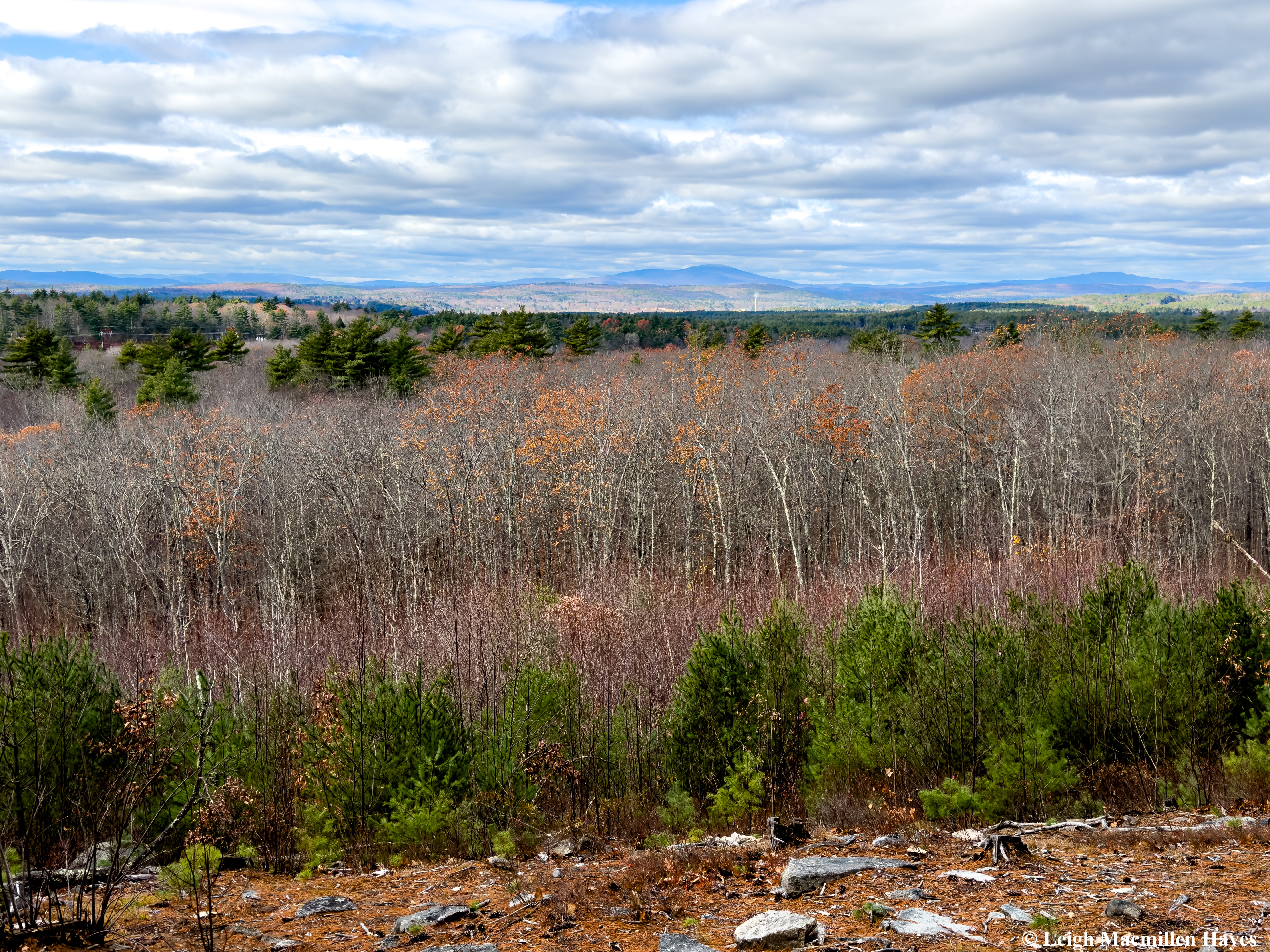
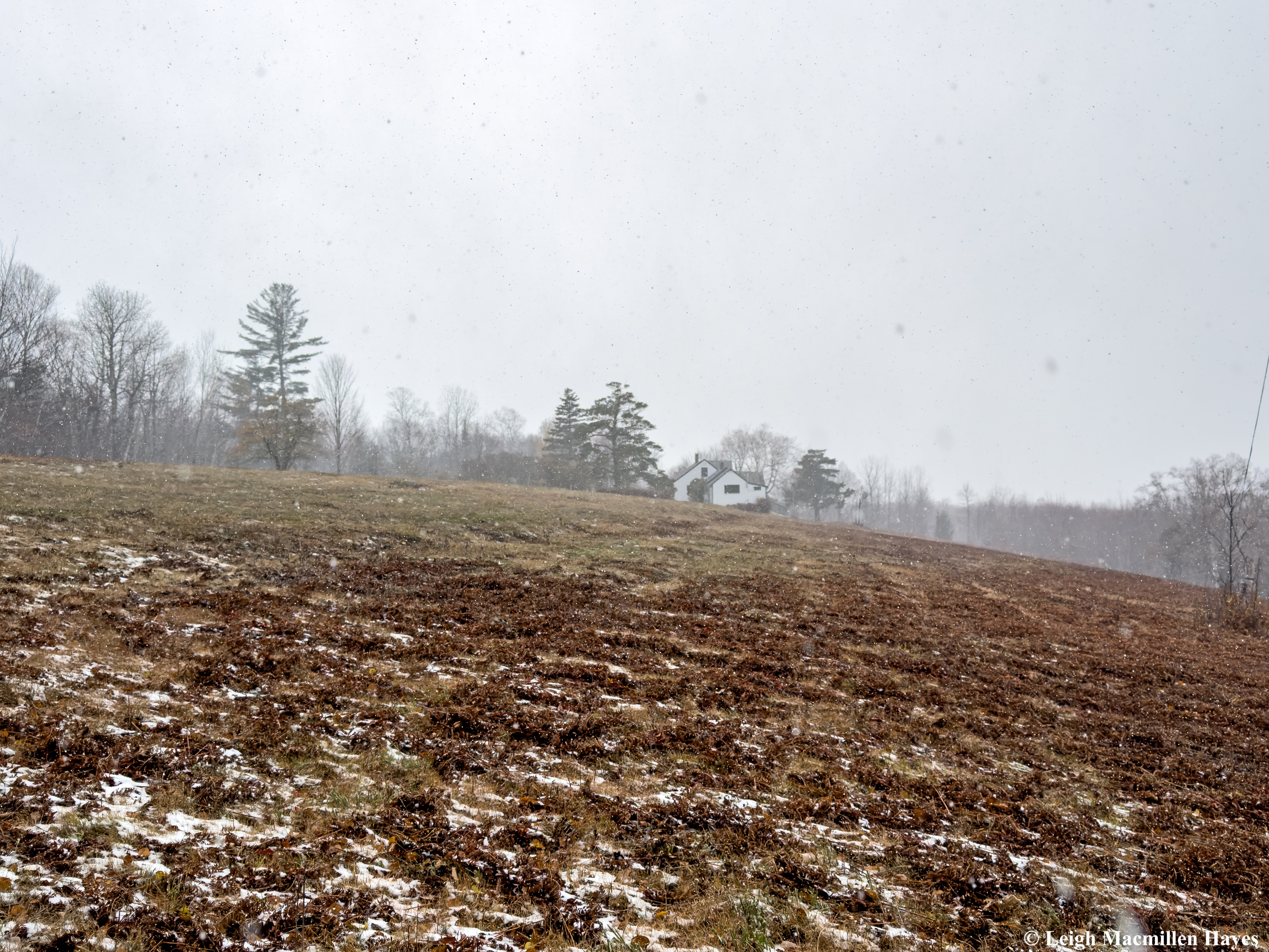
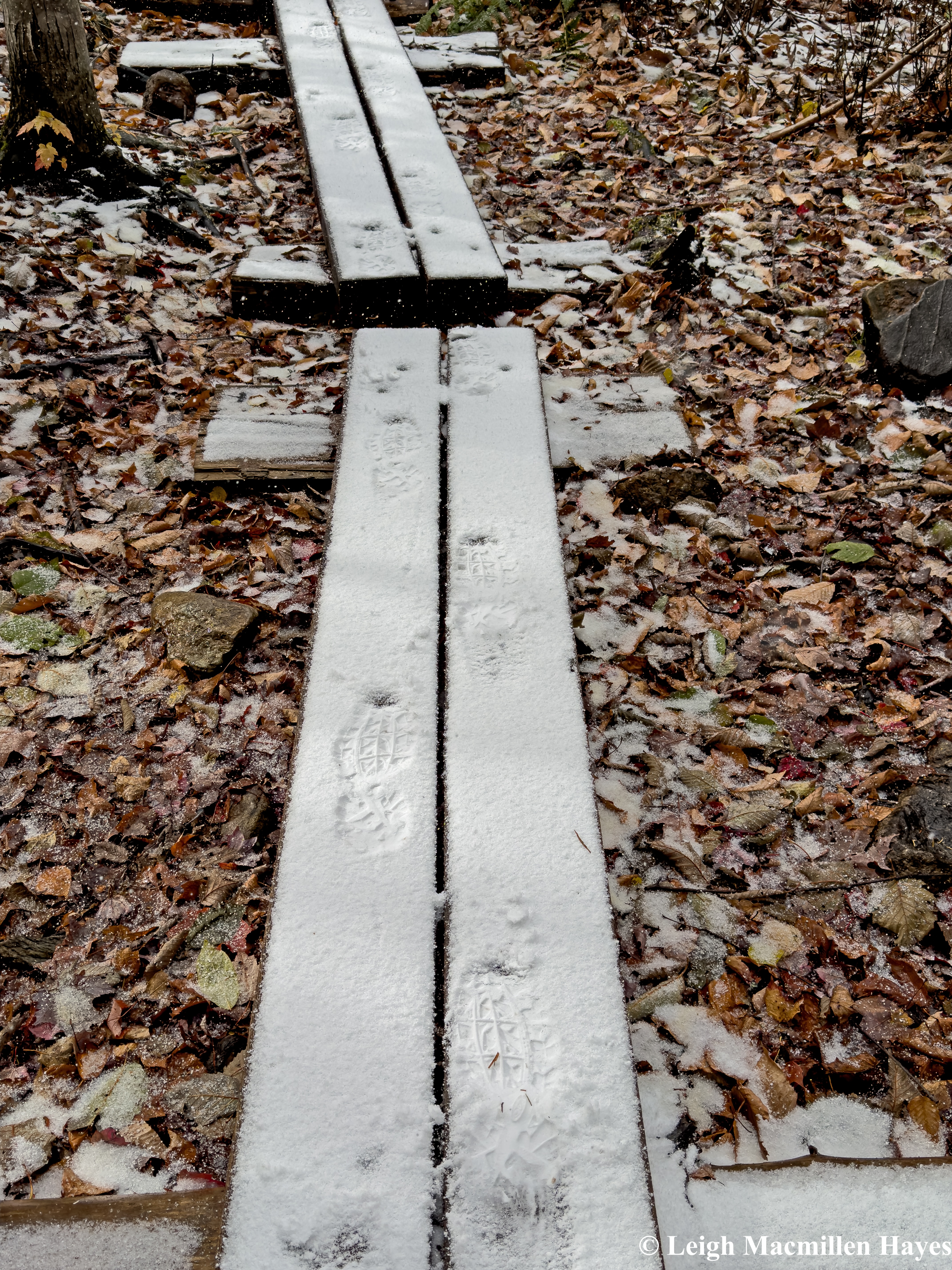
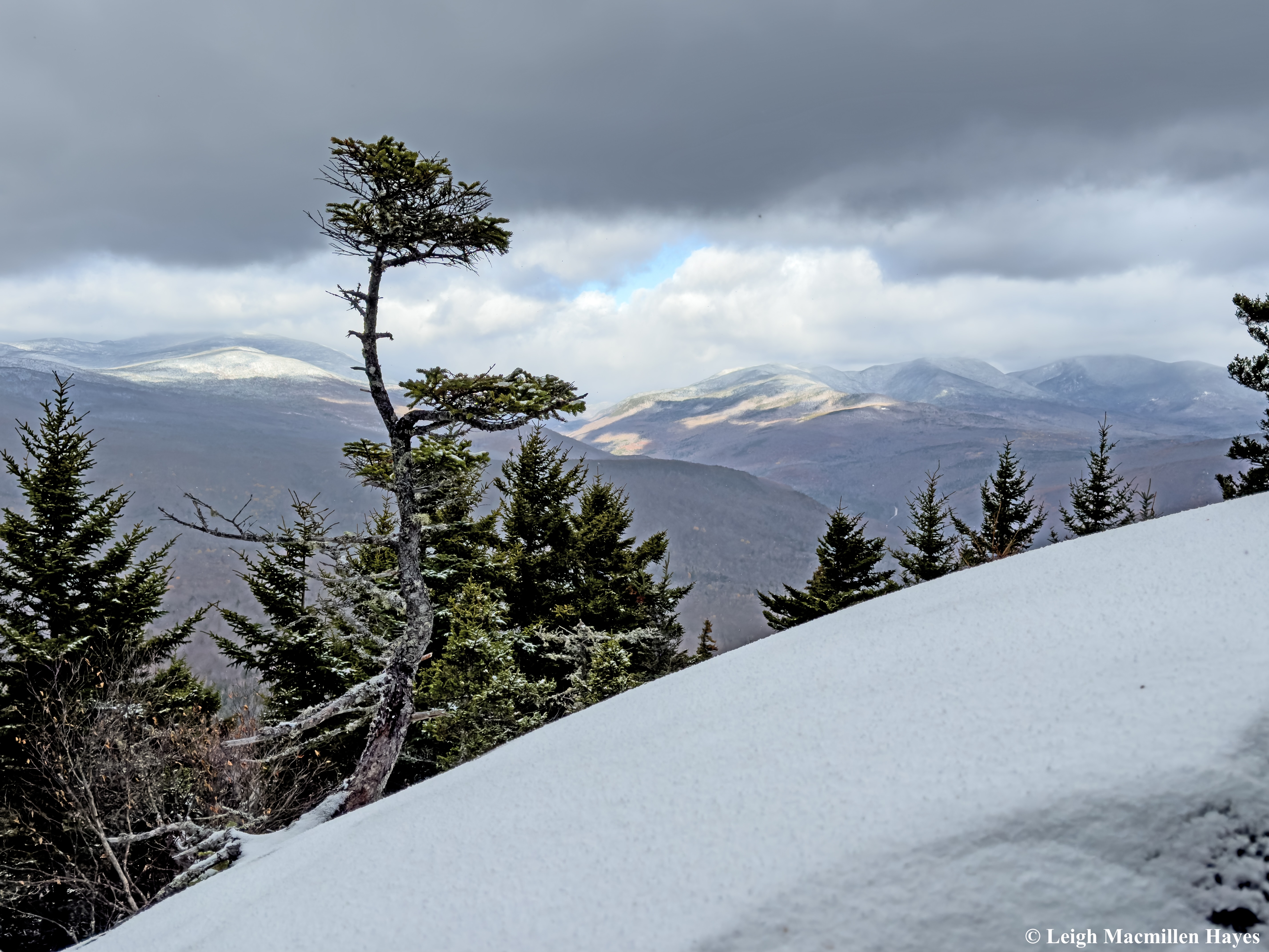
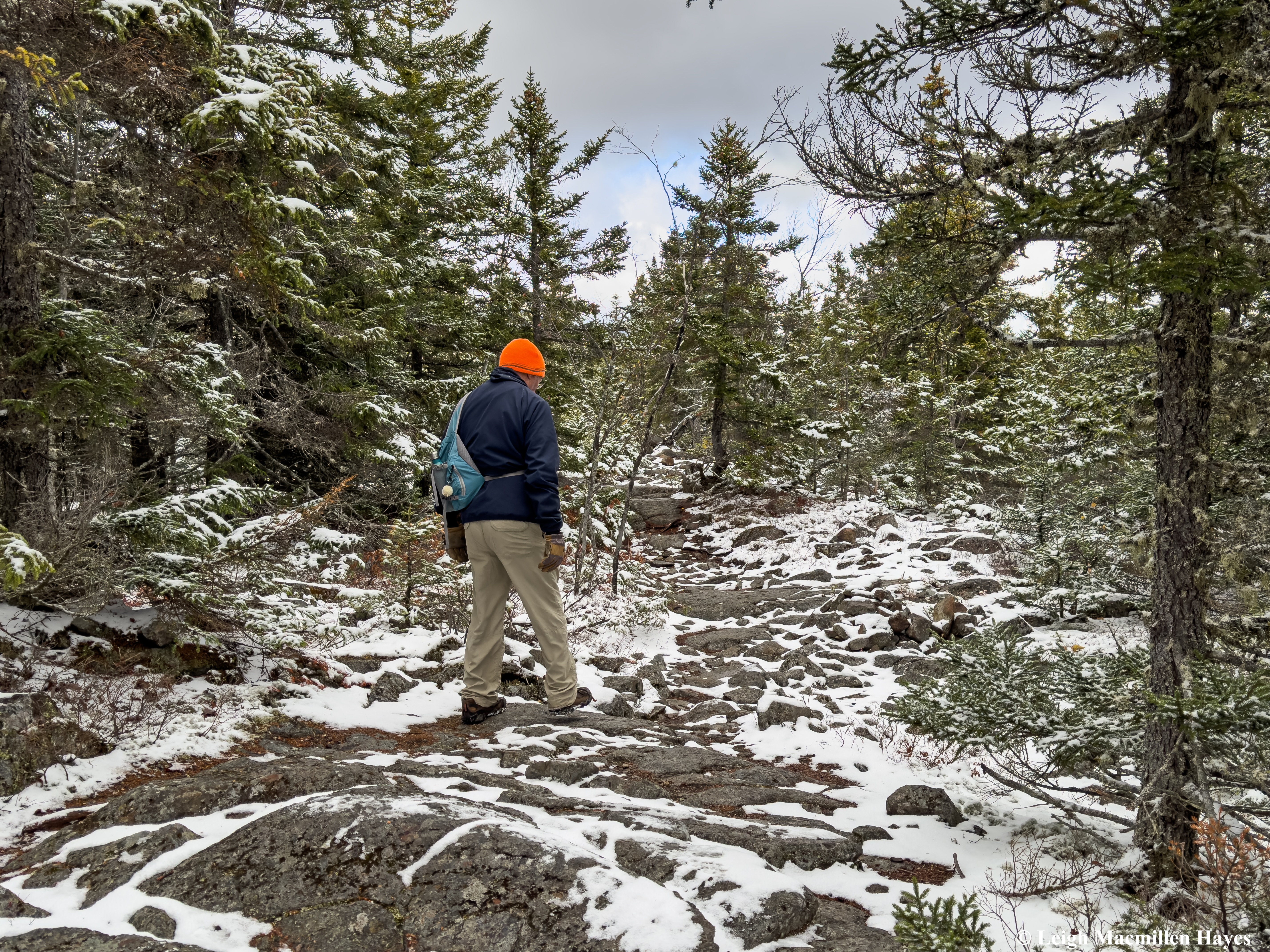
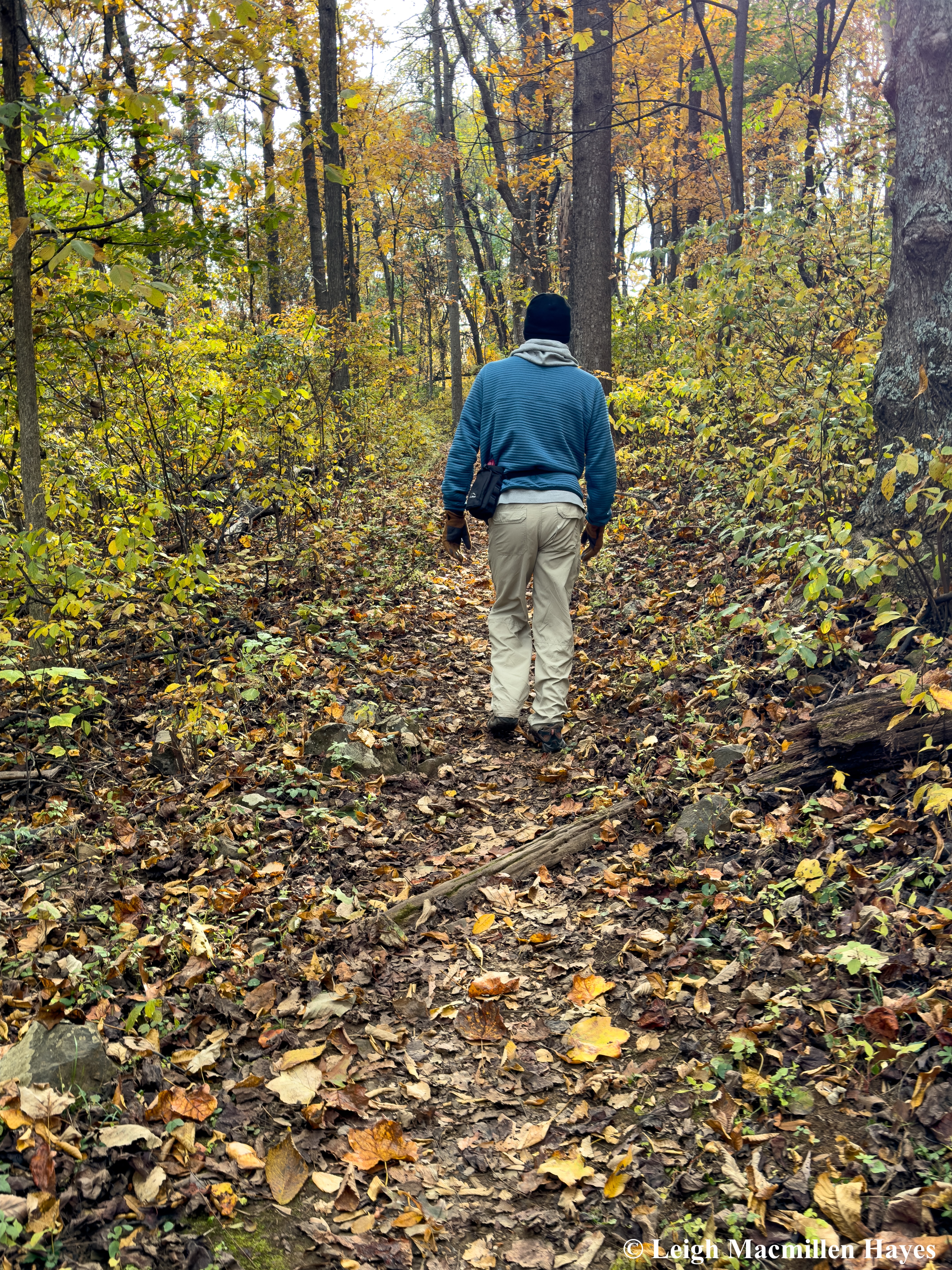
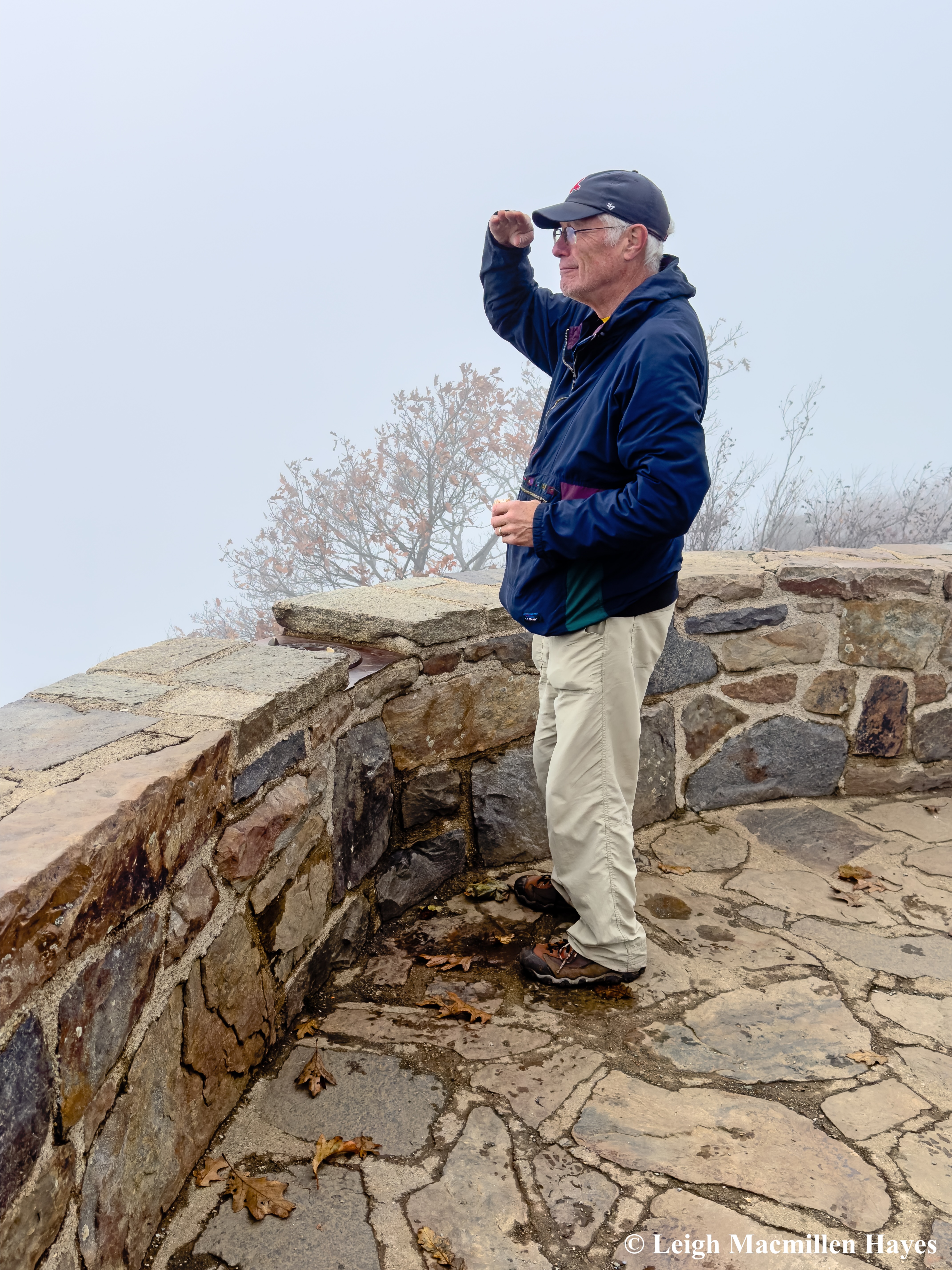
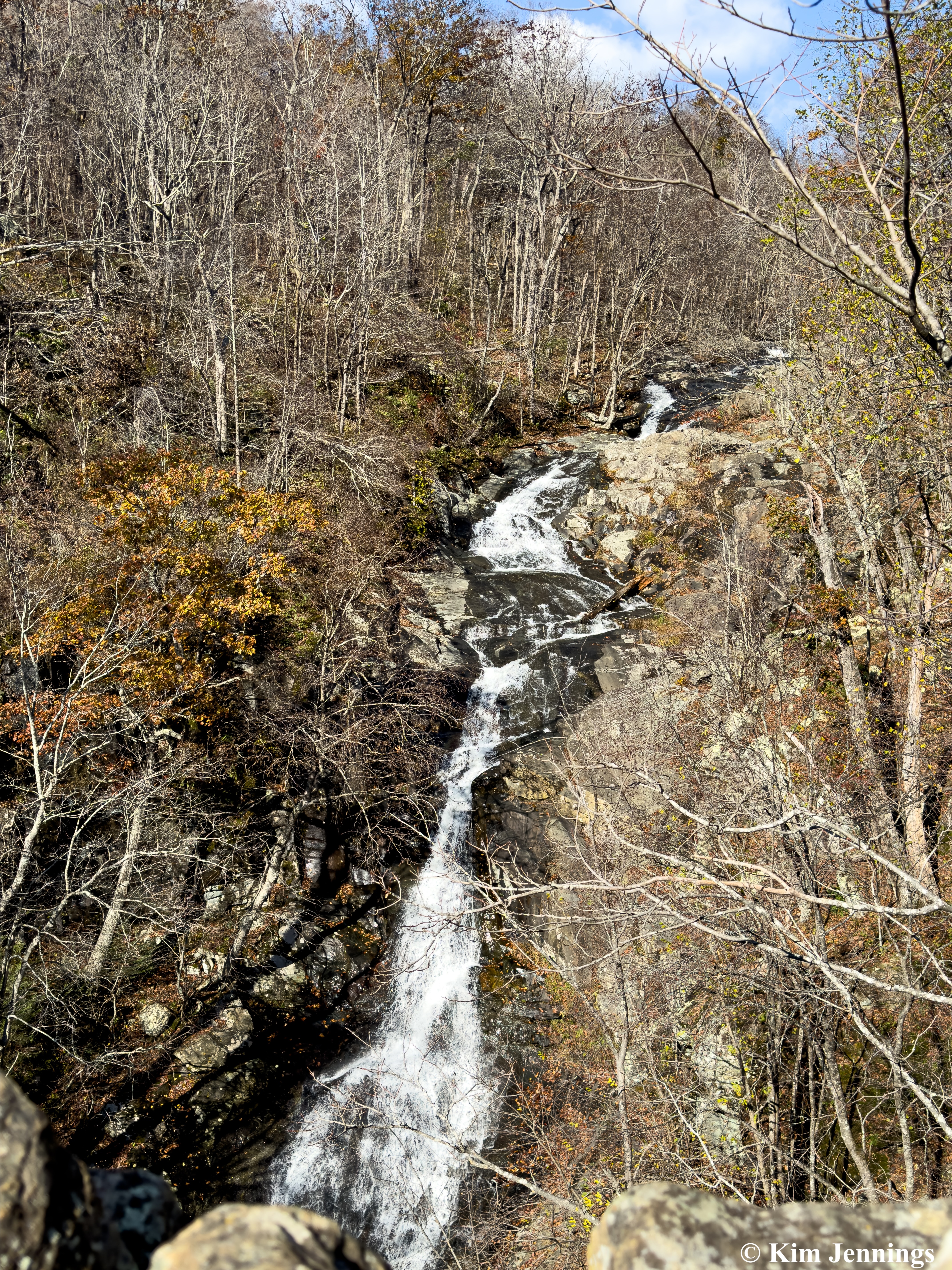
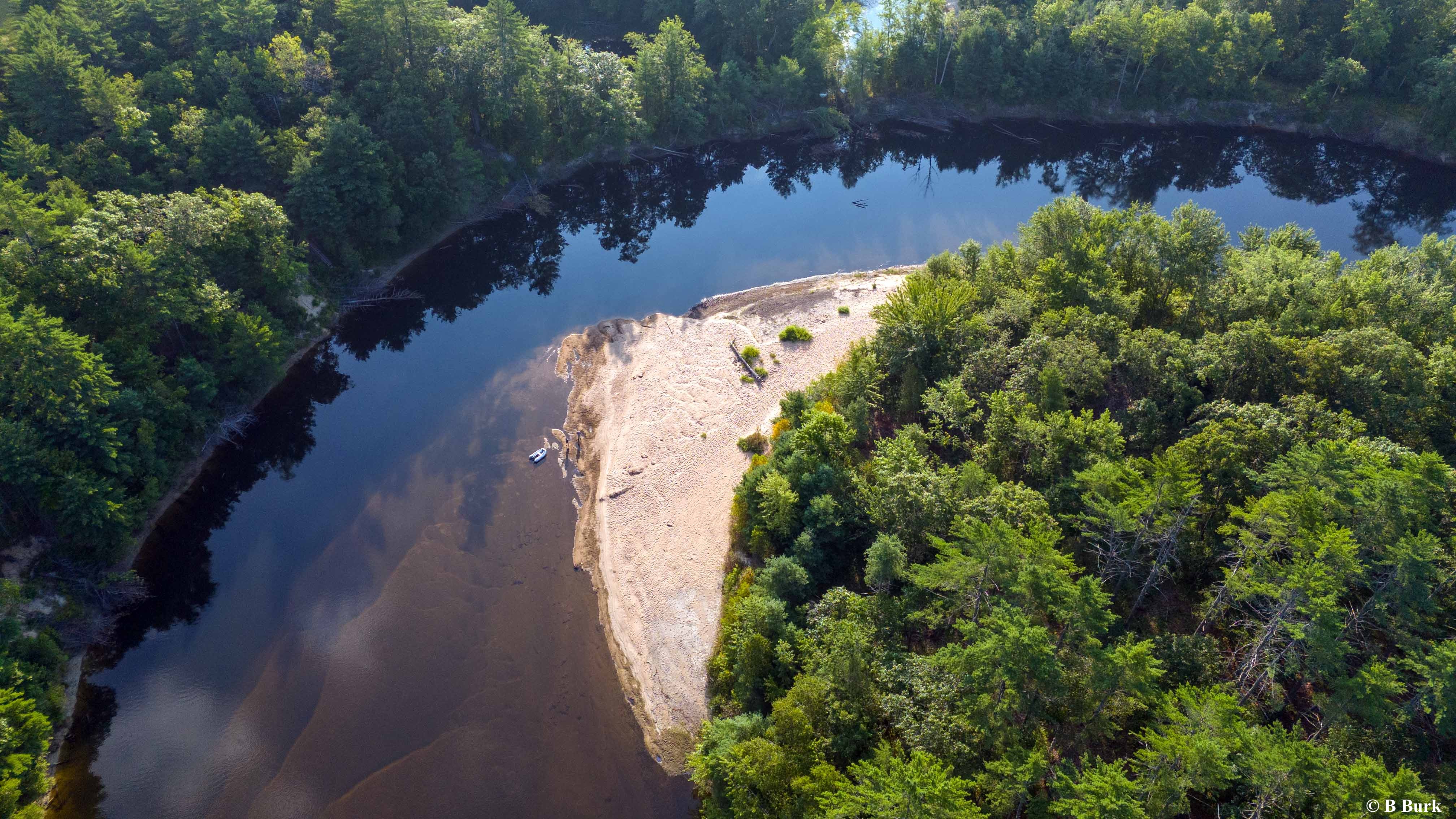
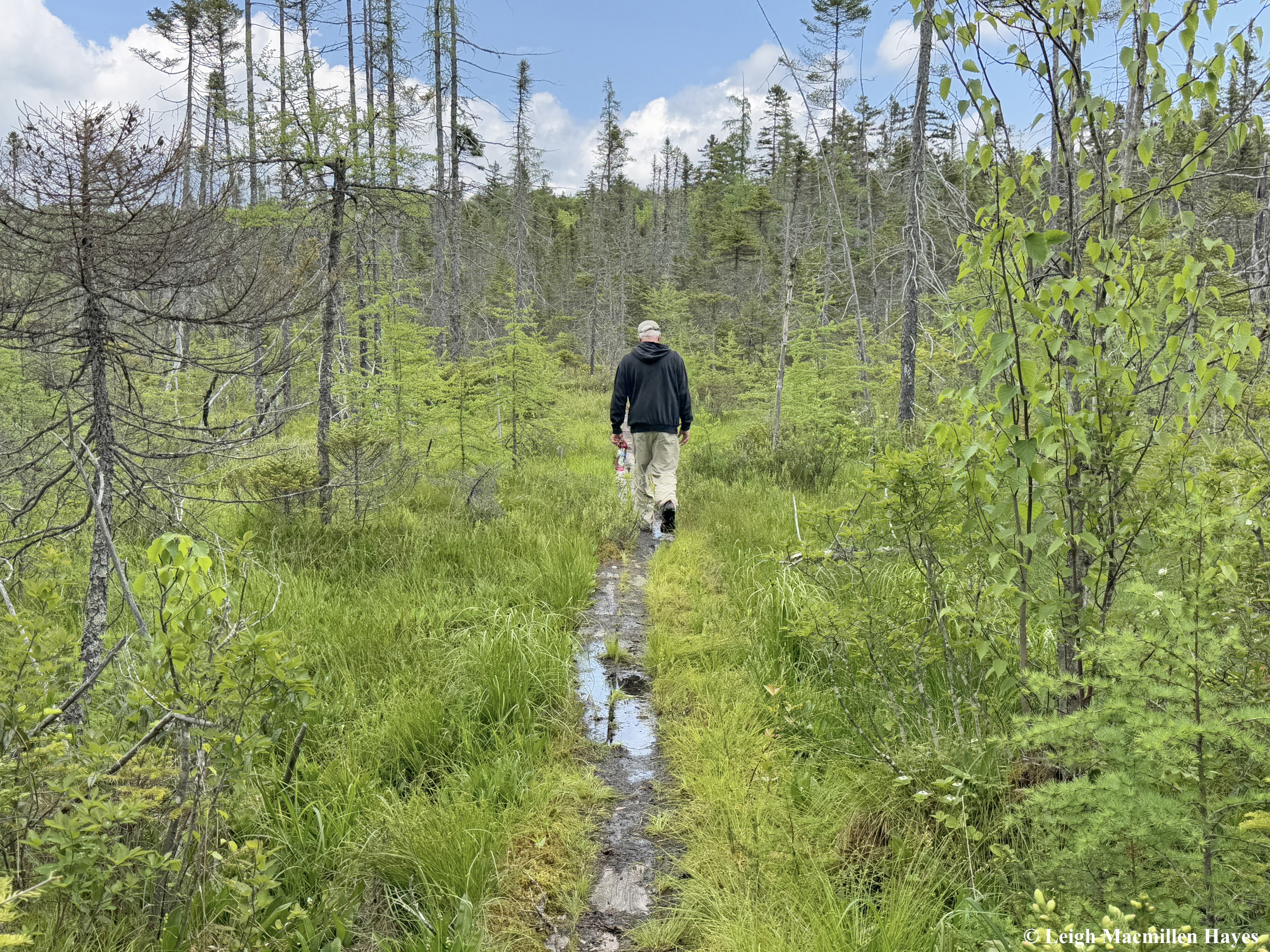
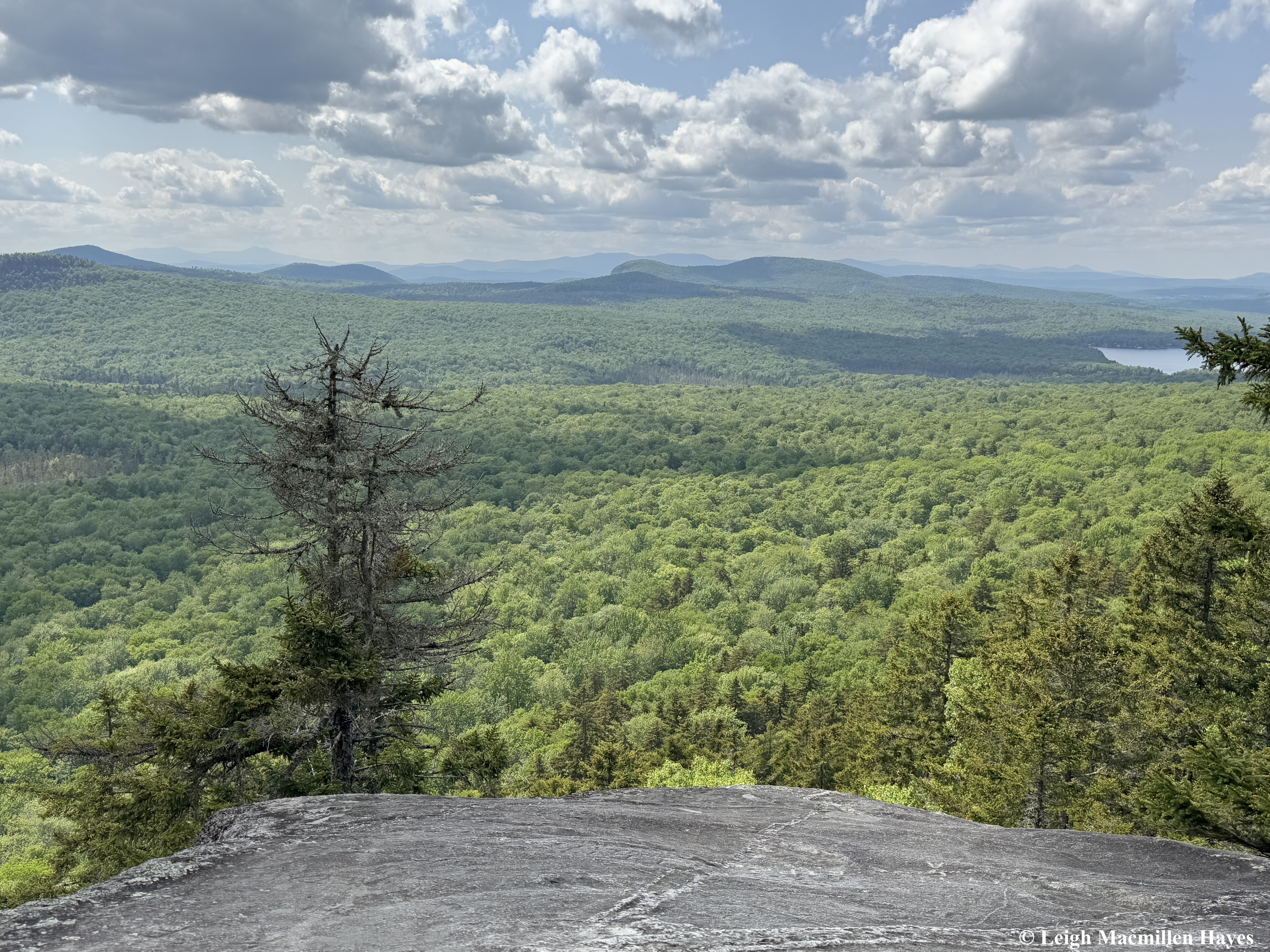
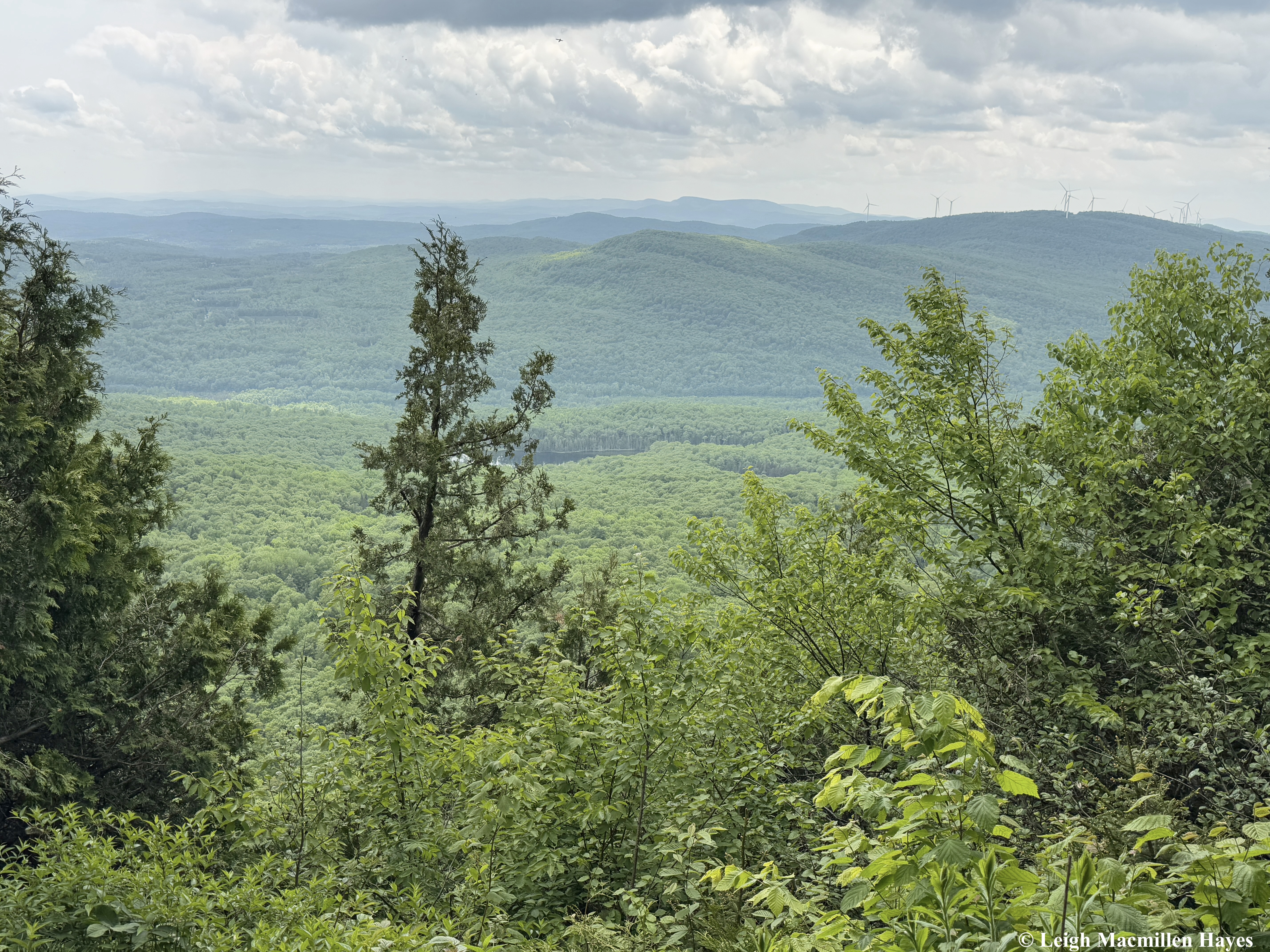
And so we headed off on the Oak Hill Tower Trail, with a plan to stay to the right, or was it the left, as we are direction-challenged, but really, we did know where we wanted to go and the vista spots that we wanted to experience, such as this one where we could see Mount Sunapee and Mount Kearsarge (not Kearsarge North that I’m more familiar with) in the distance. That said, I did record our journey on my GPS.

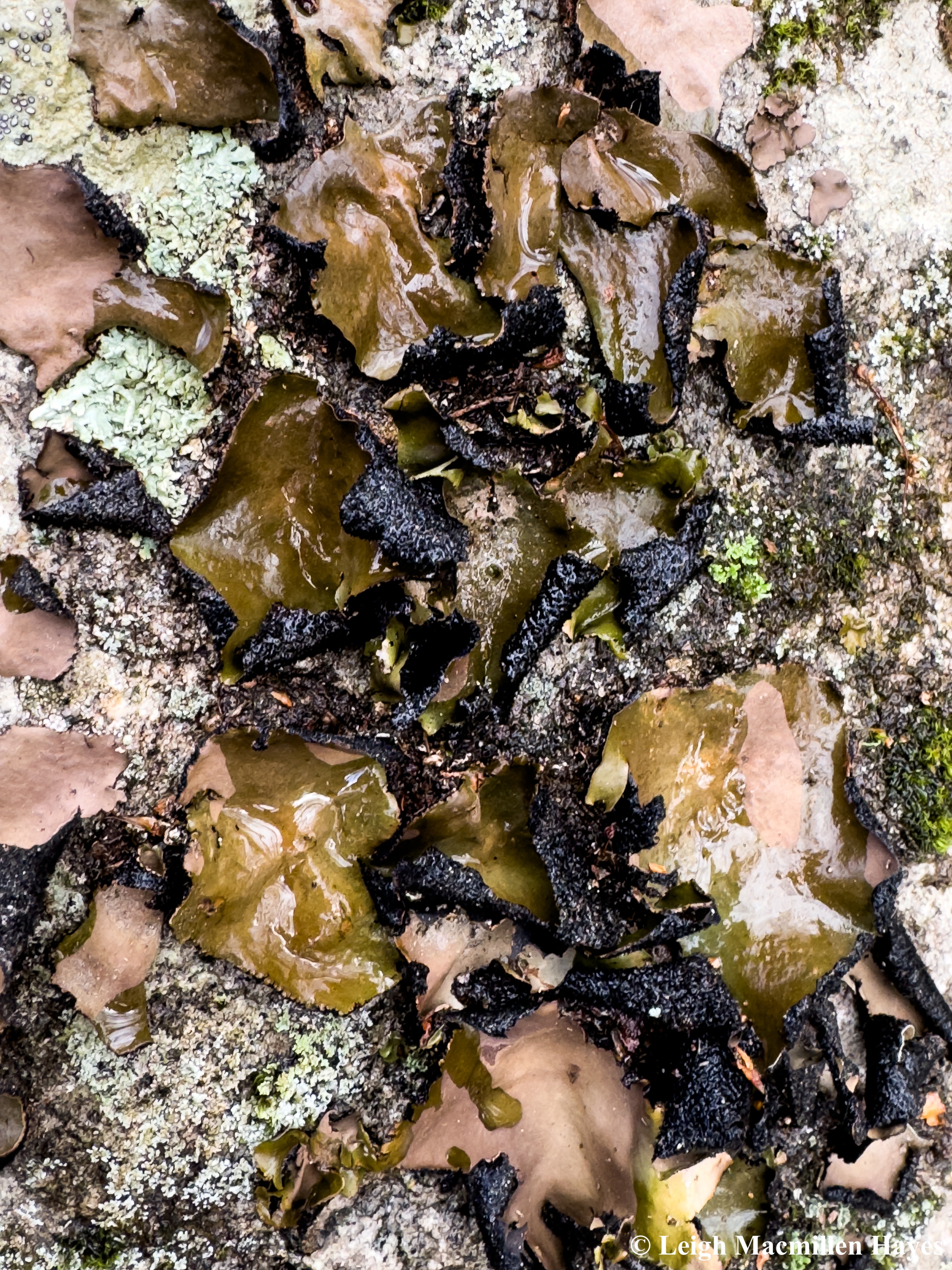
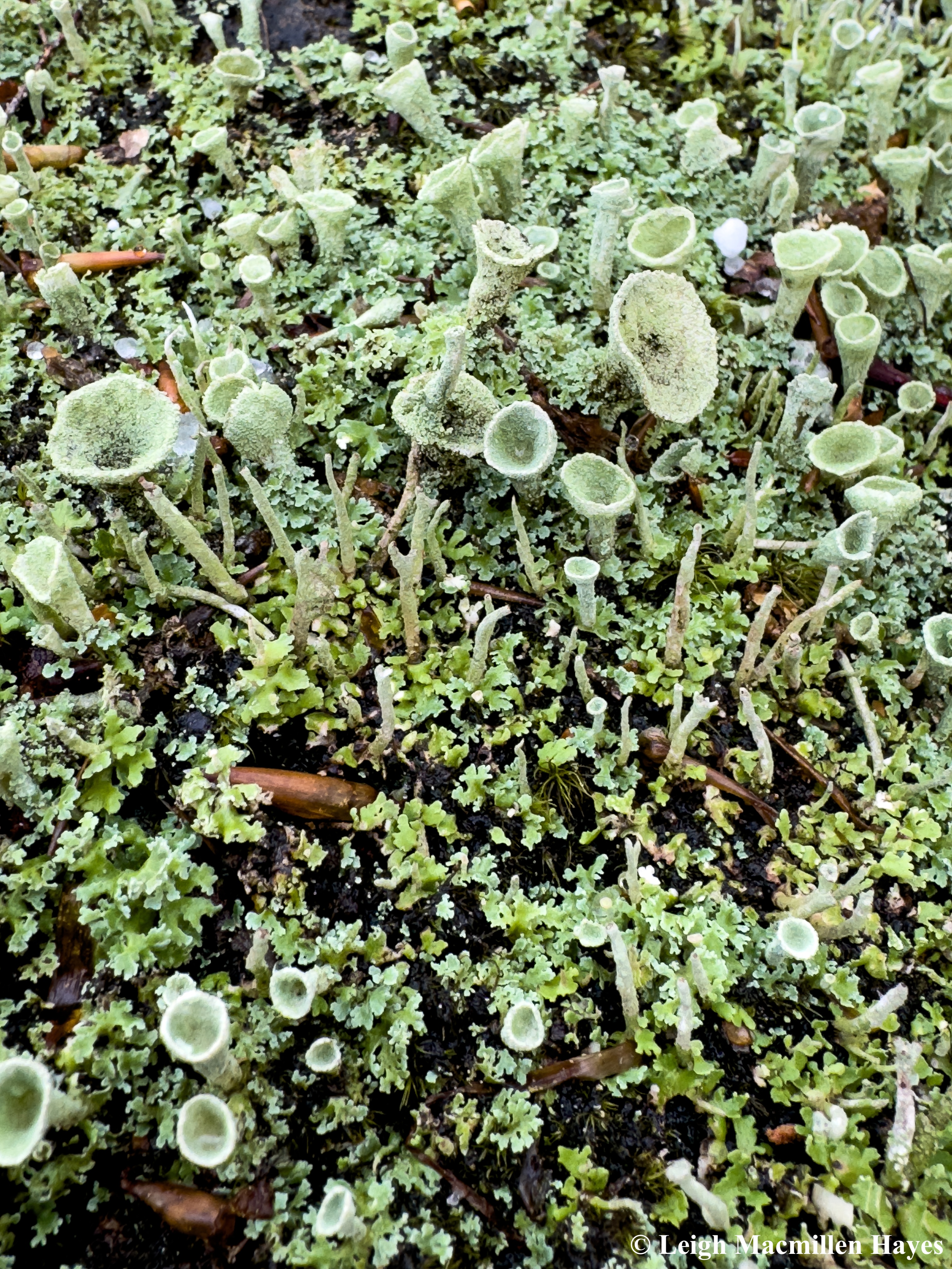
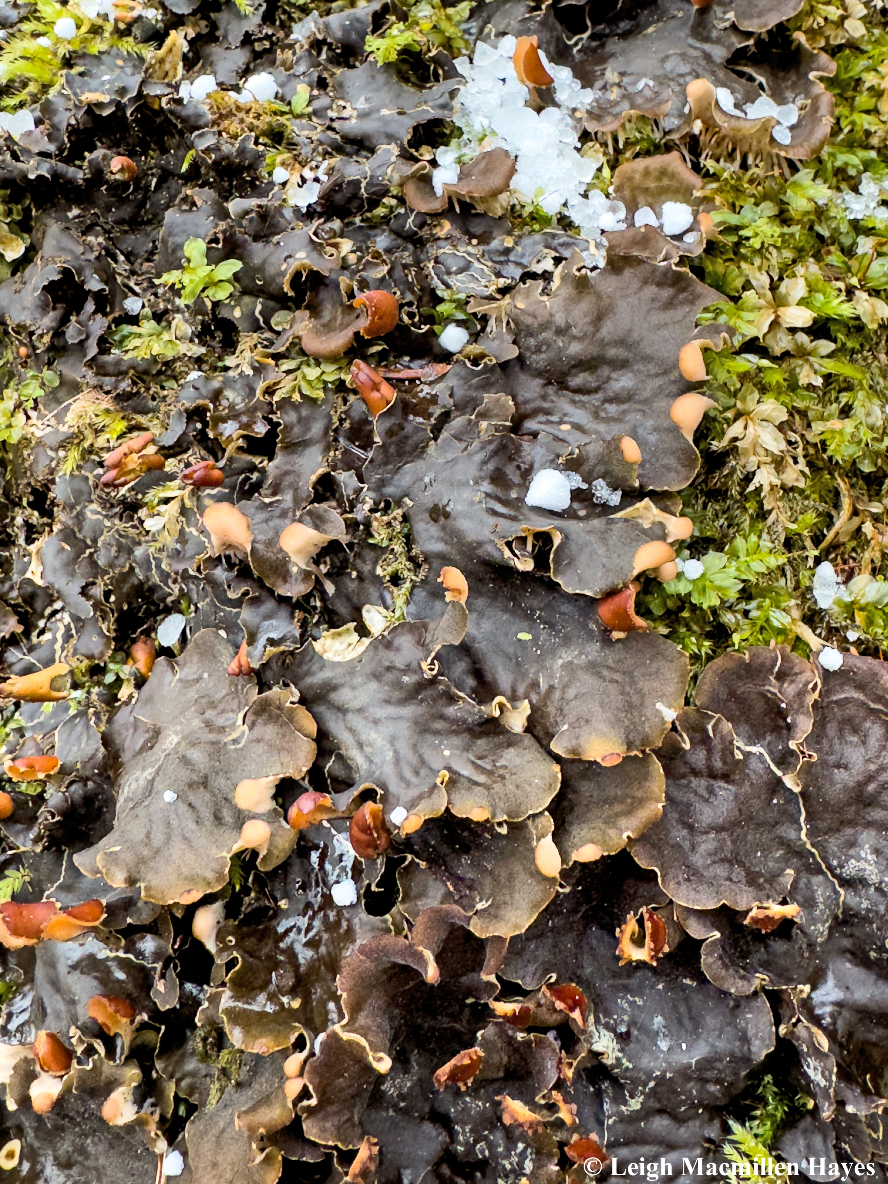
Because we were catching up as well as reminiscing about our junior and senior high school years, we let our tween or teen selves kick into action every once in a while, including by pouring water upon some dried and brown Rock Tripe. We watched with awe as the algal component of this umbilicate lichen immediately kicked into action and the “leafy” parts turned green and became more pliable.

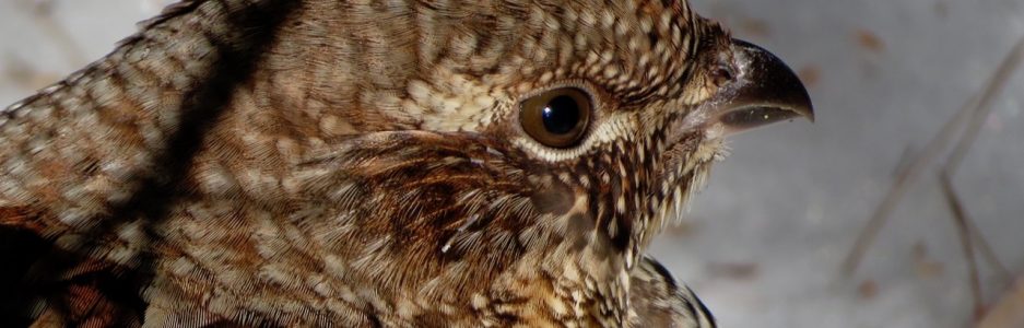
And there were a few Winter Fireflies to admire, especially the pink parentheses that form brackets behind its head. I explained that though the eggs, larvae, and pupae glow, the adult form doesn’t light up the same as the Lightning Bugs we enjoy in the summer months.

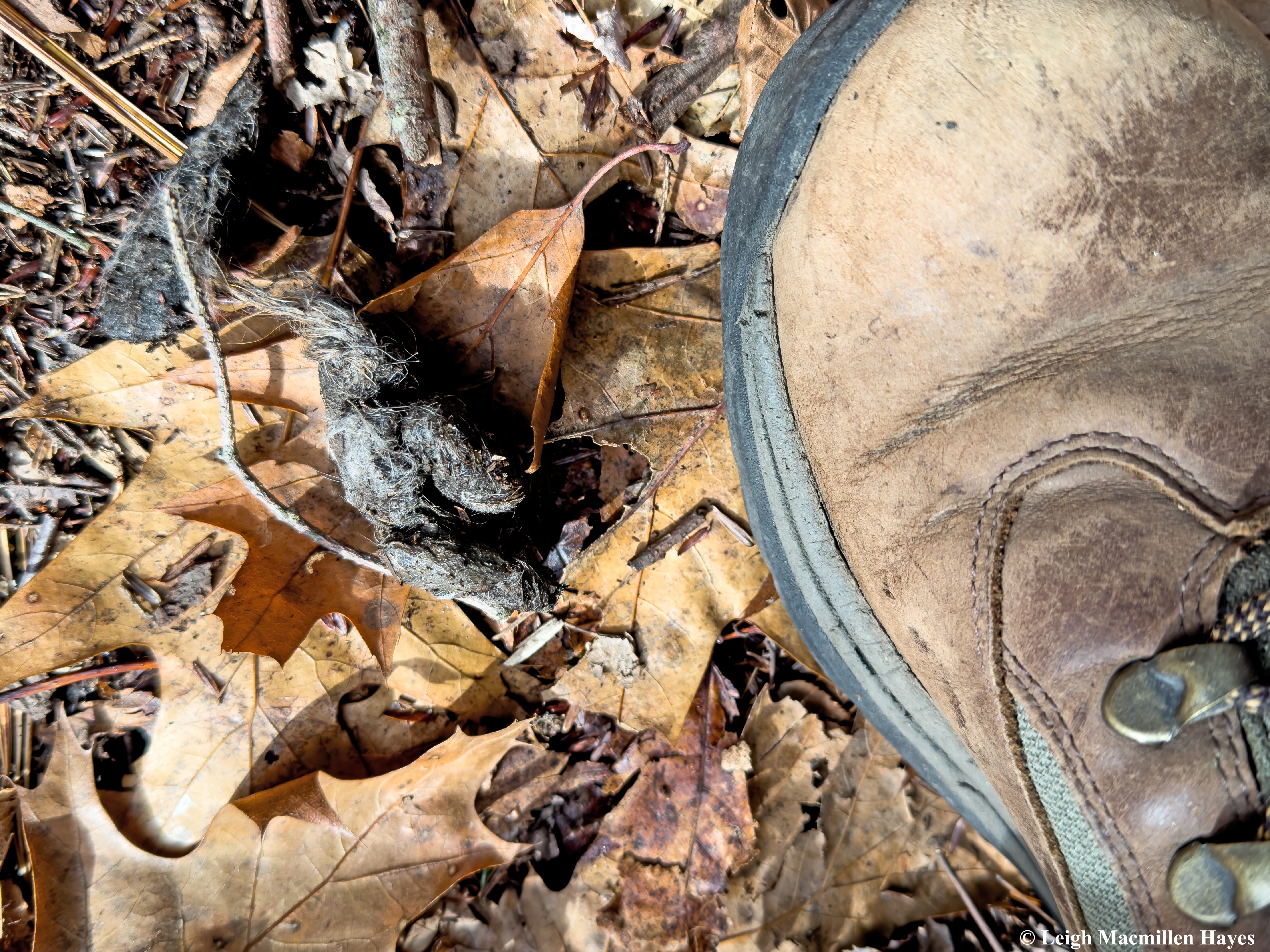
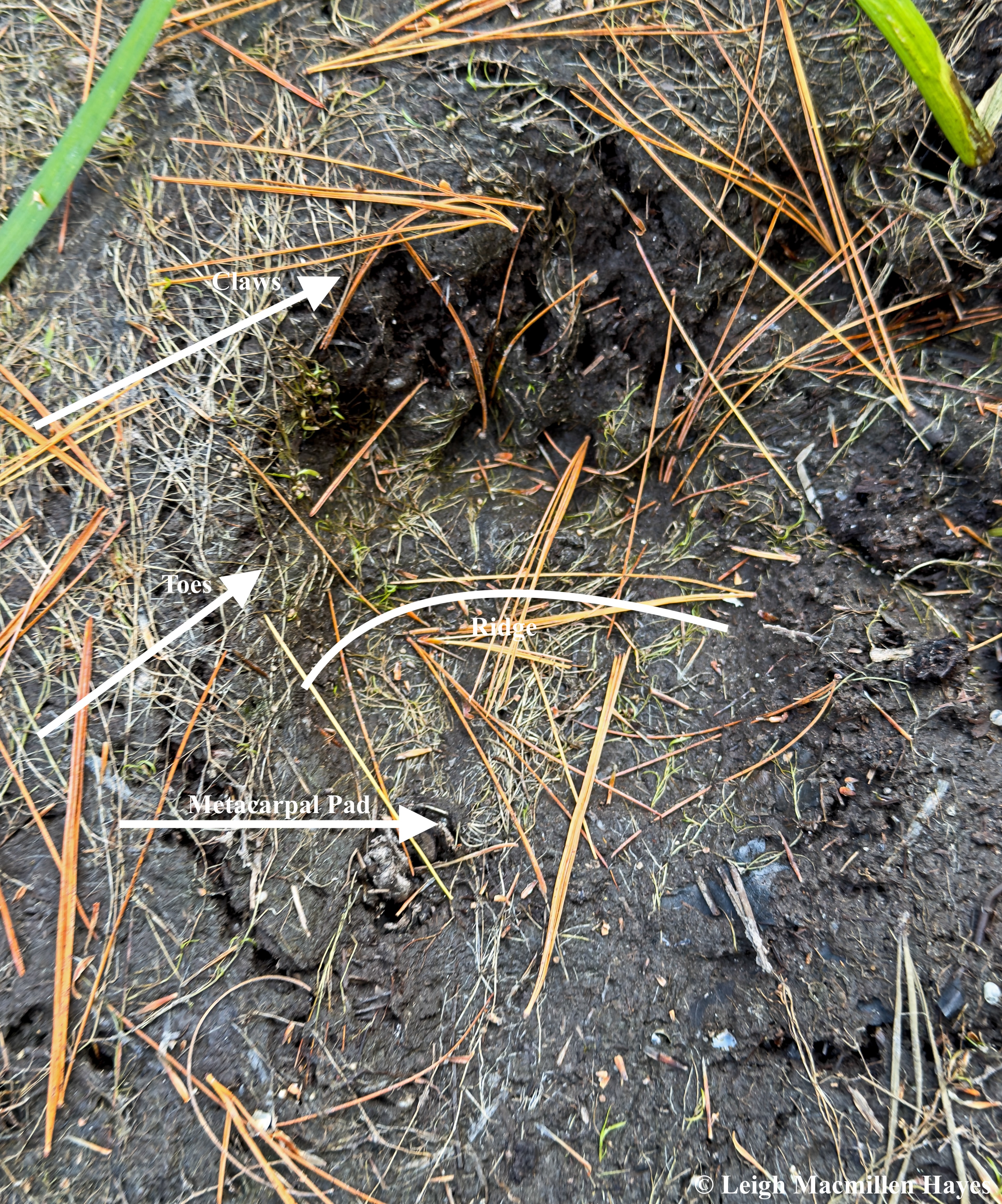
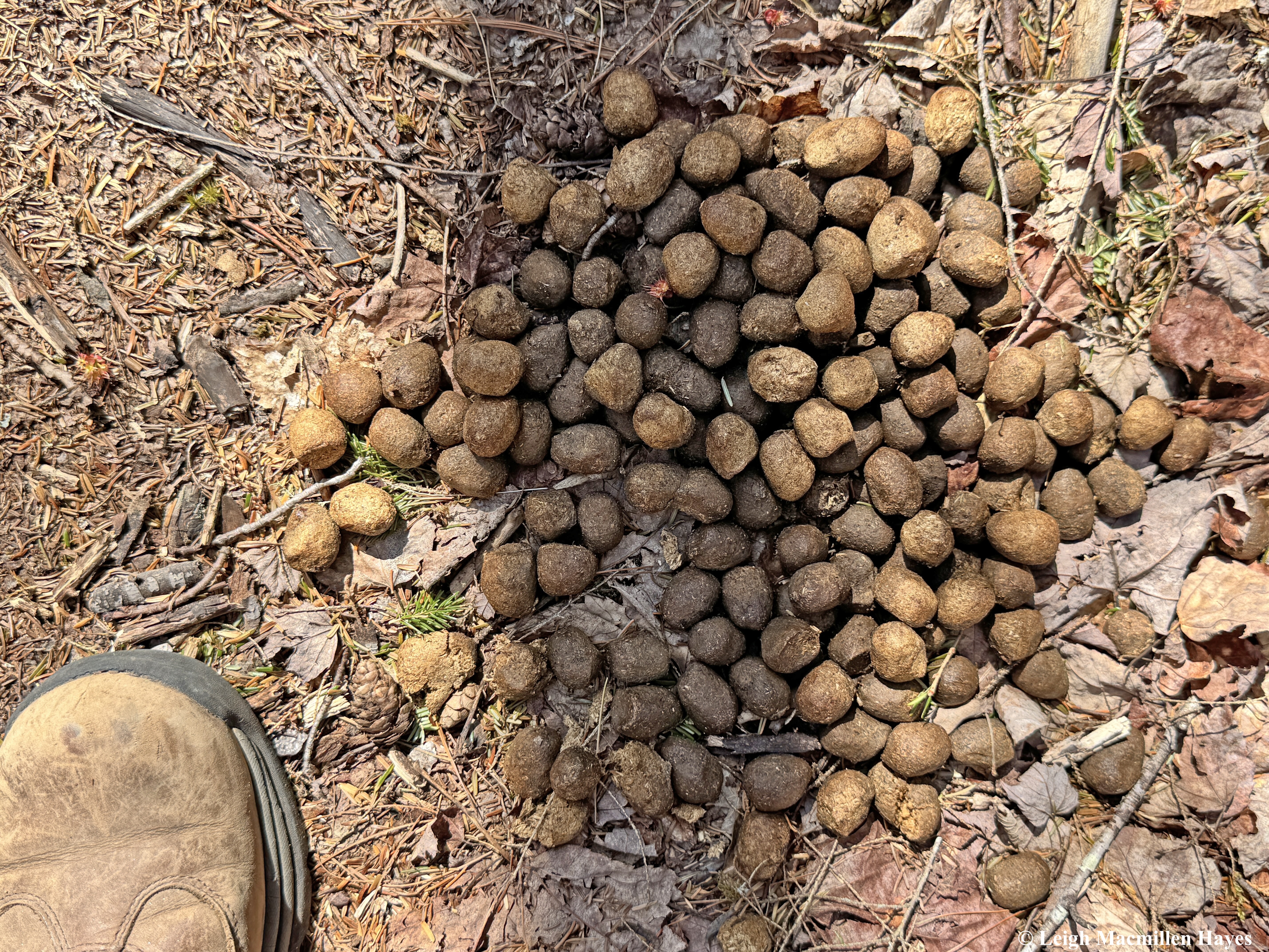
Our next great find was a fun one for me. I’m not sure she was quite as impressed, but she did want to know where all the fur may have come from in this Red Fox scat. We weren’t in Snowshoe Hare territory, but we were certainly in squirrel and vole habitat and so it could have been a combination that helped to form this twisted specimen with its blunt form on one end and tail on the other.

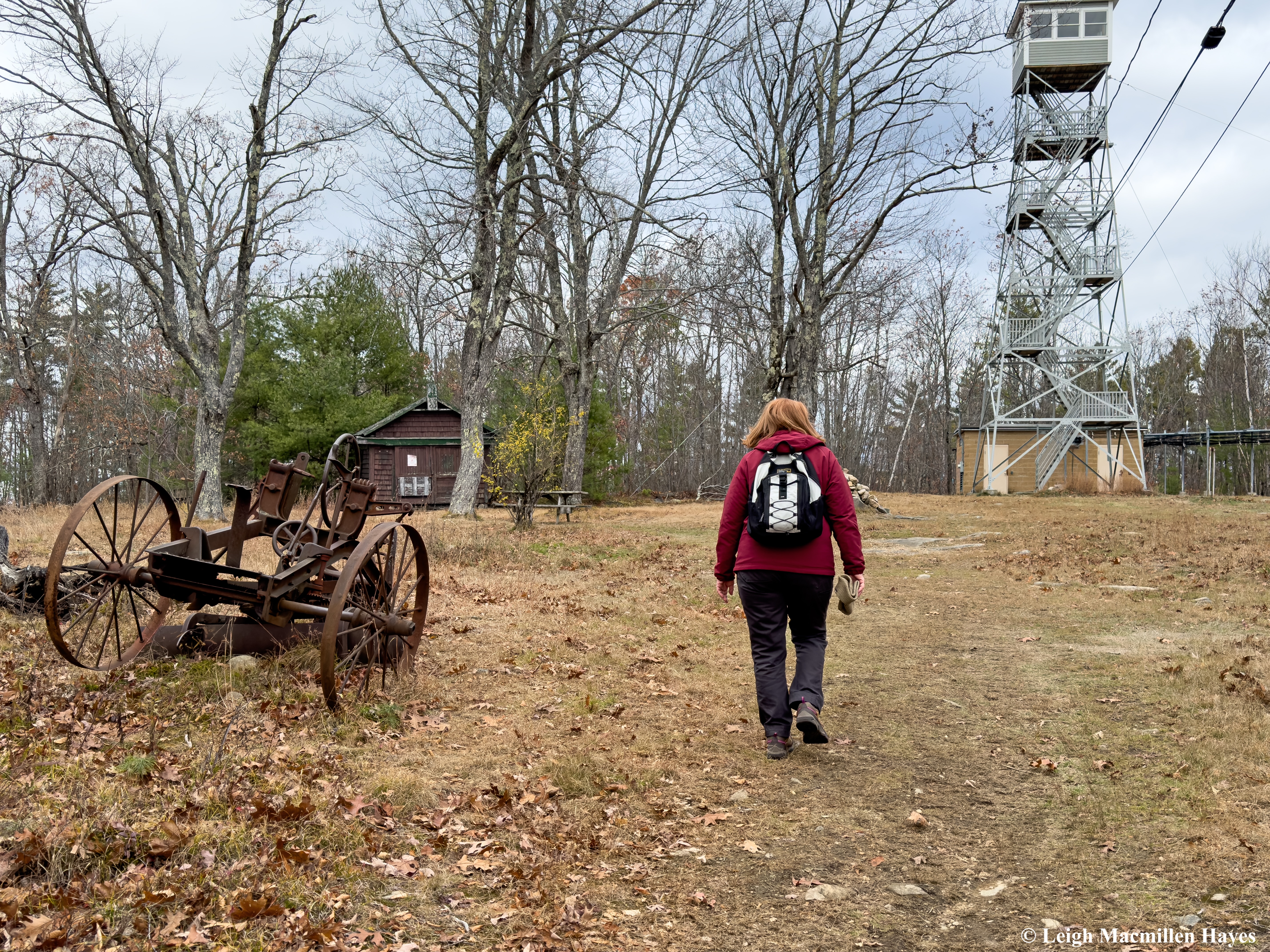
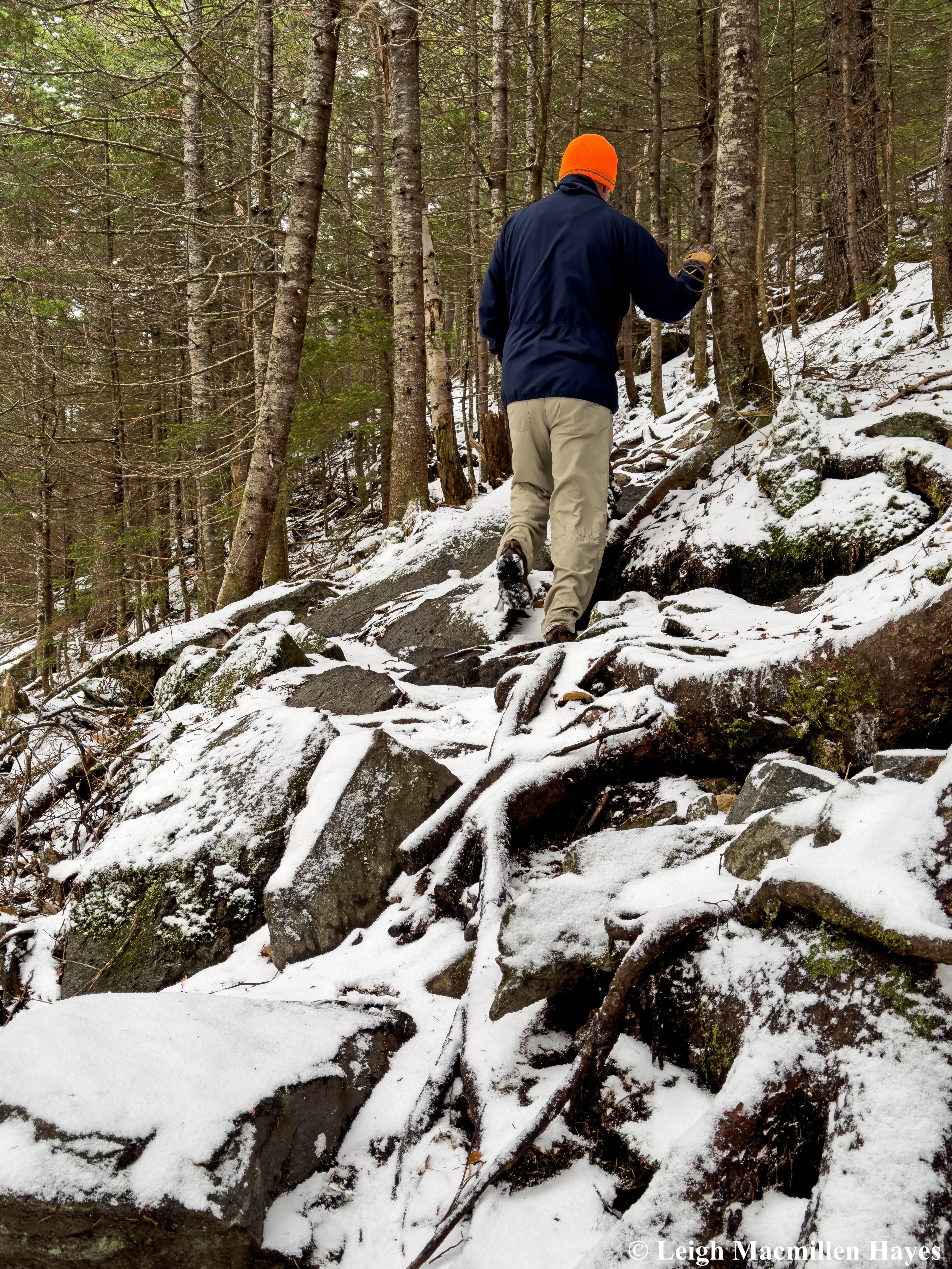
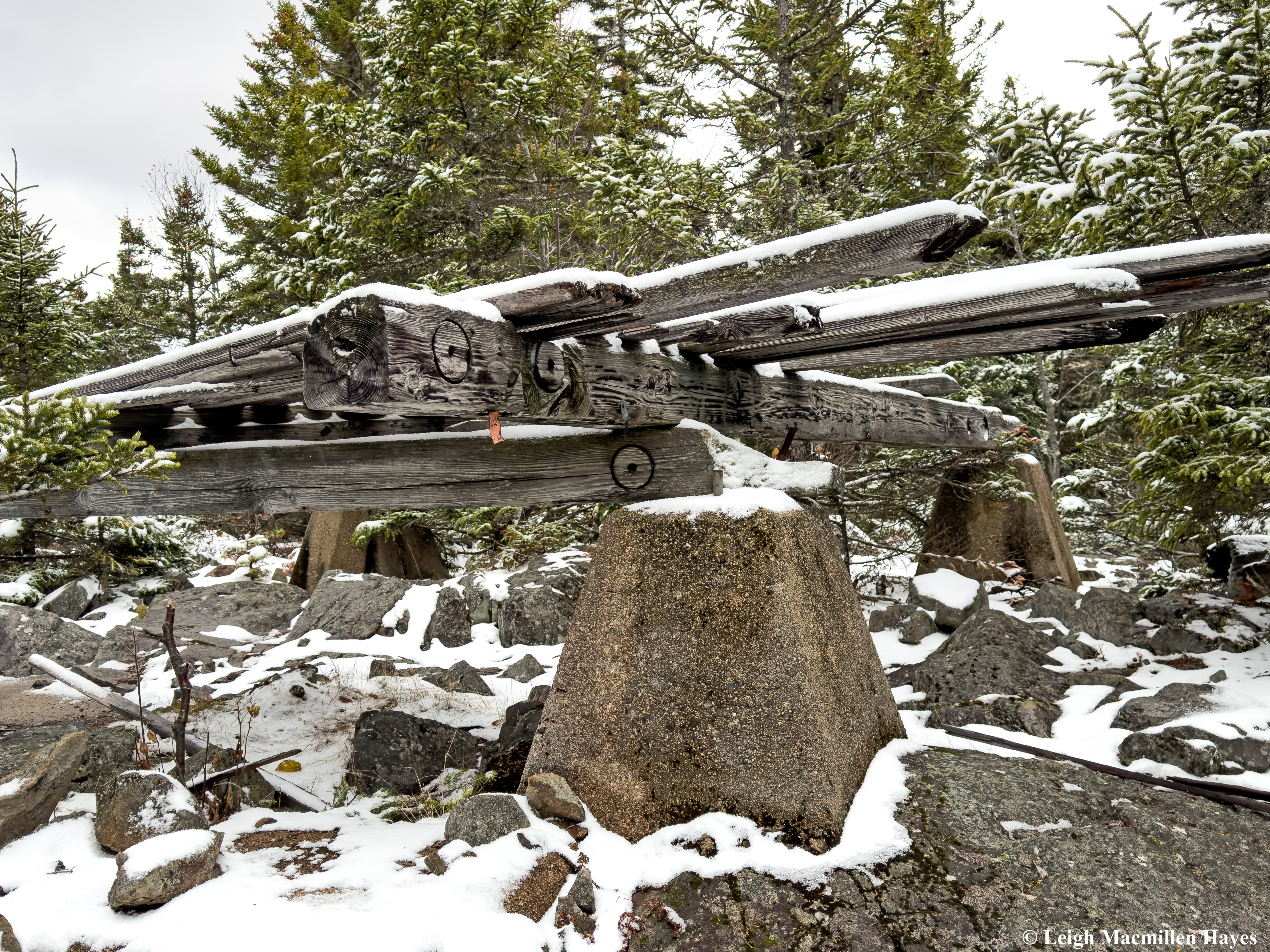
About an hour and a half after we began our journey, we reached the old fire tower for which the trail was named and noted also the house where the fire rangers would have bunked when it was necessary to step out of the cab at the top of the tower (think thunderstorm).

There was also a picnic table and since we had each brought a PB & J sandwich, this became our lunch stop.

Back on the trail, we spotted some puffballs, and again the need to play struck our fancy.

And so she found a stick and poked each one and we laughed as puffs of smoke, aka spores, wafted out of the little balls.

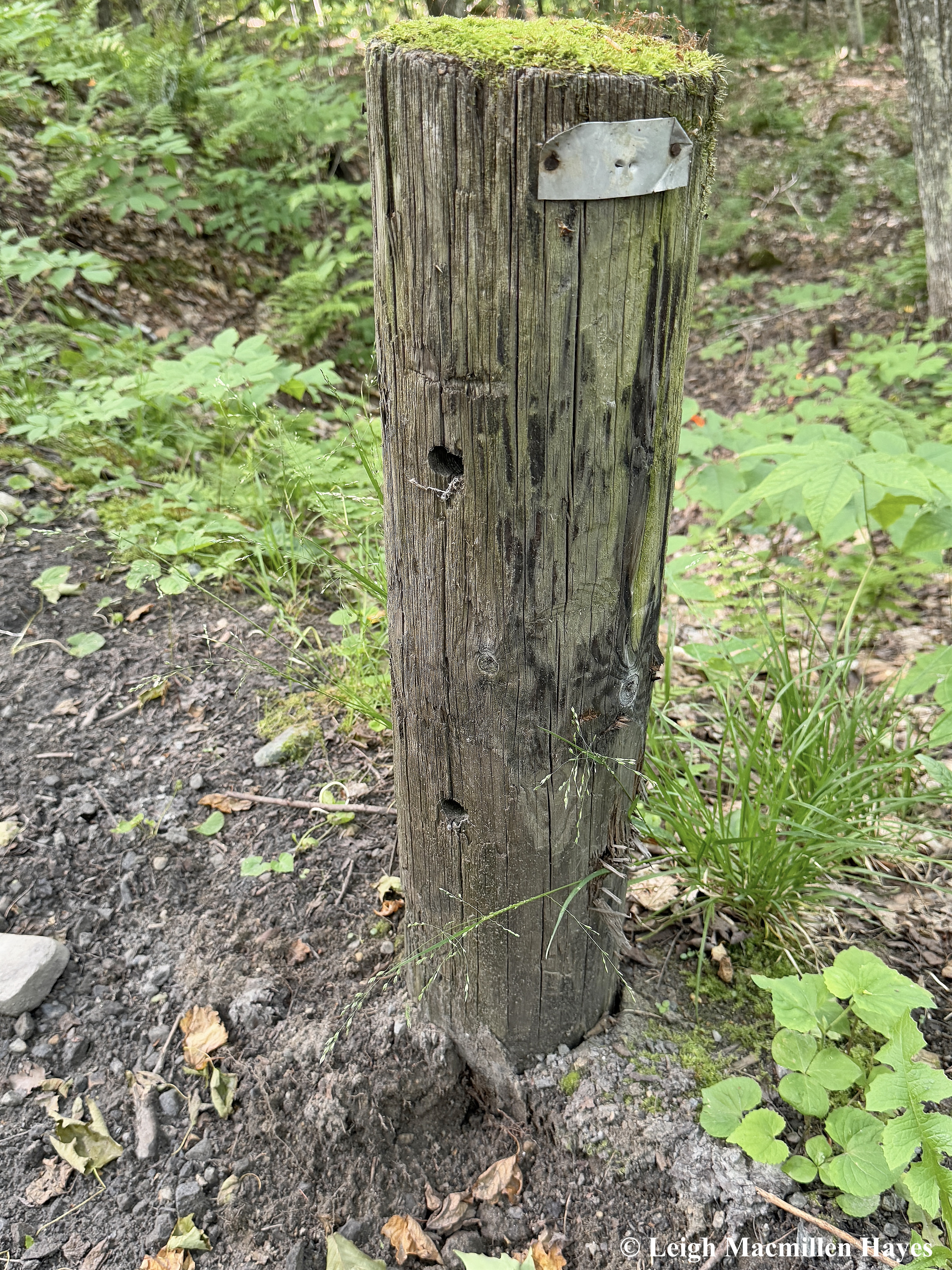
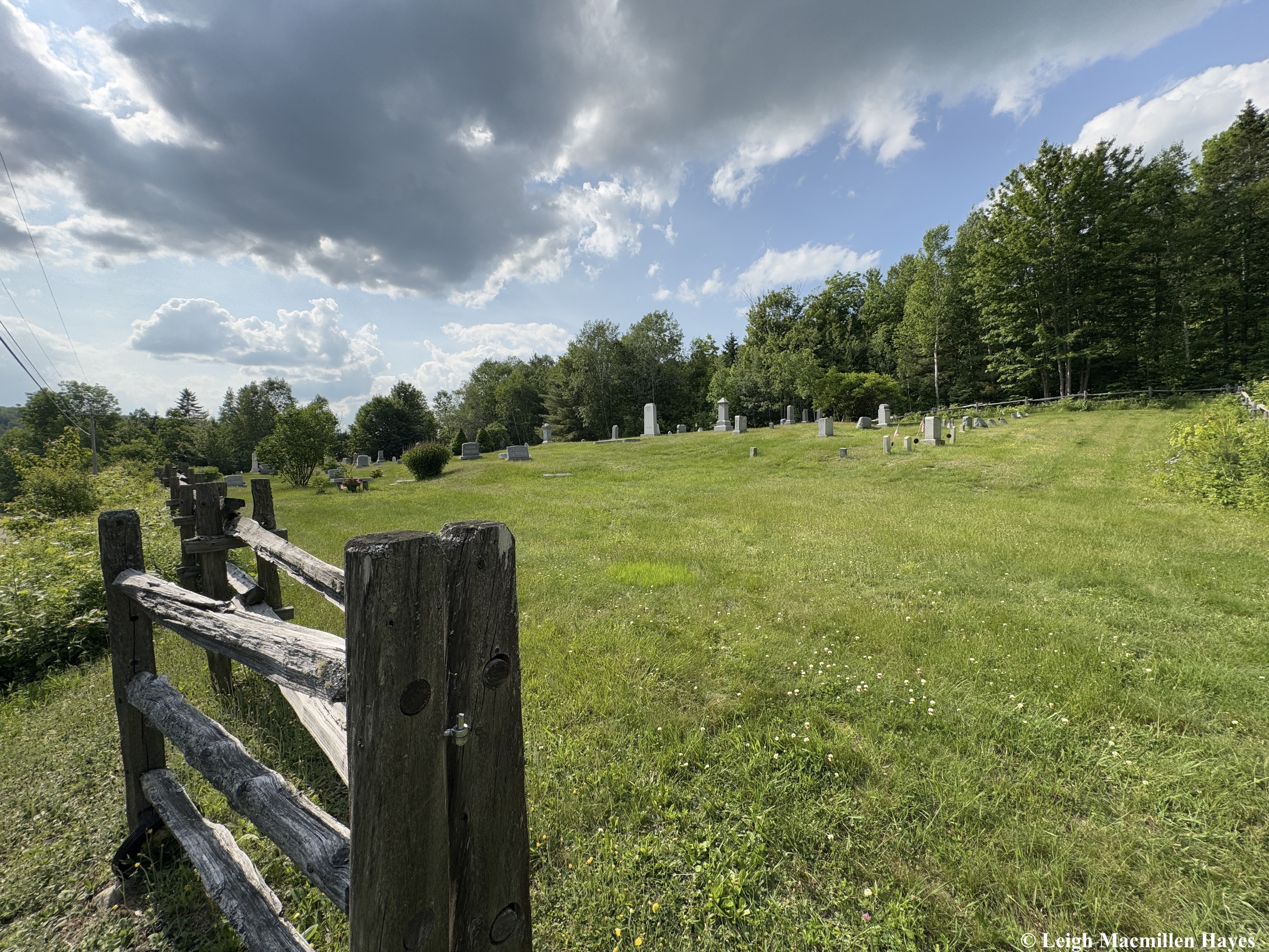
The next day found us upon a different trail that had been part of a working farm from the 1700s until about a year ago and known as Dimond Hill. Barbed wire that once kept animals in or out had become part of a stump, which often happens when a tree sprouts beside a boundary and over time grows around the obstacle so that they seemingly become one.

So much so, that a former limb had separated from the tree, but still the wire “glued” them together.

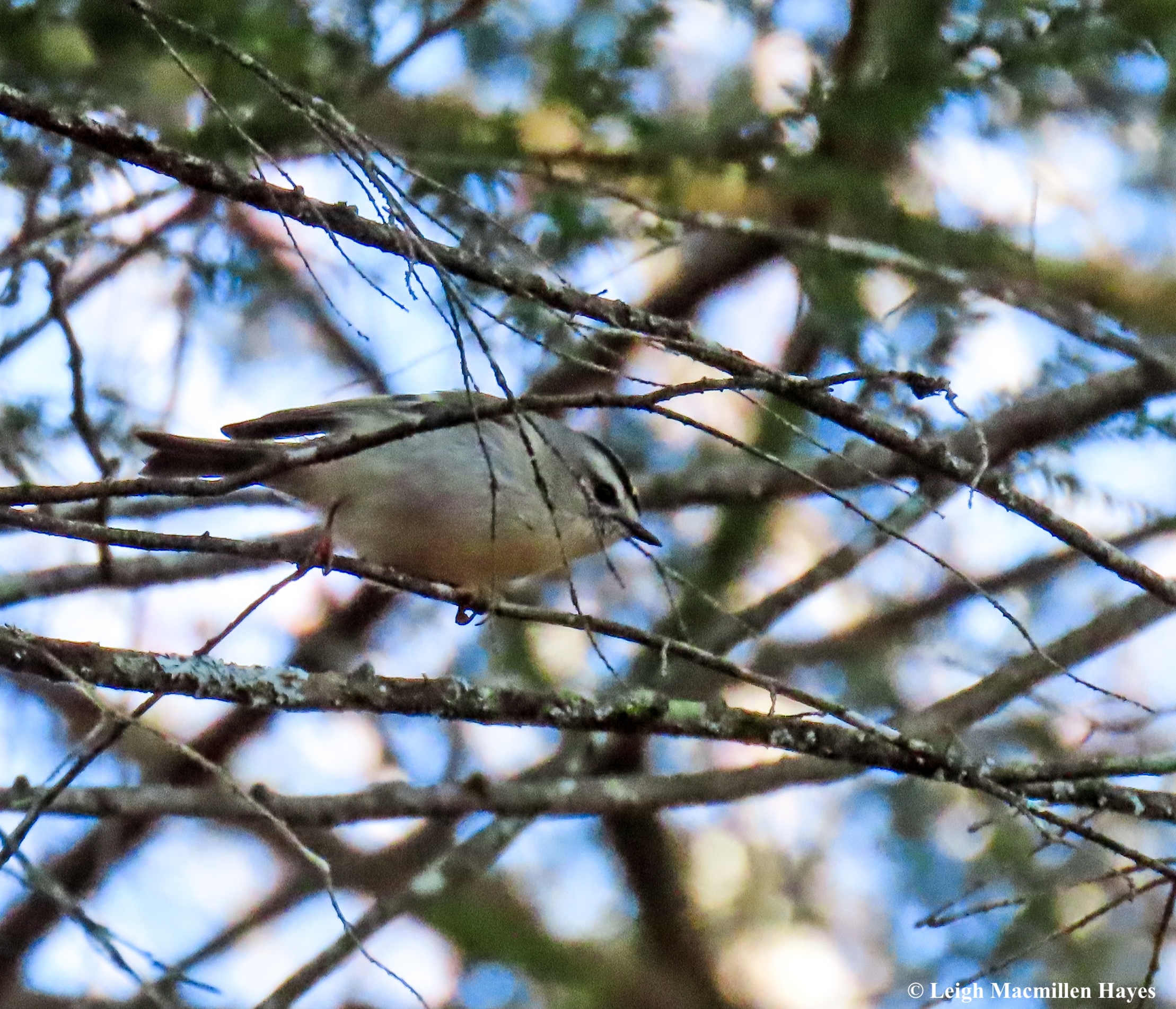
In one section, some wee birds flitted from tree to tree and though it was difficult to get a clear photograph, I was thrilled to be in the presence of Golden-Crowned Kinglets, even if only for a few minutes.

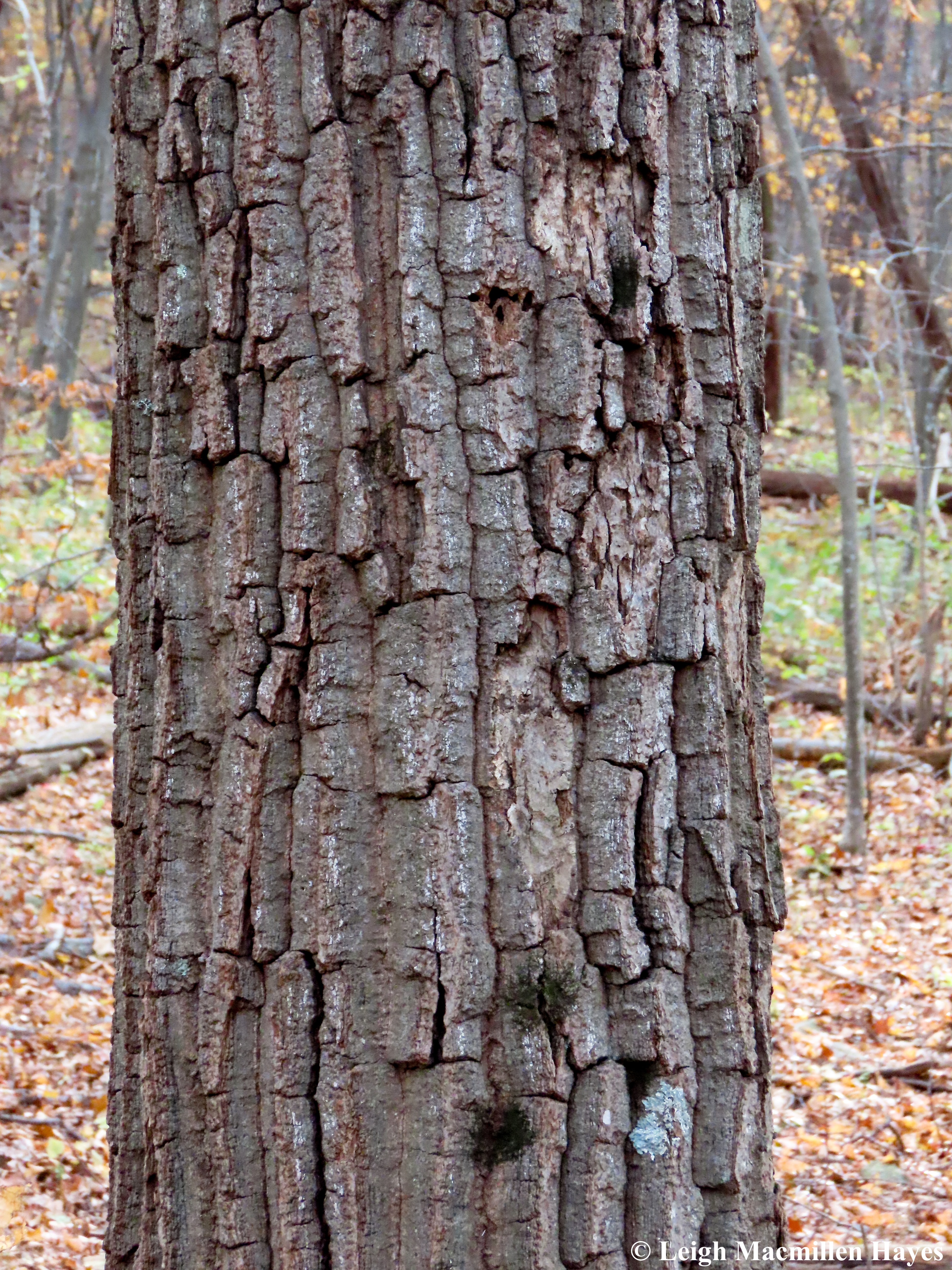
We talked a lot about tree bark along the trails, and nature in general, and all kinds of other topics as well, but every once in a while a tree stopped us in our tracks, such as this one. In my opinion, it offered a great example of the Bull’s Eye Target Fungus that affects Red Maple bark, but doesn’t kill the tree. I explained to my friend that it offers a quick way to identify this species of tree.

And in our midst, as we hiked we occasionally spotted Bruce Spanworm Moths flying about. What I forgot to mention on Saturday was that the males fly, but the females are wingless and we should have looked about because we may have found one. But knowing my friend, now that she knows this, she will be on the lookout. So will I.

We completed a circuit of trails on one side of the main road and then crossed to the field where vegetables and animals had once been raised. It struck us as odd that instead there was a door in the middle of the trail. A locked door at that.

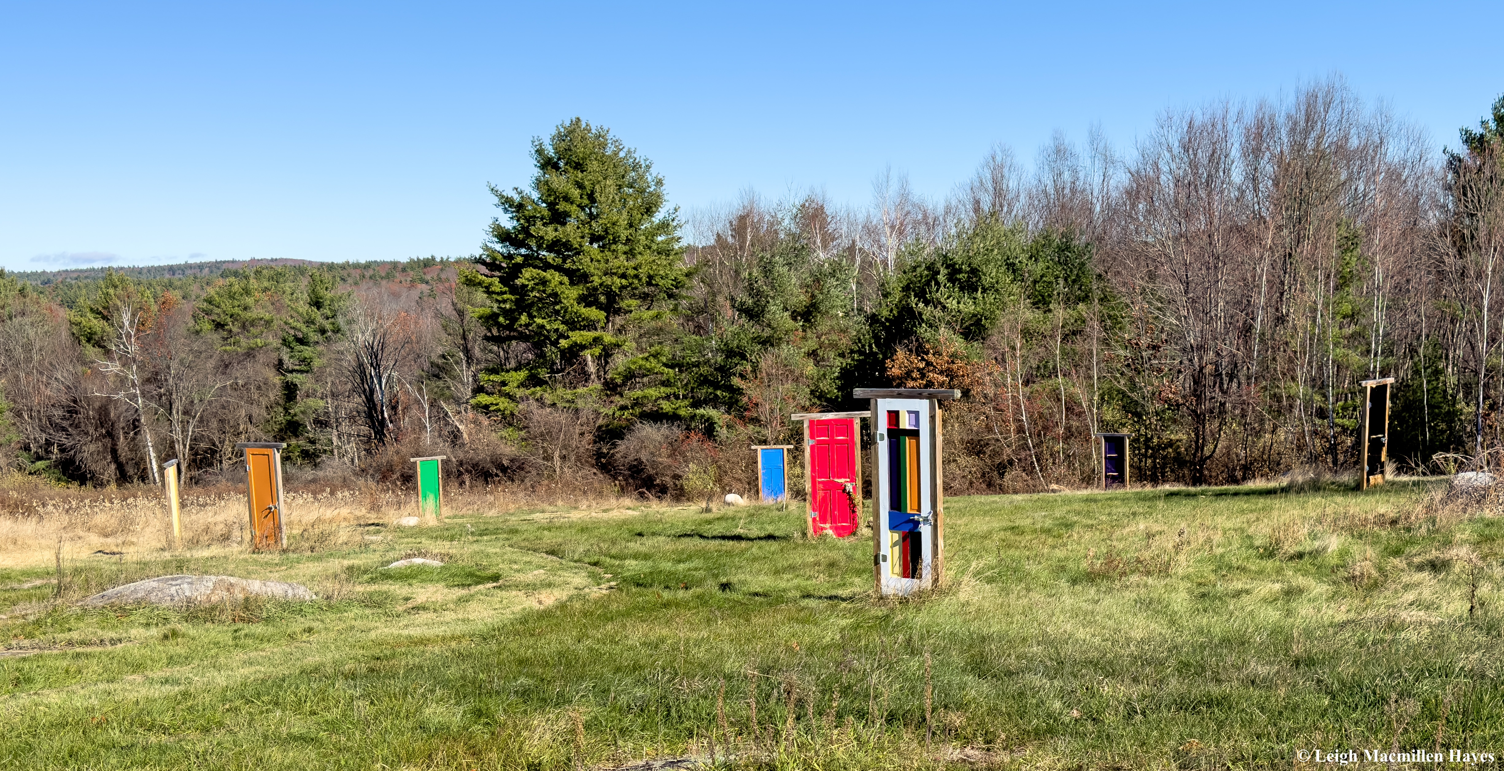
And then in the field below, we found one multi-colored door through which if one could unlock and pass, would lead to a circle of eight more brightly painted doors. You’ve heard of Stonehenge? We decided this was Doorhenge. Or perhaps Doorhinge.

The purpose for this installation? We don’t know, but we did wonder if the doors were strategically placed to represent compass points.

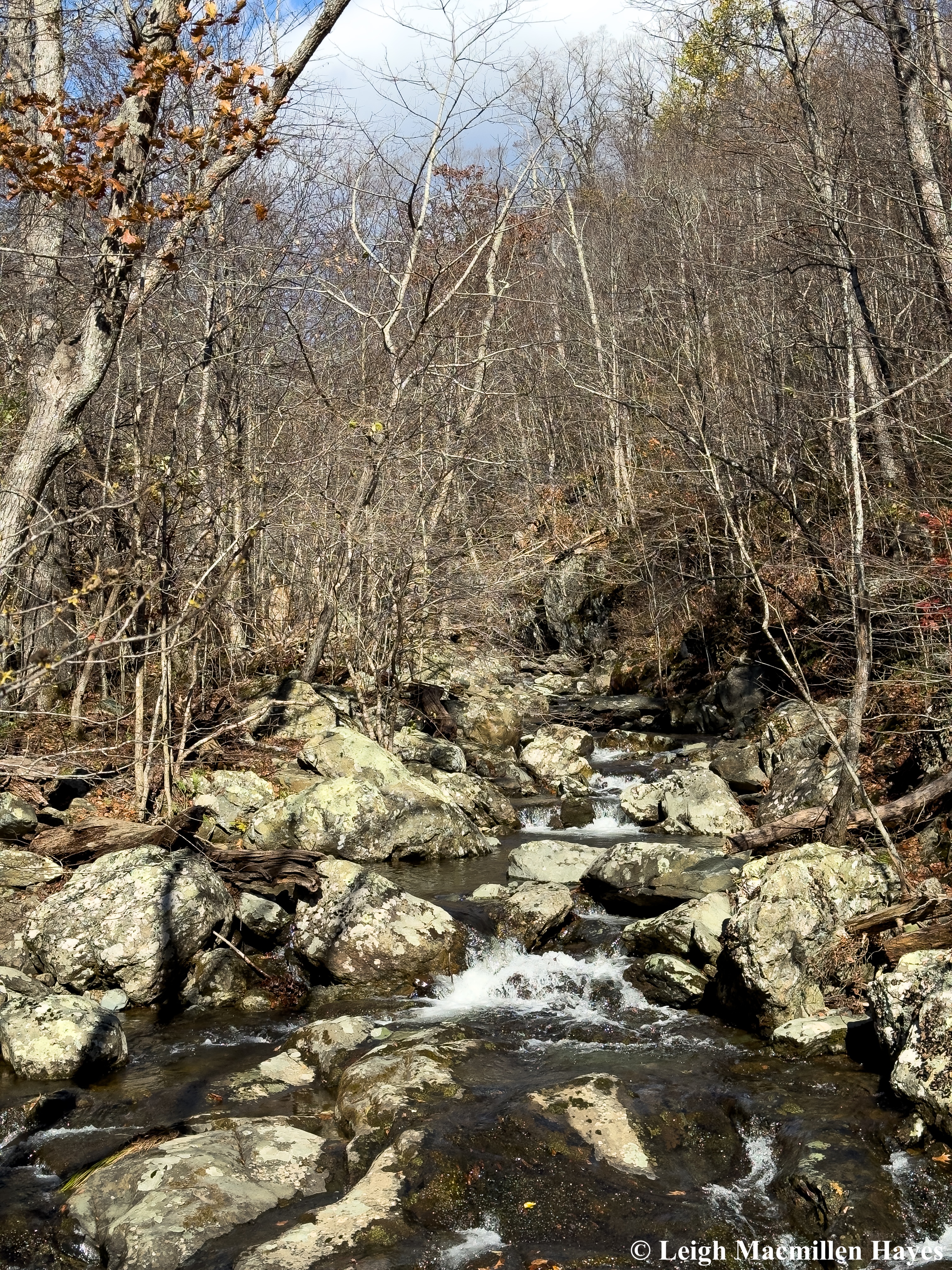
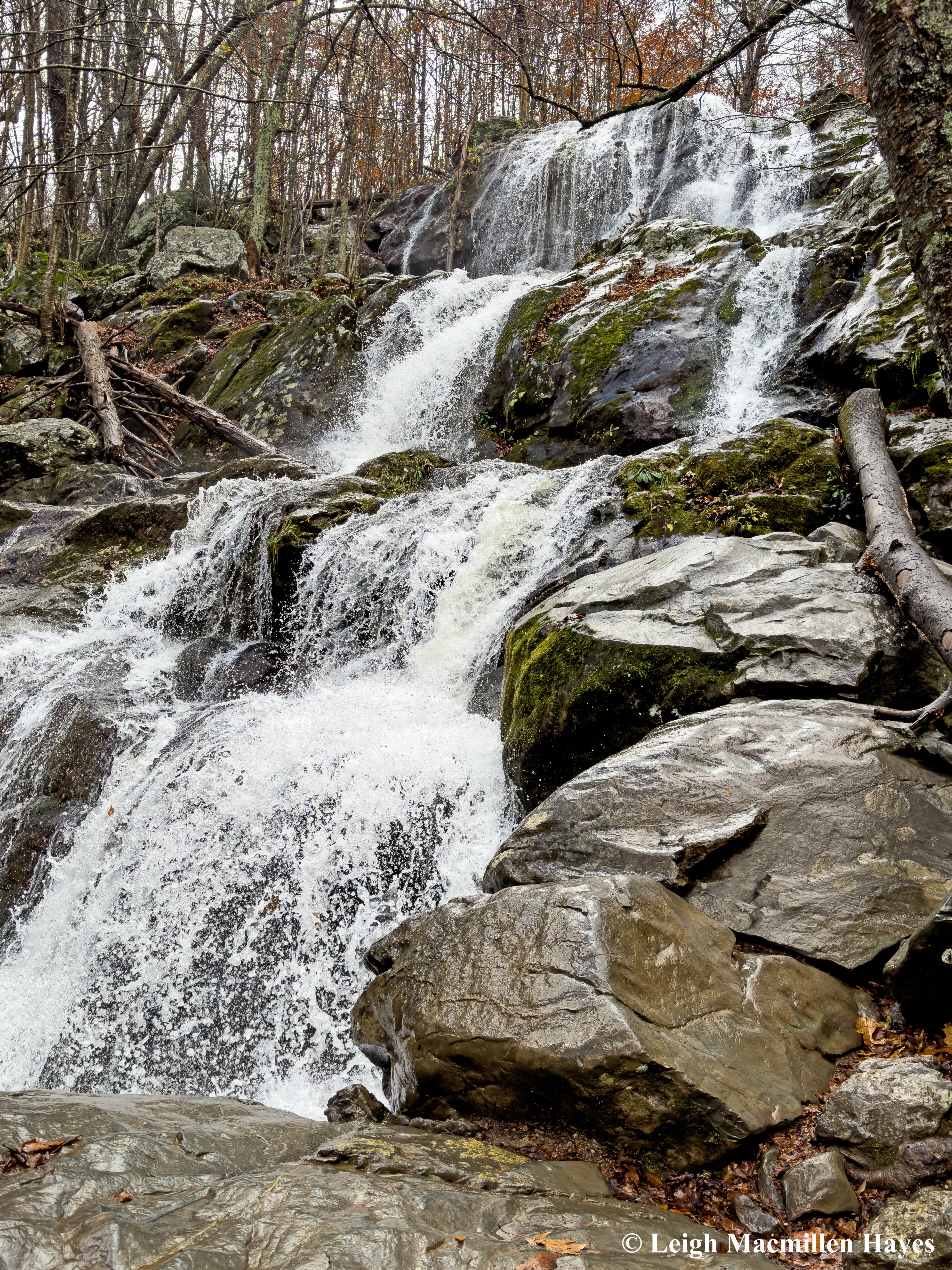
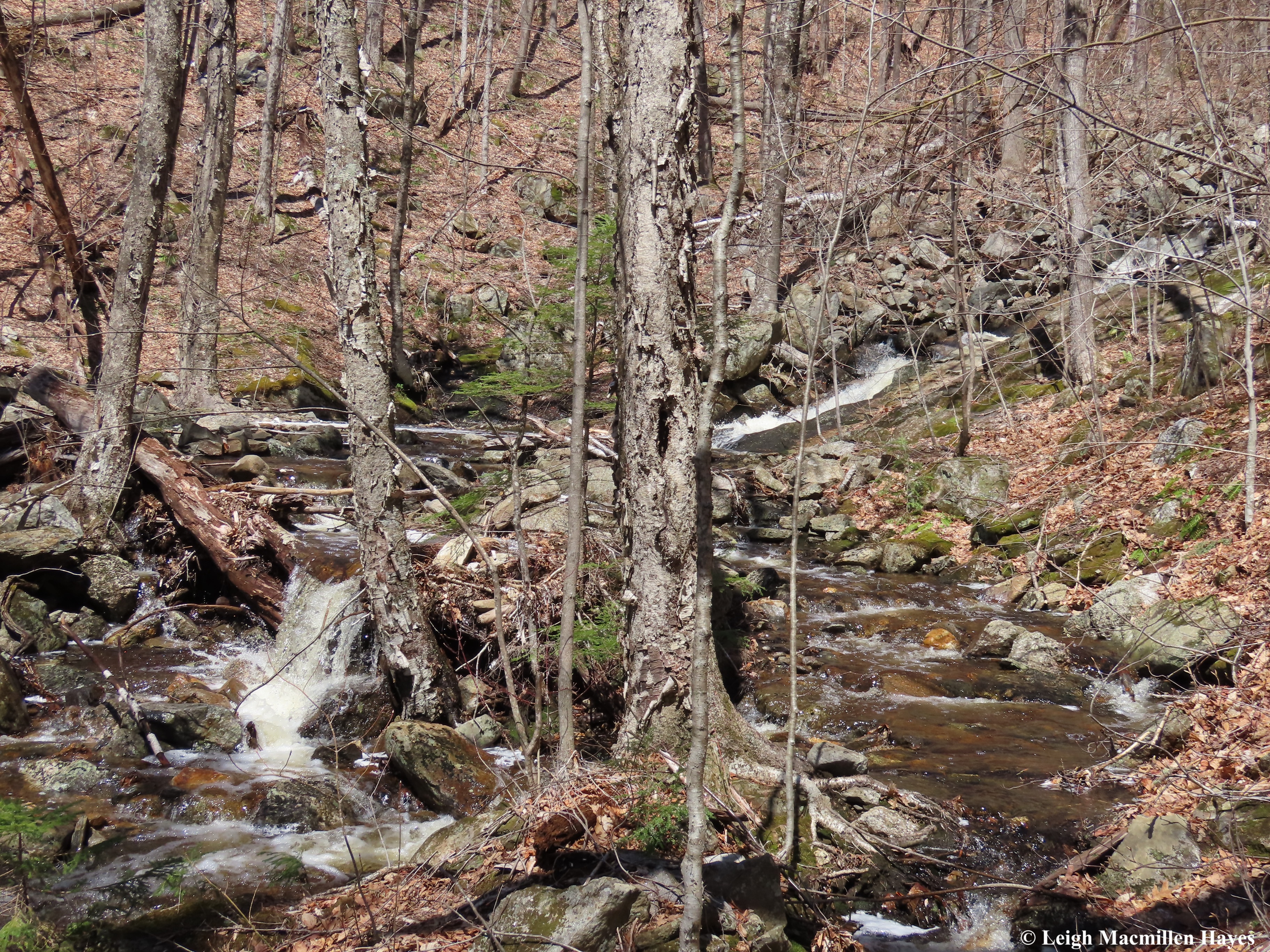
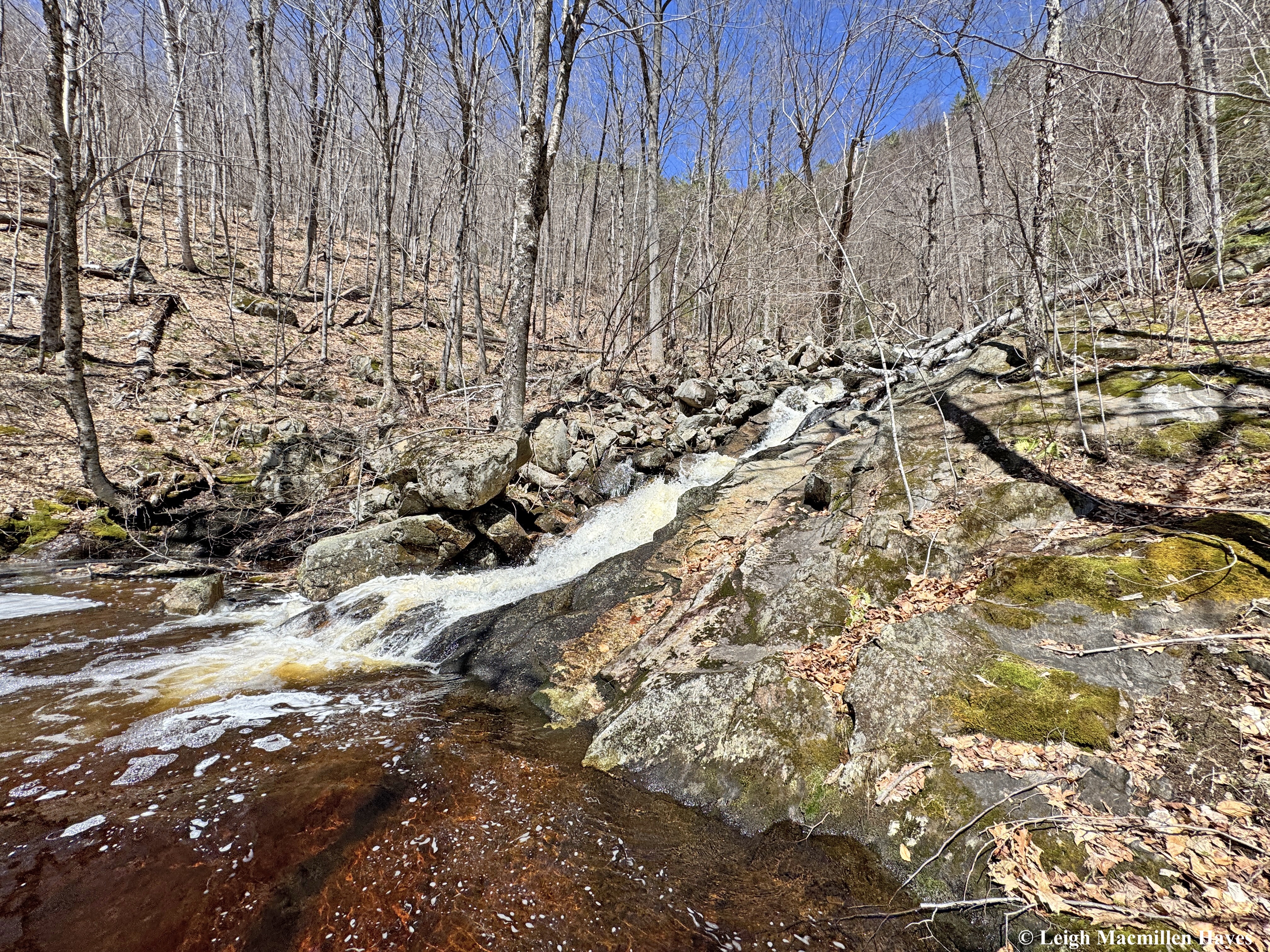
We knew we didn’t have time to hike the entire trail, but were thrilled to reach water, which I think must have been Ash Brook. What we did note was that it was an active Beaver territory.

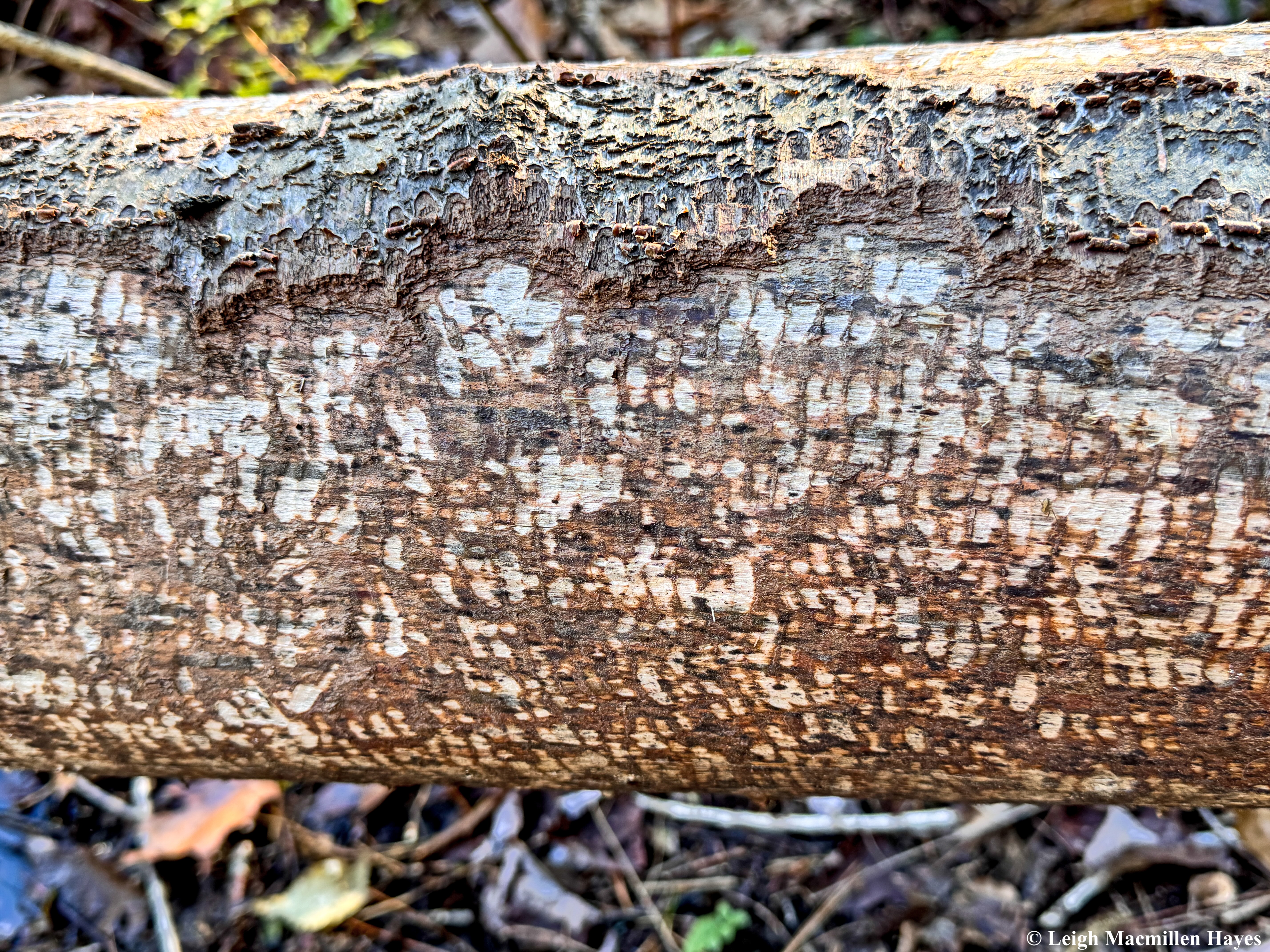
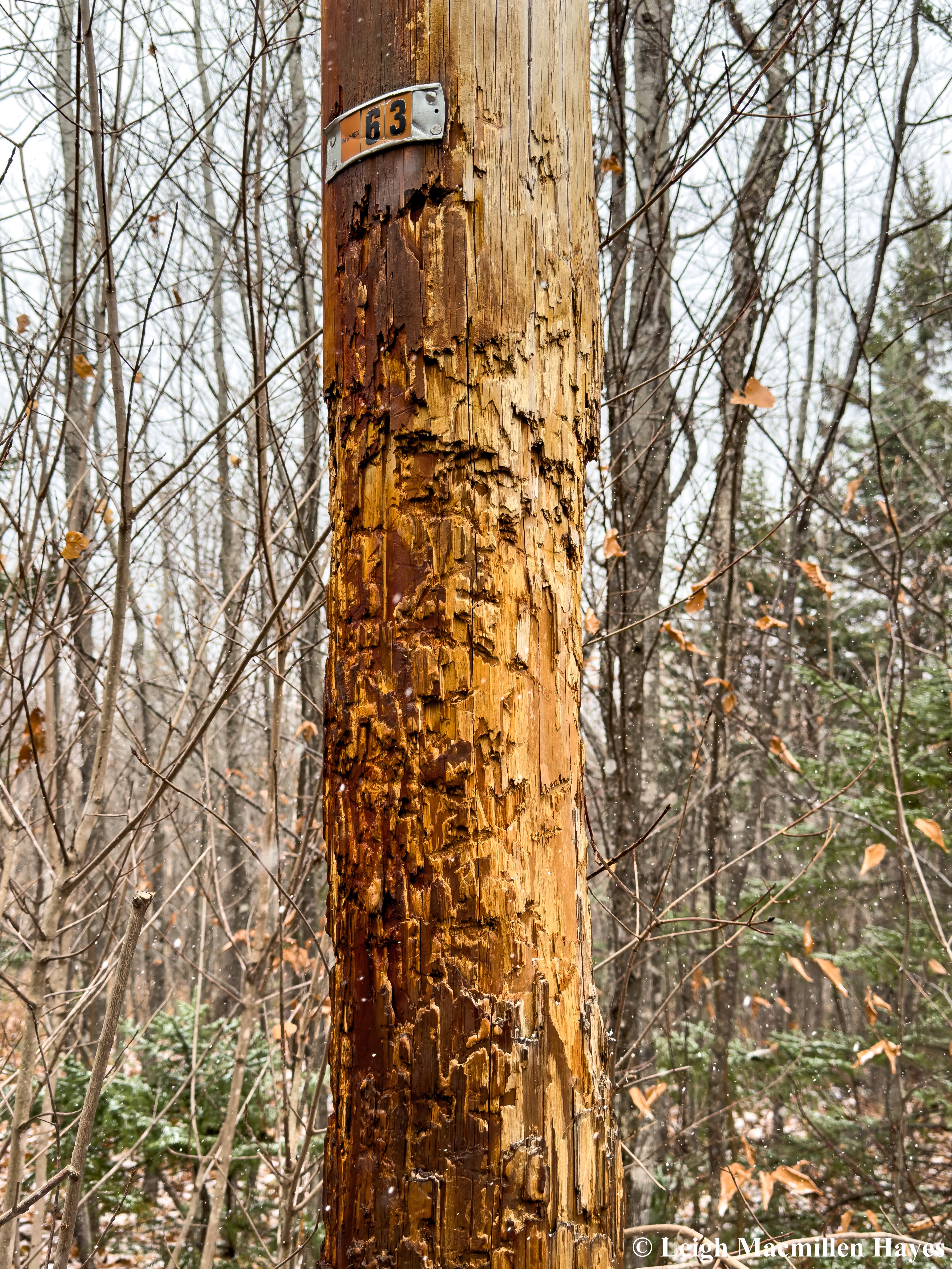
And the work of the Beaver’s teeth as upper incisors met lower to consume the cambium layer where sugars and water and nutrients were exchanged through phloem and xylem, was well documented. Barely any bark was left untouched.

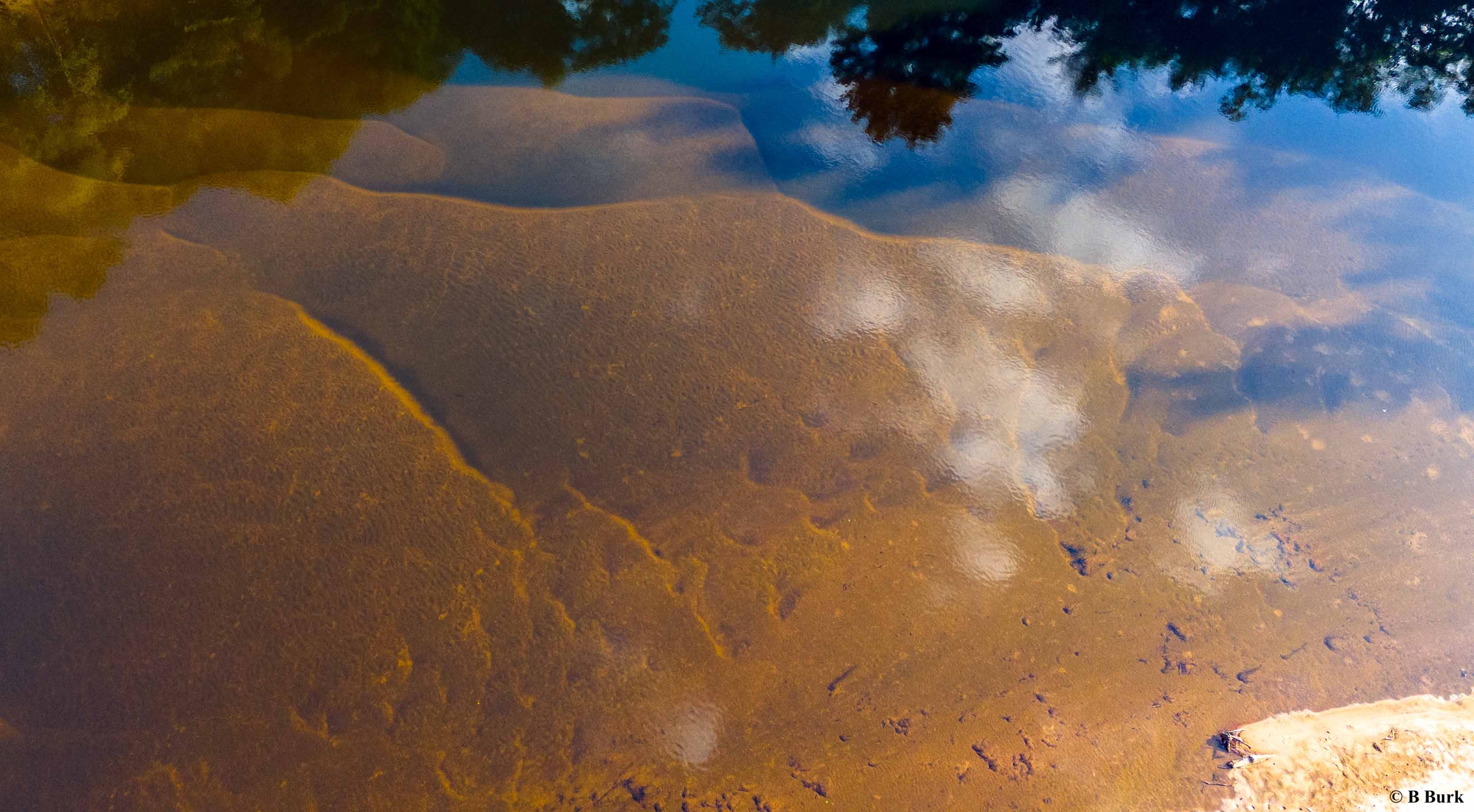
Not far from our turn-around point we reached more water and though we couldn’t find the actual Beaver Lodge, we did note that a skim of ice had formed. And the ice-covered water reflected the Bluebird day we were enjoying.

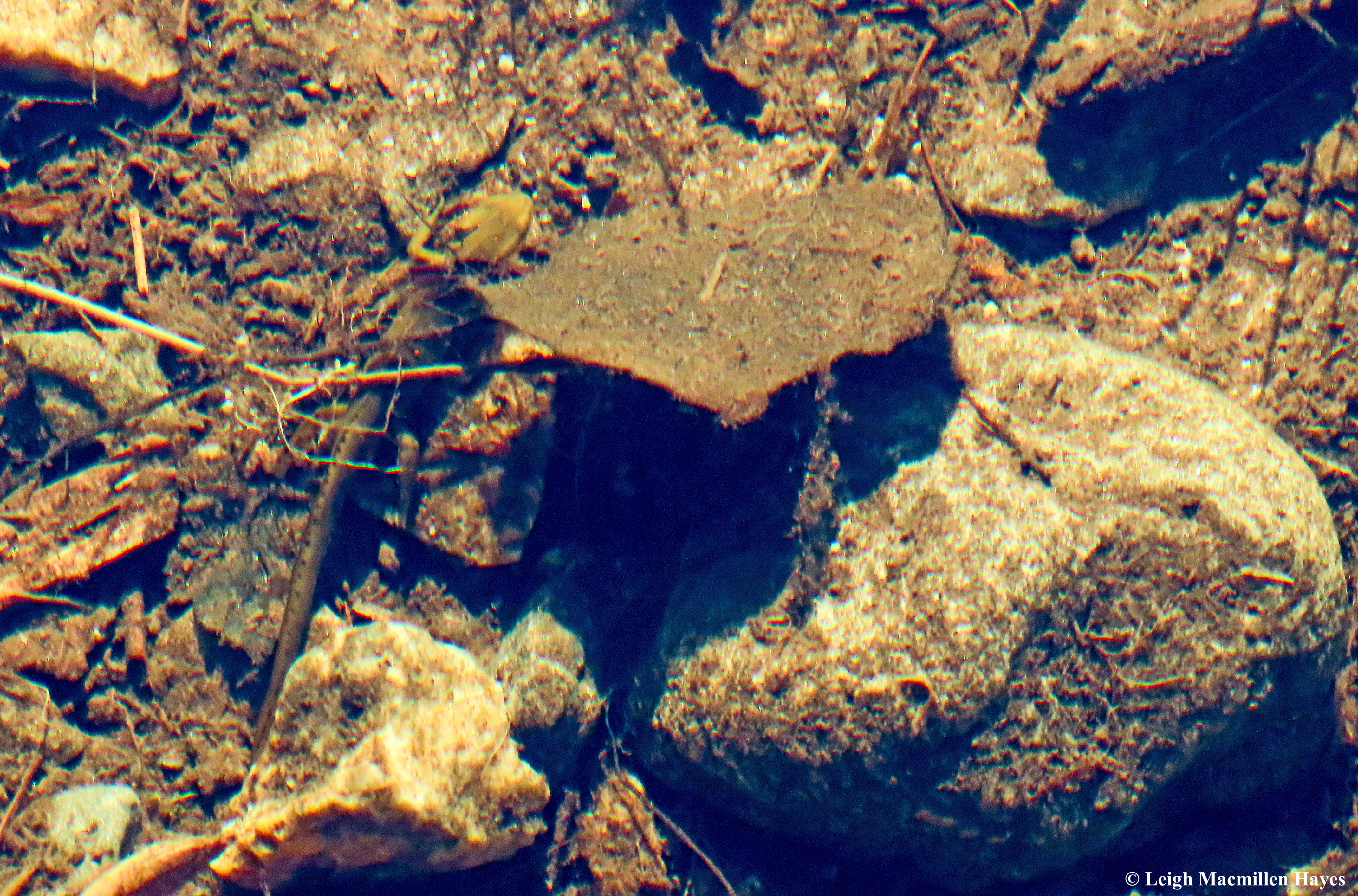
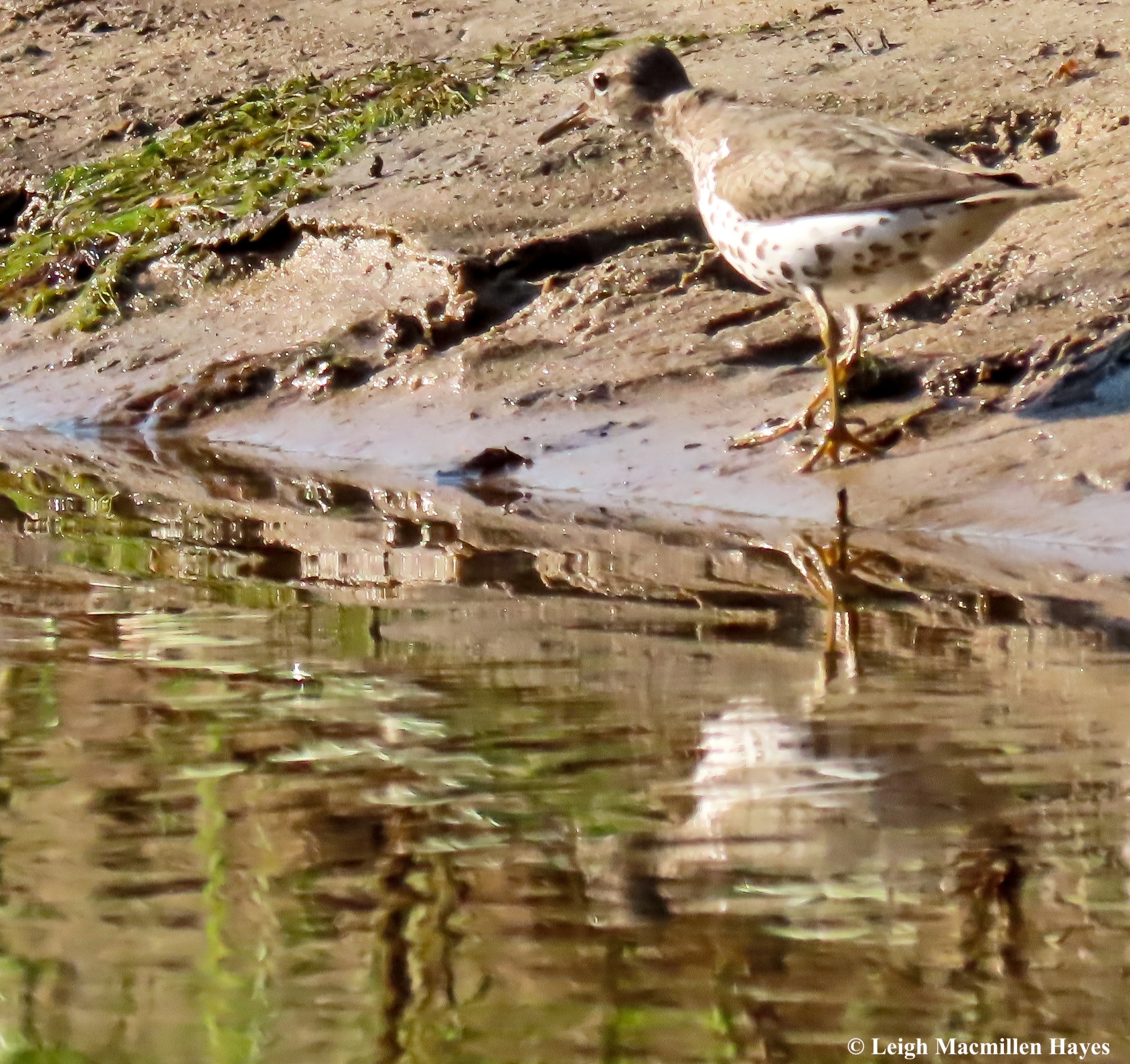
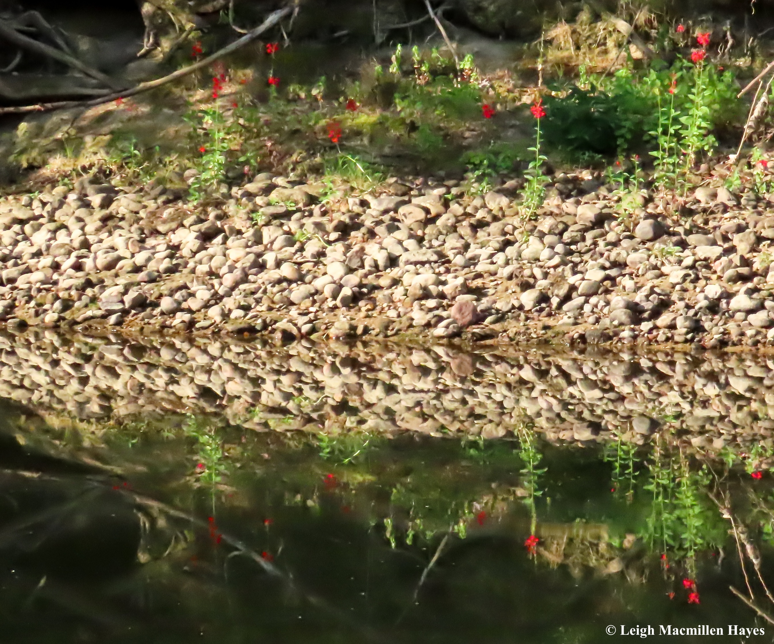
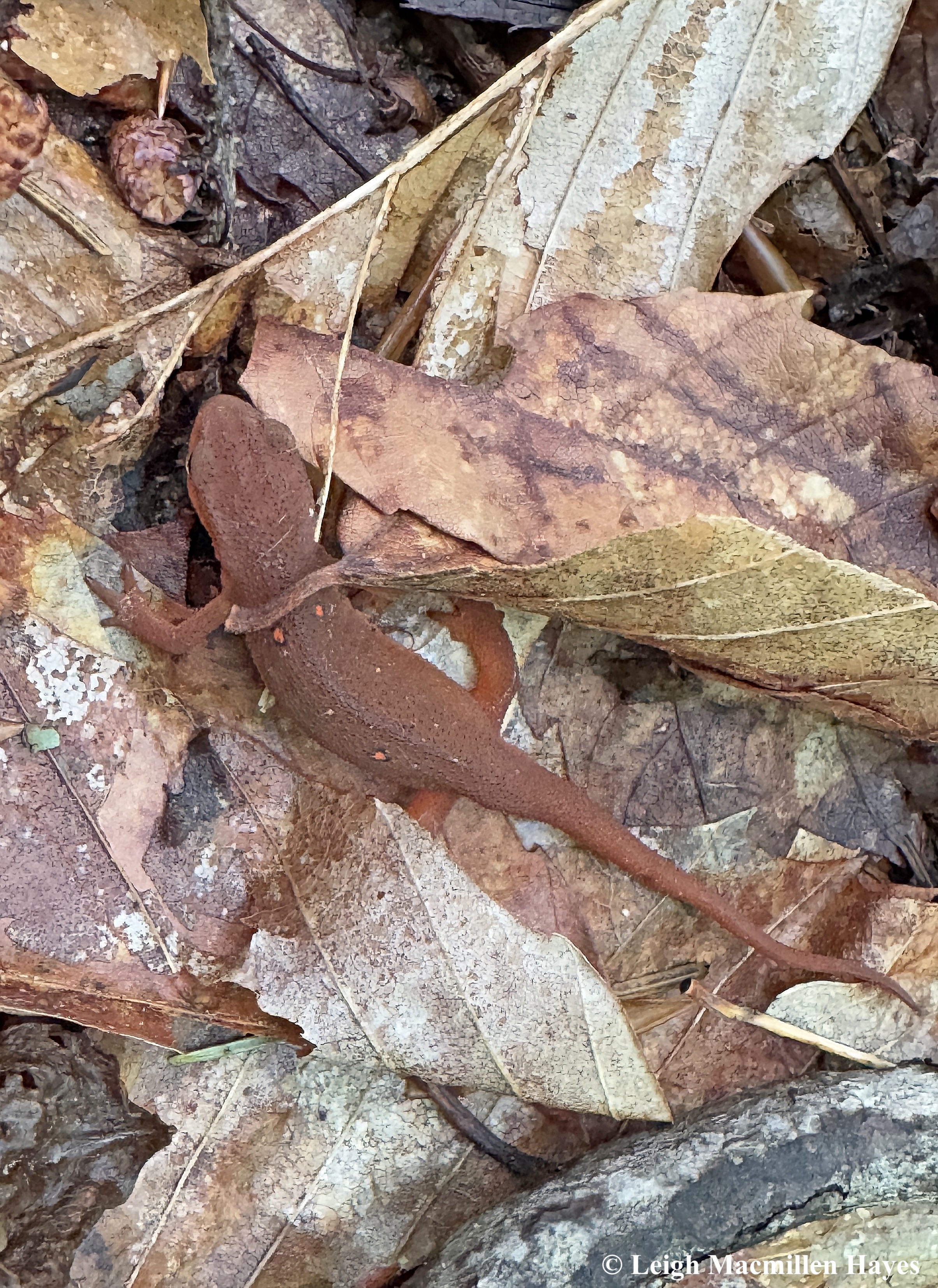
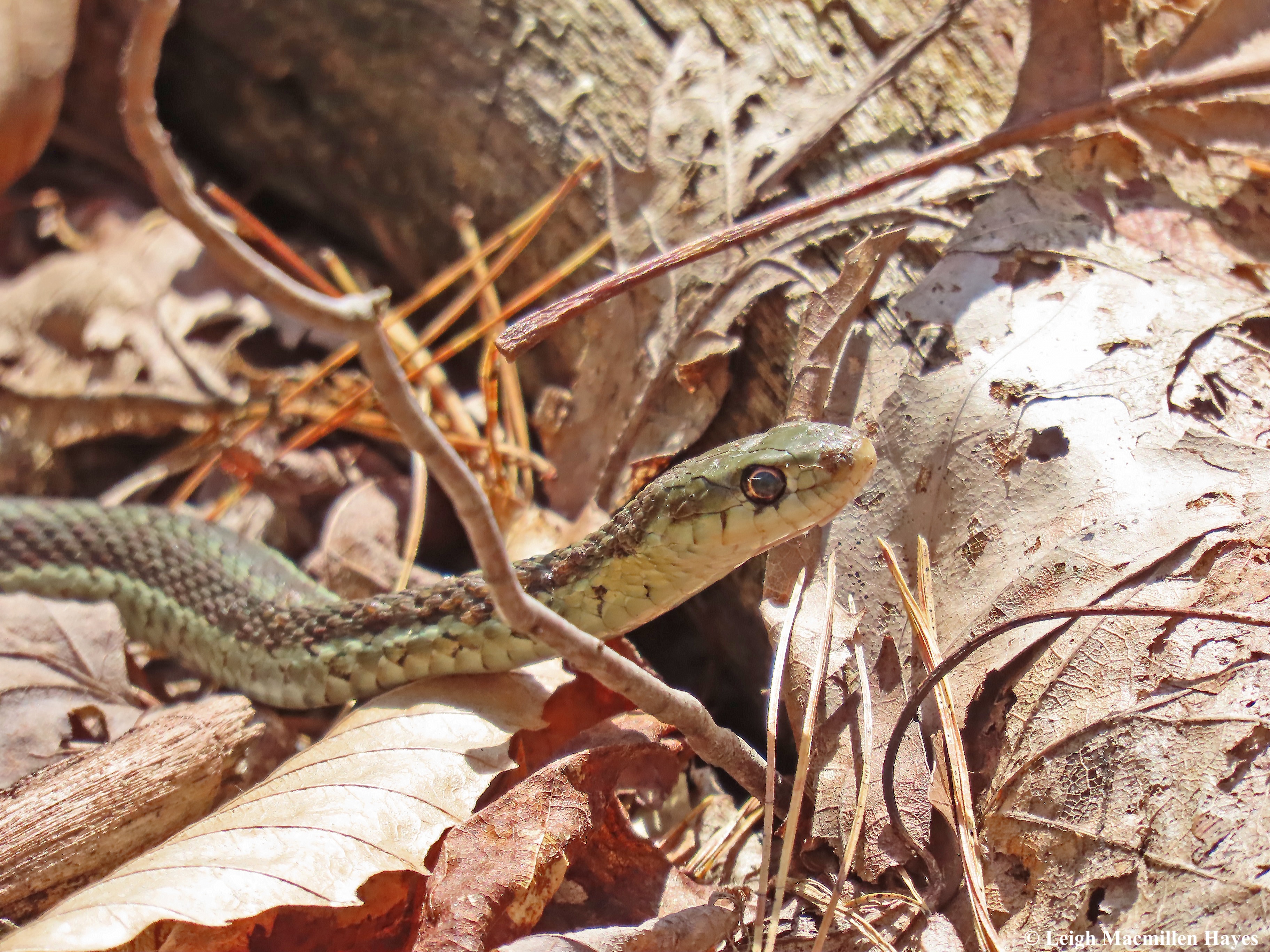
Her eagle eyes also picked up on an Eastern Newt in the water below. Can you see it in this Where’s Waldo image?

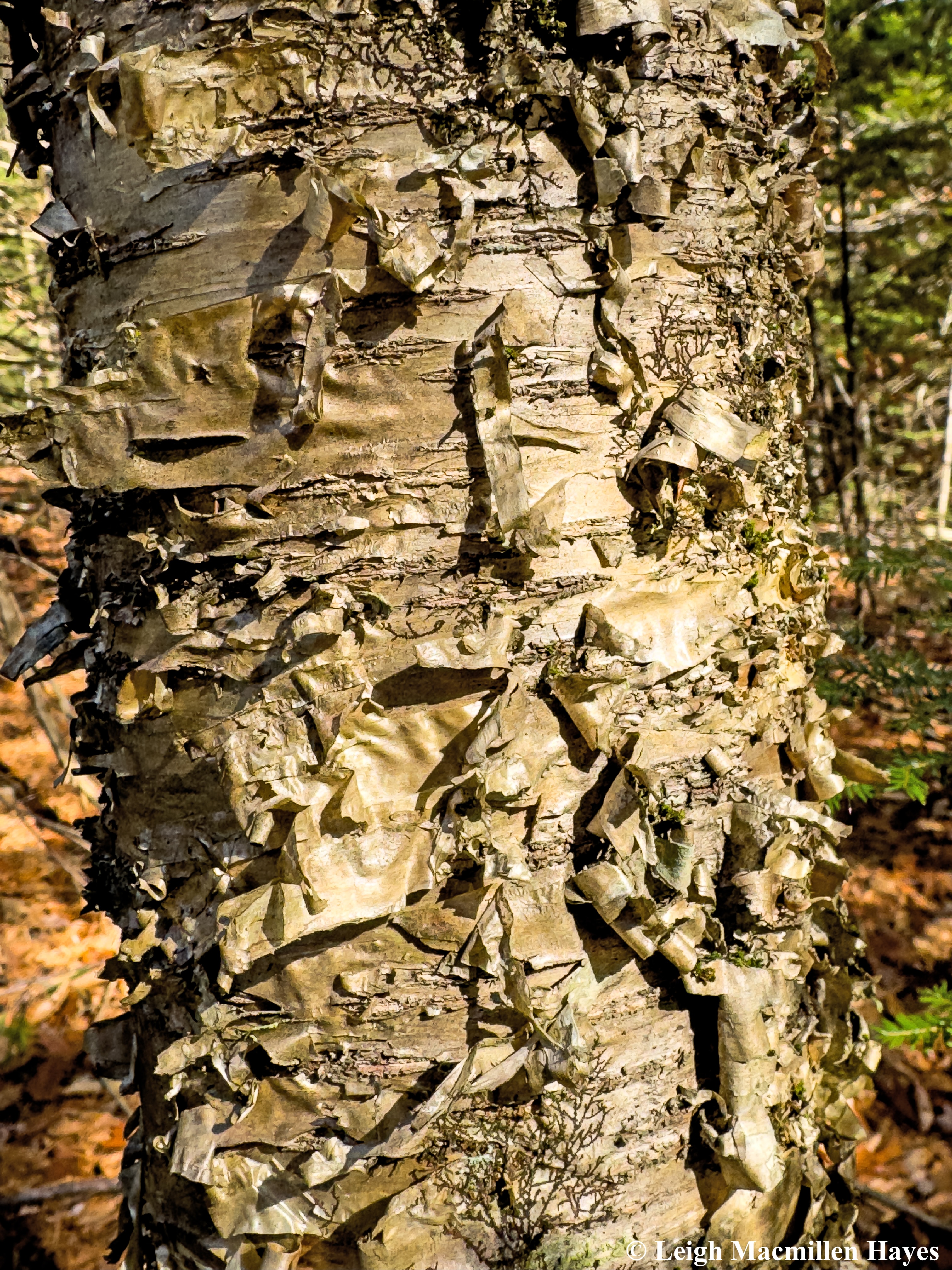
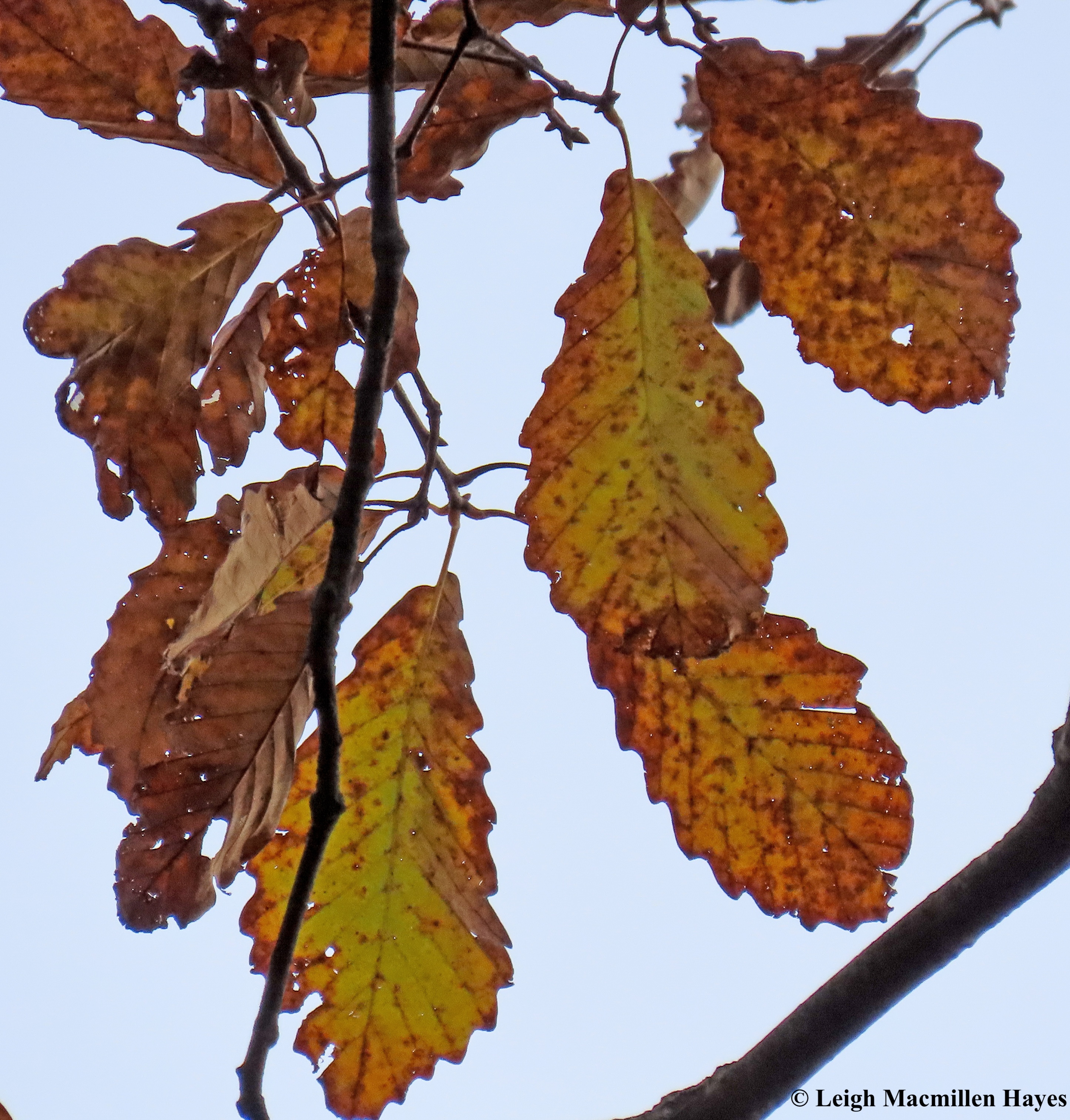
Upon our trek to our turn-around point, for this was an out-and-back trail, we discussed Paper (white) Birch and Gray Birch and my friend mentioned that she didn’t remember ever meeting Yellow Birch.

And then, as often happens, on the return trip we started to spot its curly presentation over . . .

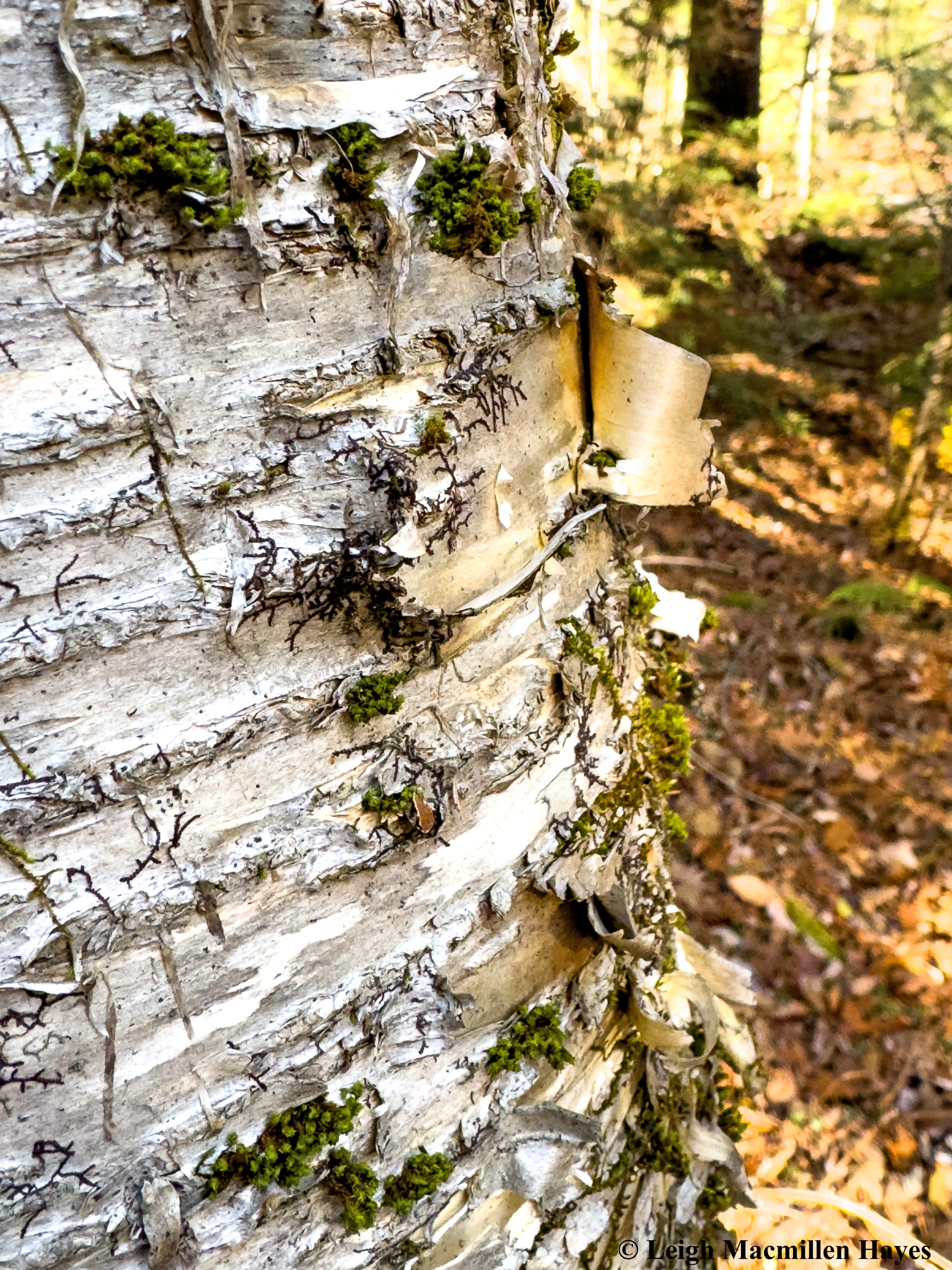
and over again and I explained that as the tree matures it takes on a more silver gray appearance, but my friend liked that she could still see the gold in the curls.

That said, sometimes the Paper Birch trees also had a golden underbark and so I reminded her that she had to also consider how the trees peeled, Yellow being in ribbons while Paper peels in, well, sheets of paper sometimes. Had there been twigs that we could reach, I would have done the touch and sniff tests, but that will have to wait for another adventure.

We even had the surprise opportunity to greet a Maple-leaf Viburnum, a species I’d shared photos of with her earlier in the fall.

We’d given ourselves a turn-around time so that at the end we’d have a chance to sit and eat left-overs from the dinner we’d enjoyed at The Common Man the night before and soak up the warmth of the sun and try to wrap up our conversation that had gone on for almost 24 hours. Well, except for when we were sleeping, of course.

In the end, we gave great thanks for making the time to meet each other at the Halfway Point. Well, the almost Halfway Point if truth be told for I’d only traveled two hours from Maine to reach Concord, New Hampshire, while Carissa had driven three hours north from Connecticut.

I’m so grateful for this friendship that has spanned decades and that we can renew it along the trail despite the distance that separates our everyday lives.

Thank you, Cris!

Pressed to find a new mountain trail

Several friends had told us about a mountain in New Hampshire that we’d never climbed before and so we thought we’d change that situation today. As we drove toward Jackson, there were occasional raindrops and I turned on the windshield wipers, but road conditions were good, thankfully. We could see in the mountains, though, that there was mixed precipitation and we promised ourselves that if conditions warranted, we’d go somewhere else and leave today’s Plan A for another day.

By the time we reached the dirt road to the trailhead, it was really beginning to snow/sleet, and so rather than drive the 1.2 miles up, I found a good place to park, and walk up we did. Mind you, had My Guy been behind the wheel, our journey would have been different. But . . . as steep as the road was at times, I LOVED walking along it.

First, there were the over-sized Pixie Cup Lichens, looking as if they were on steroids, though perhaps it was the crisp mountain air that appealed to them.

And then some old raspberries from the Purple-flowering Raspberry bushes and I told My Guy that the first time I remember encountering them was on a nearby road leading to the Mountain Pond loop. He recalled the adventure and the company we kept that day, but not the flowers, which were in bloom given that it was in a different season.

At the base of a Sugar Maple was a HUGE patch of the Many-fruited Pelt Lichen, its apothecia the tan-brown saddle-shaped lobes.

And then there were the also HUGE leaves of Coltsfoot, an interesting plant that likes disturbed areas like this and flowers first before it produces leaves. Spotting the leaves in the fall, reminded me of the spring flowers.

And I borrowed this one from another post I wrote two years ago. Though the flowerheads look like Dandelions, the stems have modified leaves, and it really is a unique plant.

Why the name “Coltsfoot?” Because the leaves are supposed to resemble the foot of a colt.

Ah, but the best part of the long walk up this road was the fact that there were camps and they needed electricity. Well, the poles were there. And the wires were there. But over and over again, we discovered the wires were on the ground, buried under the leaves and it seemed like they’d been down for a long time.

What intrigued me though? I mean, seriously, a telephone pole in the middle of the woods interests a so-called naturalist? YUP! All of those marks you see below the mangled number are the bite marks and scratch marks of a Black Bear. The bear turns its head to the side and then scrapes the bark with its upper incisors coming to meet its lower incisors.

In the process of doing this, it usually has its back to the pole as it might be leaving a scent or at least getting a good scratch out of it.

And in the process, some bear hair gets stuck. Yes, that’s bear hair. It’s bleached out from the sun, indicating this was deposited at least six months or more ago.

As we continued up, every pole became my friend. My Guy is used to this and so he patiently waited while I gave them the once over.

And again I was rewarded, this one being with black hair, indicating it was a more recent deposit.

I could have turned around then and headed home.

But we didn’t because we’d finally reached the trailhead, which is located on historic Hayes Farm, dating back to the early 1800s, and My Guy was sure he must have some ownership in the land.

Like a few views during our trip to Virginia last week, any mountains beyond were obscured in the moment.

Across the field and then into the woods we ventured, our footsteps being the first to make an impression in the snow.

For much of it, as we followed one switchback to the next, the trail was moderate and then it got a bit more challenging, especially with snow thrown into the mix.

We’d read that there were six switchbacks, but we counted several more. With each one, I’d ask My Guy what the number represented at the pizza joint he worked at when he was in college–1 being plain, two-green pepper, three-onion, four–green pepper and onion, and so it went. If you meet him, throw a number at him and stand in awe as he shares a flavor. Of course, we can’t check the facts so have to trust that he’s not making it up. But then again, I know this guy, and he’s not.

We were almost to the summit, where we knew we wouldn’t have a view, but saw a spur trail and decided to follow it. About twenty feet later we stood behind a boulder and looked out at the Presidential Range.

Like two days ago, it was another super windy day, and we could see the trees sway a bit above us, but felt rather protected in the woods. And at this boulder, it was the same and so we decided to turn it into lunch rock. There was no where to sit, and so we stood and ate our sandwiches, enjoying the view before continuing on.

A short time later, we reached the summit, and as expected there was no view of the surrounding mountains. But we did find the Geological Survey Marker and recalled being on a mountain in Maine when a woman hiked up to said marker, taped it with her hiking poles, told us she was on a mission to touch as many as possible, turned around and proceeded down the mountain. To us, it felt like she was missing a lot, but to her, it was what she did and who were we to dispute that.

The summit was once the site of a fire tower, back in the day when that was the means to spot smoke or flames in the woods. Now, the four cement stanchions and some boards are all that remain, but we did wonder about work to build this one and so many others like it. That said, I’d read that the original trail up this mountain was rather a straight line, and perhaps that made it easier to get materials to the top.

From the summit, there was another .7 miles to go to reach a ledge with a view and an old mine, but we had set a turn-around time because My Guy had a commitment later in the afternoon, so we went a wee bit in that direction and then decided to save the rest of the journey for another day. We really liked this trail and want to visit it in a different season and complete the entire length of it.

On the way down, a few things captured our attention that we’d missed on the way up, including these two trees that intertwined.

And the midden (trash pile) of a Red Squirrel, who had popped out to dine between our ascent and descent.

On the same downed tree, we spotted the squirrel’s track pattern and that of Juncos which flitted about in the trees as we passed by.

And back at Hayes Farm, which is protected by a conservation easement with Upper Saco Valley Land Trust, conditions had changed and the mountains came into view.

As we headed back down the road for that final 1.2 miles, giving us a 6.5 mile round trip, I continued to check the telephone poles, and then across a ditch, this colorful sight captured my attention. What in the world could show off these colors in November. My mind quickly scanned my knowledge, which isn’t always up to par when it comes to flowers, but nothing registered. Until I took a closer look by crossing the ditch. And touched the petals and leaves. Um. They weren’t real! So strange. They were well embedded in the sidewall of the ditch. But why? We’ll never know.

What we did know is that we’d been pressed to find a new mountain trail and Iron Mountain did the trick. Guffaw. Did you catch what I did there?

Above and Below: a few wonders from skyline

Grab a cuppa your favorite beverage cuze this is gonna be a long one.

We haven’t taken a vacation in the past two years, but this past week changed that . . . thankfully. It was rather a last minute decision and the Wednesday evening prior to our Sunday afternoon departure found us booking places to stay and suddenly it felt real.

And then it was.

After a long drive, which we split up with a stay in Scranton, Pennsylvania, where we kept looking for the truck carrying “30,000 pounds of … bananas,” we pulled into Front Royal, Virginia, and vacation really began.

Our intention was to drive along Skyline Drive in Shenandoah National Park and hike as many trails as we could fit into five days. Thankfully, our friend Kimmy had given us a bunch of suggestions, and the rangers at the Visitor Centers had maps for each one.

On each of the trails we hiked, metal bands on the trail markers were stamped with the direction and mileage, and after not paying attention on Day 2, and finding ourselves at least a half mile beyond the point where we should have been looping around, we had to backtrack, and learned our lesson. Always check first before proceeding.

Had we looked, rather than thinking that we knew better, we would have discovered that the trail was to the right.

But it was a loop, so we thought we would end up back in the same spot. The laugh was on us. And laugh we did.

The trails we followed varied from easiest to moderate to difficult with somewhat steep sections or scrambles, and we loved the variety . . . underfoot and in the shrubs and trees, but more on that in a wee bit.

Many had outlooks where we could enjoy the view, but one in particular, reminded us to look, that being White Oak Trail.

As the week went on, it was fun to note how the foliage changed. When we first arrived, the view at Compton Gap was that of a November tapestry . . . golds and greens and oranges and rusts . . . just a bit past peak. By the end of the week, after a windy, rainy period, many trees had lost their leaves.

The next day, though we drove up the long and windy road and through Mary’s Tunnel, it was said rain that greeted us.

On that day and on and off the next, how far Was forever?

Not very.

Even from the stone look-out at the summit of Stony Man, all was obscured.

But . . . we weren’t the only ones making the trek, and as we met other hikers along the way, we all chuckled about the lack of a view.

It didn’t really matter. We were there to hike, and that we did. And to enjoy each other’s company, and perhaps the lack of view put the emphasis on the latter focus.

There were other days or even moments on the same days, when we could see Forever, and gained a better understanding of the local topography.

And sometimes we followed water, the very sound of which gladdened our hearts because it’s been so dry not only in New England, but also in the mid-Atlantic states, maybe more so, and the rain was welcomed by all.

It even offered instant showers and since we were on and off the Appalachian Trail, we suspected thru-hikers might enjoy this very spot where the water poured down as a gift from above.

By week’s end, we had three favorite hikes, this one being to Dark Hollow Falls.

And then with two friends to White Oak Falls we discovered another favorite. I must admit that though this photo was taken with my camera, I let my friend, Kimmy, do the dirty work as the rocks she climbed over daunted me, especially as the wind roared.

The view also included much smaller sightings, like this Shaggy Soldier (Galinsoga quadriradiata), a curious little plant that was still in bloom along many of the trails. From a Botany in Scotland Blog, I read that “The genus Galinsoga is named after Ignacio Mariano Martinez de Galinsoga (1756- 1797). He was a famous physician in Spain’s royal court and is remembered most for writing a book about the health hazards of wearing corsets.” I’m not sure that answers the question of why the common name, but I do know that I completely agree with him about the health hazards of wearing corsets.

My heart nearly split in two when I spotted these Chestnut Oak leaves. A friend recently saw one of these in Portland, Maine, but this was my first introduction to the species.

The mature bark is a combination of ridges and furrows, with a blocky presentation.

As I continued to meet new trees, I was thrilled and challenged and so purchased a Pocket Naturalist® Guide of Virginia Trees & Wildflowers.

My next introduction was to Sassafras, with its tulip-like, three-lobed leaves. There were so many on the ground, that they became part of the scenery along some trails.

And on Day 2, yes, it was chilly, but I took the opportunity to honor a Sassafras with a hug. That was one huge tree.

Again, the bark had ridges and furrows, though it wasn’t blocky like the Chestnut Oak. But . . . I could have easily thought it was an Ash. In hindsight, however, we didn’t encounter any Ash trees.

Though I have met the American Sycamore before, in fact, there used to be a large one in a neighboring town and for all I know it may still grow there. it was still fun to get a sense of the size of the leaves.

And then there was the Eastern Cottonwood, a cousin of our Aspens (Poplars), and I could only imagine all of the fluff along the Hawksbill Greenway in Luray, where this tree grew.

By its bark, I never would have known it, but fortunately, there was a sign below it that indicated it was a Cottonwood. I love signs!

Again, any of the barks we met all looked the same, at least during our brief encounters, so I was grateful for leaves that helped me differentiate them.

Others from away have mentioned Pawpaw, but this was my first time seeing the leaves that are widest at the middle.

They seemed to grow in clumps or groves and I wondered if they were all from seeds or is some root sprouting had also taken place. They reminded me of American Beech, which can do both and quickly fill an area where the sun shines.

One that I had never even heard of was the Princess-tree, and it had leaves the size of umbrellas. I’ve since read both pros and cons about this tree and you can do the same and make up your own mind about it, but it was certainly a surprise to meet it.

Almost last was one we found at the Shenandoah Heritage Village Museum. Again, I’ve heard of it, but this was a first time seeing it. My what long needles.

At about eight inches, each packet of three led me to identify it as a Loblolly Pine. I am sooo grateful that I purchased that guide.

So here’s the thing about the conifers. For a couple of days we met only deciduous trees, and most of them were the species I mentioned above. And then, as we went higher in elevation, we began to meet a few Eastern Hemlocks and White Pines and many of the trees we are familiar with in our woods. My Guy even noticed the various communities, and along some trails Mountain Laurel grew almost like a hedge.

I’ve saved this particular leaf for last in the tree section of this blog. Oh, believe me, I have plenty more to say. But this skinny leaf that My Guy held for me, is another Oak species.

We only knew about it because on our rainy day hike, when we turned around from a mountain adventure and decided instead to explore in Luray, we discovered this sign along the Hawksbill Greenway, a two-mile trail through town.

We looked up the hill from the sign and didn’t spot anything that looked different. After we’d walked to both ends of the trail and back to our starting point in the middle, we headed up one street that led us to the next, and then one more because we had spotted something that we thought just might be the champion.

Meet the Chinkapin Oak. Born about 1775, think about all that this tree has witnessed. I wanted to hug it, but refrained because I didn’t want to accidentally introduce something to it. For example, what if I had teeny aphids on my mittens that I wasn’t aware were there from having touched other trees? No, instead, I just stood in awe of this mighty giant. We both did, actually.

Returning to the trails, sometimes we came upon historic sites, this one being the Fox family graveyard.

Lemuel F. Fox died in 1916 at the advanced age of 78. That’s actually an incredible feat.

Especially considering he survived the Civil War, where he served with the Confederate States of America.

At the Snead Farm on another trail, we discovered what seemed to be a raised dooryard and large foundation and sensed the Sneads had some money.

Perhaps the house burned down, or was taken apart and moved, but the horse barn still stands.

I peeked into each of the stalls, just because I could.

Interestingly, visitors can ride horses on some trails specifically designed for them. though this one isn’t.

It’s a place for everyone, including those with mobility issues, for the Limberlost Trail is accessible. .

And truly it is a place for everyone as we met people from a variety of states and countries, including Sri Lanka, Spain, England, Germany, Israel, and more.

A place for all also includes the critters who make their homes here. Deer. Did I mention White-tailed Deer? They are everywhere. We also spotted the occasional Gray Squirrel. And we really wanted to see a Black Bear, but didn’t have that opportunity.

Our most prolific mammal sighting, other than Deer, the Northern Short-tailed Shrews. These are not everyone’s favorite food as they emit a toxin and so are quickly dropped upon capture. Either one larger predator didn’t learn the lesson the first, second, third, fourth, or fifth time, or there are so many of them running around at night that the everyone tries to make a meal of them.

On the day we hiked with our friends, we had a couple of fun insect sightings, including this Punctuation or Anglewing Butterfly–be it either a Question Mark or Comma. It never did show the underside of its wings so we couldn’t determine it to species, but it was still a fun butterfly to spot.

Speaking of spots, we saw at least three Spotted Lanternflies. I was intrigued with their colors, but Kimmy told me to squish them as they are extremely invasive.

And because of her we got to see a Walkingstick upon a rock where she just happened to place her hand. If it hadn’t moved in that moment, she would probably not have seen it. We were all grateful that it did move. And then it posed for us.

Now that you’ve stuck with me for this long, I’ll let you know that I saved some of the best for last.

On that rainy day, we not only walked the Hawksbill Greenway, but we also went on a self-guided tour of Luray Caverns. According to the brochure we received at the ticket booth, the caverns are the largest in the East and were discovered by a tinsmith and local photographer in 1878. This diorama depicts that moment when the discovery was made.

And X marks the spot where it was made. Can you imagine the man’s excitement and amazement?

Discovered in August, we were told that the first tour occurred that November.

The cavern is a cave where Stalactite and Stalagmite meet, but in this instance that is an optical illusion. Can you see why?

There are veils to admire.

As well as a tent . . .

made of “curtains” that seem almost transparent.

We chatted with a couple of young docents and they told us that this structure is seen as something different in every season–from a Christmas tree to a pine cone to an ice cream cone, and one more that neither of us can remember. But the big question was: what ice cream flavor?

The answer: Rocky Road.

And then there were the Fried Eggs. Or oysters on a half shell?

We highly recommend a visit. I’ve only shared a few of beyond-belief spots, as around every corner there was a different formation to look at. I felt like I was in fairy land with lots of action everywhere as stories unfolded.

Back on the trails, we also had fun finds, like this columnar jointing, which turned it into yet another favorite trek. It’s known as the Fort Windham rocks and is greenstone and part of a series of lava flows, that we spotted in other places as well.

It reminded us of the Giants Causeway in Ireland, a geological phenomenon of 40,000 basalt stone columns formed by volcanic eruptions over 60 million years ago.

And so we posed.

We posed again at Dark Hollow Falls.

And then I took a shift as a park ranger. (Actually, the park rangers are furloughed under the current shutdown, so we were reminded each day to be extra careful while hiking because rescues could take hours.)

As for My Guy . . . no vacation is complete without a trip into the local hardware store.

But where my readers usually see only the back of him, he was happy to lend his almost 6′ height as a reference for this large boulder.

And while we were truly excited to spend a week hiking together, we were equally excited to share the trail with these two, Maddie, a high school senior who had the day off, and her mom, Colonel Kimmy Jennings, USAF retired. Kim was a student of mine back in her middle school days. It’s always a joy for all of us when we can meet up and share the trail, though typically it’s when she makes a trip home to Maine, so she was thrilled that we’d actually ventured south. And our pose was in front of another example of columnar jointing.

After we hiked for about four hours with them, we had one more hike to tackle bringing our total to ten trails, that being Mary’s Rock, and then we left Luray and returned to Front Royal for the night before beginning our two-day journey home with a stop over in Albany, NY and a quick tour of the Norman Rockwell Museum on the final stretch.

Like any vacation, we’ll cherish this one forever.

Above and Below, I guess it was actually more than a few wonders that wowed us along Skyline Drive and in the area.

Surprise Ending

Sometimes we follow familiar trails and other times we go off the beaten path. Well, sometimes we go off the beaten path along familiar trails. And other times, we just plain go off the beaten path because we’ve never explored an area before, and even then, we don’t exactly follow the intended route and part of that might not have been our fault for perhaps maps and blazes didn’t correspond. But in the end . . .

Wait. Let’s start at the beginning. We drove across the border into neighboring New Hampshire for a hike and though we’d never been to this spot before, I suspected when I spotted the fruits upon the Mapleleaf Viburnum, that we’d made the right choice. Usually it’s the colors of the leaves that tug at my heart strings, for there is no other tree, or shrub in this case, that exhibits these colors in combination: pinkish-red, purple, magenta, and burgundy.

But the dark blue fruits have disappeared on most that I’ve seen this fall and so I was thrilled to discover so many upon several of this species.

We followed the trail, and then went off trail, of course, for about 2.5 miles, but noted that the description of wetlands was rather deceiving. Oh, they were there, but not clearly visible from the trail and even when we did get to the edges, we could barely see the water for buffer vegetation was so dense. That said, I’m sure the water quality was good. That said, we were in an area with some warning signs about a mining operation years ago, and so the water quality must have been compromised and we can only hope is recovering.

As we circled our way out, we noted that we could have been anywhere in northern New England for we were familiar with all the plants and trees we met. And then My Guy, who does not like mushrooms as part of a meal, spotted a bunch of Red-belted Polypores, which we both admired for a few moments.

Our first leg of the journey completed, we ate lunch and then drove down the road and wandered into the woods again to locate the site of an open pit that was last mined in the early to mid 1900s.

Since then, others have tried their hand at prospecting and if you are a “Where’s Waldo” fan, I encourage you to try to locate a trowel in the photo above.

Among the waste rock dump, I was amazed to see a Marginal Wood Fern with its bluish-green leaves and loaded with sori (groups of spores) lining the edges of each leaflet. Their dark color indicates the spores had ripened, but still visible was the whitish, translucent tissue (indusium) that is kidney-shaped, and partly covered the spores.

We left that trail behind and headed off to complete one more loop. Well, we thought it was a loop. Turns out we followed two different trails that did not meet.

But, along the way, we discovered this huge bird box, a nesting box meant to encourage Barred Owls. I’ve since read that these should be in a mature hardwood forest near water. This one was located on a conifer at the edge of an old log landing. There was water nearby, though it took us some a while to locate it. Has the nest ever been used, we wondered. The Barred Owls in our neck of the woods seem to find tree hollows in which to set up housekeeping and the fact that I hear them most nights and occasionally spot one during the day, and have for several decades means they are quite happy living here, and don’t need a box.

But I digress and return home in that last thought and we hadn’t returned home yet for we had two more discoveries to make on our rather off-course trek, the latter one being the most significant.

As I said, we eventually located a wetland after bushwhacking once we reached a dead end on the trail. We would have explored it more, but had just realized that what we thought was a loop wasn’t and we wanted to know where another trail might lead in the time we had left before heading home.

Take note of the water level. Not too low. Curious.

In trying the connect dots, we returned to our starting point of this third leg of the journey and then hiked in the opposite direction. Again we reached a dead end. And again, we bushwhacked from there and came to one rather dried up wetland. Why?

Perhaps there was a beaver upstream? We don’t know. But we did spend some time exploring it.

At first glance, it was so barren and my heart was saddened for the loss of life. Obviously, this used to be part of the forest as evidenced by the tree trunks. And then it was flooded. And now it isn’t. Since the drought? Since before that? Answers we don’t have.

My Guy explored in one direction and I moved across the mud in another and met a stump garden.

In its own dried-up way, it was a thing of beauty with lichens and mosses and plants and grasses and trees all finding their niche in the midst of such apparent devastation.

On the barkless outside, I discovered a myriad of lichens from Pixie Cups to Powderhorn (now apparently called Wands) to Red-fruited Pixie Cups.

Not to be confused with British Soldiers, which do not have cups, the Red-fruited Pixie Cups brought a smile to my face due to their goblet formation topped with those outlandish caps along the margins. The red is actually the apothecia or reproductive structures where spores develop.

Beyond the garden stump was another and even another, their roots wrapped in a forever embrace.

But the show stopper was what I spotted in the mud. A track. There were deer tracks galore. But . . . another mammal or two or three had also passed this way. Note the details.

I present to you, my dear readers, a bear print. Black Bear in this neck of the woods. The smaller toe is on the left, which means this is a right front foot–their big toes are on the outside of their feet rather than the inside like ours; better for climbing trees.

Do my arrows help you to see the parts of the foot?

Bears are waddlers, which means they have wide hips and their pattern tends to be a bit of a zig zag, with a hind foot landing near where a front foot had been. Oh, let the tracking season begin.

With two white lines, I’ve tried to trace two bear tracks that My Guy is studying.

Suddenly this desolate, dried-up space, wasn’t so bad after all.

This was our surprise ending. My heart be still.

Zodiac Three: A Perfect Picture

The message arrived again for a boat trip, but this time the meet-up time was 5:30am, rather than 6. So I set my alarm for 4:00 in order to have an hour of quiet time to greet the day in darkness as I read and meditated and reflected and sipped coffee.

It was still dark when I arrived at the Captain’s home and hopped into his truck, with the boat in the back.

About ten minutes later we were in Hiram, Maine, at a boat launch along the Saco River. It’s been his dream for three years to make this journey and I love that I get invited along for the adventure.

I would have written about Zodiac Two, when we cruised along (with a small electric motor) the Old Course of the Saco in Brownfield Bog, but my photos were all out of focus and so since then he has given me a photography lesson and many tips.

The sun was just brightening the sky as we headed upriver, a smart plan in case the motor’s battery ran out of juice and then we could paddle and float back to the launch site.

I’ve been on the Saco a bunch of times in a variety of boats, but neither of us had ever explored this section below the Brownfield Bridge and I was struck by how calm and clean it was. The water is also quite low–thanks to the drought that we’ve been experiencing again this summer so we had to be aware of sandbars and stumps and logs and rocks. Well, actually, any time you are on the river, you have to be aware of obstacles.

As we started the journey a dragonfly landed on my leg, and she proceeded to try to lay eggs. Have you ever felt the tip of a dragonfly’s abdomen try to pierce your skin? It’s a bit of a prickle. While she was doing that, I tried to snap a photo, but neither she nor I were successful. Still, I counted her as a good omen.

Sometimes, as we gently cruised along, we each took photos of the same scene, so some of these are his used with permission, and others are mine.

The reflection of the shoreline was one that struck both our fancies. We didn’t talk about it, but it was the layers that intrigued me and reminded me of the force of the water in this mighty river that originates in Saco Lake at the top of Crawford Notch in New Hampshire and winds its ways with a million oxbows to North Conway, NH, and then into Fryeburg, Maine, and across the state before it flows into the Atlantic Ocean in Saco.

Sometimes we realized we were looking at Silver Maple floodplains and other times there were steep cliffs. Always, we knew if there was a house or camping trailer near the edge, because they seemed to be located on high ground, but all the trees were cut between their high ground and the river to provide a view, and the result was intense erosion. One person even had several tarps draped over the ground in what we figured was an attempt to stave off the erosion. We think leaving the trees and trimming branches would have been a better choice, but no one asked us.

Another sign of erosion, the visible roots of many, many trees, also created works of art and my brain is already painting this scene in the future . . . maybe.

And then there was this work of art–a Silver Maple Lollipop, its leaves already shutting down chlorophyl production perhaps as a result of the dry spell we’ve been experiencing.

Slowly the sun rose and the water captured the sky in whirls and swirls and rainbows of its own making.

We’d both headed into this boat ride expecting to see birds, which we did, but we really expected Great Blue Herons and Bald Eagles. The drama artists. Our best sighting of the day was this Spotted Sandpiper, who walked along the river’s edge and then flew ahead and landed and did the same thing all over again. Over and over again.

Once the sun was fully up, our day turned into a bright one, and we had a nice breeze to accompany us. Plus tons of dragonflies and a few damsels, all of whom did not wish to let the paparazzi photograph them. Still, we gave thanks for we could see bugs in the air, but nothing attacked us, unlike during our Zodiac One and Two trips.

At what became our turn-around point, we got out of the boat and waded through the water to a beach, where Captain B set up his drone.

Above us, the waning moon stood out in the Bluebird Blue section of the sky.

The drone allowed us to see the lay of the land, and despite the fact that I’ve seen it recently from Mount Cutler while hiking with My Guy and a friend, I was once again reminded just how beautiful this area is and how small we are.

Do you see that beach in the river’s bend? We were standing there.

You might be able to see the Zodiac now.

And the two of us near the boat. Plus the indentations of a million duck and goose footprints. A flock of something skittered and flew off as we approached this spot, but they were too quick for us to identify.

The drone also gathered this shot of the layers of silt in the water. Or maybe we weren’t really on the Saco, and had instead taken a trip to Mars? Oh, but wait, there is a reflection of trees that very much spoke to our being in Maine.

On the way back, we spotted Cardinal flowers that we somehow missed on the first leg of the journey. They decorated a few sections of the shoreline and maybe stood out more because the sun was shining so brilliantly on them.

For Captain B, it was a new flower to add to his list. For me, it was a sign that it is August and we were by water because they do like wet feet.

We also spotted one tiny Painted Turtle that didn’t seem at all bothered by our presence. I’d really wanted to see a turtle, so was thrilled with this finding. But surprised that we only saw one.

According to my GPS, our trip was four miles in each direction, but then I realized that the APP cut some corners, so maybe it was 4.5 miles one way. Plus I forgot to start it until after we’d left the beach.

The length wasn’t really important. It mattered more to have the opportunity to discover this wild and scenic and quiet section of the river (and not have to paddle!).

As for the perfect picture, this is one that Captain B snapped and I can’t believe he actually captured the fawn. We were both surprised, even though we’d expected to see deer, when a Doe and her spotted youngster stood by the water’s edge as they nibbled on grasses, but they saw us and quickly dashed into the woods, their white tails on high alert.

The sight of the two of them, however, is what I’ll cherish in my mind’s eye because that’s really where perfect pictures are stored.

Zodiac Three: The Perfect Picture. Thank you again and again, Captain B, for creating the opportunity. And I can’t believe you did get this last photo after all.

Vermonting We Did Go

Okay, so “Vermonting” is not a word. But we did go. And came home richer for the experience.

It takes us forever to plan a vacation, even a mini-one. Well, actually, it only takes a few minutes once we put our minds to it, but prior to that it’s a lot of “We should go to . . .” or “We need to get away,” or any of a myriad of other comments, and we do nothing.

So about a week ago we cleared our calendars. We knew kinda sorta where we wanted to go, but didn’t know where we might stay, until we discovered The Barn in Peacham. We have a red barn attached to our 1870s farmhouse and long ago turned the upstairs into a movie theater/rec room for our sons, all that being a rather rough rendition of either–the movie seats were from an actual theater in our hometown, which was the best part. The seats are still all up there. And there’s a pingpong table and an air hockey table and trophies (remember the Porcupine Invasion last November?) and various other things, plus now a Yoga area for My Guy, but it’s hardly like the space we rented for the weekend as pictured above.

Cozy, roomy, tons of natural light, everything we needed, even eggs and English muffins if we came up short for our first morning.

I think one of my favorite things, and I had lots of favorites, were the little windows that lined the floor in all four rooms. And above these in the kitchen, a Fannie Farmer Cookbook on a shelf. It was touches like this that enhanced the already perfect space.

And our host and hostess, Chuck and Mercy, were equally delightful, and full of information. Thanks to them we discovered Three Ponds Sandwich Kitchen in Danville our first night and marveled in the deliciousness.

But what we were really there for was to hike. And so Saturday morning we went in search of the trailhead to Peacham Bog. If you happen to see My Guy this week, ask him how that search went. We’re still laughing.

We did find the trailhead, but obviously not where we expected it to be. And at the recommendation of Brian at the Groton State Forest Nature Center, we decided to hike the two miles in to the Bog and then continue along a multi-use trail before reaching Devil’s Hill, circling back along the same route.

The natural communities along the way made us feel as at home as the barn, for we (read “I”) felt like we were walking among old friends such as the Mountain Woodsorrel. I love its peppermint ice cream presentation.

And then, in a damp spot Swamp Beacons lit the way and I was drawn back in time to my first encounter with them while tramping through the woods in Lovell with friends Parker, Joan, and Dave. RIP Parker–please know that you accompany me on and off many a trail and I know that you would be happy that I actually remember some of what you taught me.

Vowing not to count Lady’s Slippers, we didn’t. But they were there, though most waning.

At last we reached the coveted bog, where a boardwalk was long ago placed to keep hikers like us from stepping onto the fragile environment.

It was at this point that another funny story evolved, but again, you’ll have to visit My Guy at his store to get the rest of the story.

At last reaching the platform with a bench at the end of the boardwalk, we sat down to eat sandwiches and take in the scene and sounds that surrounded us.

Sphagnum mosses formed the peat base and laurels and Tamaracks and Firs and flowers and insects all expressed themselves.

I, of course, can never see too many Pitcher Plants and be forever wowed by those downward facing hairs that entice insects in to the pitcher-shaped leaves where the end-of-life lurks.

And the otherworldly flowers were in full bloom, including this one that hosted a long-horned insect and a sub-imago Mayfly (read: Dun).

I’ve been wowed by these for a long time and years ago drew this rendition as a teaching tool that now is the background for my iPhone.

There were Unadorned Bog Flies pollinating Bog Labrador Tea.

And Cotton Sedge showing off their hairy tufts.

Our next leg took us from the Bog to the Groton multi-use trail, being used mainly by horse riders and moose. We saw neither, but their tracks were evident in the mud.

What we did spot was this Aurora Damselfly being wrapped up by an Orb Weaver Spider. I knew the damselfly immediately because of the uneven stripe on the sides of the thorax.

And had recently tried to paint a mature form of the same species.

We also met a couple of Red Efts, the teenag and terrestrial stage of the Eastern Newt. The red spots act as a warning to predators because if consumed, they secrete poison toxins from their skins. As humans, we can touch them and live, but to ingest one would be harmful. So don’t try that.

A couple of miles later we reached the trailhead for Devil’s Hill and snaked our way up the switchbacks to the summit, where this view of the rolling hills and iconic geography of Vermont stood out before us.

On the way down, a male Luna Moth presented itself, hiding as it was under a Striped Maple leaf.

I love these leaves and their twigs, especially the growth rings that stand out so predominately, and My Guy appreciates that the leaves serve as Nature’s Toilet Paper. TMI? But really, they are easy to identify and they are soft.

Returning on the multi-use trail before retracing our steps on the Peacham Bog Loop, we had to walk through tall grasses and sedges, which did not make my heart so glad because this was heavy tick territory. I had on tick gaiters and repellant. We took at least five off My Guy.

But, this pair of Craneflies did share a canoodle moment with us, so that won me over for a second.

All in all, we hiked over eleven miles that day, and were too beat to go out to dinner, so instead drove to the West Barnet Quick Stop, about 1.5 miles from our weekend home. There we ordered Chicken Cordon Bleu Paninis with Pesto, and a salad to share. And while we waited for our meal to be created, noticed Shain’s of Maine Ice Cream in the freezer, which made us chuckle. Wait a minute. We were in Ben & Jerry Country. Never fear–they had a much better presentation in another freezer.

And, while we waited, I asked the woman who was creating our salad if she lived in the area. “All my life,” she said, and added, “So far.” We chuckled, but then I asked if she knew so and so, a couple I know from church who had lived just down the road for many years (a fact I’d only learned days earlier).

Her face lit up with a smile as she recalled them and said they used to frequent her other store and that their daughter had worked for her. As tired as I was, that smile of hers was the perfect ending to a great day.

Well, it wasn’t quite over yet. For there was no TV at our weekend digs. And so I taught My Guy to play Parcheesi, and then I beat him.

The next morning we drove north to Orleans to meet my first college roommate and her husband, Bev and Bill, at the Carriage House for breakfast. Funny thing–as I drove up Route 91, there was one car in front of us and approaching it, with its Maine license plate, I spotted Lakes Environmental Association and a Loon Echo Land Trust stickers on the rear window. It had to be someone from our hometown. Sure enough, as I passed it, I recognized the mother of one of my former students. And a wondermyway follower.

Betty, if you are reading this, that was us on the highway with you on Sunday morning at 8:30 or so.

We spent two hours talking and eating and talking and talking some more over omelets and coffee and Bev and Bill suggested that we hike Mount Hor, which overlooks Willoughby Lake. I’d been to Willoughby before with Bev and two other dear friends, but never hiked in that area. And so we did. They gave us easy to follow directions and we parked and then walked almost two miles up the CCC Trail. I love that this was another project meant to keep people working when times were tough.

Though the hard packed surface we walked on was not the original road, we kept spotting these posts and my theory is that they were original and held cables that connected one post to another and kept vehicles from catapulting down the steep embankment.

When we finally reached the actual trailhead for Mount Hor, I met a new flower. Canada Violet. It made sense since we were probably about ten miles from the Canadian border. Delicate. Pure white. A well-defined runway to the nectar. And leaves offering a different take on the violet theme.

What we soon realized was that it not only grew tall, but also in large clumps.

Oh my gosh, our next find–Maidenhair Fern. Such a unique presentation and color and, oh my gosh!

At the summit, we had three choices. First we headed to the Summit Vista, where the view included Cedar trees in the foreground and two delightful couples who were enjoying GORP and blueberries but when they heard that we had homemade Peanut Butter Chocolate Chip granola bars a la The Stow Away Baker in our backpack, they wanted to chase us down the mountain.

From there, we hiked another mile across the ridge line to the East View, overlooking Lake Willoughby.

While there, we spotted a Peregrine Falcon soaring on the thermals, but neither of us got a good shot of it. Still. Forever in our minds eye. And sometimes, those are the most memorable moments.

From the North Vista we looked across at the cliffs of Mount Pisgah and wondered how many more falcons we weren’t seeing.

Back down the CCC Road we did walk once we stepped off the mountain trail and my favorite find was a Mountain Maple, that stopped me in my steps for a few minutes as I had to remember who it was that I was meeting.

Back at Lake Willoughby North Beach, Mount Hor is on the right and Mount Pisgah on the left, creating a fjord-like presentation.

From there, we drove south to South Barton as I let my nose lead the way and found a cemetery I’ve visited in the past for some of my ancestors are buried here.

Recognizing family names is always a treasure. And actually, within the post railings of this place I noted at least three different families that have contributed to my DNA. I’m pretty sure my love of the north country, be it Northern New England or Canada, comes from these folks.

On the way back to our home base, we grabbed sandwiches to go from Three Ponds and gave thanks for their goodness.

And then this morning, after packing and cleaning and chatting briefly with Chuck, we had one more place to explore–Kettle Pond State Park within Groton State Forest.

So here’s the thing. My understanding of a kettle bog is that it’s kettle or bowl shaped. And has an outer layer of herbs, with the next layer surrounding it of taller herbs, and then a third layer of shrubs encircling the kettle, and finally, trees who like wet feet, like Red Maples, forming the final ridge around the pond.

None of this was present. Well, there were shrubs and trees, but not in layers like I’m used to seeing. And the shape of the pond was more north-to-south glacial-related than kettle-related. Hmmm?

Still, some great finds like this Spotted Salamander egg mass along with four others in a deep puddle along the trail. Can you see the embryos forming?

And a Garter Snake that had been basking on a rock in the trail until we happened along.

And Twin Flowers, each sharing a petiole, growing like a mat along a glacial erratic.

And Stair-Step Moss growing abundantly like a set of stairs here and there and even over there.

And a warning, which was more of an invitation at the only private cabin along the way, a route which offers lean-to shelters for groups to rent. I love this sign. We looked forward to meeting said dog, but sadly, no one was home.

Flat-fruited Pelt Lichen also lined the trail. So much to see. So much more to learn.

Oh, and an Eastern Newt in the water. It was like the Newt brought the trail to a full circle beginning with the Red Eft on our first hike of the weekend and ending with this adult form.

Our time Vermonting came to an end this afternoon, but oh, what a wonder-filled time we had. We hiked so many miles while meeting old and new friends, dined with dear old friends, met friends of friends who were old friends to each other and new friends to us, and just plain had fun making new memories.

Thank you Chuck and Mercy, and Bev and Bill, and Debbie and those at Three Ponds, and Brian at the Nature Center, and to all the others we met along the way for making our experience such a rich one.

Vermonting we did go. Word or no word, it was exactly what we needed.

My Guy, The Giant Butterfly Whisperer

It’s Monday. And that typically means a Mondate for My Guy and me. Especially if he’s worked all weekend. And a Mondate most often means a hike. So, that being that, we headed off to conquer two trails today. Neither was overly long, and one was rather easy, while the other was moderately difficult. But both offered sightings that have us still smiling.

I’ll start with the second hike of the day because this is my blog and I can do that sort of thing. We were in Shelburne, New Hampshire, and so on our way back to Maine, we stopped at the Shelburne Forest, a trail we tried to hike a year or two ago, only the Mosquitoes or Black Flies or both were so thick, that after about a quarter mile we turned around and raced out–treating ourselves to ice cream sundaes in Bethel, Maine, instead.

Today was different. Blue Sky. Slight Breeze. 75˚.

We soon began to notice a theme along the River Trail. First we encountered several Fox scats, indicating this spot may have marked a territory. It seemed like it was important enough to return and leave a sign again, and again, and again.

A wee bit farther and more Fox scat.

And several displays of Moose scat, this one being from this past winter, while another had more debris on it and was starting to break down, indicating a previous winter.

We also noted Beaver works in the form of a dam, plus some cut trees on the trail beside a steep embankment to the river. And deer prints and scat. And coyote scat.

I mentioned that I’d like to come back in the winter to see who spends time here.

My Guy’s response, “Anyone else might think you were talking about people, but I know you are not.”

He gets me!

I had two other favorite sightings along this “Scat” trail. The first being the leaves of Trout Lilies. NUMEROUS leaves of Trout Lilies. So now I know I need to return soon to see the flowers, rather than just wait until winter.

And a Garter Snake that surprised My Guy because it was in the middle of the Forest Trail as we completed a loop, but quickly slithered away.

I kept hoping it would stick its tongue out to get a sense of its surroundings, but for some reason it didn’t honor us with such.

Now it’s time to turn back the clock and head off on the Peabody Brook Trail, which was our late morning hiking spot, the first hike of the dat. We were grateful for signs like this when the trail crossed a logging road.

We chose this trail because we’d read about it in New England Waterfalls, by Greg Parsons and Kate B. Watson. I know Kate from church and love that these two visited waterfalls throughout New England to include in their comprehensive guide. We’ve visited some, but have so many more to do.

At the beginning, the Peabody Brook flows through a ravine and due to a rainy weekend, it cascaded over, around, and under the boulders, and was an ever-present companion for much of the trail.

Other companions included several Anglewing Butterfies, that I couldn’t identify until I saw their underwings, as the markings indicate either a Comma or a Question Mark.

And there were Hobblebush leaves, with their corrugated presentation, beginning to unfurl.

Plus a few Painted Trillium plants showing off their leaves of three, though no flowers yet, and causing My Guy to comment, “You’ll probably take a trillion Trillium photos again this year.” Did I say he knows me well?

Upward we climbed into the great blue beyond, for so it seemed on this gorgeous day.

And then we reached a junction, and I, for one, was excited about what might be ahead.

Would we meet Devlin, the giant in my fairy tale, The Giant’s Shower? After all, he lives only a giant step away at Arethusa Falls.

I also thought we might see a few fairies, including Devlin’s favorite, Falda, for such was the neighborhood, with lots of mossy areas among the Hemlocks.

And then My Guy got excited when he spotted something? A giant? Maybe, but in the form of Giant Falls, and if you allow your eye to move a wee bit to the right of his pointer finger, you’ll see the white water through the trees.

Where we’d left the brook for a bit as we climbed up, the spur trail led us back down and suddenly there was fall after fall after fall beside us.

We considered eating lunch beside a large pool. But then reconsidered, but not before I noted some features of the brook that I’ve been sharing with a homeschool family this year. A POOL.

And EDDIES. And FLOWS.

And FOAM. And that very foam was being picked up by the breeze and “snowing.” Oh how my ten-year-old friend would love that.

Do you see the little white dots above the water and rocks?

We decided to hike farther up the steep trail to reach lunch rock so we could enjoy the power of the falls fanning over the boulders.

Take a moment to listen to this incredible force of nature.

After taking in the scene around us, it was time for lunch. And that’s when the magic began to happen.

A fairy flew in. I kid you not.

That’s just a butterfly, you might think. “Just”? No, no, no. I’m sure it was a fairy disguised as a butterfly, because the fairies don’t want us to know that they are present.

And . . . it landed on My Guy’s right leg.

As we both watched quietly, it walked down his pants to his hiking shoe.

And then it began to puddle. PUDDLE. ON. HIS. SHOE. LACE.

Puddling is a butterfly act intended to seek minerals and other nutrients from things such as scat, carrion, puddles, etc., but a shoe lace? And on My Guy’s shoe lace? What, indeed, could the lure be?

We’ll never know. But what we do know is that the Anglewing Butterfly was an Eastern Comma, based on the white comma shape on its underwing.

Spectacular.

The butterfly spent at least five minutes with My Guy: who seemed to appreciate that he had suddenly turned into a Whisperer. I don’t know that he’s ever held that status before.

When we finally departed, we had to hike back out along the same trail upon which we’d journeyed in, and . . . cross a bridge that bowed in the middle. Certainly the sign that a giant frequented it.

My Guy: The Giant Falls Butterfly Whisperer.

Worth a wonder.

P.S. No, there will not be a sequel to The Giant’s Shower. Self-publishing is expensive and I still have a bunch of books left from the second printing because I’m terrible at promoting it. It’s easy to do here on the blog, but not in real life.