Amazing Race–Our Style: The Grand Finale
At last–the day we’d anxiously anticipated for the past month. Actually, for the past year.
I was sure the post-it note we found attached to the door would instruct us to drive to Lincoln, New Hampshire for a visit to the ice castle. My guy thought we’d find ourselves on a dogsled journey.
But no . . . either of those would have been too easy I suppose. Instead, we had to end this race in the same manner we had begun. Aboard a snowmobile. Egads! My least favorite mode of transportation.

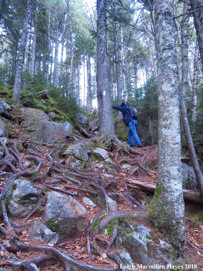
To top it off, my guy’s two-seater is headed to the shop for some engine work. But his brother came through and lent us a machine so we were able to stay in the race. Our task was five-fold. 1. Ride through Sweden, Waterford, Lovell, Fryeburg and Bridgton; 2. Identify an interesting natural wonder; 3. Frame a picture; 4. Conquer the moguls; and 5. Pull the entire Amazing Race–our style together in a coherent order.

We started in the frigid morning air and no one else was about so we had Highland Lake and Stearns Pond to ourselves. Our journey took us whizzing across lakes and ponds, along open trails such as ITS 80 and 89, and through some narrow connecting pathways–or so they seemed to this untrained eye. I’d brought along my Trackards and the tracks were many, but all remained a blur.
You have to realize by now that for the two of us riding a snowmobile is like the tortoise meeting the hare–my desire to move slowly through the world met his need for speed. In the end, I did OK, and he went as slow as was safely possible, and even slower than that when he felt my knees nudge his back. But really, my teeth did chatter. Oh, maybe that was because of the temperature.

In Lovell, we got in line to gas up.

Funny things can happen when you’re standing around waiting for your turn at the pump. A nature moment presented itself in the form of a willow gall. Now I can’t wait to return to look at the willow blossoms in the spring.
From there, we made our way across to the Kezar River Reserve for the roadway had been groomed. Alas, at the kiosk, for some unknown reason, the groomer had backed up and headed out to Route 5, so we had to do the same. That wasn’t our only roadblock. We found our way onto a road that had previously served as the trail for a short bit, only to discover where road should have rejoined trail a house had been built. Again, we had to backtrack. Yikes. How would these affect our time?

We also noted historic sites as we cruised along, including the old Evan Homestead in Sweden, the Brick Church in Lovell, and Hemlock Covered Bridge in Fryeburg, which served as our lunch stop at 2pm.

It was there that I found the photo to frame for challenge three–the mixed forest reflected in the Old Course of the Saco as taken through a bridge window.

And then, after the bridge, we meet our fourth challenge: the moguls. For at least two miles, maybe more, between Hemlock Bridge Road and Knights Hill Road, we bounced up and down as if we were riding a bucking Bronco. Truly, I spent more time in the air than on the seat and each time I landed, it was with a thump. I was certain I’d fall off or at least my body would be flying behind the sled while I’d still be attached–via the vice grip I had on the backseat handlebars. Talk about white knuckles. Oh wait, maybe that was from being cold.
Somehow, we survived . . . and so did our relationship.
As for the other contestants, we weren’t sure where they were because as it turned out there were many riders out there and they all looked the same! Well, maybe they had their idiosyncrasies and I wasn’t paying attention to the little details of jacket and helmet color and design, but I’d much rather look at tree bark, mammal tracks, and winter weeds this time of year than people apparel.
Soon after the moguls, it was time for the last task. We encountered a display of twelve photographs; each represented a moment of wonder we’d encountered during the race and one of us had to place them in order from start to finish.
My guy had done all the driving and maneuvered us successfully through the mogul course (I didn’t fall off, remember) so it was my turn to complete this final challenge.
Episode one: The elephant face we discovered along the Narrow Gauge Trail.

Episode two: A rainbow in the Harpswell sea mist.

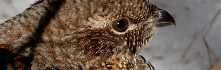
Episode three: The exotic kissing pigeons with heart-shaped white cere on their bills.

Episode four: The gallery of midnight artists at the Battery on Peaks Island.

Episode five: A Crimson-ringed Whiteface Dragonfly beside Shingle Pond on the Weeks Brook Trail.

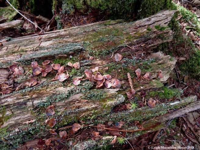
Episode six: A sand collar in Clinton, Connecticut. While it felt like sand paper above and was smooth below, it was actually a mass of snail eggs.

Episode seven: After climbing Table Rock, a couple paid for our pie at this roadside stand and so we did the same for the next vehicle that pulled up.

Episode eight: The 1930 122 ft. steel-hulled yacht Atlantide, that served in WWII and was featured in Dunkirk.

Episode nine: (possibly one of our favorites) The cribbage board in the two seater below Piazza Rock on Saddleback Mountain.

Episode ten: An alpaca at America’s Stonehedge in Salem, New Hampshire.

Episode eleven: Finding an H to represent us while looking for decorated trees in the Maine Christmas Tree Scavenger Hunt.

Episode twelve: The final episode and another framed photo of the Old Course of the Saco from Hemlock Bridge.
Phew. I was pretty certain I had them all correct. And so on to the mat we drove, arriving at 3:36pm. And then as we stepped off the sled we discovered that we’d lost our backpack somewhere on the trail. The only item of any value in it was my cell phone.
We were concerned about that, but also found out that without the pack we couldn’t cross the finish line. So, we made a quick decision because we needed to be done by 5pm. I hopped off the sled and my guy took off in a spray of snow to search. We were sure it was near the moguls. Apparently, along the way he questioned people and learned that someone (thank you whoever you are) had hung the pack on a tree. Over the moguls he went, but to no avail. He was in a dip on his way back to the covered bridge when he spied it. Wowza.
At 4:41pm he pulled up to the mat.
And we crossed it together–As. The. Winners. YES, we WON!
But, of course, we won. For if you have followed us from the start then you’ll remember that in episode one I wrote: I created a Valentine’s gift for my guy–our very own Amazing Race. My rationale was that we enjoy the show, but know that while there are certain stunts one or both of us could handle with ease, there are others that would certainly cause us to be last to the mat–and lose. So, why not create an Amazing Race that we have a 99.9% chance of winning. If we lose, we’re in big trouble.
I do feel bad that I fibbed to some of you, but you got caught up in the challenge and I didn’t want to let you down. Some of you asked me about it and I have a terrible poker face so I was sure you’d figure it out. In the spirit of it all, I was glad that you didn’t. That added to our fun.
And all of the characters–they were real people we met along the way. Team Budz in episode six was my sister and brother-in-law. Team Purple was a hearing-impaired woman full of moxie we met during episode eight in Camden. She hiked in sandals and had spent the previous month camping solo. The others we named for their attitudes, hometowns or some other attribute. I don’t know if you noticed, but we began the journey as Team Wonder, which I probably only mentioned once, but by episode eleven I’d forgotten that and called us Team Hazy–thus the H to represent us. Ahhhh.
Of course, my mom always washed my mouth out with soap when I fibbed, so if you want to do the same, I can’t say I blame you.
Thank you all for following us on this adventure. We’ve had fun looking forward to and participating in a variety of adventures. Though I’d given my guy a list of locales for each month, I didn’t know what the various additional challenges would be until they presented themselves.
Today’s activity was supposed to be a dogsled ride in January. But, the weather gods and price gods weren’t on our side and when the weather didn’t cooperate on his days off we chose not to spend the money. An alternative was the ice castle, but we’ve done that before and were too late in trying to purchase tickets this year, so . . . why not end as we began. On a snowmobile journey. The third of my lifetime and longest one yet. We spent over five hours on the sleds. Well, my guy spent even one more hour. And now we’re snug at home and sipping some Bailey’s Irish Creme before we tune in to British comedies and fall asleep on the couch.
The Amazing Race–Our Style has come to an end. Thanks for tuning in. We had fun and hope you did too.
Amazing Race–Our Style: episode eleven
DECEMBER 3, 2018
The second to last episode of the Amazing Race–Our Style was upon us and we hoped it wouldn’t be the final one for us.
Today’s clue was a bit different than most. It gave us four specific locations–and much to our delight, all were within 20 minutes of home! How could we be so fortunate?
We were also given a time frame and a few other instructions. We were to arrive at our first destination at 10:30am. From that starting time, we had until 5pm to finish our tasks and send four photos to a certain website. The sooner we completed all of the tasks, except for sending the photos, the better our chances of hanging in for the final episode. The pressure was on.
One of the biggest challenges was that the photos we needed to send were selfies. We aren’t selfie fans, unless you count photos of our footwear!

Our overall mission today: to locate the four trees that had been decorated by homeschooled children and/or local land trusts. Since there were four teams left and four different properties, we were each given a different location in which to begin.

Our starting point on this very foggy morning was Western Foothill Land Trust’s Roberts Farm Preserve in Norway, Maine. As instructed, we arrived at 10:30 and made sure to stay on the snowshoe trails only, for there is also a network of groomed ski trails. The trail was long and sometimes wet, while other times icy, but we didn’t notice too much as our eyes were focused on the trees. Of course, we were occasionally distracted, such as when a downy woodpecker flew into sight.

My guy was certain he knew where the tree would be located, but . . . it wasn’t, at least as far as we could tell in the fog.

We did spy a spider web embellished with beads of water and I remembered a story based on a legend about a poor family who had no decorations for their Christmas tree. As the tale goes, while the children slept, spiders spun webs of silver around the tree’s branches. The next morning, the family awoke to a Christmas tree sparkling with silver webs. Today’s webs were such and though we hadn’t found the decorated tree I was already richer for the experience of looking.

And then . . . my guy walked right by it. I was surprised I didn’t, for we both expected a different evergreen species to be adorned.

Most of the ornaments were meant to feed the critters and we saw deer tracks in the snow.

Among the mix was a tree cookie with a wood-burned sketch–perhaps of Roberts Farm?

While my guy picked up fallen treats to rehang on the tree, I practiced my selfie skills. I was feeling confident that we could pull this off.

And when I told him that we’d have to send the photos to mainechristmastreehunt.com, he was eager to pose–and I was shocked. We tried to make sure that the tree was visible in the background.
We checked off that tree, hopped into the truck and headed to Lovell.

OK, so we knew when the clue arrived that we had a bit of an advantage for we’d been invited to join the Fairs, Farms, and Fun 4-H Group that decorated the tree at the Greater Lovell Land Trust’s Chip Stockford Reserve on Ladies Delight Road in Lovell a few weeks ago, and I’d just co-led a walk on the trail this past Saturday where other adults had fun looking for it. And redecorating it.
Oh well. Other teams had had different advantages during different episodes, so it was our turn.
But, the most curious thing–when we arrived . . . there were no tracks made by any of the other teams. Team Purple was supposed to begin at this point. Had she gotten lost?

Because we knew right where to go, our journey was quick and we easily relocated the tree on the one mile loop with a spur. And . . . discovered that the birds and deer had once again dined on the bird seed ornaments.
When it comes time to remove the decorations after Chrismas, the task will be super easy.

Thankfully, the subtle birch bark hearts continued to add a festive note.

And so we posed.

We did discover a new clue at the kiosk on our way in–we were to find something in the woods that represented our team. We found an H for Team Hazy.

Within the clue package, we were also told to take time to eat–at a place locals frequent. We chose Quinn’s Jockey Cap Country Store in Fryeburg and somehow managed to resist the sweet treats while we ordered sandwiches.

And then it was on to the Mountain Division Trail on Route 113 in Fryeburg to look for Upper Saco Valley Land Trust’s Andrews Preserve. There are no signs or trails at that preserve, but our adventure on Saturday had included a visit there. That’s why I couldn’t believe that this was the intended challenge for today’s episode, but all had been decided almost a year ago and it just worked out that I knew where we needed to go today. That being said, I let my guy lead.
He had a bit of help as one or two others had been that way–leaving their tracks in the snow.

And . . . he did a super job, quickly spying the tree. What I love about this scavenger hunt is that each tree has a different theme and flavor. The USVLT tree was decorated by a teen and her mom, and the teen didn’t want the animals to eat all the ornaments. Understood.

They created a pipecleaner garland and added glittery bulbs. It’s a bright spot in the middle of a thickly wooded site.

And so we posed again.

Our final destination was to Lake Environmental Association’s Pinehaven Trail at the Maine Lake Science Center on Willet Road in Bridgton. This is a place we know well for it’s practically in our backyard, but we didn’t know which tree would be decorated. And so we began our hunt, pausing briefly to remember the fun we’d had on the low elements challenge course that dots the trail. We’d actually completed that challenge one rainy day and were thankful (and surprised) we didn’t have to attempt it in the snow.

Suddenly, the decorated tree jumped out with its brightly colored garland and we rejoiced for we’d found all four trees. And still had plenty of time.

The laminated garland featured words related to LEA’s mission and activities. And so did the tree cookies, much to our liking.

And so we posed for one final time. We still aren’t great in the selfie department, but it would have to do.

Our next task before sending off the selfie photos to the website, was to create a scavenger hunt for others. You already know the four properties and their locations. Plus for each organization, I’ve included a link to their websites.
Your task, should you choose to complete it while you look for the decorated trees, is to also locate these finds.
1: Phoebe nest protected from the weather.

2: Shiny chrome in the forest

3: Home for flying salamanders

4: Wet wetland

5: Fairy castle with many spires and towers

And finally, #6: Snowshoe snowflake!
The numbers:
4 trees: √
4 selfies: √
Photo to represent our team: √
Scavenger hunt for others: √
Total time to complete race: 5 hours
We finished this leg of the Amazing Race–Our Style by 3:30pm, uploaded the selfies, sent them to Maine Christmas Tree Hunt, and found out that we took first place today! Yippee. (We were sad to learn that Team Purple made some wrong turns and got delayed.)
One more leg to go in January. Who will be the winners of the Amazing Race–Our Style? Stay tuned.
Amazing Race–Our Style: episode ten
I can’t believe we are still in the race, but we are. And so last night the clue arrived as mysteriously as ever and a wee bit vague: Drive west and then south, following Routes 16, 125, and 111. Find your way to Stonehenge.
While we were certain that Route 111 in New Hampshire was not going to put us on a flight to England’s Stonehenge, we decided to follow the directions and see where we ended up.
We did note that Team Speedy was ahead of us as we drove south on Route 16, but in Ossipee they turned right onto Route 25. Oops, wrong number, but we weren’t going to tell them that.
Two and a half hours later and BINGO! We’d found our destination.

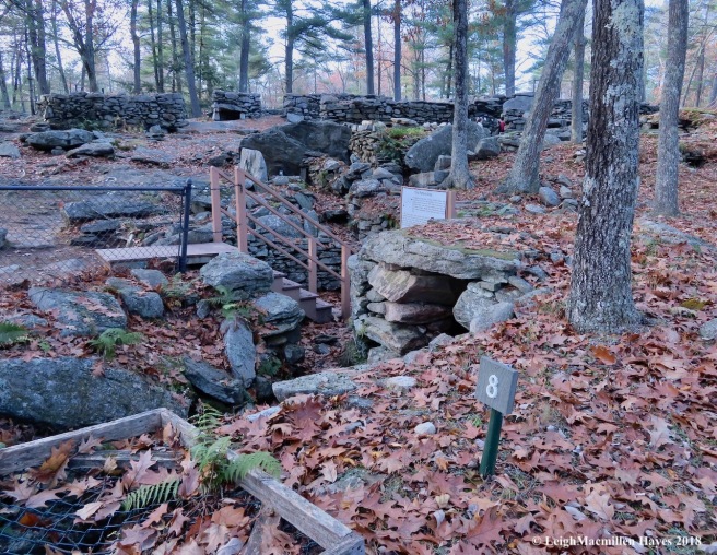
America’s Stonehenge in Salem, New Hampshire. Who knew? I’d lived in New Hampshire for ten years prior to moving to Maine in 1986 and never heard of this place. But . . . apparently the time had come.
We entered and watched a brief introductory film. First named “Mystery Hill Caves,” the name was changed to America’s Stonehenge in 1982 because researchers believed that better reflected their understanding of the site.
Was it built by a Native American culture or a migrant European population? Who knows? But what we did learn is that carbon dating has helped age some of its features at over 4,000 years old, making it possibly the oldest man-made construction of chambers, walls and ceremonial meeting places in the United States.
The site has been under continuous research and there are a variety of theories about its origin. Our main challenge was to observe and learn.

But first, one of us had to determine the time of day. My guy rose to the occasion and placed the pole in the center of the sundial.

“2:11 pm,” he said. Pretty darn close for it was actually 2:09, but we were told to proceed.

The first part of the journey included a Three Sisters Garden of corn, pole beans, and pumpkins. There’s a replica of a dugout canoe and a wigwam for such were found on the property, plus some pottery and other artifacts.
And then we worked our way up the hill and into the maze of chambers. Some referenced astrological events; others were the works of Jonathan Pattee who built a wooden structure upon some of the chambers, but it burned in 1855 and his son later sold off some of the artifacts; and William B. Goodwin, the first researcher to own the property.
Fortunately for us, many items worth noting were labeled. Number 8 was an Upper Well, also known as the Well of Crystals because excavations in 1963 proved that quartz crystals were found in a vertical fault twenty-two feet below. Such crystals may have been worshipped or used for tools by ancient cultures.

By the well was the Pattee area, and so I ventured down and stood before a chamber that may have served as either his family’s root cellar or at least storage space.

Nearby was a collapsed chamber. The roof slab that now stands upright is estimated to weigh 6.5 tons. And here’s the cool stuff–tree roots near the back wall of the chamber were carbon dated to the late 1690s, indicating the walls were built prior to Mr. Pattee’s residency. Further research indicated the following: “In 1969, charcoal that had sifted into the walls was found below these roots at two to four inches above bedrock and dated to 1400 BC. In 1971, a third and even older date of 2000 BC was obtained.” There’s more, but that’s enough to be mind boggling. BC?

The astrological importance of the site was noted throughout and we found the True South Pointing Wall.

Directly opposite of it was the entrance to a south facing chamber. For me, the curious thing about this chamber was that it was damaged in a 1982 earthquake–and I quickly recalled that quake as I remembered feeling its tremors.

Then there was The Pulpit. It’s believed that quarrymen used this spot as a staging area to load stones onto wagons in the 1800s, thus giving the property another chunk of historical value. It’s also thought that Mr. Goodwin had the upper part of the structure reconstructed by his crew for he believed that the site was built by Irish Culdee Monks.
I have to say that my guy and I weren’t beyond that interpretation for some of the chambers reminded us of Newgrange, a Neolithic passage tomb alleged to be older than Stonehenge and the Great Pyramids. Constructed during the Stone Age, about 5,200 years ago, Newgrange is a large circular mound in Ireland that covers 300 feet in diameter and stands 36 feet high. A stone passageway leads to three small chambers. Some describe it as an ancient temple, a place of astrological, spiritual and ceremonial importance. Hmmm . . .

Another interesting chamber from our point of view was the V Hut, so named for its shape. This one reminded us of the Mystery Structure in Lovell, Maine, for part of it forms a similar sort of V shape.

Throughout the journey, our focus was brought back to orientation of chamber openings. So the curious thing about this particular one and the one opposite of it–they had an east-west orientation. All other openings faced south.

The outer wall of the East-West Chamber offered a different look than any we’d previously seen. Using photographs from the Goodwin era, the outer walls were restored in the late 1970s.

They led to a wonder-filled pathway. Do note the white paint–that was used throughout to feature key points. Though I thought it ghastly, it did serve its purpose and the drawing you see on the bedrock was part of a very important drainage system. Curiously, the area was well drained, but when we later walked surrounding trails we had to work around water obstacles–why can’t we figure out today how to make the water move in an effective fashion?

The pathway we were traveling led to the Oracle Chamber. And then there was more white paint. But, take notice. The U-shape above was painted around drill marks probably made by those 1800s quarrymen as they broke off slabs.
But it’s the Vs that were of even more interest.

The V wedges were similar to those found at ancient sites in Europe we were told. Before the invention of the steel drill in the early 1800s, stone masons apparently made these V wedges.

Now all oracles need a sundeck and lo and behold, such existed. As we admired it, a few orbs did the same and we had to wonder about the ghosts living among the rocks. They certainly had stories to tell.

The Oracle Chamber was known to be the most important area with a variety of features including an upper drain, secret bed, speaking tube, roof opening (see the sunlight coming through at the end of the chamber?), seat, closet, and deer carving. It was actually rather dark and we could locate some of the features, but never saw the deer carving, which would have been a treat.

Before we’d entered the Oracle Chamber, we’d viewed one of several tables within the complex.

But it wasn’t until we were standing above it that it made more sense. The Sacrificial Table was a 4.5 ton slab with a grooved channel. Its a point of controversy for the site, but some believe that because of its size it was used for sacrifices. The oracle had a speaking tube in his chamber located directly beneath it that adds to the assumption.

If only mosses and lichens could talk, the tales they could tell. But then we wouldn’t have mysteries to consider.

Speaking of such, one of our challenges was to identify a fern that grew among the rocks. It had several key features, including the fact that all of its fronds grew from a central point in a circle and it was still quite green–as in evergreen. A quick look at its spore arrangement on the underside and the answer was clear–marginal evergreen wood fern.

We also had to name three colors represented by the oak leaves on the grounds: Black, red, and . . .

white.

And then it was time to climb the Astronomical Viewing Platform. I was initially put off by the sight of the modern structure and thought perhaps it was a children’s playground tossed into the mix. But . . . thankfully I was wrong. Constructed in 1975, from the platform you can view the major astronomical alignment stones, including true north for summer and winter solstice. Trees were cleared in 1967 along the various important date sights and are still maintained. When the structure was first constructed, there were probably no trees atop the bedrock. This afternoon, as we looked out, our view included the November 1st sunset.

We followed the trail toward the November 1 Sunset Stone.

And were equally excited to note the Winter Solstice Sunset Monolith. This was the first monolith that researchers suspected to be a solar alignment. On December 21, 1970, the shortest day of the year, it was photographed. Because the Earth’s tilt has changed, it’s a bit off these days, but would have marked the southern most set of the sun almost 4,000 years ago. Wow!

Before we left, we had another challenge: to find something that reminded us of the maze we’d just journeyed through–and in many ways the pine tree’s route system seemed to provide a map.

We also needed to pay homage to the alpacas who now call this place home and in their own way bring us back in time. The earliest evidence of man at America’s Stonehenge was 7,400 years ago as proven by evidence from a fire pit, and alpacas were domesticated about 5,000 years ago–in South America.

That being said, our final challenge was to find a more up-to-date representation and a message etched onto a rock seemed to fill the bill.

Back into the museum we journeyed and imagined ourselves into a contour model of the property with yellow lines representing the various astrologically important dates and sight lines. We’d also learned that a line can be drawn directly from America’s Stonehenge to England’s Stonehenge along the Solstice.
When our time was done, we were more than wowed. And had a lot to absorb about our learnings.
But, we were in a race and as quick as we’d wanted to be, we feared we were too slow.
Team Speedy, however, apparently went way off course when they turned onto Route 25. They were the last to cross the mat and have been eliminated. (Quietly we were heard to mutter: YES!)
Team Purple won this leg as she has done several times even though she’s solo. And still sporting her sandals despite the colder temps.
We actually placed second today and were thrilled. We’re still in the race!
Only two more episodes to go. It’s down to Team Purple, Team Cape Cod, Team Livermore and us. Who will be the final three? Stay tuned for The Amazing Race–Our Style: episode eleven.
Amazing Race–Our Style: episode nine
“Drive to Newry and receive your next clue,” was the message we received midday yesterday and so as soon as my guy closed his store and sent in an order for more merchandise, we hopped into the truck and began our journey north. In Newry, just beyond Bethel, we found out we were to continue on to Rangeley and patronize the local businesses.

First, however, we had to get there. Darkness enveloped us and flurries confused my vision as I drove with caution through Grafton Notch to Errol, New Hampshire, and then back into Maine toward our destination. Our wildlife sightings: two raccoons, a snowshoe hare still brown in color, a couple of deer and a cow moose and the bull moose you might see to the left of the first telephone pole. We were excited to say the least. And, I had proof that my slower speed was apropos–cuze my guy was teasing me.

It was almost 8:00pm when we pulled into town and stopped at Parkside and Main for a burger. The restaurant closed at 8, but owner Kash Haley was gracious and told us to relax. So between plays in the football game, and bites of our burgers, we oohed and aahed as one of the waitresses shared photos of her grandchildren with us.
And then once all the patrons and staff had left, we sat for a bit longer at Kash’s insistence and enjoyed the game and each others company while he cashed out and sanitized the kitchen.

This morning found us rising to a blue sky over Rangeley Lake. Doesn’t the saying go like this: Blue sky in the morning, snowflakes in the offing? For they were and we knew we had to dress appropriately for a day outdoors. But first, we had a few more local businesses to visit, the first being Keep’s Corner Cafe for breakfast and then we grabbed sandwiches from Woody’s Deli at Loony Bin Variety. And with the check came our next clue: “Rangeley–equator to pole, it’s all the same.” Huh?

But, we did our research and sure enough, the western Maine town of Rangeley is located precisely between the Equator and the North Pole. How cool is that? And it was at that sign that another clue appeared. “Choose one: Either explore Orgonon or Find your way to the giant AT sign and seek the piazza.” Several years ago we’d snowshoed the trails at the Wilhelm Reich Museum, aka Orgonon, so we chose the latter for today’s challenge. The AT we understood to be the Appalachian Trail, but a piazza on the trail? Would there be a hut with a porch? Perhaps a fancy porch?

A few miles south we found the giant AT. And across from the parking lot on Route 4 we spied the opening to the part of the trail we thought we should follow.

And so we ventured forth, stopping moments later for a couple of deposits of red fox scat. Another critter to add to our 24-hour menagerie.

We crossed a sluice way of the Sandy River, and imagined the history stored in the rocks.

As we hiked, snowflakes decorated the variety of maple leaves.

And we began to notice that our journey would pass through a variety of natural communities and over various obstacles including roots,

boardwalks,
and rocks mixed with roots.

My guy was in the lead, though he commented throughout that I wasn’t far behind, trailing only by a few footsteps. But when he reached a certain point, I’d been looking down for careful foot placement and so I didn’t know what he was exclaiming about–until I looked up. At. Piazza. Rock.
From Maine Trailfinder we discovered this tidbit: “According to the geological notes about this area, ‘The granite of Saddleback is jointed into huge building blocks. An unusually large one has slid out of its place in the mountain side and, instead of breaking and skating down the slope like the others, has balanced across another block to create one-half of a cantilever bridge, forming Piazza Rock.’” Oh, did I mention that we were hiking up Saddleback Mountain?

Perspective isn’t gained until one actually stands under the building block. The clue said that one of us must climb atop the structure and the other view it all from below. Thankfully, despite his fear of heights, my chivalrous guy chose the upper path.

He made it seem so simple as he crawled up the rock and then contemplated the platform before him. For a second, he wasn’t sure he’d be able to go further. But, that could mean the loss of points for us. I didn’t say anything to encourage or discourage because I was standing on safe ground below.

My job was to appreciate the boulder from its underside. And certainly I did as I looked up at the stone diving board planted for a giant’s leap.

And bravely making his way toward the tip–my guy!

I looked up to where he stood–atop a turtle head, for after all, we stood on turtle rock.

And he looked down . . .
Later he told me that his father always said as he stepped onto a porch, “I’m going out to the piazza.” Indeed.

Interestingly, both of our fathers accompanied us on this leg of the race for apparently as my guy thought of his dad, I spent some time thinking about my father and how much he would have loved exploring trails such as this one with us.

But, we were in a race and so though we reveled in memories of our fathers, we had to move back to the trail signs and check for our next clue, which was again a choice: “Make the next move or Channel your best bat.” What?

We followed the trail, crossed one of many streams and located the Piazza Rock Campsite–all set for the next temporary residents who would leave no trace behind.

It was right behind the hut that we noticed the privy–and location for any who chose to make a move . . .

In the game of cribbage that is for a game board sits between the two-seater. My guy might have chosen this for he knew he could beat me, but he was once again chivalrous and suggested we channel our best bats. Team Pink did stop at the privy and we never saw them after that so we wondered if they gave up on their card game and moved on to Orgonon.

We, however, continued on and reached “The Caves.” One after the other, we shimmied through, hardly as graceful as a bat might fly.

It wasn’t easy, but we moved in and out and reached our next clue: Locate lunch rock with an aquatic view.

Onward we climbed, reaching Ethel Pond first, where the ice at the edge was thin and my guy reminded me that I should approach with care.

About a half mile up the trail we spotted another wetland. Really, we expected to see a moose in each, but when one expects to see a moose or any other form of wildlife, it doesn’t happen. And it’s truly more enjoyable when the offering is a surprise.

Speaking of surprises were the first ice formations of the year.

Periodically, we crossed water, but the ice formed best at our last crossing, where lunch rock awaited. We’d made it to the stream that flowed from Moose and Deer Pond, a place we couldn’t necessarily visit, but could appreciate for the wildness it offered its wildlife residents.
Lunch rock stood in front of my guy and it was there that we enjoyed the chicken salad sandwiches we’d ordered from Woody’s Deli at the Lonny Bin.
As we looked about, we discovered that we weren’t the only ones to dine in that vicinity, for the balsam fir scales and cone cobs indicated that the resident red squirrels were also frequent diners.

And, it appeared, another had also consumed a meal for Junco feathers were plentiful. A foe of a different feather had gained a few joules of energy.

Our lunch spot became our turn-around point and with great speed we made our way back to the sluice in now time at all, completing our eight mile hike with side trips in 5.5 hours, sorry that we couldn’t summit Saddleback Mountain because we were told to return to our truck by 3:30pm. We actually reached the truck by 3:10. In our minds, another day will find us returning and summiting Saddleback as we really like the trail and were eager to discover what else it had to offer.

As we drove toward Errol on our return trip, we spotted Team Mustang stopping just below Orgonon and wondered what they questioned when they stepped out of their car.
We continued on to the starting point in Newry, ready to step on the mat and end this leg of the race, only to discover that we’d made a mistake.
How could that be?
We thought that lunch rock was our turn-around point, but we should have continued about 50 more feet where a spur trail would have led us to Eddy Pond. Oh, we could see the pond, but not get close to it. If only . . . we’d paid closer attention to the map.
As it was, when we arrived at the mat beside Puzzle Mountain Bakery in Newry, we had to sit for a half an hour and wait. No one arrived. Thankfully. And then we had to answer one important question: How many streetlights are there in Upton? Eight. Check.

We finished third but got the streetlight question right and so we received a blueberry raspberry pie. YUM.
The Amazing Race–Our Style: episode nine . . . and the fun continues; we’re still in. Phew.
Amazing Race–Our Style: episode eight
The clue arrived as mysteriously as usual on Sunday and we had to quickly book a seat for two on a seaworthy vessel. Thankfully, we got the first time slot for 10:30 Monday morning. And so, despite some fog, we drove northeast.
But . . . before we reached our destination, we had a challenge to answer to along the way. My guy needed to complete the crossword puzzle in the Portland Press Herald on his own. And then, while I did the driving, he needed to give me a clue, word by word until I’d completed the puzzle orally. Unfortunately, one letter held me up and we knew we’d loose a few moments if everyone else in the Amazing Race–Our Style finished it without flaws. We wouldn’t know for sure until the end. My glitch–the “r” in Urdu–the language spoken mainly in Pakistan.

Two and a half hours later we reached the location where our next challenge would begin. Of course, we had to pay attention to the signs and not park where permission was granted only to those who worked the waterfront.

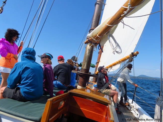
Our mission was to sail upon the gaff-rigged schooner Surprise. According to her website, Surprise was “built by the Waddell Shipyard in Rockport, Massachusetts, for Martin Kattenhorn. Surprise began her life as a racing and cruising yacht. Mr. Kattenhorn had commissioned Thomas McManus, the most famous American designer of fishing schooners, to design a vessel of about 45 feet, which could be safely sailed by a crew of no more than three persons. In early 1918, Surprise slid down the marine railway.
Her final dimensions were: Length overall 57 feet, Length on deck 44 feet, Beam 12 feet, Draft 7 feet, Displacement 21 tons.
Her topsail schooner rig allowed Mr. Kattenhorn to fly a mainsail, foresail, staysail , jib, and a fisherman staysail. Her working sail area, not counting topsails, was just under 1000 square feet. Surprise was a respected racer. In 1923, she captured sixth place in a fleet of 22 vessels in the first race to Bermuda after World War I. Mr. Kattenhorn was a founding member of the Cruising Club of America, and Surprise carried the club’s ensignia from Bermuda to Nova Scotia and ports in between from 1918 until Mr. Kattenhorn’s death in 1959, an incredible sailing career!”
All of that history, and we realized we needed to pay attention. (Note to self: remember these facts) Already into the eighth leg of the race, we had a feeling that the historical value of some of our adventures would play a key part if we stay in the race until the final episode.

At the established time, we boarded the boat and looked around at our shipmates. No fellow contestants. Huh? How could that be? But perhaps the rest had chosen the alternate activity that involved some baking and deliveries. We were much more comfortable setting sail with Captain Will, who when he wasn’t applying sunscreen, used his left foot to steer the boat out of Camden Harbor.

Half way out, First Mate Laird asked for help in hoisting the sails. We knew this offering was intended for us. I quickly jumped up and my guy followed. My job–to use the hand-over-hand method to raise the raise the main gaff at the top as my guy kept the main boom parallel. Of all our challenges thus far, this was among the easiest and we felt right at home.

Finally under sail rather than motor power, the boat moved away from Camden Harbor and out into Penobscot Bay.

As we continued, the captain and first mate exchanged roles, because really, they are both comfortable and supportive in each. While Captain Will explained that Surprise was celebrating her 100th birth year, First Mate Laird looked up.
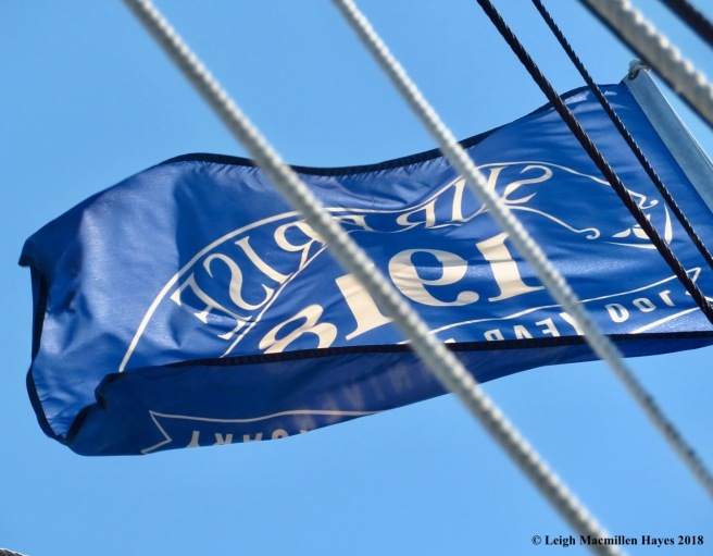
Above, a flag blowing in the breeze commemorated the celebration.

As we headed out to Mark Island in Penobscot Bay, so named because early mariners used the island to mark their bearings, we noted a ghost ship on the hazy horizon.

Will and Laird both exclaimed about what a perfect sailing day it was. Indeed.
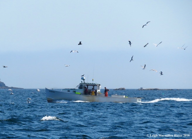
The further out we moved, the more we noticed lobstermen checking their traps as gulls circled in hopes of an offering.

These were the folks who had headed out onto the water at 4 am as they surveyed the grounds where they’d set traps. A Maine lobsterman is allowed to set up to 800 traps, but as we learned today, it not only takes time to gain a lobster license and no longer is it a tradition handed directly from father or grandfather to son or daughter, but one doesn’t set the full amount of traps to start. And we learned that Lobsterman Toby is the local God of the Traps and the one to consult before dipping into a lobstering career.

Some collected lobsters while others replaced traps. It’s not an easy life, but don’t tell a lobsterman that. Oh yeah, and one more fact, women who lobster are also called lobstermen . . . with pride.
Once we changed tacks, positions on the boat shifted, as should be expected.

From all sides, we viewed the Curtis Lighthouse. The station was first established in 1836. As the lighter rocks tumbled down in front of the current house indicated, when the first building was demolished, the rocks were not intended to be reused or repurposed. The present lighthouse was build in 1896 and automated in 1972. (Note to self: remember these facts)

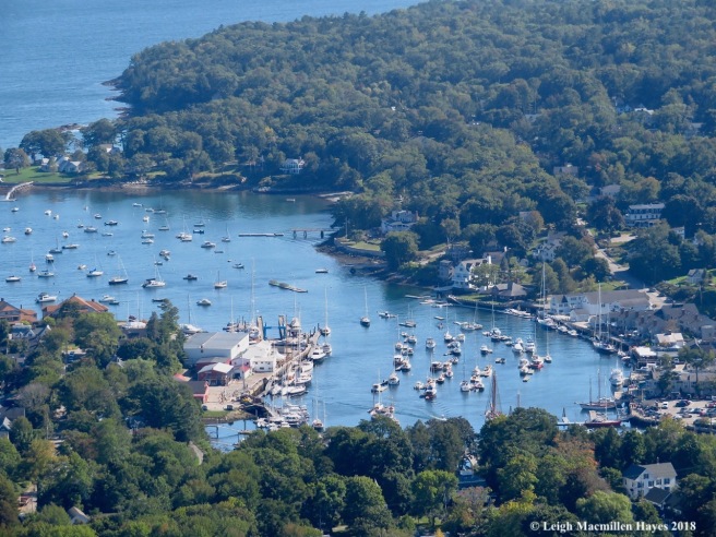
Slowly we tacked and then motored back into the harbor, with Mount Battie’s domed shape, a reflection of the harbor’s outline, standing tall in the background.

Captain Will shared a third point of interest to add to our bag of potentially important historical points should we make it to the end of this race: The 1930 122 ft. steel-hulled yacht Atlantide. The boat played a life-saving role in World War II as allied troops pinned down by the invading German army were evacuated at Dunkirk, France. And it was featured in the movie Dunkirk.

As we sailed closer to shore, in a pattern of symmetry that matched our departure, everything was restored to its original position and the term shipshape revealed.
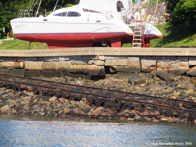
Back under motor power, we passed by an old marine railway, which probably resembled the one Surprise originally slid down.

At last, our sailing experience of the day slowed. And a female mallard swam beside the boat, perhaps her hope for a handout redeemed occasionally by others.

Meanwhile, a cormorant bathed.

With precise precision as a neighboring boat docked, we pulled in, Laird jumped off the boat and all ropes were secured. Our journey had ended and we needed to hustle to a lunch spot.
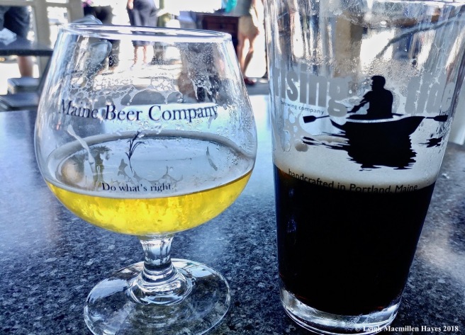
We chose Peter Otts and a Maine Beer Company Peepers Pale Lager for me, while my guy enjoyed a Guinness–because it’s good for you! Two delish haddock sandwiches rounded out our menu choices.

But we still had one more task to complete–to locate a symbol of WWI while hiking. And so up Route One we drove to Camden Hills State Park in hopes that we’d chosen the right place. It was rather deceiving at the start of the hike for across one boardwalk after another did we walk.

Eventually, however, the incline steepened and terrain became more of what one might expect along the coast of Maine–rocks and roots to navigate around and over.

We hadn’t seen a single other contestant and had no idea how we were doing, but knew we’d lost a wee bit of time on the crossword challenge, and so we paused for a second and my guy expressed his inner Cousin Itt.
The funny thing we noticed about the trail system was that no matter how much further we had to go, many of the signs indicate 0.5 miles, and even after we’d covered a section of 0.25, the next sign stated the summit was still 0.5 ahead. It amused us and from then on we knew everything was a mere half mile away from somewhere.
At the summit of Mount Battie, the view encompassed the harbor below.

But it was what stood behind us that became significant.

We’d found our WWI symbol, a memorial to those local people who served our country. And another piece of history to tuck under our hats for future reference.

Though we couldn’t see Acadia because of fog, the view was still breathtaking from the top. It was there that we encountered another contestant who actually asked us for some help with the trail system. Team Purple is legally deaf and her partner had deserted her, so we were happy to offer assistance.

To that end, we gave her a head start while we paused to honor Edna St. Vincent Millay. And give thanks that we saw what she had seen.

Eventually, we did catch up with Team Purple, but she was a hearty hiker and we let her continue to lead.

She, however, had another idea in mind, and in true alliance fashion, the three of us, our shadows lengthened as the sun slowly lowered, crossed the finish line of this episode together. We weren’t the first to complete today’s challenges, but we’re still in the race.
Going forward, we wish Rebecca of Team Purple the best.
Phew, eight episodes of the Amazing Race–Our Style completed. Only four more to go. Will we survive? Stay tuned.
The Amazing Race–Our Style, episode seven
We never know when the clue will appear and so it was a complete surprise to find it this morning. “Drive 50 or so miles north and locate the Big A near the table.”

We took our chances and drove to Bethel and then on to Newry and beyond. Lo and behold–the Big A appeared. And so we parked across the street, slipped into our hiking boots, and began the journey. At the time that we arrived, we were the only contestants, so we wondered if we were behind or ahead.

At first the trail was deceivingly flat. “I’ve got this,” I thought.

But we soon came to a point where the white-blazed trail headed to the left and the orange-blazed trail to the right. We had a choice to make. White would mean a bit further journey, but it was easier. Orange was much more difficult, but if we played our cards right, we might ascend quickly. It wasn’t long before we realized that our hearts pulsed rapidly. And then we met Team Livermore . . . and passed them. They are younger than us, so I was feeling a bit smug. Until we came to the wrought iron rungs. I guess I was shaking a bit, from the looks of the photo, but really, climbing up the rungs was a piece of cake compared to the rest of the scramble . . .

over the steep, boulder-strewn trail.

Along the way, I paused periodically pretending to note things like a boulder covered with a moss map . . .

and an orb web sparkling in a bit of sunlight. The truth is that I was catching my breath. After seeing the web I had to put the camera away, for we’d reached a point where we needed the use of both hands. And just above the web my mind shut down as My Guy stepped from one boulder over a gaping hole to the next. He patiently told me where to place each foot, and try as I might, I couldn’t move. Along came Team Livermore and I knew we were skunked, but I had to let them pass. They made it look effortless and so four more times I attempted to make the crossing, and on the fifth try I went for it. And I’m here to write about it, so obviously I lived.

Team Livermore may have passed us, but we soon caught up and moved ahead. We kept thinking we were about to reach the summit, when the rock would indicate otherwise and at one point we had to hike down a bit before climbing up again, which didn’t seem quite fair given how hard we’d worked. But then again, rock is rock and we certainly didn’t want to climb directly up its face.

At last–success. We found the table we’d sought: The summit of Table Rock.

Before us, The Eyebrow and Old Speck.

To the south, Sunday River Whitecap.
We didn’t stay too long on top for we weren’t hungry yet. And Team Cape Cod showed up. They’d chosen to come up the easier trail, so we knew we were ahead of them. We do like them though, so we hoped they wouldn’t be too far behind. Just as we started to make our way down, Team Speedy came along via the orange-blazed trail. We’ve had them on our tail in previous episodes and they have a bit of an attitude. That being said, we did what we often do–we practically ran down the blue and then white-blazed trails.

At lunch rock, we paused briefly beside the water and contemplated the map for a moment, making sure that we were headed in the right direction.
Further along we met a couple from New Hampshire–thru-hikers who had started in Georgia in March. We had nothing in our packs to offer them in terms of extra food, but bid them good tidings. Soon after, we heard Team Speedy again, and so with even more gusto, we finished our descent.

Before moving on, we had a couple of tasks to complete. The first was to share photos of a flower–we chose the purple asters;

a fruiting plant–trillium;

and a fruiting mushroom–ours being one of the cup variety.

We also had been instructed to find two more examples of the letter A, and so here is one . . .

and the other. All were in honor of the white-blazed Appalachian Trail.

Making our way south on the road, our next clue indicated that we needed to find a moose, or at least evidence that one had been there previously. And so we found this deep cave, which the photo doesn’t do justice.

As the local lore goes, however, a moose once fell in.

We were also instructed to find Mother Walker. We found the falls named for her that flowed through a gorge.

And we found a mother lode of Indian Pipes, all turned upright because they’d recently been fertilized. But who was Mother Walker? We never found the answer to that question.

With three stops left to make before locating the mat and finishing today’s leg of the race, we needed to locate a screw. Heck, I was with a hardware guy so that should have been easy.

But this screw was in the form of a water fall. Screw Auger Falls. In the 1800s, settlers had built a saw mill directly over the falls that was powered by the current. A screw auger is a hand tool used for boring holes in hard material. It all began to make sense.

While we were there, we took in a view of the arch, just in case we encounter a question about it should we make it successfully to the end of race.

And the falls below, were the story of water and glaciers was carved into the bedrock.

And then, and then, we continued south to a spot where we were told to fulfill our sweet tooth craving.

As we contemplated all of the possibilities, three folks came along in a truck (two of them from Norway, Maine, and the third visiting from San Francisco), bought a pie and gave us the money to buy one as well. But we had enough money. So we felt awkward, though we promised to pay it forward.

My Guy had just put the $20 into the metal tank when a vehicle from New York pulled in and a young couple stepped out. He walked over and told them about the previous couple, gave them $10 for their pie and asked them to pay it forward. Ahhh. Maine, the way life should be. And is!

At last, our final stop–we crossed the mat and learned we were first yet again.

While sipping a celebratory brew, Team Speedy came in. Bingo! They were second in place. Drats. But at least we beat them. We never saw the other teams.

All in all, The Amazing Race–Our Style, episode seven was most gratifying as we successfully summited Table Rock in Grafton Notch. Thanks to Team Cape Cod for taking a photo of us.
Oh, and dessert tonight will be . . . Maine Wild Blueberry a la Puzzle Mountain Bakery and the kind folks from Norway, Maine.
The Amazing Race–Our Style, episode six
The clue was rather vague as clues go: Drive five hours south to the second dot to the right in Harbor View. And so we did.

The map provided helped–sorta.

And just before dark we located the spot that included not only a view of the outer harbor, but also the back side of Hammonassett Beach State Park on Long Island Sound in Connecticut. It was like we knew exactly where we were going.

As it turned out, we were joined by another couple with whom we’d formed an alliance for the race and so we decided to spend the weekend completing the challenges together. Funny thing–I think we felt so comfortable with them because she looked very much like my sister and he reminded us of my brother-in-law. With them was a young man who is about to celebrate his 24th birthday (in two more days) and so we all celebrated with him–but even his presence was part of the challenge. And so Team Budz (the alliance couple) and Team Wonder (us), shared the responsibility of his presence. They picked him up at the train station. We provided the cake, which he decorated himself. We also offered the musical accompaniment, much to his dismay. And together, presents, much to his delight.

Refreshed after a good night’s sleep in that delightfully salty air, we faced new challenges, such as sighting three mammals. Together, Team Budz and Wonder spied cottontail rabbits, which were probably the eastern species that was introduced into New England in the late 1800s/early 1900s and have expanded in range ever since, rather than the native New England Cottontail. Both feature large hind feet, long ears, and a short, fluffy tail that resembles its namesake–a cotton ball. Suffice it to say: it was a cottontail. We also saw a red fox that looked a bit mangy and was too close to home, poking up as it did on the rocks in front of our accommodation, and a momma raccoon that, sadly, had been struck by a car–ever so gently struck.

Challenge number two found us seeking two sea birds. We found adult Ospreystanding guard,

and scanning the water for a fishy meal.

Meanwhile, their young patiently awaited breakfast in the nest built of sticks upon man-made platforms that were installed at least thirty years ago. And actually, while we watched them, we noted something disturbing–tangled fishline dangling from the construction site. That led us to send out a word of caution–dispose of your tangled fishline so the birds and other aquatic species with whom we share this Earth don’t get wrapped up to the point of no escape, aka death.

We did note that while some of the young Osprey stretched their wings to capture the sun’s warmth and waited for mom and pop to return with a meal, a couple of smaller birds used the nest structure as a great place to pause below and contemplate the surrounding world. Osprey eat fish and perhaps the smaller birds knew that? Or they just made the right decision.

The Great Egret was the second bird we were assigned to watch . . . as it watched.

And preened.

And exclaimed its beauty.

And watched some more.

And focused.

And then . . . the splash.

And success.
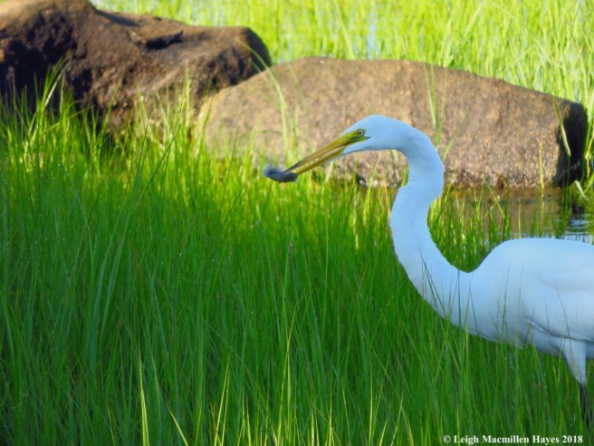
A meal.

To pull in.

And swallow.

And swallow some more.

Suddenly, in a flash of time, for so it seemed, Team Wonder needed to hold up its end of the alliance bargain and get this guy back to the train.

But–we needed directions to the railroad station, for we wanted to make sure that he made his connection in New Haven.

We were told to look to the sky for a message–and it was there that we found an advertisement unfolding in what struck us as a strange place, but perhaps it wasn’t so strange after all, for it was above some train tracks. Another Happy Birthday Message?
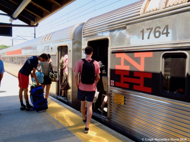
Whatever, it turned out to be the right one. First, the Shoreline East to New Haven and then the Metro North to Grand Central. And off he went–to his home of the past year and his career in the film editing industry (and his 24th birthday in two more days).

Meanwhile, back at the ranch, aka Alliance Inn, the tide was slowly coming in, but we headed out, two teams as we were, ready to take on the next adventure.

My guy and Mr. Budz led the way through the shallow water the outer harbor has long been famous for.

It’s a tradition of the neighborhood–this gathering place at low tide.

Team Wonder did get a wee bit worried when Team Budz paired up ahead–where they going to ditch us at the channel?

But they didn’t. Instead, they paused with us to look at one of the wonders we needed to find by the sandbars–what was it?

A sand collar–which felt like sand paper above and was smooth below. It was actually a mass of snail eggs. A rather amazing form.

On the sandbars and in the water, Spider Crabs appeared fierce, but were really quite nonchalant. Note the round and spiny carapace, with small spines running down its back. The crab is known to attach bits of algae, mud, and seaweed to many sticky hairs all over its bodies for camouflage, thus giving it a frightening look, but don’t take it seriously. It moves quite slowly and won’t pinch your toes like some of its relatives.

And then we saw the wicked cool Lady’s Slipper of the Sound. Slipper shells they may be, but their natural history is amazing. The following is from the University of Rhode Island: This shell is shaped like an egg or oval that has been cut in half with the top of the shell turned sharply to one side. Looking at the underside of the shell, it is easy to see how it got its name. Underneath the shell is a ledge to support the internal organs; this ledge extends about half the length of the animal. Different slipper shell species are characterized by different shell textures, including rough, smooth, ribbed, corrugated, and flat. Although they have a foot for locomotion, by the time they reach maturity they anchor themselves to a hard substrate and remain stationary.
And there’s more: All common slipper shells start their lives as males, but some change to females as they grow older. A waterborne hormone regulates the female characteristics. Once they change into females, they remain females. They often stack up on top of each other for convenient reproduction. The larger females are on the bottom, the smaller males are on the top, and the hermaphrodites are between the two. If the ratio of males to females gets too high, the male reproductive organs will degenerate and the animal will become female. Eggs are laid in thin-walled capsules that the female broods under her foot.
Common slipper shells also form stacked aggregations when there is no hard substrate on which to attach. They attach to objects in large numbers and can sometimes suffocate the animal on which they are attached.
Who knew? I just thought they were common slipper shells.

We’d finished the sandbar challenge and had no idea how the other teams might be doing, though we did wonder if some of them were thrown off for we spotted a sign that said “sanbars” instead of “sandbars” and we could only hope that they’d gone off in search of the former–to no avail.

Alliance Inn beckoned, as did the incoming tide, and so we headed back toward the shore.

And the next challenge–completing the Sunday crossword puzzle. My guy read the clues and told us how many letters and the four of us shouted out answers–whether they fit or not. I silently kept score (sorta) and was sure that Team Wonder was in the lead, but didn’t want to make a big deal out of it, for we had agreed on an alliance after all. At least for this weekend.

At last the sun set on the day. And the outer harbor.

And we celebrated the day’s discoveries with a bottle of The Cottage for it seemed apropos. I think we were all in agreement, however, that the bottle was much better looking than the flavor and we aren’t exactly wine connoisseurs.

And then this morning dawned with another bird ID challenge. First up–who had taken up housekeeping in the apartment building meant for the Purple Martins? House Sparrows.

And we wondered if they might have some young in Apartment D for come and go did the male and female, both attentive to whomever hung out within.

Overlooking it all, a Purple Martin–though he never defended his territory.

And immature Starlings . . .

as invasive as ever . . .

stood ever so ready to move in to Apartment B.

Who stood on the right-hand jetty? A Greater Yellowlegs Sandpiper, its bill longer than its head.

And on another jetty to the south–a Cormorant gathered warmth in its wings, first turning to the right.

Then to the left.
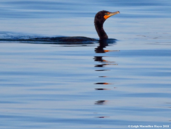
And finally slipping back into the water and cruising by.

At last, much to our dismay, our time with Team Budz drew to an end, quite like the way a day lily such as those my mom so loved and planted everywhere, shared their pollen and then closed up. Who knows what the next episodes will bring. Will we continue to join forces with Team Budz to complete the next challenges? Will they pull ahead of us? Or we ahead of them? We’re only halfway through the Race and as we all know–anything can happen.
But–as we lived in the moment, we certainly loved this episode’s opportunity to celebrate a certain young man’s 24th birthday, ID birds we hadn’t paid attention to since we were kids, explore the sandbar once again, and enjoy the camaraderie of this couple we’ve grown quite fond of. As we go forward, may the best team win . . . and if it can’t be Team Wonder, then we sure hope it’s Team Budz.
The Amazing Race–Our Style, episode five
I’m not sure how it happened, but when we arrived at Route 113 in Fryeburg to pick up our clue we realized we were the first contestants for this episode of The Amazing Race–Our Style.
Consequently, we had a quick decision to make–the main clue referred to the Baldfaces and we recognized the fact that that entailed a challenging climb. Though my cast has morphed into a smelly splint [envision sliced cast up one side and then add two wide strips of velcro], I was relieved that we could take advantage of the Fast Forward clue that mentioned shingles in a white forest.

We checked the map and located a trailhead for Shingle Pond only a few miles away. BINGO.

The trail begins along Forest Road 317, but a few curves later heads into the nitty gritty of the White Mountain National Forest.

Toward the beginning we could hear the buzz of logging machinery in the distance, but it wasn’t all that loud and certainly didn’t drown out the not-so-sweet buzzing of the local mosquitoes. Our first real challenge, for one can hardly count those flying buzzers and stingers as an obstacle, but more a way of life, came in the form of staying on the trail. It was blazed yellow, but occasionally we had to slow ourselves and our minds, and look around for some clues. There was only one cairn, which was fine with us, but after that spot we spent several minutes of valuable time looking for yellow in every direction . . . to no avail. Finally, however, my eyes cued in on what appeared to be a worn path between some trees to our right and my guy passed through some muck and logging slash to discover that indeed we had found it. That happened more than once, but each time we paused, scouted and eventually made the right decision. They didn’t promise us easy when we signed on for our own version of the reality show.

The path took us across Weeks Brook for which the trail had been named and it was there that we noted a trillion trilliums–all past their prime.

Through hemlock groves and mixed forests we hiked, occasionally passing by patches of clearcuts. Our next challenge was to determine the benefits of such habitat. The answer seemed obvious for so much was the bird song–from those I recognized like Ovenbirds, Veerys, and Hermit Thrushes to warblers that we could hear but not see. If we hadn’t been racing against the clock it would have been fun to try to figure out some of the song makers.

We also noted plenty of signs, such as browsed tree buds, that told us moose and deer had foraged in those areas.

Challenge number 3 required that we locate a few plants and note whether they were edible or not. Wood Sorrel was easy–and most welcome on this sultry day for its a thirst quencher.

Indian Cucumber Root was another enticing edible and it grew abundantly in the forest. As pleasing as the flower is above its second tier, it’s not their fruits that appealed to us, but rather the small white rhizomes buried in the ground which offered a cool and crisp cucumbery taste. Even my guy can attest to that.

The one herb we didn’t taste test was the Wild Calla or Bog Arum. It’s known to cause severe irritation of the mouth and throat if consumed. We left it be.

We did find one other plant that we wouldn’t think of eating, but always revere–Pink Lady’s Slippers, in this case a matching pair.

And not far beyond–Prince Charming himself. Even his eyes were surrounded by a ring of gold.

At last we reached the two-acre Shingle Pond. Though we wanted to be greeted by a moose in the water, we were pleased with all that we saw and heard, including bull, green and tree frogs.

Though we were two miles and lots of ledges below the summit of Kearsarge North, as we ate our PB&J sandwiches created by my guy, the sight of the historic fire tower evoked lots of memories and got us dreaming about our next opportunity to sign the guest notebook.

Our task at the pond was to bushwhack around its perimeter and note some of the species who called this mountain pond home. Probably my favorite discovery was the Crimson-ringed Whiteface Dragonfly.

Over and over again we saw it, that bright red body standing out in contrast to its dark abdomen. There were a zillion dragonflies, many of them darners and clubtails zooming about, but this skimmer had the decency to perch frequently and reveal its finer details.

As we moved around the pond, we met trees to climb over, under and around.

Many were felled by the resident beavers, so we had another who made its home there to add to the list.
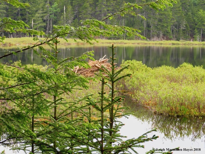
In fact, we found the most recently built beaver abode.

And the dam that made it all possible.

One special sign of wildlife may gross you out, but we were delighted for this pile of scat indicated a bear had passed by earlier this spring. I’d wanted to look for bear trees on the hike up, but these days my eyes are mighty focused on trail conditions. And scat is just as good, if not better than a tree with old claw marks. Well–both are wonderful . . . really.

One other resident was insistent that we take notice and I think we may have paused near a nest tree. When I asked my guy if he could hear the Conway Scenic Train whistle emanating from the other side of the mountains, he said that all he could hear was the chickadee’s chatter.

The return hike down was via the same trail, but when we reached the log landing and later the logging road we had one final challenge to complete–the flutter-by challenge. Who were those beauties that flitted about, gracing the landscape with their presence? For starters, we discovered several Atlantis Fritillaries seeking nectar from eggs and bacon flowers, aka Bird’s-foot-trefoil.

Once over easy, it was equally beautiful.

And the learning continued for we watched numerous White Admirals flit from spot to spot. But notice the coloration–including orange spots below its white bars.

This blue version was also a White Admiral. Needless to say, we admired it no matter its variation.
And with that we had successfully completed the fifth episode of The Amazing Race–Our Style. All day we didn’t know are status in comparison to the other contestants, but six miles and four hours later we had nothing to fear. We definitely won this leg for we stood upon the mat at the Pit Stop much earlier than any of the other contestants.
As much as we would have liked to climb the Baldface Circle, it wasn’t in the cards for us today. And as a final note to today’s journey–I added a few more mosquitoes to the natural history museum forming on the velcro of my splint. It’s a museum, however, that I hope will close soon, for it stinks–literally and figuratively.
The Amazing Race–Our Style, episode 4
We’d barely set off on episode 4 of The Amazing Race–Our Style when we hit our first roadblock just around the corner from home. A small patch of roadway at the foot of a friend’s driveway was being paved by the State. Our first challenge–how many state employees does it take to repair such a patch? Fifteen. Two to stop traffic, two to operate equipment, one to supervise, and ten to stand around and drink coffee.
Our next roadblock–a stop at our local hardware store to return a rented chainsaw. Well, truth be told, more like a borrowed chainsaw from the rental department. Regardless, the clock ticked on.
And still, there was one final roadblock–a stop at Prompto Ten Minute Oil Change, where we got to sit and watch the action, which actually took less than ten minutes.
At last, we reached the ticket office of Casco Bay Lines in Portland, Maine . . . as a ferry was departing. The ferry we wanted to be on. C’est la vie.

Since we’d missed the boat. we decided to use the time until the next departure to our benefit and ate an early lunch at the Porthole, where we both ordered the scrumptious beer-battered fish sandwich.

Following lunch, we hurried back to Gate 5, not sure if we’d be the only contestants on board.

When it was time, my guy handed over our tickets and received our first clue.
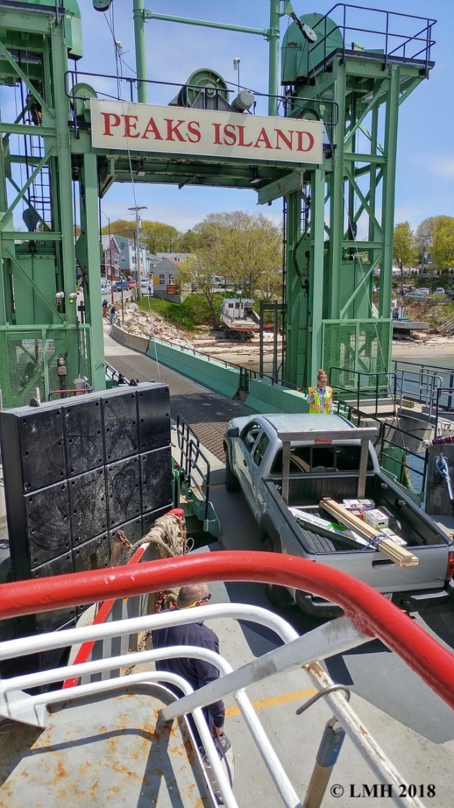
We needed to exit the boat at Peaks Island in Casco Bay. That was easy given that this particular ferry only traveled between Portland and the island.

Finally, we were ready to get into the nitty gritty of the day’s adventure. We had a choice–ride all the way around the island on bicycles without stopping or complete a loop that only covered half the island via a golf cart, but included a few stops. Because of my current one-armed bandit situation, we chose Mike’s Carts.

Another set of contestants made the same choice, which made us realize we still had a chance to stay in the race. Mike explained the finer points of island driving.

As we made our way to the first island challenge, we enjoyed the views.

The rocky coast of Maine proved to be much more than that, at least in this section–Cairn Beach. Other contestants passed by this challenge, but we decided to try it.

According to the clue, we needed to build a cairn that somehow reflected the surroundings. Examples surrounded us.

One rock at a time,
we created a base until . . .

our final product was an artistic representation of the cattails behind it.

Upon completion of the cairn, our next clue suggested the need for batteries. And so we followed a trail away from the water.

But really, water was a part of it. And a boardwalk–in much worse condition than the one that flipped my feet into the air on last week’s Left-handed Mondate.

With great care I followed my guy–for two women we wanted to overcome were ahead of us. All the way along, birds serenaded us.

Thankfully, the boardwalk gave way to solid ground and among the offerings at our feet I noted a sausage-shaped boudin–I could only hope we might earn extra points for knowing such.

The trail led us to a gallery of sorts for its a place frequented by midnight artists. Were we in the right place?

The question remained as we admired the creative works–but what did they have to do with batteries? Did the clue refer to the energy of the artists?

And then the answer was made obvious–we were exploring the Battery Steele constructed in 1942. According to the Peaks Island Land Preserve: “During World War II, Battery Steele was the most important fortification in Casco Bay. Its two 16″ guns, triangulated by observation towers on Peaks Island, Jewell Island, Cushing Island, and Bailey Island, could shoot a shell weighing 2,240 pounds nearly 30 miles at enemy battleships or submarines to protect Portland Harbor.”
If you look closely, you might see my guy starring into a tunnel. The team of two women challenged us to walk down the dark tunnel. They made it about a third of the way before running out while screaming. We accepted the challenge and made it only as far, using my handicap as an excuse to turn around–I couldn’t spy any obstacles in the dark and didn’t want to risk tripping. Would our calm departure overcome their hysteria?

No matter, for we knew the outcome was out of our control. Because we’d chosen a cart over a bike, we next needed to locate the road that cut across the island and back toward the harbor. An islander was out for a walk and we stopped to ask if we were headed in the right direction. She told us to stay to the right, cross over at the four corners, and continue down the hill. Bingo. We returned the cart and received our next clue–to locate the smallest store on the island that is open year round.

And that’s how we ended up in Duffy’s Hardware.

It’s a one-room wonder that serves an important niche.

With the hardware challenge completed, we next needed to walk along until we discovered the Traveling Gnome. We found it subtly hidden in a garden with Casco Bay forming the backdrop.

The gnome’s clue was to find a way to the beach. We began to worry because time was running short and we found one locked gate after another.

But, we don’t give up easily and at last found a slice of sand.

While walking along our goal was to locate three natural representations. The first–nature’s artistic palette.

The second–something with an historical reference.
The third–natural homes aka barnacles.

And then we both had to complete the lobster trap maze. Could we do it successfully?

Piece of cake.

Speaking of cake, we had some spending money and a wee bit of time before the ferry arrived so we visited the local grocery store to satisfy our need for a sweet treat since the ice cream shop wasn’t open. Among the offerings we found sundaes and purchased two.

Ahhhh. But when you are suddenly sidelined by a wrist fracture, consuming some treats requires help and so my guy broke the sundae up for me. It also means letting go of the fact that one might end up with sticky fingers for a while. If only The Amazing Race–Our Style included special credit for overcoming personal obstacles. Hmmm–maybe down the road.

We’d completed all of the island challenges when one last question (mark) appeared.

Could you find a stone that represented our relationship and today’s Mondate?
We did. And with that we completed another episode of The Amazing Race–Our Style.
The Amazing Race–Our Style, episode 3
We were a bit confused by the clue–something about an oven and ice and we felt like maybe we were headed to a kitchen. My guy doesn’t cook all that much and I avoid it as much as possible, so we knew this was going to be a tough leg of the race. Surely, we’d be there all night trying to concoct something and the sky would darken on our chance of winning.
To top it all off, it was an equalizer. That meant that though we were early to the starting point, all participants would begin at the same time. And so we had some time on our hands and a few dollars to spend on lunch and libations.

As we sipped, our clue was revealed. And we were ready to heed it, despite our anxiety over the cooking issue.

Following lunch, we still had more time to kill and decided to walk across the footbridge in Boothbay Harbor.

It was a bit of a ghost harbor on this day, but it won’t be long and people and boats and more people will fill this space.

As we walked around town, we did some window shopping–of the best sort.

And then a view at a clock reminded us that we had a place to be by 1:15.

Look for the crooked sign, the clue stated. We found it.

Follow the trail. We did.

Note the tide. It was obviously out.

Locate the bridge that connects Oven Mouth Preserve West to Oven Mouth Preserve East. Bingo.

But what was below us, we wondered. And that was our next challenge. We had to figure out the configuration of this land. It looked like an old bridge, but rather, it was a former dam that had been used to create an ice pond on the other side of the bridge upon which we stood. Aha–the icy portion of this leg of the race. Our task was to discover its history. Reading a brochure produced by the Boothbay Region Land Trust we learned the following: “In 1880, in response to a growing demand for ice, [the cove now known as Ice House Cove] was dammed to form a fresh-water pond and an ice house was built. The ice was shipped by schooner, mainly to Boston and New York.” Today, any blocks of ice would surely have melted as happened in our water bottles.

While we looped around the two peninsulas we had a several other challenges to complete. First, we needed to find three examples of critter sign–other than the ubiquitous red squirrel middens. We checked off number one with a garter snake that slithered past.

Number two: mammal tracks in the mud below. We couldn’t get close enough to identify it, but noted the trotting pattern.

And number three, the remnants of a paper wasp nest.
Another challenge down. How many more to go?

It wasn’t long before the next presented itself as we wound our way around the property. First, we needed to find evidence of the land’s former use–as a sheep pasture in the 19th century.

And then the letter D. We never did learn what the D stood for, but . . . we found it.

And finally, a sausage-shaped boudin among the folds, formed by the pinching and swelling from compression and shearing.

The tide slowly flowed in as we journeyed on.
And at the point where the Cross River met the Back River, we noted a rip current visible in the swirls.

At last we crossed back over the bridge from east to west and then peeked at the dam juxtaposed as it was in the shadow of the modern-day bridge.

From the outermost point of the west side, we paused to look back toward the dam and bridge–did the early explorers really see this rounded cove as the inside of an oven, thus naming it Ovens Mouth? It was certainly unique. Fortunately, we could enjoy the view without turning up the heat. If they thought it was an oven, we agreed. If it meant we didn’t have to cook, we definitely agreed.
From the brochure, we did learn more history: “This area has always been inviting for maritime activities because of its deep-water access and protected location. Settled in the mid-1700s, one of the region’s earliest shipyards was located here and both British and American vessels hid in the coves during the Revolution. Soon after the Civil War, the property came into the hands of the Tibbets-Welsh family, who owned it for more than a hundred years.”

We had one last challenge to complete before finding our way to the mat. Our final mission: to note three sights that represented our relationship.
Kissing trees–check.

A heart-shaped rock–check.

Whispering sweet nothings–check. (Note the heart-shaped white cere on their bills. And no, he is not picking her nits. Well, even if he is, isn’t that a loving move?)
Once again, we managed to stay ahead of other contestants, didn’t squabble too much, avoided our worst fears and completed the assigned tasks without much stress. In the third episode of our imaginary rendition of The Amazing Race–Our Style, we landed on the mat in first place once again. What’s next? Stay tuned.
The Amazing Race–Our Style, episode 2
Even though we’d won the first leg of our Amazing Race adventure, we were disappointed with the start time we received for today’s journey. We couldn’t leave home until 10:24 a.m. But, despite that, we’d read the clue carefully, checked the maps and navigated to the starting point:

The world-famous cribstone bridge that connects Bailey Island and Orr’s Island in Harpswell, Maine. Though it may look rickety, it’s stood since 1927 and as far as we knew had only been repaired once–in 2010. The stacked granite blocks are held together only by gravity and allow the tide to flow freely. The bridge was placed on the the National Register of Historic Places in 1975. Would we make it across?

We did. And continued on to Land’s End, where our next clue awaited by the Maine Fishermen’s memorial. It was also a memorial to my mother, for the only other time we’d been to this place was either before we were married or shortly after and Mom was with us–enjoying most the Land’s End Gift Shop. Today–it was closed for the season. It was also a memorial to Dad for he would have told us to fill the innermost recesses of our lungs with salt air. And so we did.
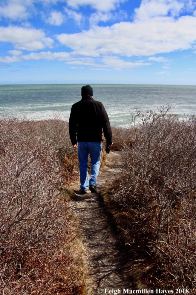
Out to the rugged coast of Maine we headed. Just a few days ago, a Nor’easter had made its presence known in these parts and still today the surf spoke to its force.

Our task–to be mesmerized.

And to record it in a variety of renditions.

And so we did both.

Numerous ohs and ahs escaped our lips.

And we hadn’t even ventured far.

Finally, we arrived at Thunder Hole and though the wave action wasn’t all that spectacular, we did hear the thunder. Our job–to note which side sounded louder. We chose the left and received our next clue.

One of us had to get as close to the surf as possible. And so he did.

Together, we needed to appreciate the power.

And so we stood.

And watched.

As water exploded.

And then we received our next clue–to move on to the next spot.

The Giant’s Stairs.

The blocky formation earned it the whimsical name of the Giant’s Staircase many years ago. We were reminded of the Giant’s Causeway in Ireland and prior to arriving wondered if it might look the same. It didn’t, but every giant leaves his own mark on the world. Fortunately, we didn’t need to climb down for today’s challenge–just to acknowledge it. Which we did with pleasure. It seemed only the waves were allowed to ascend and immediately descend–so quick was their exit.

Having accomplished that leg of the race, we next needed to spy five rainbows. One.

Two.

Three.

Four.

Five.

Task done. And then my guy had to tell me when to take a shot for dramatic effect.

He nailed it.
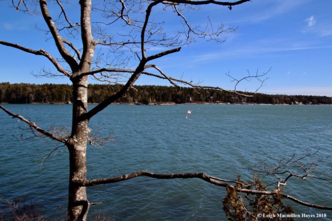
We were feeling good about our position when our next clue told us to eat locally so we grabbed sandwiches at “BIGS,” aka Bailey Island General Store and Eatery. And then we headed to our next destination located on Orr’s Island–Devil’s Back. The name was curious to us, but the trail system is located on either side of Route 24, which apparently is known locally as Devil’s Back. It does form an obvious spine between the two sides of the Harpswell Heritage Land Trust property.

Winds had wreaked havoc mainly on the Gun Point Cove side where we walked all of the trails first.

And then we slipped across the spine or Devil’s Back to the Long Cove side. Curiously, the land trust describes the forest here as being mixed, but mostly I noted evergreens including cedars like these, spruce, fir, and pine, with a few maples and paper birch in the mix. I suppose it’s all in the eye of the beholder.

As we were cruising along, we did get U-turned. It happens on the Amazing Race and was to be expected because we had been in the lead for so long.

And so we had to recall the folds of the rock along Casco Bay. By looking at the angle, our eyes began to see the metamorphic rock turned on its side due to intense pressure in its long-term history and understood that over time various pressures and results of heating and cooling events caused the variation in color and mineral size of the bands. We could also see the arc the folds created that had since eroded.

An easy one for us (well, me anyway) was to identify the fern that grew on the rocks along the Long Cove side of Devil’s Back–Common Polypody it was.

And then there was the geologic formation–an igneous dike (lighter color) that cut across the metamorphic rock created we believed by the pinching and swelling from compression and shearing to the Northeast that formed sausage-shaped boudins.

And we had to name that lichen–sunburst with deep orange disks of its fruiting body or apothecia. Again, we were feeling kinda confident, but one never knows in a race such as this.

Our final U-turn challenge was to locate a stone wall–and we did. Island style is so much different from inland style.

We thought we were done, but discovered we still had a couple of more challenges to complete. The first was to locate two whimsical sites–in keeping with the Giant’s Stairs. And so we found a fairy house.

And an octopus.

Our last challenge before we headed to the mat–to locate two American flags blowing in the breeze at Cundy’s Harbor. Bingo. One.

And two.

At last we arrived at the mat and much to our surprise–got a wee bit sprayed! But that didn’t matter for we’d beat our imaginary contestants and once again finished first. Our prize from the Gnome and Travelocity–a leftover homemade pizza dinner. That meant we didn’t have to prepare a meal when we arrived home on this Mondate. Yippee.
The Amazing Race–Our Style: episode 2. Check back in with us in April to see what challenges we’ll face next.
The Amazing Race–Our Style
I’m sure when we said our wedding vows back in 1990, there was something in there about only riding a snowmobile once. And I did that once two years or so ago–mostly because I knew it would please my guy. Certain memories remain from that experience: I felt like a bobblehead inside the helmet; I lacked control as I sat behind him and couldn’t see; when I did peek around, I was sure my head was going to strike a tree so narrow was the trail; and I didn’t like the speed. Oh yeah, and at a road crossing, I do believe I jumped off and walked to the other side. With all of that in mind, I’m not sure what I was thinking when I created a Valentine’s gift for him–our very own Amazing Race. My rationale was that we enjoy the show, but know that while there are certain stunts one or both of us could handle with ease, there are others that would certainly cause us to be last to the mat–and lose. So, why not create an Amazing Race that we have a 99.9% chance of winning. If we lose, we’re in big trouble. All that being said, our race includes twelve events, one for each month. And this month’s activity meant a snowmobile ride for two. Oy vey. I created this so I could only blame me.

We awoke to five inches of snow this morning and knew that today was the day. After an early lunch, I tried to delay the inevitable. The dishes needed to be washed. And dried (I never dry the dishes). Toilet cleaned. I even thought about vacuuming, but my guy stopped me. And presented me with a black helmet. It was much too big and kept shifting around. He gave me a second helmet to try on. I felt claustrophobic and couldn’t take it off fast enough. “We have another,” he said as he headed to the barn. Darn. And the third one fit just right. Double darn.

Our mode of transportation was ready and waiting. No long lines of others vying for a seat. No being put off until a later time. Our race had begun.

We hopped aboard and headed off down the trail. At first it was sort of okay and I almost relaxed, until that is, we took a sharp corner and I clenched my hand rails while leaning away. Sometimes, I felt like I was a kid again in the back of the school bus and jumping up and down as we went over the bumps on Valley Road in my hometown.
I was glad my guy couldn’t hear me unless I leaned close and spoke up–I kept my own running commentary for the first twenty minutes, which occasionally included an expletive not worth repeating.
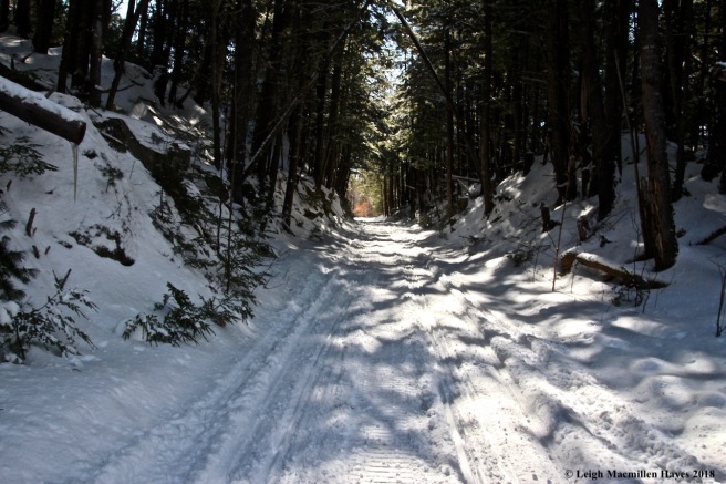
At last we reached the Narrow Gauge trail, where my guy picked up the speed, but given it’s a fairly flat old railbed, I chose not to complain. And as good as his word, he stopped whenever I asked. One of my favorite spots along the trail is what we refer to as the tunnel, for in that section only, the walls are high on both sides and hemlock trees tower over.

One of the things about riding on the machine is that you don’t get to really see anything. He loves it because it takes him places he wouldn’t ordinarily go. Yeah, there’s that. But . . . I prefer a slo-mo approach. And so today, we melded our ways–full speed ahead (although he thinks he took it slow) and complete stops every once in a while to take a look at things like sap forming an icicle,

hemlock roots and rocks intertwined,

and an elephant.

At last I walked back to him and we continued on our way. We were only going to go the length of the Narrow Gauge, but I was surviving and my guy smiling.

Our next destination–Hancock Pond in Denmark.

I asked him to stop by this camp intentionally, for I wanted to show its owners, Faith and Ben, the midwinter view–and lack of snow mainly because of its orientation to the sun.

Despite the fact that most of last night’s snow had already melted, rock tripe along their shoreline had turned green–photosynthesis in action.

As we walked back to the chariot, we noted the houses on top of Bear Trap. My guy suggested that we turn around and head in that direction next. From the start, I suspected our plan of an out and back trip wouldn’t occur for he loves to return via a different route, while I don’t mind following the same path back because I usually see something I missed previously. But . . . I agreed with him.

We did have to travel a wee bit back on the Narrow Gauge to reach the turn toward Narramissic, located just below Bear Trap. Since we were passing by for a second time, I asked to stop at Perley Pond for a quick look.

Around the edges, the melt down was beginning.

And then onward and upward we rode to Narramissic, the Peabody-Fitch Homestead erected in 1797 by William Peabody, one of Bridgton’s first settlers. Today, the property is owned and managed by the Bridgton Historical Society.

Our main mountain wasn’t part of today’s journey, but the view of the ridgeline was spectacular from the farm’s field.

From there, we passed by the spur to the bear trap, and continued on toward Holt Pond. For a while, I felt lost in a daze as we flew through woods in varying degrees of succession due to logging events over the years. I tried to look for bear trees for I knew there should be some, but didn’t spy any. And hardly recognized our place when we suddenly arrived at the emerald field near Holt Pond.

I also completely missed the quarry from which the Stonehouse was built. The house had an interesting history. In the early 1800s, John Mead built a primitive house in South Bridgton. Like the big bad wolf of fairy tales, wind huffed and puffed and blew the house down. Mr Mead was quoted as saying, “I can and will build a house that will stand the winds and weather.” And so he did–using the plug and feather method to cut the stone from the nearby quarry and transporting it a half mile via a stone boat or sledge. The stone treasure rose from the hillside, where Mead had situated it out of the wind. The field was certainly windy and we didn’t pause for long.

Our next stop was to a place I’d never visited before and I was impressed by its size–Otter Pond. Today, I felt like we were the otters as we slid across the snow-covered ice.

At the far edge, I found a spot I hope to return to for it looked like an interesting wetland.

For today, the cattails, their seeds blowing in the breeze, were enough to whet my appetite.

And then in a few more zigs and zags, we found ourselves in familiar territory as we passed by my guy’s store.

Two more road crossings and a few more bends in the trail–and finally the mat welcomed us home after a successful finish to the first leg of The Amazing Race–our style.

You must be logged in to post a comment.