Zodiac Three: A Perfect Picture

The message arrived again for a boat trip, but this time the meet-up time was 5:30am, rather than 6. So I set my alarm for 4:00 in order to have an hour of quiet time to greet the day in darkness as I read and meditated and reflected and sipped coffee.

It was still dark when I arrived at the Captain’s home and hopped into his truck, with the boat in the back.

About ten minutes later we were in Hiram, Maine, at a boat launch along the Saco River. It’s been his dream for three years to make this journey and I love that I get invited along for the adventure.

I would have written about Zodiac Two, when we cruised along (with a small electric motor) the Old Course of the Saco in Brownfield Bog, but my photos were all out of focus and so since then he has given me a photography lesson and many tips.

The sun was just brightening the sky as we headed upriver, a smart plan in case the motor’s battery ran out of juice and then we could paddle and float back to the launch site.

I’ve been on the Saco a bunch of times in a variety of boats, but neither of us had ever explored this section below the Brownfield Bridge and I was struck by how calm and clean it was. The water is also quite low–thanks to the drought that we’ve been experiencing again this summer so we had to be aware of sandbars and stumps and logs and rocks. Well, actually, any time you are on the river, you have to be aware of obstacles.

As we started the journey a dragonfly landed on my leg, and she proceeded to try to lay eggs. Have you ever felt the tip of a dragonfly’s abdomen try to pierce your skin? It’s a bit of a prickle. While she was doing that, I tried to snap a photo, but neither she nor I were successful. Still, I counted her as a good omen.

Sometimes, as we gently cruised along, we each took photos of the same scene, so some of these are his used with permission, and others are mine.

The reflection of the shoreline was one that struck both our fancies. We didn’t talk about it, but it was the layers that intrigued me and reminded me of the force of the water in this mighty river that originates in Saco Lake at the top of Crawford Notch in New Hampshire and winds its ways with a million oxbows to North Conway, NH, and then into Fryeburg, Maine, and across the state before it flows into the Atlantic Ocean in Saco.

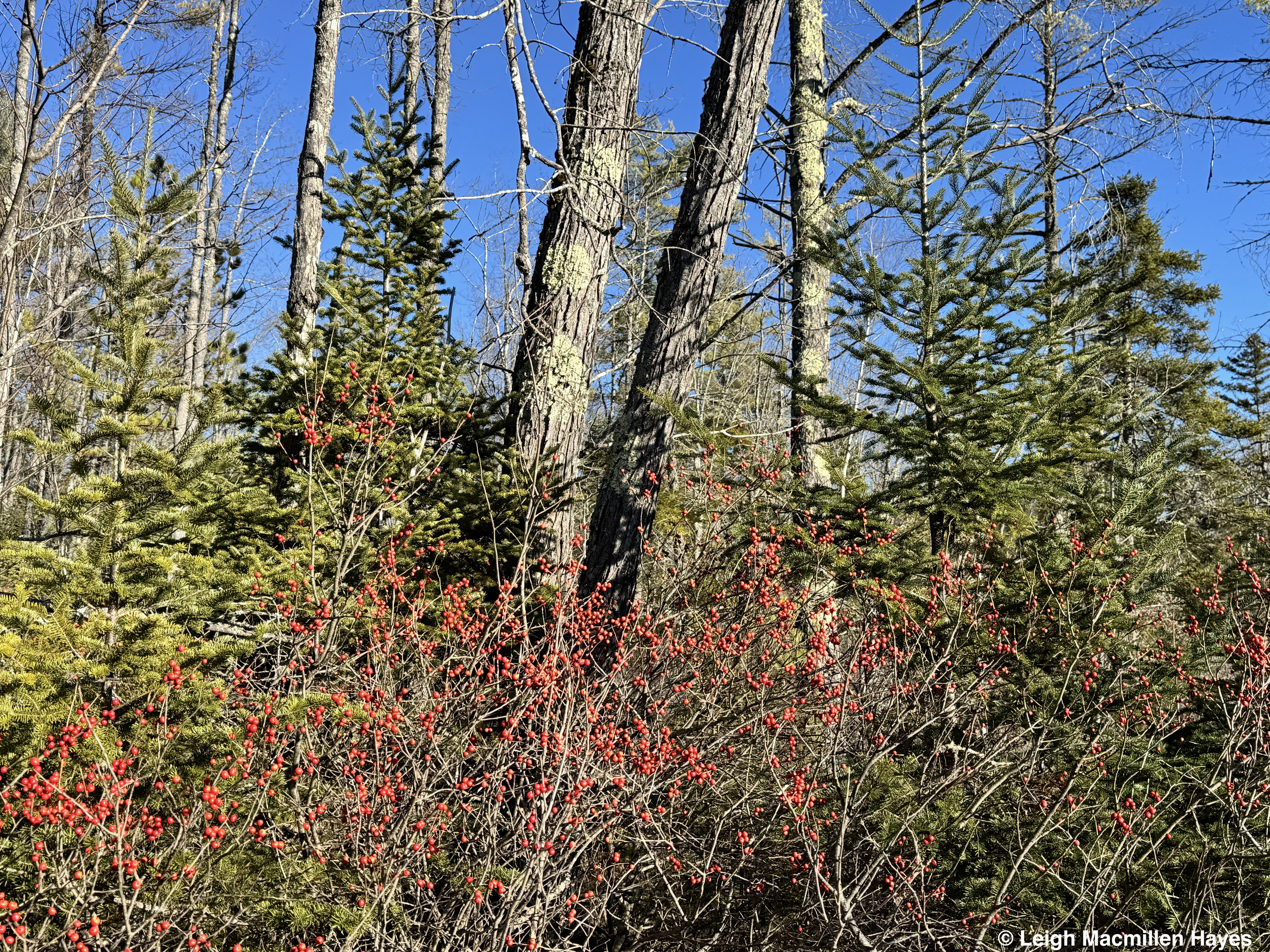
Sometimes we realized we were looking at Silver Maple floodplains and other times there were steep cliffs. Always, we knew if there was a house or camping trailer near the edge, because they seemed to be located on high ground, but all the trees were cut between their high ground and the river to provide a view, and the result was intense erosion. One person even had several tarps draped over the ground in what we figured was an attempt to stave off the erosion. We think leaving the trees and trimming branches would have been a better choice, but no one asked us.

Another sign of erosion, the visible roots of many, many trees, also created works of art and my brain is already painting this scene in the future . . . maybe.

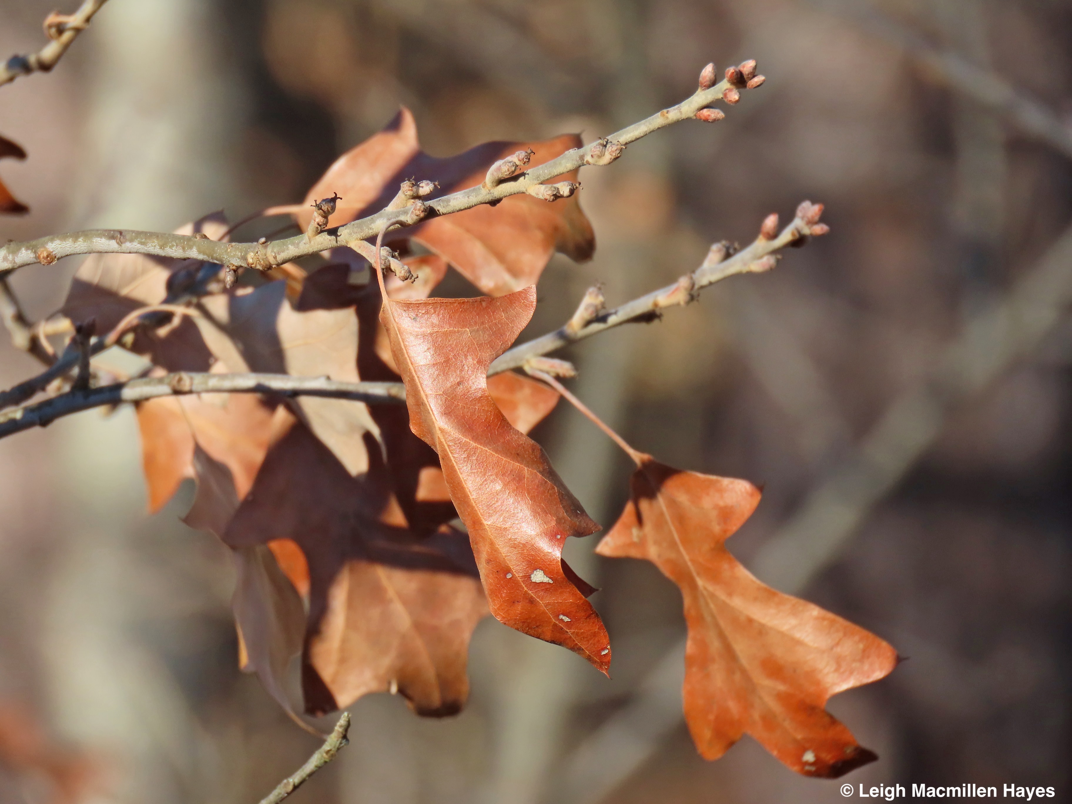
And then there was this work of art–a Silver Maple Lollipop, its leaves already shutting down chlorophyl production perhaps as a result of the dry spell we’ve been experiencing.

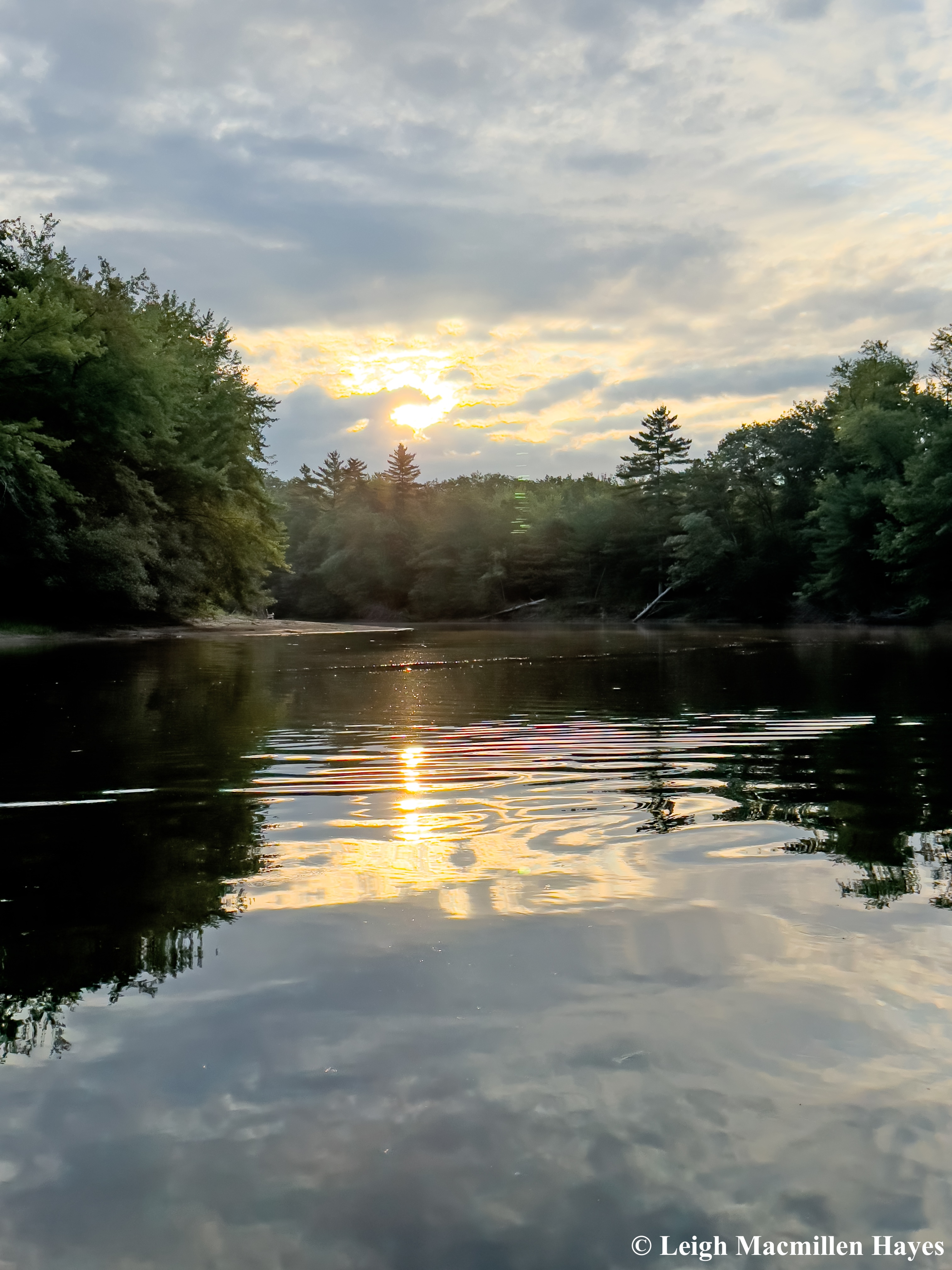
Slowly the sun rose and the water captured the sky in whirls and swirls and rainbows of its own making.

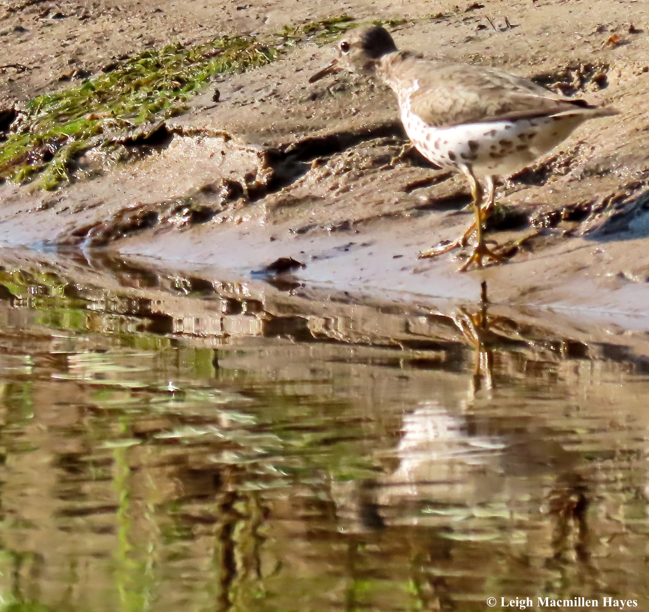
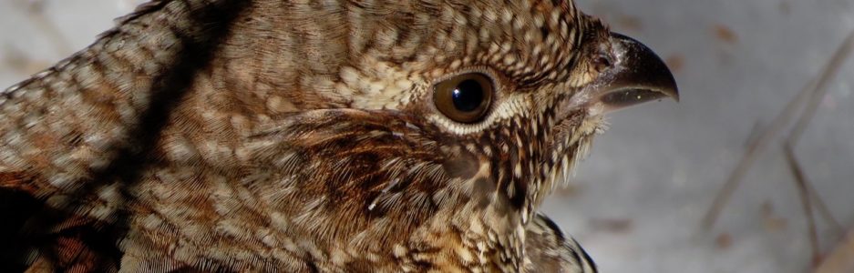
We’d both headed into this boat ride expecting to see birds, which we did, but we really expected Great Blue Herons and Bald Eagles. The drama artists. Our best sighting of the day was this Spotted Sandpiper, who walked along the river’s edge and then flew ahead and landed and did the same thing all over again. Over and over again.

Once the sun was fully up, our day turned into a bright one, and we had a nice breeze to accompany us. Plus tons of dragonflies and a few damsels, all of whom did not wish to let the paparazzi photograph them. Still, we gave thanks for we could see bugs in the air, but nothing attacked us, unlike during our Zodiac One and Two trips.

At what became our turn-around point, we got out of the boat and waded through the water to a beach, where Captain B set up his drone.

Above us, the waning moon stood out in the Bluebird Blue section of the sky.

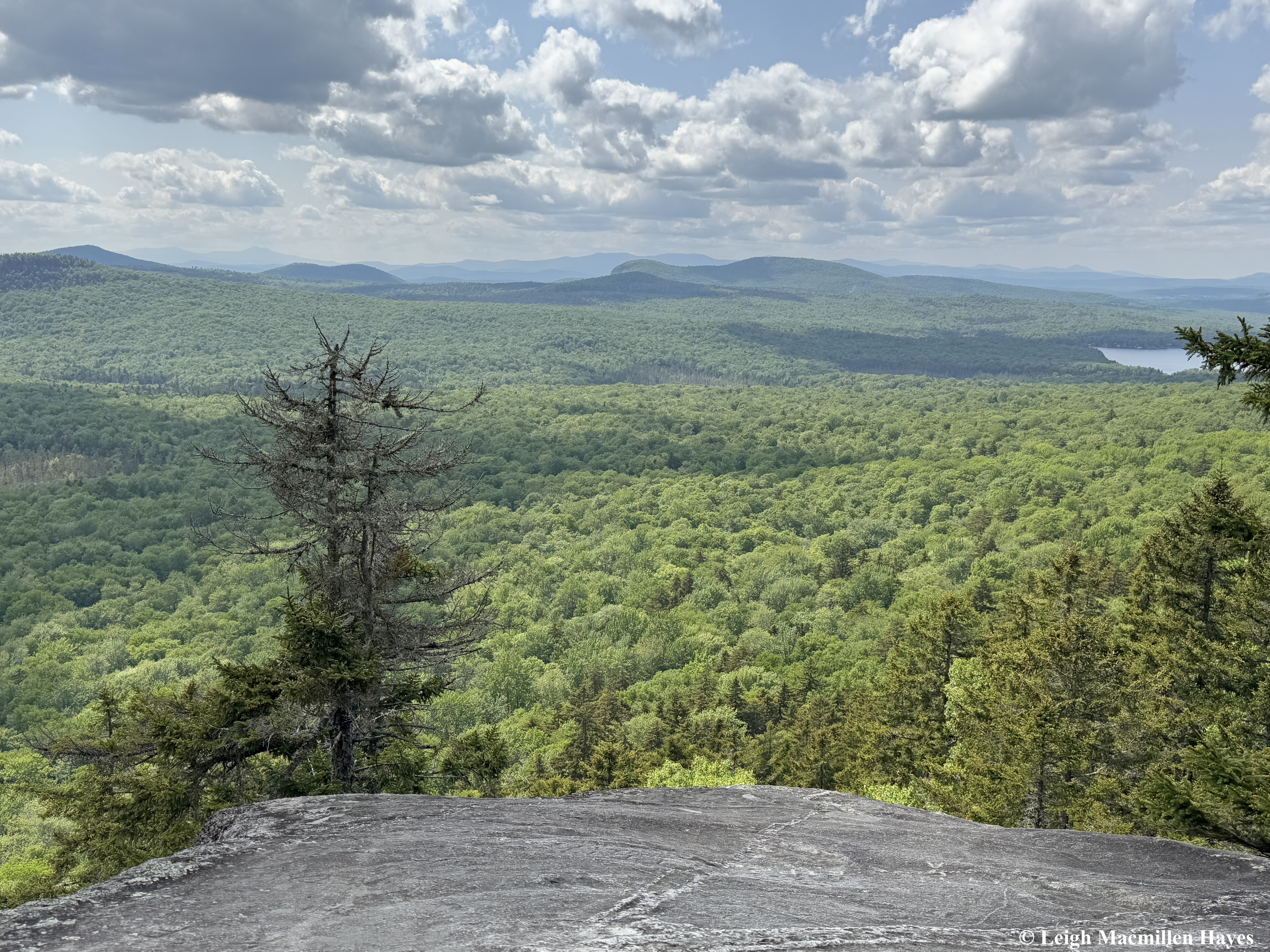
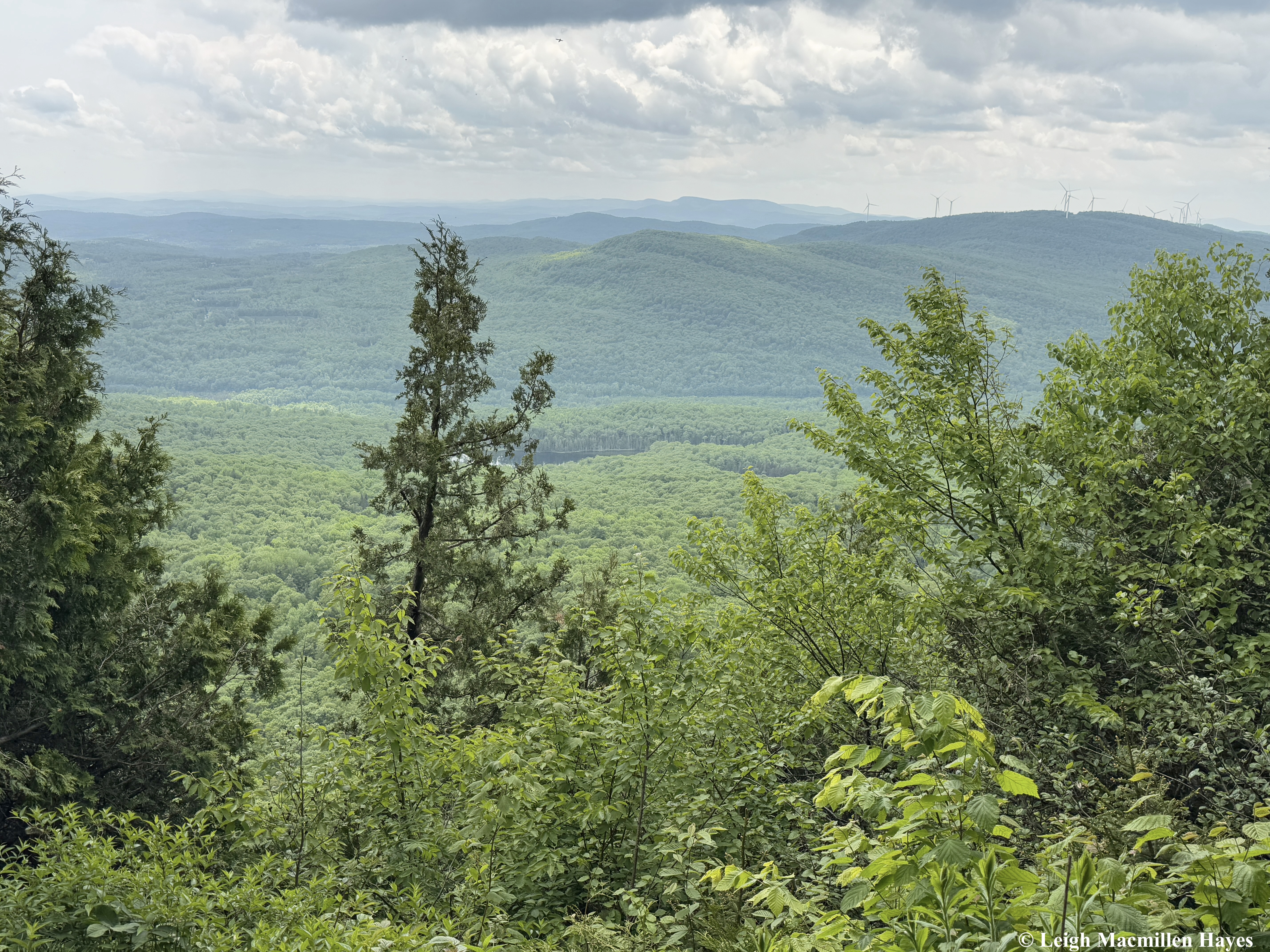
The drone allowed us to see the lay of the land, and despite the fact that I’ve seen it recently from Mount Cutler while hiking with My Guy and a friend, I was once again reminded just how beautiful this area is and how small we are.

Do you see that beach in the river’s bend? We were standing there.

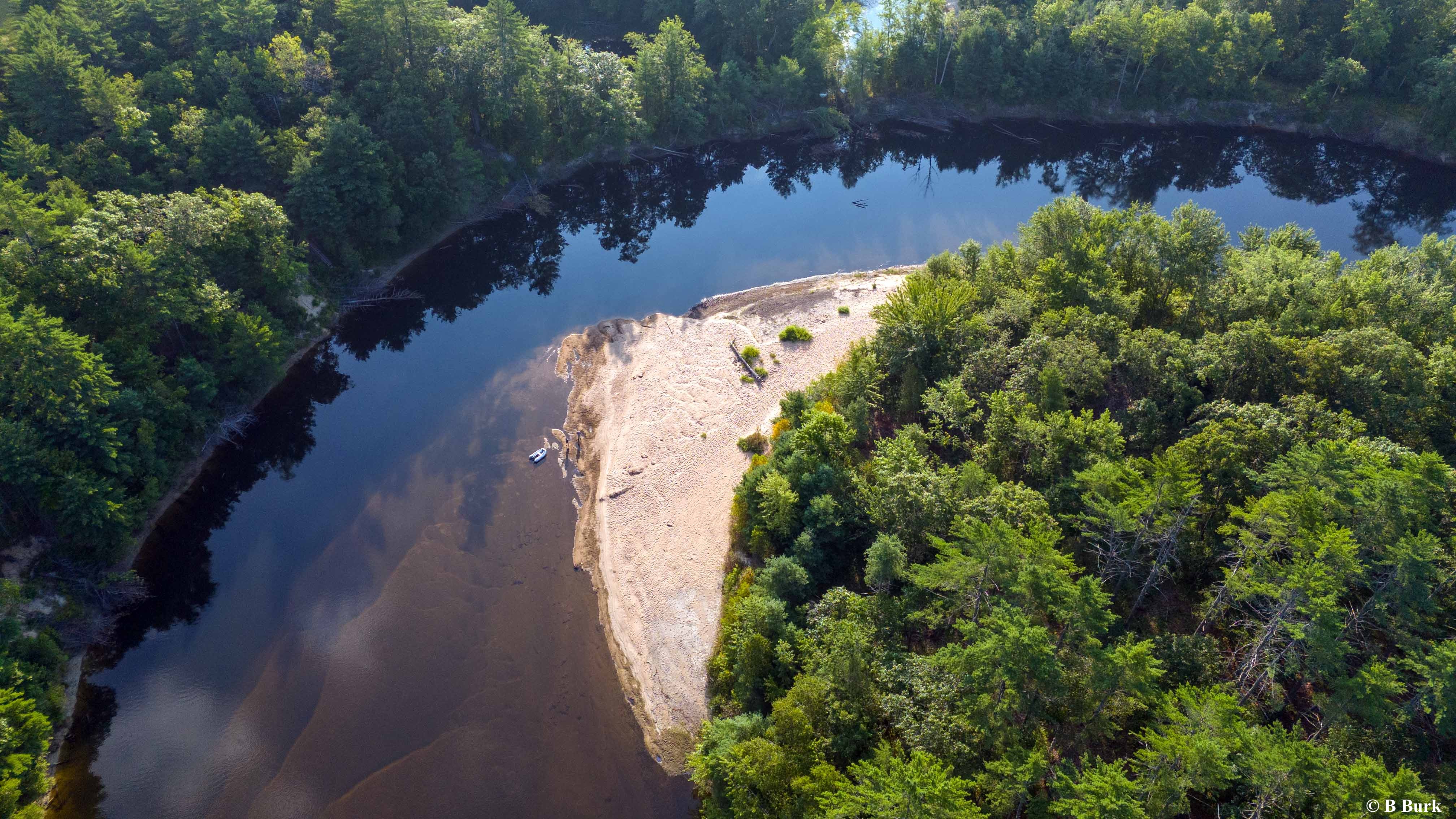
You might be able to see the Zodiac now.

And the two of us near the boat. Plus the indentations of a million duck and goose footprints. A flock of something skittered and flew off as we approached this spot, but they were too quick for us to identify.

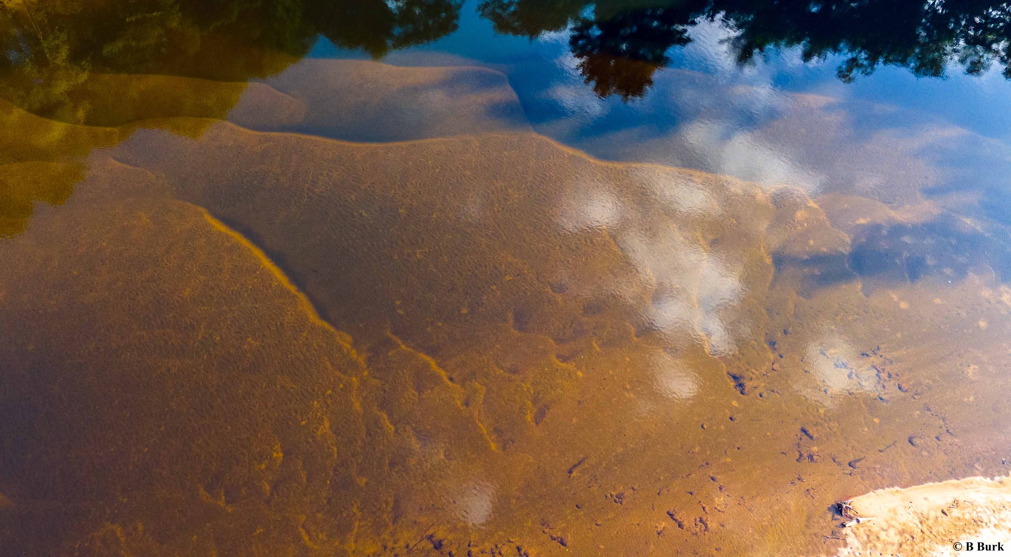
The drone also gathered this shot of the layers of silt in the water. Or maybe we weren’t really on the Saco, and had instead taken a trip to Mars? Oh, but wait, there is a reflection of trees that very much spoke to our being in Maine.

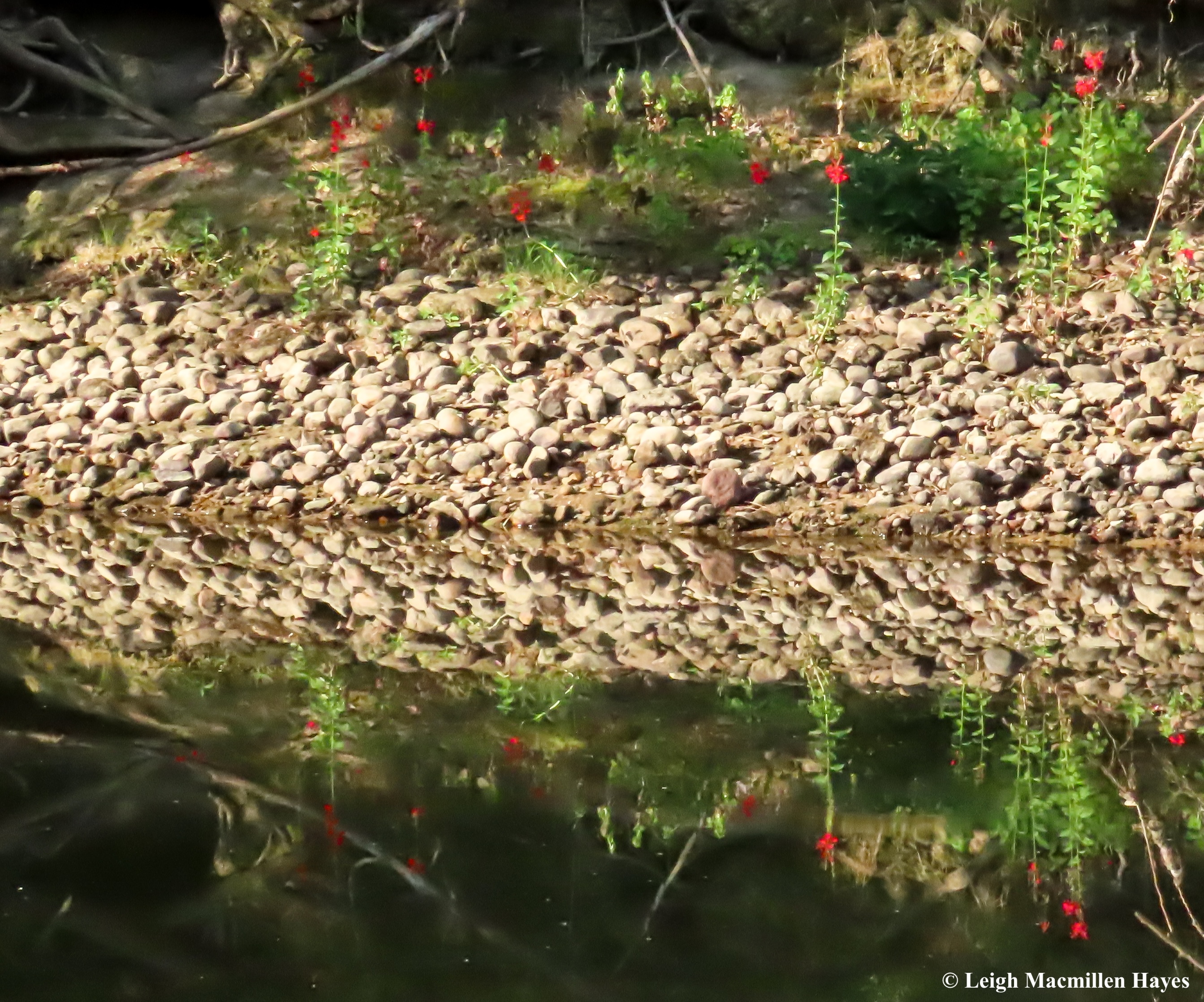
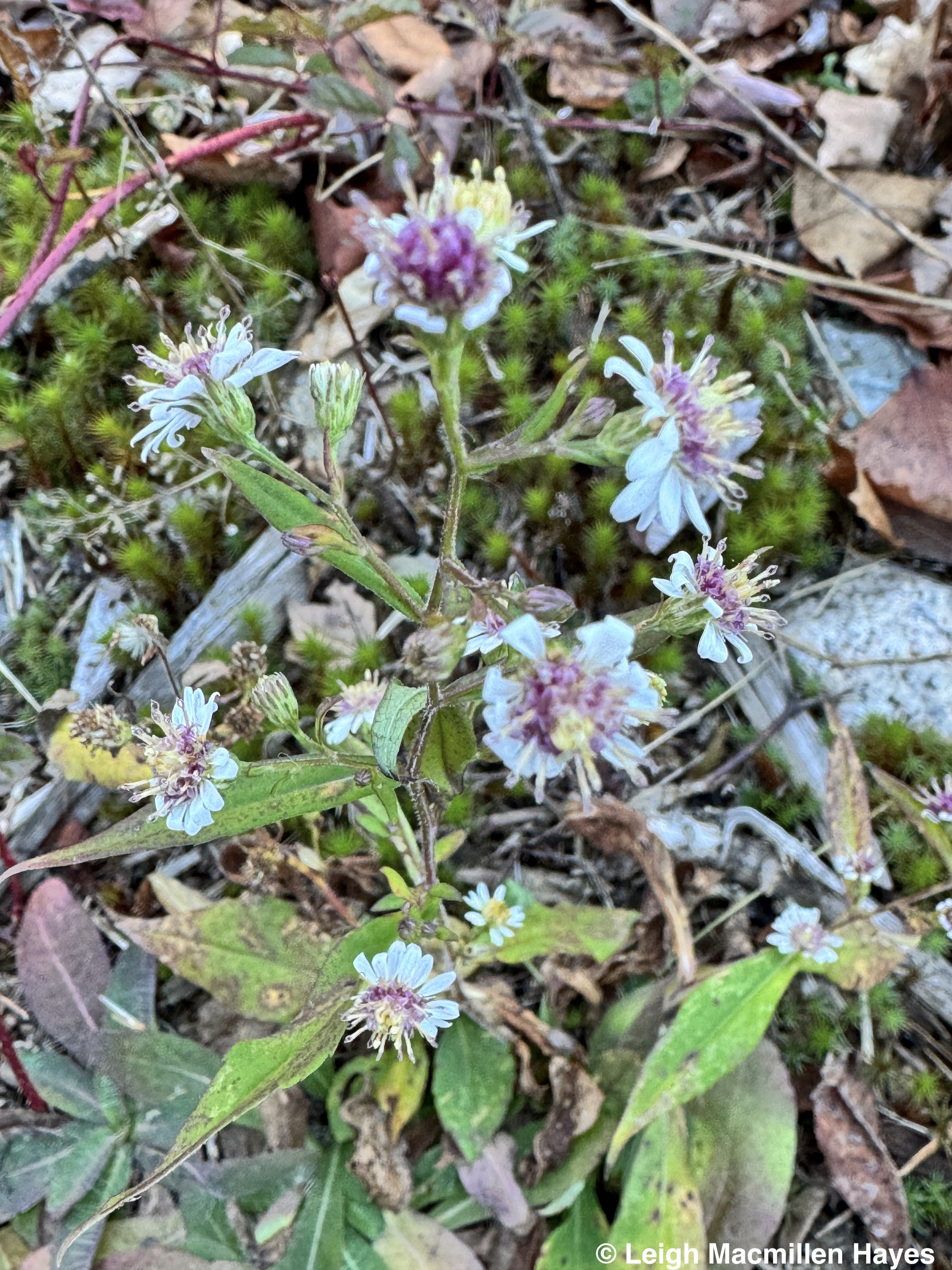
On the way back, we spotted Cardinal flowers that we somehow missed on the first leg of the journey. They decorated a few sections of the shoreline and maybe stood out more because the sun was shining so brilliantly on them.

For Captain B, it was a new flower to add to his list. For me, it was a sign that it is August and we were by water because they do like wet feet.

We also spotted one tiny Painted Turtle that didn’t seem at all bothered by our presence. I’d really wanted to see a turtle, so was thrilled with this finding. But surprised that we only saw one.

According to my GPS, our trip was four miles in each direction, but then I realized that the APP cut some corners, so maybe it was 4.5 miles one way. Plus I forgot to start it until after we’d left the beach.

The length wasn’t really important. It mattered more to have the opportunity to discover this wild and scenic and quiet section of the river (and not have to paddle!).

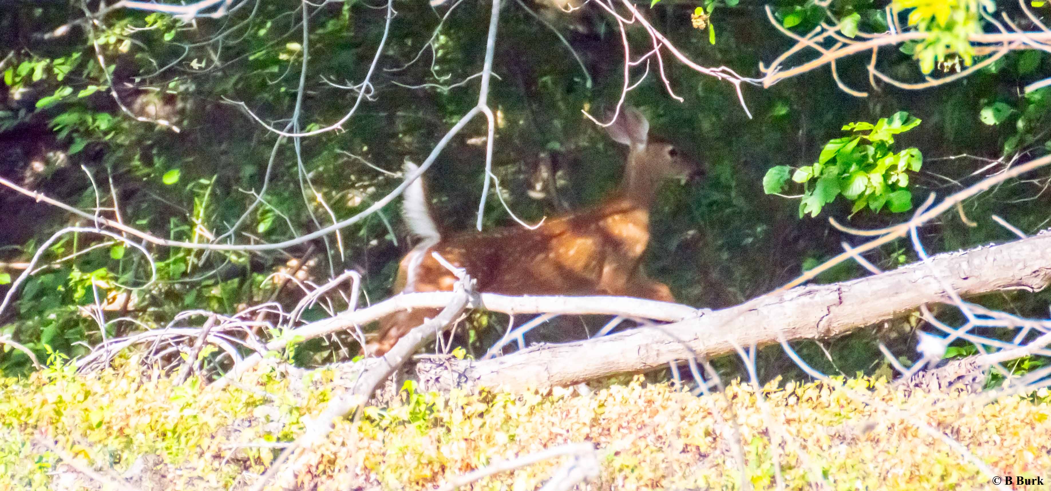
As for the perfect picture, this is one that Captain B snapped and I can’t believe he actually captured the fawn. We were both surprised, even though we’d expected to see deer, when a Doe and her spotted youngster stood by the water’s edge as they nibbled on grasses, but they saw us and quickly dashed into the woods, their white tails on high alert.

The sight of the two of them, however, is what I’ll cherish in my mind’s eye because that’s really where perfect pictures are stored.

Zodiac Three: The Perfect Picture. Thank you again and again, Captain B, for creating the opportunity. And I can’t believe you did get this last photo after all.

Vermonting We Did Go

Okay, so “Vermonting” is not a word. But we did go. And came home richer for the experience.

It takes us forever to plan a vacation, even a mini-one. Well, actually, it only takes a few minutes once we put our minds to it, but prior to that it’s a lot of “We should go to . . .” or “We need to get away,” or any of a myriad of other comments, and we do nothing.

So about a week ago we cleared our calendars. We knew kinda sorta where we wanted to go, but didn’t know where we might stay, until we discovered The Barn in Peacham. We have a red barn attached to our 1870s farmhouse and long ago turned the upstairs into a movie theater/rec room for our sons, all that being a rather rough rendition of either–the movie seats were from an actual theater in our hometown, which was the best part. The seats are still all up there. And there’s a pingpong table and an air hockey table and trophies (remember the Porcupine Invasion last November?) and various other things, plus now a Yoga area for My Guy, but it’s hardly like the space we rented for the weekend as pictured above.

Cozy, roomy, tons of natural light, everything we needed, even eggs and English muffins if we came up short for our first morning.

I think one of my favorite things, and I had lots of favorites, were the little windows that lined the floor in all four rooms. And above these in the kitchen, a Fannie Farmer Cookbook on a shelf. It was touches like this that enhanced the already perfect space.

And our host and hostess, Chuck and Mercy, were equally delightful, and full of information. Thanks to them we discovered Three Ponds Sandwich Kitchen in Danville our first night and marveled in the deliciousness.

But what we were really there for was to hike. And so Saturday morning we went in search of the trailhead to Peacham Bog. If you happen to see My Guy this week, ask him how that search went. We’re still laughing.

We did find the trailhead, but obviously not where we expected it to be. And at the recommendation of Brian at the Groton State Forest Nature Center, we decided to hike the two miles in to the Bog and then continue along a multi-use trail before reaching Devil’s Hill, circling back along the same route.

The natural communities along the way made us feel as at home as the barn, for we (read “I”) felt like we were walking among old friends such as the Mountain Woodsorrel. I love its peppermint ice cream presentation.

And then, in a damp spot Swamp Beacons lit the way and I was drawn back in time to my first encounter with them while tramping through the woods in Lovell with friends Parker, Joan, and Dave. RIP Parker–please know that you accompany me on and off many a trail and I know that you would be happy that I actually remember some of what you taught me.

Vowing not to count Lady’s Slippers, we didn’t. But they were there, though most waning.

At last we reached the coveted bog, where a boardwalk was long ago placed to keep hikers like us from stepping onto the fragile environment.

It was at this point that another funny story evolved, but again, you’ll have to visit My Guy at his store to get the rest of the story.

At last reaching the platform with a bench at the end of the boardwalk, we sat down to eat sandwiches and take in the scene and sounds that surrounded us.

Sphagnum mosses formed the peat base and laurels and Tamaracks and Firs and flowers and insects all expressed themselves.

I, of course, can never see too many Pitcher Plants and be forever wowed by those downward facing hairs that entice insects in to the pitcher-shaped leaves where the end-of-life lurks.

And the otherworldly flowers were in full bloom, including this one that hosted a long-horned insect and a sub-imago Mayfly (read: Dun).

I’ve been wowed by these for a long time and years ago drew this rendition as a teaching tool that now is the background for my iPhone.

There were Unadorned Bog Flies pollinating Bog Labrador Tea.

And Cotton Sedge showing off their hairy tufts.

Our next leg took us from the Bog to the Groton multi-use trail, being used mainly by horse riders and moose. We saw neither, but their tracks were evident in the mud.

What we did spot was this Aurora Damselfly being wrapped up by an Orb Weaver Spider. I knew the damselfly immediately because of the uneven stripe on the sides of the thorax.

And had recently tried to paint a mature form of the same species.

We also met a couple of Red Efts, the teenag and terrestrial stage of the Eastern Newt. The red spots act as a warning to predators because if consumed, they secrete poison toxins from their skins. As humans, we can touch them and live, but to ingest one would be harmful. So don’t try that.

A couple of miles later we reached the trailhead for Devil’s Hill and snaked our way up the switchbacks to the summit, where this view of the rolling hills and iconic geography of Vermont stood out before us.

On the way down, a male Luna Moth presented itself, hiding as it was under a Striped Maple leaf.

I love these leaves and their twigs, especially the growth rings that stand out so predominately, and My Guy appreciates that the leaves serve as Nature’s Toilet Paper. TMI? But really, they are easy to identify and they are soft.

Returning on the multi-use trail before retracing our steps on the Peacham Bog Loop, we had to walk through tall grasses and sedges, which did not make my heart so glad because this was heavy tick territory. I had on tick gaiters and repellant. We took at least five off My Guy.

But, this pair of Craneflies did share a canoodle moment with us, so that won me over for a second.

All in all, we hiked over eleven miles that day, and were too beat to go out to dinner, so instead drove to the West Barnet Quick Stop, about 1.5 miles from our weekend home. There we ordered Chicken Cordon Bleu Paninis with Pesto, and a salad to share. And while we waited for our meal to be created, noticed Shain’s of Maine Ice Cream in the freezer, which made us chuckle. Wait a minute. We were in Ben & Jerry Country. Never fear–they had a much better presentation in another freezer.

And, while we waited, I asked the woman who was creating our salad if she lived in the area. “All my life,” she said, and added, “So far.” We chuckled, but then I asked if she knew so and so, a couple I know from church who had lived just down the road for many years (a fact I’d only learned days earlier).

Her face lit up with a smile as she recalled them and said they used to frequent her other store and that their daughter had worked for her. As tired as I was, that smile of hers was the perfect ending to a great day.

Well, it wasn’t quite over yet. For there was no TV at our weekend digs. And so I taught My Guy to play Parcheesi, and then I beat him.

The next morning we drove north to Orleans to meet my first college roommate and her husband, Bev and Bill, at the Carriage House for breakfast. Funny thing–as I drove up Route 91, there was one car in front of us and approaching it, with its Maine license plate, I spotted Lakes Environmental Association and a Loon Echo Land Trust stickers on the rear window. It had to be someone from our hometown. Sure enough, as I passed it, I recognized the mother of one of my former students. And a wondermyway follower.

Betty, if you are reading this, that was us on the highway with you on Sunday morning at 8:30 or so.

We spent two hours talking and eating and talking and talking some more over omelets and coffee and Bev and Bill suggested that we hike Mount Hor, which overlooks Willoughby Lake. I’d been to Willoughby before with Bev and two other dear friends, but never hiked in that area. And so we did. They gave us easy to follow directions and we parked and then walked almost two miles up the CCC Trail. I love that this was another project meant to keep people working when times were tough.

Though the hard packed surface we walked on was not the original road, we kept spotting these posts and my theory is that they were original and held cables that connected one post to another and kept vehicles from catapulting down the steep embankment.

When we finally reached the actual trailhead for Mount Hor, I met a new flower. Canada Violet. It made sense since we were probably about ten miles from the Canadian border. Delicate. Pure white. A well-defined runway to the nectar. And leaves offering a different take on the violet theme.

What we soon realized was that it not only grew tall, but also in large clumps.

Oh my gosh, our next find–Maidenhair Fern. Such a unique presentation and color and, oh my gosh!

At the summit, we had three choices. First we headed to the Summit Vista, where the view included Cedar trees in the foreground and two delightful couples who were enjoying GORP and blueberries but when they heard that we had homemade Peanut Butter Chocolate Chip granola bars a la The Stow Away Baker in our backpack, they wanted to chase us down the mountain.

From there, we hiked another mile across the ridge line to the East View, overlooking Lake Willoughby.

While there, we spotted a Peregrine Falcon soaring on the thermals, but neither of us got a good shot of it. Still. Forever in our minds eye. And sometimes, those are the most memorable moments.

From the North Vista we looked across at the cliffs of Mount Pisgah and wondered how many more falcons we weren’t seeing.

Back down the CCC Road we did walk once we stepped off the mountain trail and my favorite find was a Mountain Maple, that stopped me in my steps for a few minutes as I had to remember who it was that I was meeting.

Back at Lake Willoughby North Beach, Mount Hor is on the right and Mount Pisgah on the left, creating a fjord-like presentation.

From there, we drove south to South Barton as I let my nose lead the way and found a cemetery I’ve visited in the past for some of my ancestors are buried here.

Recognizing family names is always a treasure. And actually, within the post railings of this place I noted at least three different families that have contributed to my DNA. I’m pretty sure my love of the north country, be it Northern New England or Canada, comes from these folks.

On the way back to our home base, we grabbed sandwiches to go from Three Ponds and gave thanks for their goodness.

And then this morning, after packing and cleaning and chatting briefly with Chuck, we had one more place to explore–Kettle Pond State Park within Groton State Forest.

So here’s the thing. My understanding of a kettle bog is that it’s kettle or bowl shaped. And has an outer layer of herbs, with the next layer surrounding it of taller herbs, and then a third layer of shrubs encircling the kettle, and finally, trees who like wet feet, like Red Maples, forming the final ridge around the pond.

None of this was present. Well, there were shrubs and trees, but not in layers like I’m used to seeing. And the shape of the pond was more north-to-south glacial-related than kettle-related. Hmmm?

Still, some great finds like this Spotted Salamander egg mass along with four others in a deep puddle along the trail. Can you see the embryos forming?

And a Garter Snake that had been basking on a rock in the trail until we happened along.

And Twin Flowers, each sharing a petiole, growing like a mat along a glacial erratic.

And Stair-Step Moss growing abundantly like a set of stairs here and there and even over there.

And a warning, which was more of an invitation at the only private cabin along the way, a route which offers lean-to shelters for groups to rent. I love this sign. We looked forward to meeting said dog, but sadly, no one was home.

Flat-fruited Pelt Lichen also lined the trail. So much to see. So much more to learn.

Oh, and an Eastern Newt in the water. It was like the Newt brought the trail to a full circle beginning with the Red Eft on our first hike of the weekend and ending with this adult form.

Our time Vermonting came to an end this afternoon, but oh, what a wonder-filled time we had. We hiked so many miles while meeting old and new friends, dined with dear old friends, met friends of friends who were old friends to each other and new friends to us, and just plain had fun making new memories.

Thank you Chuck and Mercy, and Bev and Bill, and Debbie and those at Three Ponds, and Brian at the Nature Center, and to all the others we met along the way for making our experience such a rich one.

Vermonting we did go. Word or no word, it was exactly what we needed.

Bald Pate Mondate

Driveway and pathways cleared of snow? ✔️

Bird feeders filled? ✔️

Sandwiches packed? ✔️

Microspikes in truck? ✔️

And we were on our way over the hills and through the woods.

It’s actually a short journey to this trailhead, but by the time we arrived, it was already 11am and others had been there before us, thus making the trails easy to follow in the fluffy snow.

And even My Guy appreciated the beauty that surrounded us.

About an hour later, we reached lunch log and the view through the trees included Peabody Pond in Sebago.

It wasn’t long after that when we climbed up to the beginning of the open ledges at the summit and looked back toward Pismire Mountain in Raymond in the distance and a bonsai Pitch Pine in the forefront.

There are a few landscape photos one must take when on this mountain, Peabody Pond being one of them. Thanks to the volunteers and staff of Loon Echo Land Trust who cut down some trees to open up the scene.

Another must-take is Hancock Pond to the west, and we always wave to our friends Faith and Ben, even though we know they aren’t in residence at this time of year. But we trust that they wave back anyway, from their winter home.

Before we left the summit, I took a couple of seconds to admire the Pitch Pine needles because I wanted to honor some of the evergreens that grow here.

While White Pine has bundles of five needles, spelling M-A-I-N-E for our state tree, or W-H-I-T-E for it’s common name, I used to think that trees with three needles were Red Pines. They are not. Rather, these are the needles of the Pitch Pine: three strikes, you’re out!

Red Pines also grow on the summit and in other places along the trails, along with the ubiquitous Whites.

Red Pines, however, have bundles of two rather long and stiff needles that snap in half easily, rather than being short and flexible like those on White Pines.

Our journey continued to a false summit, where another view shot needed to be taken. Often, from this spot, Mount Washington is visible in the saddle of Pleasant Mountain’s ridgeline, but the red arrow is pointing to clouds that obscured the mighty one on this beautiful, crisp day.

My Guy asked me which way to go, and I told him to keep turning right at intersections. That is, until we reached the Trail End sign. He didn’t obey the sign, nor did he turn right here. Instead, we did a U-turn and headed toward the parking lot.

Along the way, however, I wanted to honor one more evergreen because I know several grow here, but don’t often get to see them at other places where we hike. These are the needles of Jack Pine; in short bundles of 2: Jack and Jill.

And right next to them I met another evergreen I can’t recall ever spotting before. Maybe I have, but today it was like meeting it for the first time: a Northern Cedar. What a fun find. And the topic for a future public hike formed in my mind: Meet the Evergreens.

About three hours later we arrived back at the kiosk, noting ours was the only truck in the parking lot. We’d met only one other person and his friendly dog, but by the prints left by other humans and dogs, we knew the trails had been well traveled today.

The orangy-red indicates our trails of choice. We’re rather predictable on this mountain, most often traveling this route.

At the end of the hike, I returned the hiking pole I’d borrowed, grateful to Loon Echo Land Trust and its kind volunteer who had created these, since when I went to grab my pole from the back seat, I realized I’d pulled it out the other day. Silly woman.

Hiking pole in truck? Not a ✔️

As soon as we arrived home, I put it back in so that next time I’m ready and someone else can use the poles at the kiosk.

Thank you once again to Loon Echo, not only for the pole, but for preserving this beautiful property in perpetuity and maintaining the trails and always thinking not only about the landscape and its importance, but all who travel here as well.

It was a perfect day for a Bald Pate Mondate.

Time Travel: Trail Until Rail

Picture this: It’s 1888. You’re in a train car on what was once the Portland and Ogdensburg Railway (P&0), but is now leased by Maine Central (MEC) and renamed the Mountain Division Trail. You are making the journey from the White Mountains of New Hampshire to Portland, Maine, with a brief stop in Fryeburg, Maine.

Off the train you hop, and suddenly you find yourself wandering down the Mountain Division Trail in the year 2024. Only, it’s not the rail bed that you walk upon, but rather a paved path beside the tracks.

And you give thanks, because this is the season of doing such, though really we should do so every day, for the Mountain Division Alliance, formed in 1994, out of concern that the rail right of way would be lost. MEC had sold the line to Guilford Transportation in 1981, about twenty plus years after the demise of passenger service. About seven years later, freight service also ended.

In 1994, The Mountain Division Alliance, under the direction of Alix Hopkins, Director of Portland Trails, “brought people together from over 20 groups. Out of this group came the vision for a rail with trail connecting the nine communities [Portland, Westbrook, Windham, Gorham, Standish/Steep Falls, Baldwin, Hiram, Brownfield, and Fryeburg] along the rail corridor from Portland to Fryeburg.”

The Alliance was started to “convince the State of Maine to purchase the rail bed right-of-way. The vision that a bicycle and pedestrian trail could be built along the rail line connecting Fryeburg to Portland came about at this time [1994],” wrote Dave Kinsman, former president of the Mountain Division Alliance in an article published by The Brownfield Newsletter.

So back to going for a wander down the trail. I did such this afternoon, and it’s a path I love to follow at any time of year, because it offers such diversity so I hope you’ll not hop right back on the train just yet, but instead wander with me.

Some may see it as the land of dried up weeds and some trees, but oh my. There’s so much to see.

For starters, Black Locust trees, with their two-toned braided bark.

Dangling from the locust twigs are the “pea” pods that contain “bean-shaped” seeds ready to add another generation to the landscape.

And then there are the oaks, this being the blocky bark of White Oak, which is always a treat for because I have to travel to locate it.

I’ve said it before and I’m sure I’ll say it again, but I LOVE White Oak leaves in their autumn/winter presentation. While they look like mittens with a thousand thumbs, it’s the salmony color and way that they dry on the twig as if they were caught in an awkward dance move that really captures me. Maybe because I can relate to those awkward movements, having never had a sense of rhythm.

Behold also, the White Oak’s cousin, Northern Red Oak, with its raised ridges offering ski slopes for those who dare, accentuated by the red in the furrows.

It’s like a perfect classroom along the Mountain Division Trail because the bristly lobed leaves of the Red Oak are so shiny in their shade of mahogany.

And not to be left out in this lesson: Bear Oak (aka Scrub Oak), growing in a more shrubby manner than the other two. It’s the leaves of this species that remind me who I’m meeting–notice how the second set of lobes from the stem are larger than any of the others.

In the mix of deciduous or broad-leafed trees are plenty of conifers, including those we encounter often in this neck of the woods from White Pines to Eastern Hemlocks, and Spruce and Balsam Fir. But . . . there are a couple of standouts along the Mountain Division Trail such as this one with three needles in each bundle.

It’s those bundles of three, and the fact that occasionally a clump of needles grows directly out of the bark rather than on a twig that provide the clues for this species: Pitch Pine, three strikes and you are out. Get it? Baseball–pitch–three needles/bundle. I wish I could take credit for coming up with that mnemonic.

I promised more than one interesting conifer and tada. Only thing is, all the other conifers retain their leaves (needles) throughout the winter, thus giving them the name of Evergreens because they are forever green, even when they are shedding some needles.

This pyramid-shaped tree is the only deciduous conifer in Maine: the Tamarack (Larch and Hackmatack being its other common names).

Tamarack’s needles turn a golden yellow in autumn, and eventually all fall off. But, it’s a cone-bearing tree, thus it’s a conifer.

Picking up speed now, along the rail grows Great Fox-tail Grass, and its name seems a great descriptor.

Then there’s the Sweet Fern, which isn’t actually a fern for it has a woody stem, but what I love most about it in fall and winter is the way its leaves curl, each doing its own thing.

In a wetland, for the habitats vary along the way, Winterberry is now showing off its brilliant red berries. And the Robins are thrilled as are many other birds seeking fruit at this time of year.

Mullein, tall as it stands, has already spread many of its seeds as evidenced by the open pods.

And the same is true for the even taller Evening Primrose.

It’s the fruiting structures of both of these plants that make them beautiful standouts as winter weeds.

Aster seeds are slowly taking their own leave, one hairy parachute at a time.

But here’s the thing. Not all Asters have gone to seed and I was surprised to find several Calico Asters still flowering. Given that the past few days have been quite brisk, this didn’t make sense.

But the same was true for Yarrow.

And I saw a bunch of Blue-stemmed Goldenrods still blooming. While the Asters and Goldenrods flower late in the season, perhaps I shouldn’t have been surprised, except that this past weekend’s wild rain and wind, and temps that felt more like November than we’ve experienced lately, made me question what I was seeing.

I was thrilled as I approached the airport end of the trail to find a few Dog-day Cicada exoskeletons still clinging to the underside of the fence railings. My, what large lobster-like claws you have, the better to dig yourself out of the ground when you are ready to emerge from your root-sap-sucking days to form wings, and fly away, and find a mate.

Because my imaginary train had let me off at Porter Road in Fryeburg, about halfway between the two ends of this four-mile route, I wandered and wondered for about two miles toward the airport end, located just beyond the mileage sign.

Portland: 47 miles away.

But it’s not all rail trail . . . yet.

As I looked across Rte 5, I imagined what will happen next. “A twelve-member Mountain Division Rail Use Advisory Council was created in June 2021 to study and review the 31 miles of state-owned, inactive rail line in order to make recommendations for its future use. Frequent meetings occurred . . . at which the civil engineering consulting firm, HNTB, ‘presented feasibility studies for future rail, rail with trail, and interim trail/bikeway use options and economic benefits. It was determined that restoring rail use would cost $60,000,000. For rail with trail, the cost would be $148,300,000. Removing the rails and building a trail until rail, which would keep the rail bed intact so the trail could return to rail if needed, wold cost $19,800,000. The final vote was 11 – 1 in favor of Trail Until Rail . . . After thirty years of work and thanks to the efforts of so many people, on July 6, 2023, Maine Governor Janet Mills signed LD404 into law, authorizing MaineDOT [Department of Transportation] to remove the railroad tracks and construct a 31-mile, multi-use trail until rail on the Mountain Division Rail Line between Fryeburg and Standish . . . Trail Until Rail means that this will be an interim trail because it can be pulled up and the tracks restored to rail should the return of train operations be economically viable. As stated on the alliance’s website: ‘Most major rail corridors are federally protected in perpetuity (that’s forever!). If the tracks ever need to go back in for train service, they will.'” ~ from my article Trail Until Rail: Mountain Division Trail Expansion in published Lake Living, Fall 2024, vol. 17, no. 2.

I turned around by Route 5 and followed the rail with trail back to my truck. Though I’m a hiker, wanderer in the woods by nature, the Mountain Division trail always amazes me with all that it has to offer and today was no different.

If all goes as intended, this 31-mile rail until trail project will be broken into six segments and within two years work will get underway to connect the airport end to this spot by the intersection on Route 160 in Brownfield.

Thanks for taking the time to travel with me today.

Thanks also to Terry Egan, vice president of the Mountain Division Alliance, and Andrew Walton, secretary of the organization, for walking a section of the trail with me several months ago and sharing their stories and visions of this asset to our area.