Our intention had been to explore the Pondicherry Wildlife Refuge in Jefferson, New Hampshire, during the summer months, but intentions are just that. An aim or a plan. In our case it was an aim that was a bit off plan.
Today, however, dawned, as each day does, and we honored the plan we’d made last night by packing a lunch and getting out the door by 9:30.

An hour and a half later, we’d driven across Route 302 through Crawford Notch, recalling sites we’d enjoyed from the Conway Scenic Train less than a week ago, and on to Jefferson where we found Airport Road, aka Hazen. At the kiosk, we developed a bit of a trail plan and then ventured forth.

The area is supported by several organizations as noted on a website: “Pondicherry is a Division of the Silvio O. Conte National Fish and Wildlife Refuge, and it is owned and managed by the U.S. Fish and Wildlife Service in partnership with New Hampshire Audubon and the New Hampshire Department of Fish and Game. A local Friends group also plays a role in the management of the refuge, and the New Hampshire Bureau of Trails has specific jurisdiction for the rail-trails.”
For a mile and a half, we followed the rail trail to its vantage point. Well, not quite all the way, but to the Waumbek Station, where three rail lines once converged.

We thought we’d step out onto the Tudor Richards Viewing Platform, then continue on the rail trail. But, a woman ahead of us had stepped onto the platform to practice Tai Chi and so we let her be and walked for a bit on the Presidential Recreation Trail, a 20-mile link to Gorham, New Hampshire.
Along the way, much of the scenery looked more like November than October, given the fact that we were further north than our hometown. But, a few goldenrods still bloomed. And upon some of their stems, the Goldenrod Ball Gallmaker had made itself a home.

Though we’d planned to eat lunch upon the observation deck, we were delightfully surprised to locate a small bench overlooking Cherry Mountain and so down we sat. PB& Strawberry and Peach, we each enjoyed a half of the others intended sandwich.

Eventually, we returned to the observation deck and enjoyed the fruits of Witherod and High Bush Cranberry that outlined the boardwalk leading to Cherry Pond.

The Pliny Range offered a backdrop on this day filled with sun and clouds.

In the distance, Bufflehead Ducks swam.

Returning to the junction, we continued northeast where rail trail joined rail and one could imagine the clackety clack of trains passing by.

A bit further on, we turned left toward Little Cherry Pond, where the natural community began to seriously embrace all sorts of coniferous trees.

At our feet, the trail cover was a bit more golden and much shorter than our native White Pines.

Looking toward the sky, Tamaracks sang their cheery autumn song as their needles turned golden before dropping. I’m forever intrigued by this deciduous conifer. And thrown into the mix of the cathedral ceiling: spruces of colors I need to spend more time with for throughout the refuge grew white, red, and black spruce. My task down the road: get to know each one individually so that I recognize them in new settings.

While I can tell you that there are five needles in a White Pine bundle, three in a Pitch Pine, two longer ones in a Red Pine, and two shorter needles in a Jack Pine, the needles of the Tamarack are produced in clusters of ten to twenty.
They are attached to the twigs in tight spirals around short spur branches. giving the tree a feathery look.

Upon a downed conifer, a jelly fungus offered its own version of a flower.

At last we reached Little Cherry Pond, where more Buffleheads swam.

And then we noticed another swimmer who made us smile. Yes, that’s a beaver. We couldn’t see his destination for it was around a corner and signs warned us not to venture further in order to protect the area.

Backtracking a bit, all the while admiring the plants including Rhodora, Creeping Snowberry, Trailing Arbutus, Pitcher Plants, and so many more (I need to return in the spring), we found our way back to the Mooseway Trail. (Note: “You Are Here” was taken on the way in, but I wanted to give perspective. Look for the Mooseway Trail toward Mud Pond.)

Not long onto the Mooseway Trail, I was thrilled to discover Lungwort growing up a tree trunk. Its ridges and lobes create a leafy lettuce or lung tissue appearance (thus its common name).
Because lungwort’s main photobiont is a green alga, it is also a type of cyanolichen, thus meaning it contains nitrogen-fixing bacteria. When lungworts fall following a storm, they decompose into the forest floor, contributing their nitrogen reserve to the soil.

The Mooseway Trail seemed easy to follow at first, but soon it became more of a bushwhack and we wondered when the last human had ventured forth. We found all of three blue blazes indicating the way.

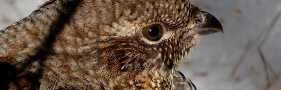
But after the third, we had a choice to make. Head north or south. We chose south. And within a short distance the trail completely disappeared. Thanks to GPS and occasional glimpses of Cherry Mountain, we persevered. And startled a snowshoe hare that startled us. I couldn’t capture it in a photo for so quick was its hop, but suffice it to say that the hare’s coloration was gray/white, given the next season that had already visited some of the surrounding mountains.

Maybe it only took a half hour, but it sure felt like hours before we finally found the rail again. I actually considered kissing it, but my guy convinced me otherwise.

There was so much more of the refuge to explore, but we followed the trail back, giving thanks to the shape of the mountain that helped give us perspective on our location as we’d bushwhacked.

And a backward look upon the pond brought to light the snow that had fallen upon the Presidentials, previously hidden in the clouds.

As for that darn Mooseway Trail that led us astray . . . it did have much to offer including this Bobcat scat. We also found a specimen of coyote.

And not only Moose scat, but also some prints. We were rather excited by that.

And then the crème de la crème: bear scat filled with berries. Yes, we’d scanned the trees for claw marks, but if they were there, they were difficult to distinguish (cuze, um, we were moving at my guy’s speed). Despite that, this display made us both happier than happy.
I had no idea when I chose most of the places for our Bear to Beer Possibilities, what the trail’s tales might be, but really, our success rate was quite high.

And we topped off our success by sipping some suds at an old fav in Glen, New Hampshire. For him: Moat Mountain’s Matilda’s Red Rage. For me: Tuckerman’s Pale Ale.
For both of us: Bear to Beer–we got this one. Seven miles later, bear scat to beer at Pondicherry Wildlife Refuge and Red Parka Pub.

Leigh,
Totally fascinating blog as always. Your photography was mesmerizing as always. I loved the thought of seeing “Buffies” at two different locations. Are they migrating? Thank you for taking us to places we would probably not see otherwise. Glen and I will really have to make more of an effort to travel to new locations. Thanks for your inspiration, Leigh!
Jan
LikeLike
Jan, we LOVE all our local hikes, but discovering places new to us is also so much fun. We only have a few more in our “Bear to Beer” box of ideas, so I might have to come up with a new theme soon 😉 Thanks for taking the time to look, read, wonder, and write. I suspect the ponds provided a needed break during the “Buffies” migration.
LikeLike
Leigh, this was a wonderful blog post. I am one of the volunteers who helps maintain the trails at Pondicherry. The Mooseway XC Ski Trail will be brushed out starting in November in time for the ski and snowshoe season. Sections of this trail have a lot of raspberries and ferns making for brushy walking until we can clear them. Once the swamp sections freeze in December the trail is easy to follow and is very popular with skiers and snowshoers because of the abundant wildlife signs found along the trail. The trailhead at Mud Pond off of Route 116 is plowed in the winter and there is a kiosk at the trail. There is also a Pondicherry Map available for $2.95 at many stores. Thanks again for a great post.
LikeLiked by 1 person
David, thanks so much for that explanation. Given the scat we found, it must provide excellent habitat and therefore excellent winter tracking. I’d love to get back that way this winter if driving conditions allow from my home in western Maine, but will most definitely return in the spring for the landscape must be amazing given all the shrubs and flowers that grow there. I’ll also look for the map. Again, thanks so much.
LikeLike
Great read from here in PA! Thanks for returning me through your words and pictures.
LikeLike
Thanks for coming along to enjoy the journey, Joel.
LikeLike