Fall After Fall Mondate

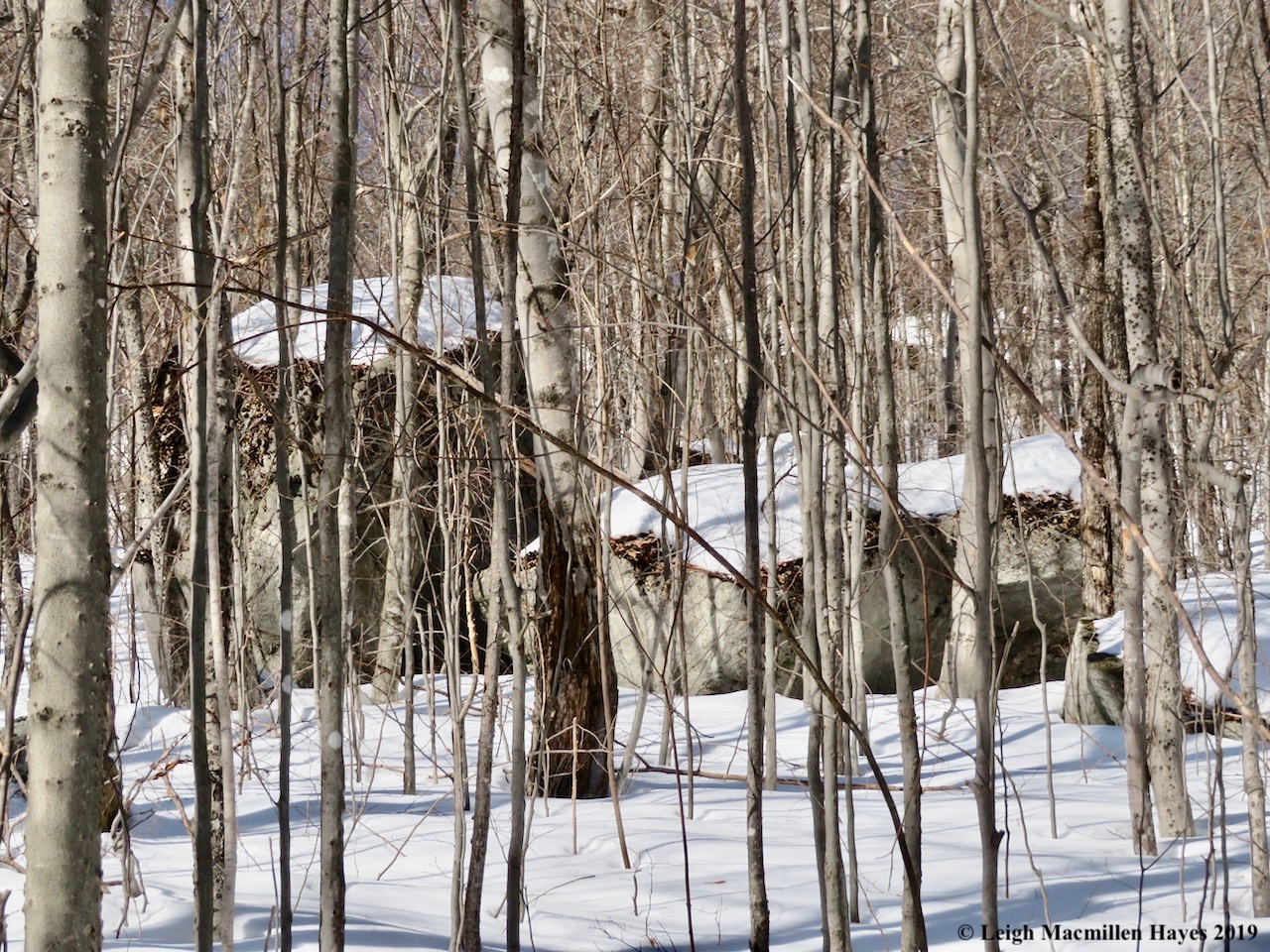
At the start of today’s hike I met a rock. A rock covered in soft green broom mosses. A rock that invited a caress. And so I did. Repeatedly.

When I mentioned that it was the perfect pet rock to My Guy, he reminded me that it wouldn’t fit in my pocket. Details. Details.

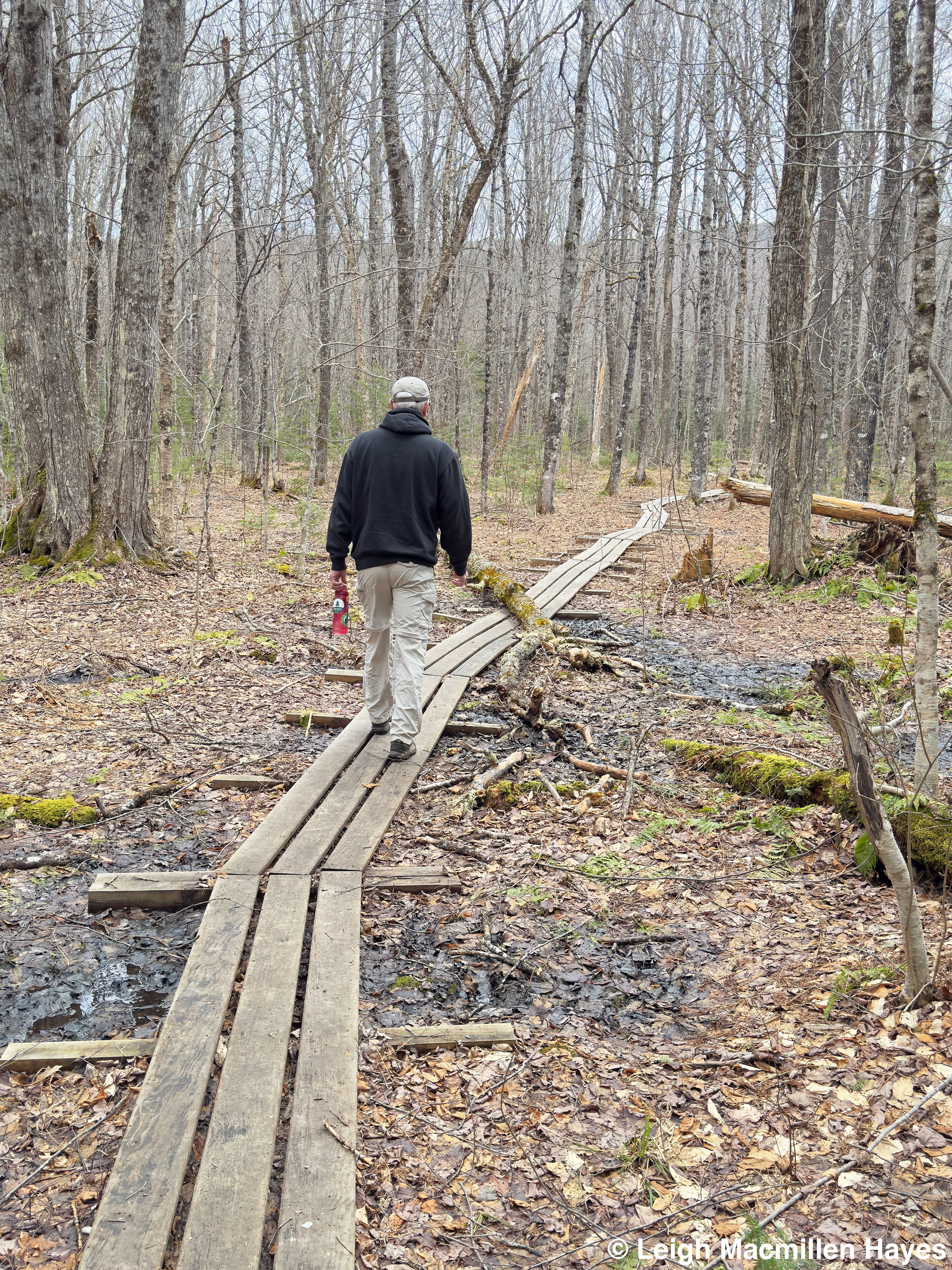
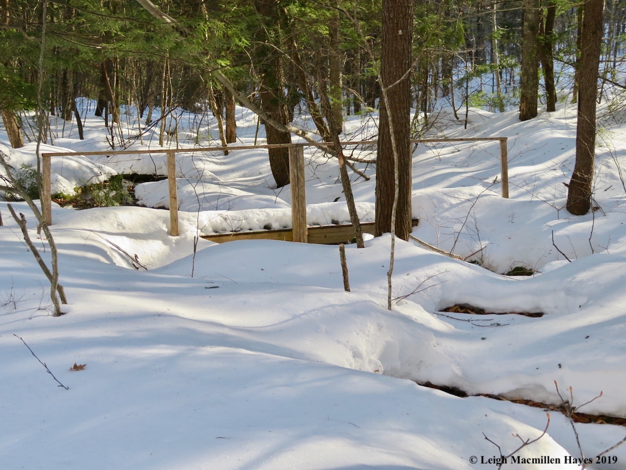
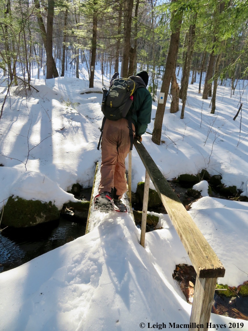
And so our hike continued through a wet area where we gave thanks for the boardwalk system. And for the opportunity to change out our hiking uniform from winter to spring. Oh, we had Muck boots in the truck, but welcomed the opportunity to wear hiking boots, and summer hiking pants, and sweatshirts, and baseball caps instead of winter gear.

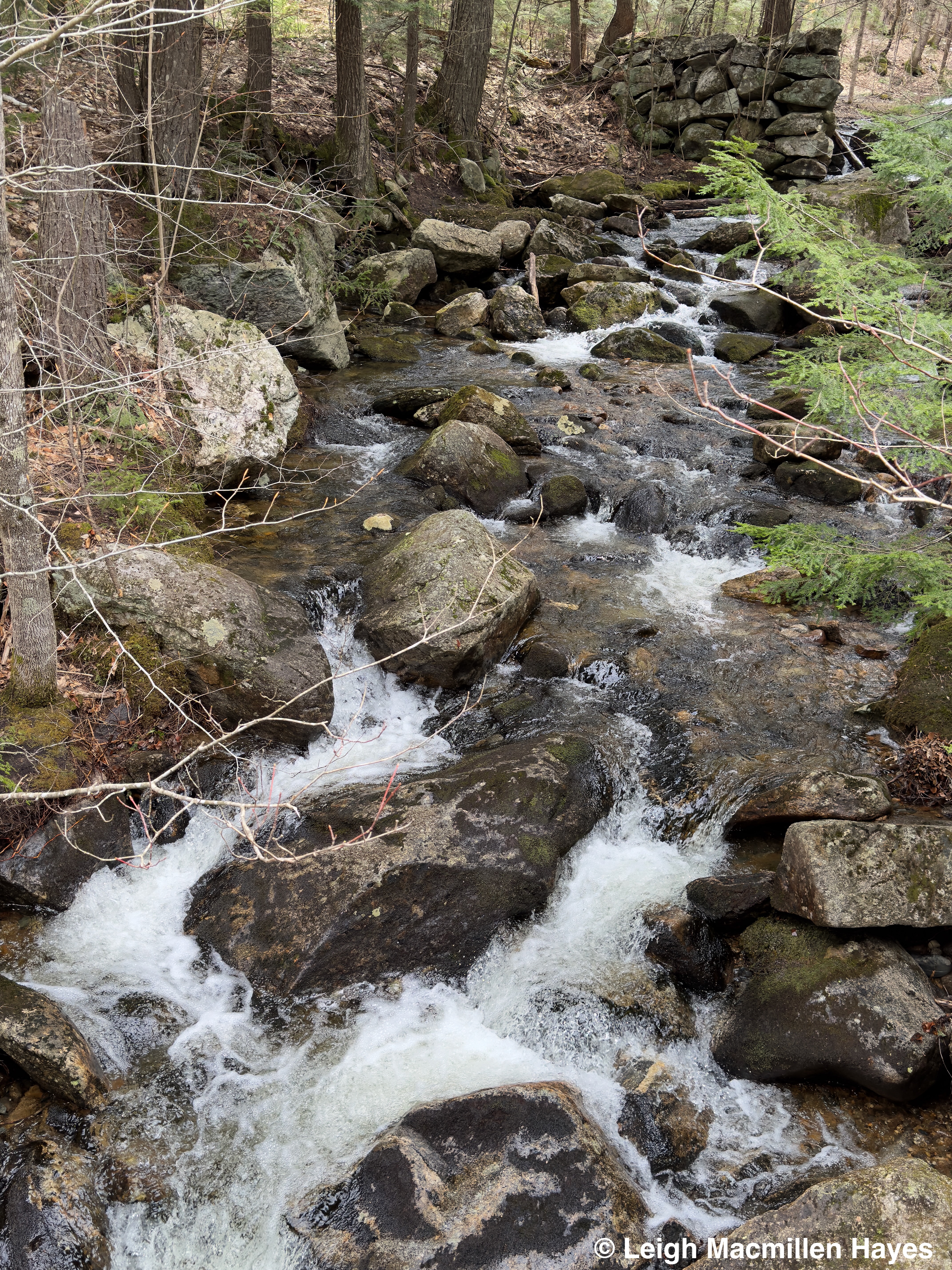
The wetland wasn’t so wet, but the water swirled around rocks just below an old mill as we crossed a bridge over the brook known as . . . Mill Brook.

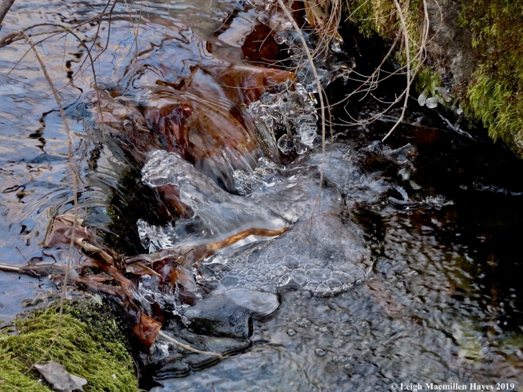
In its lower reaches, we paused to rejoice in how the water swirled around and over and under the boulders and reveled in the fact that their faces were smoothly carved as can only happen in places where so much H20 has flowed for eons.

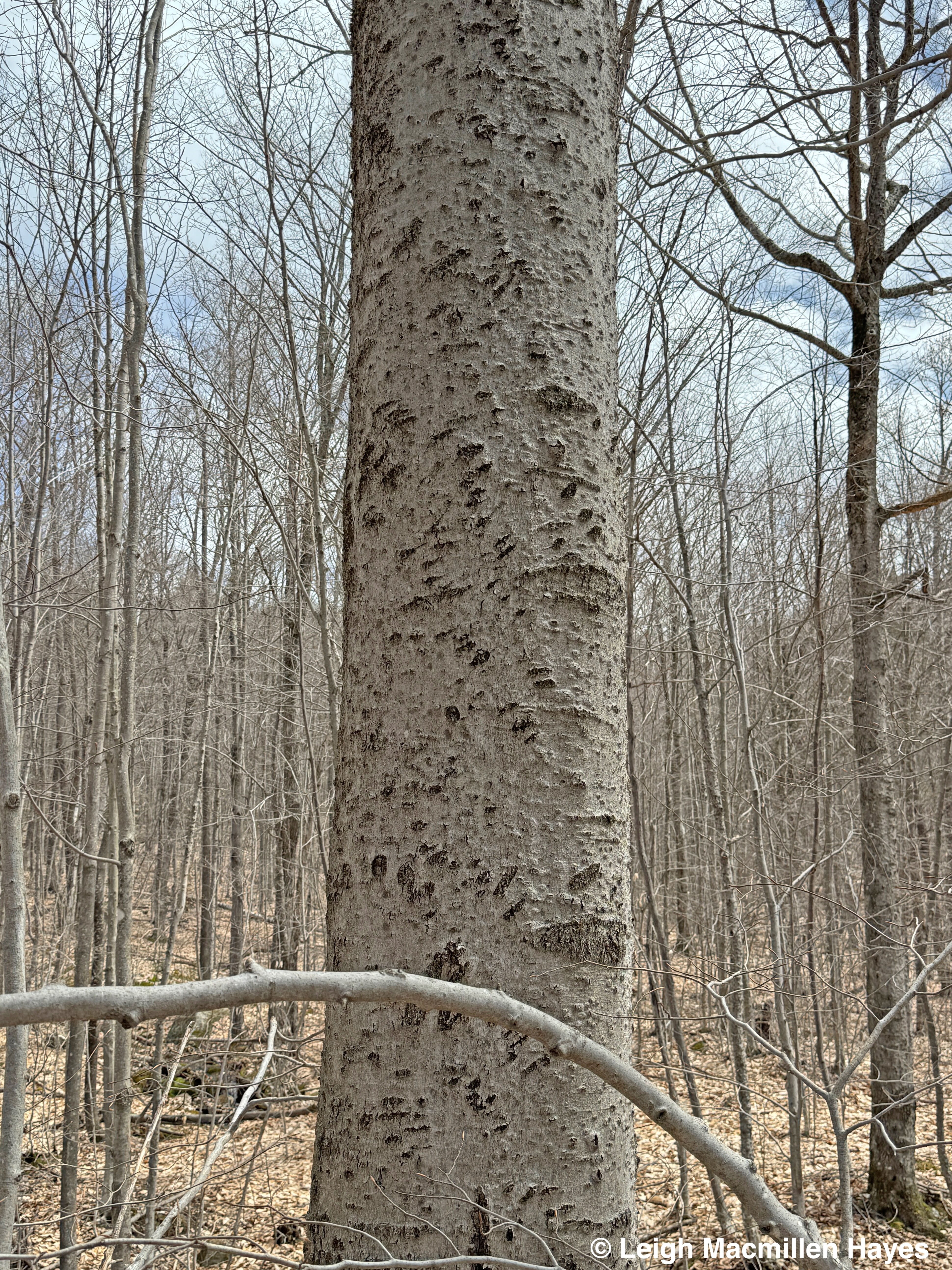
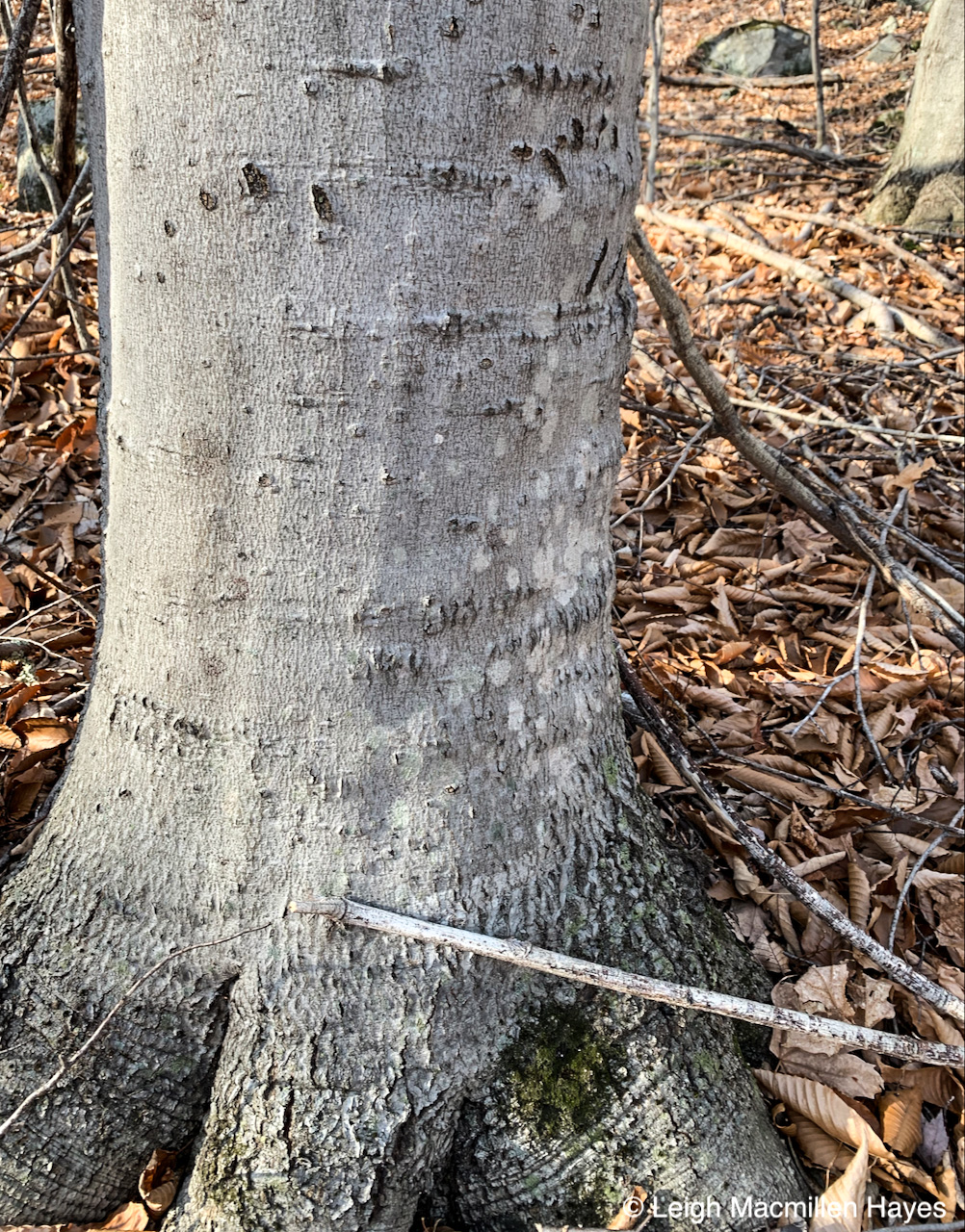
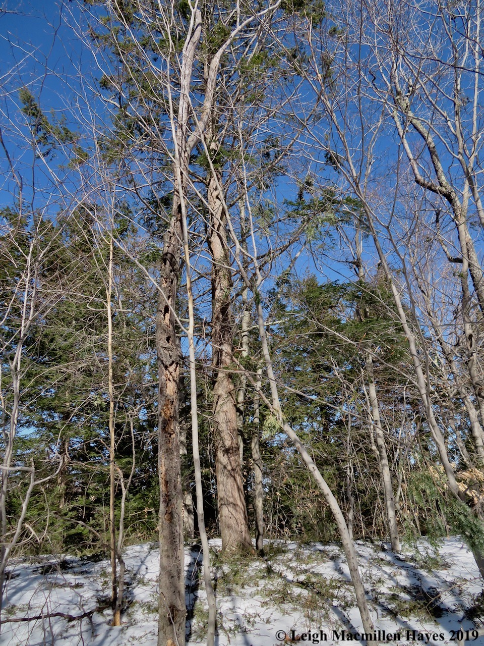
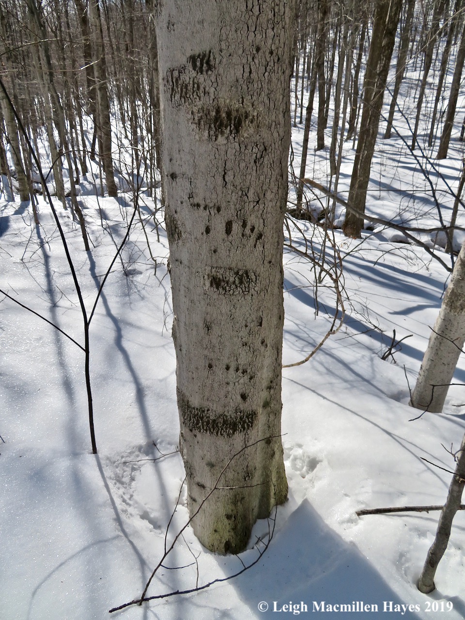
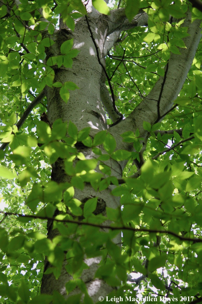
Leaving the water behind for a time, we met some friends. Beech Trees. Particular American Beech Trees. American Beech Trees more commonly known to us as Bear Claw Trees. And in this case, an oft-visited Bear Claw Tree.

Where there is one there is usually another. And another. And another. We found several, but imagined that many more exist given how many claw marks we found on these trees.

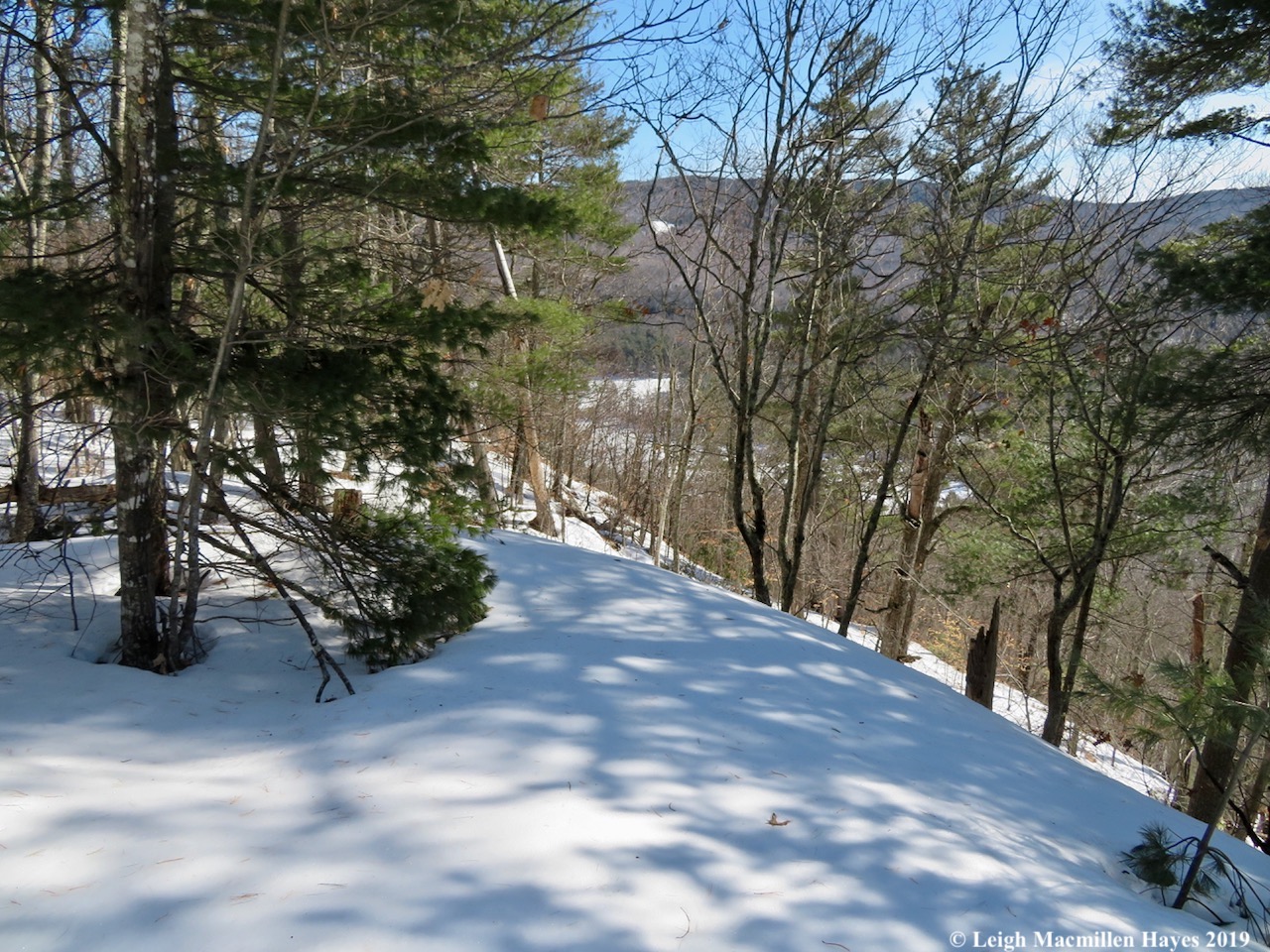
About two miles or more from the trailhead, we followed the spur trail to North Ledge (aka Lunch Ledge) and sat down to dine. Below stood a forest of hardwoods that we’d passed through and we had to wonder how many more Bear Claw Trees we might find if we actually took the time to go off trail and look. One of these days.

I did take time to examine a few fruticose lichens growing on the bark of a hemlock overlooking Lunch Ledge, this one being a Boreal Oakmoss, which is actually a lichen despite its mossy name.

And a Bristly Beard Lichen, with its short bristles decorating each branch.

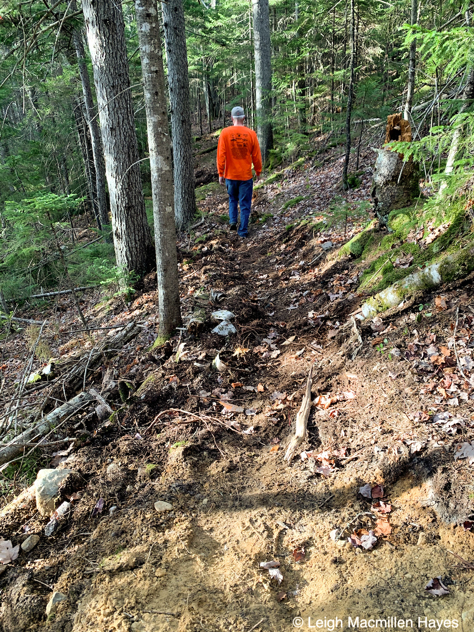
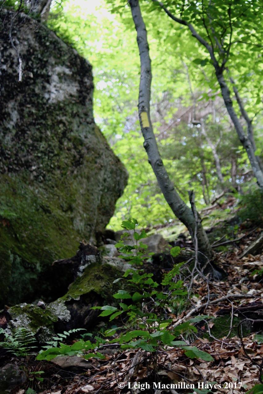
From North Ledge, it’s at least a mile and a half across the mountain, with ups and downs and all arounds to get to the other side. Including snow. Given that we’d had two spring snowstorms, with the first being March 24, and both dumping a couple of feet upon the landscape, it was no surprise. Should we have donned our Muck boots?

Nope. I poked my hiking pole in at one point and discovered there was at least a foot of snow left in spots, but it was soft and easy to hike through and so we did.

At last we reached the southern side, where the trail turned and hugged the edge of the mountain. It was downhill from there.

But first, a quick break at the outlook, where we actually met the only other person who was on her way out as we were on our way in. Looking west, we could see snow showers in some surrounding mountains, but our day consisted of a few raindrops, sunshine, clouds, and a breeze. Perfect for hiking.

Also perfect for hiking: a delayed dessert of Dark Chocolate McVities! A favorite of mine since 1979 when I devoured their biscuits on a regular basis while attending school in York, England.

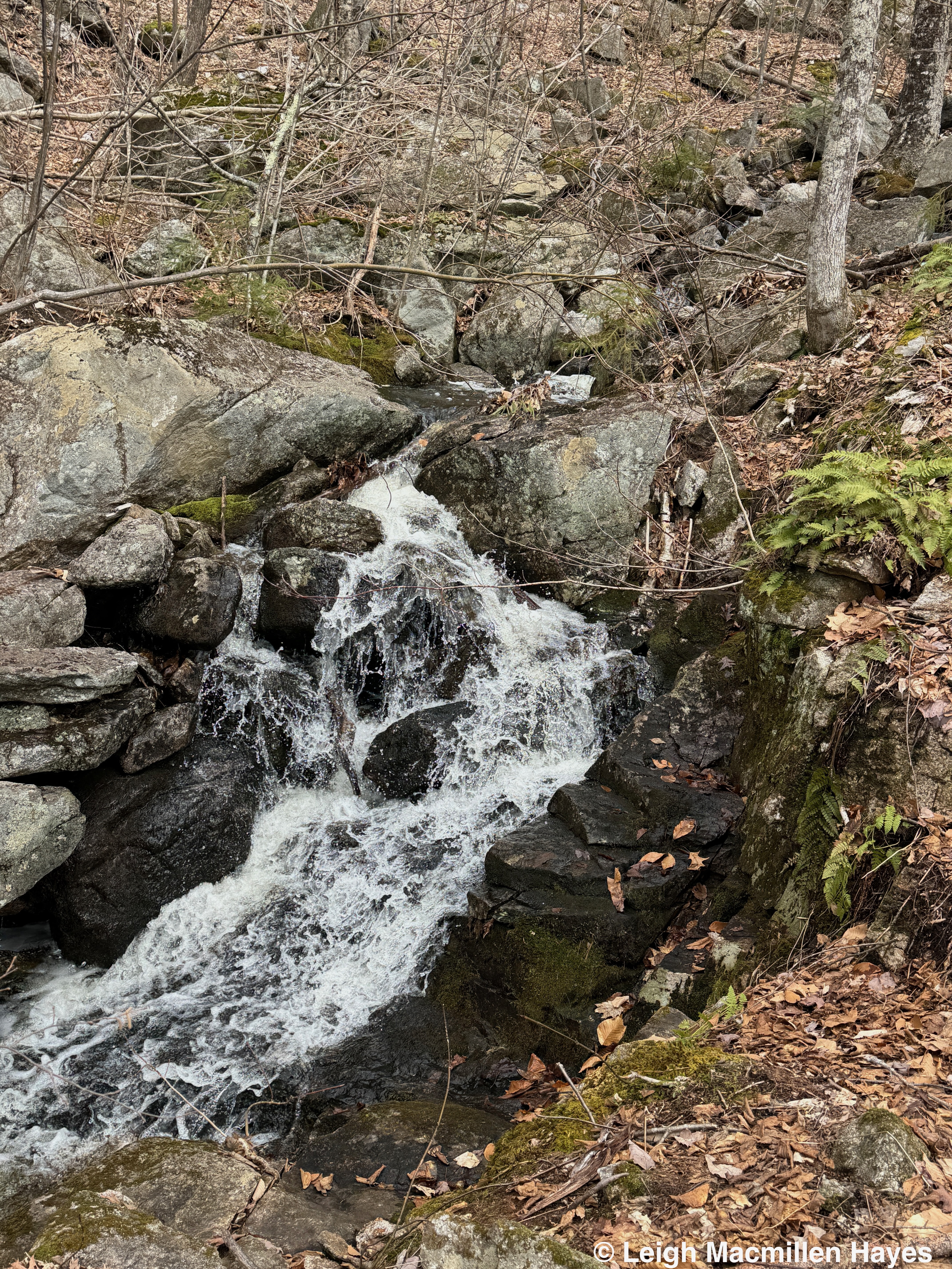
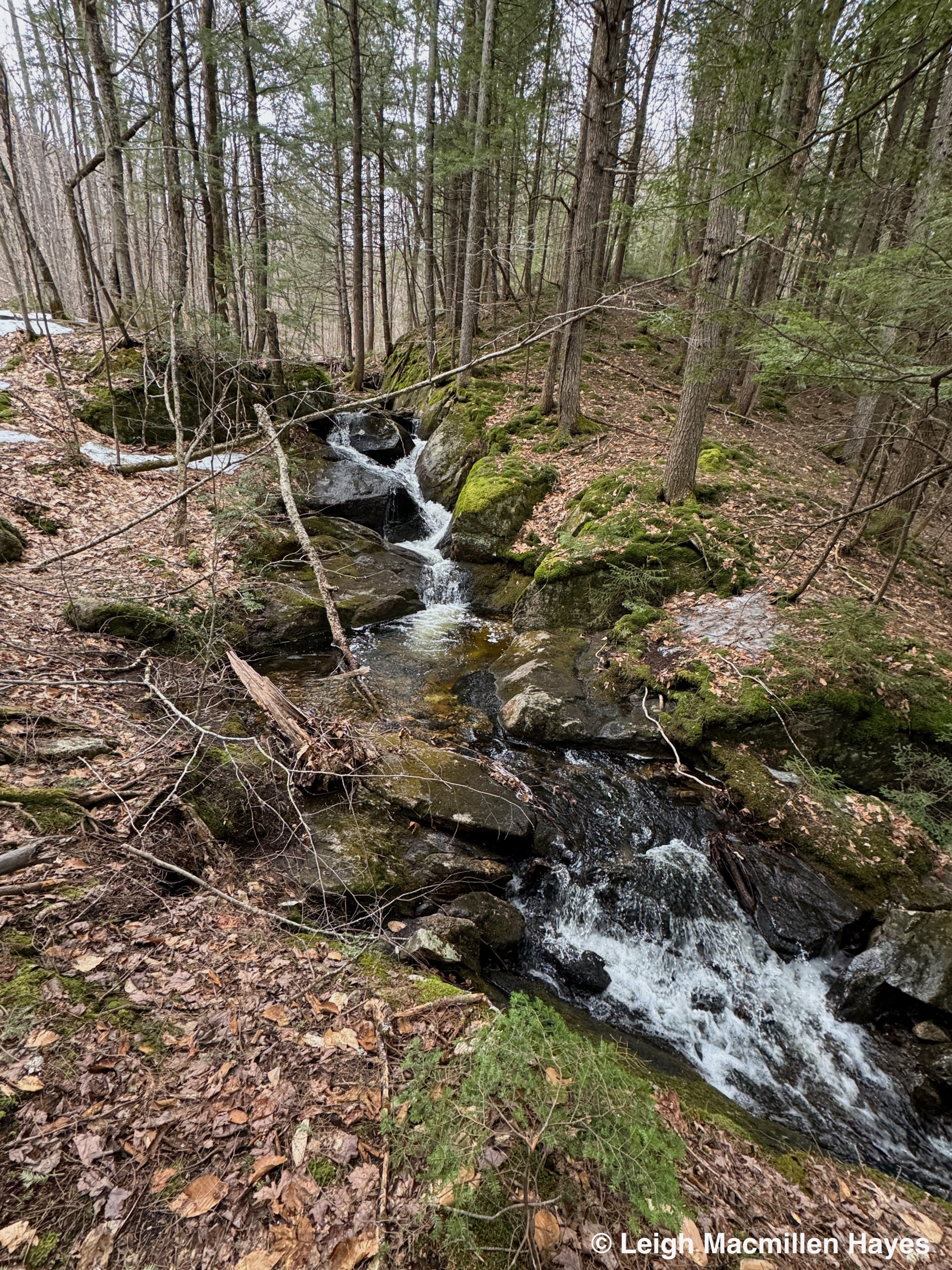
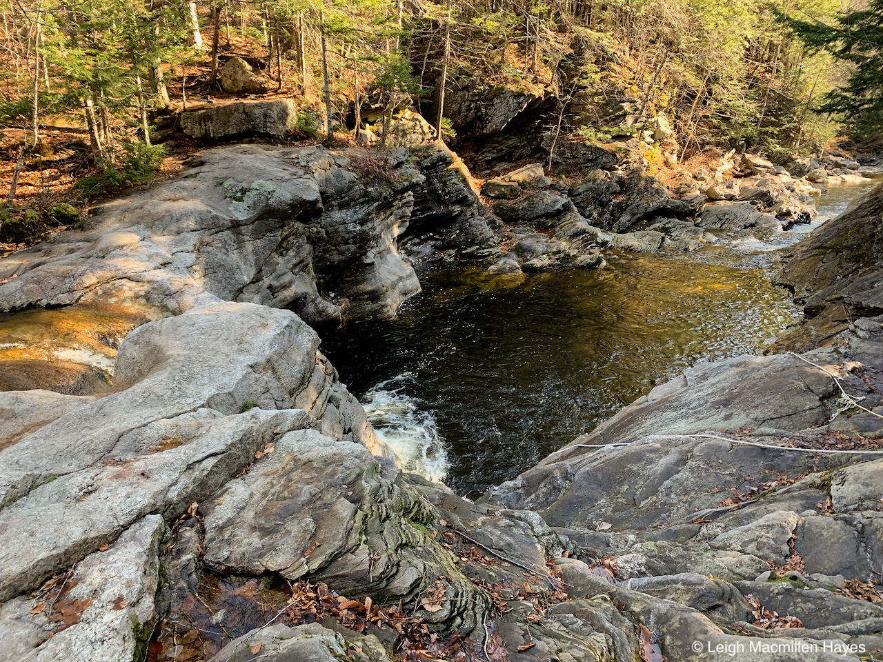
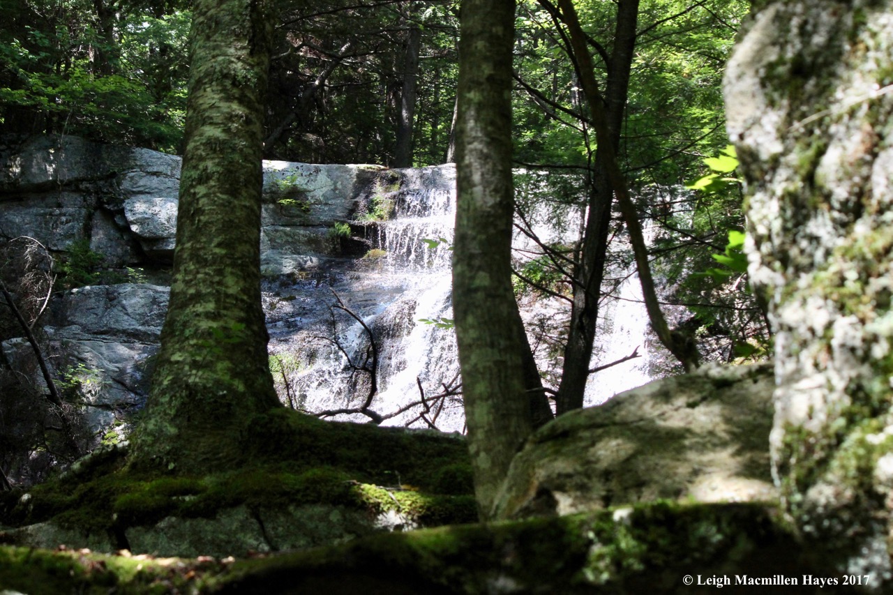
Downward we hiked and then we met Mill Brook again as it cascaded forth.

And forth.

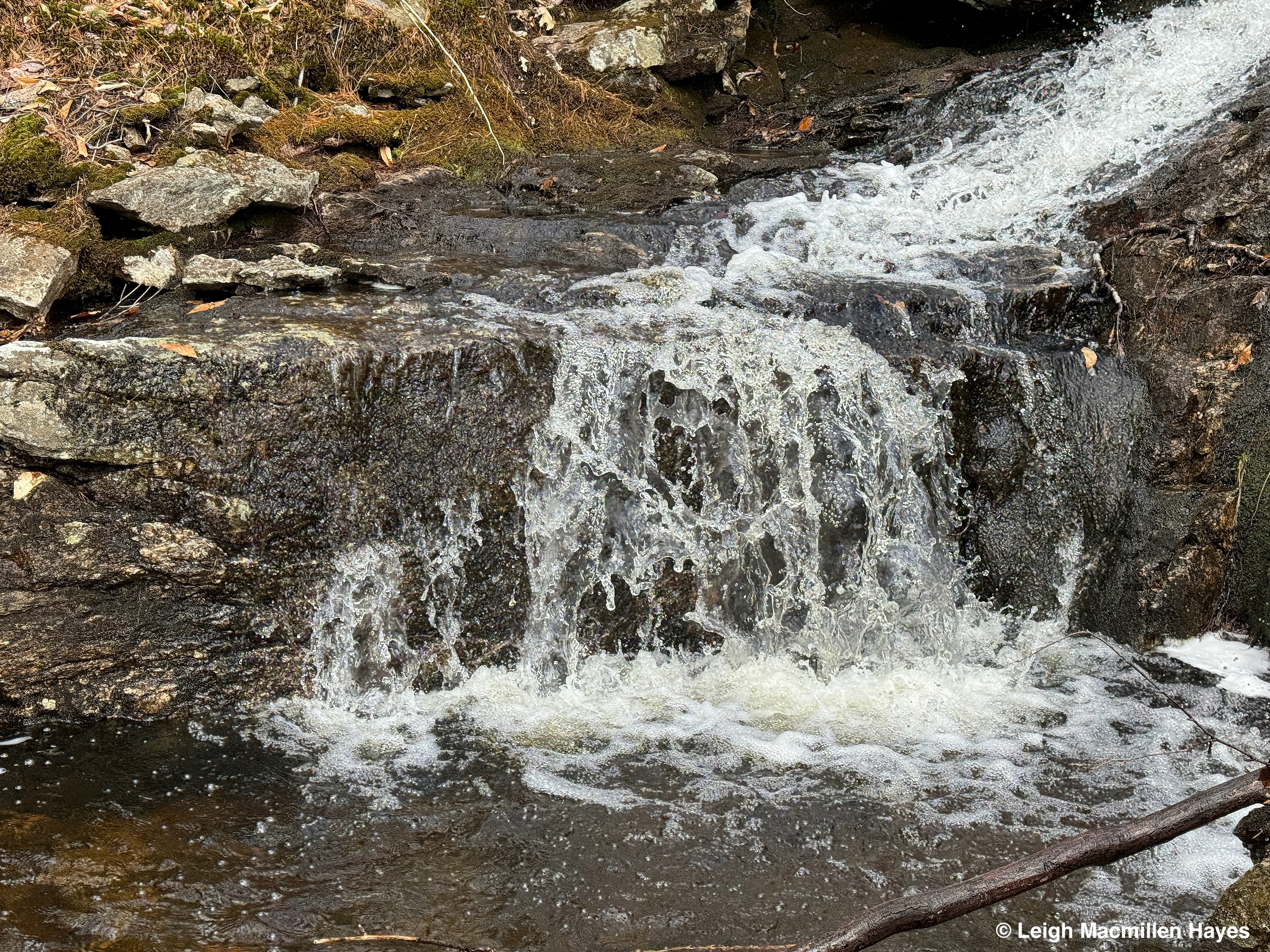
And continued forth some more.

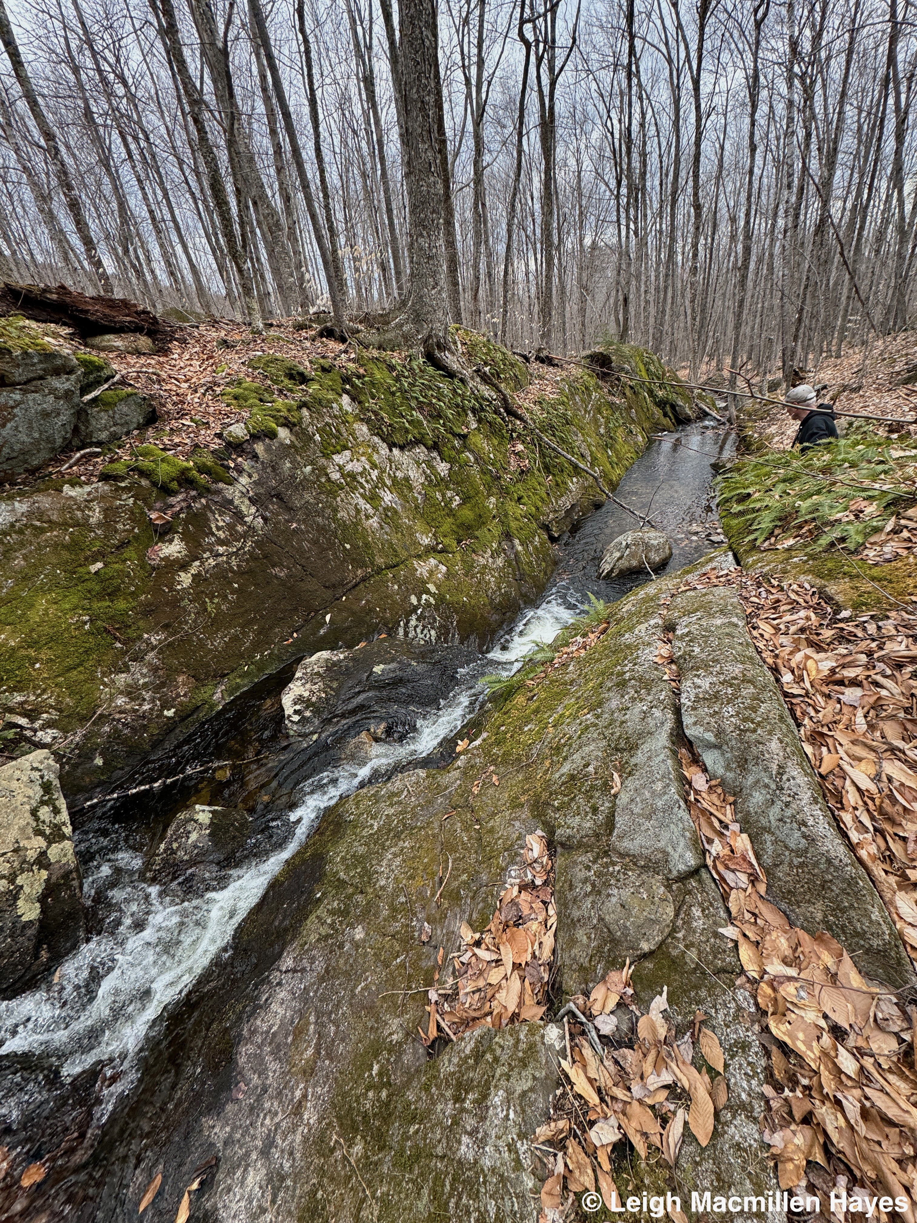
We followed as it flowed between a crevasse in the boulders–headed as you might note toward . . . My Guy.

And admired it repeatedly along its course.

Occasionally it fanned out over boulders in its midst.

And plunged into pools.

It was a lot of water and we were thrilled to hike beside it and are still exclaiming over what a fun hike it was. Oh, there was mud. And ice. But those were secondary condtions. So far, we agreed, this was our favorite hike of the year.

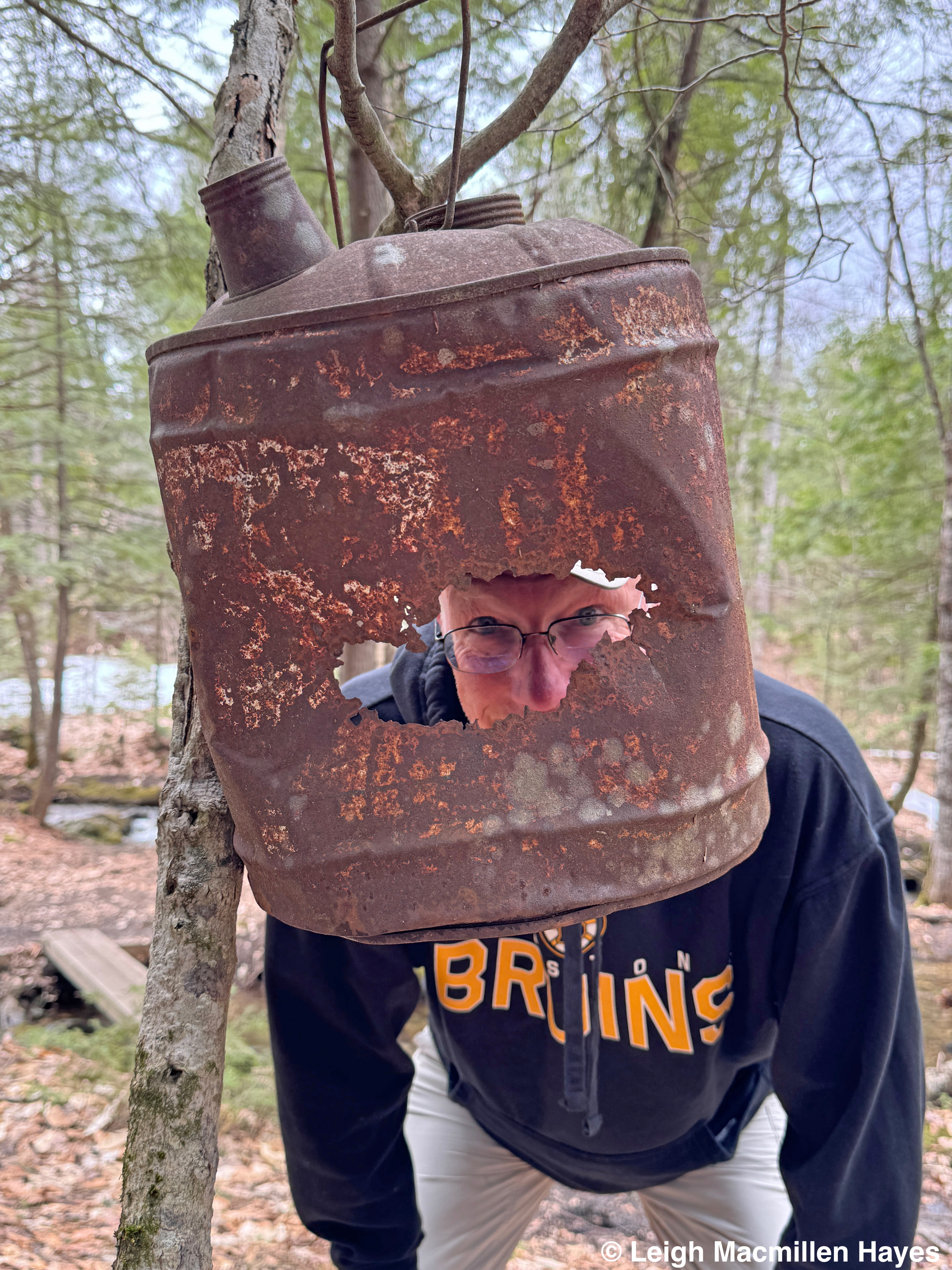
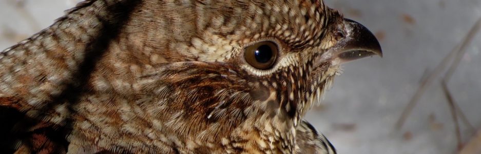
Where were we? Where bears of all types roam, including this crazy Bruin, who is usually a Maine Black Bear.

And no, we did not fall, though I know a few of you were wondering because you know my ability to do so at inopportune times. It was the waterfalls that we followed that made this Fall After Fall Mondate at Long Mountain so special.

Thanks as always to Mary McFadden and Larry Stifler. Through their generosity, many trails in the area are open to the public. And through the work of their employee, Bruce Barrett, those trails are well maintained.

Cascading Mondate

Yeah, so on Sunday my guy and I hiked about four miles all told and found three geocaches in the mix cuze he’s now hooked, which is fun on my end since it slows him down a wee bit.

And on Monday–almost eight miles covered. But it wasn’t the mileage that mattered. Really.

Our morning began beside still waters. Well, the water was hardly still, but considering how crowded the area can be on a summer day, it was a delight to be the only two human beings in that space for those moments.

It’s a cool spot on many levels. No, we didn’t slide into the pool below; nor did we jump off the 20-foot cliff. Rather, we stood in awe and appreciated. That is, after finding another geocache located nearby.

Eventually, we pulled ourselves away because there was more water to meet, though we were surprised to arrive at a closed gate. No signs forbid our trespass and so we walked around the gate, and up the dirt road to the parking area and kiosk. On the way, we could hear a machine being operated and wondered if we’d stumbled upon a logging operation. A few minutes further along, a young man with an easy grin pulled up in a pick-up truck and knowing that the gate behind us was closed, we figured he must have something to do with the property. Sure enough, he told us they were working on the roadway and bike path ahead. The gate is closed for hunting season, but will reopen in the winter. Still, we were welcomed to hike on.

Half a mile later, we slipped into the woods and left the machinery sounds behind.

Occasionally, we walked across bog bridges and into the future.

Looking down at our feet was a constant, given that there were lots of slippery beech leaves to contend with, but . . . beech leaves mean one thing: American Beech Trees. And much to our delight, smack dab beside the trail stood a well-used beech tree. Some of the claw scratches weren’t all that old, given the width of the scars, and though this year proved to be yet another mast year for Northern Red Oaks (is it just me, or have red oaks been producing acorns on a yearly basis for at least the past five years?) it wasn’t so for the beeches. But perhaps last year or the year before or maybe a few years ago, this tree was a magnet for Ursus americanus.

We could have turned around then for our hearts were delighted, but, of course, we didn’t and soon found ourselves beside a single-wide stone wall.

Barbed wire that a tree had grown around told us the wall was intended to keep animals in . . . or out, depending on your point of view.

Certainly the tree knew, and had we spent a few more minutes with it, I suspect it would have quietly shared more knowledge with us, but we were on a quest and knew we only had so much daylight left.

And so, we hiked on. Until we reached one rather large blow-down and wondered: if a tree falls in a forest . . . Our answer: it land on the ground. Presumably with a thump. And this one must have created a ground-shaking thump.

Not far above the tree, a fanciful picnic table graces a knoll, and invites all questers, including this guy, to pause.

He didn’t pause for long. Back on the trail, as we climbed higher, the naturally community did what it does, and changed. For a bit, the delightful aroma of Balsam Fir spurred us forward, both by our feet and by our thoughts of the holiday season to come.

At last we reached water, and I thought our quest might be over. Could this be what we sought? As much as I loved watching bubbles form and pop, I was rather disappointed.

But after crossing rocks to get to the other side, the fall coloration of Tiarella (Heartleaf Foamflower) in all its hairiness called for attention.

And then, as we entered an opening where pine saplings grew in the sun, one showed off its crosier-shaped leader–bent over as commanded by a pine weevil. The tree will grow, but the live whorl of branches below will take over as leaders and change its stature.

Did I mention that the natural community kept changing? My guy and I soon realized that that was one of the things we really enjoyed about the trail, for there was so much diversity. And just steps beyond the weeviled pine, we entered a beech stand, where you know who had lumbered before us.

As much as we knew we needed to keep moving, we couldn’t help but search and didn’t have to stare far off trail to see evidence of so many bear claw trees. We figured we spied at least 25, though ask me tomorrow and I may say 30. They were everywhere and we wondered how many more we had missed.

But . . . there was more to see and so down a portion of trail that the young man we’d met had created all on his own and opened only last week, did we tramp. It was so new that the ground practically sprang under our feet. Can ground sprang?

We’d reached our quest at last and had to hurry three plus miles back as quickly as possible, promising each other not to stop and recount the bear trees, and we emerged at the parking lot as the sun was setting, with only the half mile walk down the road to our truck left to complete.

Oh, but what was our quest? It wasn’t a geocache this time.

And it wasn’t the bear trees; though they were a bonus.

Rather, it was the water that cascaded forth in three locations on this Mondate and already has us dreaming of return visits–though on a day when we either begin hiking earlier or there’s more daylight so we don’t have to hike down in twilight.

Thank you, Rosemary Wiser, for hiking this trail before us and giving us the inspiration.

Mondate Shared with Tom and Ron

Midmorning found us driving down a lane in Stoneham, Maine, made extra narrow by high snowbanks. At the second entrance to the Greater Lovell Land Trust’s Five Kezars Reserve we were delighted to discover the driveway had been plowed just enough to allow a vehicle or two to park. And so we did.

Our initial plan had been to wear micro-spikes and carry snowshoes, but as we’d passed by the first entrance, we noted that no one had climbed the Mountain Trail, and the road leading back to it had been well sanded, so we left the spikes behind.

Walking back up the road was easy, but then . . . we had to conquer what was probably the most difficult part of the entire journey–the snowbank between the road and the trail.

Thankfully in northern New England, those who drive plow trucks know to knock the snow back a day or so after a storm, thus leaving room for the next storm. (In this case, there’s one on the horizon for tomorrow night with another 8-12 inches predicted). The result is a shelf that makes the snowbank easier to climb up and over.

We did just that with the utmost grace in our steps.

Once on the other side, where the sign gave an indication of depth, we donned our outer footwear.

And walked up to the kiosk where we stood eye to eye with the roof rather than the map.

We did study if for a moment as my guy had not been on the new spur trail overlooking all five of the Five Kezars.

The trails are incredibly well blazed and blow down wasn’t much given the winds of winter, but . . . we did note one small beech that had fallen off trail and taken the signs with it.

A little further up we found another sign encouraging us to climb even higher–as in skyward. Perhaps it knew something we didn’t know.

For the first half of the trail, we mainly focused on our feet, making sure that the cleats on our snowshoes dug into the slippery surface.

Once the trail leveled off, we started looking around. And being winter with no leaves to distract one’s view, the snow-topped boulders stood out like tiny homes in the woods.

About halfway up the Mountain Trail, where it turns left and joins an old jeep road to the summit, a new path was carved last summer–Tom’s Path so named for the late Tom Henderson, who had long served as the land trust’s executive director.

My guy had walked about on the ledges there with me on previous excursions, but this was his first time actually following the new trail and so he studied the “You Are Here” spot on the map.

Along the way, I wanted to pause just before the trail turned left for I had a suspicion about the area below the rock. My suspicion proved correct; a porcupine had created a den under the ledge.

That was further verified by the downed hemlock twigs.

A bit further up the trail we found even more evidence of porcupine activity for many of the trees showed off the tooth scrape marks left behind as the critter sought the cambium layer below the bark.

Recently I saw bark under a porcupine tree that confused me for I’ve always thought of them as eating the bark completely and leaving no mess–unlike a beaver. But today’s findings indicated that all had been consumed.

Behind all of the porcupine artwork trees stood another much larger that will probably be naked by spring.

The debris was the typical–nipped twigs cut at an angle . . .

and plenty of healthy looking scat. 😉

The bark on the big old hemlock, however, had flaked off revealing its cinnamon color beneath for the porcupine had created a regular climbing route.

From below, I looked up in hopes of seeing the rodent, but realized all the evidence had to be enough. I did wonder–Tom always said he wanted to return as an otter, but just maybe he’s a porcupine right now. He was a forester, after all, and loved anything tree related.

A few minutes beyond the porcupine area we found our way to the termination of the spur and took in the view of four of the Five Kezars below: Little Mud, Mud, Middle and Back.

Being winter, a few more steps to the left revealed the fifth of the Five: Jewett.

Retracing our steps, we returned to the Mountain Trail and followed it to the summit where lunch rock had been graciously cleared . . . just for us.

There was no wind and the sun felt delightful–so we sat for a bit taking in the view of the ponds below and Pleasant Mountain with Shawnee Peak Ski Area in the distance.

When we finally decided to move on, we first stepped out to the north so we could get a glimpse of Mount Washington in the backdrop.

And then we pulled it in with a telephoto lens.

Following the orange connector trail down, we began to notice more mammal activity. We’d left the porcupines behind, but the snowshoe hare always seem to dine in one particular location.

And scat 😉

We also noticed bobcat tracks like these, muted though they were, crossing over the trail, while we followed coyote tracks down the trail.

And twice we encountered engravings in the snow that at first glimpse we thought were wing marks, but changed our story to one of the predators playing with a prey as it dangled from the mouth. Hmmm.

Continuing down, we constantly looked up–at beech trees for we knew many revealed bear claw marks. Sometimes we had to look extra closely because the cankers on the tree hid the possibilities.

Though this wasn’t part of the Christmas present to my guy in the form of Bear to Beer Possibilities, it could have been a contender.

Our eyes scanned many a tree and we know we missed a bunch today, but we’ll save those for another day. I did think about returning and creating waypoints to mark each one on GPS, but then we wouldn’t have the fun of looking.

And because we were doing such, we found a new one today. Chances are the next time we look, it will be new to us all over again–if you know what I mean.

One other tree also drew my attention. Well, really, they all did. But yesterday I was explaining this very pattern to some folks on a guided walk, and wish I’d had such an example: target fungus on red maple. Indeed!

Eventually we reached the bridge crossing at Ron’s Loop, so named for Ron Gestwicki who was the first president of the Five Kezars Watershed Association and driving force behind creating this reserve that we could enjoy upon occasion, but the mammals know best.

While my guy sashayed straight across the bridge, I chose to go forth in a sideways pattern. In the middle, I remembered once slipping down under the rail, but thankfully today I reached the other side without incident.

The mammal activity continued along the half of the loop that we traveled. Other travelers included the coyote that left its mark on a high spot in the middle of the trail and several more crossings by the bobcat.

I was hoping for an otter slide because sometimes we are so blessed, but instead we found a few tracks of fisher passing through, their five tear-drop shaped toes on display.

Though we’d spent several hours on the trail, it seemed we reached the final bridge crossing in no time and my guy performed a chivalrous act of stomping down the snow to make for an easy crossing.

The water below offered a hint of every season as it flowed forth: summer’s blue sky, autumn’s dried leaves, winter’s clear ice, and spring’s fresh greens.

As we passed by the kiosk for Ron’s Loop on the way back to my truck, we gave thanks to the two men for which the trails were named: Tom Henderson and Ron Gestwicki. We were grateful for their leadership and the opportunity to continue to share the trail with them, especially on our Monday Date or Mondate.

B is for . . .

Our original plan was to hike to the summit of Blueberry Mountain in Evans Notch today,  following the White Cairn trail up and Stone House Trail down. But . . . so many were the cars on Stone House Road, that we decided to go with Plan B.

And so up Route 113 I drove, turning left just before crossing from New Hampshire back into Maine.

b-view from Basin

By the parking lot for The Basin, we pulled out our lunch and set up camp temporarily at a picnic table as we enjoyed the view of the manmade pond and Sugarloaf Mountain before us.

b-basin rim

The Basin is a low-elevation glacial cirque carved out of the east side of the Baldface-Royce range. Though we’ve visited the pond on numerous occasions, we’d only hiked the trails circling it once before. And as we recalled while sharing a brain in the memory department, that had been thirteen years ago when our oldest son was in seventh grade. It was a fine September day and we’d headed off to climb the Basin Trail. At first, we couldn’t find the brook crossing, so eventually we made our own. And, what we didn’t realize that day was that at the top of said trail we should have turned around and descended. Instead, in our ignorance, we’d continued on the Basin Rim Trail, assuming they were one in the same. Not so. Hours later, we practically slid down one of the Royce trails, splashed across another brook, bushwhacked to the road and followed it down as quickly as we could to our vehicle. It was late in the afternoon and we knew that our seventh grader was anxiously waiting for us . . . because it was also the very day that he could receive his school-supplied Apple computer if his parents attended an after-school meeting with him. That was pre-cell phone time in our lives and we didn’t have enough change for the one pay phone at the Stow Corner Store, which happened to be closed. We raced home, found he wasn’t there and while my guy went in search of our younger son, I zoomed to the middle school, sweaty, muddy and bloody (from a few encounters with branches and rocks), to find that my sister-in-law who teaches there had stood in as a surrogate until I arrived. Today we carried a map.

b-trail sign

And knew what Rim junction meant.

b-hobblebush1

As the north wind blew, it felt rather autumn like and added to our memory bank, while also the perfect day for a hike. And the hobblebush berries and leaves showed off their almost autumn colors.

b-trillium 1

Berries were abundant–especially upon red trillium,

b-bunchberries

bunchberry,

b-doll's eye 1

and white baneberry (doll’s eyes–can you see why?).

b-following the yellow brick road

The trail was easy at the  start, switching from roots to stones to rocks before climbing. Since we’d attended Lake Region Community Theatre‘s fine performance of The Wizard of Oz last night and the trail blazes were yellow, it felt a bit like we were following the yellow brick road.

b-hermit fall sign

At about the one-mile mark, we chose the Hermit Falls loop.

b-lower hermit falls

Water poured over the lower falls,

b-Hermit Falls

and from there we spied the upper.

b-Hermit Falls 2

Though a couple of fallen trees crossed the waterway, the view and sound were pleasing to our senses. It was at this point that our climb became steeper.

b-bear tree 1

We spend a lot of time looking down when climbing up, but because we were in a beech forest I knew I had to look–for bear claw trees. And I wasn’t disappointed.

b-bear paw 2

Even in the upper trunk we could see the marks left behind.

b-maple division

And then my guy pointed out another tree he thought I should note–it looked rather like a burl gone bad. We don’t know what happened, but the final result was rather gnarly, and still the tree continued to grow and produced leaves.

b1-boulders

Huge boulders littered the woods as we continued our climb.

b-light at the end of the tunnel

Closer to the summit, the trail followed a rather precarious shelf beside the base of a big headwall cliff–I didn’t take time to photograph it for I was focused on each step, but at last we saw the light at the end of the tunnel.

b-summit which way should we go?

Before stepping out to the viewpoint, we walked ahead to the spot where we’d erred thirteen years ago. Today it’s well marked. In fact, this junction includes five options and my guy took the time to point in each direction. Our choice: to return from whence we’d come–behind us.

b1-summit 1 (1)

At last, we turned back to take in the view from the Basin below us to Pleasant Mountain on our far right. We noted a cloud casting its shadow over Blueberry Mountain and trust we would have been blown off had we stuck with Plan A.

b-summit blue bead garden

Though we’d brought containers to pick blueberries, that wasn’t to be. But at the summit we noted a blue of a different hue, a blue-bead lily garden by our feet,

b-summit mountain ash berries

and mountain ash berries maturing above our heads.

b-velvety fairy fan fungi 1

Finally, we started down. After the initial scramble on the rocks and roots just below the summit, I once again turned my attention to the life around me and realized I’d missed this display of fungi on the way up–velvet stalked fairy fan mushrooms (Spathularia velutipes). They actually reminded me of miniature cowboy finger puppets donning oversized hats.

b-bear tree on way down

And . . . another bear claw tree–this one highlighted with a trail blaze. How sweet is that?

Follow the yellow brick road.

b-back on flat ground

At last we were back on flattish ground and made our usual mad dash out.

b1-deer hill bog 4 (1)

As we drove home, I gave my guy a choice–ice cream at the Stow Corner Store or turn onto Deer Hill Road (actually a road of many names) to the bog and then to Evergreen Valley. He said the choice was all mine and so I chose the latter. And as I knew it would because it always does, it made me want to return when I have time on my hands. I will–that is a promise to myself.

b-bull frog 1

Today’s stop included a chorus of bullfrogs–adding to my list of finds beginning with the letter B.

b-bye

As it worked out, we were glad we followed Plan B.

B is for . . . The Basin and the bog and all that we saw in between.

Thanks for stopping by.

Bye bye!