As we tried to figure out where we’d hike today, we decided a familiar route would suit us and I was pleased when my guy suggested Mount Tom in Fryeburg. It’s an old favorite that has improved with age since The Nature Conservancy added a new trail recently. This property was important to them because the Saco River flows below.
I’d first explored the new trail with Marita Wiser, author of HIKES & Woodland Walks in and around Maine’s LAKES REGION, in October and then with my guy a short time later.

Today, we decided to park our truck across from the old trailhead and walk down Menotomy Road so we wouldn’t have that trudge after our hike. I wish the trail was a loop, but it can’t be and so we made our own. The snowstorms of the last two weeks had buried the cemetery entrance and only a couple of headstones poked out.

One and a half miles later, we climbed over the snowbank at the trailhead and strapped on our snowshoes.

We were thankful that someone or two or three had packed the trail before us.

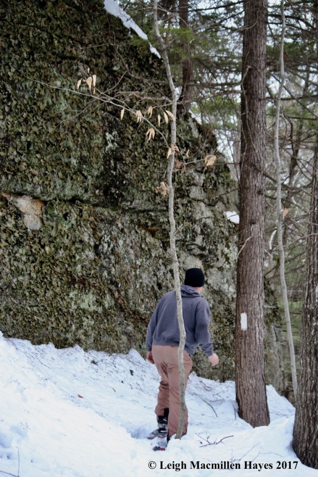
Just after stepping onto the West Ridge Trail, we passed between a house and barn foundation. All that was visible–the center chimney’s supporting structure, which probably dates back to the 1800s. Perhaps the original homesteaders were buried in the cemetery.

At first the tromp was easy because it passes gently across the terrain and so I had time to look around. Fresh tinder conks growing on paper birch trees pleased my eye.

I love their colors, which reminded me of oyster shells I’d spent a childhood collecting.

A few minutes later I spied a house I hadn’t noticed in the fall. My guy looked over and told me it wasn’t a house at all.

He was right, of course. Two large boulders, erratics dropped by the glaciers that formed Mount Tom, a Roche Moutonnée, stood out because of their snow covered tops. We didn’t move closer, but I’ve a feeling they provided homes for mosses and ferns and other assorted flora and perhaps even wildlife. So maybe I was also correct.

After crossing the snowmobile trail that passes through the preserve, we continued on through the hardwood forest and started climbing up and sometimes down. Through the trees we spied the summit, but still had a ways to go.

One of my favorite trees grows in this forest–white oak. And though it’s not common in the woods I normally traverse, I’m learning to identify it by the plated blocks of its bark.

It helps, of course, when the round-lobed leaves are found nearby.
At last we reached the ledges, where I’d hoped to see bobcat sign. We did see porcupine evidence, but the snow was soft and tracks almost indecipherable.

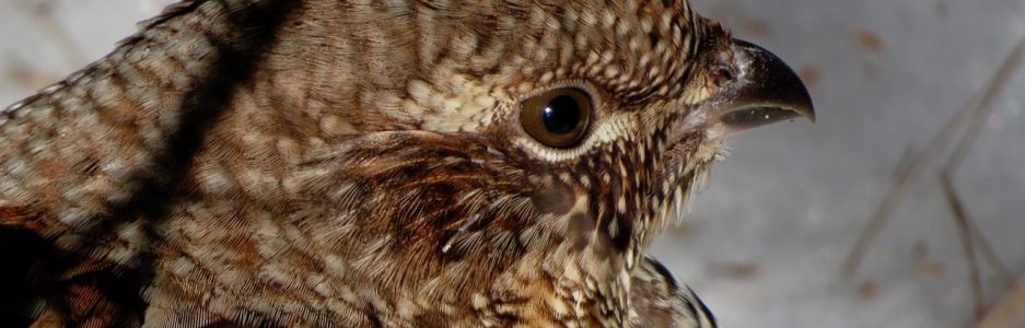
We also found plenty of signs of another frequent visitor. But with that–a major disappointment. I’m sorry to report that I didn’t find any pileated woodpecker scat today.

Across the trail from the pileated debris, the work of a gray squirrel. Dinner required toil–it had dug a hole that looked to be about three feet deep. How do they know where to find those acorns they cached last fall? I’m always in wonder of such digs. And those that they don’t find become trees. It’s all good.

I probably wouldn’t have missed this tree, but my guy wanted to make sure I saw it. He spread his arms in the same manner and felt it was welcoming us to the ridge. Indeed.

Nearby, someone else was welcomed–and I’m not referring to the acorn. Yes, that provided a squirrel meal, but scattered feathers indicated a downy woodpecker met its demise. And a predator dined.

We were almost to the summit when a burl revealed some of its inner beauty–the bark having fallen off. Grains once straight twisted and contorted thanks to a virus or fungus or some other means. I loved the swirl of lines, some thin and squiggly.

And then the beauty of the view greeted us–Pleasant Mountain in the distance and the Saco River valley below. We met a young family at the summit and thanked them for paving the way. They’d never climbed here before and asked about the old trail down.

We explained that that was our choice and though it’s a bit steeper, it’s a quicker way back to the road.

We also told them we’d do the honor of paving the way because it had been a storm or more since anyone had trudged that way.

Because it’s a rather straight downhill, we felt like we were floating for most of the trail and welcomed the sight of Mount Kearsarge among the beauty of the young birches. Once the trail widened, the snow was deeper and it became a trudge again, but the end was nearing.

Right before reaching the road, Old Glory flew as she faithfully does in the field.

And always a favorite–the barn beside the trailhead highlighted by the mountains and sky.
We’d come to the end and were thankful for the opportunity to climb Mount Tom again. We were especially thankful for the family who’d gone before on the West Ridge Trail–it was a bit of a slug for us, but even more so for them and we wondered if we’d have completed the loop had it not been for their hard work. We don’t know their names, though we do know their dog’s–Roscoe. May Roscoe’s owners sleep well tonight.

Thank you that I am always able to tramp along with you. Very nice, Ursula >
LikeLiked by 1 person
Always enjoy having you along for the tramp, Ursula. Hope you are well.
LikeLike