Finding Our Way on Mount Tom in Fryeburg, Maine

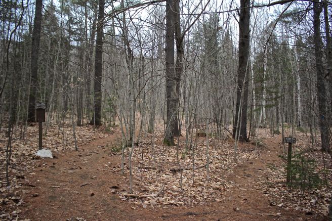
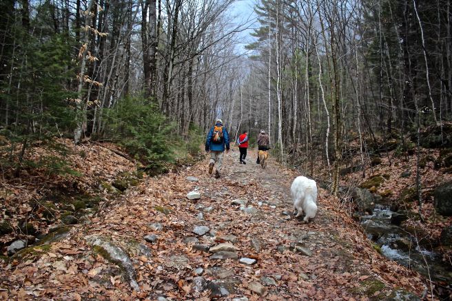
I ventured this afternoon with my friend Marita, author of  Hikes and Woodland Walks in and around Maine’s LAKES REGION, along with her daughter’s beagle, Gracie, on a new trail in Fryeburg.

t-preserve-sign

Mount Tom, a Roche Moutonnée, is an asymmetrical hill with a gently sloping up-ice side that has been smoothed and polished by a glacier. The other side is abrupt and steep–the down-ice side where the rocks were plucked off, leaving a more cliff-like appearance. As Marita noted, its most impressive view is from a distance, but today we sang its praises from up close. We’ve both hiked a 1.5 mile trail to the summit for years, but recently The Nature Conservancy developed a new trail that we were eager to explore.

t-fdn-1

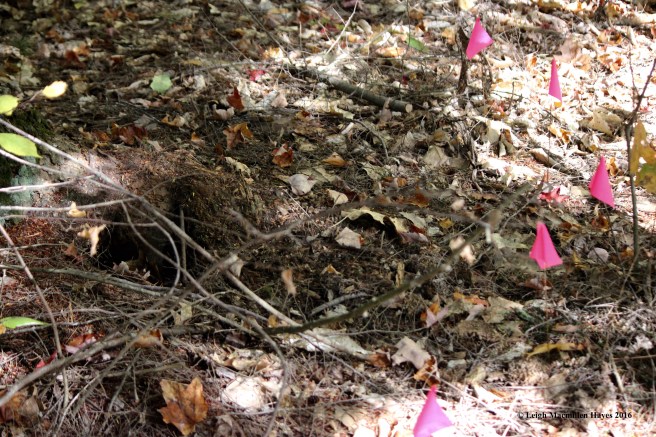
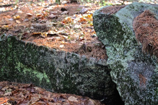
Within seconds I was exclaiming with joy. A huge, and I mean HUGE foundation shared the forest floor. Note the outer staircase to the basement.

t-center-chimney

And the large center chimney.

t-fryeburg-1858-map

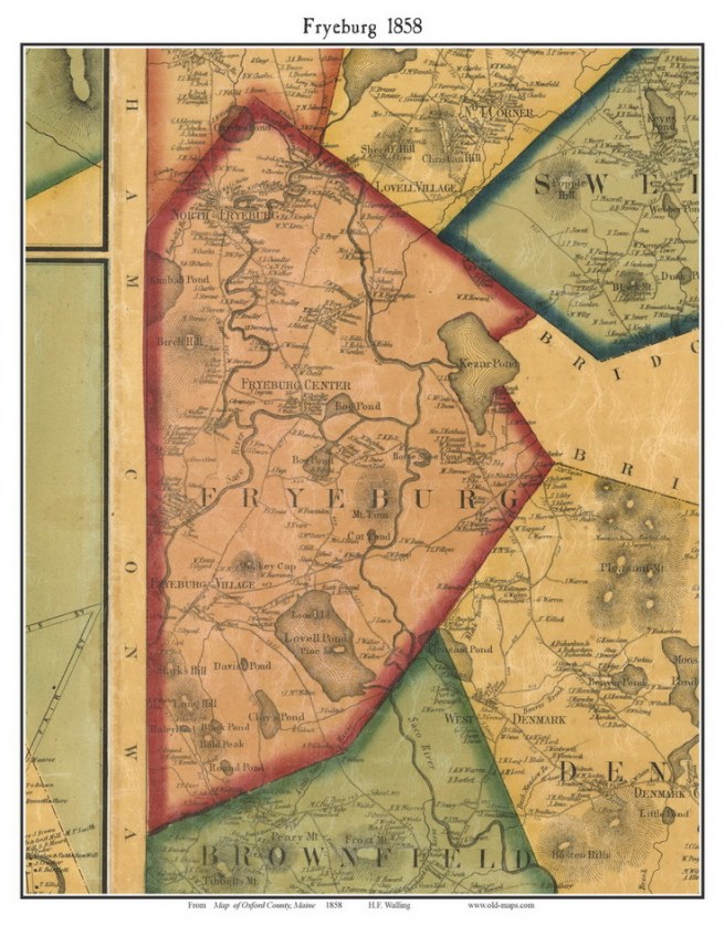
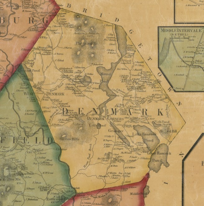
On an 1858 map, I found that A.H. Evans owned a home in about this vicinity, but I don’t know if this was his. Or any more about him. It will be worth exploring further at the Fryeburg Historical Society.

t-house-connected-to-barn

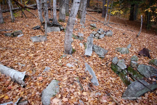
The house extended beyond the basement.

t-barn-1

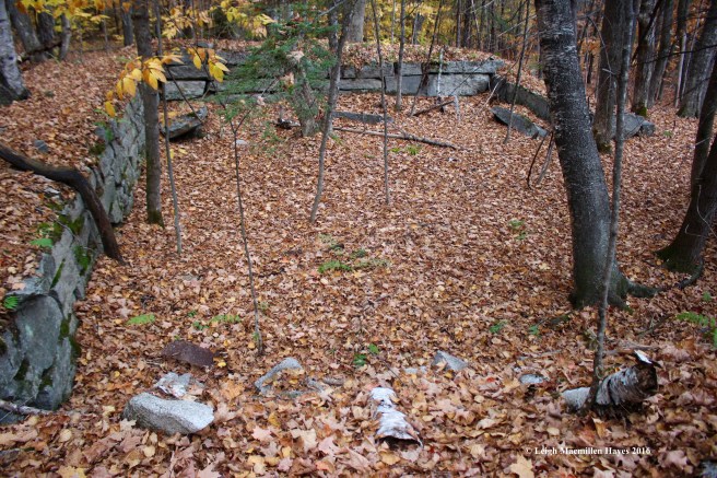
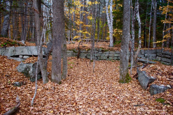
And was attached to an even bigger barn.

t-barn-2

Ash trees grow beside the opening, but I wondered if we were looking at the manure basement.

t-trail-blaze

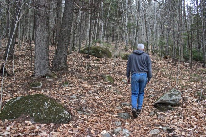
Finally, we pulled ourselves away and returned to the trail. Well, actually, we tried to return to the trail but couldn’t find it. So we backtracked, found this initial blaze and again looked for the next one. Nothing. Nada. No go. How could it be?

t-marita-and-gracie

That didn’t seem right, so we decided to follow our noses, or rather Gracie’s nose, and sure enough we found the trail. If you go, turn left and cross between the house and barn foundations.

t-gracie

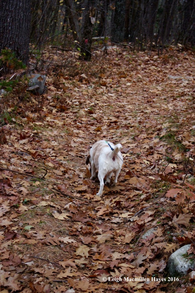
After that, for the most part, we were able to locate the trail, but it was obscured by the newly fallen leaves and could use a few extra blazes. Gracie, however, did an excellent job following the scent of those who had gone before and leaving her own.

t-saw-dust

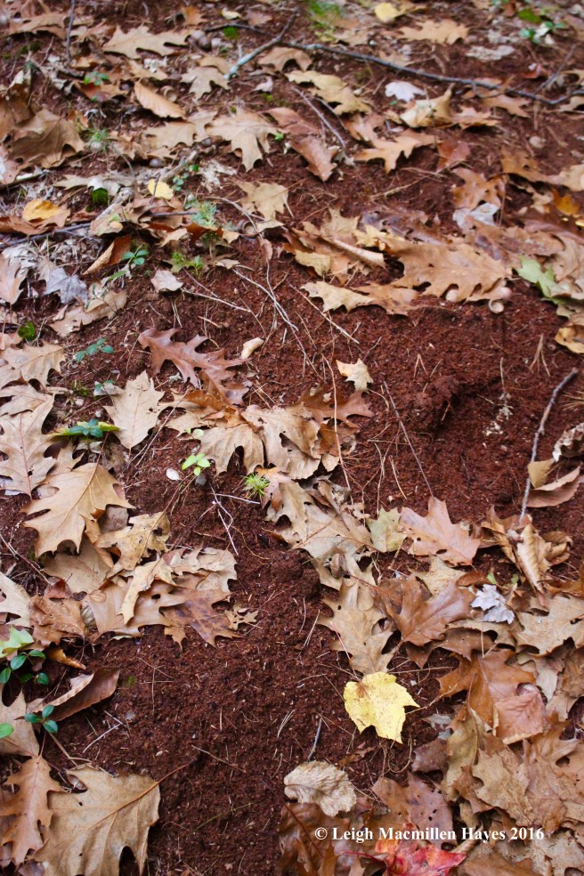
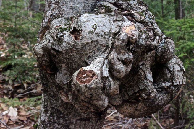
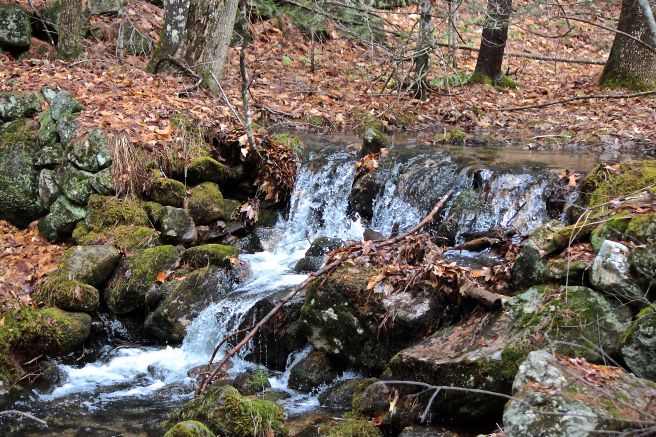
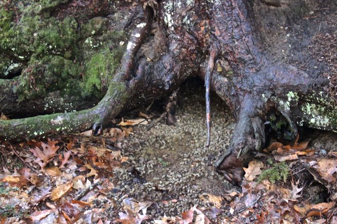
The path took us over a large mound of sawdust, something I’ve found in several areas of Fryeburg.

t-color

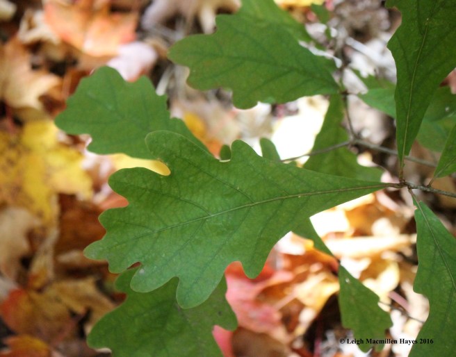
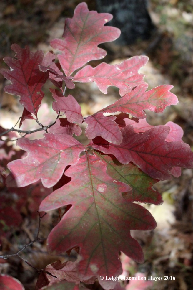
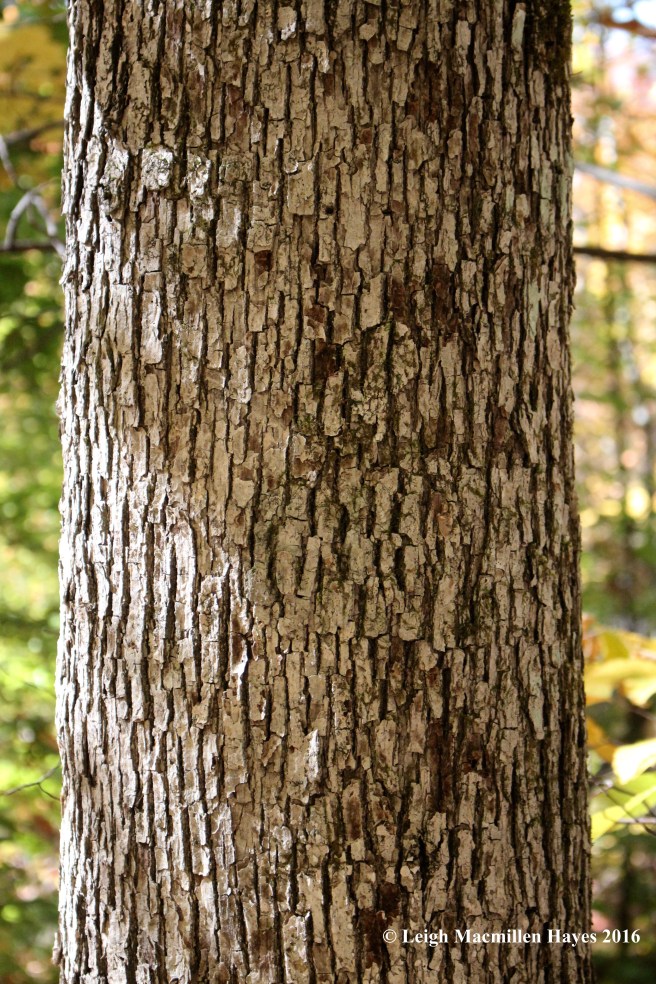
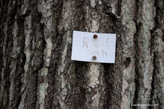
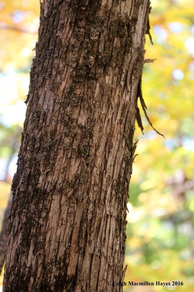
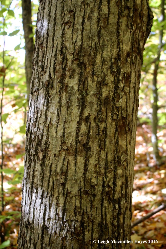
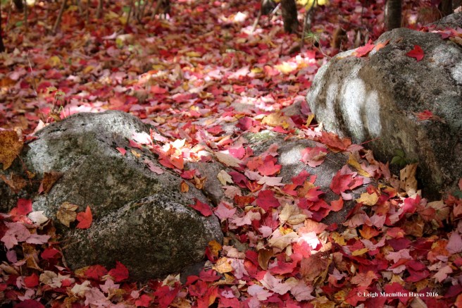
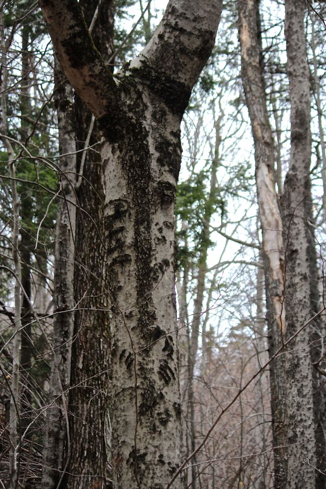
The predominate trees were beech, white and red oaks, thus providing a golden glow to the landscape.

t-ledges-1

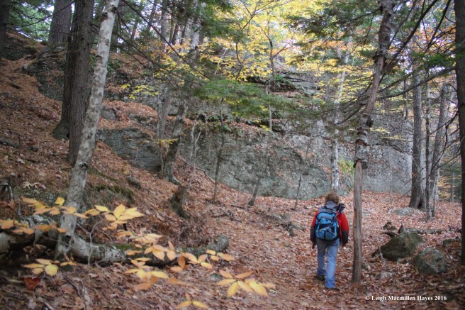
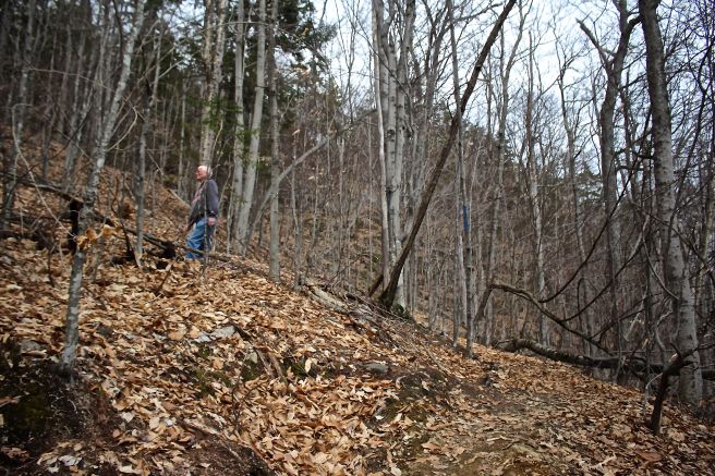
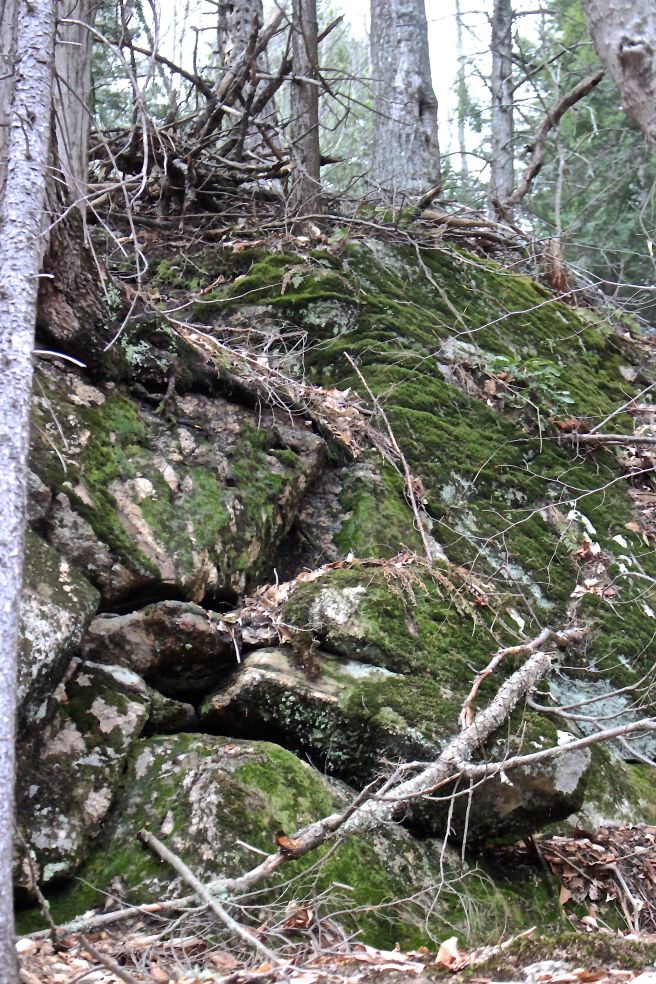
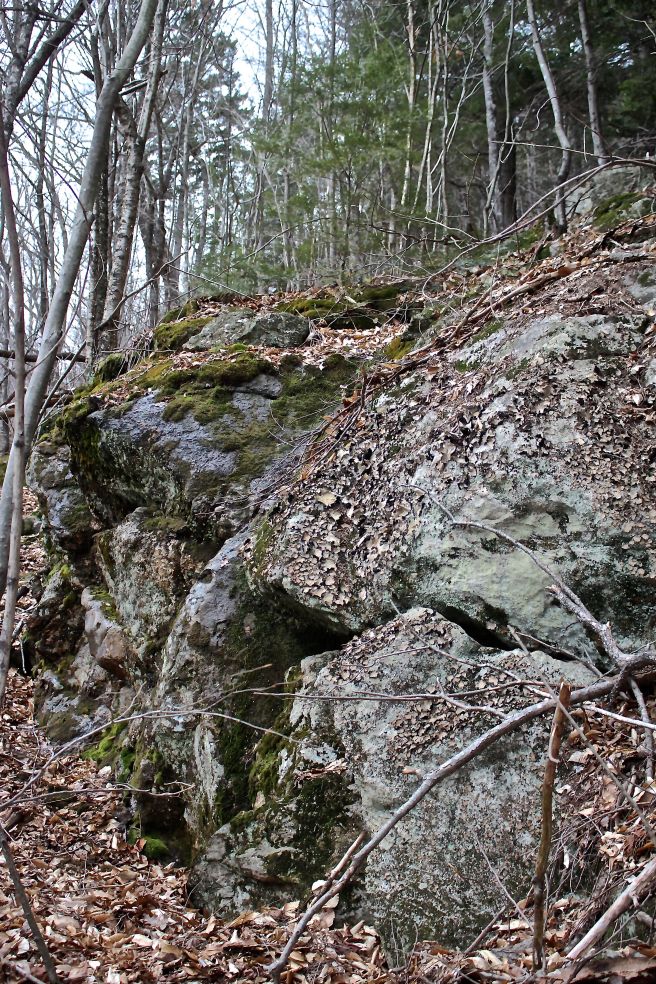
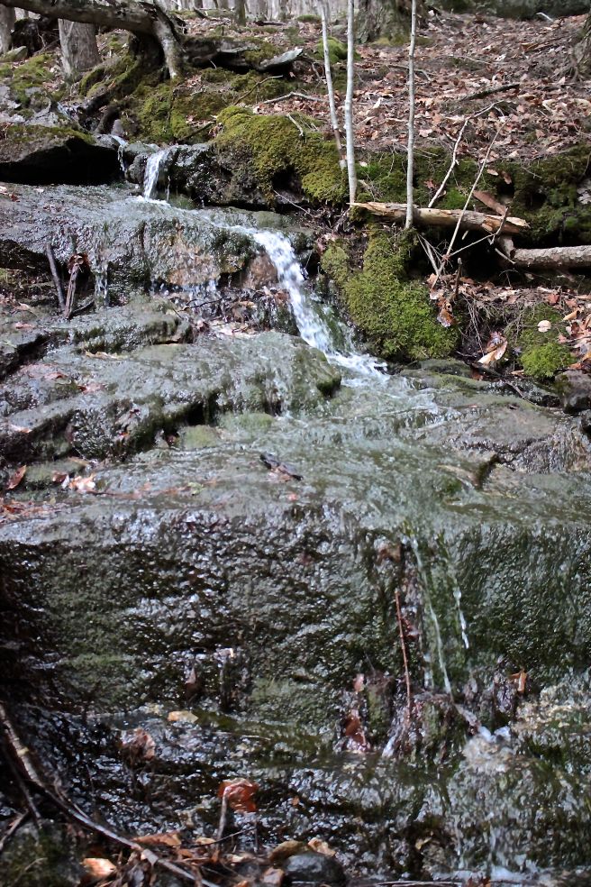
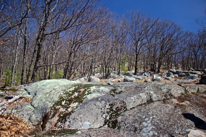
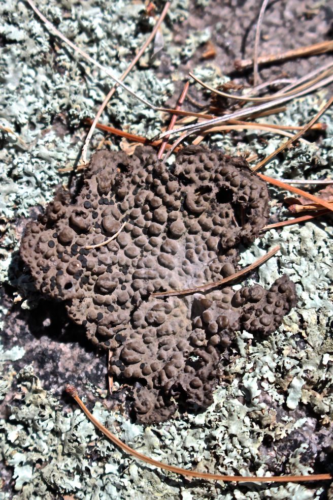
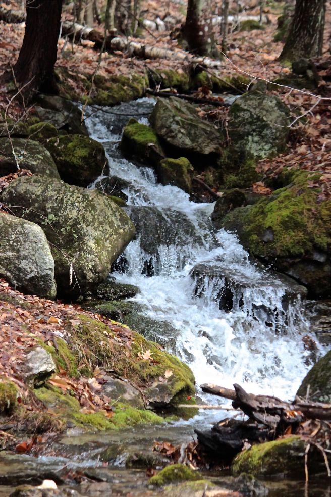
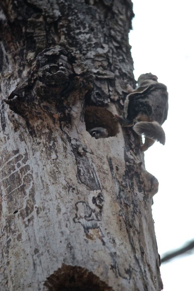
And then we came to the ledges. Bobcat territory. Note to self: snowshoe this way to examine mammal tracks.

t-ledge-island

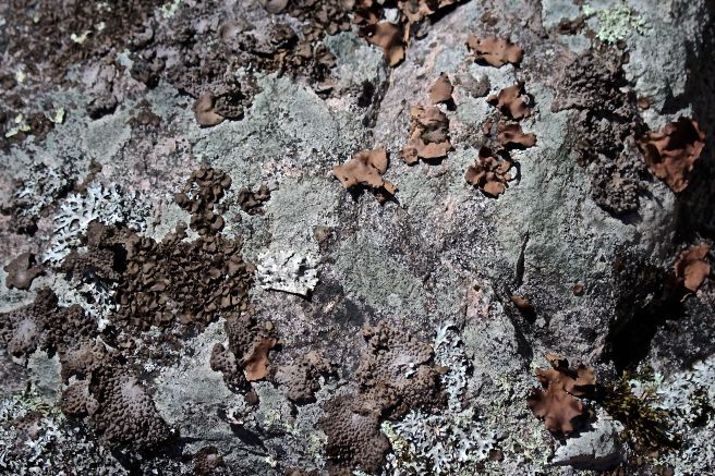
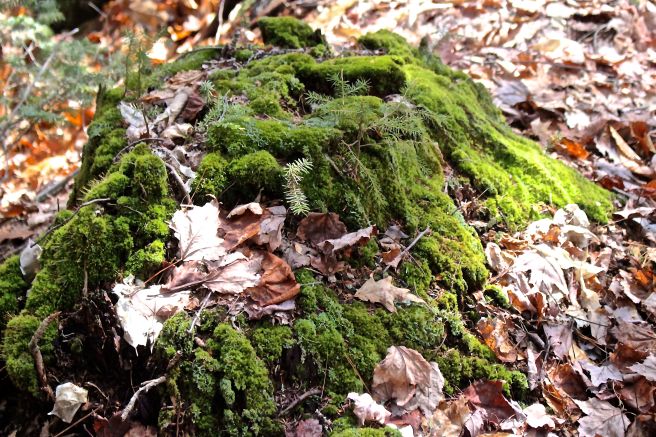
The trail was situated to provide a close up view of the ledge island, where all manner of life has existed for longer than my brain could comprehend. Life on a rock was certainly epitomized here.

t-intersection

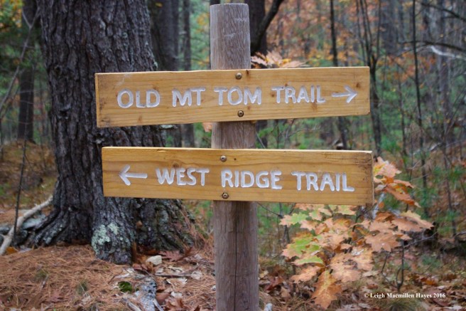
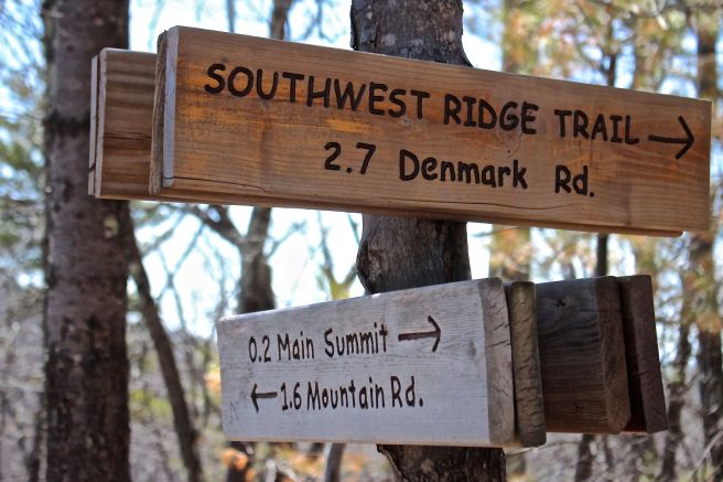
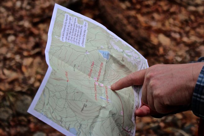
We continued our upward journey for over 2.3 miles (thanks to Marita’s Fitbit for that info) and eventually came to the intersection with the trail we both knew so well.

t-summit-sign

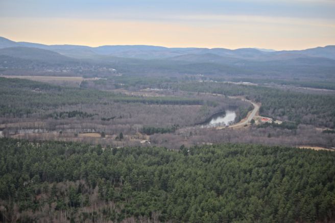
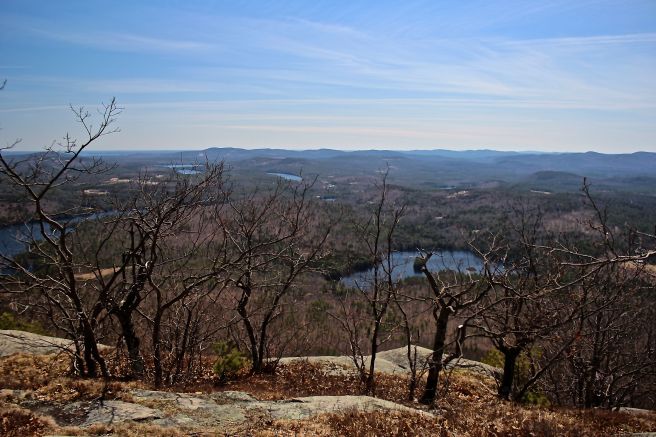
From there, we walked to the summit where the views have become obscured by tree growth.

t-pleasant-mtn-from-summit

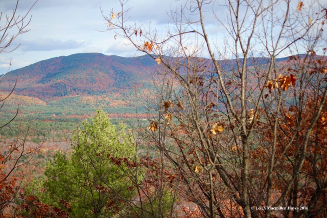
But . . . we could see the long ridge of Pleasant Mountain in front of us,

t-kezar-pond

Kezar Pond to our left,

t-richardson-1

t-richardson-farm

and the Richardson Farm on Stanley Hill Road to our right.

t-ladys-slipper-pod

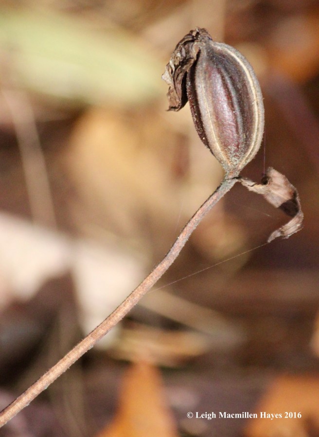
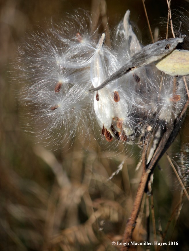
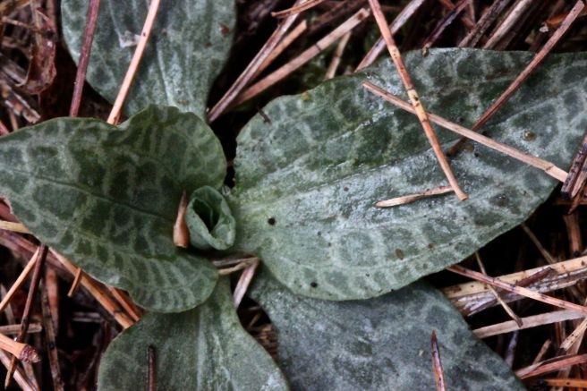
Also along the summit trail, the woody seedpod of a Lady’s Slipper. Ten-to-twenty thousand seeds were packaged within, awaiting wind dispersal.

t-mt-tom-house

We decided to follow the old trail down, which passes through a hemlock grove and then suddenly changes to a hardwood mix. Both of us were surprised at how quickly we descended. And suddenly, we were walking past some private properties including the 1883 Mt. Tom cabin.

t-northern-white-cedar-bark

t-northern-white-cedar

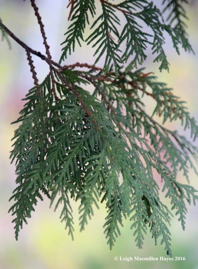
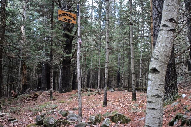
The cabin sign was actually attached to a Northern White Cedar tree. I’m forever wowed by its bark and scaly leaves.

t-flag

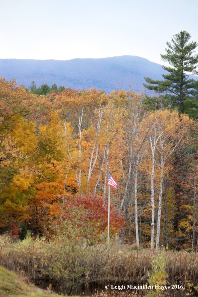
In the field beyond, Old Glory fluttered in the breeze.

t-barn

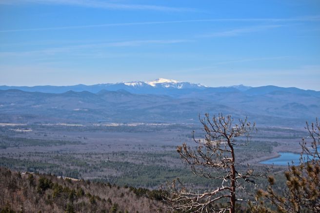
And just before Menotomy Road, we spied Mount Kearsarge in the distance.

t-menontomy-cemetery

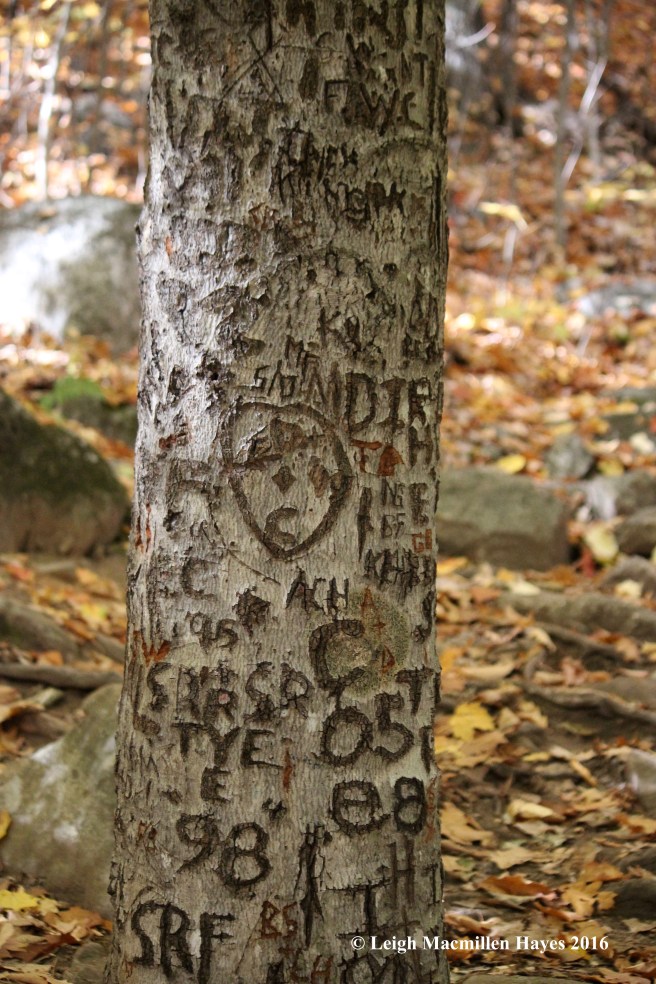
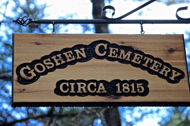
Since we’d taken the loop trail approach rather than an out and back on the same trail, we had to walk along Menotomy Road, so we paid the cemetery a visit and checked out the names and ages of those who had lived in this neighborhood.

t-pine-on-grave-stone

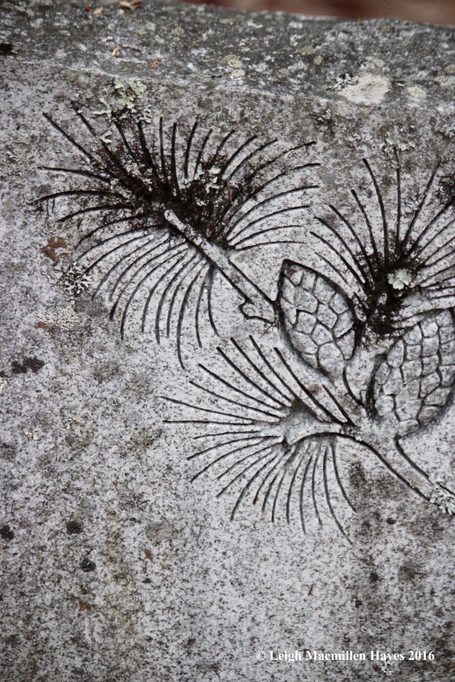
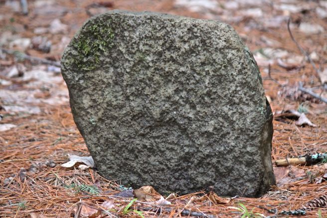
One of the older stones intrigued me with its illustration. I think I would have enjoyed getting to know these people.

t-menotomy-pumpkins

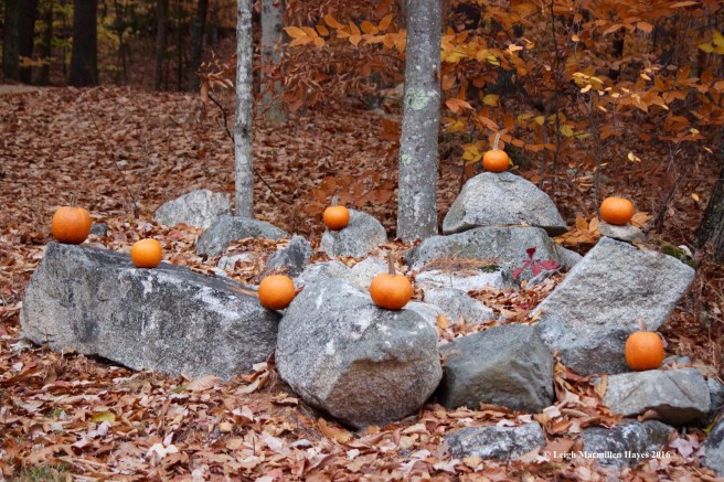
As we continued on, I was reminded of recent adventures in Ireland  and the realization that we notice more when we walk along the road rather than merely driving by. We both admired this simple yet artful pumpkin display.

t-menotomy-road-1

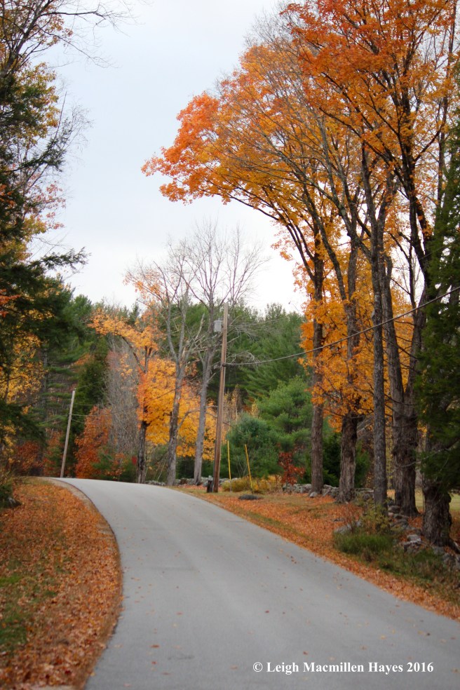
If you go, you might want to drive to the old trailhead, park your vehicle and then walk back to the West Ridge Trail. We parked at the latter and had to walk the 1.5 back at the end, when it seemed even longer. But truly, the road offers its own pretty sights and the temperature was certainly just right, even with a few snow flurries thrown into the mix, so we didn’t mind. We were thankful we’d found our way along the new trail and revisited the old at Mount Tom. And I’m already eager to do it again.


Everybody Loves Raymond? Mondate

My guy and I were up for an adventure this morning as we headed off to a property recently acquired by Loon Echo Land Trust. I’d been there once before, but at that time there was no trail system and I certainly hadn’t climbed to the summit.

r-forest-climb

We were on a 356-acre property bisected by a paved road. First, we hiked the upper section, passing through a hardwood forest.

r-white-oak-green-leaves

Immediately, I realized we were in the presence of one of my favorites–noted for the mitten-ish presentation of its leaves. One would have to be all thumbs to fit into this mitten, but still, my heart hums whenever I spy a white oak.

r-white-oak-red-color

Or in this case, many white oaks, some exhibiting the wine color of their fall foliage.

r-white-oak-bark

And the bark–a blocky look that differs greatly . . .

r-red-oak-on-bm1

from the ski trail ridges of red oak.

r-hophornbeam-bark

Hop Hornbeam also grows abundantly in this forest.

r-approaching-forest-summit-yellow

As we neared the summit, we noticed that the sky view had a yellowish tone reflected by the ground view. Most trees were of the same age due to past logging efforts, but the predominant species was sugar maple.

r-basswood-2

Another favorite tree also grew abundantly here. I think they are also favorites because I don’t see them as often. In this case, the bark, though furrowed and ridged like a northern red oak, featured an almost combed flattened ridge.

r-basswood-leaf

And its leaves–oh my! Notice the asymmetrical base? And the length–my boot is size 8. American basswood–an important timber tree that is known to share the community with sugar maples and hornbeams–all of which provided that yellow glow.

r-raymond-summit-view-1

At last, we reached the vantage point.

r-skyward

Above us, a mix of colors and species.

r-oak-leaves

Before us, a mix of white and red oak leaves.

r-crescent-view-3-1

And beyond us, the view of Crescent Lake

r-crescent-rattle-1-1

and Rattlesnake Mountain.

r-ladybird-1-1

While we admired the view, ladybird beetles (aka ladybugs) swarmed us. Well, not exactly in swarm formation, but more than is the norm.

r-green-trail-tag

After admiring the view for a while and wondering about the ladybirds, we backtracked a bit and decided to explore the green trail, assuming that it looped about the summit.

r-dry-leaf-sound

The trail conditions changed constantly, and one thing we realized was that the leaves had dried out and we wished we could have bottled their scent along with our crispy footfall as we trudged through–the smells and sounds associated with autumn.

r-bear-claw

Eventually, we entered a beech commune and what to my wondering eyes should appear–bear claw marks? We ventured closer, circled the tree and looked at others in the neighborhood before determining that our eyes had perhaps played a trick on us.

r-garter-snake

That was OK because within seconds a twig moved at our feet.

r-snake-tongue

We watched as its tongue darted in and out, red tipped with a black fork.

r-lunch-rock

Finally, we moved back to what we’d named Ladybird Lookout and found lunch rock where we topped off sandwiches with Bailey’s Irish Cream fudge a la Megan and Becky Colby. Life is good. Life is very good. (And we know a town in western Maine that would benefit greatly from a bakery–just saying, Megan!)

r-trail-ribbon-art

After lunch, we climbed back down and crossed Conesca Road to check out trails on the other side. There is no trail map just yet, but we never got lost. And we appreciated the artwork nature created of manmade marks.

r-forest-across-the-street-stonewall

This space offered a different feel where hardwoods combined with softwoods. And more stonewalls crossed the property, speaking to past uses.

r-hole-pink-flags

It’s here that we noticed an area demarked by pink flags and stopped to wonder why. Note to self–excavated hole and debris mean beware.

r-bee-himve

Upon closer examination, an old hive. So who dug it up? We had our suspicions.

r-mushrooms-1

We also noticed a fungi phenomena.

r-mushroom-growth

Fungi on fungi? Honey mushrooms attacked by something else?

r-mushroom-growth-3

The displays were large

r-mushroom-fungi

and otherworldly. I don’t recall ever seeing this before.

I sent the photos to Parker and Jimmie Veitch, of White Mountain Mushrooms, and Jimmie responded with this explanation:

“That’s what mycologists call “rosecomb” mutation, where a mushroom’s gills start forming on the cap in a really mutated fashion. It’s been reported in many mushroom species but I haven’t seen it in this one (Armillaria AKA honey mushrooms). As far as I know, no secondary fungus is involved.

The suspected cause (not so nice) is ‘hydrocarbons, phenols and other compounds contaminating the casing or contacting the mushroom surface. Diesel oil, exhaust from engines, and petroleum-based pesticides are thought to be the principal source.'”

r-red-leaves

As we concluded our visit, we passed over one more stone wall decorated with red maple leaves.

r-beginning-of-bri-mar

And then we hopped into the truck and traveled a couple of miles south to conquer another small mountain–one visible to us from Ladybird Lookout. (I really think LELT should name it such.)

r-brimar-milkweed

Here the milkweed plants grew abundantly.

r-brimar-white-oaks-in-field

In the field leading to the trail, the property owners planted white oak saplings in hopes of providing food for wildlife. Um, by the same token, they’d enclosed the saplings in plastic sleeves (reminding us of our findings in Ireland) to keep deer at bay.

r-brimar-ferns

The understory differed and ferns offered their own autumn hues.

r-brimar-evergreen-wood-fern

In contrast were the many examples of evergreen wood ferns.

r-bri-mar-beech-markings

We soon realized that quite literate bears frequented this path and announced their presence.

r-crescent-from-bri-1-1

At last, the view opened and we looked back at the opposite shore of Crescent Lake, though realizing that our earlier ascent was masked by the trees.

r-panther-from-bri-3-1

Turning about, Panther Pond came into view.

We’d spent the day embracing Raymond because everybody loves Raymond.

r-raymond-forest-sign

r-brimar-trail-sign

Raymond, Maine, that is. Loon Echo Land Trust is gearing up to celebrate the Raymond Community Forest that we explored this morning and the Bri-Mar Trail up Rattlesnake Mountain has long been traveled by many. In fact, when I used to write copy for the local chamber of commerce, I spent some time learning about Edgar Welch, who was the fastest man on foot and ran up Mount Washington at least once a year. He lived in Raymond and worked for David McLellan, who was partially blind from a Civil War injury. Because Mr. McLellan’s farm was at the foot of Rattlesnake Mountain, the sun would set one hour earlier than elsewhere in town. According to legend, after work each day Edgar ran up the mountain and moved rocks. Finally, he’d moved enough to let the sun shine on the farm for an hour longer. Another story has it that one day a man bet Edgar that he could beat him in a race to Portland. The man would race with his horse and buggy, while Edgar ran. When the opponent pulled into the city, Edgar was waiting for him. I love local lore.

And everybody loves Raymond. Well, my guy and I certainly gained a better appreciation for this town today.


Mondate on Mount Will

It’s been a while since we’ve actually had a Mondate. After two days of hiking the trails up Pleasant Mountain, today’s journey found us venturing a wee bit out of the neighborhood as we made our way through Bethel to Mount Will.

w-mount will sign

w-tree farm sign

The parking lot is located between these two signs. Part of the Mount Will trail system is within the 115-acre Bethel Town Forest that had served as the Town Farm back in the day.

w-2 trails

The South Cliff trail leaves from the left, while the North Ledges is on the right. This is a loop and we decided on a counterclockwise trek. It had been at least five years since we last hiked here and we’d forgotten about some of the steep sections.

w-n-parklike

Of course, at the start, it seemed almost parklike. Three years ago, several local organizations including Mahoosuc Pathways, the Oxford County Conservation Corps, Outward Bound and the Bethel Conservation Commission rerouted this particular section of the loop.

w-n-switch

Now switchbacks wind their way up toward the North Ledge.

w-bear 8

When I wasn’t looking down, I scanned the woods, ever searching for my favorite species–bear claw trees.

w-bear

And I wasn’t disappointed.

w-bear 7

We saw them over,

w-bear9

and over again. Oh happy day! We found more than these, which leads me to believe that there are even more. Let the search continue!

w-gargoyle 2a

A few trees displayed other surprise packages–burls or warty growths caused by some environmental condition such as injury, virus, fungus, insect infestation or mold. Though this growth can put stress on a tree if it becomes too heavy, generally trees with these features are healthy. And woodworkers covet burls for the unique pattern and beauty found within. That sounds like a comment on the world–we all have hidden treasures, but they aren’t always visible.

w-n-artist conk

Other tree growths include artist’s conk and

w-s-redbelted polypore

red-belted polypores.

w-n-bobcat

The trail passed below rocky outcrops–and my imagination saw bobcats. But, what would they eat? The undergrowth is limited, so I doubted snowshoe hare. That being said, spruce and hemlock cones are many and red squirrels chided us constantly.

w-n-vp

Meanwhile, at a vernal pool just off the trail, all was quiet–and still partially covered in ice.

w-n-lunch rock

Lunch rock was the North Ledge. Below, the Androscoggin River wends its way through the landscape. The Androscoggin has a long history as a life-giving force–beginning with the Abenaki Indians who used it as a water trail and knew the nuances of this 170-mile river.

w-n-carters

The fertile, ancient floodplain has served many a farmer, including the Carters who own the farm across the river below where we sat. While we ate, we shared our memories of cross-country skiing across those fields, beside the river and into the woods.

w-spruce sap

We continued on across the ridge and through the spruce forest where the sap ran blue.

w-s-sunday river

Before turning toward South Cliffs, we caught a glimpse of the trails at Sunday River Ski Area in Newry.

W-gray 1

And then we saw a sign that had us wondering. The Gray Memorial? We had no previous memory of it, so we followed the detour and walked along a snowmobile trail for about a quarter of a mile.

w-s-gray memorial

The story is sad. The airplane remnants powerful in suggestion. Upon arriving home, I found an article in the Sun Journal referencing the event. Leroy was a state trooper and his wife, Brenda, an executive secretary who became head dispatcher for the Bar Harbor Police Department. With their 14-year-old daughter, Karen, they were flying their Cherokee Piper to Bethel to spend time with relatives when the plane “crashed nose first” into Mount Will about 7:30pm. Despite her own injuries, Karen hiked down the steep mountainside to seek help. A somber site indeed.

w-s-cliff view

We backtracked to the trail and continued on to the South Cliffs, where our view again showed the river, with Route 2 following beside and both leading to Bethel village.

w-s-mtn goats

Moving off the cliff, we were sure mountain goats had laid out the trail.

w-s-ledges

Again, we were in bobcat territory, frequented by chatty red squirrels who seemed to feel quite safe as they scrambled from tree to tree.

w-oz

And then we moved into the land where the monkeys in the Wizard of Oz jumped out upon Dorothy and her friends. My guy started humming the music from his favorite movie. The reality is that these trees knew the wrath of previous storms.

w-s-heading down

Once again the trail turned S curves as we continued downward and

w-s-brook

listened to water trickling over the mossy stream bed beside us.

w-s-logging

And then we found ourselves in the midst of a recent logging operation–remember, this is a working forest. Slash galore decorated the landscape, but we suspect that all of this will be chipped eventually. One thing we happily noted–bird song. Lots of bird song at this spot.

w-s-weather1

We were almost to the bottom of the trail when an anomaly grabbed our attention and forced us to investigate.

w-s-weather 1

w-s-weather tape

We’d stumbled upon a winter weather station. We only knew that because “winter weather station” was printed in faded paint across the box. So, we get the tape measure for snow depth, but the box? And the hole covered with mesh? Worth a wonder, so we did.

w-s-weather cocoon

Apparently, a moth appreciated the efforts of the citizen scientists who created this shelter. Our hike was over, but this chrysalis holds the future.

w-covered 2

We decided to complete our Mount Will Mondate with a visit to Artist’s Bridge over Sunday River–the perfect culmination of our love for nature and history.


From Sheep to Dinosaurs, Oh My!

After leaving a truck at the base of the Ledges Trail on Pleasant Mountain, my guy and I drove to Denmark Village to attend an annual celebration of fiber: the Denmark Sheepfest.

s-sheep 1

Like us, local sheep were ready to shed their winter coats.

s-sheepish look

Waiting their turn, they offered sheepish looks.

s-sheep shearing

But we heard no complaints as the shearing began.

s-MacKay 1

From there, we continued on to the Southwest Ridge Trail of Pleasant Mountain. As we climbed, we thought about the former name of the trail: MacKay’s Pasture Trail.

s-Mac 2

Between the rock outcrops and slope we decided that in the 1800s sheep probably roamed this side of the mountain. I found an 1858 map on the Denmark Historical Society’s Web site, but it’s too small to check names.

s-Denmark_1858

(Thanks to Jinny Mae for sending me a better copy of the map–the McKay’s property is located near the base of the trail on the Denmark/Fryeburg line–makes perfect sense that the side of the mountain served as pastureland for their farm.) Sheep and shepherds–We feel a certain affinity to shepherds/shephards because it’s a family name and were saddened to learn yesterday of the death of one relative we met this past fall in New Brunswick, Canada. Our acquaintance was short, but relationship long. As the Irish say, “May the light of heaven shine upon your grave.” Rest in peace, Ellis Shephard.

s-hiking

We love climbing up this trail and pausing . . .

s-mac 3

to take in the views behind us–Brownfield Bog, Lovewell Pond, Eastern Slopes Airport in Fryeburg, Maine, and White Mountains of New Hampshire in the distance.

s-lunch

In no time, or so it seemed, we reached lunch rock by the teepee. The teepee was constructed by the late George Sudduth, director/owner of Wyonegonic Camps , the oldest camp for girls in America. His wife, Carol, whom I’ve had the pleasure of hiking with, and family still run the camp, located below on Moose Pond.

s-lunch view

Our view as we appreciated fine dining–ham and swiss instead of PB&J–Moose Pond’s lower basin to the left, Sand (aka Walden) Pond with Hancock Pond behind it, Granger Pond and Beaver Pond directly below us. Actually, if you look closely, you might see Long Lake between Moose and Hancock. This is the Lakes Region of Maine.

s-fire tower 1

We continued along the ridge and the fire tower came into view. Once the leaves pop, this view will disappear until fall.

s-vp

At the vernal pool between knobs, we only saw one large egg mass–I had to wonder if the number is related to the amount of human and dog traffic.

s-ft2

And then . . . we were there. At the summit of Pleasant Mountain. With a kazillion other people and dogs.

s-summit 3

Again, we could see the bog and Lovewell Pond behind it,

s-summit view

plus Kezar Pond in Fryeburg and Mount Washington beyond.

s-summit 2

No matter how often I gaze upon this view, I’m always awestruck.

s-trail sign

We had two options because we’d left two trucks, and decided to follow the Ledges Trail to Mountain Road.

s-toadskin

Though I was with my guy, Mr. Destinationitis, I did stop long enough to admire the common toadskin lichen with its warty pustules.

s-toadskin and tripe

Had this been a teaching moment, the lesson plan was laid out in front of me–toadskin versus common rock tripe. Warty versus smooth. A difference in color. Both umbilicate lichens–attached to the rock substrate at a single point. OK, so maybe it was a teachable moment.

s-rest

But one of us didn’t give two hoots. He tolerated me . . . while he rested. ;-)

s-ledges 1

For the most part, we hiked within feet of each other, but I can never resist stopping at this point as we come upon the beginning of the ledges that gave this trail its name.

s-trees

Continuing down, I frequently grasped trees and thought about how many handprints are imbedded in the history of this land–from Native Americans to surveyors to shepherds to trail blazers and hikers. On this made-in-Maine type of day, we encountered many people of all ages and abilities–and were glad to share the trail with them.

s-dino1

It’s not only people and sheep who have moved across Pleasant Mountain. Even today, dinosaurs made their presence known.


Following In The Footpath Of Others

Rain marked this morning’s dawn, but that didn’t daunt our group of six. We donned overcoats, gloves, hats and waterproof boots knowing that we’d encounter mud along our intended route.

And so we met near the former site of the Methodist church in the northeast corner of Sweden–Sweden, Maine, that is. Our intention was to follow the snowmobile trail for a couple of miles and visit foundations and a few other historic sites along the way.

s-you are here map

Maps dated 1858 and 1880 show a network of roads that served the scattered neighborhoods of this town. The trails we were about to walk on follow the footpaths and wagon tracks of earlier people. These were once town roads. We happened to be in the presence of the president of the Sweden Historical Society and she gave us copies of the maps to help us gain a better understanding of our destination. She also printed out a topographical map so we’d have no excuse for getting lost.

s-following trail in

With the sun suddenly shining upon us, we laughed at ourselves as we moved along because we traveled at breakneck speed. Well, for us anyway–1.8 mph when we were moving. Note the phrase: “when we were moving.”

s-stream to Patterson 1

Along the way, we paused to admire the streams that flow toward Patterson Brook and

s-vp 1

checked on life in a potential vernal pool.

s-stream 2-mill site

While we find water so mesmerizing, I couldn’t help but wonder about its potential here for the early settlers.

s-stream 3

Several times we found stone walls on either side of the streams and didn’t know how to interpret their meaning. That was OK–we appreciated not having all of the answers.

s-stream 4

The opportunity to partake of the beauty among friends old and new was enough.

s-cheyenne

Even four-footed friends.

s-single:double wall

The stonewalls, both double and single in structure, indicated that the land had been cultivated. We tried to make sense out of the sudden switch from single to double and back to single in a short distance, but really, they didn’t necessarily build walls according to our expectations of what life must have been like–a single wall meaning keep the farm animals in or out and the double being a garden wall–lots of times it was probably just plain common sense and a need to get rid of the stones that rose with the frost.

s-drilled rock

Eventually, we climbed over the wall and headed up toward this monument. Dave, who lives in this neighborhood and knows these woods well, encouraged us to ponder.

s-drilled rock 2

Why was the top of the rock split off intentionally and then left there?  Was it intended for a foundation stone? Was the neighborhood abandoned before this piece was used?

s-town line 1

We wandered further through the woods and came to the Sweden/Waterford town line. Two stone walls less than ten feet apart mark the boundary. Waterford to the left and Sweden to the right. (Did I get that right, Linda?–my left and right?)

s-town line

Orange paint also marked the boundary line.

s-kneeland foundation

We’d crossed into Waterford and stopped for a break at the Kneeland (1858)/Kimball (1880) residence, a rather large foundation with a center chimney.

s-fdn rocks, squirrel table

Apparently, we weren’t the only ones who paused here for a snack.

s-hidden brook

And then we crossed the snowmobile trail once more and began bushwhacking again. Though you see only tree shadows, leaves and moss here, it wasn’t what we saw, but what we had the honor to hear that made us stop–an underground brook. It felt like we’d stumbled upon a secret spot.

s-stone chair 2

Dave led us uphill to another special spot a friend of his discovered years ago–the stone chair. You have to wonder about this. We’re in the middle of nowhere that was once somewhere. Below this is a large hole in the earth, possibly a foundation of sorts. And beside, a skidder trail. So, who built the chair?

s-stump by chair 100:50

Atop the foundation of sorts was this cut stump–we surmised it was cut about fifty years ago and that it was about 100 years old at that time.

s-group 1

It really doesn’t matter. What matters is sharing the discovery.

s-chair and Sophie

Another four-footed friend also thought it was rather special.

s-cable

Not too far from here we found something else that spoke of logging.

s-goshen 2

We continued our bushwhack to another site of importance–and came upon it from the backside.

s-goshen sign 2

The Goshen Cemetery, circa 1815. Notice the raindrops and blue sky. A few drops fell in the middle of our walk and then it cleared again.

s-goshen cem 3

The cemetery contains stones that had been buried under the duff, but when discovered, were uprighted in spot.

s-goshen stone 2

s-goshen tomb stone

The tombstones are unmarked and as far as I know, two theories exist–an epidemic struck the neighborhood and those who died needed to be buried as fast as possible, or these were the tombs of the residents from the town’s poorhouse.

s-goshen sign 3

One thing we do know for certain. The bears like the sign and it has been remade several times and posted higher and higher in hopes that they’ll leave it alone.

s-bark art 1

Those were our historical finds, but we also made time to enjoy our surroundings, beginning with artwork created naturally.

s-beech elephant

I always say that beech bark doesn’t remind me of elephant skin, but today–elephant legs and feet, for sure.

s-downy rattlesnake plantain

Peaking out from the leaf litter, downy rattlesnake plantain showed off its white-veined leaves. Stained glass windows come to mind whenever I spy this. And though its the commonest of the rattlesnake plantains, I’m always in awe.

s-checkered rattlesnake

We also nearly stepped on its cousin, checkered rattlesnake plantain. I do have to say that if I were in charge of the world, I’d switch their names.

s-artist conks

We found artists conks and

s-hemlock shelves 1

old hemlock varnish shelves.

s-porcupine den

We know where the porcupines denned,

s-moose:striped maple

moose browsed,

s-pileated 1

woodpeckers dined,

s-deer rub

deer rubbed their antlers,

s-deer rub:paw

and pawed the ground. Do you see it at the bottom of this photo? It’s a scrape meant to communicate information to other deer.

s-flying squirrels 1

But one of my favorite sights of the day–the flying squirrels that scampered up an old snag. Notice the flat tail–a rudder.

s-fs 2

And the flap on its side, that furry membrane that stretches from the wrist to ankle–a parachute of sorts for gliding from tree to tree.

s-fs 4

And those bulging eyes–the better to see in the dark.

s-heading home

Four hours and almost six miles later, we followed the trail out, thankful for the opportunity to spend time wondering together and follow in the footpath of others.