Perfect Present

The Giant’s Shower: a book by me

I did a thing. Years ago I wrote a children’s story. Well, a bunch of them actually. And I tried to sell this particular one to publishing houses. No takers. Then, a couple of years ago I purchased a Fairy Coloring Book created by the one and only Solana, teenage daughter of the Fly Away Farm Wards in Lovell and Stow, Maine, and approached her about illustrating my fairy tale. She took on the task and did an amazing job. Then I asked copyeditor Pam Marshall to wave her magic wand over it. And I asked local graphic designer Dianne Lewis to use some fairy dust and turn it into an actual book. I always said I’d never self-publish a book. And tada: I did just that. And now it’s even better because it’s published by http://www.indieauthorbooks.com.

Aisling, a fairy who lives on Sabattus Mountain in the western Maine village of Lovell, has a vision during the Midsummer Eve celebration. 

Twinkles, flitters, a bit of fairy dust and some tsk-tsking are necessary to make Aisling’s vision a reality. 

If you read the story aloud, I highly encourage you to get all in your audience to participate in saying “Tsk, tsk,” each time Biddie does the same.

You and your children will delight in the story accompanied and the colorful and whimsical illustrations created by artist Solana Ward.  In fact, you don’t even need children to enjoy this story.

Marita Wiser, author of Hikes and Walks in and around Maine’s Lakes Region had this to say about the book, “The fairies in The Giant’s Shower will captivate children with their merry life in the forest. It’s not all magical though, as they moved from New Hampshire to Sabattus Mountain in Maine to avoid a certain devil. At least they thought the giant was a devil, but the situation wasn’t what it seemed at first. Both the writing and the detailed illustrations capture many features of the woods of northern New England, and the fun of fairy life and houses.” 

A naturalist and writer, many of you know that I hike frequently in Maine and New Hampshire, and those adventures inspired this story. I feel the fairies’ magic whenever I’m among moss-covered ground and tree stumps.

Included in the book are directions to the two featured settings, Sabattus Mountain and Arethusa Falls, featured in the photo above. Both are easily accessible for young hikers who might experience some magical moments while exploring. 

Also included is a list of character names and their explanations, as well as instructions to create fairy houses and fairy dust. 

The Giant’s Shower is available for $16.99 at Bridgton Books, Hayes Ace Hardware, Fly Away Farm, or by contacting me: thegiantsshower2023@gmail.com. Cash, check, or Venmo all work.

I do charge an extra $5.00 for shipping and handling if you ask me to send it to you.

Please consider purchasing a copy, or ten, as the book does make the perfect present.

Self-Guided Tour of Sabattus Mountain

As stories go, Sabattus Mountain in Lovell offers plenty of lore. For starters, there’s the name of the mountain. I’ve heard at least two tales and seen three spellings, but basically the legend is the same–about a Pequawket named Sabatos, Sabatis, or Sabattus, who guided hunters and one day killed a lynx, or was it a mountain lion, before it sprang upon him.

In a July 14, 2017 article, Ed Parsons of the Conway Daily Sun wrote: “Sabattus was born in St. Francis, Canada, and with the influence of French missionaries, was named for St. John the Baptist, shortened to Sabattus. When Roger’s Rangers destroyed St. Francis in 1759, Sabattus was about 10 years old. He was kidnapped and went south with the rangers. Later, he went to Fryeburg with one of them, and spent the rest of his life in the area.

Sabattus had two children with the well-known area healer, Molly Ockett. In 1783, an earlier wife of his returned from a long trip to Canada, and claimed to be his spouse. To settle the dispute, Sabattus took them to the house of Mr. Wiley in Fryeburg so there would be a witness, and the two women fought, “hair and cloth flying everywhere.” Mrs. St. Francis, as Molly Ockett called the former wife, was stronger and won out. Molly Ockett left and moved to Andover, Maine.

There’s also the Devil’s Staircase, but that’s for another day.

s1-sign

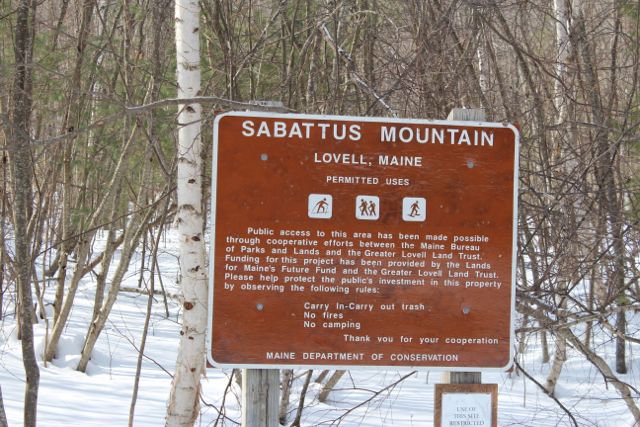
Two Land for Maine’s Future program grants, along with funding from the Greater Lovell Land Trust, enabled the State of Maine to purchase 177 acres on and around Sabattus Mountain, protecting hiking access to Lovell’s highest peak. The trail is a 1.6-mile loop to and from the 1,253-foot summit. Sabattus Mountain is now owned and managed by the Bureau of Parks and Lands. The land trust, however, has taken a keen interest in upkeep of the trail system recently because there had been much erosion ever since Hurricane Irene and the State seemed to back off maintaining it. Last year, the GLLT’s three interns built numerous water bars, especially on the eastern trail.

s6-Brent's Loop Trail Sign

Last week, Brent Legere of Lovell Box Company and Western Maine Slabworks, installed new signs to guide hikers on the trail system.

s2-self-guided nature walk

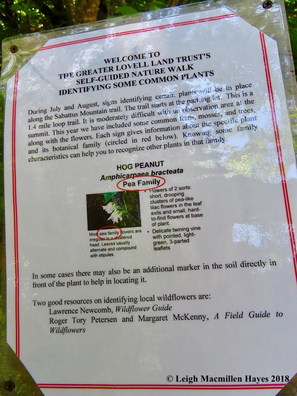
Today, a team of docents, associates and this year’s intern, under the well-organized leadership of GLLT Docent and Maine Master Naturalist Joan Lundin, installed informational signage along the loop.

s3-explaining the plan

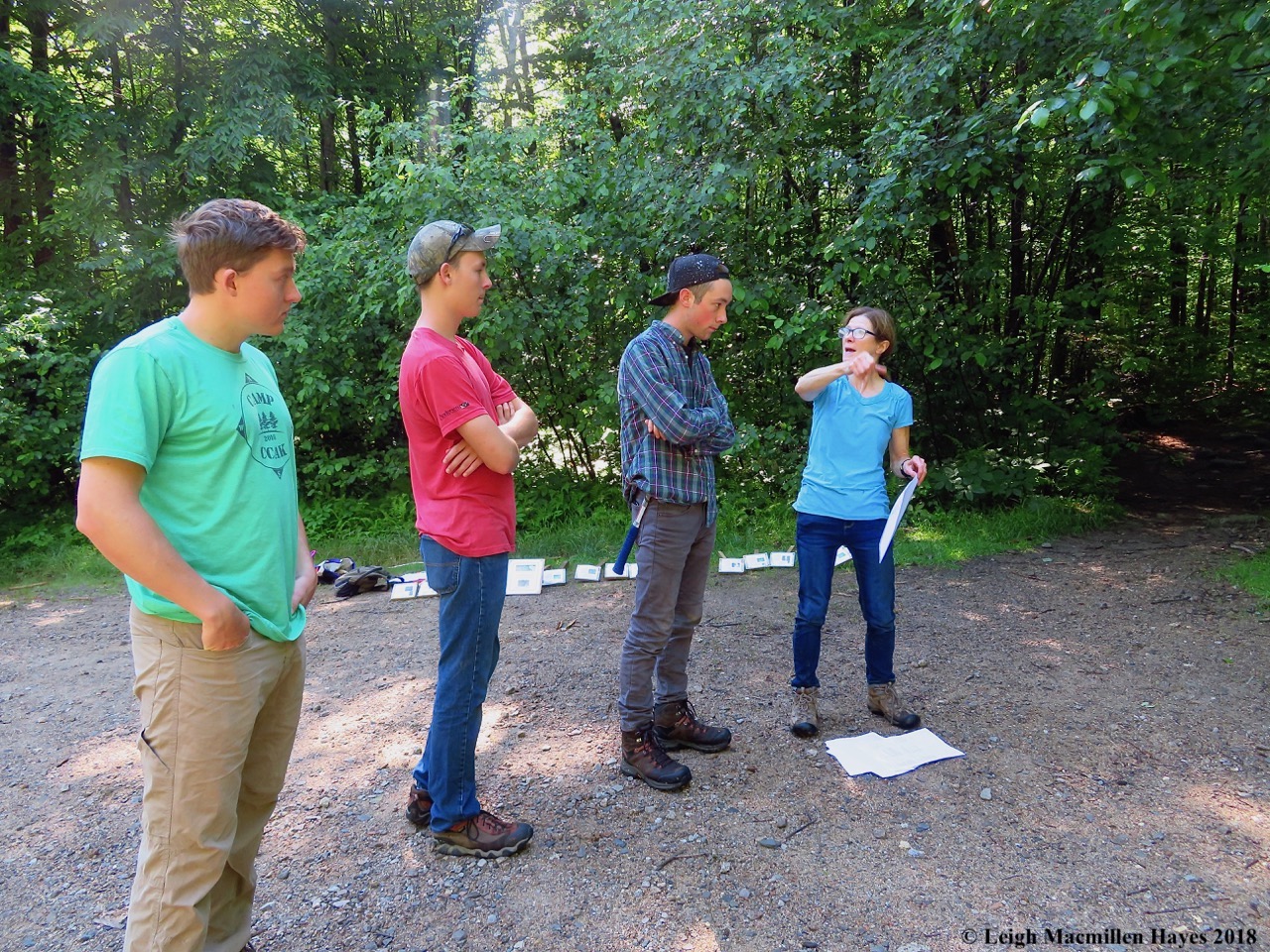
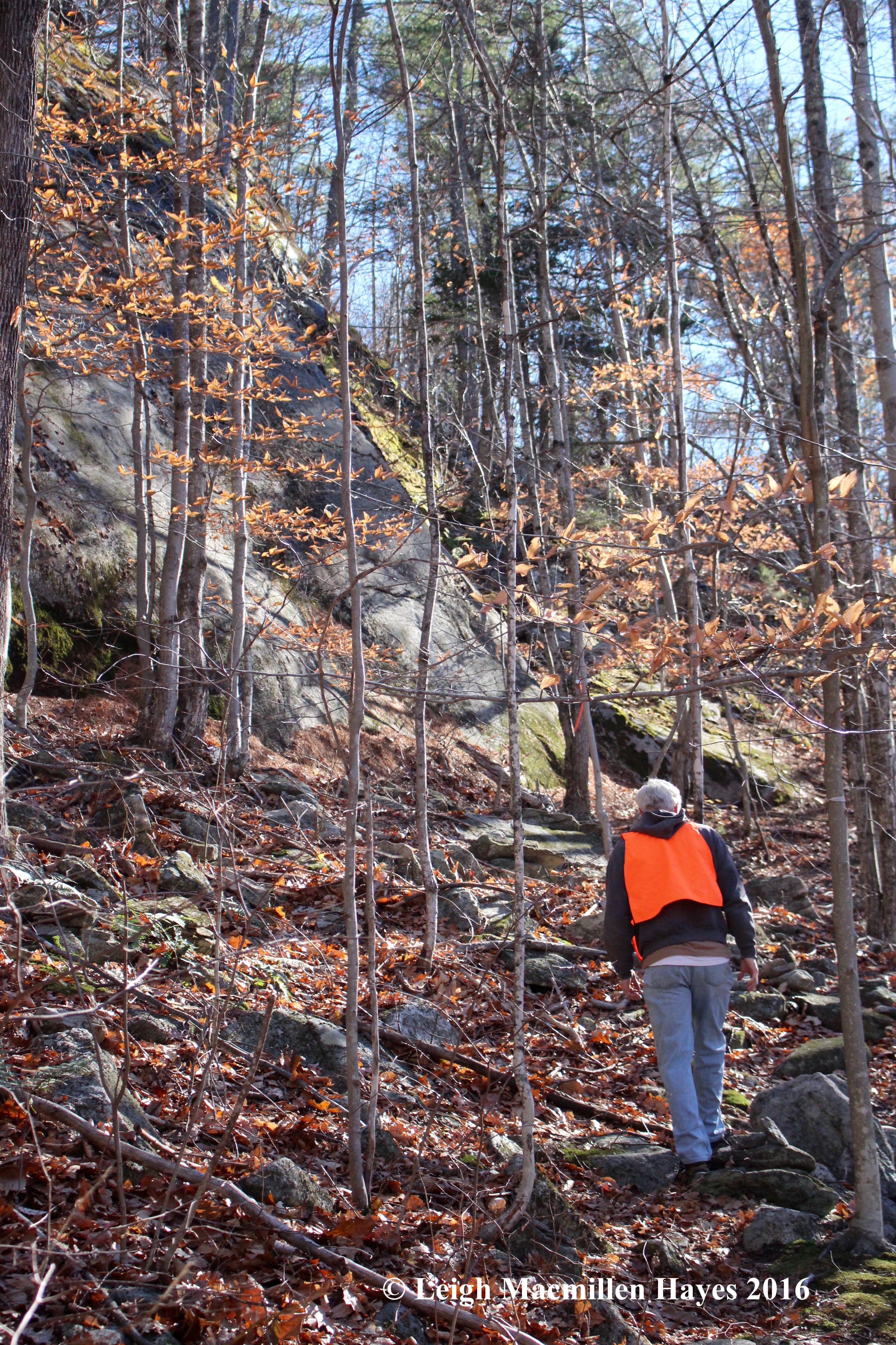
The morning began as Joan divided the team into two groups. First she instructed Intern Isaiah (in red) and Stewardship Associate Dakota (in plaid), to take one set of signs up the western trail and leave them beside examples of particular species on the way.

s5-all smiles to go

Then she prepped Associate Director Aidan, and GLLT Docents Nancy and Pam in the plan for the eastern trail.

s4-signs

All signs were laid out and ready to be hauled up the trails for installation.

s12-hi ho

And so, in true Seven Dwarf style, it was hi ho, hi ho and off to work we went.

s7-installing the first sign

Because she’d climbed the trail so often in order to prepare for today’s undertaking, Joan knew right where each sign belonged. At the start, she did most of the installing, showing off her muscle power on this steamy day, despite her petite physique.

s8-yellow birch

Each sign included common and scientific names, plus only a few key characteristics so not to overwhelm those who might stop to read them and look around to locate the particular species. It’s a technique decided long ago by the full team of docents who have undertaken this task each summer for years–always along a different GLLT trail.

s9-striped maple

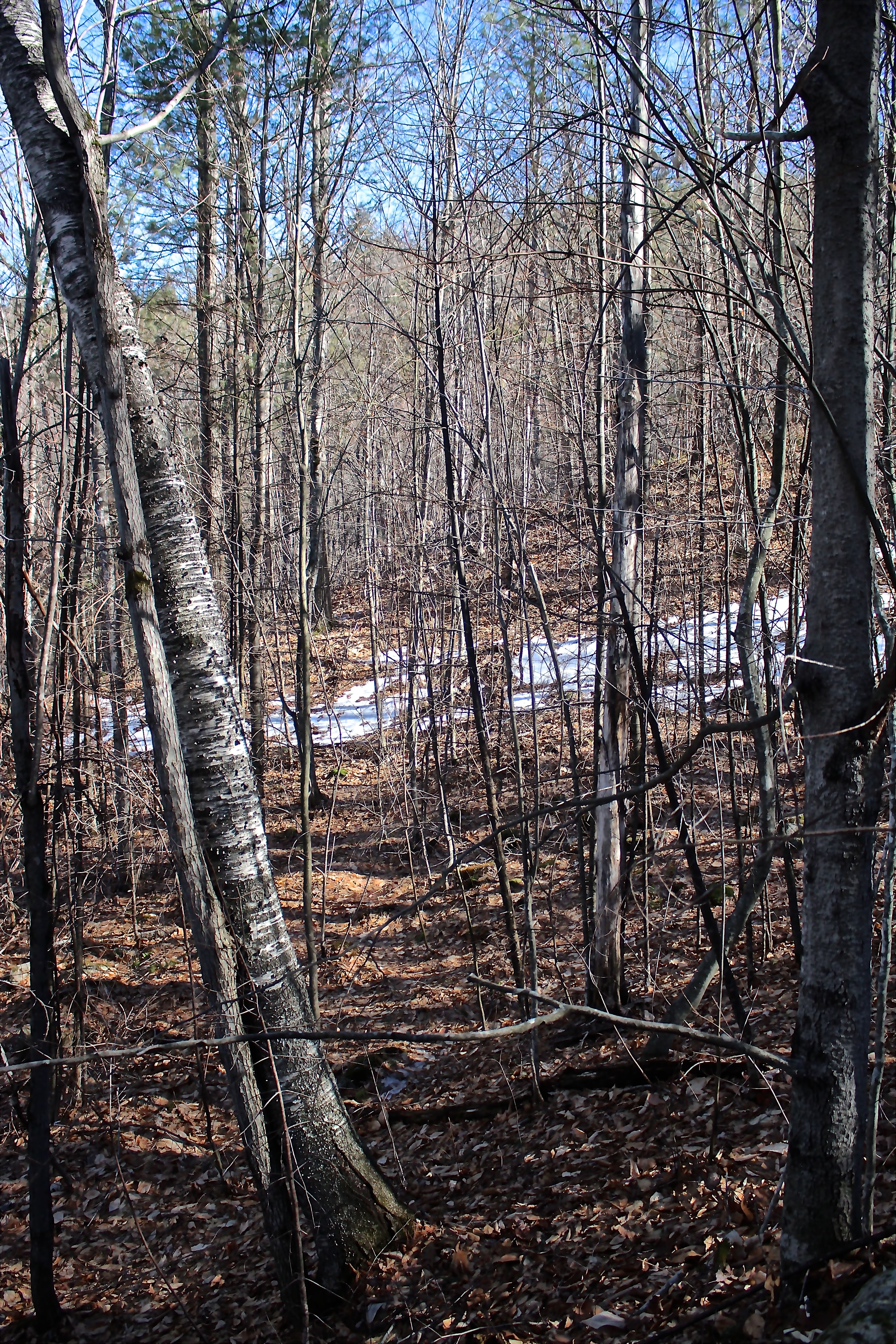
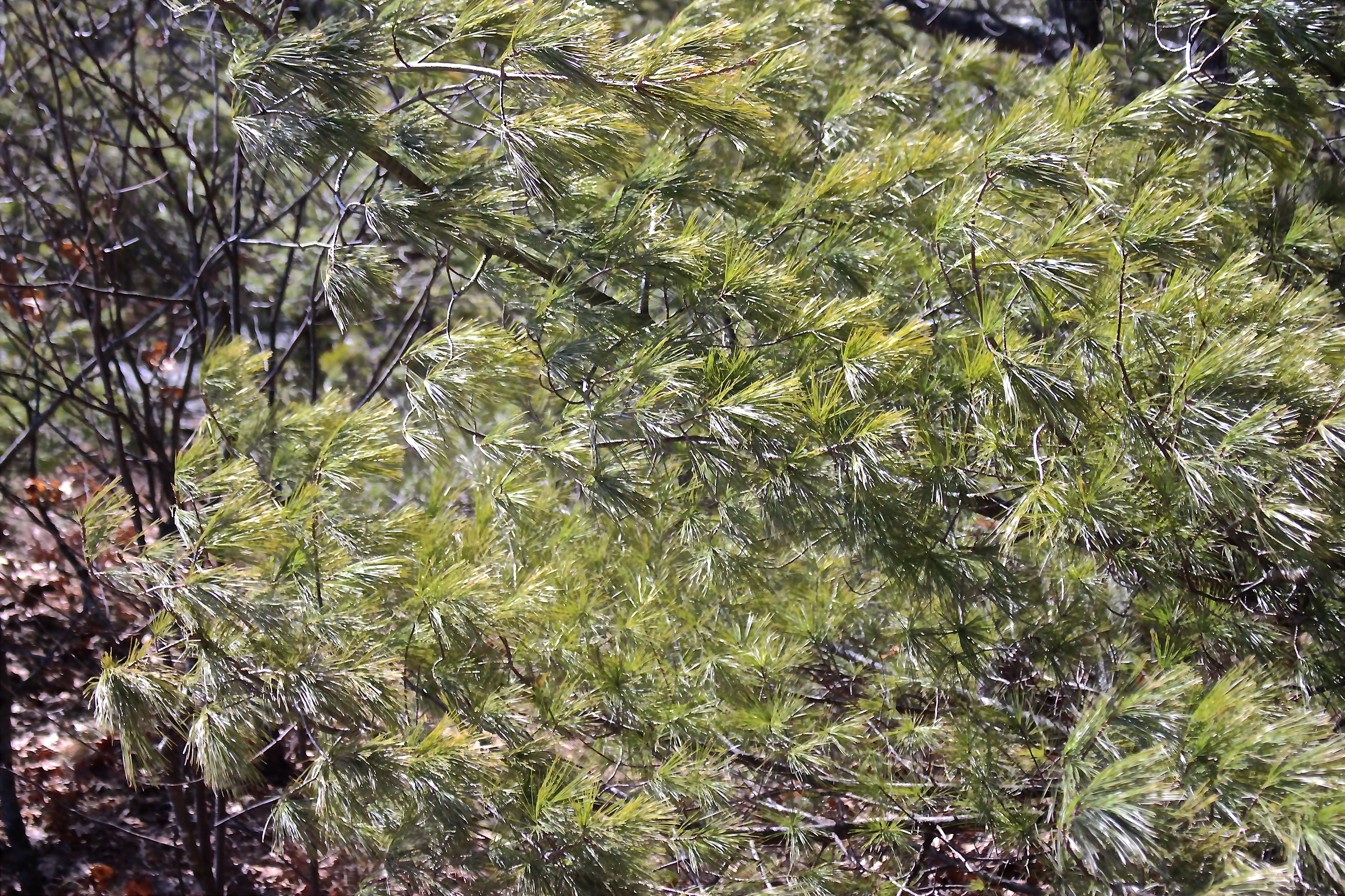
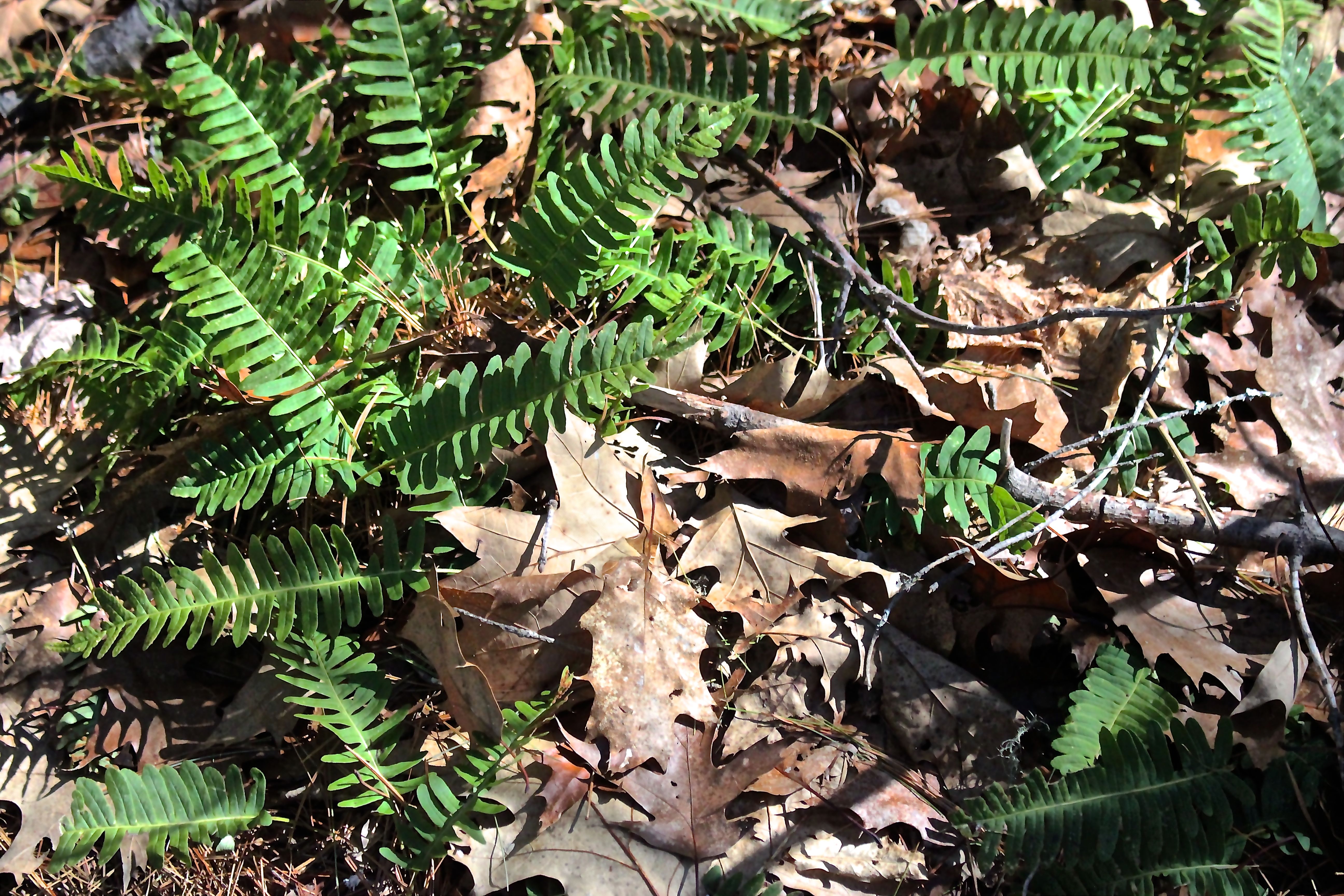
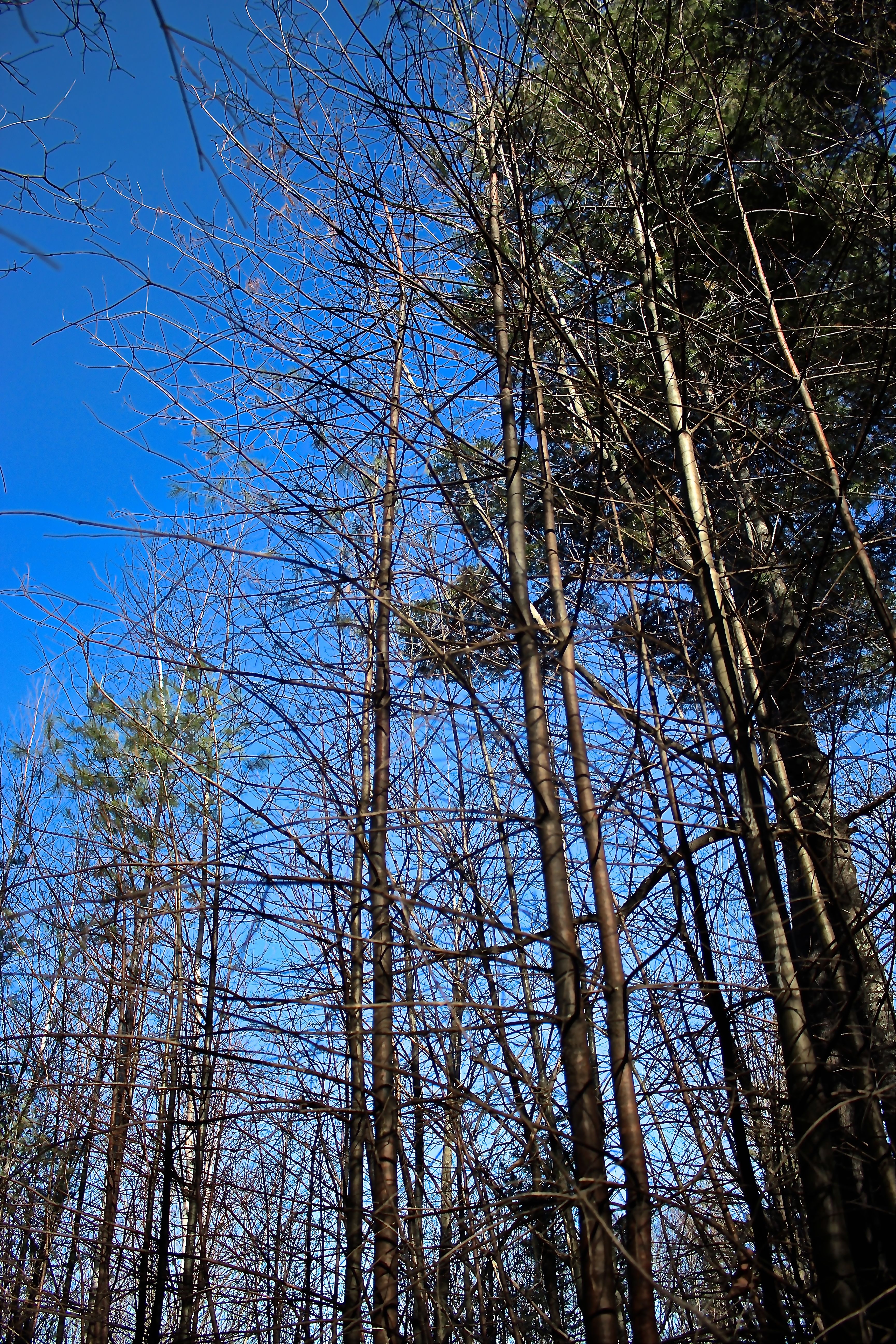
The natural community along both trails on the loop system transitioned about two-thirds of the way up. For the lower portion, the community consisted of a variety of deciduous trees.

s13-hemlock

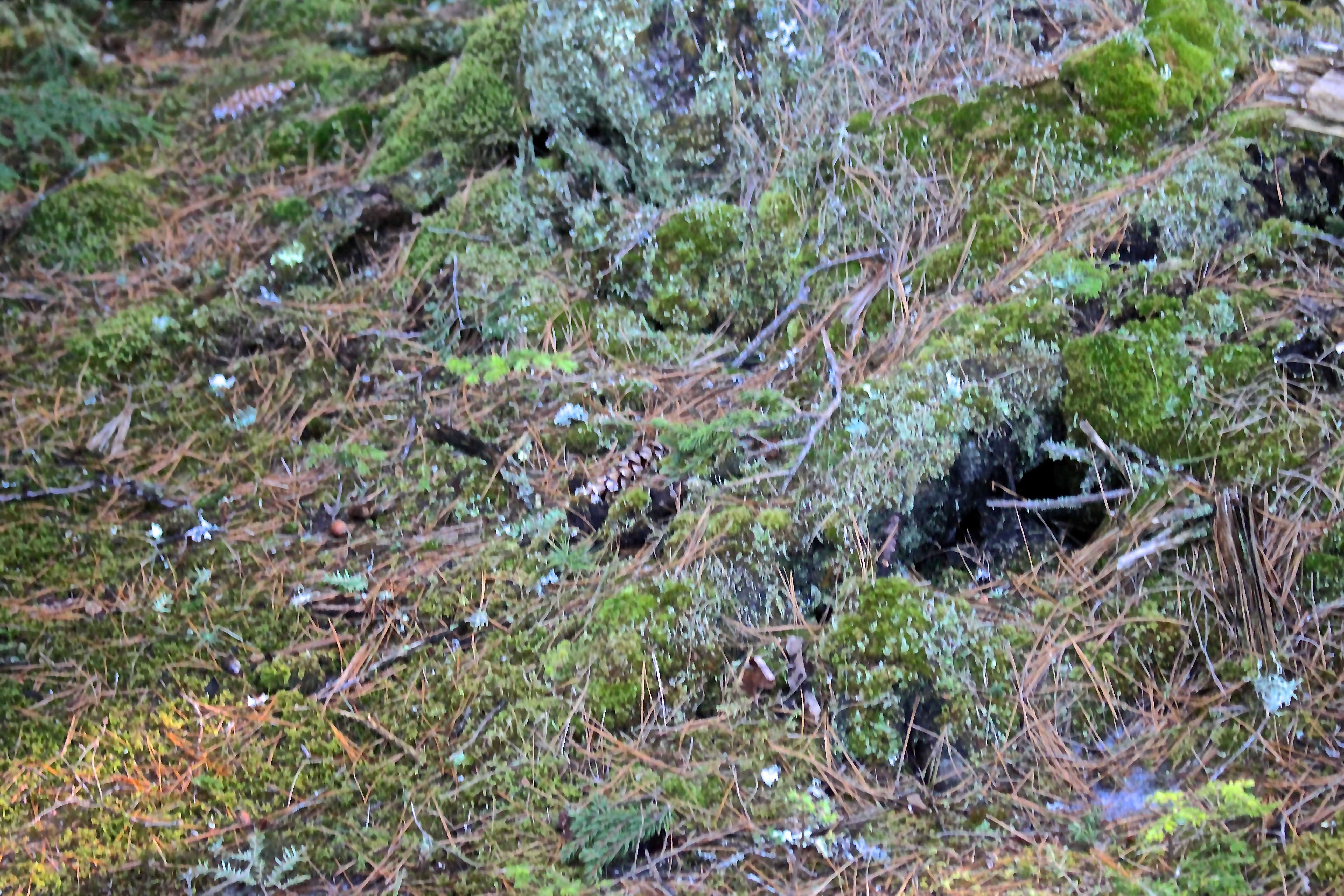
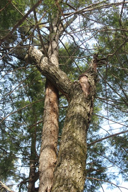
Suddenly everything changed. Light turned to shade. Dry turned to damp. Leaves turned to needles. And conifers showed off their unique characteristics.

s14-sphagnum moss

Even the forest floor changed from dried leaves and wildflowers to green mosses, including sphagnum, with its pom-pom shaped heads.

s15-loop trail sign at ridge

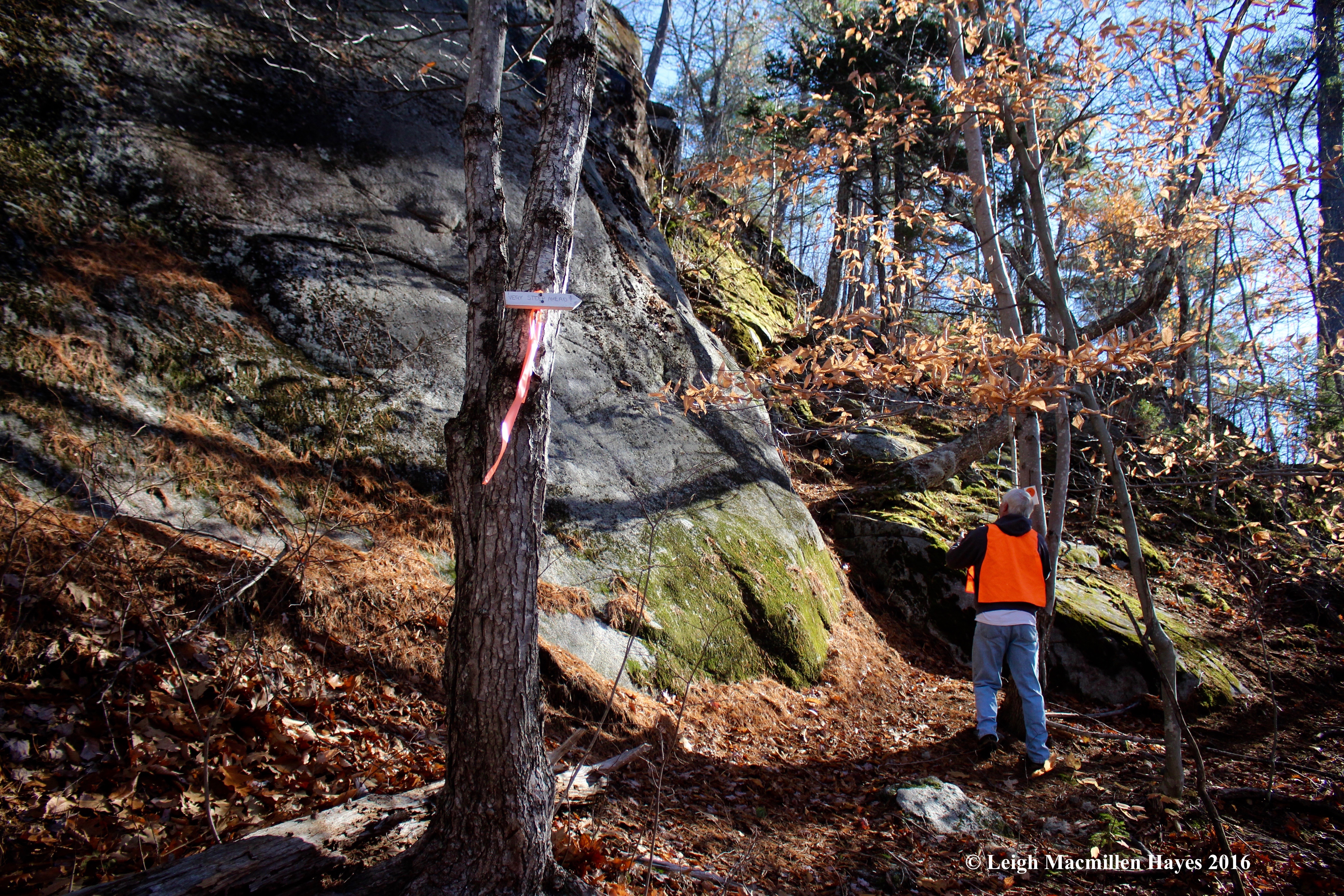
As we hiked up the eastern trail, Dakota and Isaiah swung along the ridge line and came down to find us for they had only placed their signs along the western trail as instructed by Joan, and hadn’t yet pounded them into the earth. We chatted as we moved upward, talking about the turn ahead to the ridge, and Dakota told us we’d be pleased with how obvious it was since Brent had installed the new signs. Indeed!

s16-glacial erratic

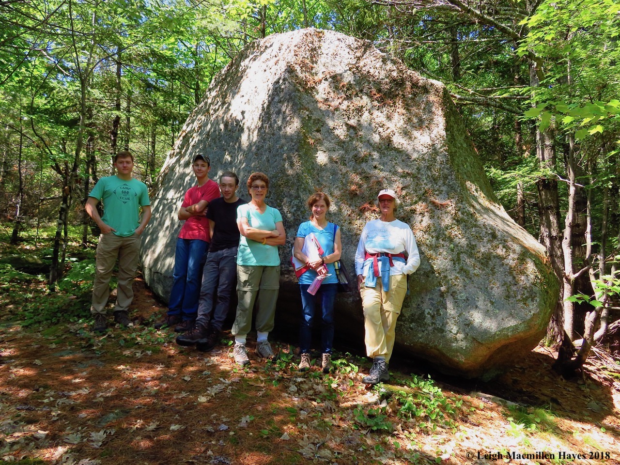
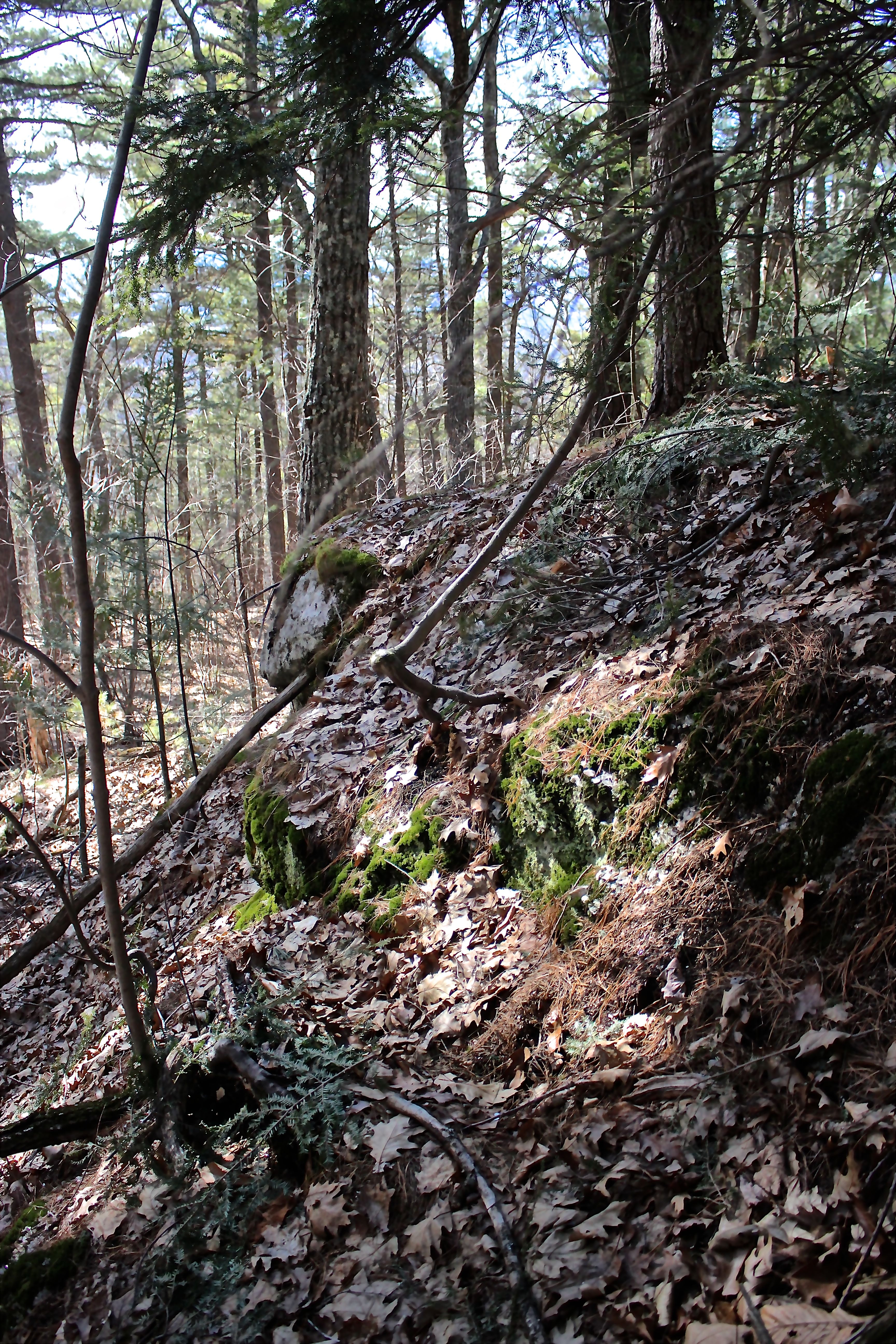
Of course, we were a group that failed at following directions, and so off trail we went to check on the glacial erratic that we knew stood just beyond a downed tree.

s17-porcupine scat

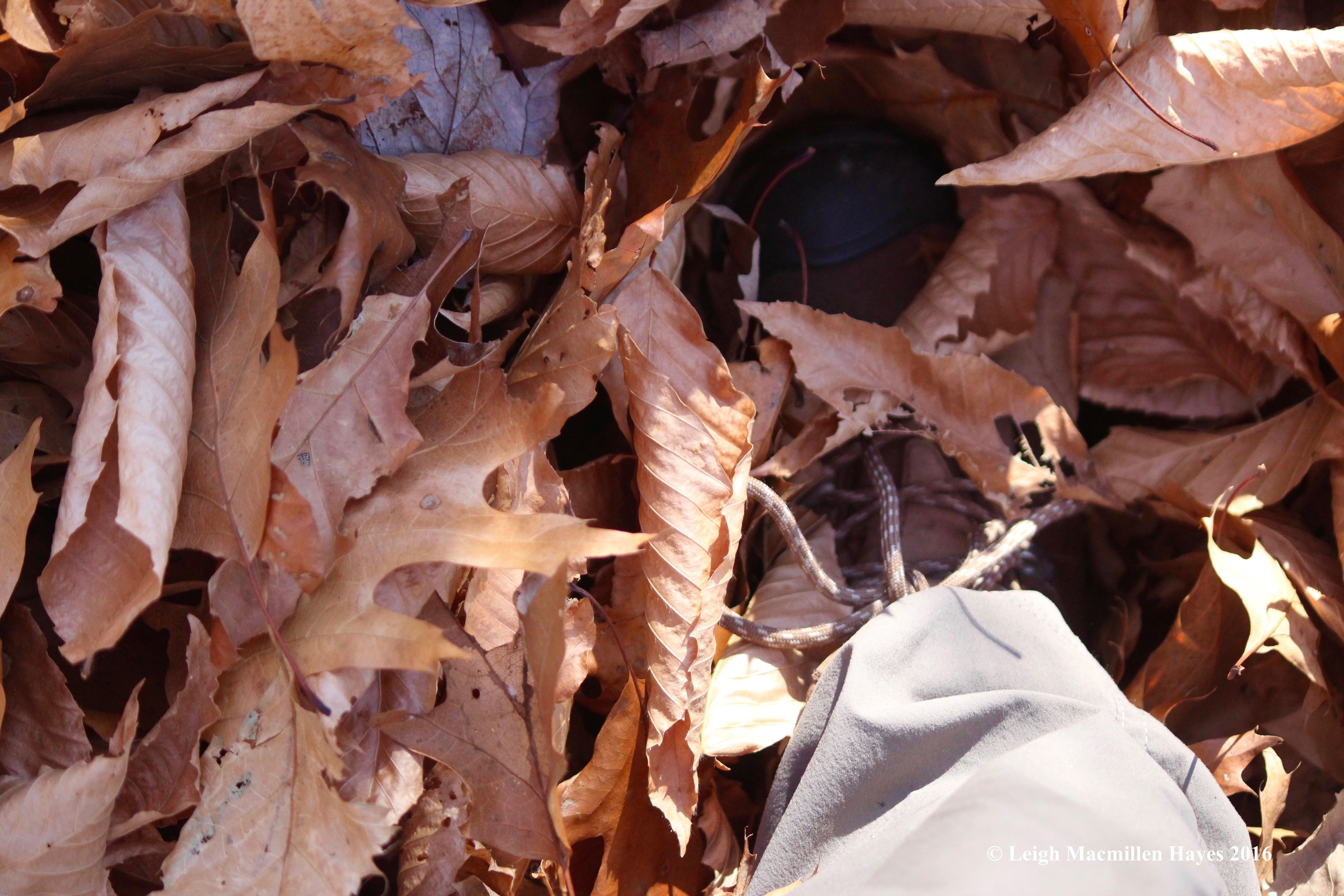
We also checked underneath, for who doesn’t like to look at porcupine scat. New and old, though not especially fresh, it’s been a winter den for at least 30+ years that I’ve been climbing this mountain.

s18-Canada mayflower

And then Joan redirected us, pulling us back into the mission of the morning and finding a place to post the Canada Mayflower sign–between the granite slabs at our feet.

s19-window on the world beyond

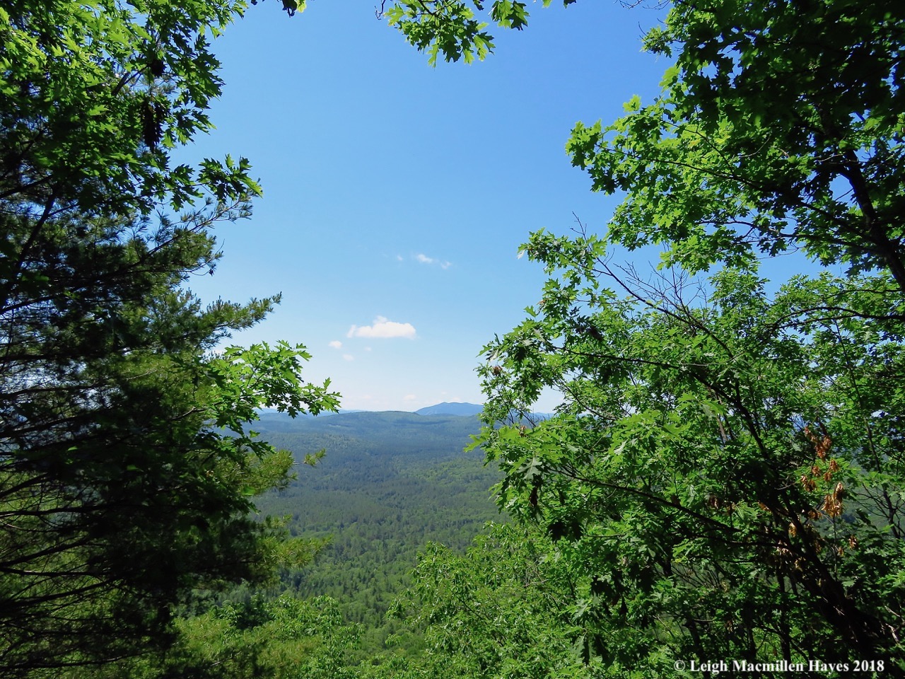
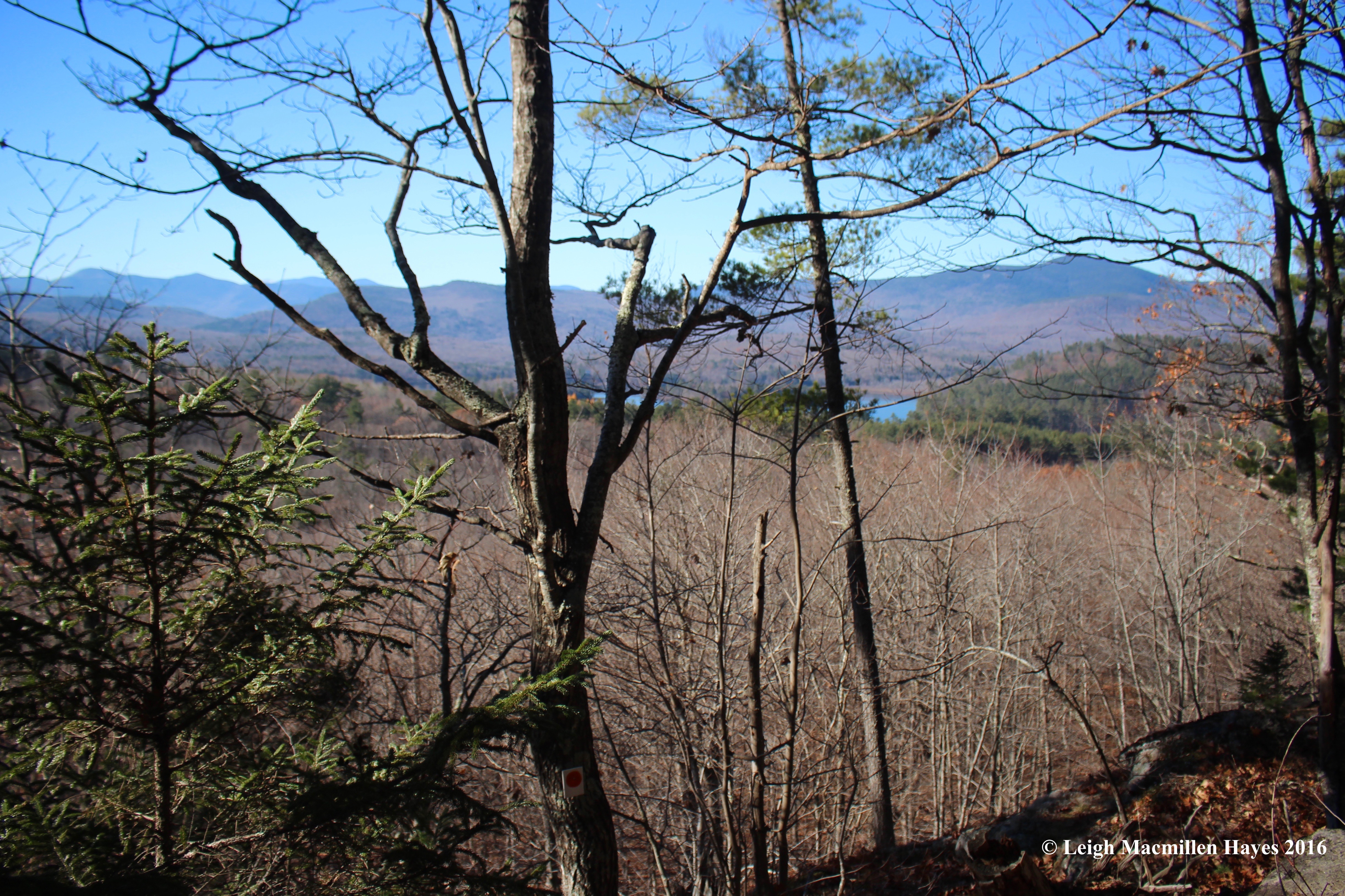
Making our way across the ridge, we paused for a second to look out the window upon the world beyond. It’s from heights like this one that we always appreciate how much of Maine is still forested. At a recent gathering with District Forester Shane Duigan, he said that the state is 85% forested–down from 90% not because of urban sprawl, but instead increased farming.

s20-main summit signs

A few minutes later we reached the main summit, where Brent had posted more signs. They’re nailed to a White Pine and mark the intersection of the ridge trail and western loop, with a spur to the western-facing ledges and scenic overlook.

s21-white pine

That very White Pine was also on Joan’s list as an excellent example, and so it will be noticed for a while.

s22-Keyes Pond and Pleasant Mtn

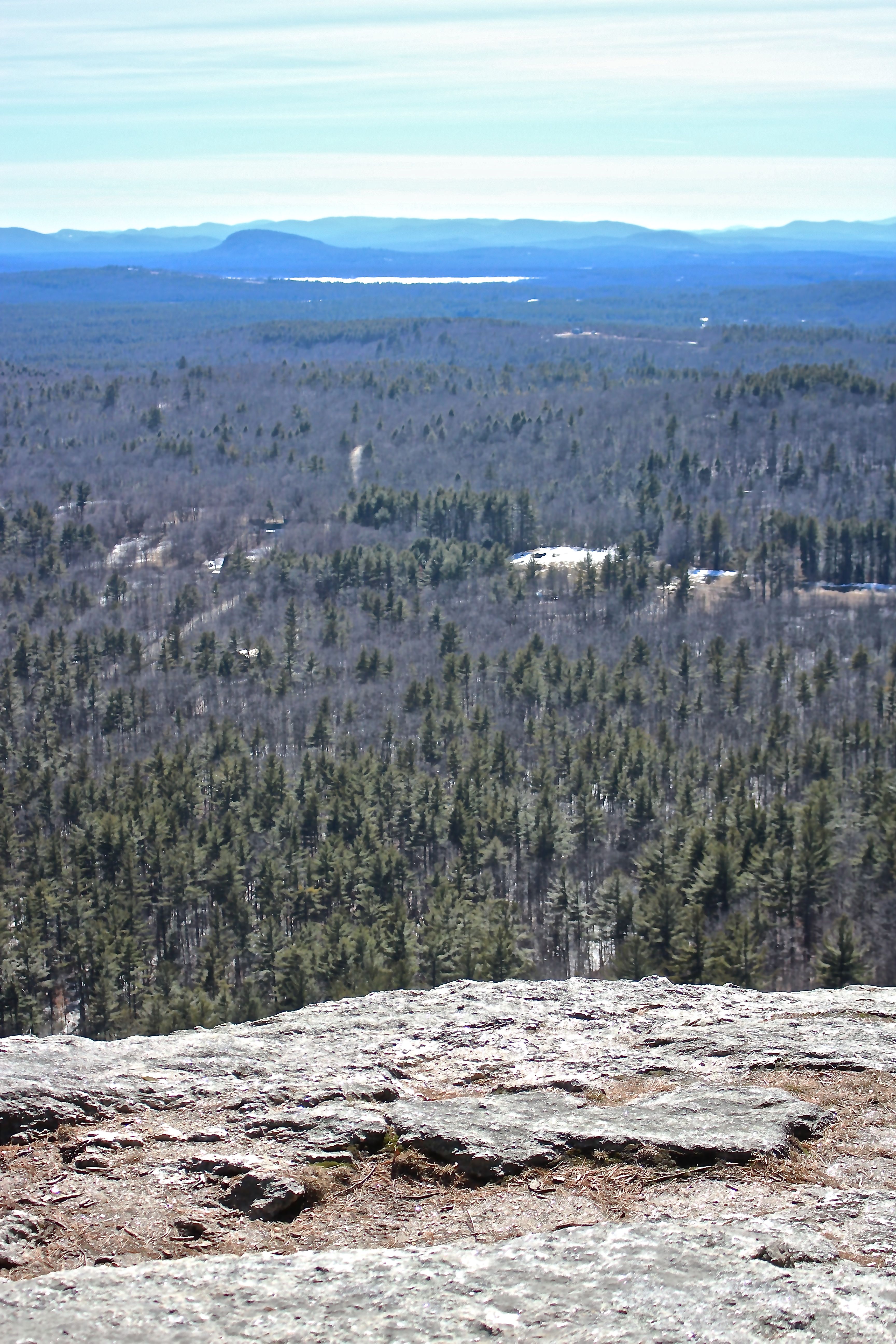
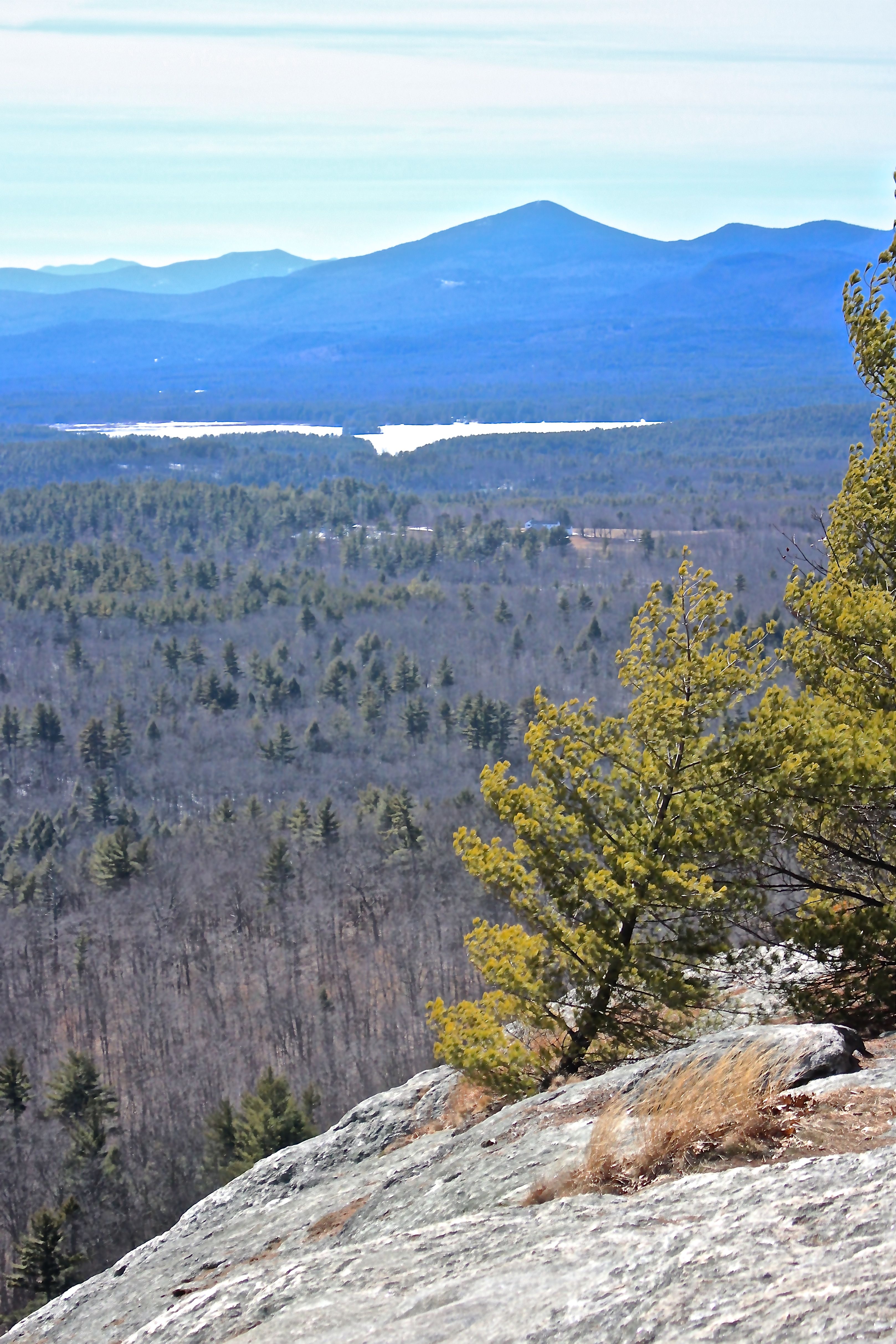
For a few minutes, we took in the wider view to the south–noting Keyes Pond in Sweden and Pleasant Mountain in Bridgton, both part of the great beyond.

s23-scenic view

And then a quick trip out to the scenic overlook, where the sweeping view included the Lower Bay of Kezar Lake and pyramid outline of Mount Kearsarge in North Conway.

s24-scenic view 2

Turning a wee bit to the north, the view also encompassed more of Kezar Lake, and the White Mountains.

s25-chipmunk

On the way down, we continued, or rather, the rest of the team continued to install the signs while I watched, and one quiet chipmunk with a piece of a leaf dangling from its mouth looked on with approval. We assumed it approved, for it didn’t chatter at us.

s26-teamwork

It seemed the signs on the western trail went into place far more quickly than on the climb up, but maybe it was because there weren’t as many. We did pause for a few minutes as Isaiah and Dakota changed out one sign for another because the species Joan wanted to feature wasn’t as prominent as hoped. But, she was prepared with extra laminated cards and quickly produced a description of an alternate species.

s27-plank

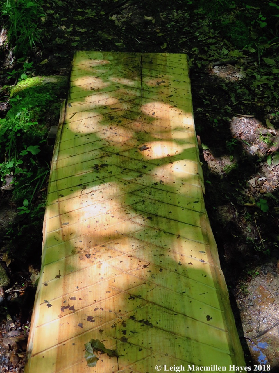
We were nearly finished with our morning’s work when we reached the new plank bridge Brent had placed across a small stream.

s28-white admiral

Back at the parking lot, we were wowed by the sight of pollinators upon the Staghorn Sumac, including a White Admiral Butterfly.

With that, our tour was done for the day, but we’d met several people along the way who were thrilled with the work we’d done. We hope you, too, will partake of the pleasant hike up Sabattus Mountain, and stop along the way to enjoy the self-guided tour. It will be in place until Labor Day weekend.

And be sure to stop by the office on Route 5 and make a contribution to the Greater Lovell Land Trust for we are a membership-driven organization and can’t do such work without your continued support.

P.S. Thank you Self-guided Tour Docents and GLLT staff, plus Property Steward Brent.


A Devil of a Mondate

Ever since I first saw a photo of a family donning their Sunday best and standing on rocks that form the “Devil’s Staircase” in Lovell, Maine, I’ve been intrigued.

d-historical-society

The photo and description on Lovell Historical Society’s Web site refers to a “staircase” on Sabattus Mountain. And so for years I imagined the staircase leading to that summit, but never located it. And then I learned that a section of trail at the Greater Lovell Land Trust’s Heald and Bradley Pond’s Reserve had earned the same name. Is there a staircase at Sabattus? Or was it accidentally misidentified? Whatever the case, when I suggested to my guy that we attempt the staircase off Route 5, he embraced the opportunity. (I’ve since learned from several friends that indeed, there is a staircase on Sabattus and the photo likely was taken there. The base of the staircase is apparently on private property and no longer a safe climb.)

d-trail-map

And so about noon we ventured forth and figured out a direction that would take us up the steep portions of the trail to the staircase and El Pulpito, and then down the easy trail–with hope that there was such a thing as an easy trail.

d-easy-trail

Actually, at the start it all seemed quite easy as I followed our Monday tradition of racing to keep up.

d-arrow-heavenward

We chuckled when he found an arrow that aimed heavenward–perhaps a sign that all would be well.

d-turning-the-arrow

My guy played spin the arrow to set it toward our destination. (Actually, on the way down, he spun it the other way. Note to GLLT–perhaps this arrow needs two nails.)

d-approaching-ledges

Minutes later, we approached the ledges and visions of bobcats danced through my head.

d-contemplating-the-climb

Acting as our scout, my guy contemplated the upward advance.

d-very-steep

We were forewarned and chose to bypass a bypass.

d-starting-up

He started up what we believed to be the same trail traveled by those Sunday venturers.

d-following-my-guy-up

I followed but not quite as speedily.

d-heading-up

My heart pounded in Edgar Allen Poe manner as I followed him up. I have to admit that there was a point where I wanted to turn around and climb down, but wasn’t certain that would be any easier. And so after pausing for a few moments, I tried to put mind over matter and placed my hands and feet in what seemed to be “safe” spots as I continued to climb.

d-view-from-above-staircase

Above the staircase we were rewarded with a vantage point of Kezar Lake and the White Mountains and a chance to slow down our heartbeats.

d-lunch-view

And later, at El Pulpito, the pulpit, the complete opposite of the Devil’s Staircase–a place to pause, eat PB&J sandwiches, and contemplate life in a relaxed manner.

d-water-at-summit

Within an hour we reached the summit of Amos Mountain and spent some time being.

d-hazy-view-at-summit

Though the sun was in our eyes, the view south was a bit hazier than one would expect on a clear November day. We later learned that a forest fire burned in Albany, New Hampshire.

d-trail-down

For our descent, we followed the blue blazes of the Amos Mountain Trail.

d-tree-across-trail

Though hardly as steep as the climb up, I was thankful for a few downed trees that slowed my guy–momentarily.

d-boot-disappears

The beech and oak leaves were over a foot deep in places and obscured rocks and roots, making for a slippery slide down.

Nevertheless, we did it. Devil’s Staircase up and a devil of a climb down–and yet, two hours later we knew we’d do it again.


Spotlight on Sabattus

Following this morning’s Greater Lovell Land Trust trek at Chip Stockford Reserve, where we helped old and new friends form bark eyes as they examined various members of the birch family, my feet were itchy. Not in the scratchy sort of way–but rather to keep moving.

It was a lovely day for a hike and Sabattus Mountain in Lovell was my destination. I love this little mountain because it offers several different natural communities and great views.

s-com 1

Though there are a few softwoods on the lower portion of the trail, it’s really the land of a hardwood mix.

s-downed twigs

About halfway up, the neighborhood switches to a hemlock-pine-oak community. It was then that I began looking for downed hemlock twigs in an array at the base of trees. I’ve found them here before, and today I wasn’t disappointed.

s-porky chew 3

The twigs had been chewed off and dropped by a porcupine as evidenced by the 45˚-angled cut and incisor marks. Though red squirrels also nip off the tips of hemlock twigs, they do just that–nip the tips. Porcupines cut branches.

s-porky cliff

Downed branches usually mean scat, but I searched high and low and under numerous trees that showed signs of activity and found none. A disappointment certainly.

s-pippipsewa

My search, however, led me to other delightful finds that are showing up now that most of the snow has melted, like this pipsissewa that glowed in the afternoon sun. As is its habit, the shiny evergreen leaves look brand new–even though they’ve spent the winter plastered under snow and ice. A cheery reminder that spring isn’t far off.

s-Pleasant 1

At the summit, I got my bearings–the ridge of Pleasant Mountain and Shawnee Peak Ski Area to the southeast.

s-mount tom & kezar pond

To the southwest, the asymmetrical Roche Moutonnée, Mount Tom, visible as it stands guard over Kezar Pond in Fryeburg.

s-Kearsarge 2

And to the west, Kezar Lake backed by Mount Kearsarge in New Hampshire. I wanted to venture further out on the ledge, but some others hikers had arrived and I opted not to disturb their peace.

s-summit wind

Instead, I sat for a few minutes and enjoyed the strong breeze offering possibilities as it floated over the summit and me.

s-porky cuts1

Crossing the ridge, I left the trail and found more porcupine trees, including this young hemlock that had several cuts–look in the upper right-hand corner and lower left hand. A number of younger trees along this stretch will forever be Lorax trees.

s-golden moonglow1

On the outcrop of quartz, I paused to admire the golden moonglow lichen–it’s almost as if someone drew each hand-like section in black and then filled in the color, creating an effect that radiates outward.

s-polypody patch

I was pleasantly surprised to find a patch of polypody ferns on what appears to be the forest floor but was actually the rocky ridge. Notice how open-faced it is, indicating that the temperature was quite a bit warmer than what I’d seen on cold winter days.

s-polypody sun

Sunlight made the pinna translucent and the pompoms of sori on the backside shone through.

s-glacial 1

The trail doesn’t pass this glacial erratic, but I stepped over the logs indicating I should turn left and continued a wee bit further until I reached this special spot.

s-porky scat 1

Its backside has been a porcupine den forever and ever. Nice to know that some things never change.

s-hemlocks and oaks

After returning to the trail, I followed it down through the hemlocks and oaks. This is my favorite part of the trail and though it’s a loop, I like to save this section for the downward hike–maybe because it forces me to slow down.

s-fairies 1

For one thing, it features the land of the fairies. I always feel their presence when here. Blame it on my father who knew of their existence.

s-fairies 2

I had a feeling a few friends were home–those who found their way into a fairy tale I wrote years ago. I left them be–trusting they were resting until this evening.

s-community transition 1

As swiftly as the community changed on the upward trail, the same was true on my descent.

s-birch bark color

On our morning trek, we’d looked at paper birch, but none of the trees we saw showed the range of colors like this one–a watercolor painting of a sunset.

s-birch bark 1

This one shows the black scar that occurs when people peel bark. The tree will live, but think about having your winter coat torn off of you on a frigid winter day. Or worse.

s-black birch 1

Off the trail again, I paused by a few trees that I believe are black birch. Lately, a few of us have been questioning black birch/pin cherry because they have similar bark. The telltale sign should be catkins dangling from the birch branches. I looked up and didn’t see catkins, but the trees may not be old enough to be viable. This particular one, however, featured birch polypores. So maybe I was right. I do know one thing–it’s not healthy.

s-pines 2a

And then I reached a section of trail that I’ve watched grow and change in a way that’s more noticeable than most. I counted the whorls on these white pines and determined that they are about 25 years old. I remember when our sons, who are in their early twenties, towered over the trees in their sapling form. Now two to three times taller than our young men, the trees crowded growing conditions have naturally culled them.

s-birch planter

Nature isn’t the only one that has culled the trees. Following their selection to be logged, however, some became planters for other species.

s-3 trees

Nearing the end of the trail another view warmed my heart. Three trees, three species, three amigos. Despite their differences, they’ve found a way to live together. It strikes me as a message to our nation.

Perhaps our leaders need to turn the spotlight on places like Sabattus. It’s worth a wonder.


Mountain Mondate

Sabattus Mtn sign

Our Monday date took us to Sabattus Mountain in Lovell this morning. It’s an easy trek offering great views, lots of wildlife activity and a decent workout in a short amount of time.

trail sign

Which way should we go? I ask myself that question over and over again. Habit took us up the right-hand trail, but in hindsight, maybe we should have mixed it up this time. A life lesson?

burl

Check out this burl. Over and under and around, oh my!

transition 1

I stood at this spot on the trail and looked down–Lots of beech, hemlock, birch and maple in the mix.

transition 2

And then I turned to look up the trail. Oak, pine and hemlock dominated the scenery. A transition point.

growing apart

Speaking of transitions, this hemlock grew apart after a couple of years. With two rather than one terminal leaders growing side by side, they eventually found their way back together.

and together again

Here they are woven back together–it’s almost difficult to tell that the two have become one. It made me think of our relationship as we trekked up the mountain. Maybe this tree didn’t really grow apart, the two parts just respected each other as their life together began and they allowed each other to continue growing in their own way, knowing that they needed to stay together ultimately because being united and supportive is what it’s all about. And maybe I’m reading way too much into a natural occurrence.

porcupine 1

A porcupine tree. Lots of porcupine activity in the hemlock grove both on this trail and on the way down.

porc trail

A well-traveled porcupine trail.

fire tower

The concrete stanchions that once supported a fire tower. Apparently, the tower was removed in 1963.

bench 1

Perfect spot for a hot cocoa break.

oake and pine

Eastern White Pine and Northern Red Oak–looks like the oak is ahead in the race to the sun right now. I wonder if that’s how it will play out over the years.

buried bench

And then there’s the other bench at the summit. We couldn’t actually sit on this one.

bobcat 1

Heading along the ridge, we found these prints that always excite me. This critter had traveled to and fro before going off trail. Notice the “C” shape between the toes and the pad. C is for cat. Yup, a bobcat. And it was at some point in the last six hours or so, because we’d had a dusting of snow. These were fresh. Yippee!

bobcat2

A bobcat is a “perfect” walker. Ah, perfection. But really, it places a front foot down, and as that foot moves forward, the hind foot steps into its place. I think you can see that here–it looks like it might be two feet sharing almost the same space.

bobcat dinner?

Breakfast? The bobcat obviously snatched some little brown thing–or tried to. This was just off the man-made snowshoe trail and right by the ledge. I was a bit surprised that the cat had followed the trail for as long as it had. They usually cross our trails and have their own corridor. But, it sure makes for easier traveling to follow where others have gone before.

old oak

This old oak has seen better days. Amazing that it’s still standing.

support of a friend

But then I looked up. We all need the support of a friend. In this case, the friend is a white pine. They may compete for sunlight, but apparently they can count on each other occasionally.

heading down

Heading down. Transitioning again. There were a zillion snowshoe hare trails. And  mice. And squirrel. Good feeding grounds for a bobcat.

lunch 3

We finished up our trek before we were hungry for lunch. But, when hunger struck we ate PB&J sandwiches beside Kezar Lake.

Thanks for wondering along on this wander through the Maine woods.