Breaking Tradition

While most people gathered round a table to share a feast yesterday, my guy and I decided to give thanks in a different manner . . .

And pardon the turkeys. Instead, it was chicken and cranberry relish sandwiches that we made in the morning, the ingredients locally sourced.

And then on to The Stone House in Evans Notch did we drive, our hearts grateful that there were only two other vehicles parked by the gate.

Our official journey began on White Cairn trail, where though we don’t always do what we’re told, this time we abided the sign, given that there was maybe a foot of water below. Otherwise, I’m sure we would have jumped in.

It’s a steady climb up Blueberry Mountain. Oak and beech leaves obscured rocks while hearts pumped vigorously. Because of the latter, my guy took a seat while I shed a couple of layers of clothing.

Part way to the summit, a look back revealed Shell Pond glimmering below.

And then in the middle of nowhere, which really is always somewhere, we met the official greeter–a cockeyed face that has weathered many a storm.

Lunch rock turned out to be Blueberry’s summit ledges, where we could again see the conch-like shape of the pond below, Pleasant Mountain’s ridge line in the far beyond, and a front moving our way by the look of the sky.

Though summer had escaped this mountain months ago, the flowers continued to grace the rocky landscape with their unique colors and seedpods, and of course, buds whispered hope for the future, this being Rhodora.

Among the mix was plenty of Sheep Laurel, its seed capsules reminding me of the jingle bells we’ll soon hear pealing Noel tunes.

Leaving Blueberry Mountain behind, we climbed more ledges where three types of reindeer lichen added their own hues and textures to the scene.

It’s a fairly long hike up and back at almost ten miles, which came into perspective when we noted the upper and lower bays of Kezar Lake in Lovell, which is about nine miles long.

Between open ledges, we frequently passed through conifer stands where occasionally we spied red-belted polypores on standing tree snags.

And then it was onward and upward again to the next conifer stand.

My heart sang within that stand when we came upon Hobblebushes, their leaf and flower buds donning hairy winter coats so unlike the waxy, scaled buds of the Rhodora and so many other shrubs and trees.

Sometimes the trail through the conifers had challenges to offer not in the form of slippery leaves, but rather ice. That’s why one packs micro-spikes at this time of year.

Those much more agile than us in this mountain terrain had already feasted and as usual left their garbage pile, aka midden, of spruce cone scales behind. They don’t observe “Leave no trace.” But it is for the Red Squirrels and all other critters and birds that we do.

It was early afternoon when we reached the second summit we sought–Speckled Mountain–where a fire tower once stood. Our pause was quick for we needed to climb down before dark. Though again, headlamps in the pack are another must have and we did.

First though, we enjoyed the view and a slice of chocolate chip pumpkin bread. Mount Washington’s snow-covered peak was part of the backdrop to the west.

It’s almost a 360˚ panorama from the top.

Daylight waned as we descended so we moved as quickly as possible.

But those views. Breathtaking with each step.

Finally back at Blueberry Mountain, we descended via Stone House Trail, which is far less challenging than White Cairn. And has bear claw trees.

Oft visited bear-claw trees.

This one even leaning as if it still recalls the mighty forager of its beech nuts.

My guy reminded me that I needed to stop looking for other such trees because the sun was low in the sky and we still had at least a mile to hike.

At about 4:20pm we reached the old airfield by the Stone House, having saved visits to Rattlesnake Pool and Gorge for another day.

Our reason for choosing to hike on this day–because it was my birthday and so as I’d promised my sister, who knows I did not receive the family’s musical gene, I sang from the mountain top where a breeze muffled my voice as it floated across the ridges and valleys to anyone who was listening below.

Walking arm in arm back to the truck as the sun set behind the Bald Face Mountains, my guy surprised me with a favorite tune that I love to hear him sing.

I have so much to be thankful for including all of you who join me either in person or virtually and help me get lost in wonder along the way.

But I am especially thankful to my family and my guy for letting us break tradition and pardon the turkey.

Wondering Beside Willard Brook

I dragged my guy along for a wander in the Hut Road neighborhood today and we made Willard Brook the center of our attention.

That being said, our journey began at Great Brook. I parked by the gate that isn’t open yet due to  road conditions–not realizing that the only other vehicle belonged to a friend, who kindly left us a note we found under the windshield wiper as we drove away hours later.

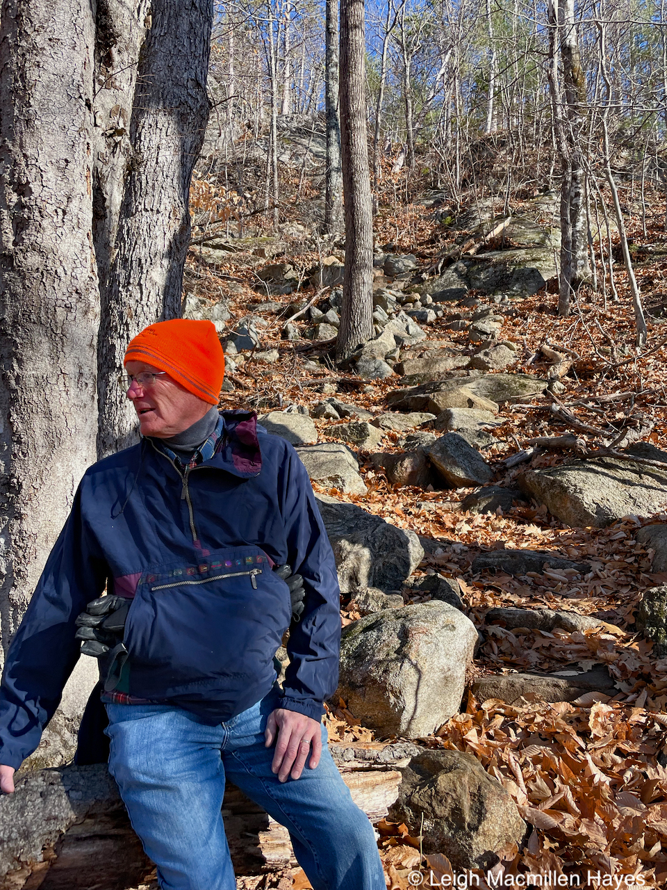
The wind was wild and we felt it rattle our bones while we walked along Forest Service Road #4. That just meant a fast walk to the start of our adventure.

h-Great falls

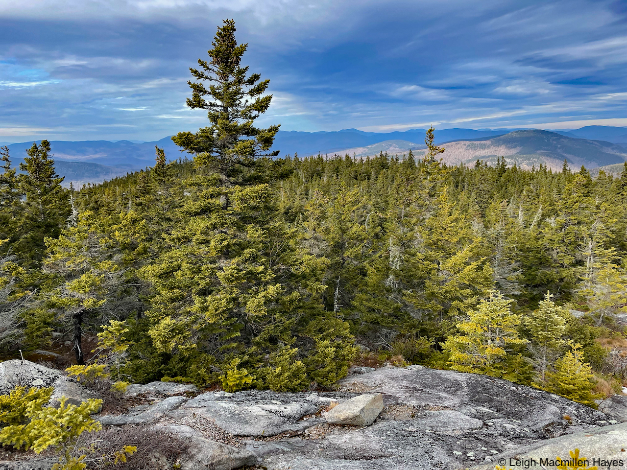
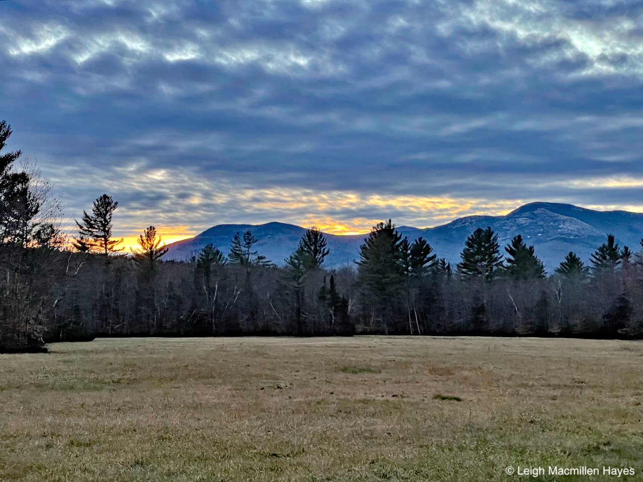
The beauty of this spot never ceases to take my breath away.

h-ice

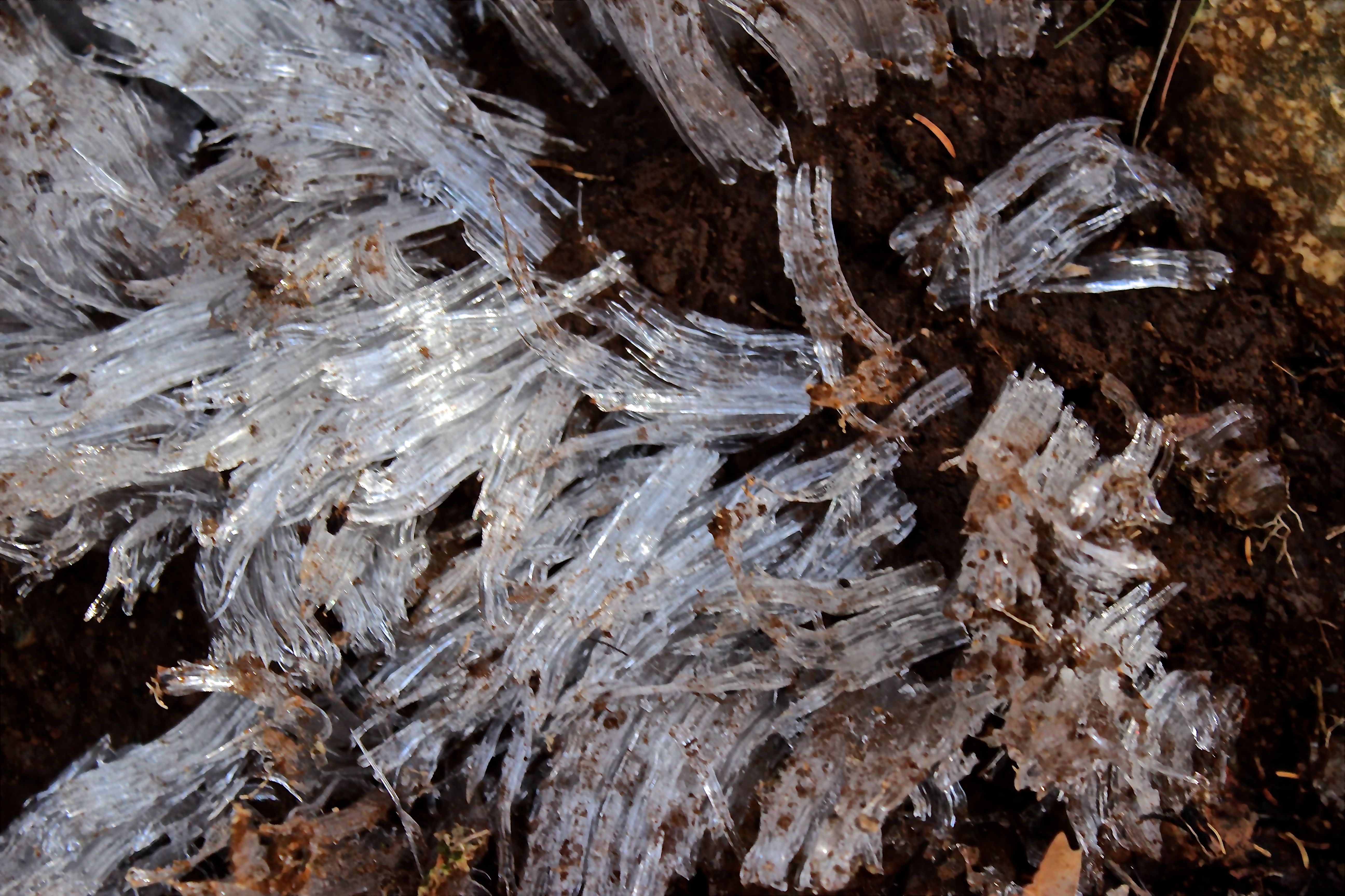
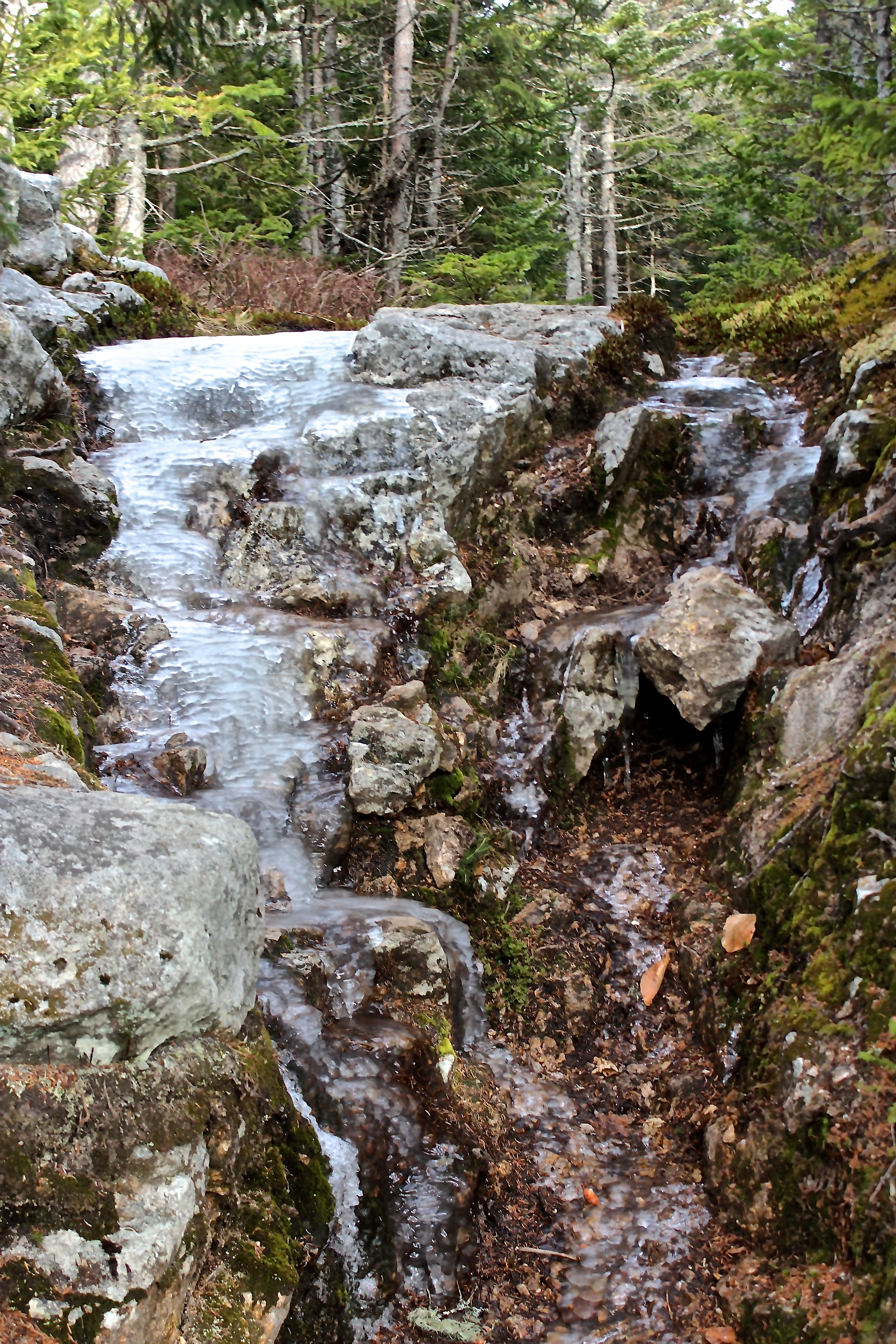
But we didn’t pause long because that wind was cold and icicles helped tell the story.

h-map

Lately, when I’ve tramped about in this area, I’ve been on the Great Brook Trail to start, but I contacted a few folks in the past two days because they’ve made comments on previous posts that indicated they have some understanding of the Native American presence that once existed here. And perhaps still does.

Stoneham_Hut_Road_1858_12-06-2015

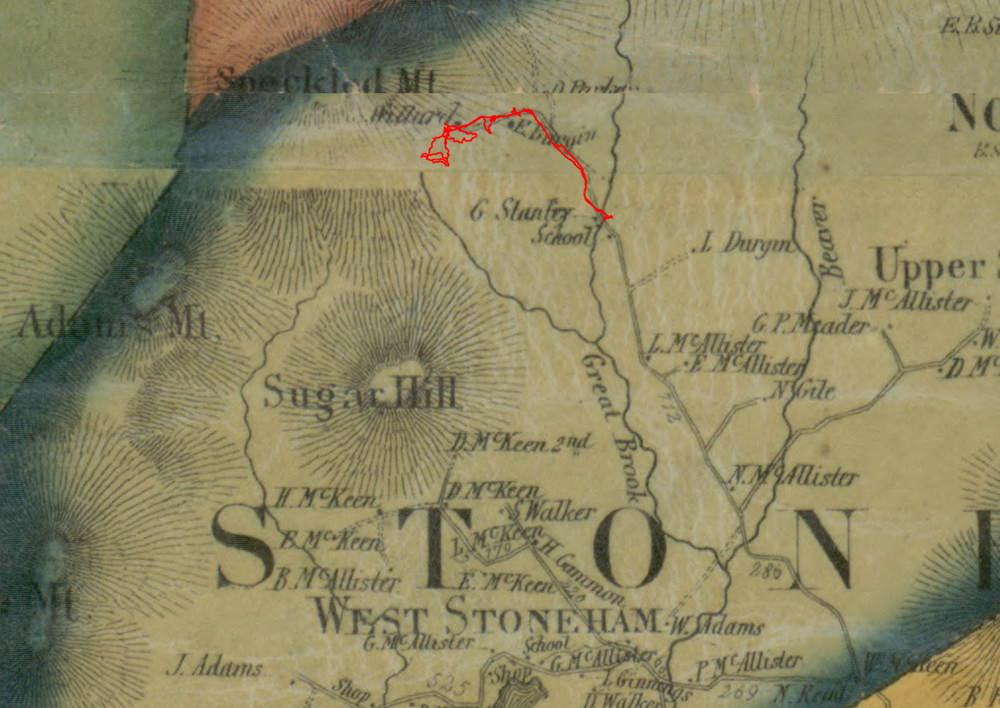
My friend, Jinny Mae, had intended to join us today, but that didn’t work as planned. She and I have explored this area a couple of times in the past few months and she’s my GPS techie, as well as a talented historian and naturalist. The above map is from a section of the 1858 map of Stoneham she posted. (Thanks JM for letting me borrow this without asking.)

Stoneham_Hut_Road_1880_12-06-2015

As Jinny Mae indicates on her blog, this is from the 1880 map and there’s been a change in ownership of the neighborhood homes.

h-stone pile beside willard

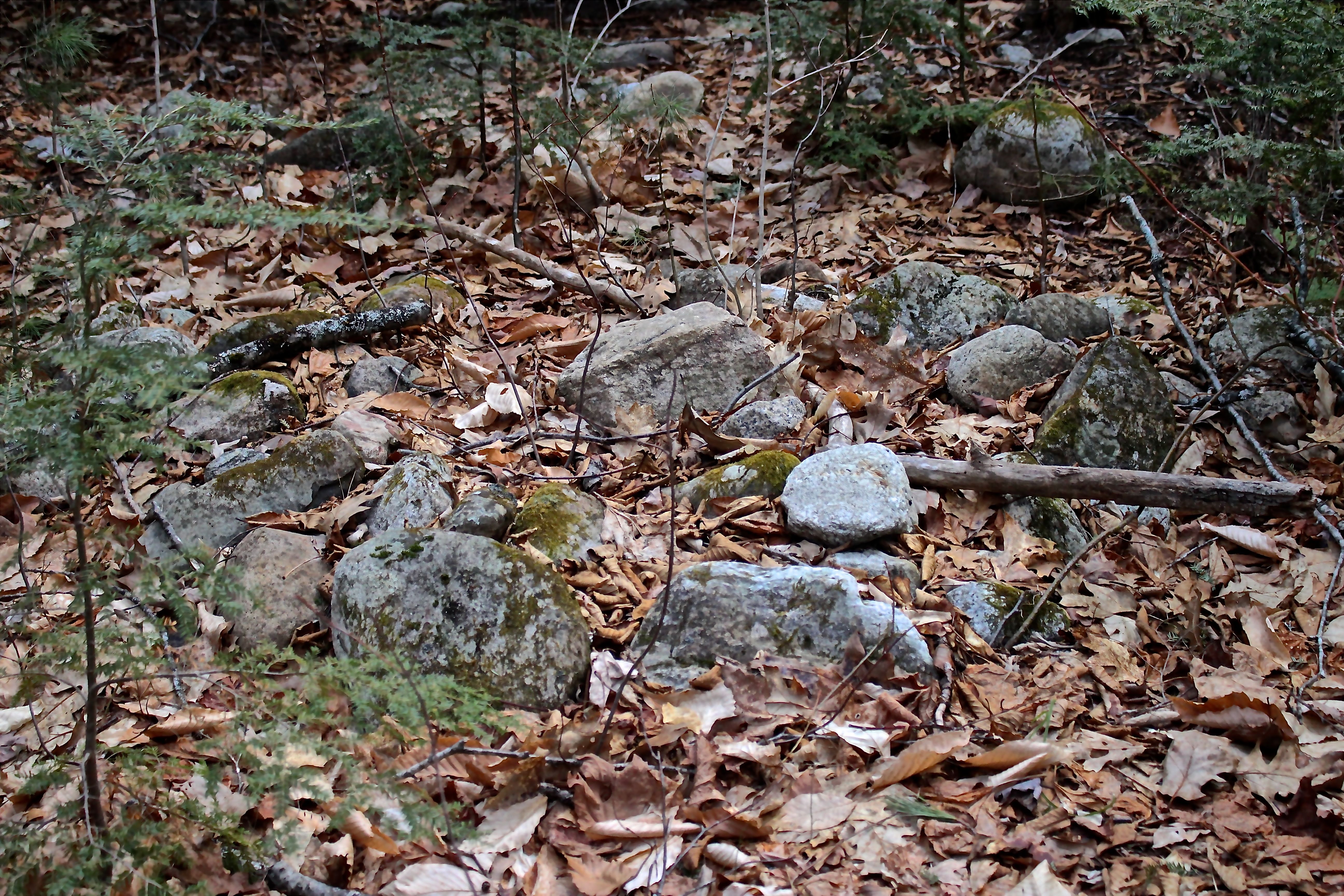
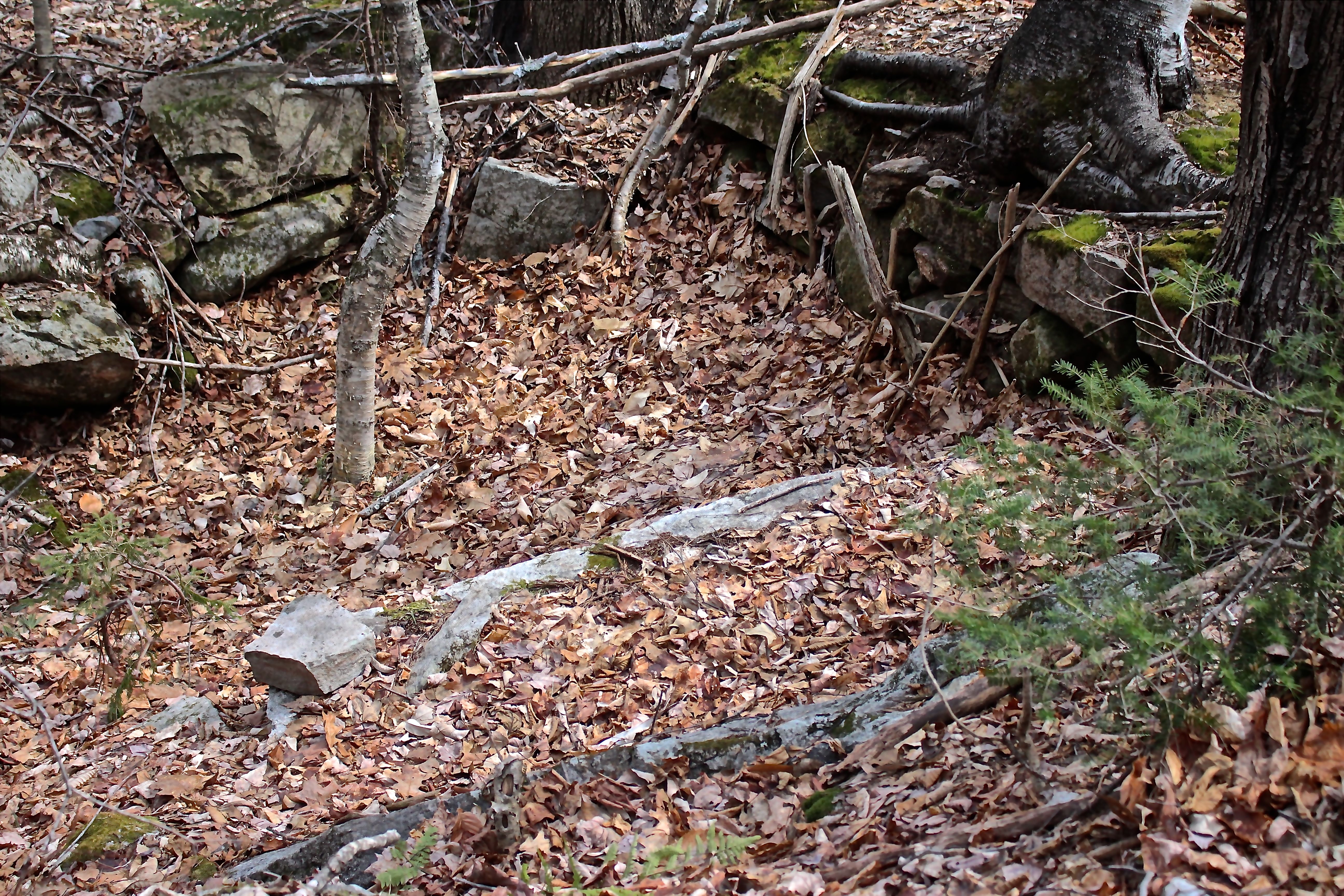
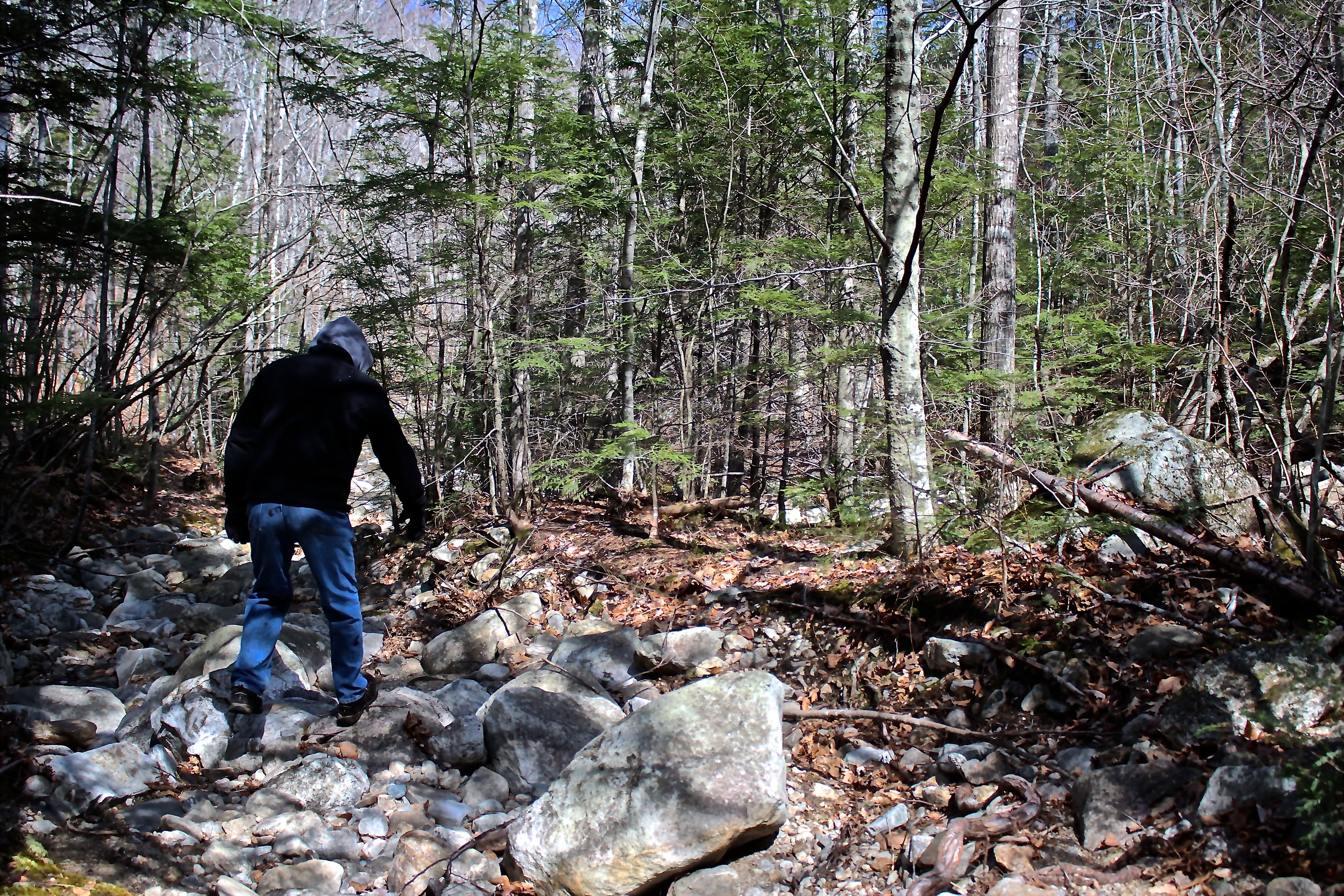
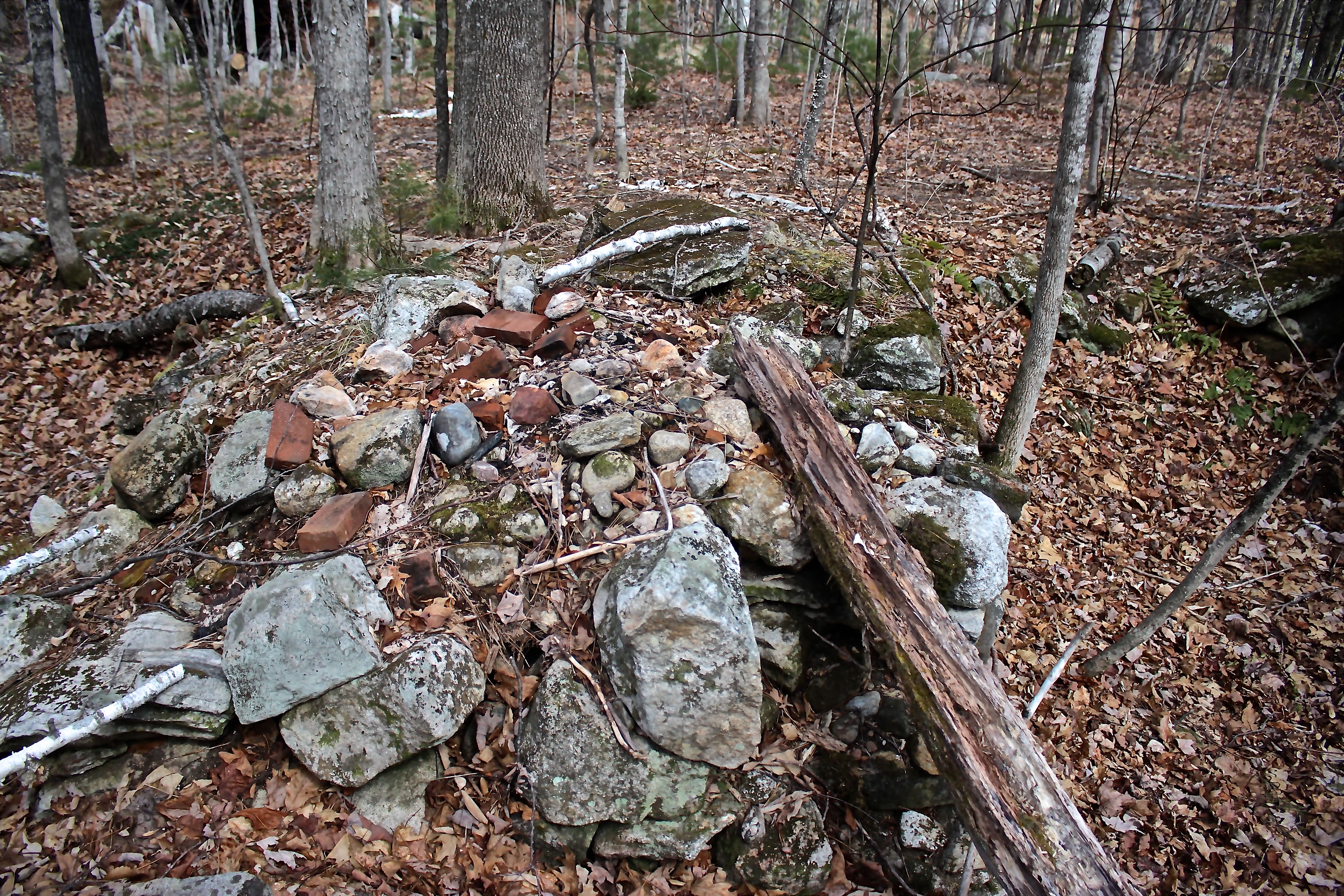
We chose a different route than the one she has outlined in red. Ours led to Willard Brook. Just before the snowmobile bridge, we turned right and began to follow the brook. I realized immediately that I’d been here before. Part of my quest was to take a look at stone placement and think about it not as Colonial only, but also as Pre-colonial or Native American. And so, I paused at every rock formation I found, including this circular configuration beside the brook. Current day fire pit? My guy didn’t think so. I don’t know.

h-stove 2

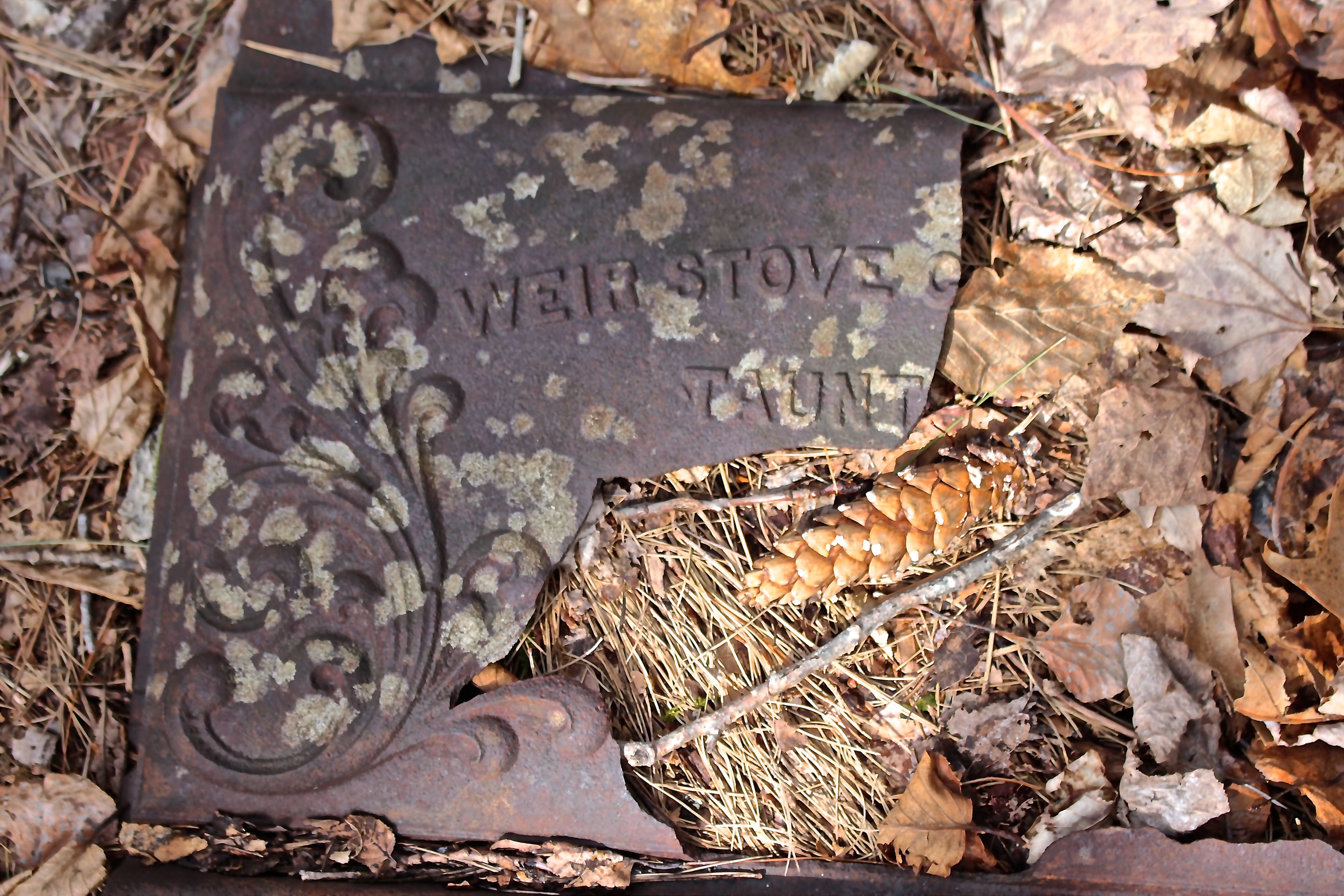
As happens in our woods, we suddenly found ourselves visiting an old camp. Debris is scattered about. This particular piece from a stove front caught my guy’s attention. He was born in Taunton, Massachusetts, and immediately recognized this as coming from The Weir, an industrial section of town. If memory serves him right, there were at least three stove companies in that area.

h-mailbox

My favorite will always be the mailbox, truly a tribute to snail mail.

h-yellow birch

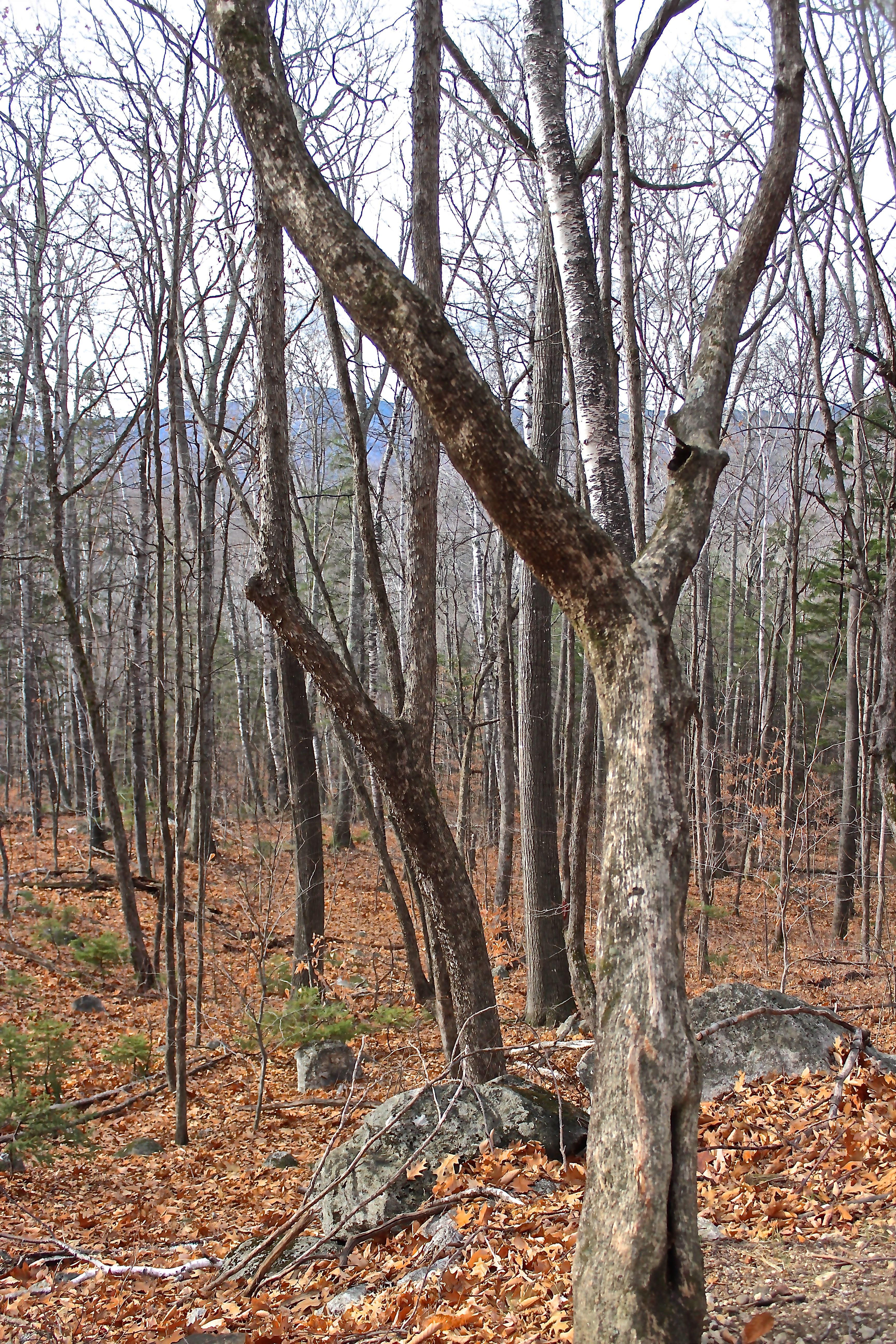
Our intention had been to follow the brook north, but we let an already traveled trail lead us instead. Soon we came to another landmark I remembered, the great yellow birch. An old yellow birch. Very old. I led a bark workshop yesterday and this is one of the trees we talked about. Yellow birch can live to be 200 years old, much longer than any of their relatives. I don’t know the age of this monument, but I do wish I could hear the stories it has to tell of this land.

h-colonial road

We turned left and followed the former road to Willard Brook. Colonial road or older?

h-stone wall turtle

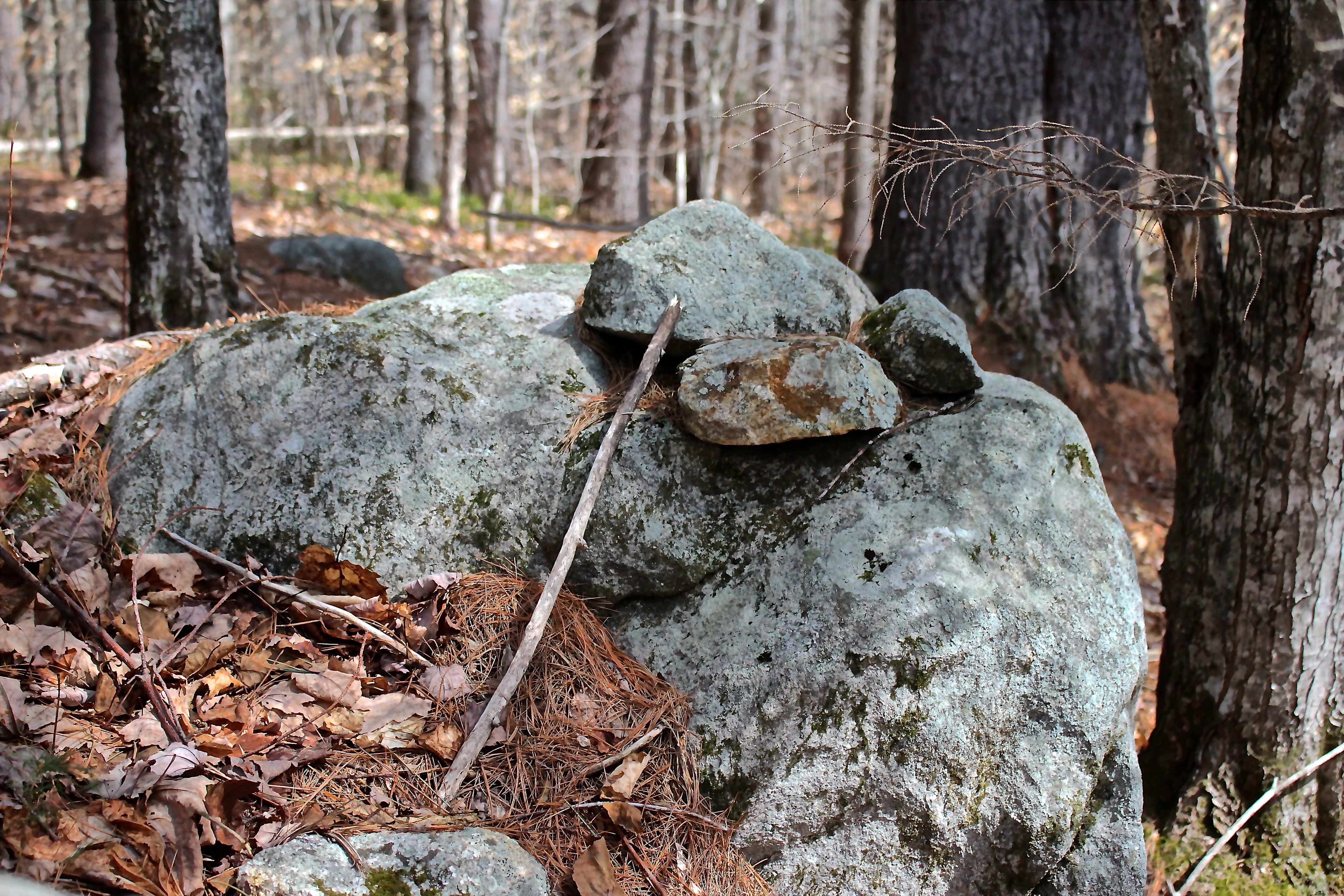
I’ve learned from others to look at the shapes incorporated into stone walls and fences. I may be making this up because I’ve had an affinity with turtles since I was a young child and own quite a collection even to this day, but I see a turtle configured in this wall. Planned or coincidence? Worth a wonder.

h-stone wall 2, turtle

Potentially another in this section of the same wall, but at the same time, this part seems more consistent in structure.

h-Willard 1

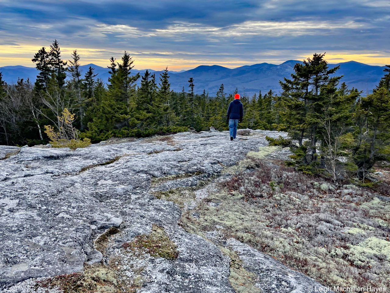
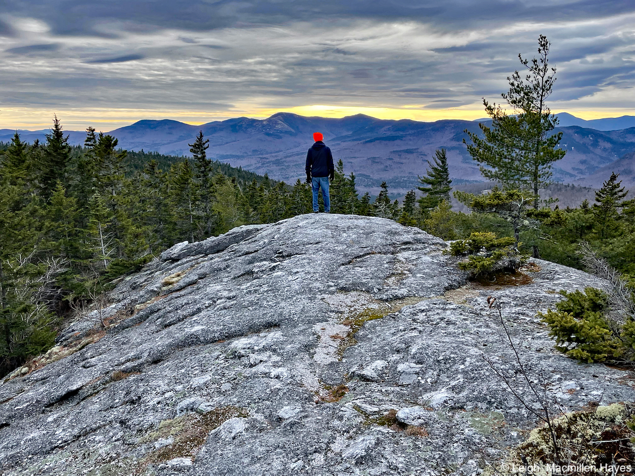
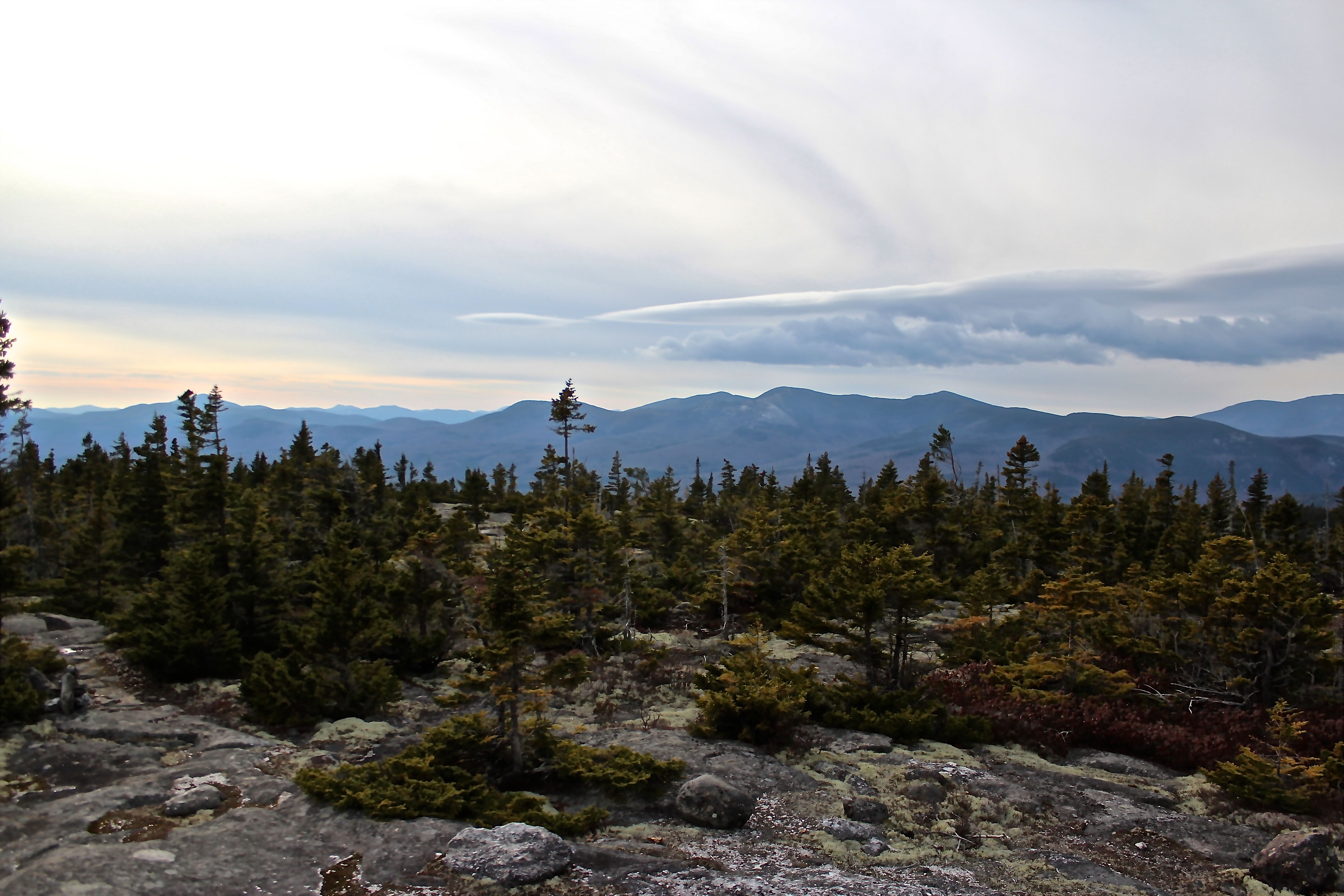
We ate the quickest lunch in our hiking history because our fingers were so cold. Even winter temps didn’t seem to bother us as much as today’s temp and wind chill. Lunch rock  sat beside Willard Brook with Speckled Mountain above.

h-entering neighborhood

And then we backtracked up the road and I took my guy up to the Hut Road neighborhood. He’d not visited this particular community before, so was happy to make its acquaintance.

h-1st fdn

Our first encounter was with the Willard homestead of 1858; later known as the McKeen homestead of 1880.

h-wall on hill, balancing

As we moved up the hill to another foundation, we passed by this stonewall, where I wondered about the difference in stone size. A balancing act perhaps?

h-fdn 2 and chamber

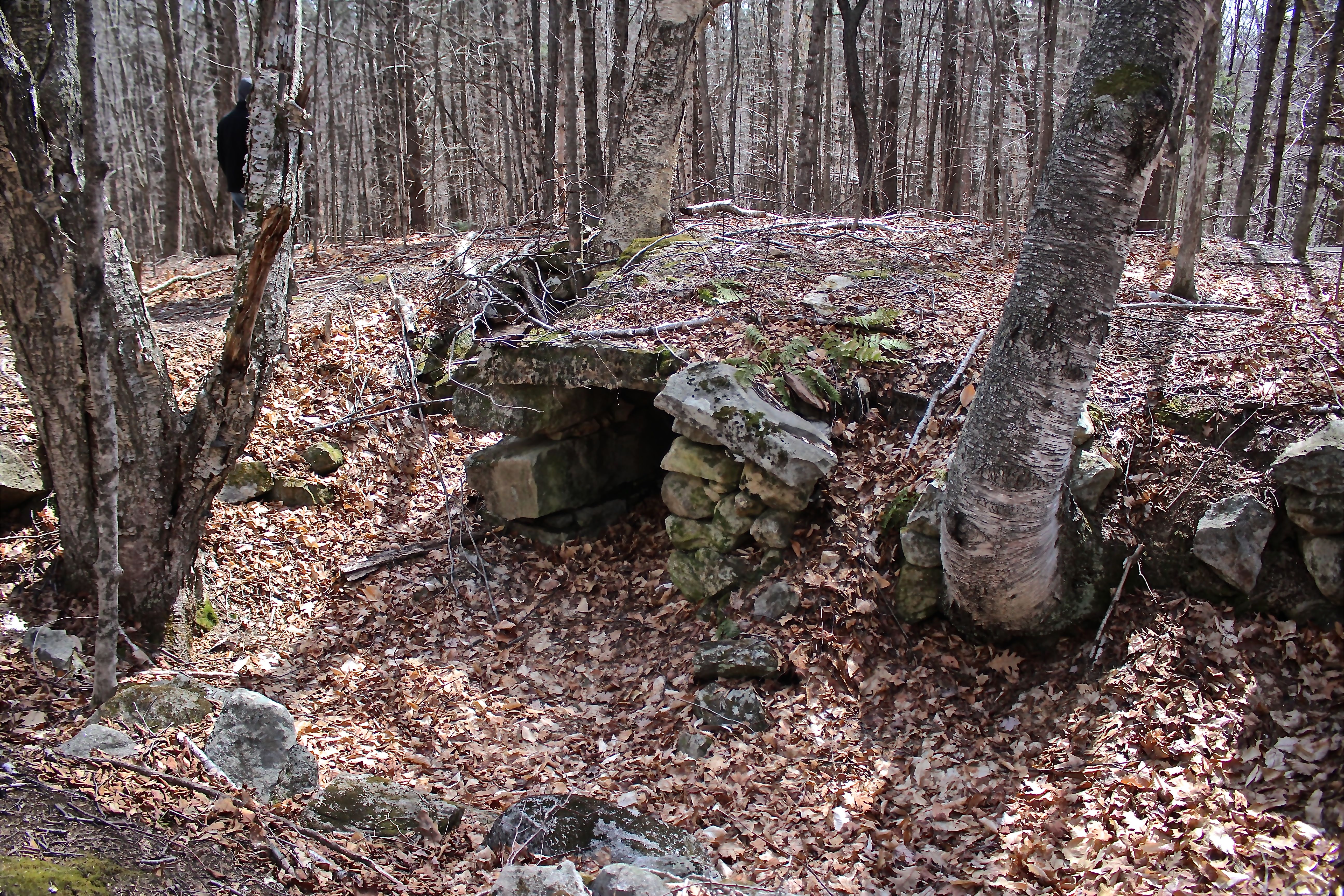
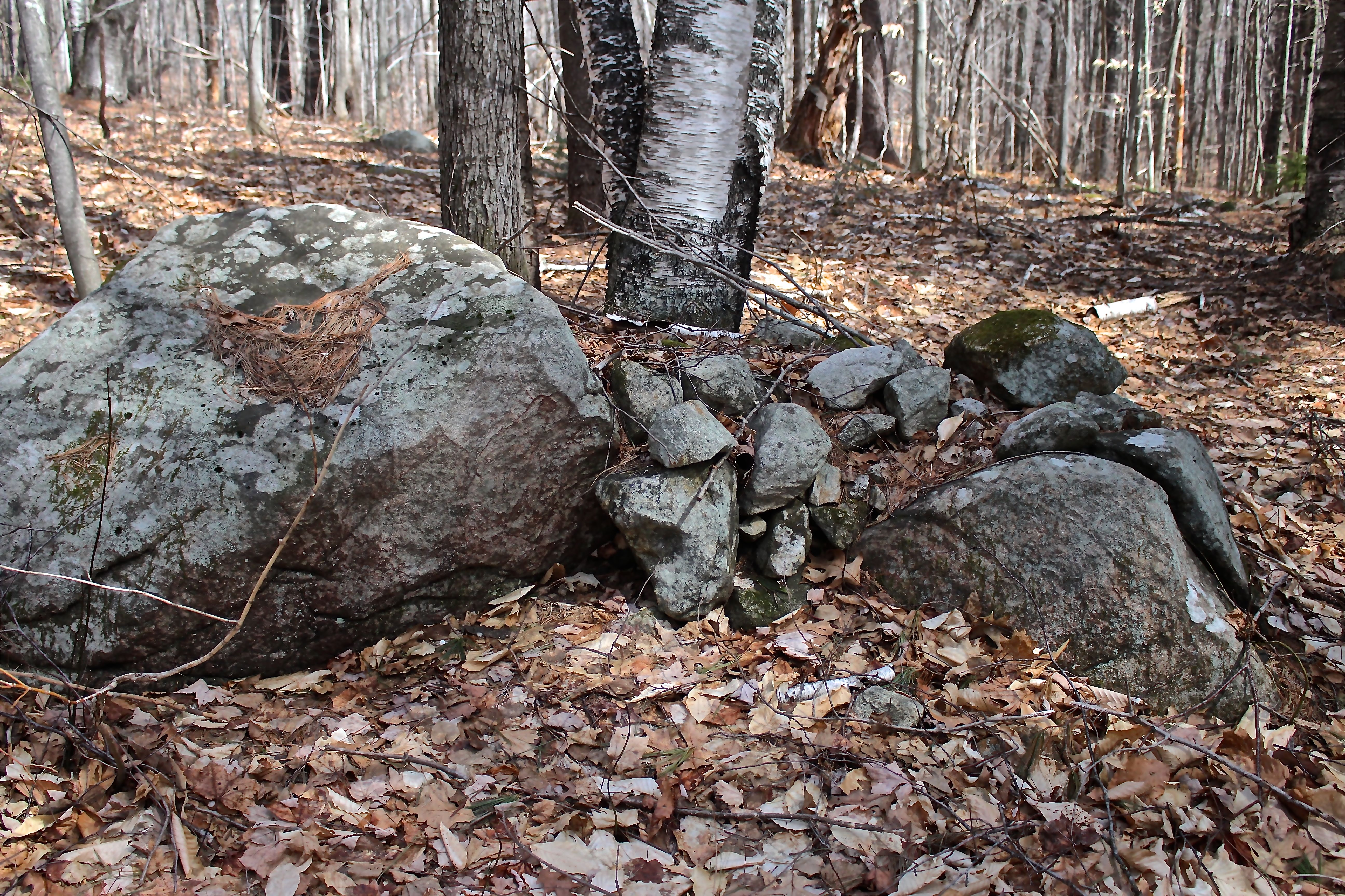
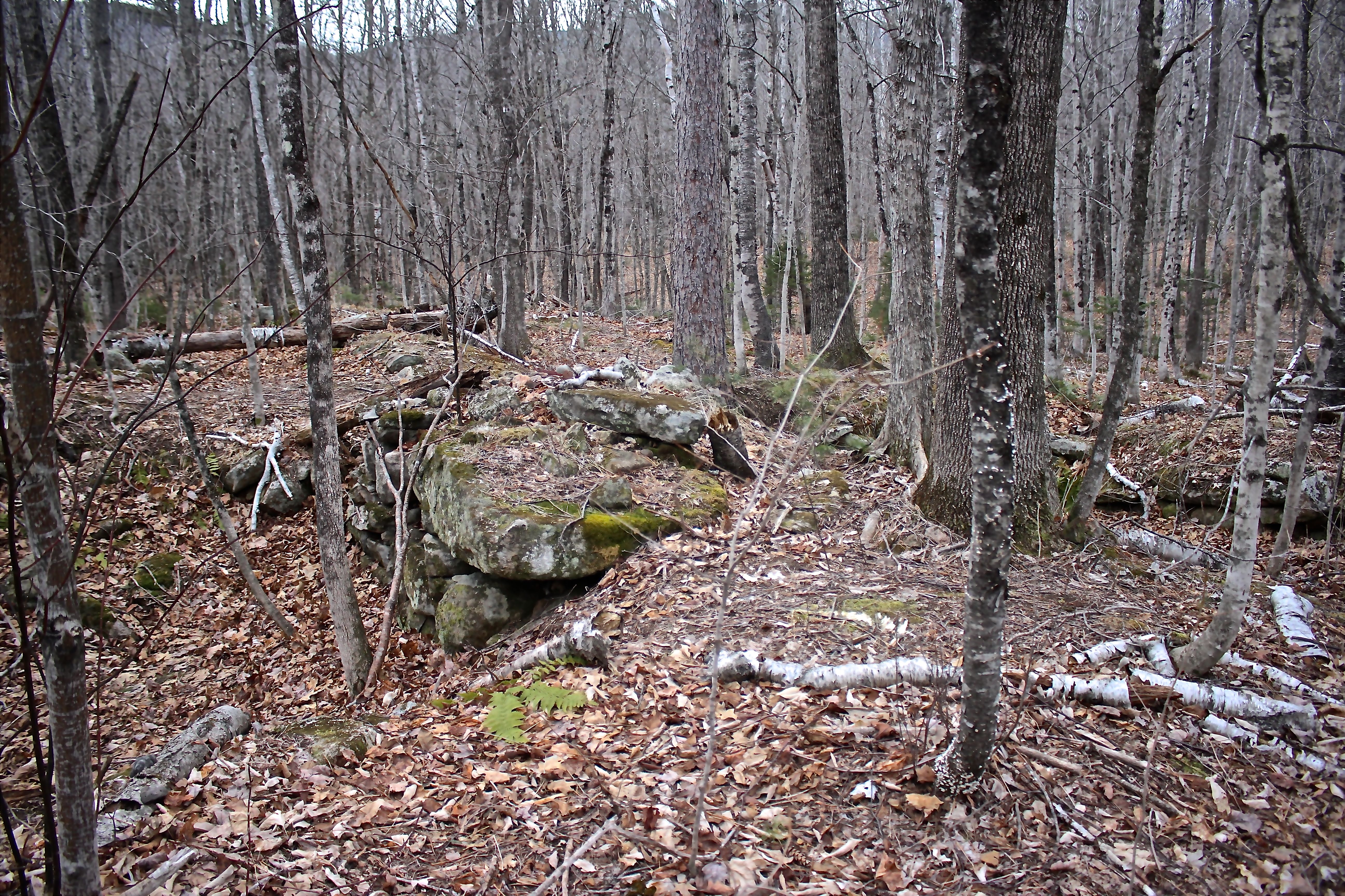
Homestead #2 belonged to the Durgins in 1858 and Rowlands in 1880. It’s one of my favorites because of the stone chamber within. Which came first–the stone chamber or the rest of the cellar? Was the entire cellar considered a root cellar?

h-chamber interior

Hence, a closer look. Oh yes, and the porcupine scat pile is still there in the back right-hand corner, but none of it is fresh. Darn.

h-chamber stones 1

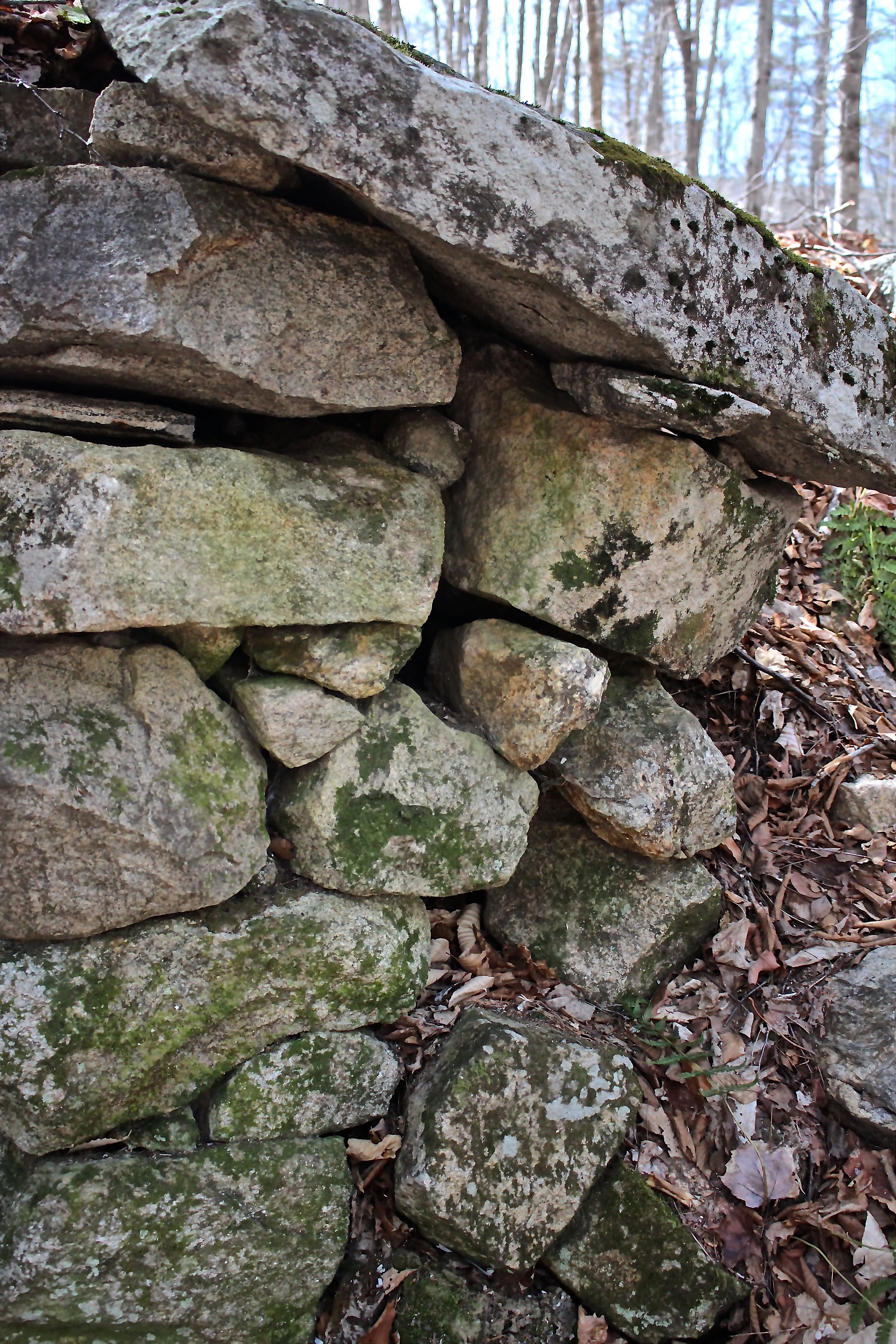
On the outside of the chamber’s edge that connects with the cellar–again my imagination took over. Perhaps my turtle’s head is the large blocky rock bottom center. Or is it a smaller version in the rocks above. Am I seeing things that are not there? Overthinking as my guy would suggest?

h-chamber back

Perhaps in the back wall?

h-chamber int 2

And in the side? Again, I see a face peering out at me just up from the bottom center/left. Do you see it?

h-rock pile 2

h-stone 5

h-stone pile 4

h-stone pile 3

While I was busy photographing stone piles in the woods and wondering about their significance, my guy followed his nose and made a discovery that has eluded Jinny Mae and me for months.

h-tombstones 1

Just like that he found the cemetery.

h-Sarah Dergin

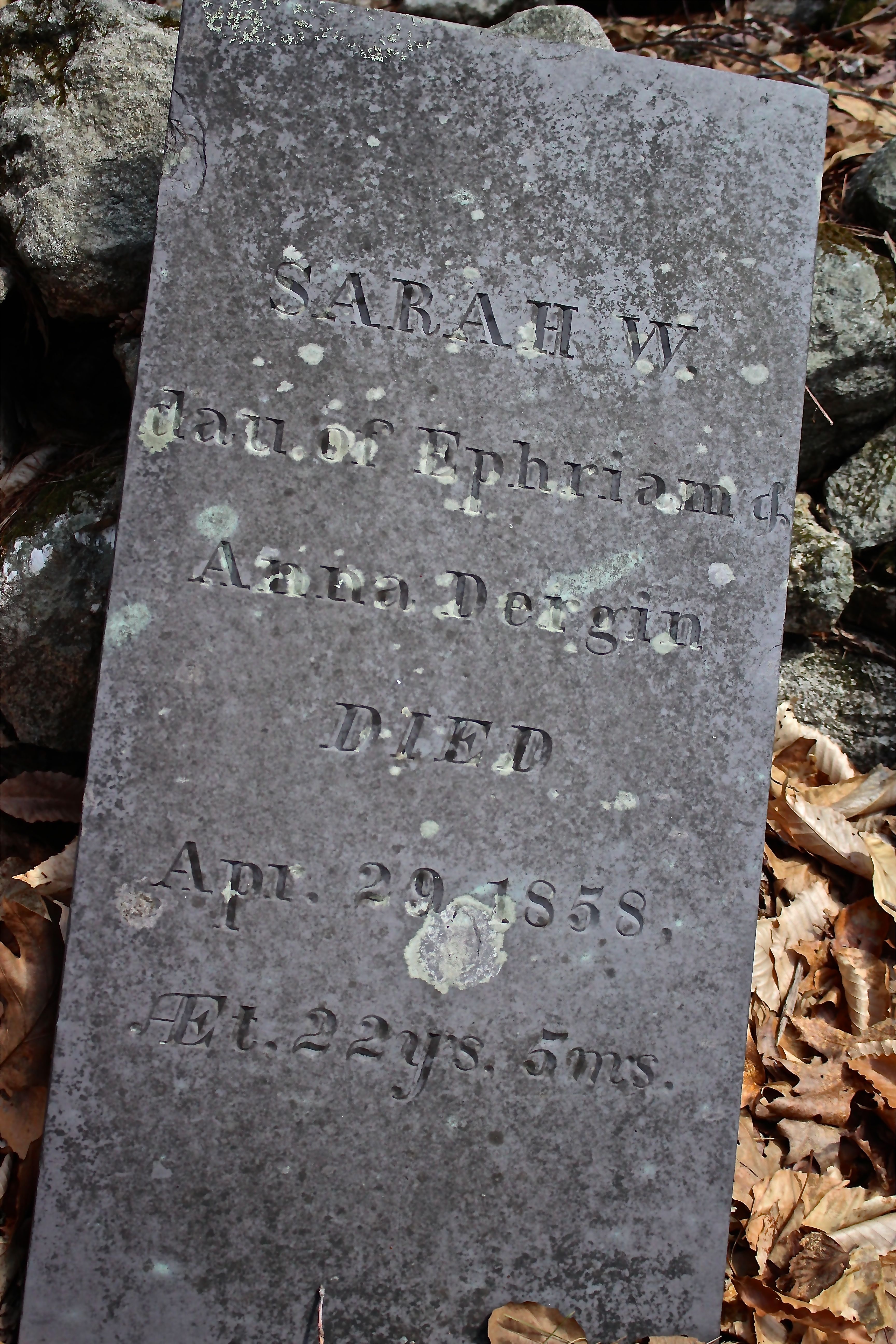
Sarah, daughter of Anna and Ephraim, is the first tombstone. She died in 1858 at age 22.

h-Mary Dergin

Beside her, Mary, wife of Sumner Dergin, who died before Sarah–in 1856. She, too, was 22 years old. As best I can tell, Sarah and Sumner were siblings.

h-Ephraim Durgin

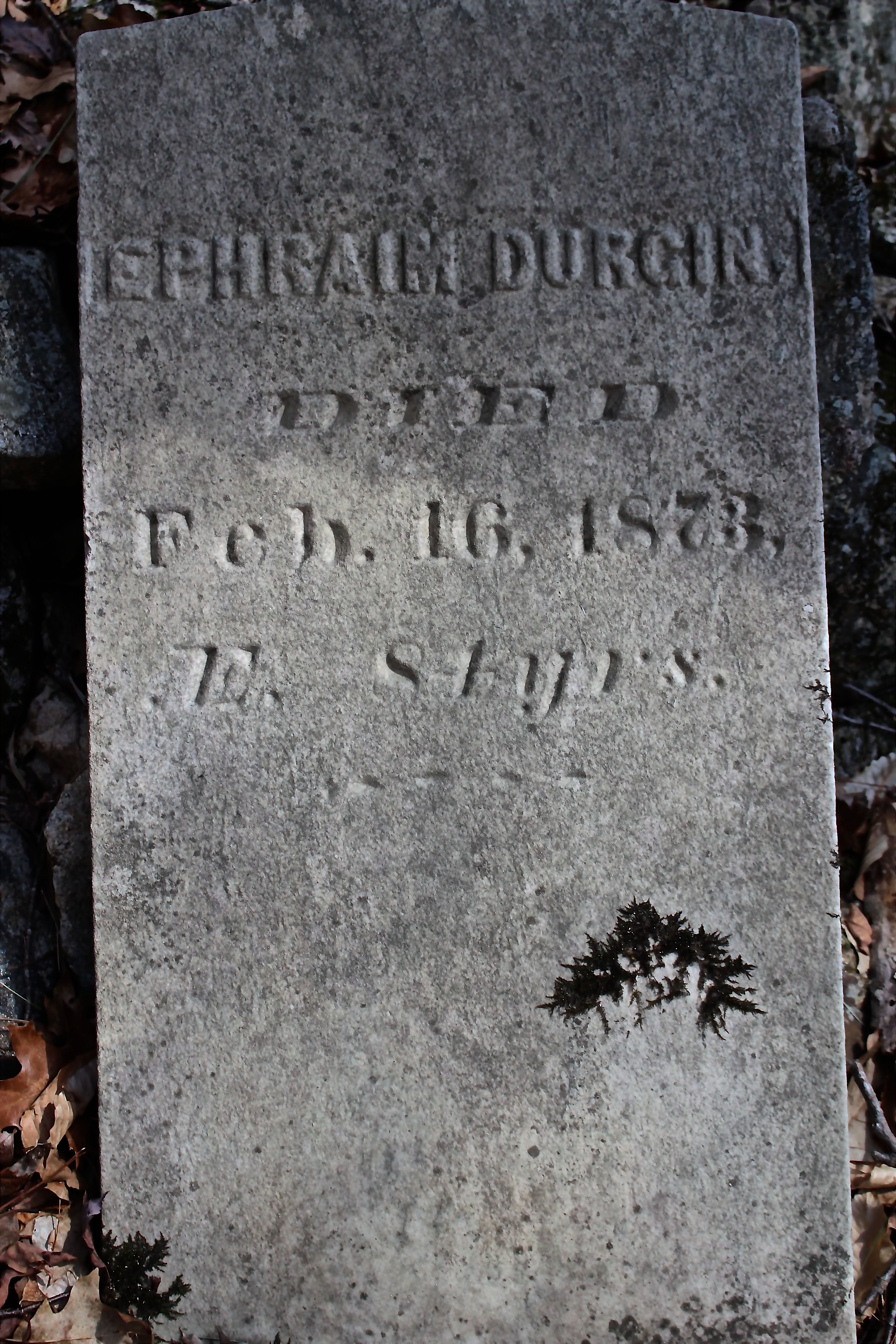
And Ephraim, Sarah’s father, who died in 1873 at age 81. Notice the difference in stone from the two girls to Ephraim? Slate to cement. And the name spelling–Dergin and Durgin. As genealogy hobbiests, we’ve become accustomed to variations in spelling.

I found the following on RootsWeb:

8. ANNA3 FURLONG (PATRICK2, JOHN1) was born 1791 in Limerick, Maine, and died 1873 in Stoneham, Maine. She married EPHRAIM DURGIN June 18, 1817 in Limerick, Maine14. He was born April 13, 1790 in Limerick, Maine, and died in Stoneham.

Children of ANNA FURLONG and EPHRAIM DURGIN are:
i.OLIVE4 DURGIN, b. 1811, Stoneham, Maine; m. DUNCAN M. ROSS, April 11, 1860, Portland, Maine.
ii.SALOMA DURGIN, b. 1813.
iii.ELIZABETH DURGIN, b. 1815.
iv.SALLY DURGIN, b. 1817.
v.SUMNER F. DURGIN, b. 1819, Of Stoneham, Massachusettes; m. MARY ANN DURGAN, July 11, 1853, York County, Maine; b. Of Parsonsfield, Maine.
vi.CASANDIA DURGIN, b. 1821.
vii.EPHRAIM DURGIN, b. 1823.
viii.FANNY DURGIN, b. 1825.

Sarah isn’t listed above. But . . . Sally and Sarah were often interchangeable.

h-cemetery view-Durgin

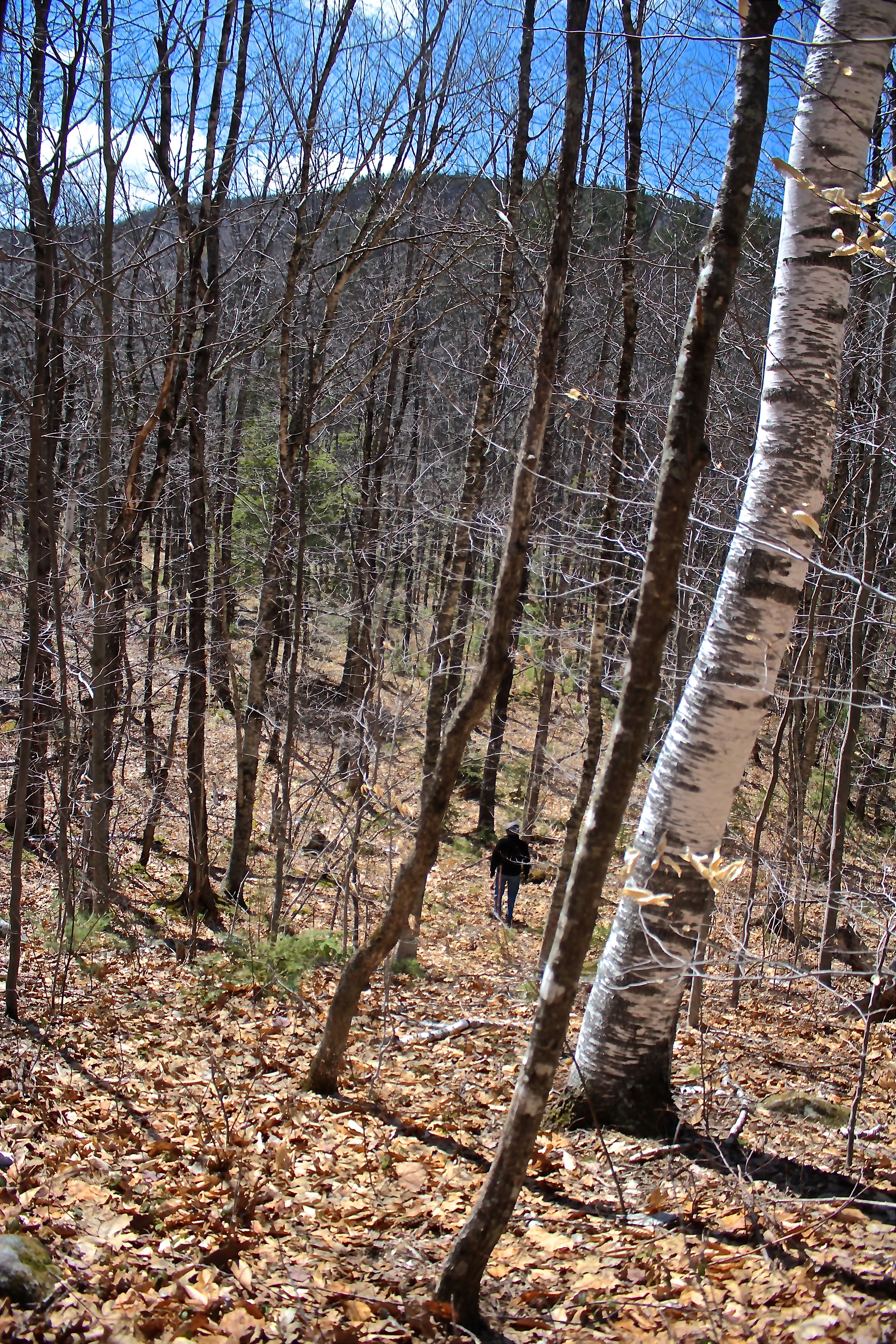
Though only these three stones stand upright, leaning against a wall, this potentially was a large cemetery. And the view–Durgin Mountain.

h-down from cem

Rather than backtrack again, we decided to travel cross-country back toward Willard Brook.

h-bog

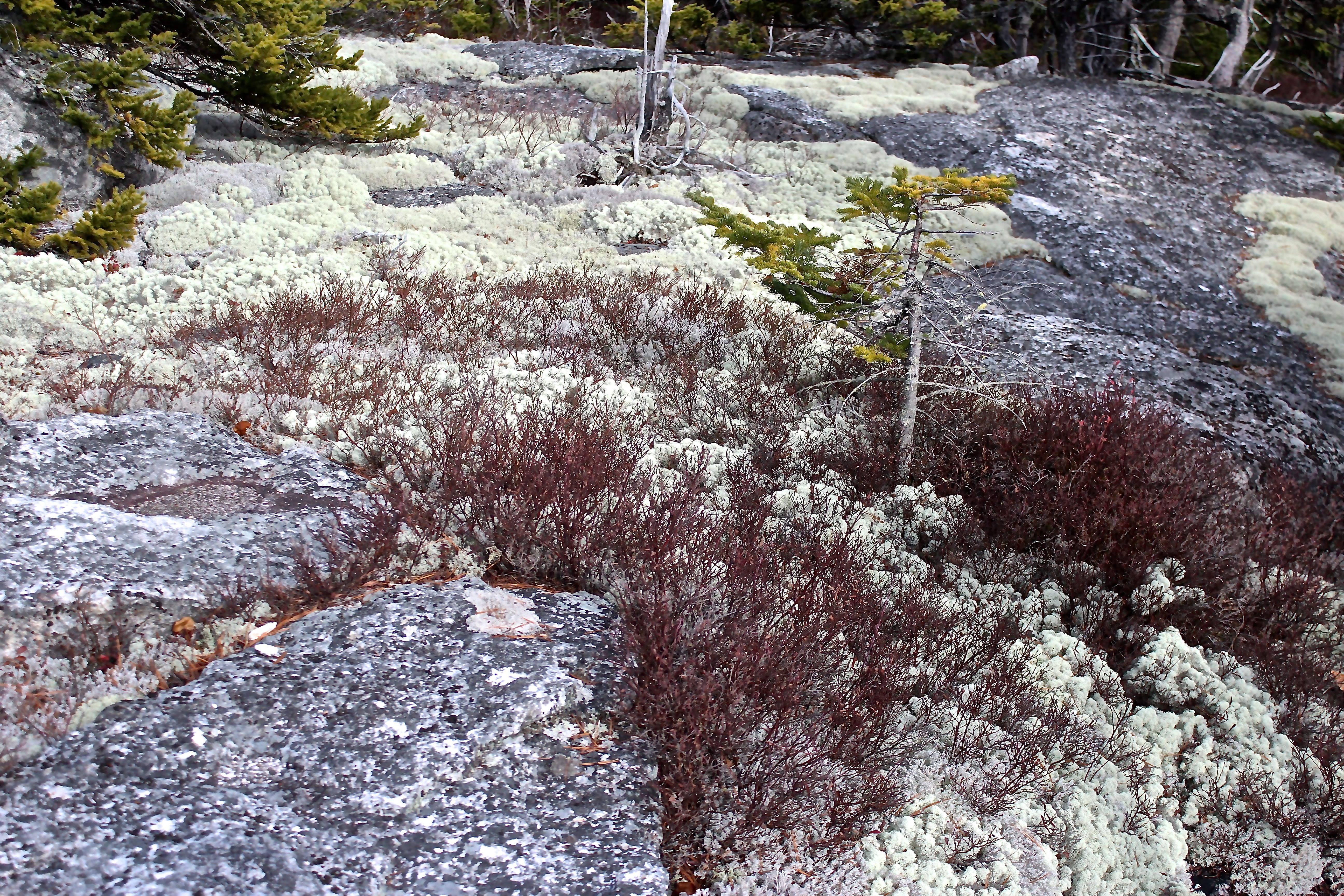
At the bottom of the hill, the area was filled with sphagnum moss and cinnamon and interrupted fern.

h-bear scat

Though I didn’t find any bear trees today, I did find bear scat 😉

h-moose scat

And plenty of moose sign.

h-red maple

The red maples offered numerous examples of the bull’s-eye fungi that I told yesterday’s workshop participants to notice. I encouraged them to develop bark eyes. Meanwhile, I’m working on my stone eyes. (not stoned!)

h-willard dry bed

As we traipsed across the landscape, my guy recognized the large yellow birch we’d come upon earlier. And then we followed the walls down to Willard Brook where bushwhacking became the name of the game. Sometimes we found ourselves moving cautiously along the rocks in a dry section of riverbed–the overflow.

h-rock slide by Willard

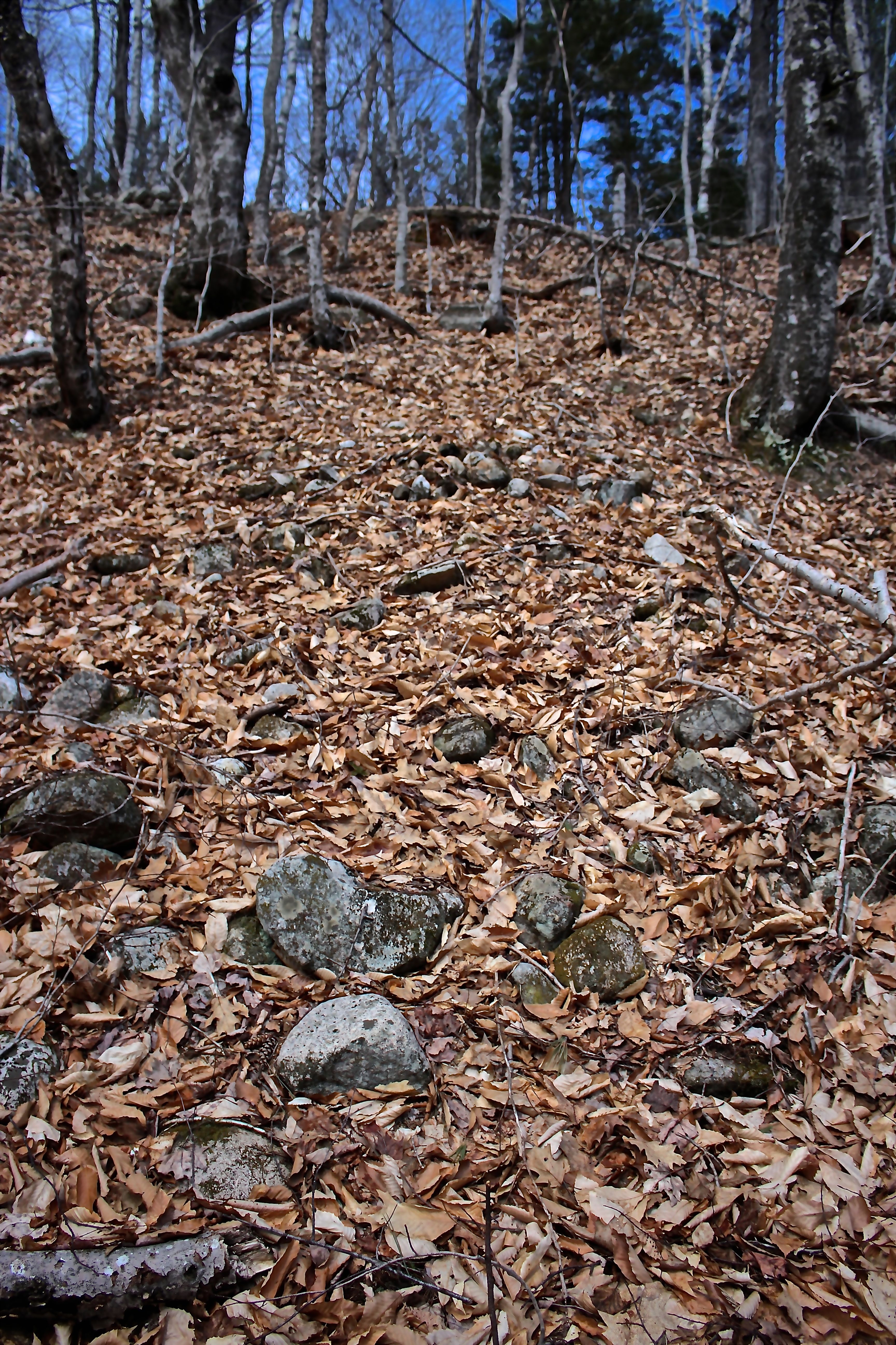
I kept my eyes open for stone treatments and found this twenty-foot rock slide that didn’t look natural. I have no idea what it represents.

h-wheels

One of the things I continue to notice and love about the woods around us–no matter how far from civilization you think you are, you never are. Notice the wooden wheel spokes.

h-trees and rocks beside willard

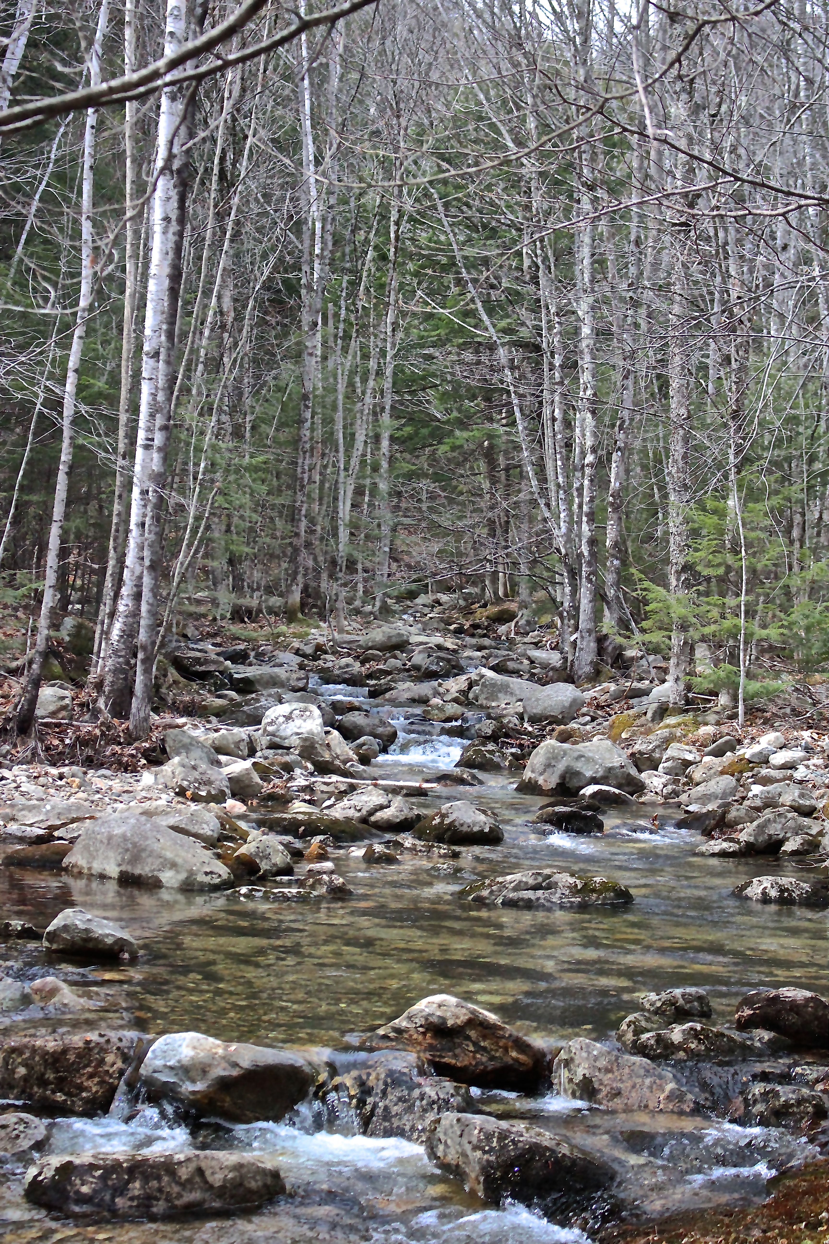
I also noticed the trees and rocks across Willard, where the water’s rise and fall over the years has carved out a unique landscape and each entity is intertwined with the other.

h-2nd bridge

Eventually we came out at the spot where we’d headed off the snowmobile trail and decided to turn right and follow it toward Evergreen Valley.

h-cairn

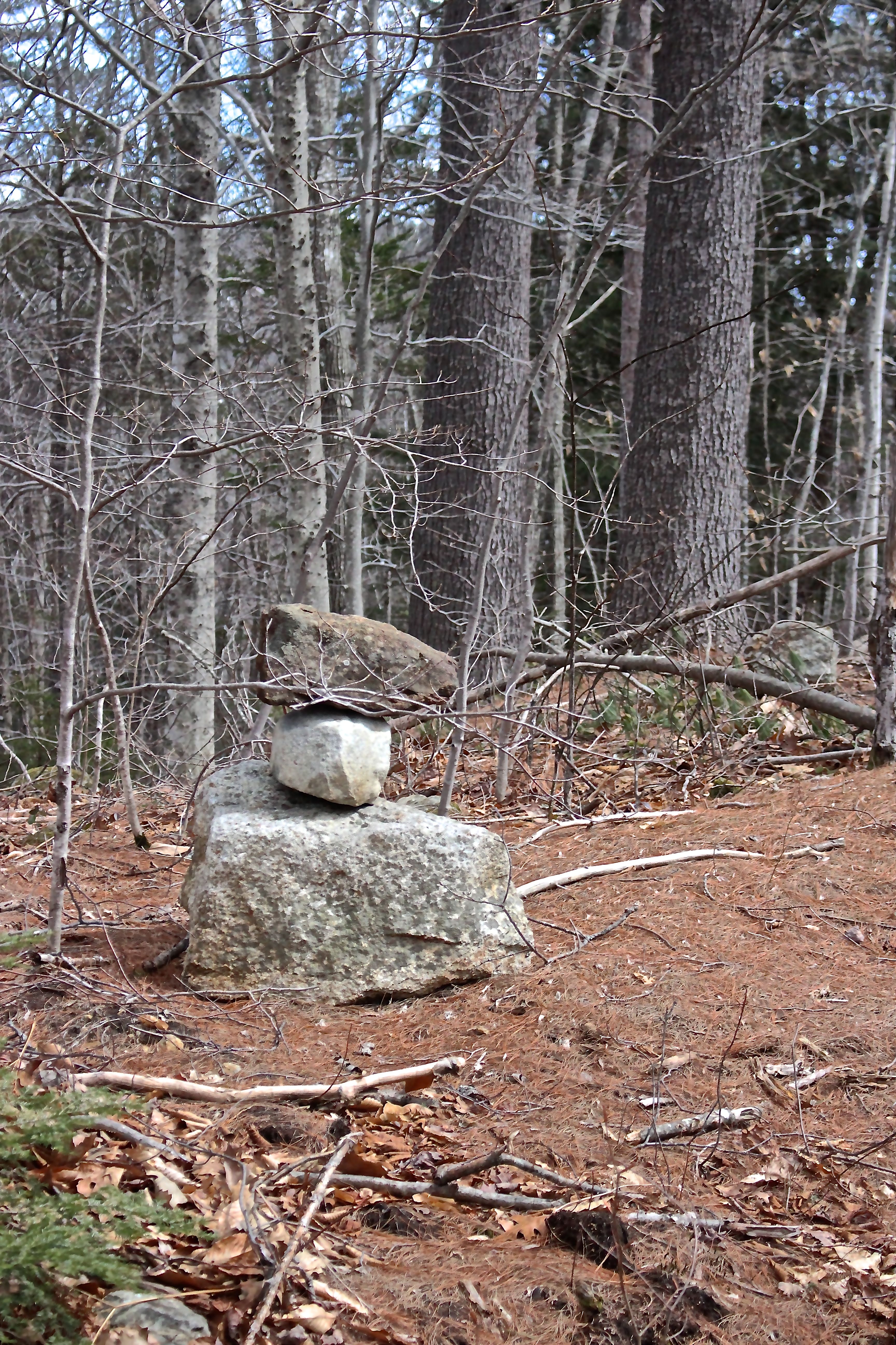
Though the walk was nice and the wind not so strong, we got to this modern-day cairn and felt we’d gone far enough. We turned back and bushwhacked down to Willard Brook.

h-scouting willard

Like Lewis, my guy scouted for a crossing. Like Clark, I followed.

h-brook crossing

Our spot to ford the brook looked easier than it was. He crossed first and landed without issue. Me too–um, almost. Only one foot slipped. His comment, “Good thing your hiking boots are waterproof.” My response, “Yeah, but my socks aren’t.” Oh well. I’ve had wet feet before and will again. When I finally took my boot off at home, I was surprised at how drenched the sock was.

h-great brook on way back

We made our way through balsam fir saplings and hobblebush and a variety of other species and turned away from Willard assuming we’d eventually encounter Great Brook again. Success.

h-great structure 2

I’d been told to pay attention to Willard for Native American sites, and found this beside Great Brook. I have no idea what it represents.

h-3rd fdn central chimney

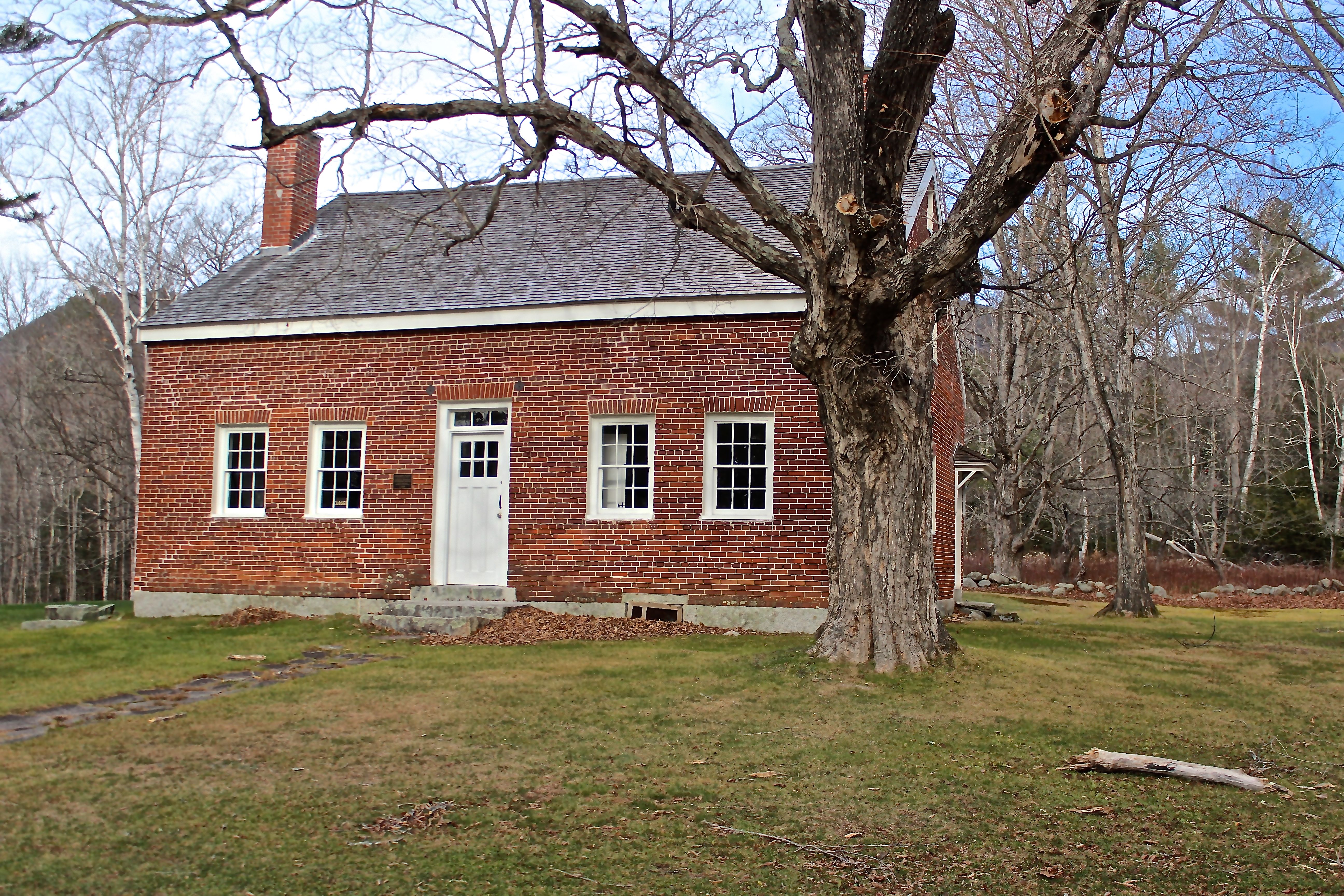
And lo and behold as we headed back to our starting point, we found ourselves at a third foundation–a rather large one with a center chimney between two cellar holes and an addition behind it. It’s where the school probably stood in 1858 and A. Gray’s home in 1880.

h-fnd 3 chimney

Bricks still top the central chimney.

h-final

Just like that, we were back at our starting point–looking at it from the opposite side of the brook.

Thanks to all those I bugged about what to look for as we tramped about today. And thanks again to Jinny Mae for her talent. I can’t wait to share this trail with you again.

We’d wandered for hours and found plenty to wonder about–especially along Willard Brook.


Savoring the Sanctity of the Mountains

“Savor the sanctity of the mountains in these incredibly discouraging times,” said a friend on Friday. And so we did.

MW morning

The mid-morning sun highlighted Mount Washington as we passed through Fryeburg Harbor–always a breath-taking view.

trail sign

Our destination: Speckled Mountain in Evans Notch–via Blueberry Mountain.

Bricket Place

Parking is at the Brickett Place, where the Brickett family farmed, logged and produced maple syrup in the mid-1800s. Their original home was log, but they later built this house with locally-fired bricks.

Bricket place signage

The house is listed on the National Register of Historic Places.

Y

Hop Hornbeam trees are abundant in a section of the lower trail. My guy saw slingshots in the unusual growth of these two, but I saw Ys. Why? Why? Paris? Syria? Around the globe?

B slides upper

About .7 of a mile from the trailhead, we paused at Bickford Slides–one of the many places for contemplation along the way.

B slides 2

While the upper slides are calm at the trail crossing, the brook funneled below us into a narrow chute, where the water’s fast movement has carved a channel in time.

granite, glacier

Later, on the Blueberry Ridge trail, I saw this pattern in the granite and thought of how the glaciers that covered our northern states scoured the land as they receded.    The land tells the story–I just need to learn how to read it.

climbng up Blueberry

We usually hike down the Blueberry Ridge Trail because it offers magnificent mountain views, but I was thankful that we switched things up today. A different perspective was welcome.

rime ice

I found myself paying attention to each step upward, mindful of leaves and rocks and water and ice. Because of this, I spent a lot of time staring at the ground. There’s plenty to appreciate at this level, like the crystals of needle ice that form within the earth.

ice 1

We left our crampons at home, but in the future, we need to add them to the pack.

ice 4

As dangerous as it is to walk on, I’m fascinated by the dramatic formations that change with the moment–forever fluid.

wintergreen

Other things worth noting–wintergreen leaves taking on their winter hue;

sheep laurel 1

Sheep laurel leaves protecting its spherical fruit;

reindeer lichen

and a variety of reindeer lichens awaiting a visit from the red-nosed, sled-pulling residents of the North Pole.

MW from Blueberry Ridge

After pausing on Blueberry Mountain, we continued up the ridge, remembering to turn back frequently and take in the view,

Shell Pond and PM

including Shell Pond below and Pleasant Mountain in the background. My guy pointed out that Shell Pond really does look like a conch shell from here.

Kezar Lake

Our view also included the islands on the northern end of Kezar Lake in Lovell.

lunch rock

We chose the largest rock we could find for today’s lunch spot. Lunch? The usual–PB&J, followed by brownies,

looking back

and topped off with another spectacular view.

squirrel lunch rock 2

We weren’t the only ones choosing a rock for lunch. This squirrel prefers the top rock on the cairn.

spruce scales

Red Spruce scales and cobs line much of the trail.

squirrel cache

And we found a few caches–a sign of things to come.

nd 4

The higher we hiked, the more natural devastation we encountered. Gazing upon it brought me back to today’s reality. Blow downs, galls, fungi, animal interactions with the landscape–it’s constantly in flux. Then there’s the human factor–we leave our imprint in ways we can’t even imagine. But . . . across our nation and around the globe?

ice on Speckled Trail

We encountered more ice on the climb to the summit of Speckled Mountain.

summit wind

The wind was blowing when we reached the summit, where a fire tower once stood.

summit view miles of mountains

The stanchions are all that remain of this former lookout site.

summit, MW in clouds

It was getting late, so we didn’t stay long,

summit, MW,

just long enough to notice that Mount Washington was disappearing into the clouds.

sphagnum and snow 2

We followed the old jeep trail that is the Bickford Brook Trail, on the way down. Rather than ice, we found snowflakes among the sphagnum moss.

hidden rocks

Once we got below the spruce-fir forest, the beech and oak leaves obscured the rocks, making it almost more difficult than the upward climb.

beech sign

I couldn’t spend as much time as I wanted scanning the beech trees for bear claw marks because I was paying attention to my foot placement, but I did pause by this tree that has served as a sign post for many years.

1976

1976–a very good year. I happen to be a member of the Bicentennial Class of North Branford Senior High School. Go Thunderbirds!

Eight plus miles and five and a half hours later, we’d completed the loop as the sun   lowered behind the mountains.

hobblebush, global prayer

My hope is that these hobblebush buds encircle the world in prayer so that all may savor the sanctity that we find in the mountains.