The Wonder Tour

When my friend JVP and I made a lunch plan for today, I offered to take her to some of my more recent stalking sites, those places I’ve been frequenting of late because of the wildlife sightings. She liked that plan and I fear announced to the world (or at least one or two others) that we were going on an adventure and our finds would be many.

But . . . yesterday’s River Otter turned out to be only slushier ice today.

And the fairground fox was nowhere to be seen, though we did get to chat with Roy Andrews, president of the Fryeburg Fair. Yes, the foxes have again taken up residence within the infield directly across from the Grandstand. I’ve yet to see the kits, and had hoped that today would be the day, but my day will come. For JVP’s sake, I was disappointed that she didn’t even get to see an adult. Our time spent with Roy, however, made it worthwhile and he shared stories and photos of last year’s fox families.

It seemed that I was striking out on the promised tour and it appeared I wasn’t alone.

But the views of Fryeburg Harbor, its fields flooded from the sudden snowmelt, with the backdrop of the White Mountains, was a treat to enjoy on this bluebird day.

And speaking of birds, we went to one area to see Kildeer, but only saw gulls . . . until we realized that American Kestrels were also part of the picture. Finally, things were picking up.

As we wound our way through the harbor, following the Old Course of the Saco River, we did catch a few glimpses of Wood Ducks, so I was feeling better about our wildlife sightings.

Once again, however, where last week I spent a while admiring a Great Blue Heron, we didn’t see anything of interest.

Until, that is, we noticed movement in the great beyond and realized a pair of Hooded Mergansers were swimming about.

I continued to strike out when I tried to show her the Sandhill Cranes, a pair I’d come to count on during my almost daily visits. Just yesterday another friend said she’d spied them in the field they’d been frequenting.

No cranes to speak of, but we did spy a pair of Canada Geese.

And a pair of Mallards in the flooded field.

Dabbling as they do.

And then, where the cranes had been previously, I spied what I thought was a lump of mud and snow, but JVP’s sight was keener and she said newborn calf. And she was correct.

As we watched, sweet nothings were whispered and no matter what we saw or didn’t see, our tour was worth a wonder and thankfully I didn’t have to reimburse JVP for the admission price.

One Plus One=Five

One plus one equals two on an average day. And so today, Marita and I set out to conquer at least one trail, with a couple of others as additional options. We ended up “bagging” as they say in hiking terms, two–including one that was totally unexpected.

s-Long Mtn lower path

Our morning began with an exploration of the new trail on Long Mountain, a 2.5 mile climb that twists and turns beside Mill Brook on property owned by Mary McFadden and Larry Stifler. Near the start, bog bridges pass through wet areas now dry.

s-Mill Brook 1

The climb is moderately gradual and the brook ever present, its rocks creating falls that added a pleasing sound and sight to our hike.

s-brook crossings

Occasionally, we needed to cross and the way was well bridged.

s-dry brook1

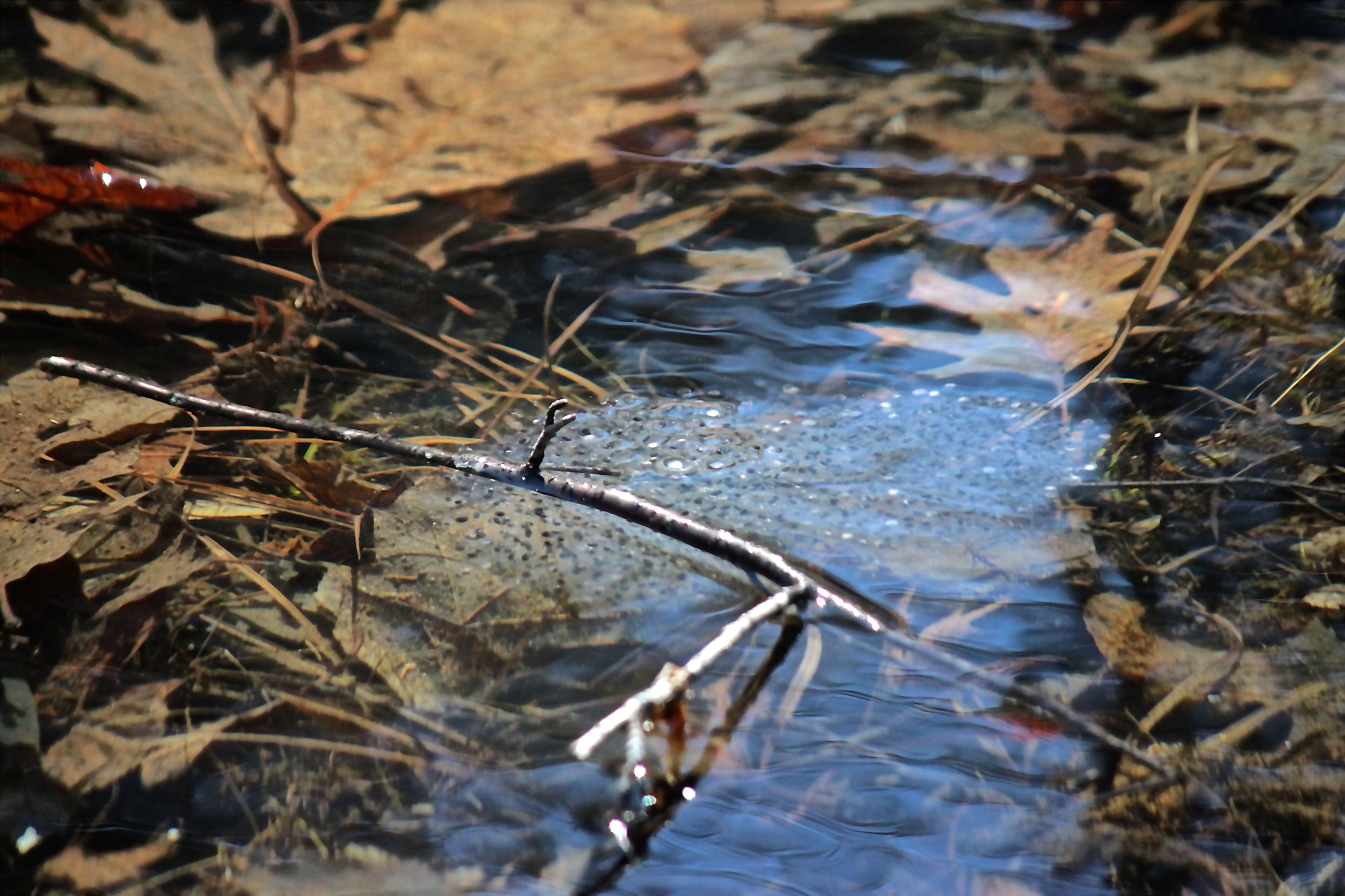
At times, the brook was dry, but those moments made us realize that we must return in the spring when we assumed torrents of water pass over the rocks.

s-Mill brook moss (1)

Moss dangling today, however, mimicked the flow that wasn’t there.

s-cairn

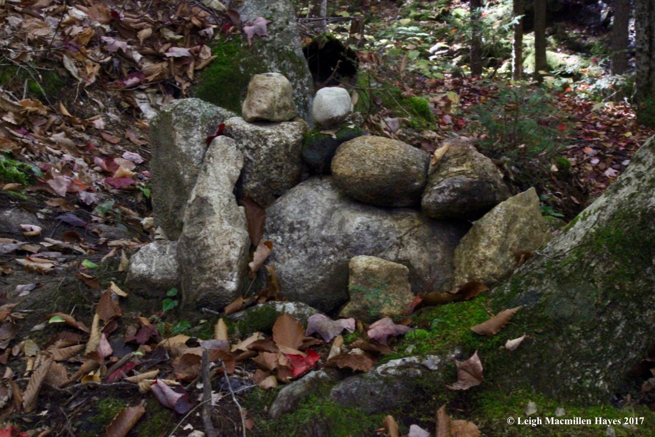
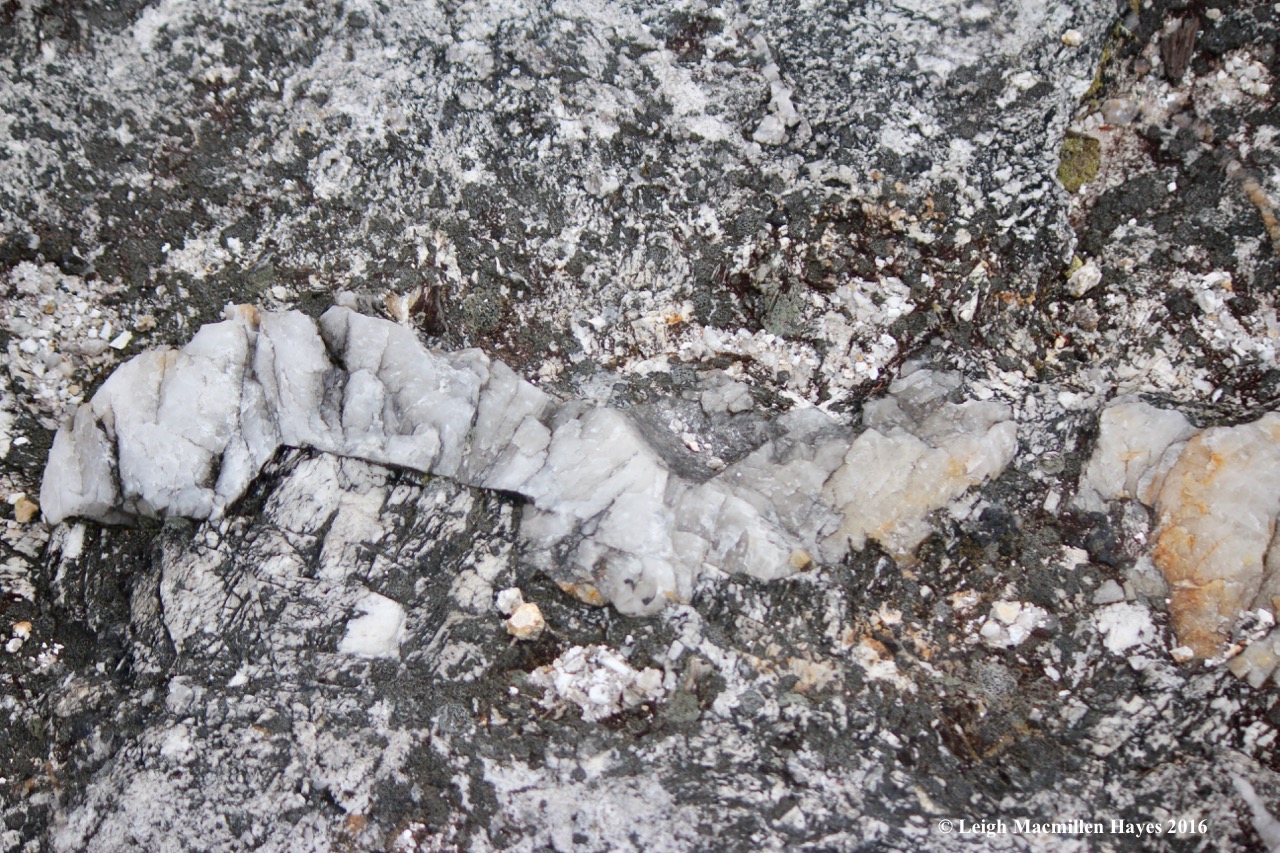
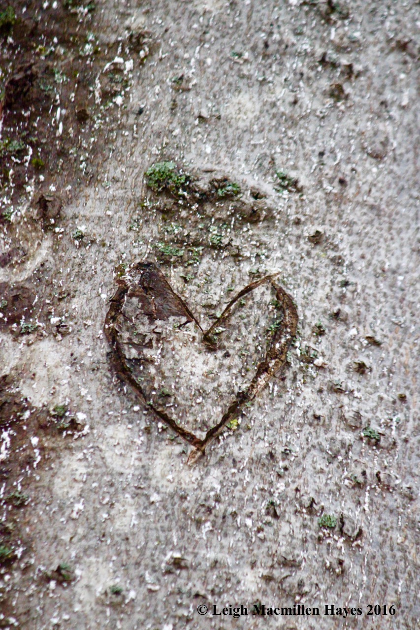
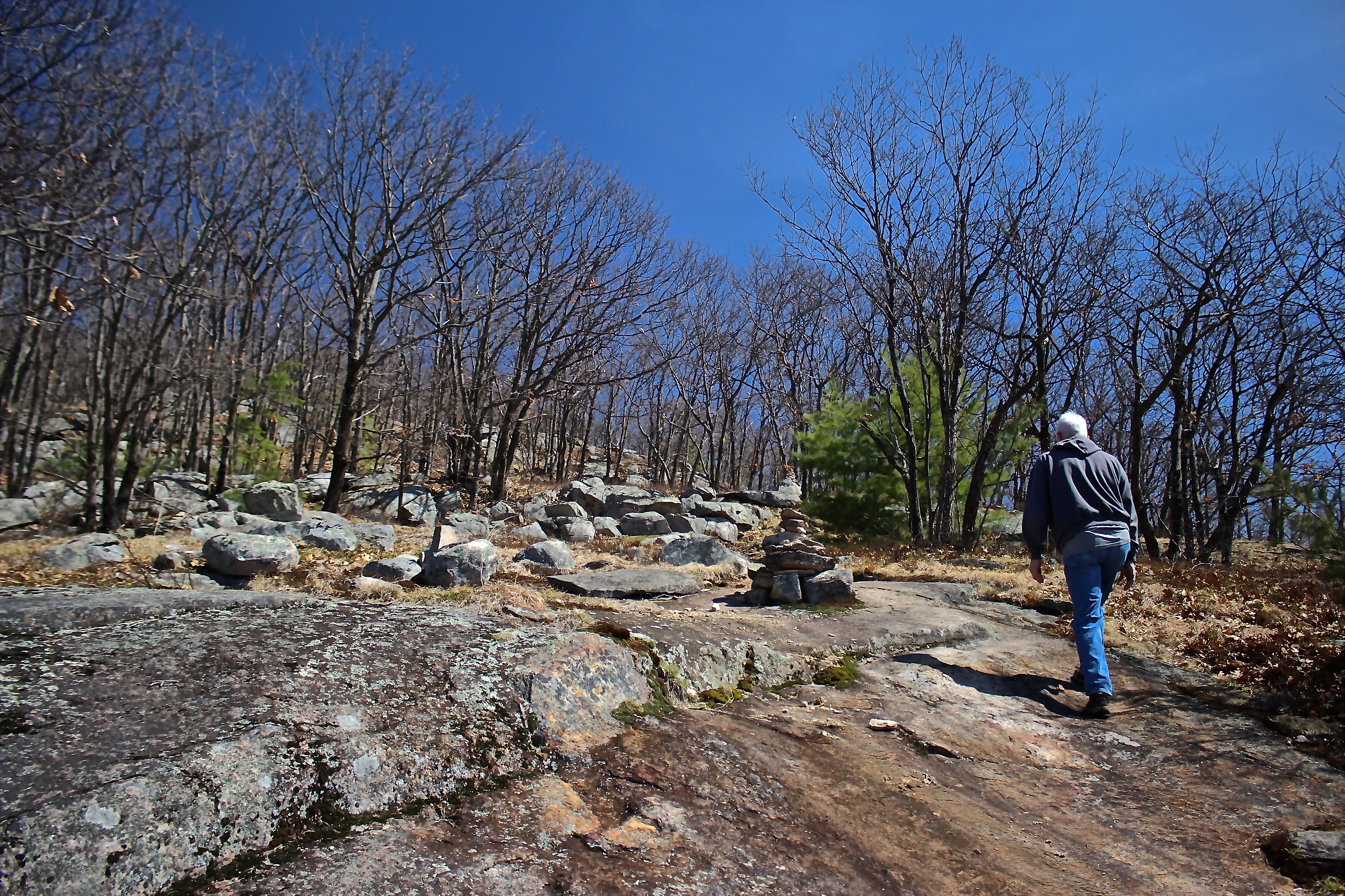
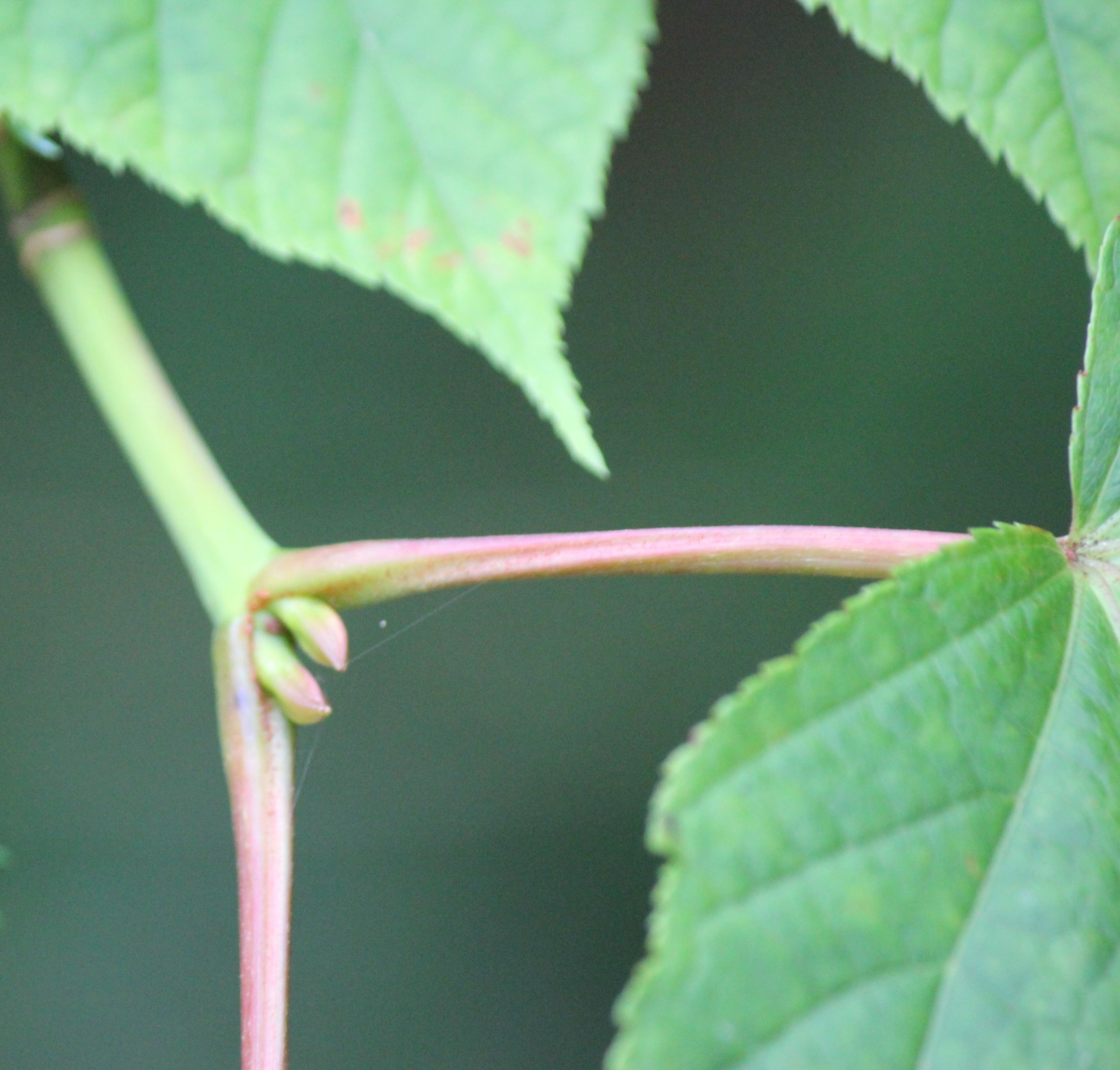
As we climbed, we noticed works of art. I’m not always a fan of cairns, but in this case, each had a flair that bespoke someone’s creative mind.

s-cairn 2

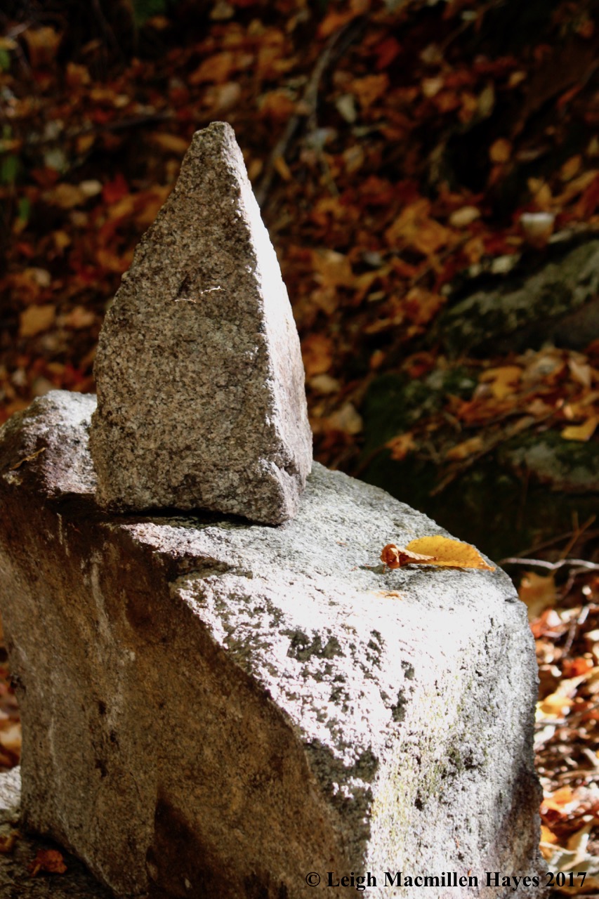
Others were simply simple.

s-water bar

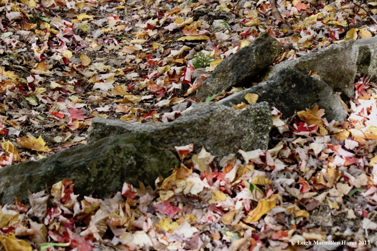
We found water bars that were equally artistic in nature.

s-flagging

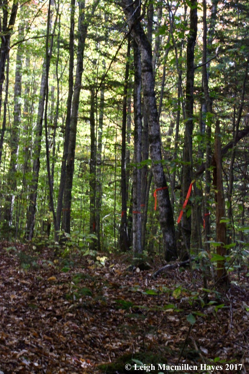
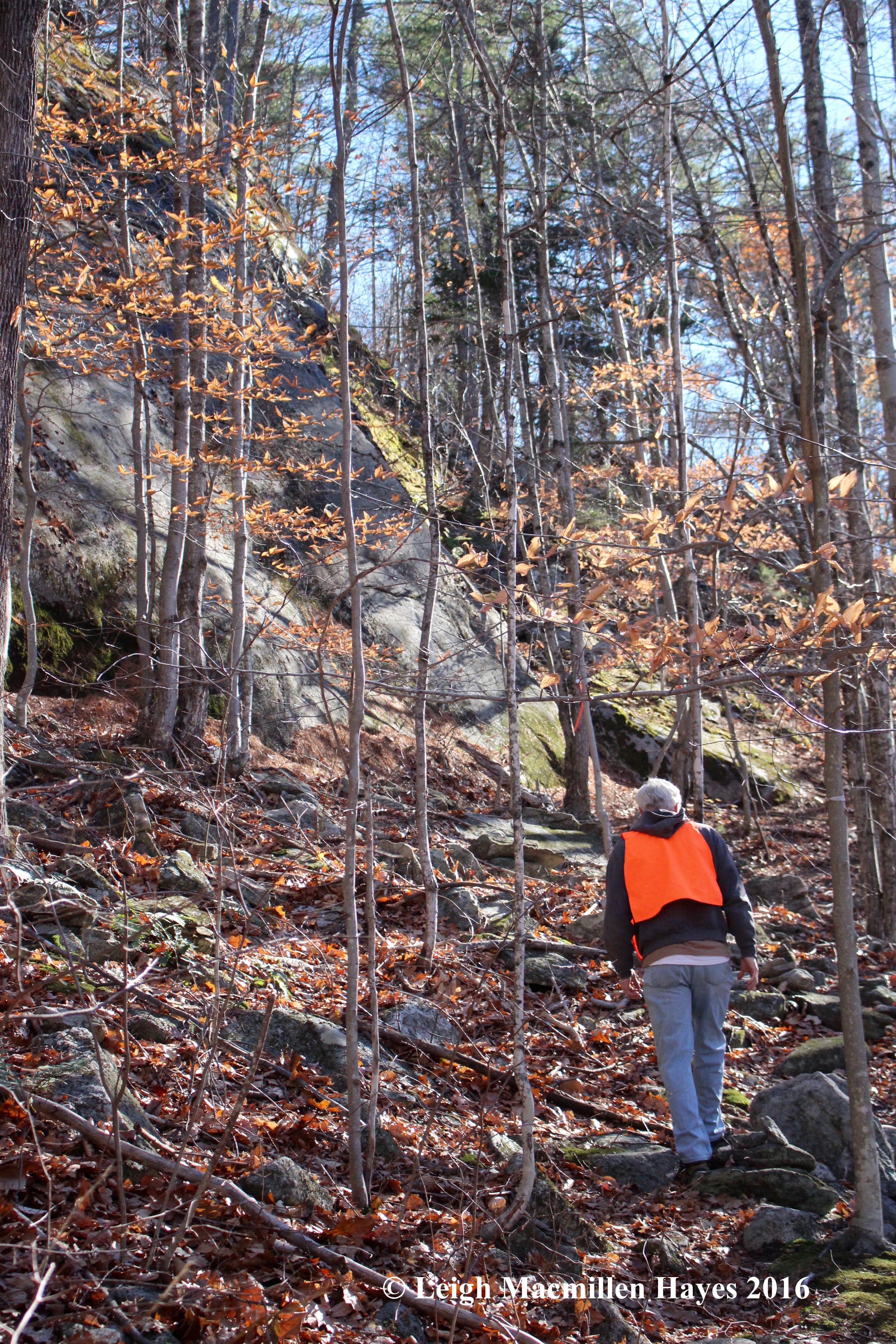
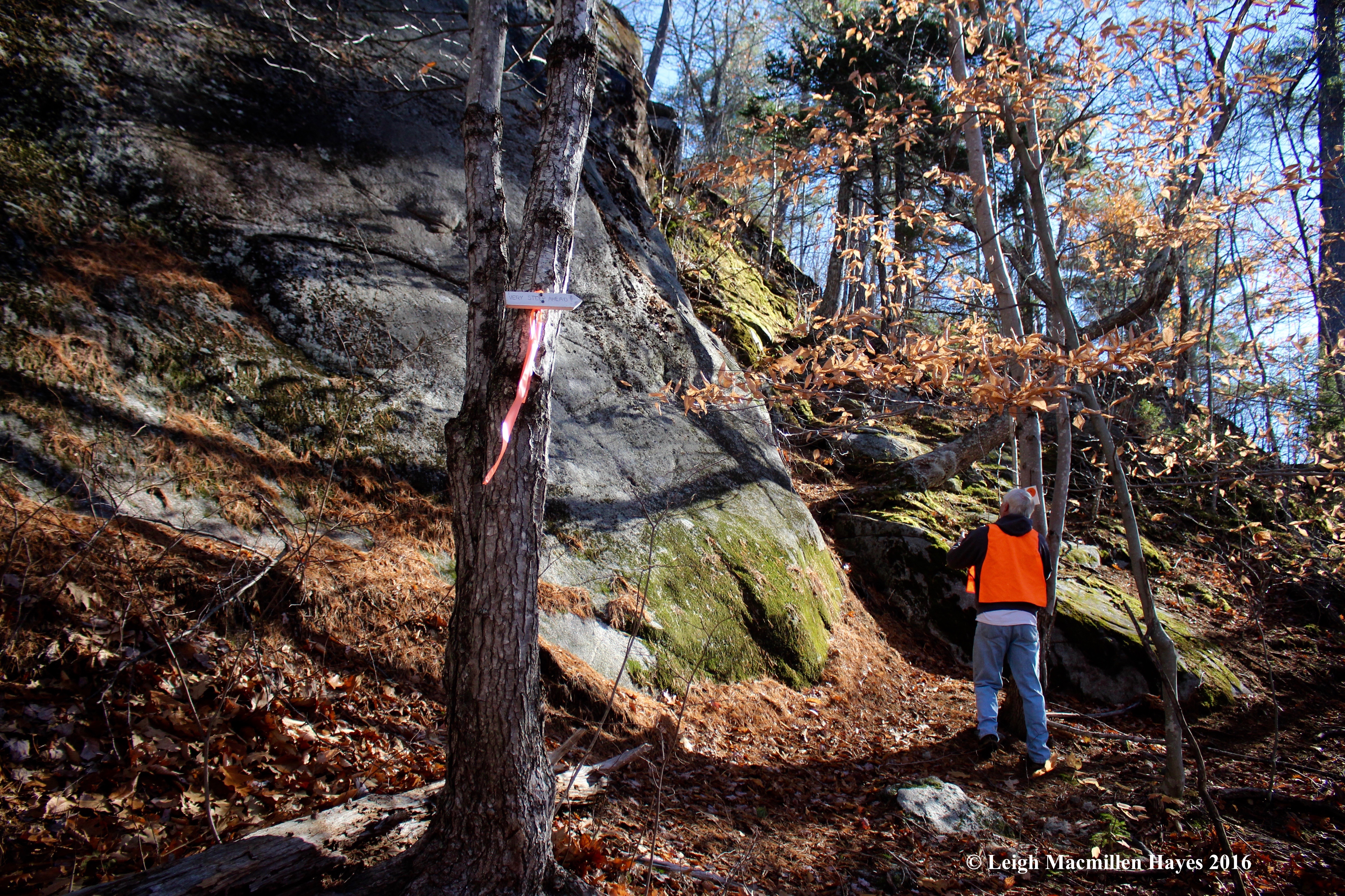
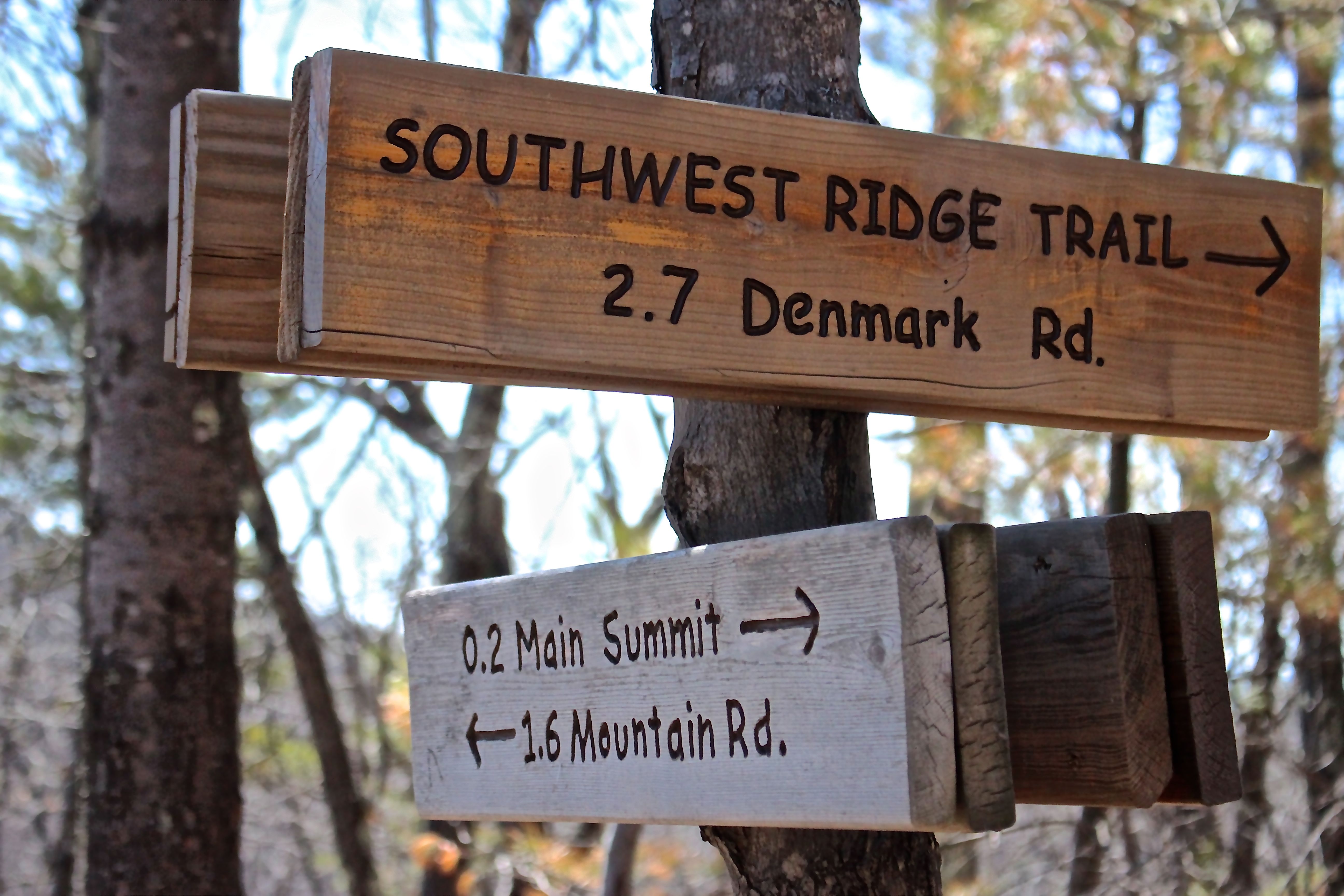
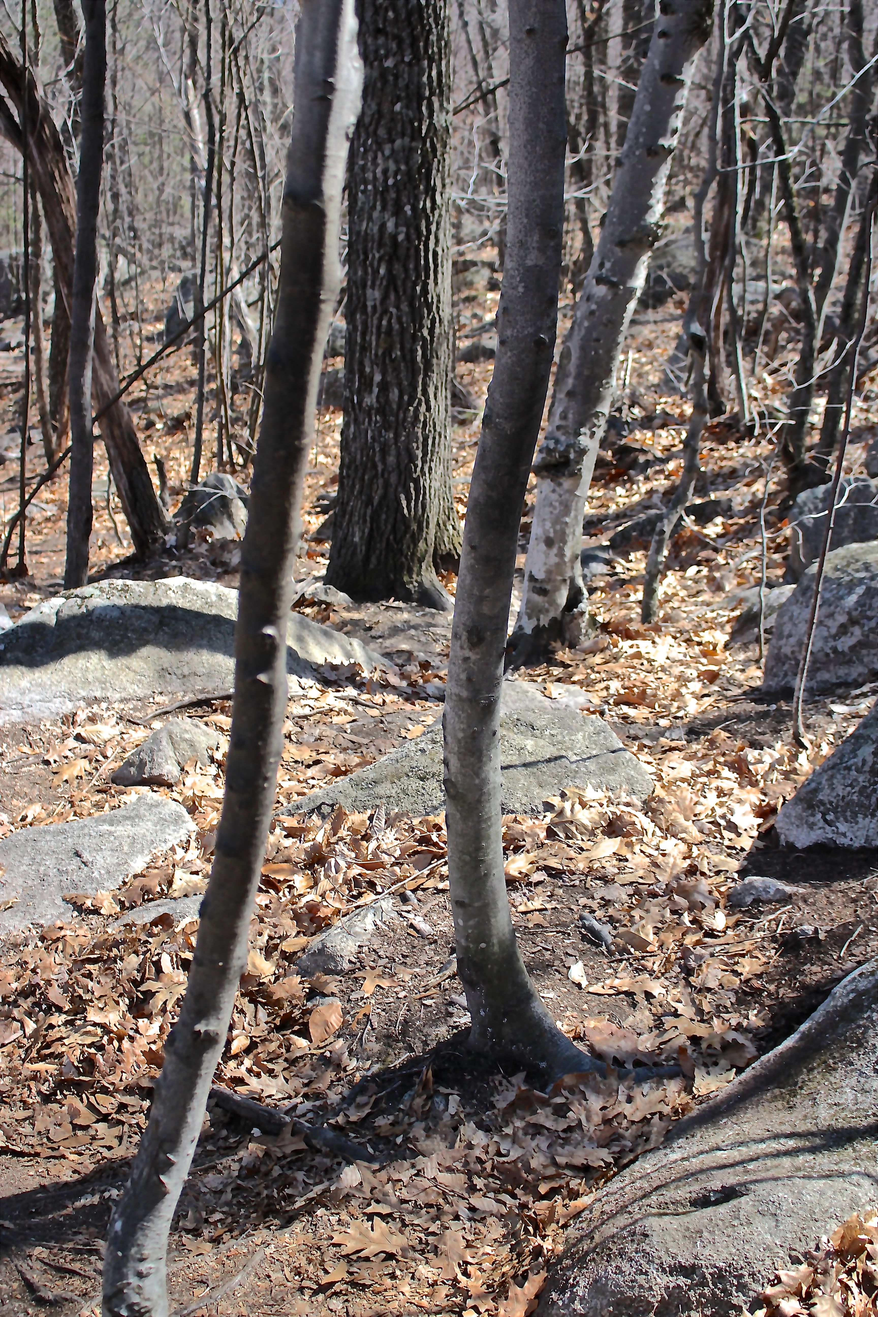
Just over a mile and a half into the hike, the trail turned and though it wasn’t as well cleared, it was certainly well flagged and losing our way wasn’t an option. There would be no getting fake lost on this climb.

s-sledge hammer

Eventually we came to a third section where the trail was again cleared and we found signs indicating the crew might be ahead.

s-stairs 1 (1)

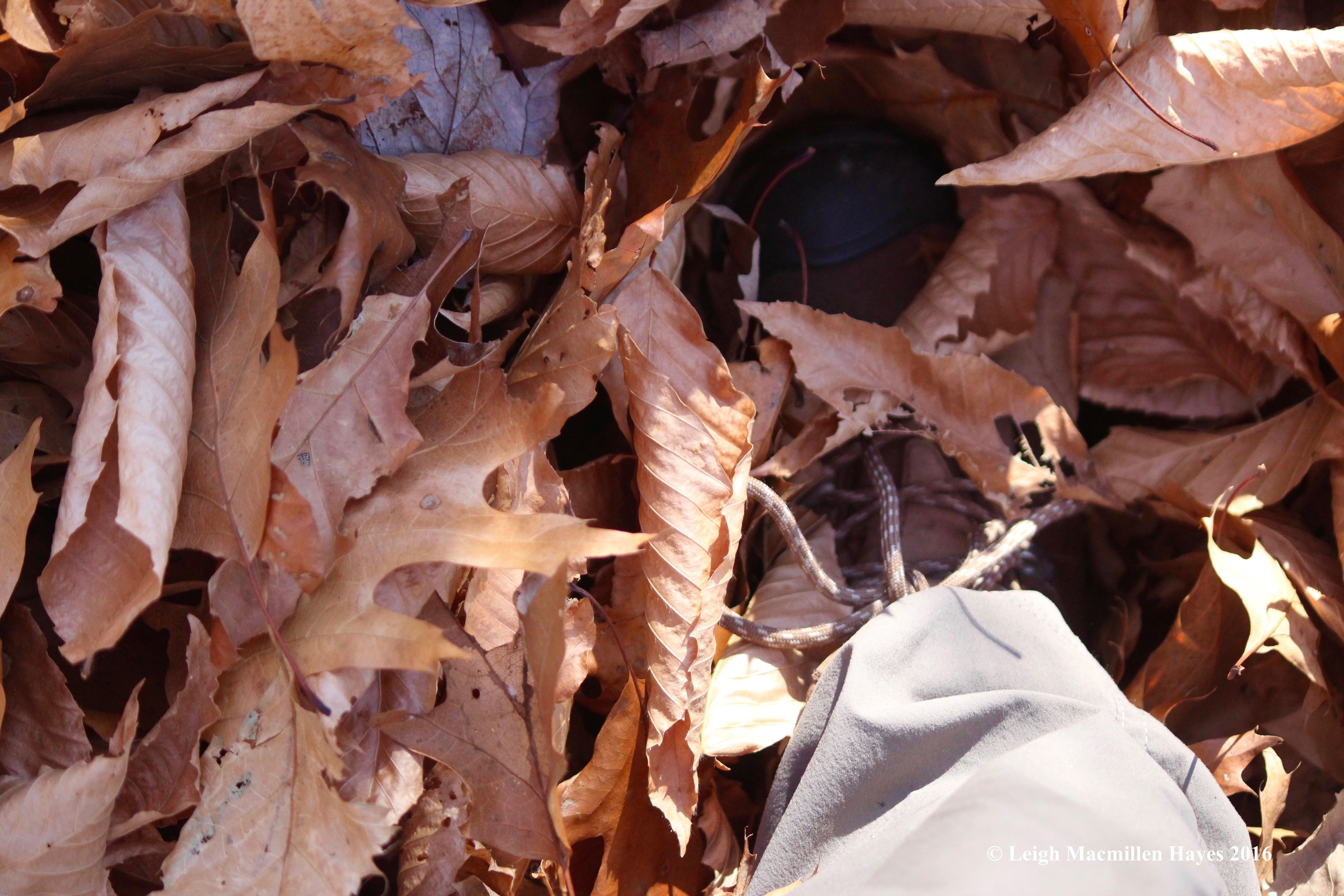
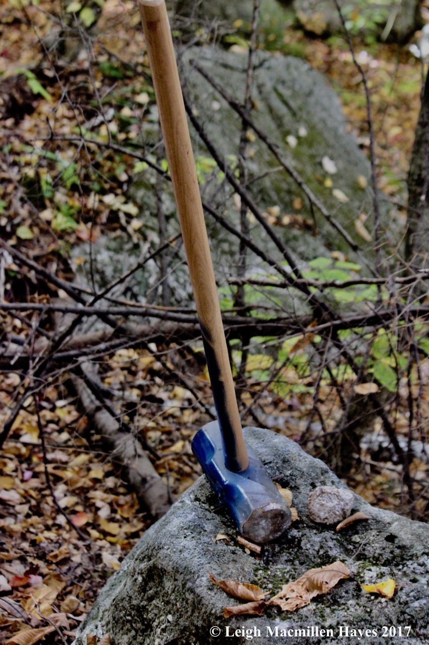
Again, we admired their work, from the stone stairs to wooden steps, all created with materials found within feet of the trail. Work gloves left behind made us wonder if perhaps they wanted us to lend a hand. If you find the gloves, then I’ve a feeling you are good at “Where’s Waldo?”

s-oak ladder (1)

The extra sturdy ladder was created on site from a red oak (and some hefty hardware).

s-Marita, Bruce and Gary 2 (1)

We were chatting companionably when we heard some movement above. And then heard their hellos. We’d found the crew–Bruce, the property manager and Larry, his right-hand man. Bruce and Marita had communicated previously, so he wasn’t surprised to see us and we were full of admiration for the work these two have done–all by hand. In fact, if you ever think you want to do some trail work in your neck of the woods, I highly suggest you locate these two and spend some time working with them for theirs is the best I’ve ever seen. We chatted for a bit, learning about their good works and the good works of the property owners.

s-lunch view

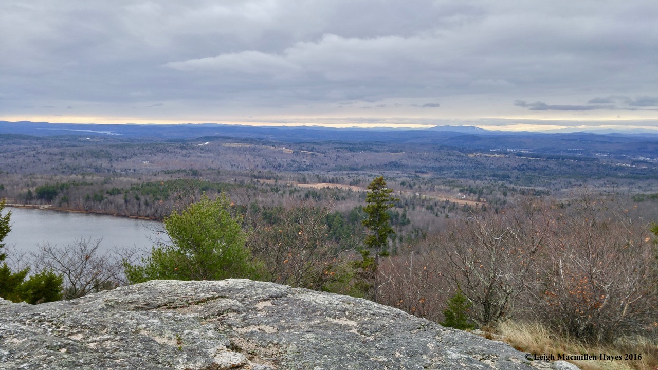
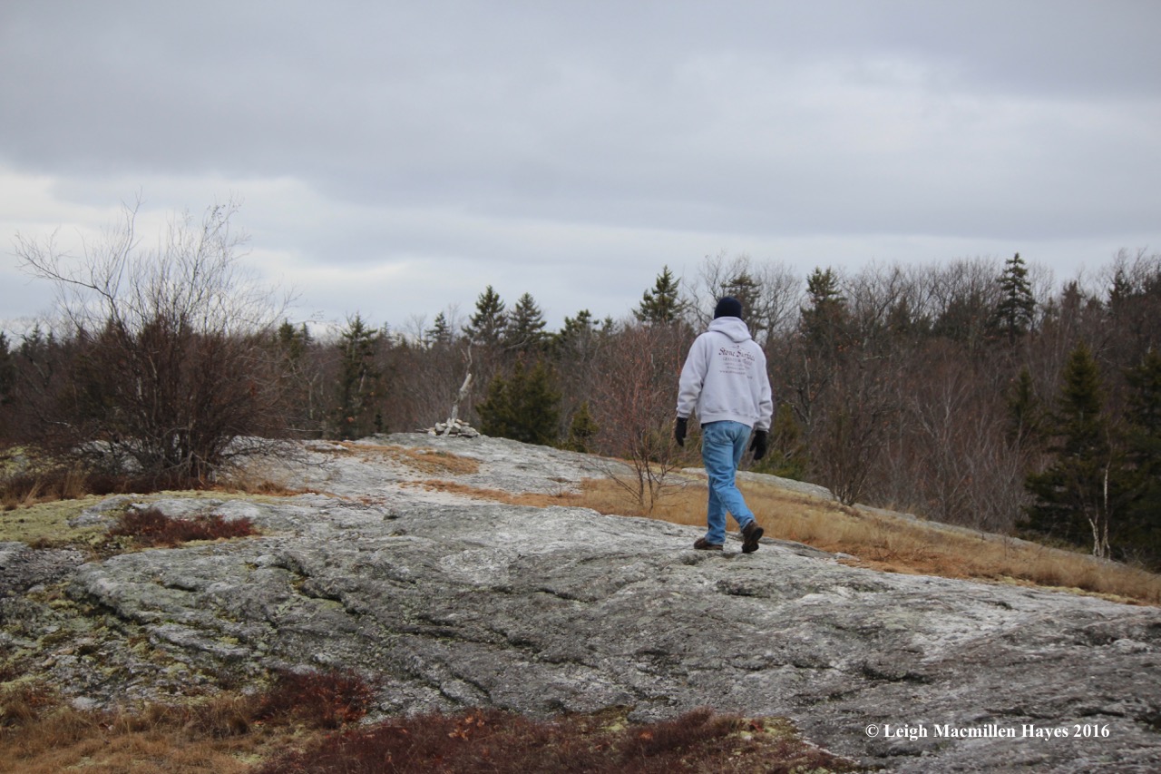
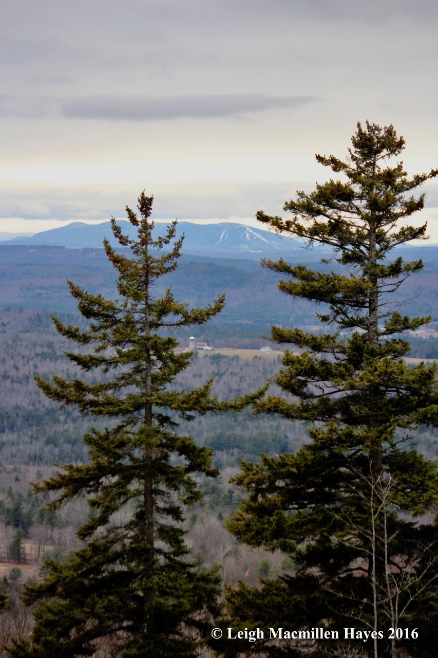
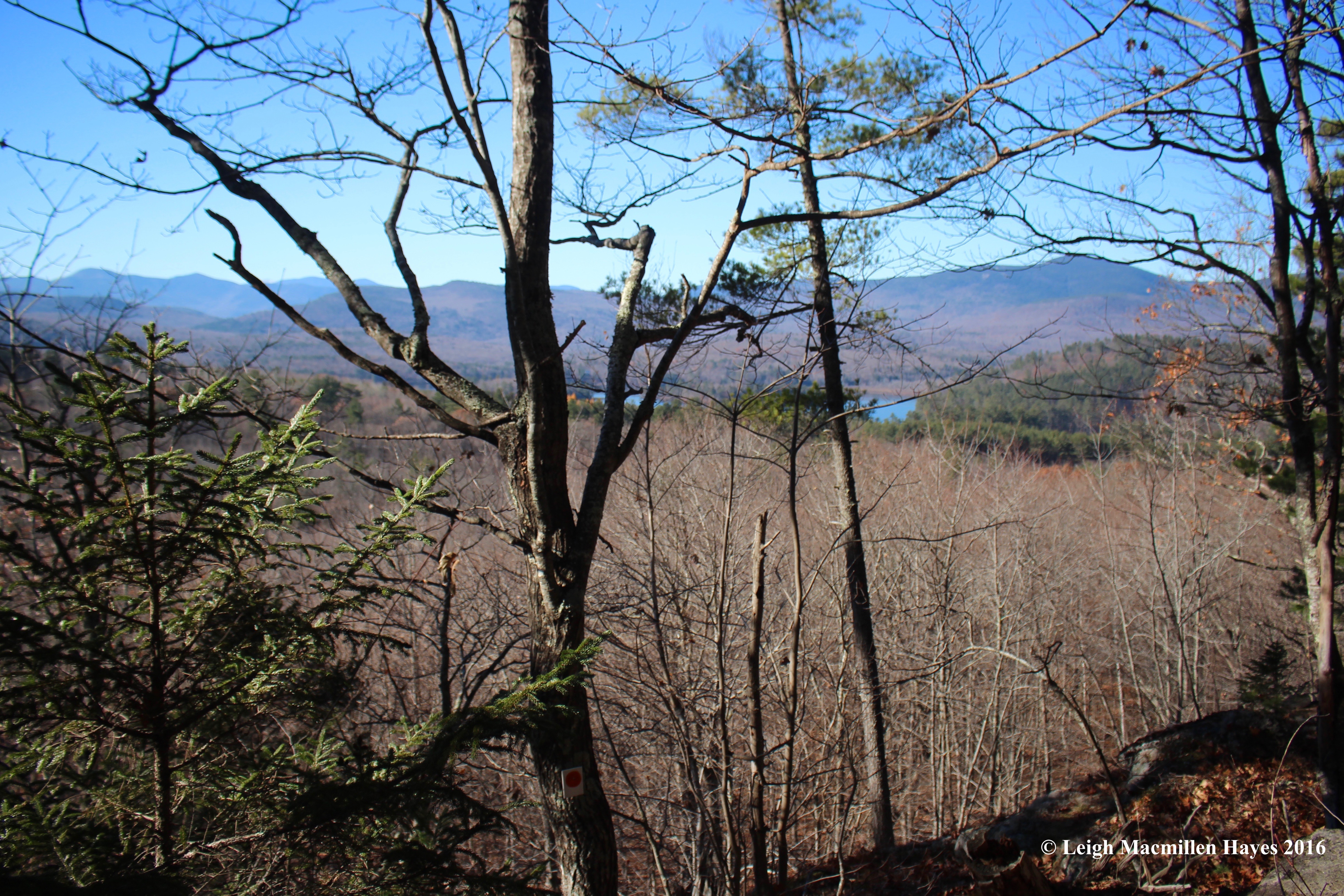
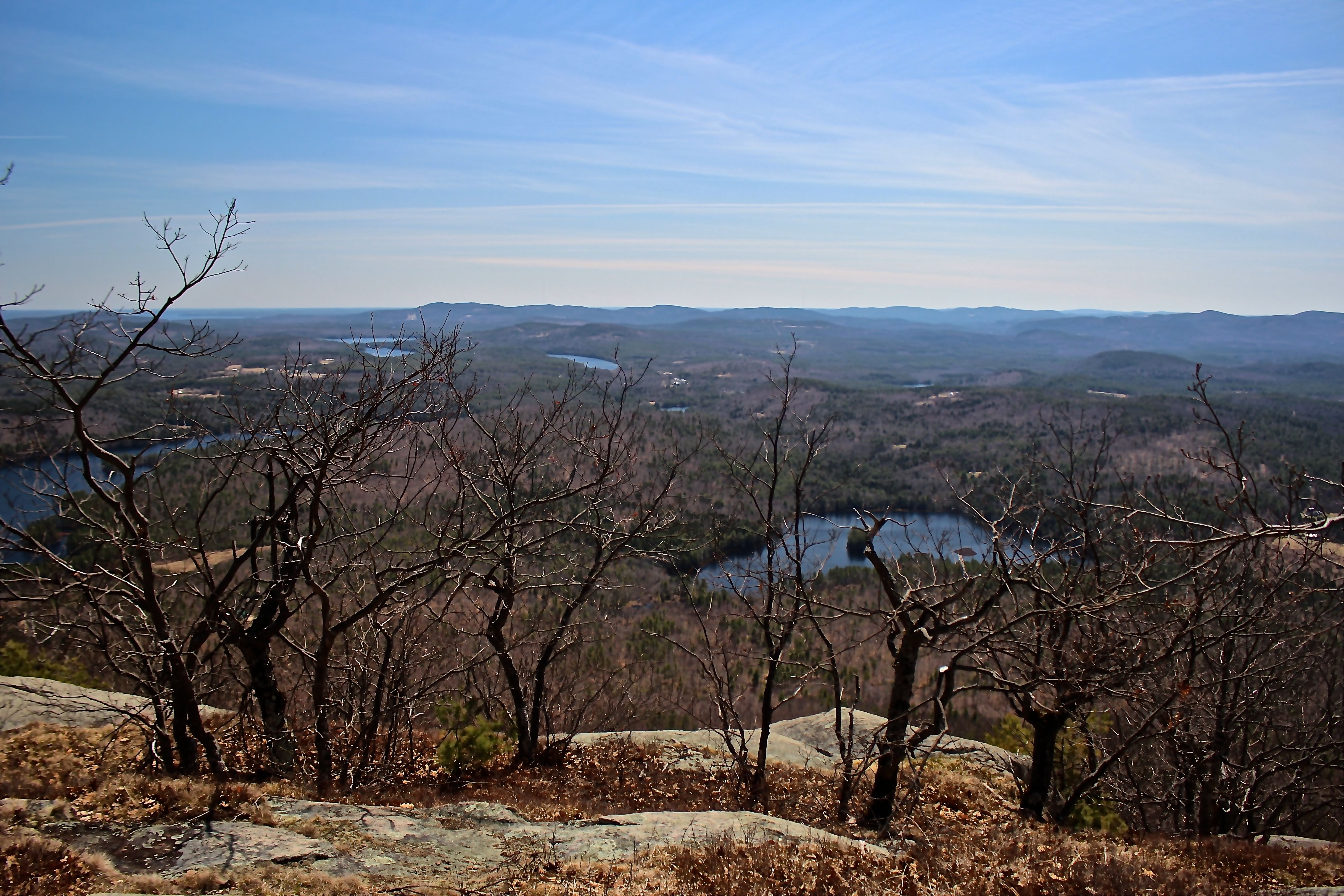
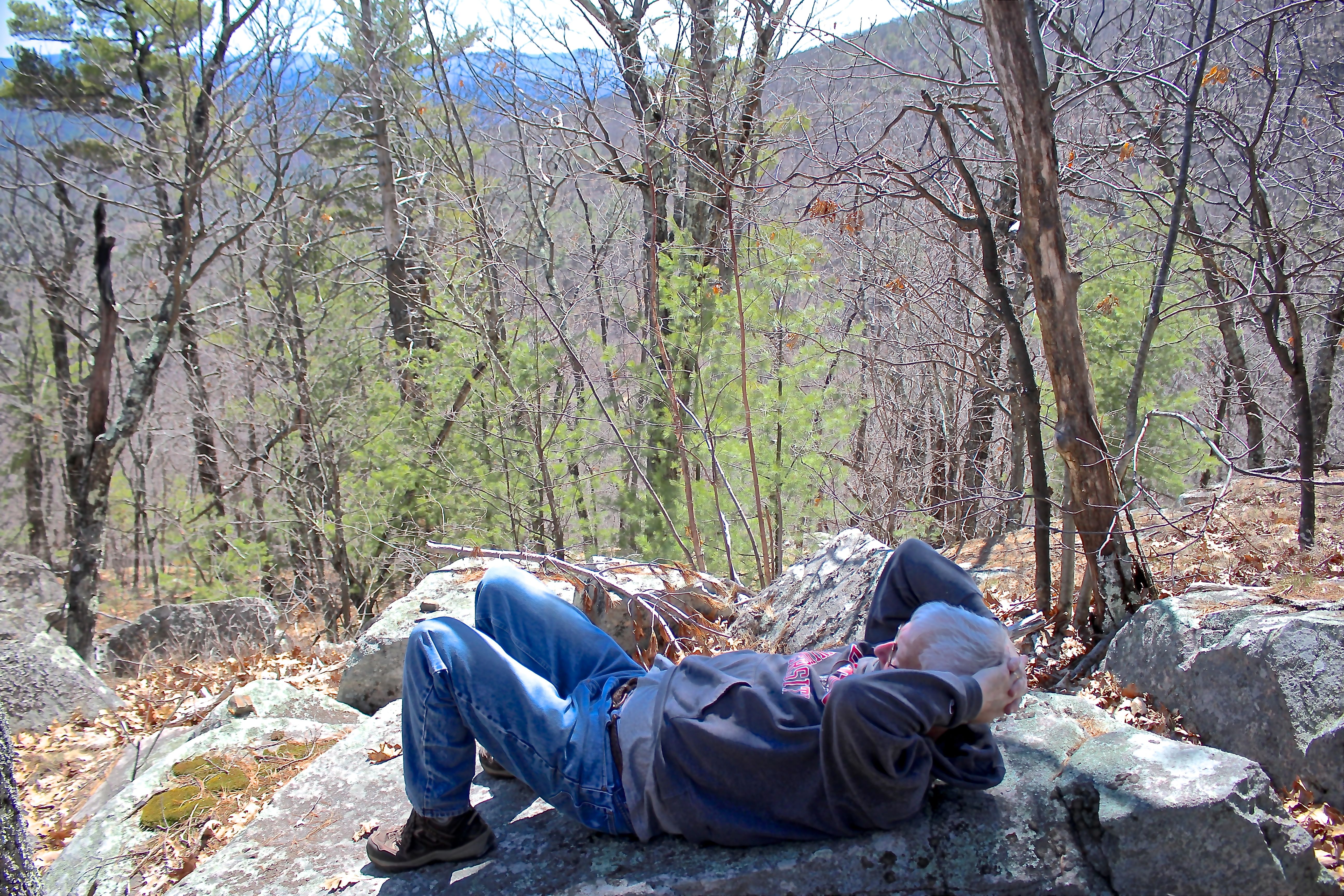
And then it was time for us to move up a few more hundred feet and out to the ledges. We didn’t reach the summit of Long Mountain, for that is owned by someone else, but the ledges with a view of Round Mountain (also owned by the Stiflers), Evans Notch and the White Mountains beyond was the perfect setting for lunch rock.

s-nature's tapestry

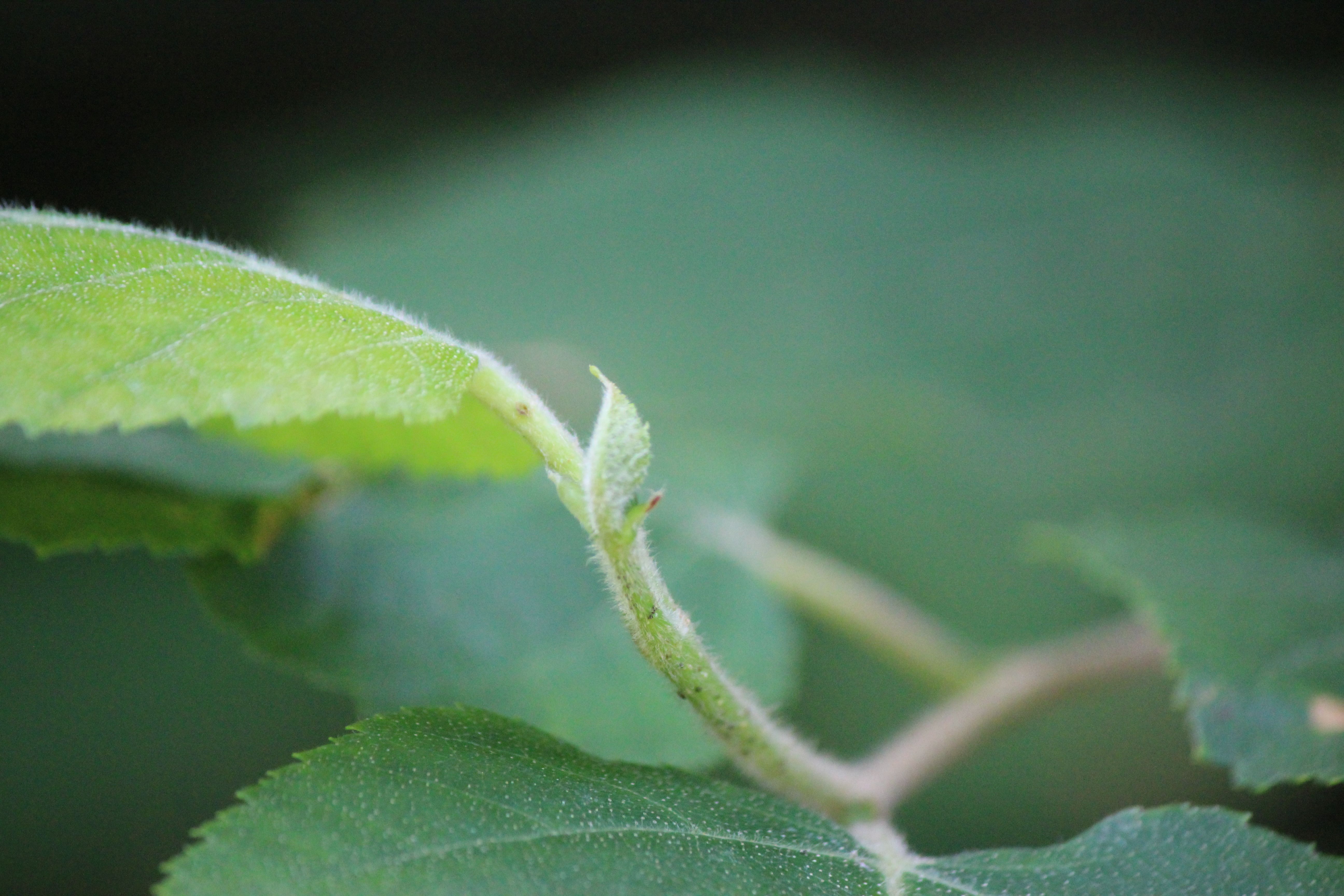
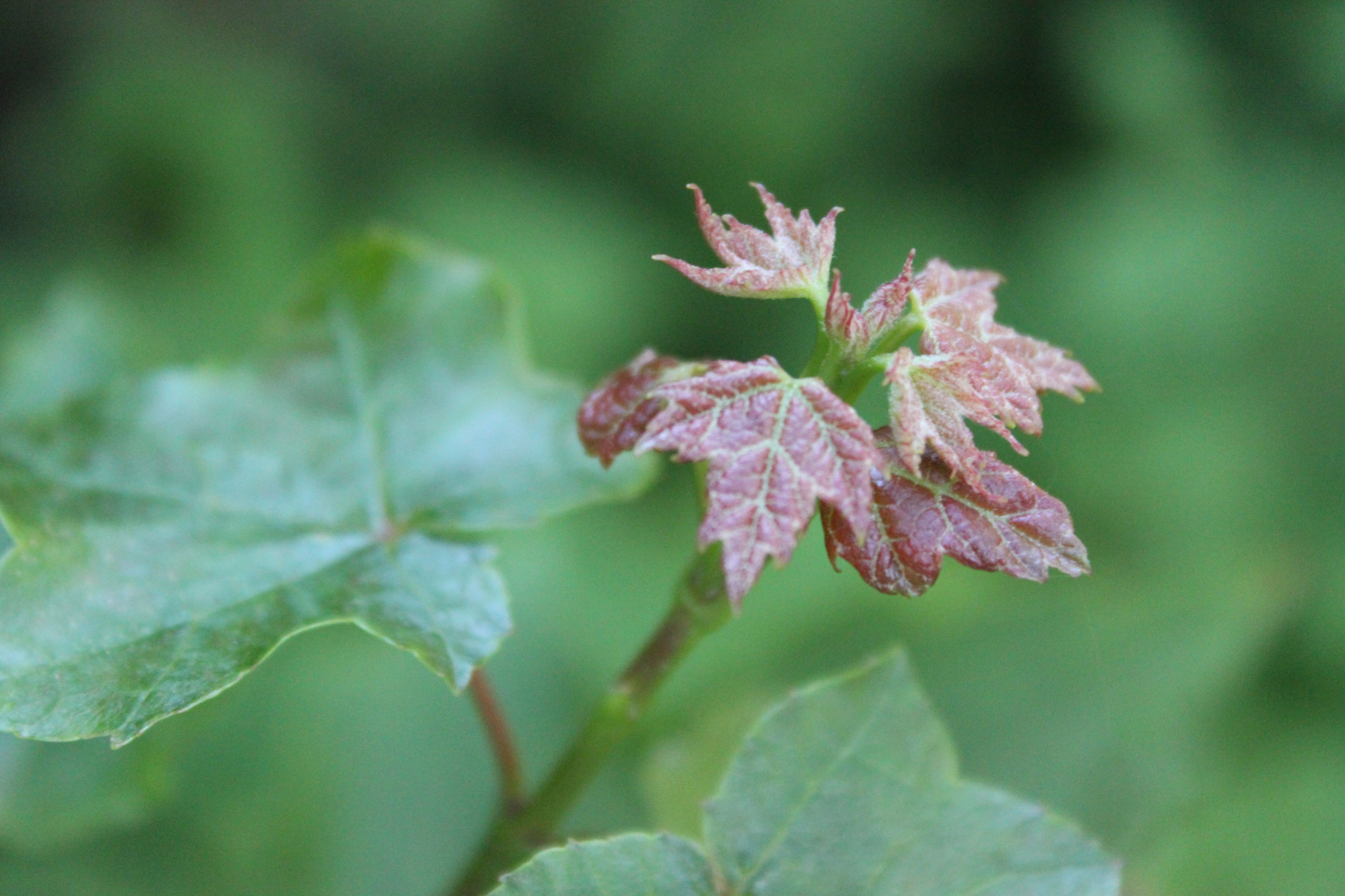
As we ate, we noted that foliage peak had passed in this part of the woods, but still, the tapestry was worth a closer look.

s-Long Mtn trail signs 2

Eventually, we followed the 2.5 mile trail down, repeatedly singing the praises of all who made this hike possible.

s-wasp nest

And then we traveled down another road we’d never been on before and located a mailbox Bruce had told us about as an indicator to the trailhead also owned by the Stiflers. We didn’t find the trail immediately, but did find this huge wasp nest, now abandoned.

s-Speck Ponds trail sign

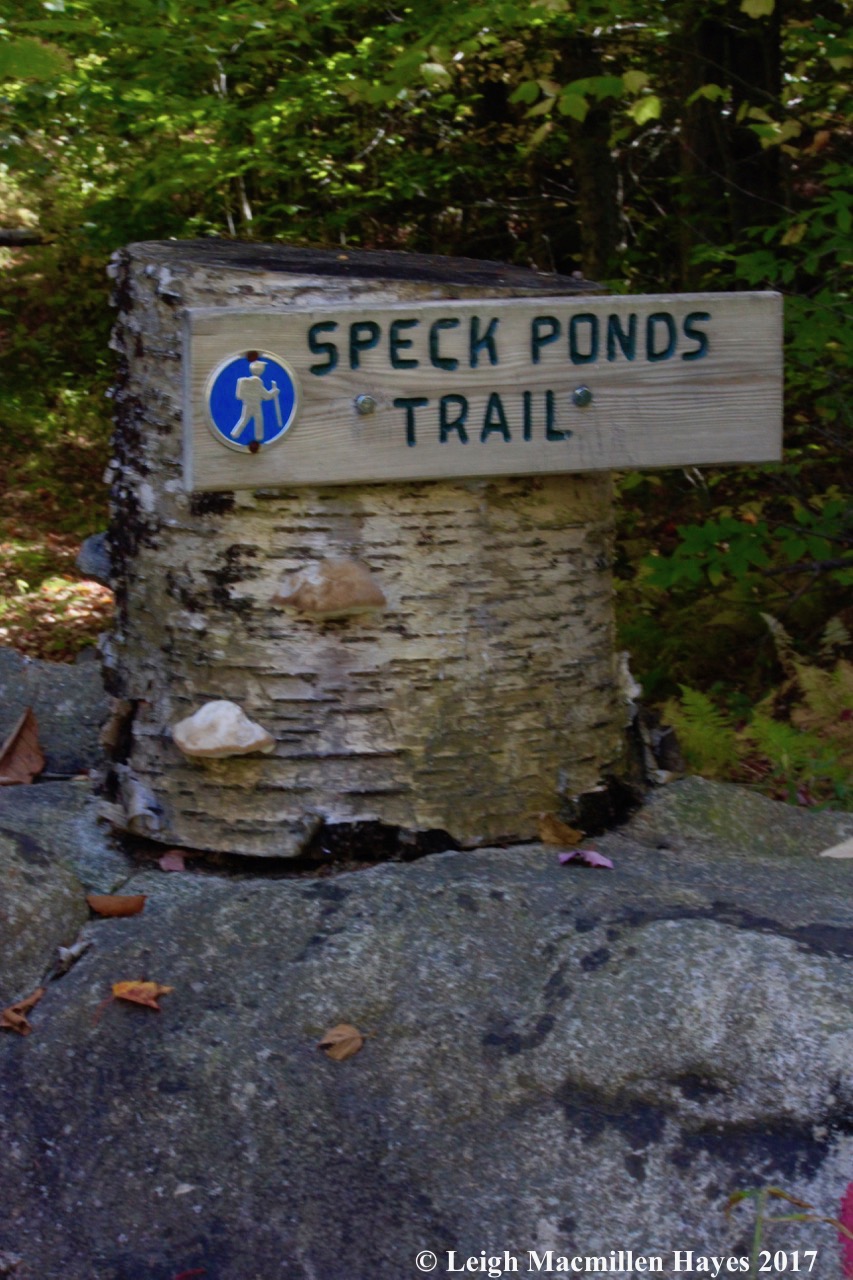
It took us a few minutes because it’s rather hidden, but within a few feet of the trail sign, we recognized Bruce’s artistic mark–sign attached to stump atop rock.

s-Speck Pond signs

And other trail signs that we admired mostly for their coloration in contrast to the paper birch to which they were attached.

s-Norway sign at Speck Ponds

s-Albany

This trail led us from one town to another in a matter of inches.

s-Mt Wash from Speck Ponds

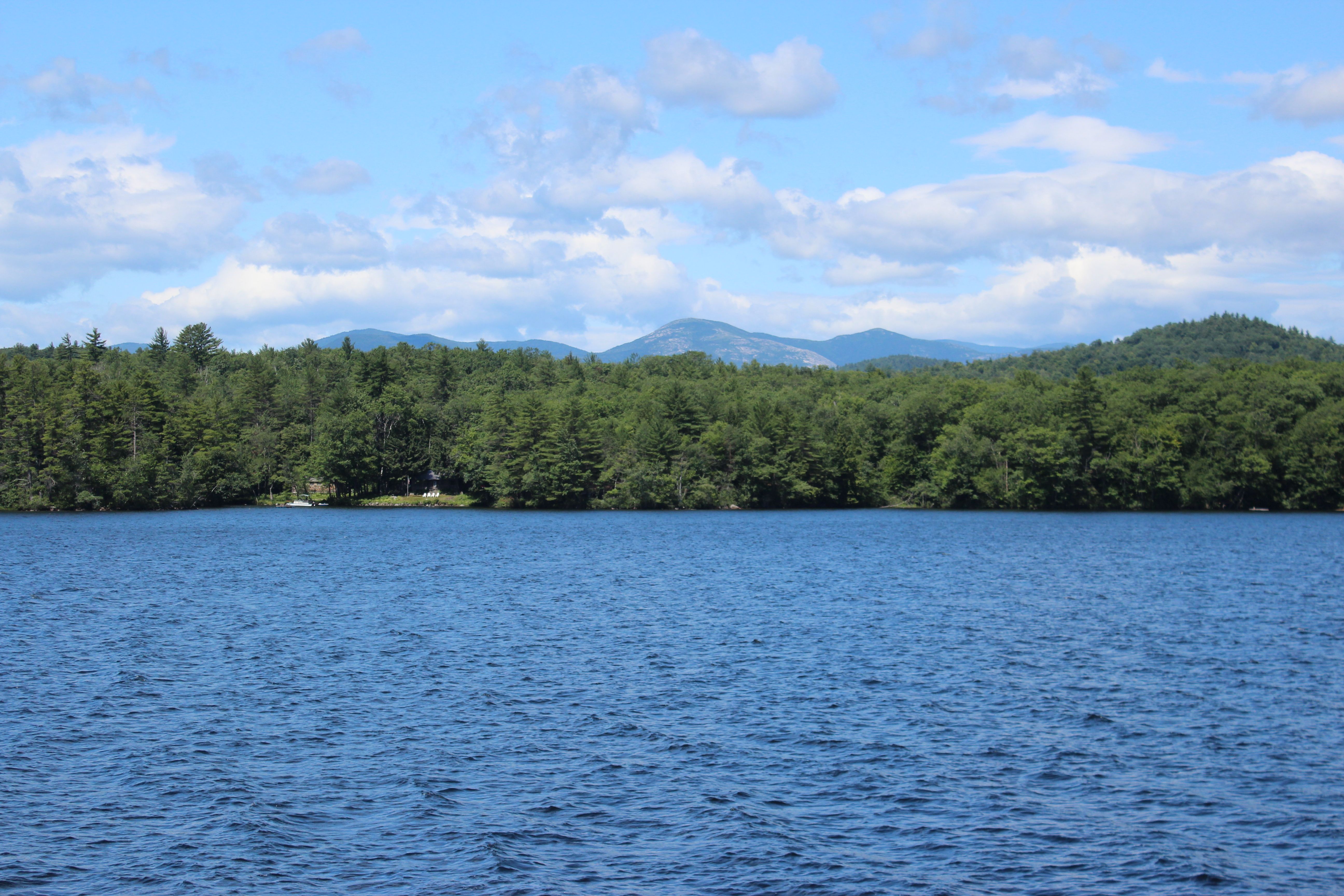
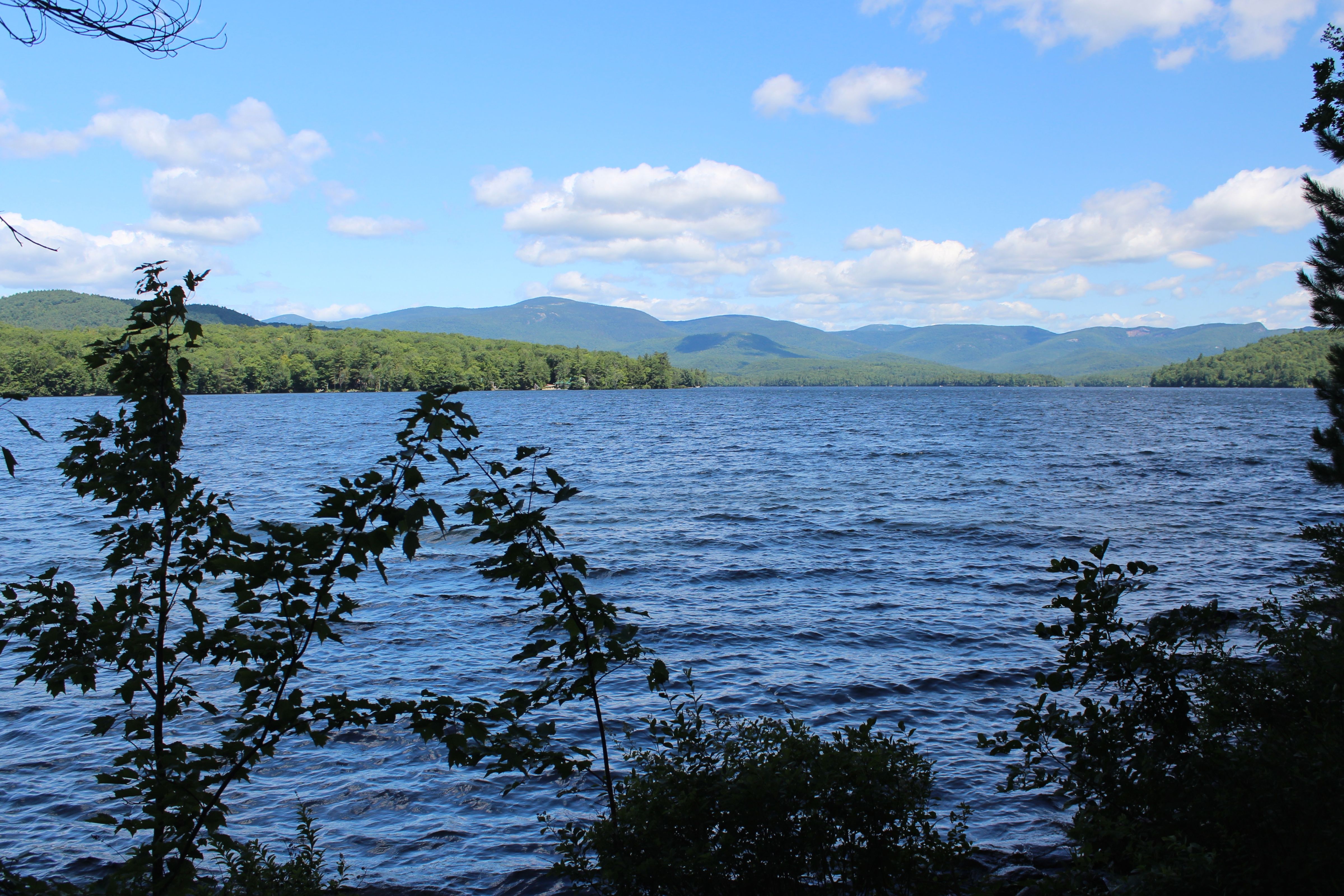
And out on the power transmission line, we turned toward the mountains. with the Whites again in our view–especially Washington.

s-pond 1 (1)

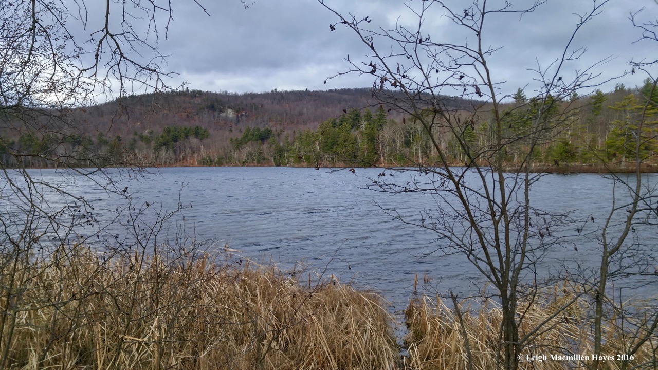
At last we reached Upper Speck and turned to the left as we started on our way to hike around it and Lower Speck in what was described to us as a bit of a figure 8. I think really it was more of a calligraphy “g” in design with a bit of a line between the two ponds.

s-leaf art

Again, our views were delightful, including leaves of different species offering contrasting colors and shadows.

s-painted turtle

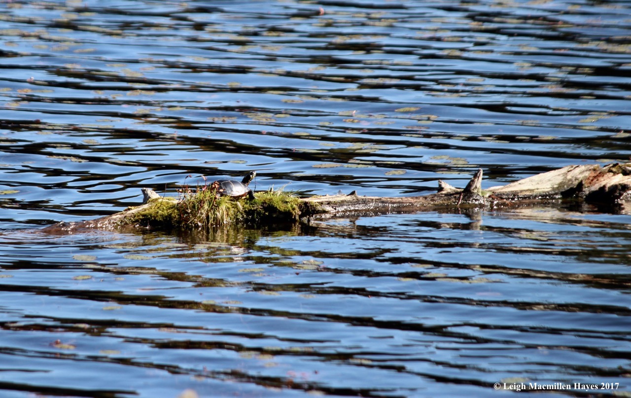
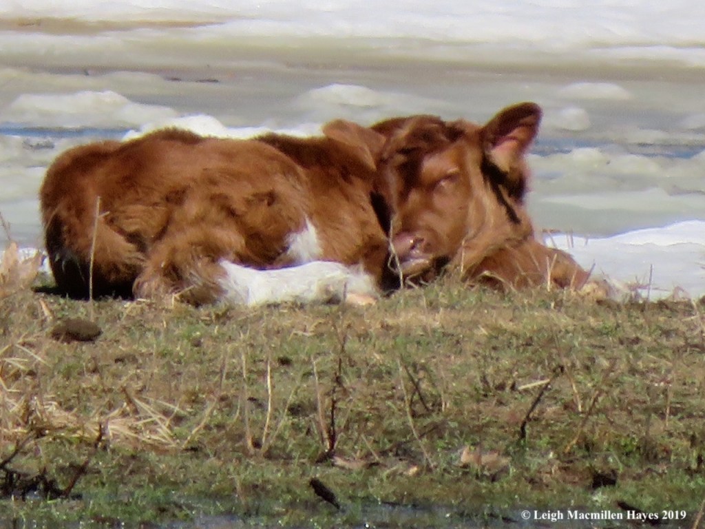
For a few minutes, we had the pleasure of admiring a painted turtle as it sunned itself before I disturbed it. I just wanted to get closer.

s-speck bridge

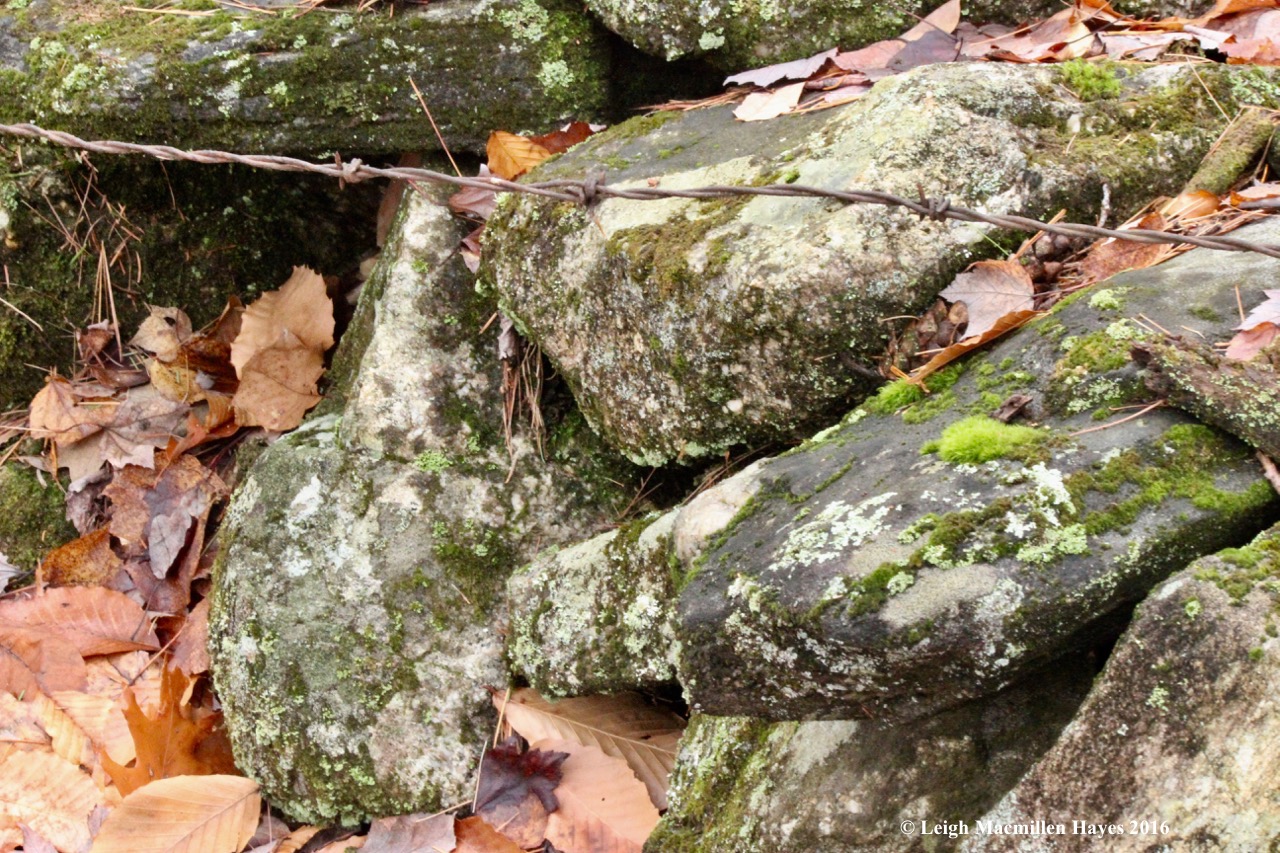
Again, bridges helped us ford the wet spots and we admired the workmanship.

s-bank lodge

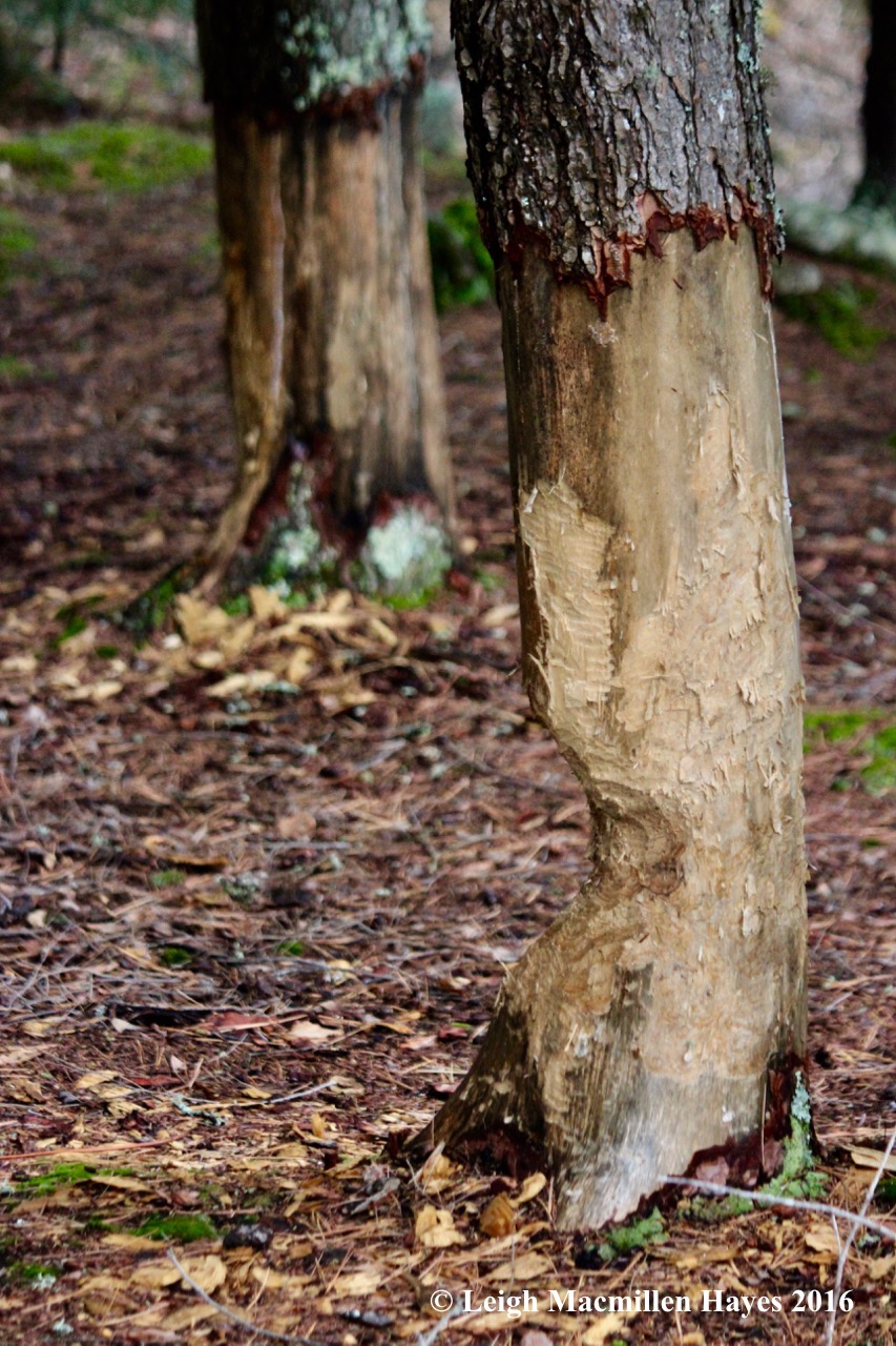
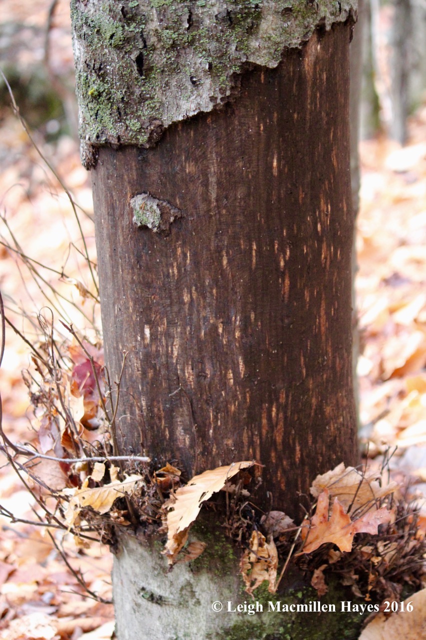
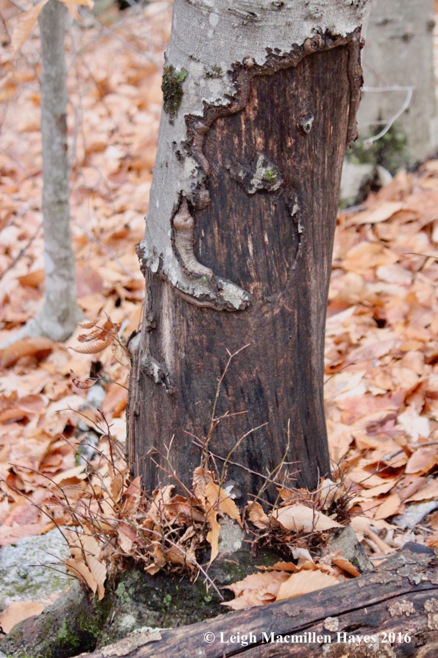
It wasn’t just human workmanship that drew our attention. We saw at least five lodges, some beside the bank . . .

s-beaver lodge 2

and others in the wetlands adjacent to the ponds.

s-beaver works old and not successful

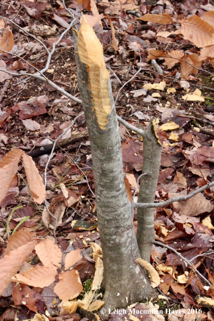
We found lots of old works . . .

s-beaver works old 2

some not entirely successful.

s-beaver dam 2 (1)

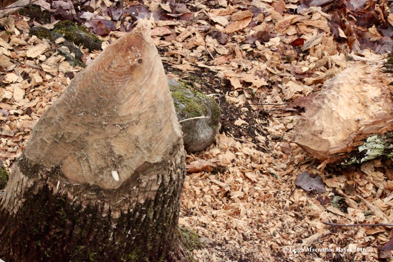
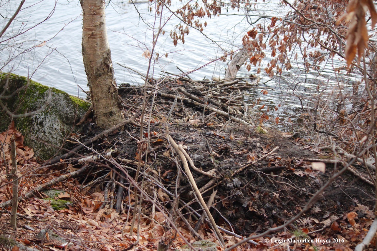
And beside a substantial beaver dam . . .

s-beaver new

we spotted a wee bit of new works–but it wasn’t much.

s-Upper Speck

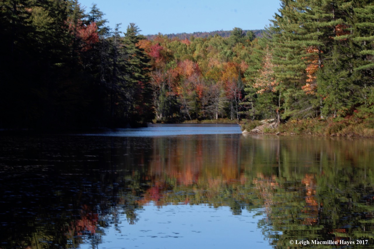
Again, the colors kept us in awe, much as they had done atop the ledges of Long Mountain.

s-fall colors 1

And finally, we completed our “g” loops and made our way out with all of these and so many other photographic memories in our minds.

Today was not an average day for it’s Friday the 13th. And we had the pleasure of learning that one plus one=five–five stars that is, for we gave such a rating to each trail we traveled, and thanks to all who made them possible for us to wander and wonder. Thank you Mary and Larry and Bruce and Gary. And Marita for inviting me to join her.


The Be-Attitudes Sundate

Today marks the beginning of the season of hope and with that in mind, my guy and I climbed Singepole Mountain in Paris. Paris, Maine, that is.

s-halls-pond-start-1

Our hike began beside Hall’s Pond, where the water reflected the steel gray sky of this late November day.

s1-barbed-wire

And stonewalls and barbed wire reflected the previous use of the land.

s1-beaver-6

In a matter of minutes we learned of its present use.

s-beaver-works-3

Everywhere we looked, beaver sculptures decorated the shoreline.

s1-hemlock-grove

We passed from the hardwood community to a hemlock grove . . .

s-hemlock-girdled-2

where more beaver activity was evident. I’ve been reading The Hidden Life of TREES by Peter Wohlleben and have some questions about tree girdling such as this. There is a theory that beavers chew off the bark all the way around (girdle) to eventually kill trees such as hemlock, so preferable species will grow in their place. But, that’s thinking ahead to future generations. Do beavers really do that?

s-hemlocks-3

On page 18, Wohlleben states the following: “As the roots starve, they shut down their pumping mechanisms, and because water no longer flows through the trunk up to the crown, the whole tree dries out. However, many of the trees I girdled continued to grow with more or less vigor. I know now that this was only possible with the help of intact neighboring trees. Thanks to the underground network, neighbors took over the disrupted task of provisioning the roots and thus made it possible for their buddies to survive. Some trees even managed to bridge the gap in their bark with new growth, and I’ll admit it: I am always a bit ashamed when I see what I wrought back then. Nevertheless, I have learned from this just how powerful a community of trees can be.”

Could this theory be true? Are the surrounding hemlocks feeding that tree via their roots? If so, does that throw out the other theory? So many questions worth asking.

s-huge-maple-1

Soon, we left the Pond Loop Trail and started to climb the Singepole Trail, passing by a gentle giant.

s-maple-2

It’s a snag now, but this old maple offered tales of the forest’s past and hope for the future.

s-downy-rattlesnake-plaintain

On a smaller scale, Downy Rattlesnake Plaintain provided a cheery contrast among the leaf and needle carpet.

s-bobcat-ledges-1

The climb was a bit challenging in places, but we held out hope among the ledges that we might see a bobcat.

s-porky-den

No such luck, but we did find this . . .

s-porky-scat

a well used porcupine den.

s1-water-2

Water dripped in constant harmony as we stepped gingerly along the narrow ledges and tucked under overhanging rocks.

s-halfway-up-2-1

About halfway up, we took a break and paused to admire the view.

s-halfway-up-view-1-jpg-communities-defined

The hardwood and softwood communities became more obvious as we looked down.

s-summit-1-1

And suddenly or so it seemed, my guy reached the moment of truth–the summit.

s-halls-pond-to-pleasant-1

From the top, we looked around and embraced our home place, which appeared on the horizon in the form of Pleasant Mountain.

s-pleasant-to-whites-1

A slight turn and the view extended from Pleasant Mountain to the White Mountains.

s-quartz-intrusion

Below our feet, the granite pegmatite shared its showy display.

s-summit-1

We’d read that there was a quarry at the summit, so we headed toward a cairn, in hopes of locating it. Too many jeep trails confused us and we decided to save the quarry for another day. Instead, we turned into the woods to get out of the wind and munch our PB & J sandwiches, the grape jelly courtesy of Marita Wiser and family.

s-wickiup-1

As we poked about, something caught our attention and we moved closer.

s-wickie-3-1

s-wickie-2-1

s-wickie-1-1

A wickiup frame. We admired the efforts of someone to create this traditional structure.

s-pleasant-mtn

Emerging from the woods, we took one last look at Pleasant Mountain, and . . .

s-summit-4

one last view of what seemed to be the summit (though it may have been a false summit).

s-climbing-down

And then we started down, once again hugging the rocks and trying not to slip.

s-flower-mushroom

On the way, I did note a few things, including this fungi that looked more flowerlike than mushroom like.

s-girdled-beech-1

s1-porky-2

And I spotted a phenomenon that occurred repeatedly. Girdled beech trees too far uphill for a beaver. What or who had debarked these trees?

s-porky-works

I may have been seeing things that weren’t real, but the lines on this particular tree made me wonder about the porcupines. Was I looking at the design they leave with teeth marks created in the distant past? Or were they wounds of another kind?

s1-beaver-5

When at last we reached the Pond Trail again, we continued to circle around it, noting more beaver works.

s-beaver-lodge

At last, we found the mud-packed lodge built into the edge of the pond. Here’s hoping for a warm winter within.

s-pond-at-end-of-day-1

Completing the circle, the biting breeze forced us to walk quickly toward our truck and the end of our hike. We have chores to complete tomorrow so our Sundate may have to suffice for a Mondate.

That being said, in this season of hope, we trust we’ll find more opportunities to consider these be-attitudes:

s1-trees-in-harmony

Be supportive of each other.

s1-christmas-fern-1

Be watchful of what’s to come.

s-heart

Be hopeful of love everlasting.

A Devil of a Mondate

Ever since I first saw a photo of a family donning their Sunday best and standing on rocks that form the “Devil’s Staircase” in Lovell, Maine, I’ve been intrigued.

d-historical-society

The photo and description on Lovell Historical Society’s Web site refers to a “staircase” on Sabattus Mountain. And so for years I imagined the staircase leading to that summit, but never located it. And then I learned that a section of trail at the Greater Lovell Land Trust’s Heald and Bradley Pond’s Reserve had earned the same name. Is there a staircase at Sabattus? Or was it accidentally misidentified? Whatever the case, when I suggested to my guy that we attempt the staircase off Route 5, he embraced the opportunity. (I’ve since learned from several friends that indeed, there is a staircase on Sabattus and the photo likely was taken there. The base of the staircase is apparently on private property and no longer a safe climb.)

d-trail-map

And so about noon we ventured forth and figured out a direction that would take us up the steep portions of the trail to the staircase and El Pulpito, and then down the easy trail–with hope that there was such a thing as an easy trail.

d-easy-trail

Actually, at the start it all seemed quite easy as I followed our Monday tradition of racing to keep up.

d-arrow-heavenward

We chuckled when he found an arrow that aimed heavenward–perhaps a sign that all would be well.

d-turning-the-arrow

My guy played spin the arrow to set it toward our destination. (Actually, on the way down, he spun it the other way. Note to GLLT–perhaps this arrow needs two nails.)

d-approaching-ledges

Minutes later, we approached the ledges and visions of bobcats danced through my head.

d-contemplating-the-climb

Acting as our scout, my guy contemplated the upward advance.

d-very-steep

We were forewarned and chose to bypass a bypass.

d-starting-up

He started up what we believed to be the same trail traveled by those Sunday venturers.

d-following-my-guy-up

I followed but not quite as speedily.

d-heading-up

My heart pounded in Edgar Allen Poe manner as I followed him up. I have to admit that there was a point where I wanted to turn around and climb down, but wasn’t certain that would be any easier. And so after pausing for a few moments, I tried to put mind over matter and placed my hands and feet in what seemed to be “safe” spots as I continued to climb.

d-view-from-above-staircase

Above the staircase we were rewarded with a vantage point of Kezar Lake and the White Mountains and a chance to slow down our heartbeats.

d-lunch-view

And later, at El Pulpito, the pulpit, the complete opposite of the Devil’s Staircase–a place to pause, eat PB&J sandwiches, and contemplate life in a relaxed manner.

d-water-at-summit

Within an hour we reached the summit of Amos Mountain and spent some time being.

d-hazy-view-at-summit

Though the sun was in our eyes, the view south was a bit hazier than one would expect on a clear November day. We later learned that a forest fire burned in Albany, New Hampshire.

d-trail-down

For our descent, we followed the blue blazes of the Amos Mountain Trail.

d-tree-across-trail

Though hardly as steep as the climb up, I was thankful for a few downed trees that slowed my guy–momentarily.

d-boot-disappears

The beech and oak leaves were over a foot deep in places and obscured rocks and roots, making for a slippery slide down.

Nevertheless, we did it. Devil’s Staircase up and a devil of a climb down–and yet, two hours later we knew we’d do it again.


From Sheep to Dinosaurs, Oh My!

After leaving a truck at the base of the Ledges Trail on Pleasant Mountain, my guy and I drove to Denmark Village to attend an annual celebration of fiber: the Denmark Sheepfest.

s-sheep 1

Like us, local sheep were ready to shed their winter coats.

s-sheepish look

Waiting their turn, they offered sheepish looks.

s-sheep shearing

But we heard no complaints as the shearing began.

s-MacKay 1

From there, we continued on to the Southwest Ridge Trail of Pleasant Mountain. As we climbed, we thought about the former name of the trail: MacKay’s Pasture Trail.

s-Mac 2

Between the rock outcrops and slope we decided that in the 1800s sheep probably roamed this side of the mountain. I found an 1858 map on the Denmark Historical Society’s Web site, but it’s too small to check names.

s-Denmark_1858

(Thanks to Jinny Mae for sending me a better copy of the map–the McKay’s property is located near the base of the trail on the Denmark/Fryeburg line–makes perfect sense that the side of the mountain served as pastureland for their farm.) Sheep and shepherds–We feel a certain affinity to shepherds/shephards because it’s a family name and were saddened to learn yesterday of the death of one relative we met this past fall in New Brunswick, Canada. Our acquaintance was short, but relationship long. As the Irish say, “May the light of heaven shine upon your grave.” Rest in peace, Ellis Shephard.

s-hiking

We love climbing up this trail and pausing . . .

s-mac 3

to take in the views behind us–Brownfield Bog, Lovewell Pond, Eastern Slopes Airport in Fryeburg, Maine, and White Mountains of New Hampshire in the distance.

s-lunch

In no time, or so it seemed, we reached lunch rock by the teepee. The teepee was constructed by the late George Sudduth, director/owner of Wyonegonic Camps , the oldest camp for girls in America. His wife, Carol, whom I’ve had the pleasure of hiking with, and family still run the camp, located below on Moose Pond.

s-lunch view

Our view as we appreciated fine dining–ham and swiss instead of PB&J–Moose Pond’s lower basin to the left, Sand (aka Walden) Pond with Hancock Pond behind it, Granger Pond and Beaver Pond directly below us. Actually, if you look closely, you might see Long Lake between Moose and Hancock. This is the Lakes Region of Maine.

s-fire tower 1

We continued along the ridge and the fire tower came into view. Once the leaves pop, this view will disappear until fall.

s-vp

At the vernal pool between knobs, we only saw one large egg mass–I had to wonder if the number is related to the amount of human and dog traffic.

s-ft2

And then . . . we were there. At the summit of Pleasant Mountain. With a kazillion other people and dogs.

s-summit 3

Again, we could see the bog and Lovewell Pond behind it,

s-summit view

plus Kezar Pond in Fryeburg and Mount Washington beyond.

s-summit 2

No matter how often I gaze upon this view, I’m always awestruck.

s-trail sign

We had two options because we’d left two trucks, and decided to follow the Ledges Trail to Mountain Road.

s-toadskin

Though I was with my guy, Mr. Destinationitis, I did stop long enough to admire the common toadskin lichen with its warty pustules.

s-toadskin and tripe

Had this been a teaching moment, the lesson plan was laid out in front of me–toadskin versus common rock tripe. Warty versus smooth. A difference in color. Both umbilicate lichens–attached to the rock substrate at a single point. OK, so maybe it was a teachable moment.

s-rest

But one of us didn’t give two hoots. He tolerated me . . . while he rested. ;-)

s-ledges 1

For the most part, we hiked within feet of each other, but I can never resist stopping at this point as we come upon the beginning of the ledges that gave this trail its name.

s-trees

Continuing down, I frequently grasped trees and thought about how many handprints are imbedded in the history of this land–from Native Americans to surveyors to shepherds to trail blazers and hikers. On this made-in-Maine type of day, we encountered many people of all ages and abilities–and were glad to share the trail with them.

s-dino1

It’s not only people and sheep who have moved across Pleasant Mountain. Even today, dinosaurs made their presence known.


Branching Out

I felt privileged this morning to sit under the tall pines overlooking Kezar Lake and the White Mountains while participating in a poetry workshop.

Judy Steinbergh, a published poet and summer resident of Lovell, conducted the workshop for the Greater Lovell Land Trust, Charlotte Hobbs Memorial Library and Hewnoaks Artist Colony. The latter graciously served as the setting.

Hewn Oaks porch

From 2012-14, Judy served as the inaugural poet laureate of Brookline, Massachusetts and she has over forty years of experience teaching poetry to students of all ages. It’s a delight to listen to her share her passion for her work and that of others. She epitomizes the rhythm of nature.

And so it was, that after Judy shared examples and techniques with us, we were set free to wander about this magnificent property in search of inspiration. Hewnoaks  was originally established as an artist colony by the Volk family in the 1890s. Today, it is a non-profit organization that gives “artists time and space to create within a natural, rustic environment.”

pines

Hewn Oaks

mountain views

Kezar

morning view

Finally, I pulled out my hand lens and focused on smaller details.

A Leaf

Life begins

 striped maple buds

As a tree bud

 oak bud 2

Tightly embraced

by Mother Earth.

quaking aspen scales

Its waxy scales

buds

and peachy fuzz

provide protection

leaf unfurling

until it unfurls

new leaves

and gathers energy

new red maple leaves

in the hope

 hope

of branching out.

~LMH, 7/22/15