A Special Mondate

Our plan was to hike up Blueberry Mountain and continue on to the summit of Speckled in Evans Notch today, but as we drove toward the White Mountains I mentioned that a friend had shared a photograph of ice inside a mine near the Basin on Route 113. And so in an instant said plan changed.

b1-sign

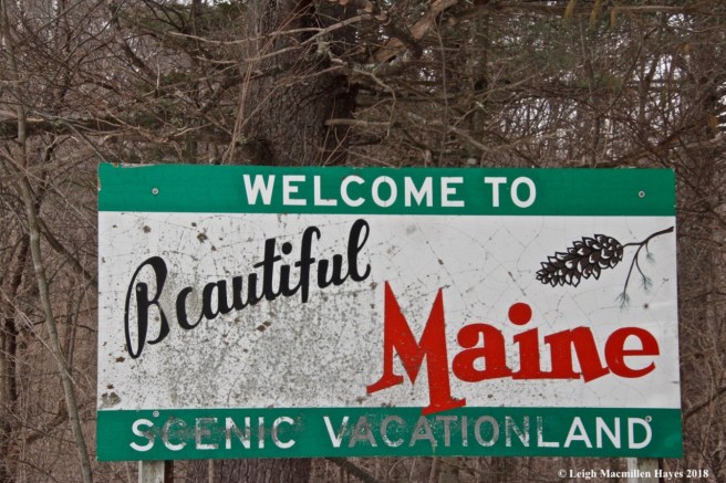
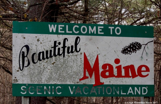
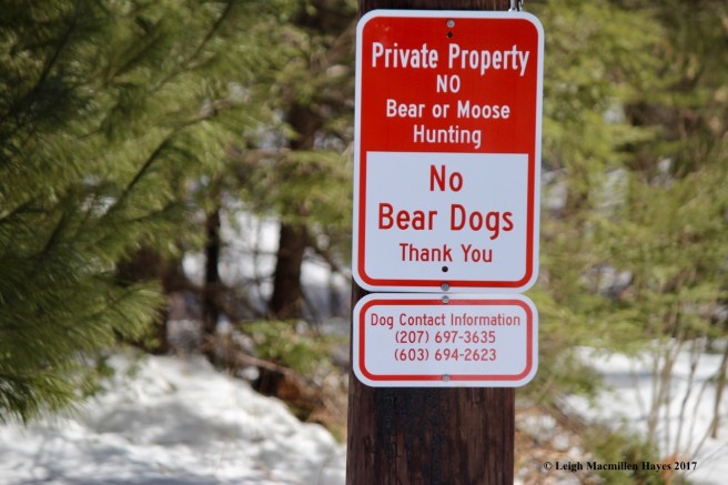
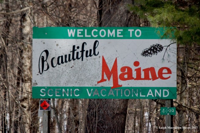
We parked near the iconic Welcome to Beautiful Maine sign and ventured off in search of the mine. Of course, I’d forgotten where exactly it was located, so we walked about a mile on a snowmobile trail until we spied private land in front of us. That was our turn around point, but . . . me thinks we should have continued because I later learned that the mine sits between public and private property.

b2-gray birch

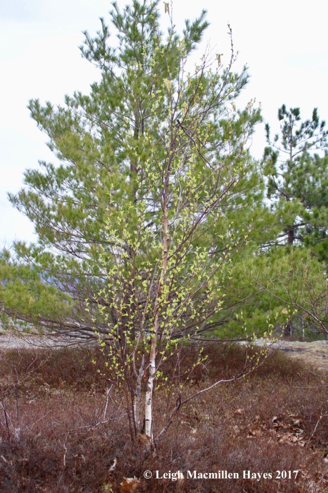
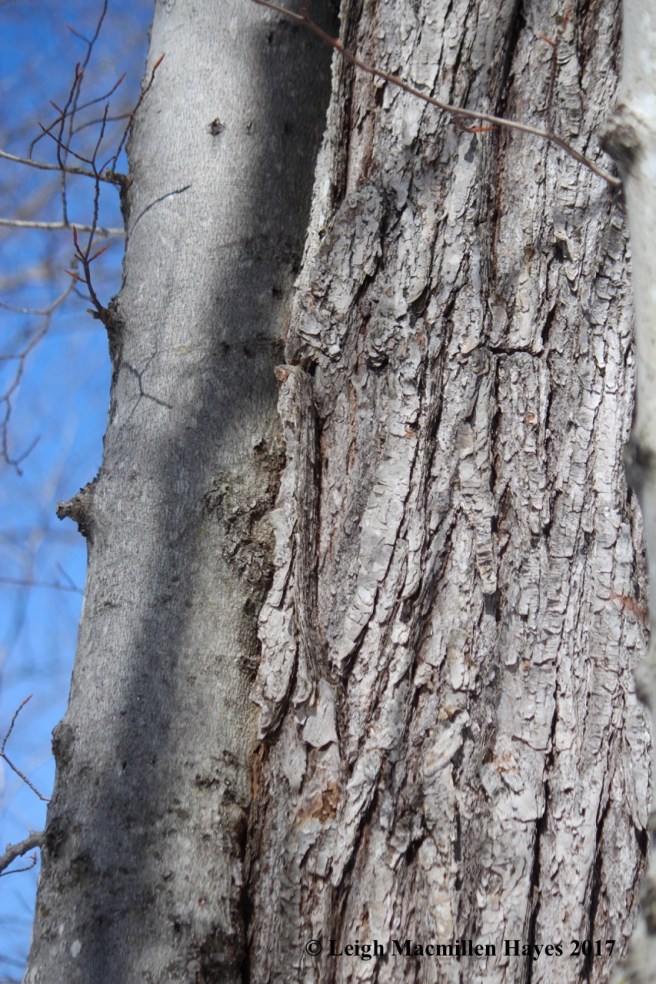
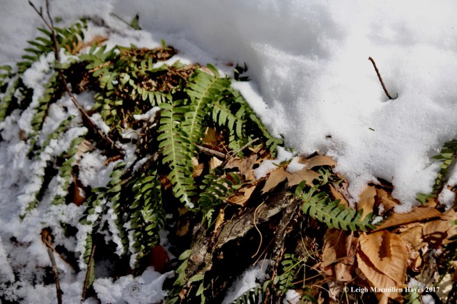
We didn’t mind for we knew we’d return with more accurate directions. It wasn’t the first time we’ve erred. And besides, the gray birches were beautiful.

b3-lemonade stand

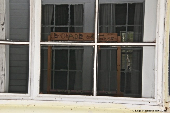
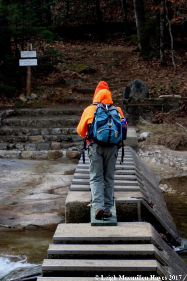
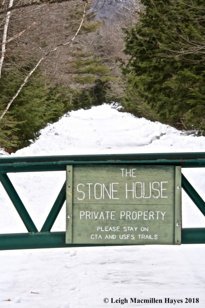
After we’d covered about three miles, we headed back to the truck and drove to Stone House Road, where we parked near the trailhead for the Leach Link Trail. We could have continued toward the Stone House since for the first time ever, it was plowed, but the lane was narrow and had we met another vehicle, it would have been a challenge to back up. Besides, I love to walk the road for there’s always something to see . . . like the lemonade stand. Who knew?

b5-Pole #15

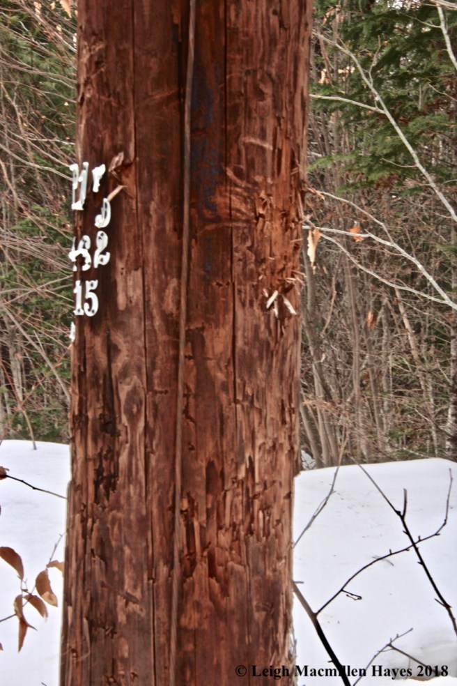
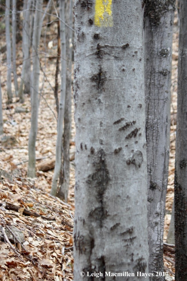
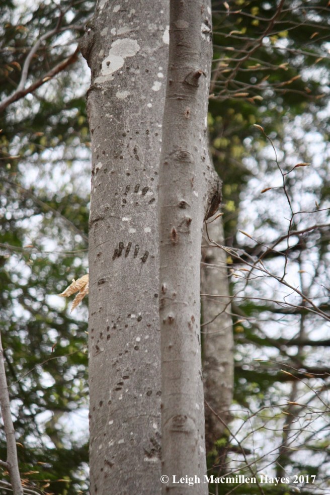
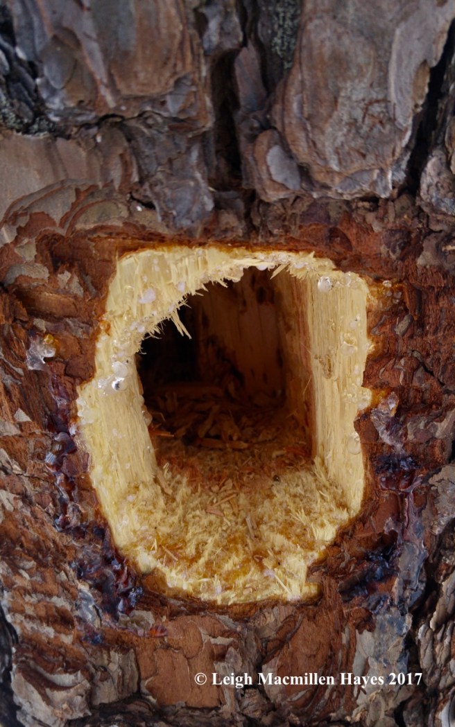
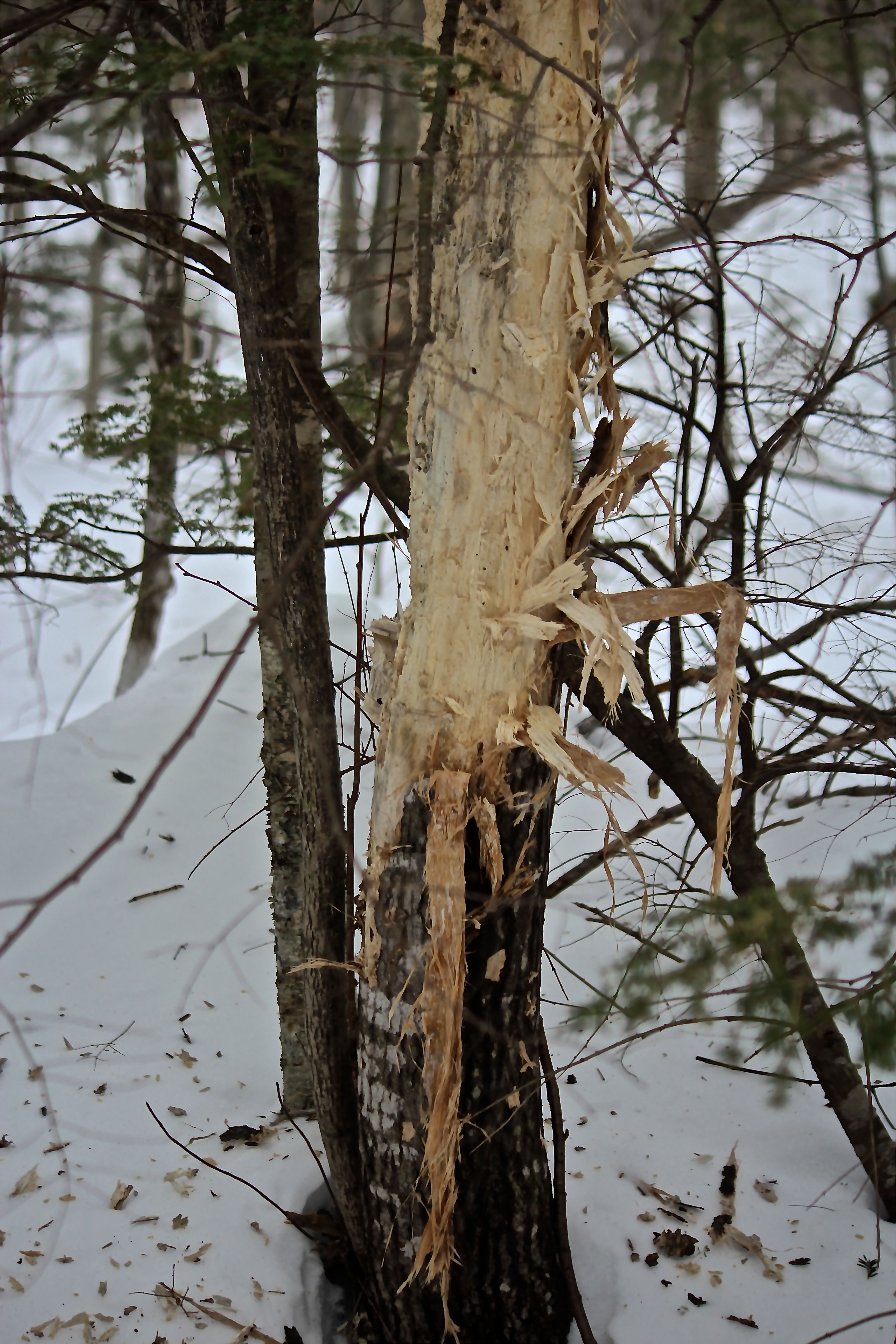
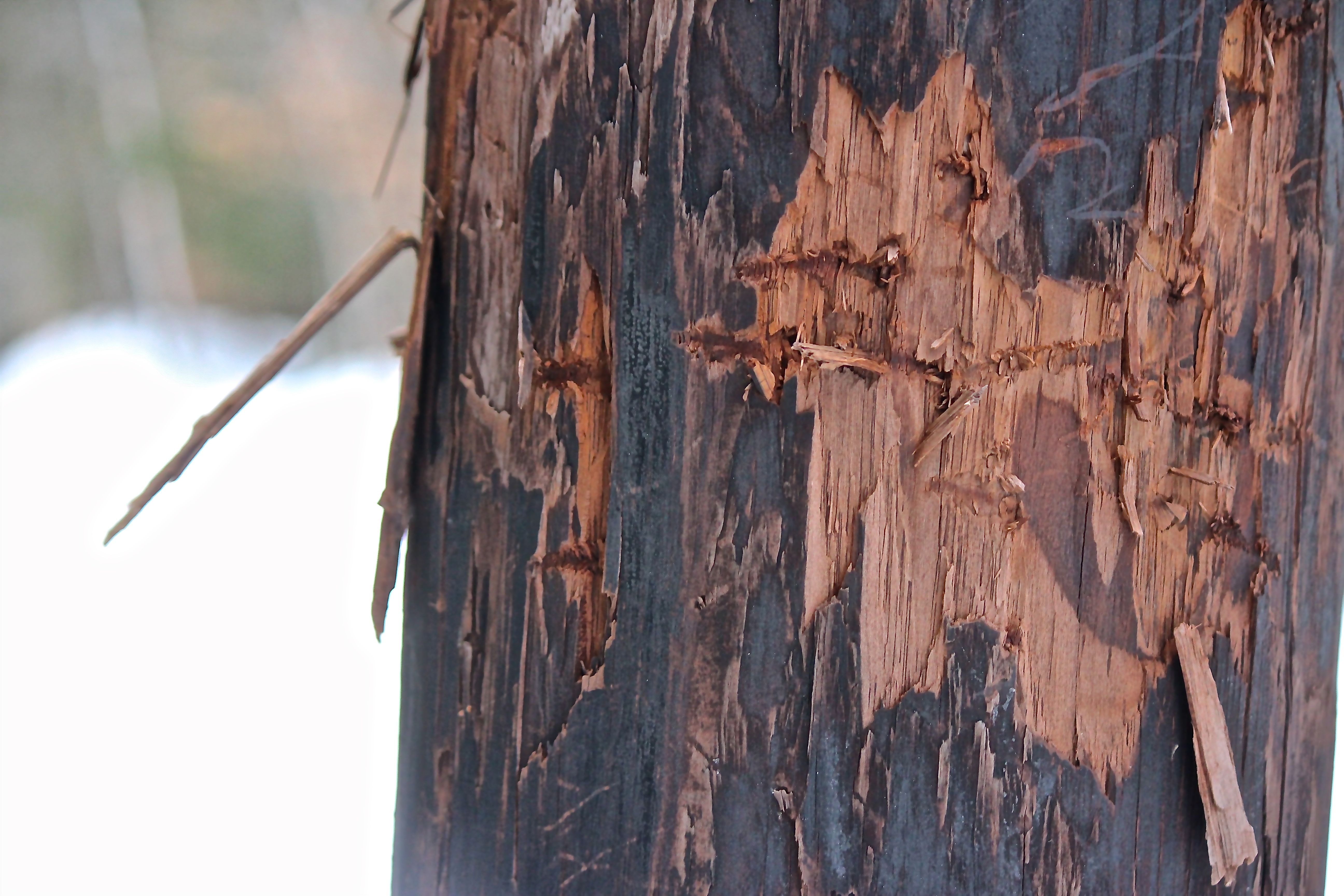
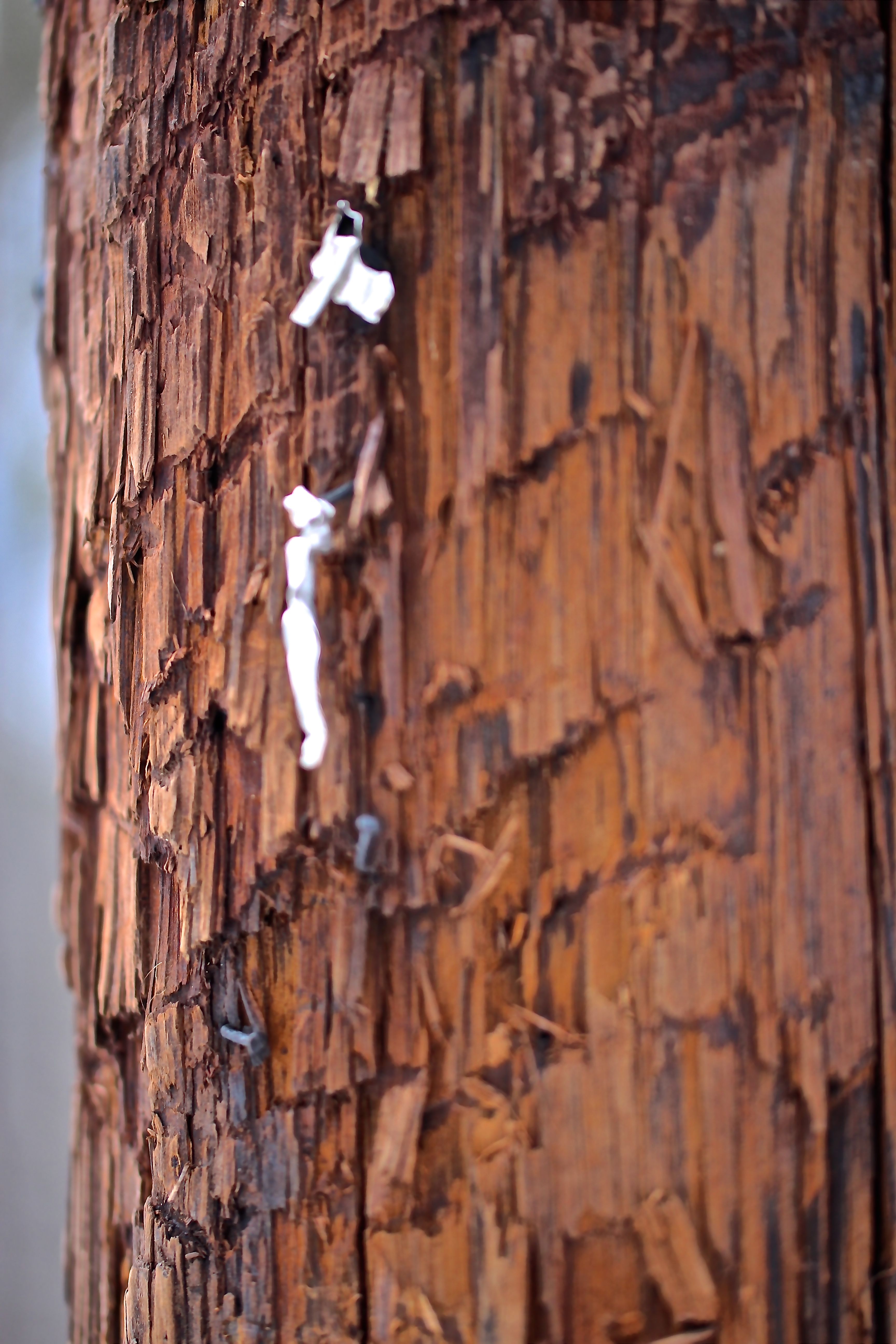
My other favorite sight along the road–telephone poles. In the past year the poles had received more attention–from black bears. Last year it seemed that any number with a 5 in it drew the most attention. Smart bears around here.

b6-pole 17 1

But it appeared that the bear(s) had added a new number to their count–#7, or in this case, #17.

b7-pole 17 2

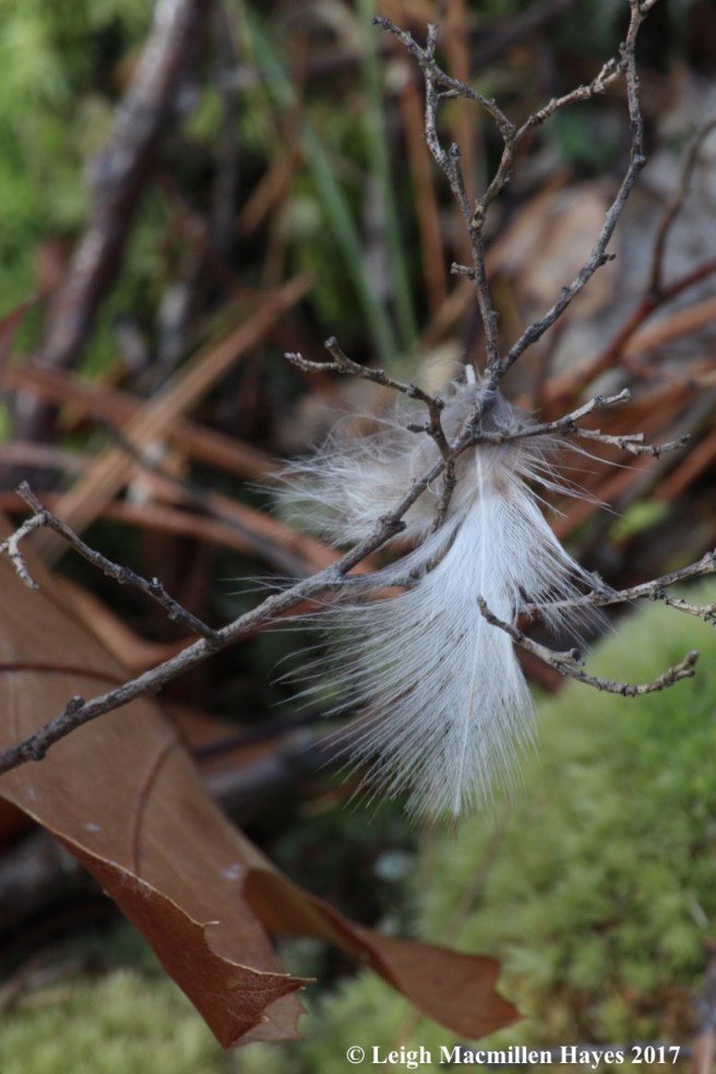
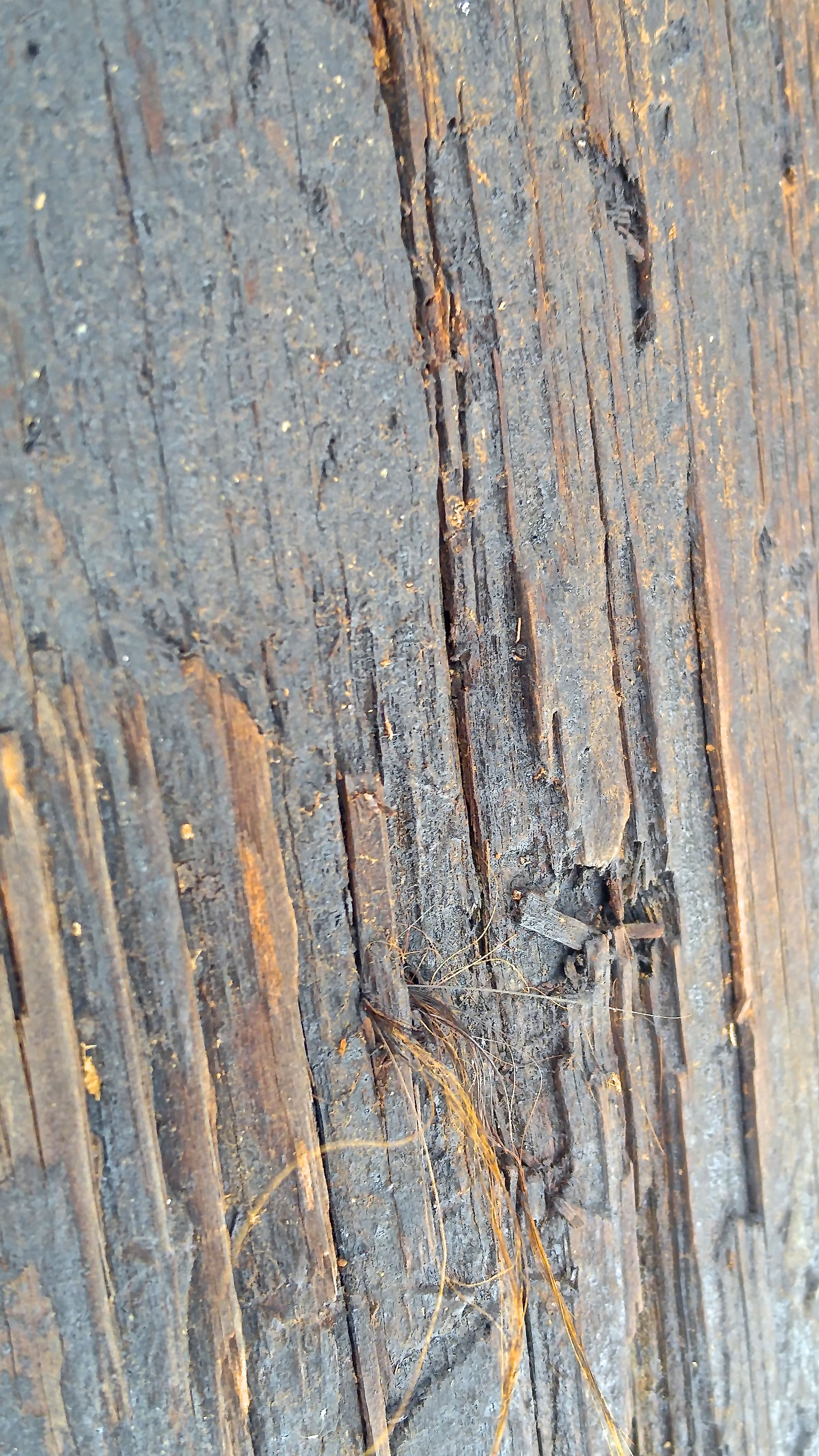
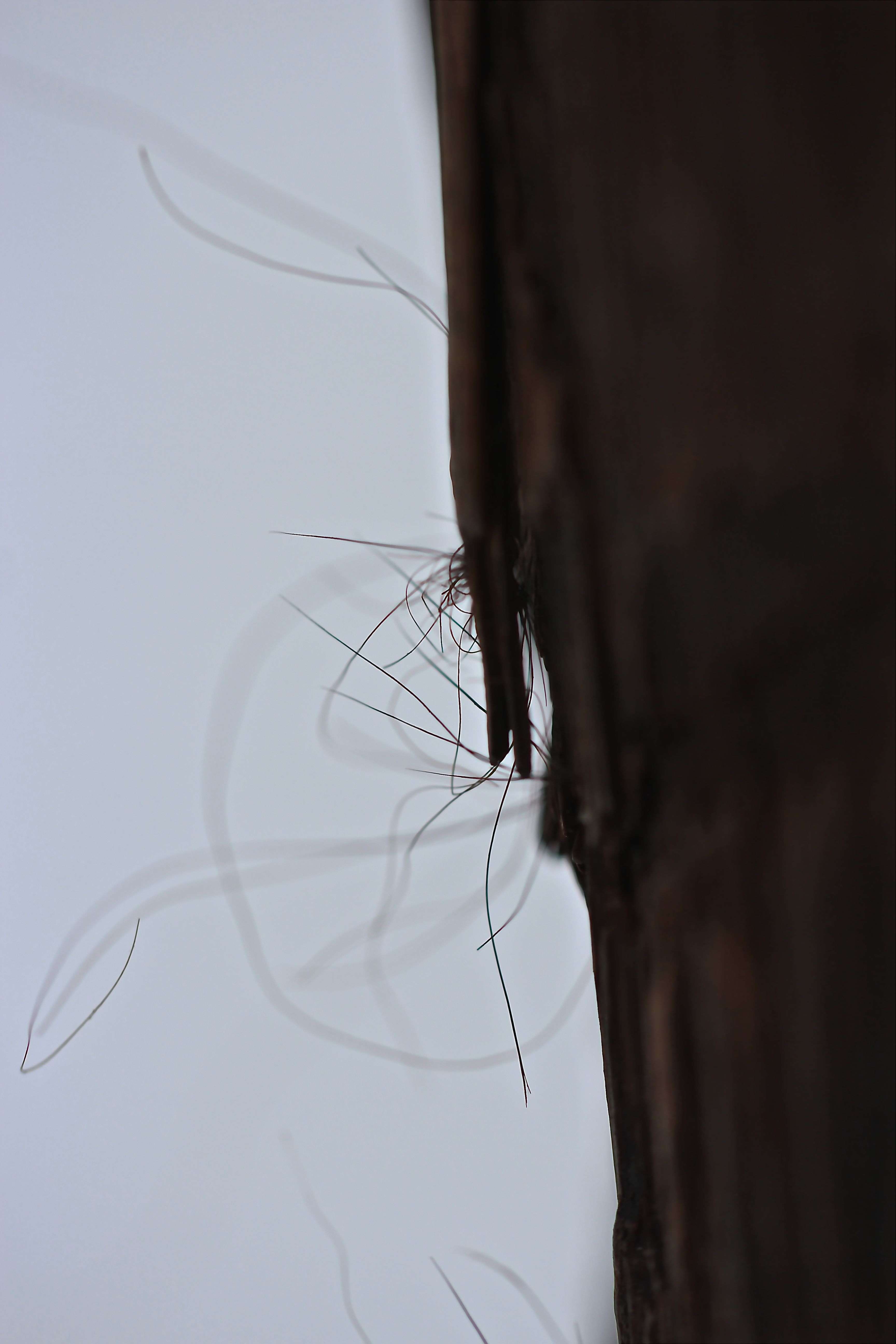
I didn’t have my macro lens with me, but found bear hair attached to some of the scrapes. It was light colored, indicating it had bleached out in the sun.

So why telephone poles? It’s my understanding that males rub their shoulders and neck to leave a scent and may also claw and bite a pole during mating season. Bites leave nearly horizontal dots and dashes–can you see them? Think of the bear’s upper and lower canine teeth meeting. How cool is that?

Eventually, I promised my guy that I’d stop pausing to check on and photograph them, but he noted that I couldn’t resist every time we passed by one. I was just looking.

b9-Stone House Road

To my guy’s relief, we soon reached the gate, where the power line went underground.

b10-balds

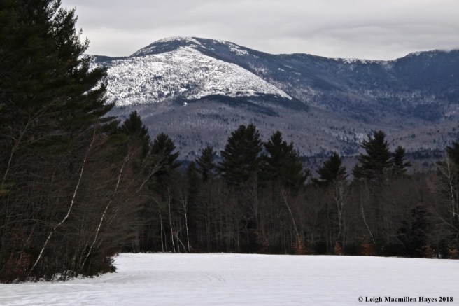
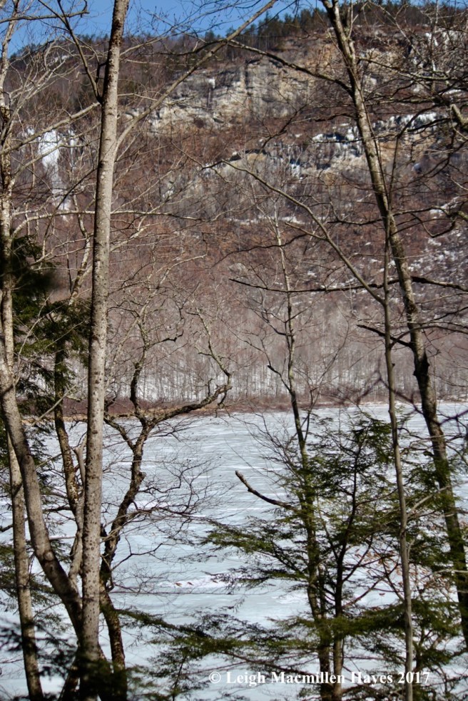
Near the airfield, we turned and paused to enjoy the view of the Baldfaces, and promised ourselves a return to those trails in the late spring or summer.

b11-gorge 1

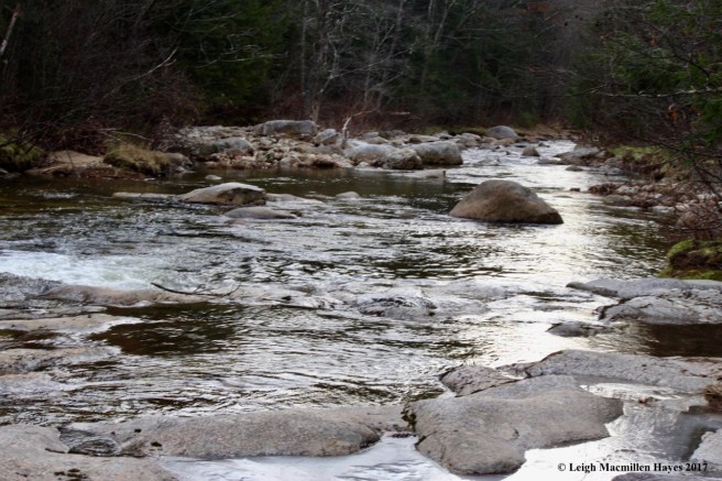
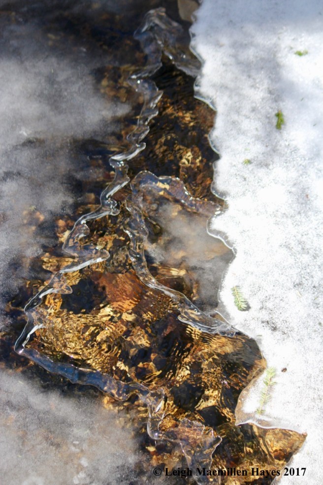
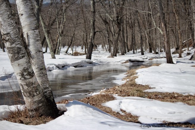
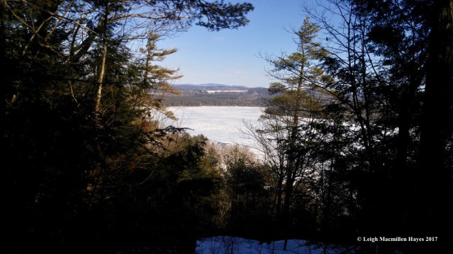
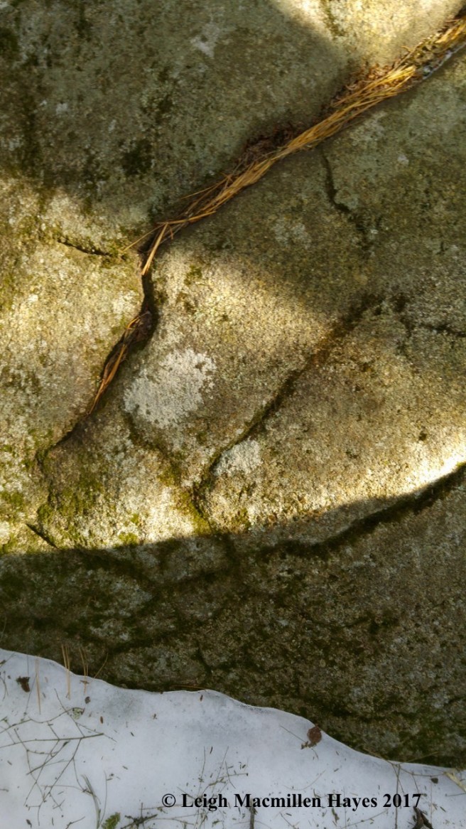
Our choice of trails today was the Stone House Trail. And no hike up is complete without a stop at Rattlesnake Gorge. First we looked north.

b11a-water racing

Ice and water, ice and water–I couldn’t get enough of the freeze and flow.

b11d-gorge 3

And then we looked south–with continued awe.

b13-pool view

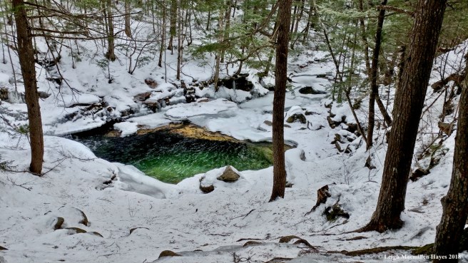
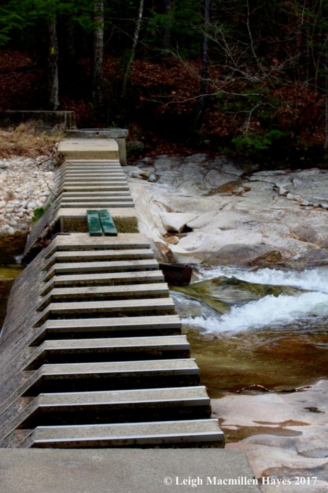
We’d thought about eating lunch at the gorge, but moved on up the trail. From lunch log, where we dined on peanut butter and blueberry jam sandwiches, we took in the view of  Rattlesnake Pool.

b12-rattlesnake pool

Any time of year it’s a magical place, but on a winter day–ah . . .

b12-emerald pool

that emerald color.

b14-rocks in brook

The brook above offered its own touch of wonder.

b17-hiking up

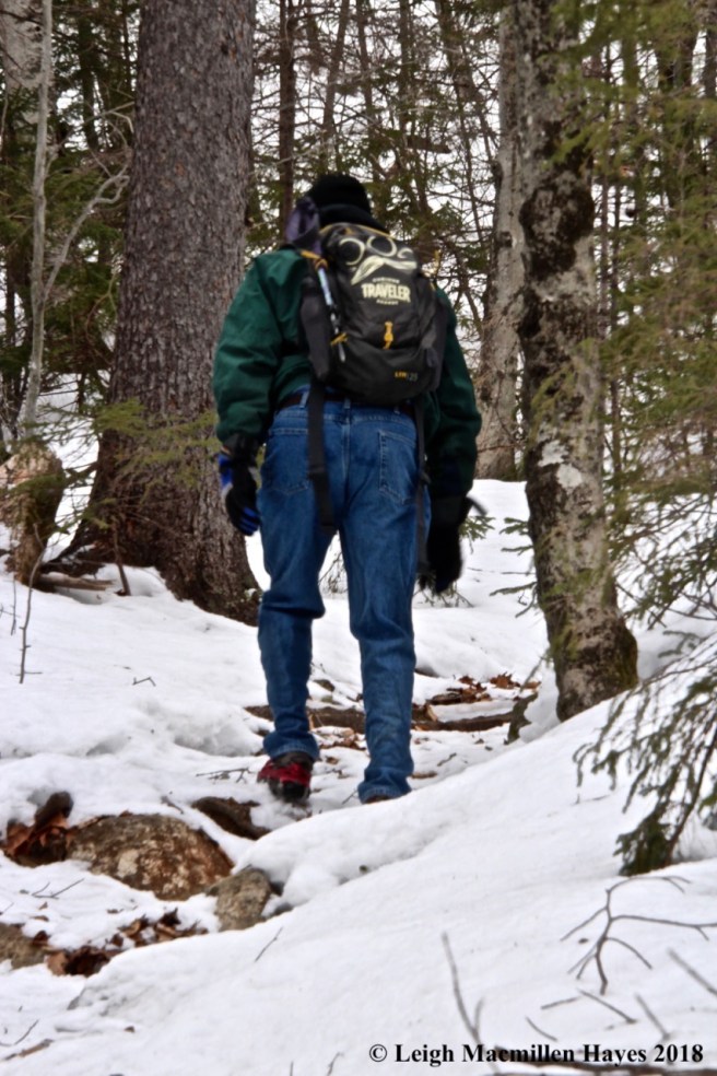
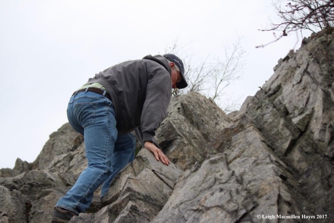
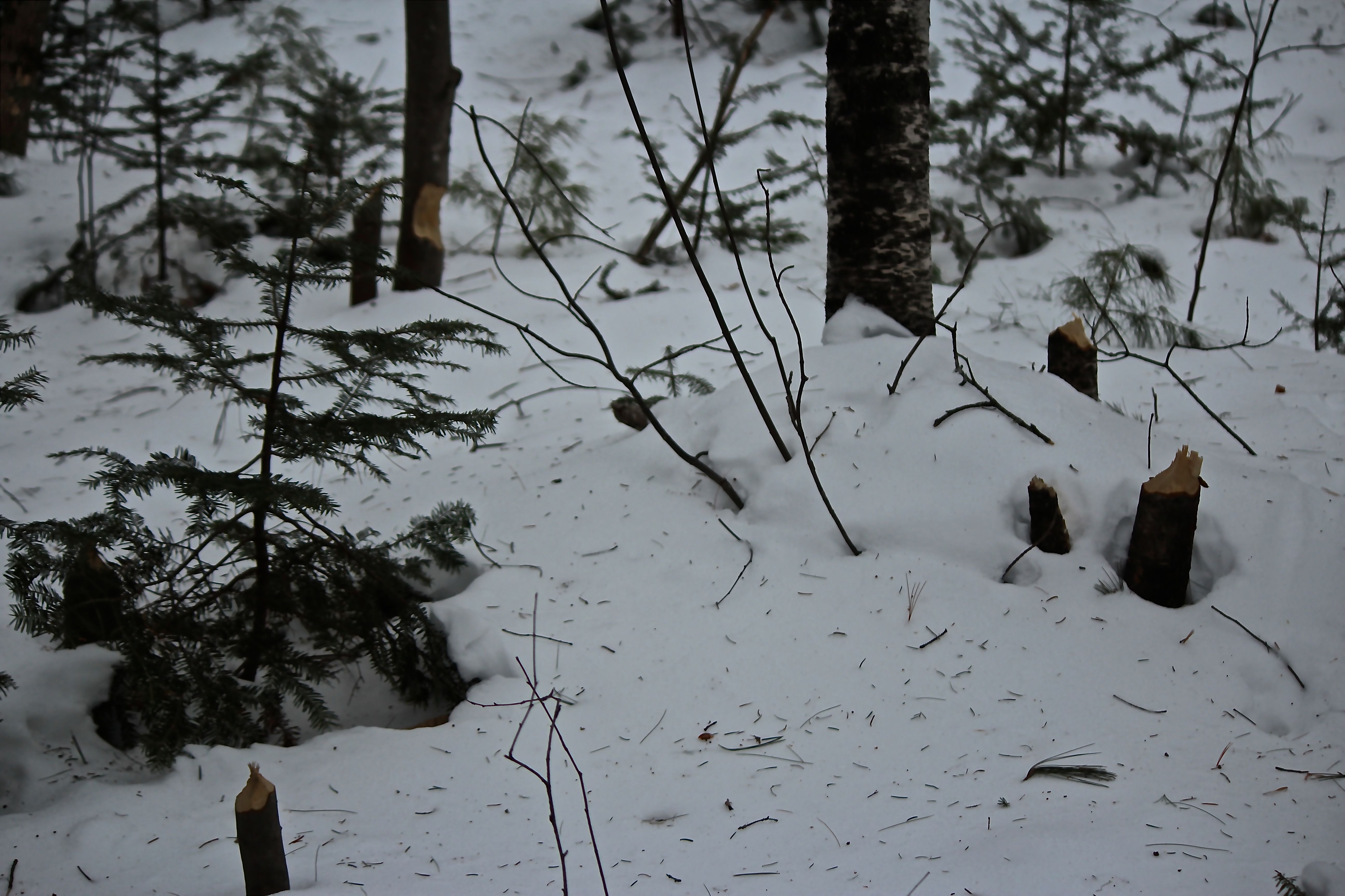
After lunch, we continued our climb on conditions that ranged from ice to snow to bare rocks. But mostly ice and snow. Microspikes served us well.

b16-Caribou sign

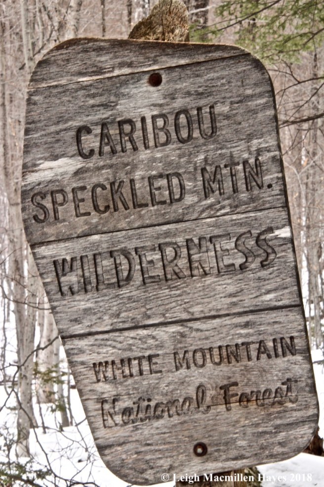
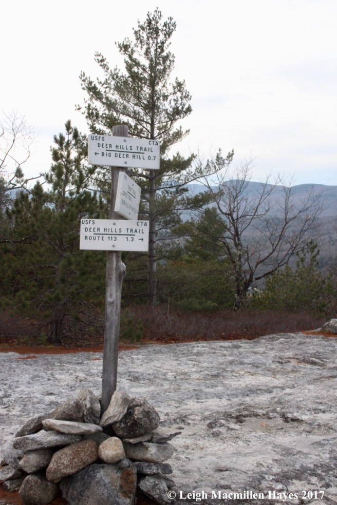
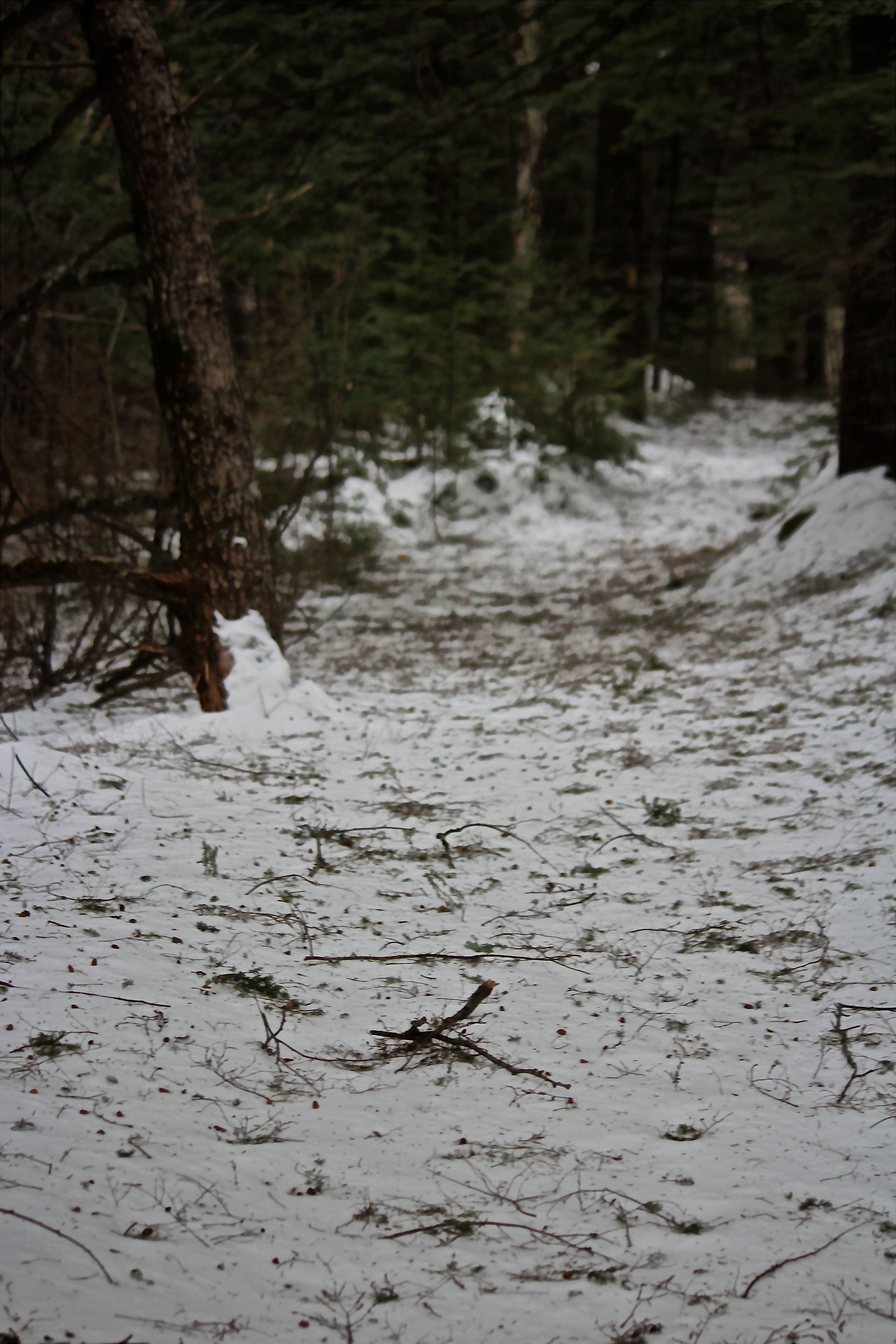
At last we crossed from the Stone House property into the White Mountain National Forest as denoted by a rustic sign.

b16-arrow

All along we searched beech bark for bear sign. And found one–a very smart bear had left a sign indeed–indicating the way of the trail. We kept climbing.

b20-cairns

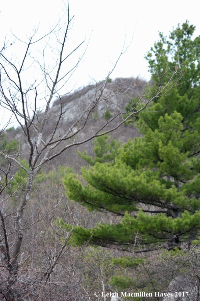
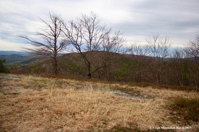
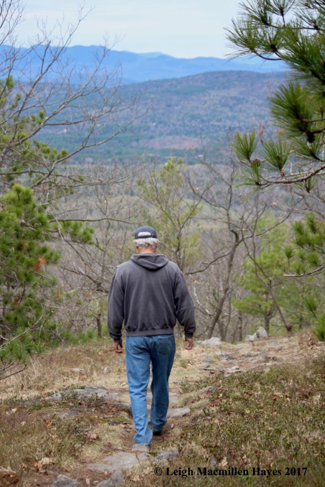
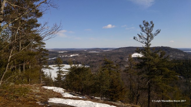
At last we reached the summit. It was later in the afternoon than we’d intended when our morning began because of our mine mission, and so we decided to skip Speckled Mountain, but were happy to check out the views from Blueberry. On the Lookout Loop we did get off trail for a bit as we missed a cairn buried under the snow. At that point we did a lot of post holing, sinking as we did to our knees and above. But finally we found the right trail.

b19-spruce

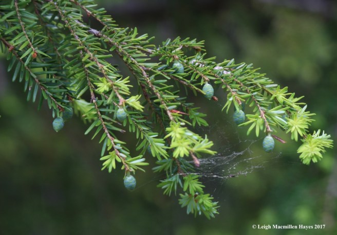
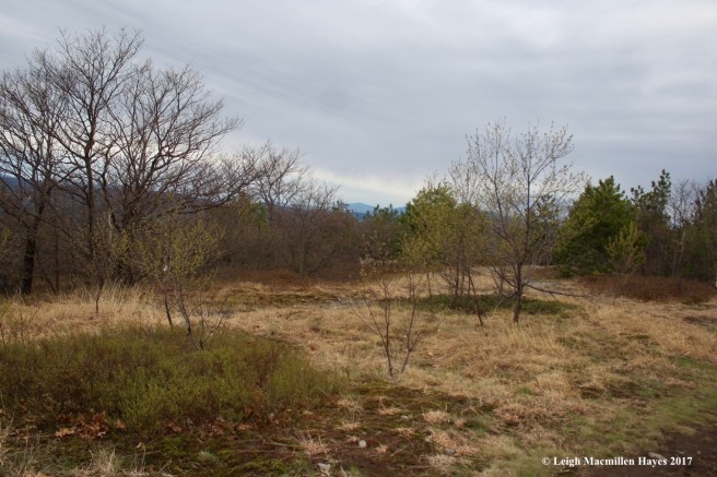
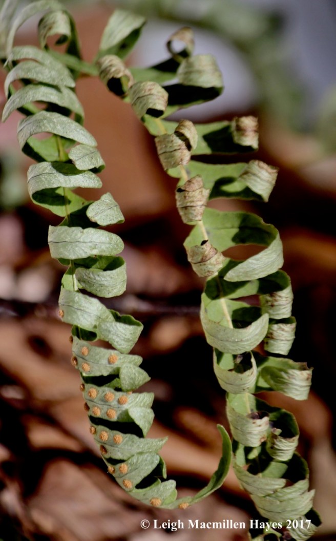
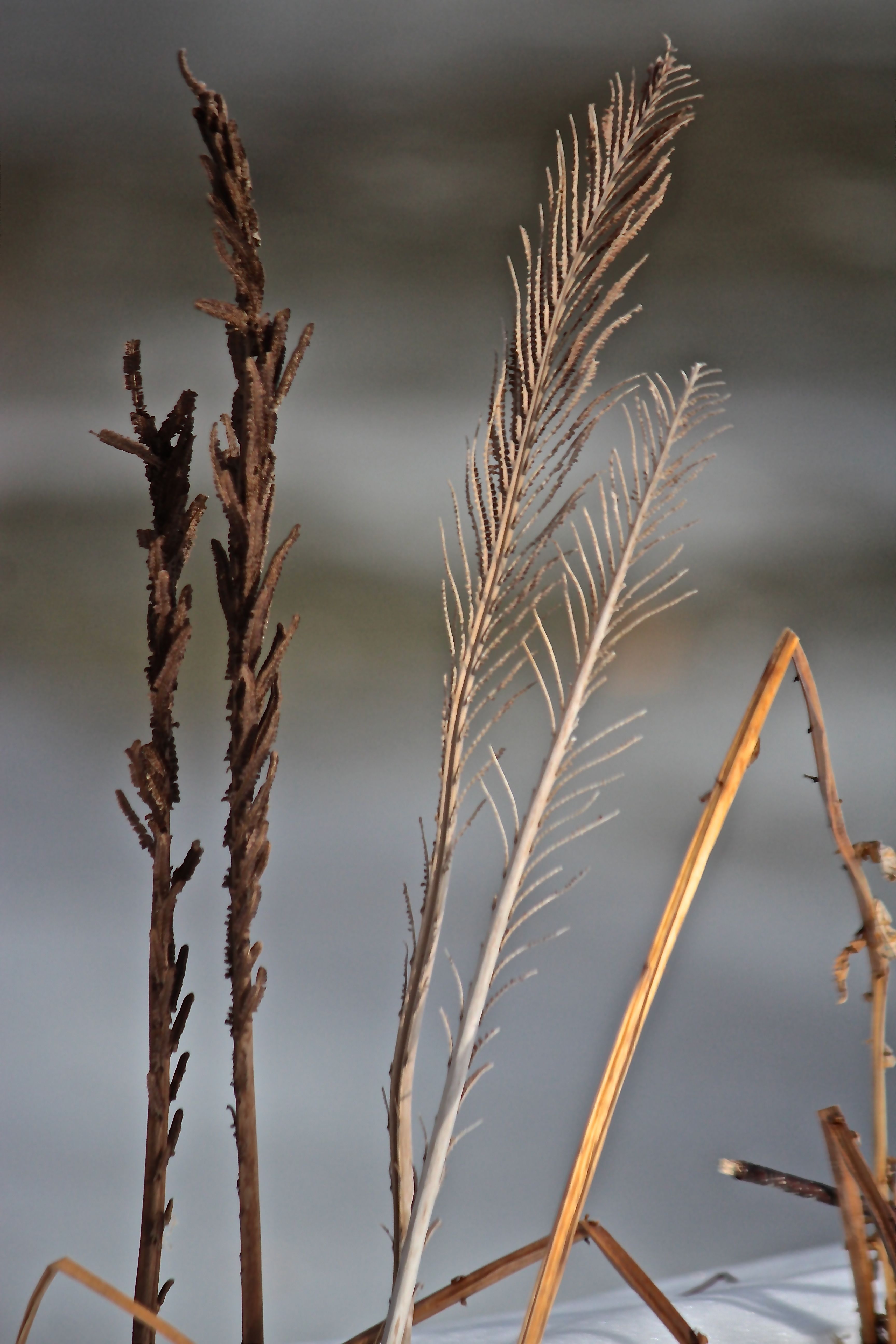
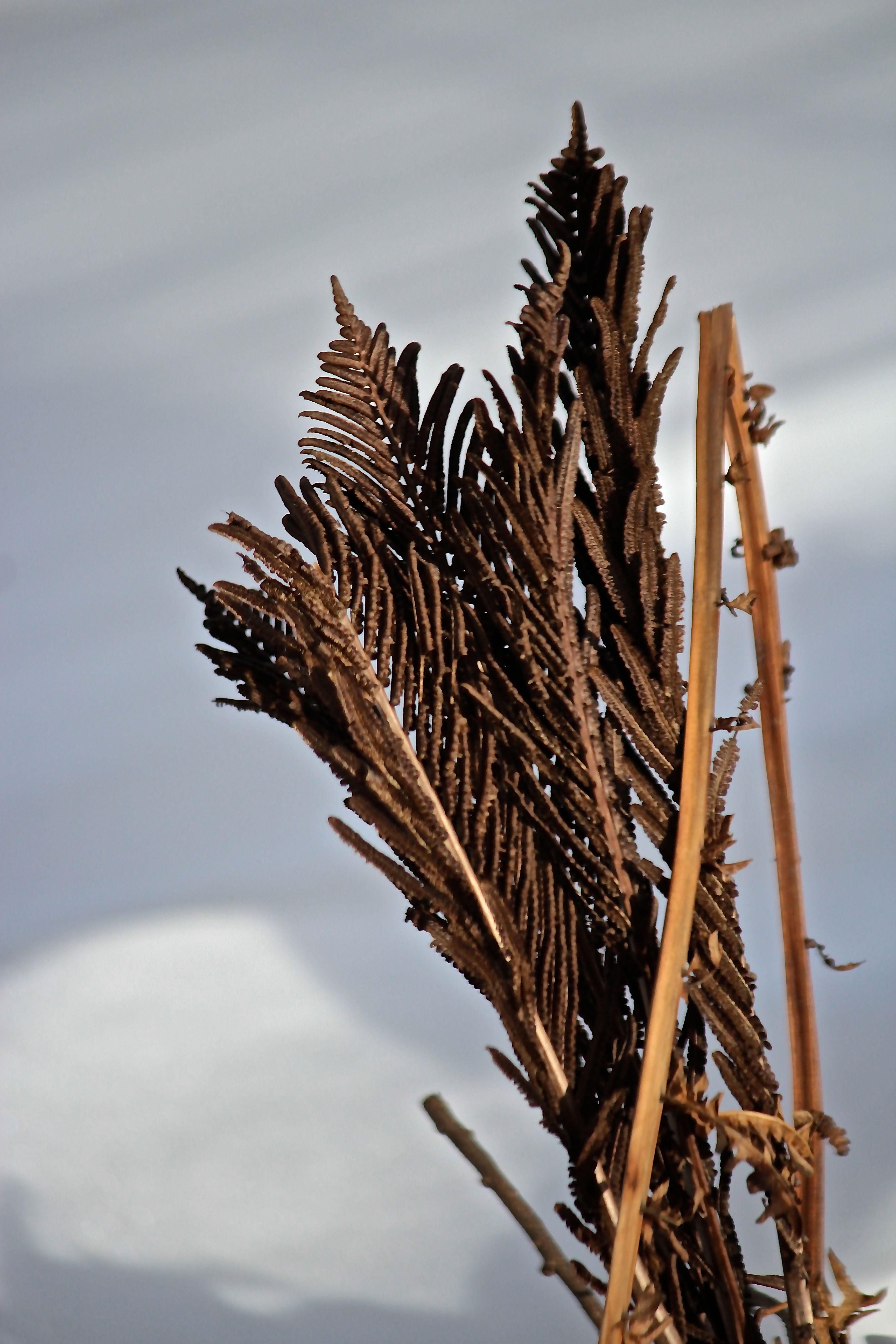
It’s there that the red spruces grew–their yellow green needles pointing toward the tip of the branches and dangling reddish-brown cones seeping sap.

b21-view 1

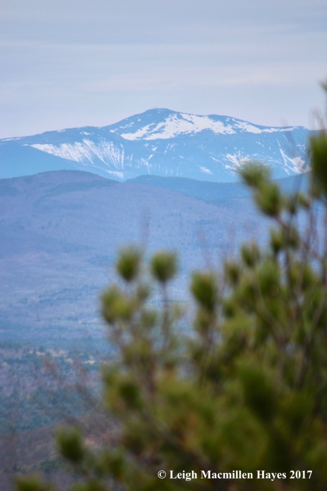
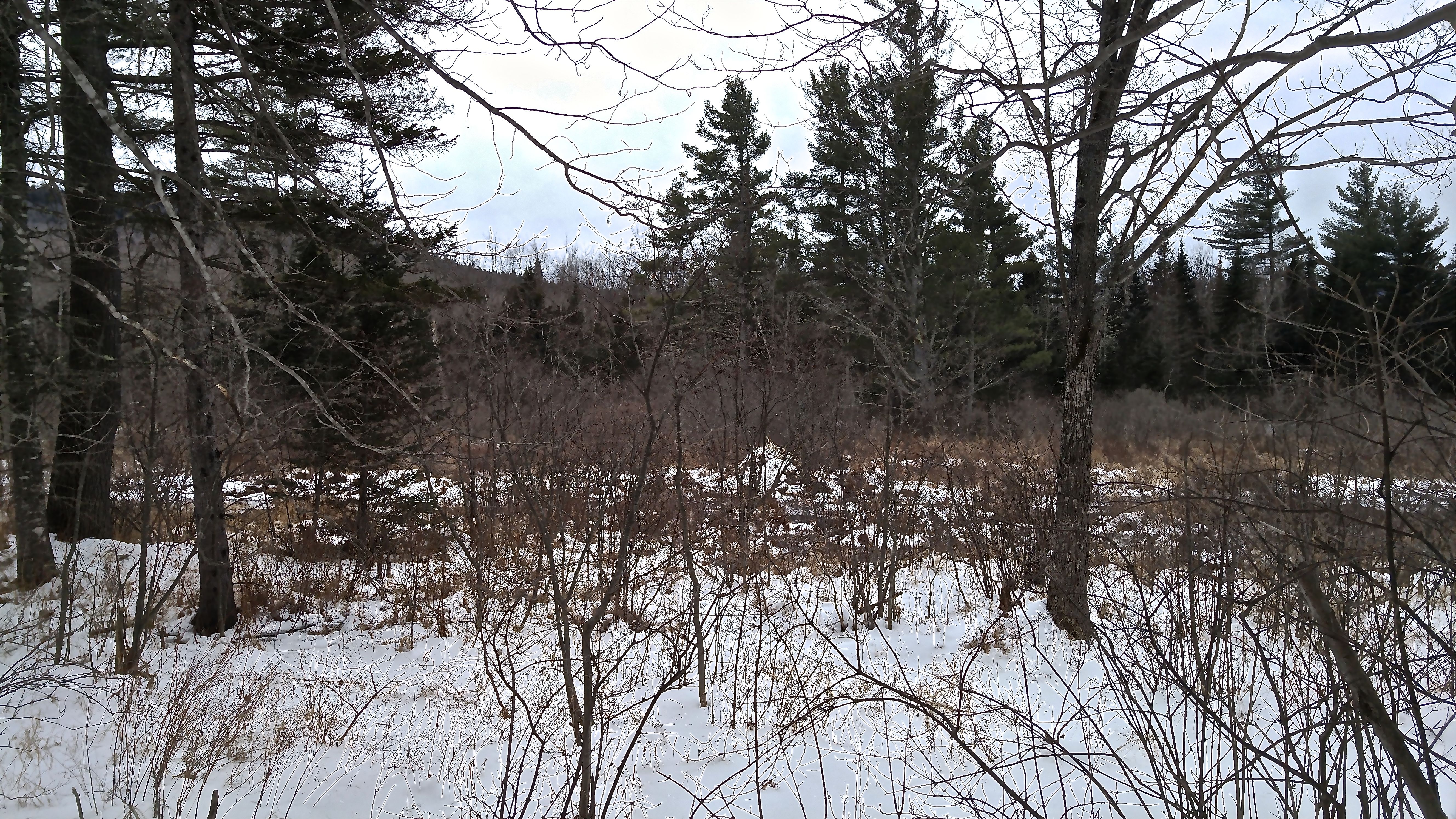
And then we found the view that stretched from Pleasant Mountain (our hometown mountain) on the left to Kearsarge on the right.

b22-Shell Pond and Pleasant Mountain

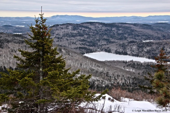
Below us, Shell Pond on the Stone House Property, showed off its conch shell shape.

b23-Kearsarge

We took one last look at the mountains and valleys under a blanket of clouds before following the loop back to the main trail and retracing our steps down.

b24-bear tracks

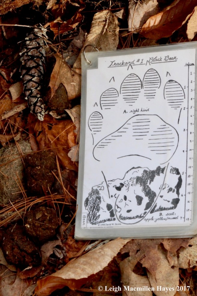
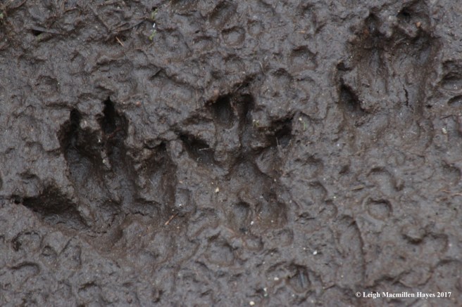
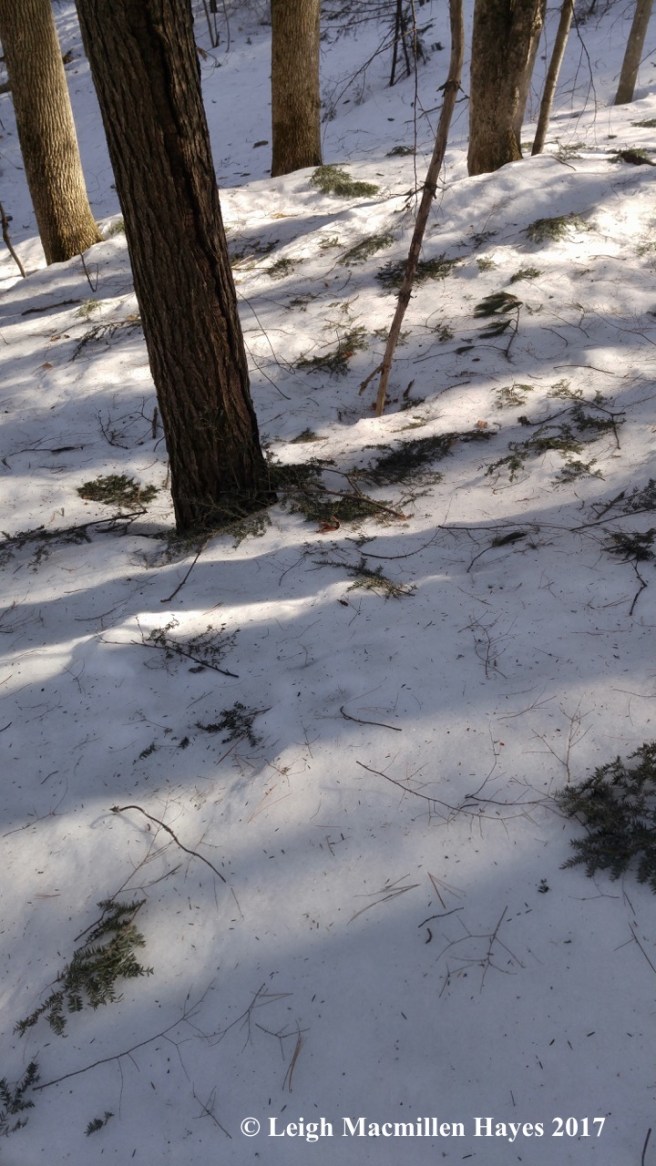
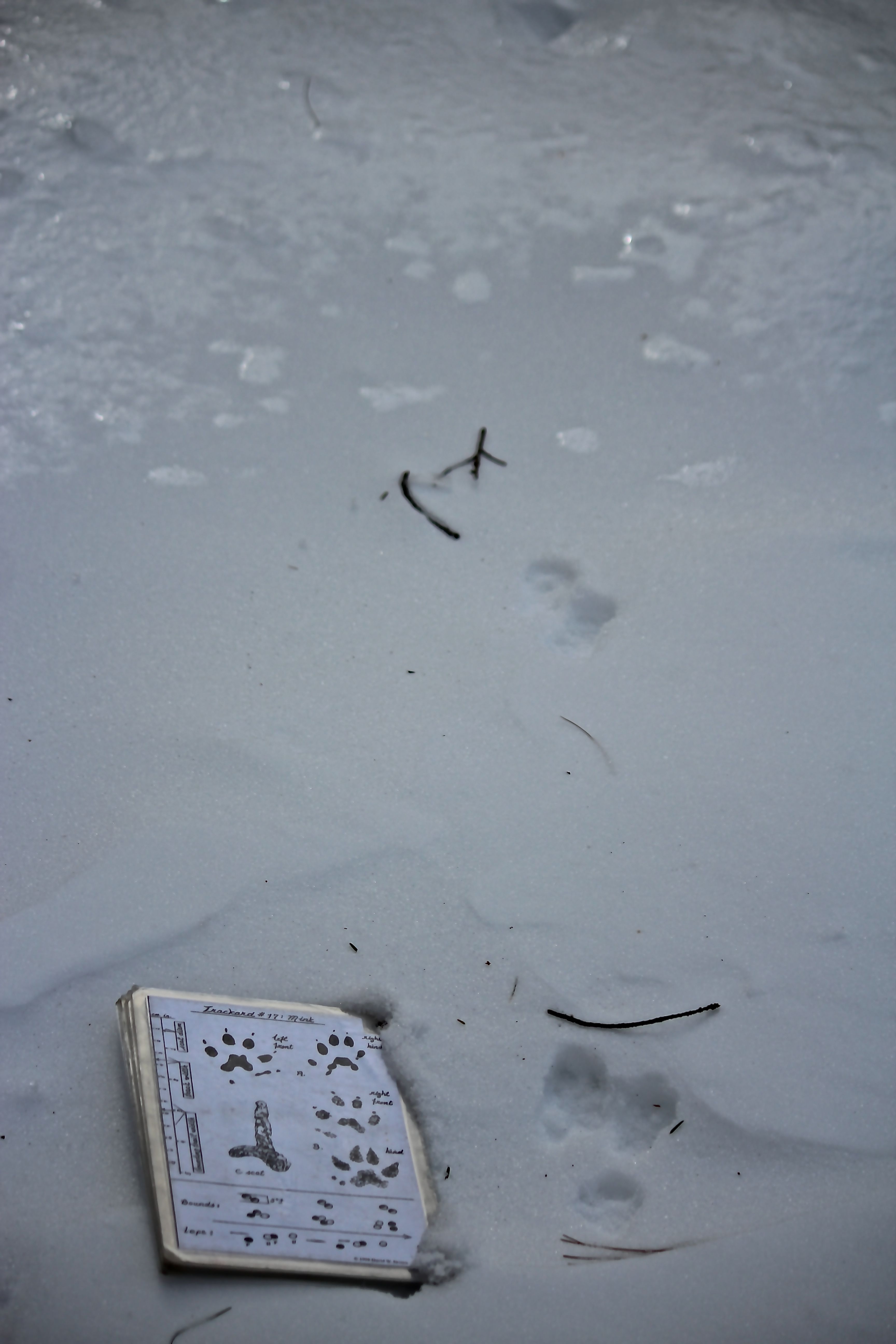
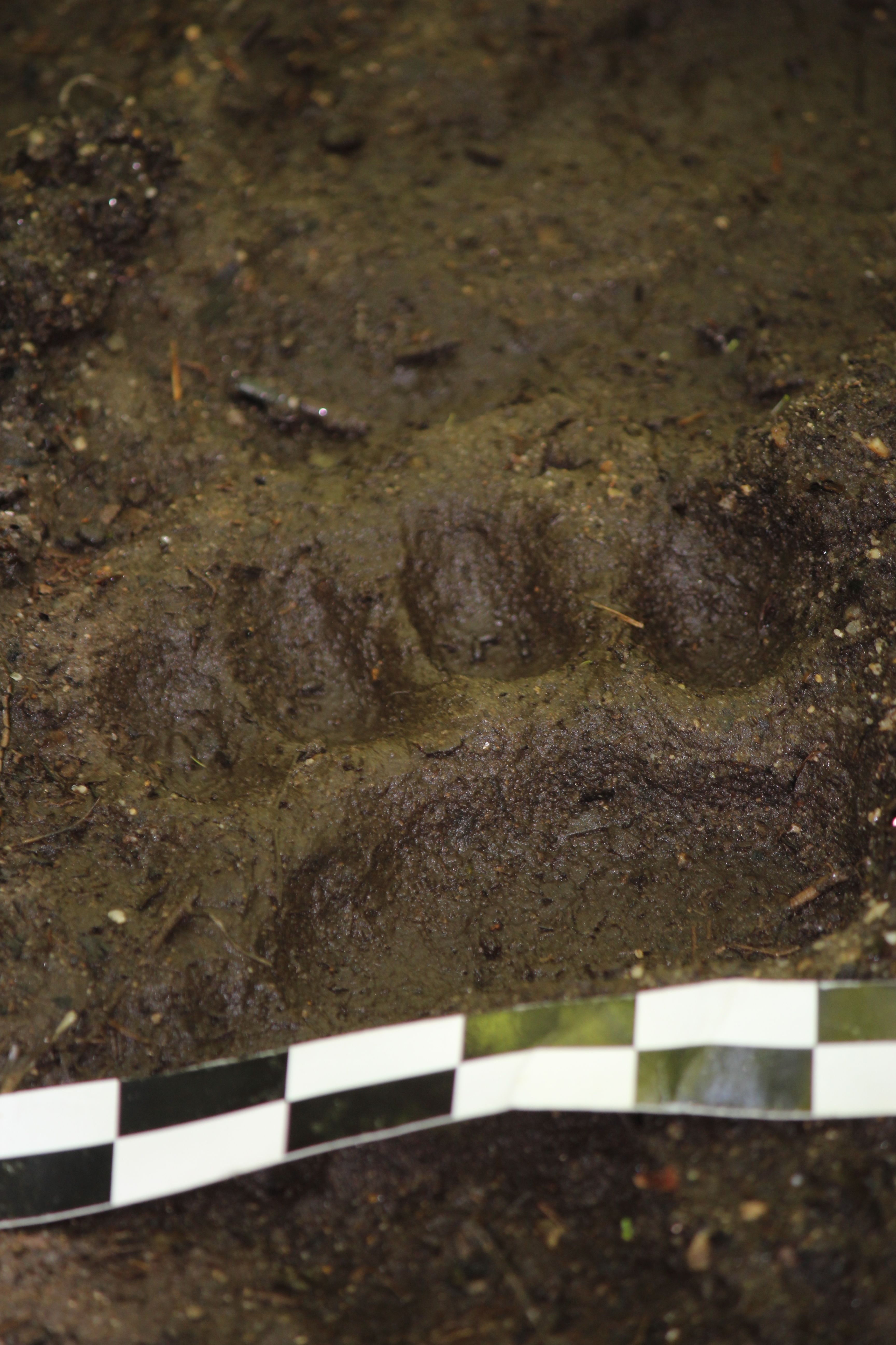
It was on the down that I got my guy to stop and examine a mammal track with me. I’d noticed it on the way up and he’d been ahead, but we both remembered that it was located at the point where the community switched from hardwoods to soft. Do you see the large prints? And distance between. It had been warmer yesterday and those prints looked like they’d been created then.

b18-bear print

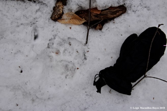
Black bear prints! Oh my!

It was the five large toes that first drew my attention as we climbed up. Was I seeing what I thought I was seeing? The pattern of the overall track was a bit different than what I’ve seen in the past where the rear foot oversteps the front foot because in snow black bears tend to direct register like coyotes, foxes and bobcats–one foot landing on snow pre-packed by another foot.

Bears are not true hibernators and this guy or gal must have been out foraging during yesterday’s thaw.

We didn’t find any bear paw trees or see the actual bear, but we were thrilled with our telephone pole signs and the prints left behind.

Indeed, it was a beary special Mondate on Blueberry Mountain.

(Corny humor comes with teacher training)


Gifts A Many

I was seranaded three times this morning, first by my guy, then my friend Marita (well, her family cut her short and maybe I helped by quickly thanking her), and finally by Gracie the beagle. The latter was the funniest of all and she managed to get through all the verses. But really, what Gracie wanted was to butter me up in hopes of joining Marita and me for a hike. Sorry Gracie. Maybe next time.

d-sign

We crossed the state boundary a few times as I drove up into Evans Notch. Our plan was to start the day at The Roost, though we weren’t sure we could get there as we didn’t know if the gate on Route 113 had been closed. As we approached the “Welcome to Beautiful Maine” sign, we saw that the gate was open and so on we continued. Until . . . we hit ice. For those who know the road, and the steep ravines to the left as you travel north, you’ll understand why we decided to back up and turn around.

d-morning colors

Back to the sign and gate we went, pulling off for photos because we love the sign and because the field across the way offered an array of colors and more ice.

d-ice layer

It was a case of bad ice and good ice, much like the witches in the Wizard of Oz and WICKED.

d-frost on goldenrod

And the good ice sparkled like winter flowers.

d-Cold Brook 1

The curious thing was that along Cold Brook, which flowed beside the field, there was barely any ice.

d-bear scat

After a few minutes, we headed down the road to the parking lot for the Baldfaces and Deer Hill. The latter was our choice for today. And it turned out to be the perfect choice for early on the trail we found rather fresh bear scat. How sweet is that?

d-leaf bouquet

The trail is flat to begin as it follows the course of a dry river beside the Cold.  Evidence of high water from fall storms was everywhere and it was obvious that the dry section of the river hadn’t always been so. Left behind were displays floral in nature–this one reminded us of a stacked bouquet.

d-Cold Brook 2

Again we reached the real deal–Cold Brook.

d-Cold Brook 3

And stopped to admire the view.

d-Granite and ice

And more good ice.

d-dam

Then it was time to make the crossing. Marita went first and when she got to the other side of the green planks she looked back and said, “You can do this.” She knows me well and that my brain kicks into “No, I can’t,” gear every once in a while. It seemed so simple and yet, at her encouragement, I kept taking deep breathes and finally after what seemed like hours but was only minutes, I put mind over matter and made my way across. And it wasn’t difficult at all.

d-hiking with Marita

The climb up was moderate and we were glad we’d donned our blaze orange on this last day of hunting season. In the parking lot, a hiker had laughed at me and asked if I thought I was going to see a moose. On the trail, we met a hunter who was out with his two sons. And at the summit we heard shots, though coming from a different direction. Yup, we were glad to be wearing blaze orange.

d-whale or frog?

We paused briefly on the climb, and noted that we weren’t alone. At first we both saw a whale, but then I noted a frog–a stone cold frog at that.

d-reaching the summit

We were only following one of the trails on this mountain today, and it wasn’t a long one.  Within the hour we reached the summit.

d-summit signs

Years ago, the signage was confusing, but it seemed much improved. Then again, we only hiked to Little Deer and don’t know about the others.

d-bald faces

From our snack spot, we enjoyed the view of the Baldfaces across the way.

d-Mount Meader

And Mount Meader to the right.

d-biotite plates?

At our feet were biotite (black mica) plates that reminded me of script lichen.

d-feather

And in the ladies room I always find the coolest sights when I pause and look around. Today it was a downy feather.

d-crossing 1

In what seemed like no time, we were back at the dam. Again, Marita went first.

d-crossing 2

She turned back, grinned at me and then watched as I quickly followed. “Yes, I can.”

d-Amy's article on Long Mountain Trail

When I arrived home, I discovered cards from family and friends in the mail, as well as a copy of the Bethel Citizen. Thanks to writer Amy Wight Chapman, Marita and I were both mentioned in an article she wrote about Long Mountain in Greenwood.

A few minutes ago, my sister and brother-in-law also called to serenade me.

It’s my birthday and I’ve enjoyed gifts a many–from ice crystals to bear scat to feathers, mixed in with songs and calls and cards and comments from family and friends near and far. I am blessed. Thank you all.


The Mighty Tracker

“Quick, look at the bird feeder,” my guy said this morning.

I expected some exotic bird and chuckled to myself, a memory of our youngest son telling me about the huge gray bird with a black head and long, long tail that it was in the driveway last week. I showed him a picture of a catbird. Bingo.

So when I did look out the kitchen window, I was taken aback–a large black bear stood at the feeder. I know I should have taken it in a month ago, but took my chances. And then I ran for my camera, not remembering that I’d left it on the counter right next to where I’d been standing. Finally, camera in hand, I dashed out the back door.  And . . .

b-bear !

he’d moved on. At the stonewall, he gave me one backward glance before climbing over it. Consequently, the bear is in this photo on the other side of the wall, but I was so excited I forgot to focus it and my guy and I will be the only ones that truly know it.

b-boots

But, I love to track mammals and so this afternoon I donned my tracking uniform and headed off on the trail to see what I might see.

b-bird feeder

I began at the spot of our first sighting–the bird feeder by the garden.

b-bear impression

All that my closer examination revealed was a few stomped leaves. No hair. Nothing else.

b-stonewall

From there, I kept examining the grass on my way to the stone wall. And then the wall itself and the trees around it. Nada.

b-tree stump

Stepping over the wall, I tried to determine the bear’s next direction. Still nothing to see. And so I started checking the numerous tree stumps, figuring it was hungry and might have looked for ants or other insects. All the disturbance I saw was made prior to this morning.

b-hemlock cones

My next decision was to follow the cowpath east and then west, but still nothing to report. I did notice the baby hemlock cones showing off their aquamarine color.

p-gray squirrel

As I walked, I heard some commotion. Did you know that gray squirrels can make more noise than a black bear?

b-deer prints

When I got to the the ruts in the snowmobile trail, I thought I might finally find what I was looking for. Instead, I spotted plenty of deer prints and  . . .

b-squirrel prints

even those made by the squirrels.

b-wood frogs 1

Since I was in the neighborhood, I decided to stop by the vernal pool, thinking perhaps the bear had done the same.

b-wood frog 2:gills

Nothing looked disturbed and the tadpoles showed off their latest growth. This might be the year wood frogs finally hop out of the pool.

b-blue-eyed grass

Not far from the pool, I discovered the first blue-eyed grass of the season.

b-turkey track

And as I returned, I went a bit beyond the cowpath and found turkey prints.

b-turkey and fox prints

There were some coyote prints as well, but one of my favorite print sightings was that of the turkey headed north and fox headed south. The fox print shows where the front foot came down and the hind foot fell almost directly into the same spot thus looking like two sets of front toes and nails pointed inward–direct registration.

Phew, I am the mighty tracker after all.

But that bear–it eluded me. It’s one for our mind’s eye as a memory shared and there it shall remain.


Love/Hate Sundate

Some days are made for hikes and today was one of them. The temperature was right–in the upper 40˚s-low 50˚s. No sun. And no bugs.

So, after church, my guy and I drove to the trailhead for Burnt Meadow Mountain in Brownfield, Maine. At the signs indicating the trail splits in two–North Peak to our right, Twin Brook to the left, we knew we planned on covering the loop, but my guy stopped and asked which way I wanted to ascend the mountain.

Nose scrunched, I replied, “North Peak.”

He chuckled for he knows my love/hate relationship with this mountain.

b-red oak leaves

Today my love began with the new leaves, like that of the red oak,

b-red maple1

red maple,

b-striped maple

striped maple,

b-beech leaves 1

and beech. I worshiped them all for their subtle colors and textures. Spring is the time of year that reminds us to live in the moment, for the natural world demonstrates constant change.

b-trailing arbutus

And then there were the flowers, like the trailing arbutus, aka mayflower.

b-Canada mayflower

And another of a similar name, Canada mayflower.

b-shad 1

In the shrub layer, occasionally we came upon the beauty of serviceberry or shadbush flowers flowing in the breeze, exhibiting their own take on these fleeting moments.

b-early saxifrage

And cleaving to the rocks as we climbed, early saxifrage. It’s also known as rockbreaker for this habit, and perhaps suggested the Latin name–Saxifraga virginiensis. Saxum-rock and frangere-to break. A funny name for an uncommon display.

b-summit ahead

I did my best admiring my surroundings for I knew what awaited. My guy paused as the summit came into sight,  expecting me to comment. For once, I kept quiet.

b-summit climb

And then, when the time arrived, we both channeled our inner mountain goat and sought hand holds and foot holds as we scrambled up the nasty dash to the top. Ha ha. It’s difficult to scramble when your heart pounds while your body quivers. This is the section I most hate–and as I always told our sons when they were youngsters, hate is a strong word. I knew I could do this for I’ve done it many times before, so I tried not to take too long as I considered my next move. Plus, rain drops began to fall and I didn’t want to be stuck contemplating on slippery granite. But still.

b-lunch rock

Finally–success. We’d reached the flattened top of the mountain–such a welcome relief after that horrible section. You’d think it was miles long the way I carry on about it. The rain drops ceased and we sat on lunch rock to dine–dirty hands and knees our badges of honor.

b-summit 1

Our view from the rock–looking back toward our point of ascension.

b-summit 2

And forward toward Stone Mountain. After lunch, our plan was to follow the Twin Brooks Trail that passes through the saddle between Burnt Meadow and Stone.

b-summit 3

And to our right–looking toward the White Mountains.

b-summit trees:layers

Though the view is almost 350˚, our immediate view behind lunch rock offered layers of life–blueberries, a young paper birch and a white pine.

b-twin brooks trail down

At last we started down. The Twin Brooks Trail is longer, but less of a struggle. That being said, it’s not a walk in the park as there are constant roots and rocks seeking attention.

b-mt washington1

But occasionally there are views. I was afraid we might not see Mount Washington today, but it didn’t disappoint.

b-birch catkin1

On the way down, we were in the land of the birch, their catkins growing long . . .

b-birch catkin pollen

and exploding with life-giving pollen.

b-viola

There were violas to admire.

b-shad 2

And more shadbush.

b-bear claws 1

But one of my other favorite things about this trail is the bear claw trees. No matter how many times I see them, they still bring a smile to my heart–and face. And a memory of seeing a bear on the North Peak trail one summer–it sauntered past us, not seeming to care that we were there. I suspect its belly was stuffed with blueberries.

b-twin brook 1

As we continued to descend, we soon heard the sound of one of the brooks for which the trail is named. Quite often on this trail, the water barely trickles, but today it rushed over the moss-covered rocks.

b-logging

Continuing on, we remembered that two hikers we meet at the start said there had been some logging and sometimes it was difficult to follow the trail. At last, my guy found the area they’d referenced. The trails are on private land and so while we couldn’t find some familiar landmarks, we nevertheless were thankful that we were still able to hike there. And, we were mindful to look for the yellow blazes as we stepped over some slash. It was quite doable.

b-bear tree 2:eye level

The result–a bear tree we hadn’t seen before was revealed.

b-bear tree 2:looking up

It must have offered plenty to eat in the past for the tree was well climbed all the way to its crown. Maybe we’d once met the very bear.  Maybe not. Who knows. But it’s worth a wonder.

b-bear of a different sort

A bear of another kind also left behind a sign of its presence. We obviously weren’t the only ones who headed to the mountain for a date.

b-bear tree 3

In one last spot a short way from finishing the loop, we found our last bear tree–again seen because of the logging. I suspect there are many more in these woods and hope they don’t all get cut.

Emerging leaves. Spring flowers. Jagged outcropping. Flowing water. Bear trees.

Really, it was a love/hate/love Sundate–joyfully spent with my guy.


Beautiful Maine Mondate

Some Monday’s we look for new places to explore or mountains to climb, but today found us visiting an old favorite that is gorgeous in any season.

s1-Stone House Road 1

Because it’s still winter (and she’s not letting go right away), we knew our hike would be extended by more than a mile on either end. We parked by the Leach Link Trail on Stone House Road and followed the telephone poles in.

s2-bear number

These are my favorite telephone poles in the world–well, for today that is, for they show the works of the clever bears that inhabit this place. The wood has been scratched and bitten, while the shiny pole number was mutilated. This was pole 5. I suppose it still is.

s3-bear hair

Hair sticks out from splinters. Bear hair.

s4-more bear hair

We found lots of it on several poles today. More than we’ve seen in the past.

s6-another pole

I’m thinking that the bears in the area have a fondness for 5. Or a dislike, for pole 15 also received rough treatment. There are more, but it was on 5 and 15 that we noticed the number destruction.

s8-bear dogs

Despite that, the bears in this area are most welcome. Because the signs are new, I asked my guy what he thought the bears will do when they emerge from their dens soon. In my mind, I saw a similar behavior to the other poles and imagined that when we return again we’ll see that the signs have also been destroyed because that’s what bears do. My guy’s response, “Clap.” Indeed, they should.

s9-gate

At last we reached the gate where we usually park to hike the Stone House property and Blueberry Mountain trails. The Stone House property encompasses about 890 acres surrounded by the White Mountain National Forest. In 2011, the owners, David Cromwell and Sharon Landry, established a conservation easement held by the Greater Lovell Land Trust. The easement allows for traditional uses including commercial agriculture and forestry, but prohibits development and subdivision in perpetuity. Thus we have both this couple and the GLLT to thank for today’s adventure.

s10-black cherry bark

When we finally reached the Shell Pond trailhead, a black cherry immediately jumped out at me. The property was last logged in 1977 and features a mix of hard and softwoods. My bark eyes love the diversity.

s11a-birch and red maple

And my bark mind appreciates the kindred spirit of the trees that manage to support each other despite their differences–in this case a beech and red maple.

s14-pileated works

I’m not the only one who likes bark–the work of pileated woodpeckers,

s15-porcupine

porcupines,

s16-beaver works

beavers,

s13-yellow birch burl

and even insects was evident throughout our three-hour tour.

s17-Yale blue

As we hiked, my dad was also on my brain. I’d received a message this morning from his former boss at Yale University who fondly recalled Dad and his brother Bob. Though quiet men, he and his brother had a twinkle in their eyes, a love for music, especially opera, and always a good joke or prank up their sleeves.

When I saw this tree in the shape of a Y, I knew it was for Dad. Even the sky spoke of the university–though several shades lighter than Yale blue. And with that came the memory that any paint my father mixed had a touch of Yale blue in it–thus was his way. It was all meant to be for Mr. Cromwell, the property owner, is associated with Yale.

s18-my guy

I couldn’t help but think that Dad would have loved the idea of our Mondates. He also would have loved my guy, but sadly they never met. Dad died of a heart attack only days before he and Mom were to spend a weekend with me in Maine–thirty years ago.  But, my guy continues to wear a Yale sweatshirt when he runs, which he did this morning. In that way, he’s made his own connection. Yeah–that’s my guy!

s19-pond views

Now that I’m writing through tears, I’ll get back to the trail, which is delightful in winter because it offers more views of Shell Pond below.

s20-cliff views

And the icy ledges above. Later in our journey, I noted the trail to the ledges had been well used–probably by rock/ice climbers.

s22-water 1

Trail conditions were such that we walked on top of the hardened snow, though I did wear micro-spikes for the entire tour. Someone waited to put his on and did a little slipping and sliding along the way. Brook crossings required stepping low and high, so deep is the snow still.

s23-ice castle

While I marveled at a castle made of ice,

s24-Christmas tree

my guy spotted a Christmas tree.

s25-polypody

We even found a few hints of green. These polypody ferns were opened, indicating warmer temps and today we certainly noted the difference compared to the brisk weekend.

s26-polypody

Of course, on another rock, some were still curled in their cold formation. They were under a hemlock and more shaded.

s27-partridgeberry

Any bit of green is a welcome sight about now and I was surprised to see partridgeberry poking through the snow.

s28-lunch bench

At last we reached lunch bench, which my guy stood upon. Yup, that’s the granite bench under his feet.

s29-lunch

We sat on it to eat our PB&J (with butter for me, of course) sandwiches. And tried to keep from sliding right down to the pond.

s30-Shell Pond

Lunch view included Shell Pond and the Baldfaces in the background. All along, we’d noted mice, squirrel, mink, fisher, coyote, bobcat, ruffed grouse, turkey and moose tracks. But as we ate we listened to the whales groan–so moaned the ice in the afternoon sun.

s31-brook

A short time later we reached Rattlesnake Brook and the orchard, where the natural community transitioned and appeared almost bucolic.

s32-ostrich fern

One of my favorite finds along this section is the ostrich fern. The structure of its fertile frond makes me smile.

s33-airfield

From the orchard we moved on to the old airfield and wondered if the family ever flies to their summer home. Though I don’t think it’s used these days, the airstrip was apparently built in the 1940s by the military for practice landings and takeoffs during World War II.

Again, the views were breathtaking.

s34-stone house and Blueberry Mtn

As hikers, we’re reminded by signs to stay on the marked trails, thus protecting the land and giving the family some space. I’m in awe of their home. The Stone House was built in the early 1850s by Abel Andrews. He quarried the large, hand-hewn granite slabs from Rattlesnake Mountain and built the 40-foot by 25-foot house for his wife and thirteen children.

s35-another wetland

I did stay on the trail most of the time, but occasionally I heard the landscape calling my name and had to investigate. Fortunately, my guy stayed on the trail all the time and kept us honest.

s36-Beautiful Maine

We walked back out to the truck and then decided to take a quick detour before driving home. Being on Stone House Road, we were only a mile from the winter closure point for Route 113 in the White Mountain National Forest. The road forms the state line between Maine and New Hampshire for several miles. And then it passes into Maine at the gate by the Cold River Campground and The Basin. And it’s there that you’ll find this iconic sign.

Welcome to Beautiful Maine and another scenic Mondate.


The Bears of Mount Tire’m

Mary Holland posted in her Naturally Curious blog that black bears are emerging now and it’s time to bring in the bird feeders. Maybe so, but today surely didn’t feel like a good day to give up a cozy spot and head out in search of food that doesn’t exist because the snow is crusted and two feet deep.

Winds were out of the northwest at about 18 miles per hour. The temperature was 8˚ that felt like -10˚ or lower. But sunshine. We had plenty of sunshine. So maybe the bears are waking from their long winter’s nap.

t-porky-works-2

Post lunch, my guy and I decided to don micro-spikes because of the snow conditions and ascend the trail to the summit of Mount Tire’m in Waterford. Only a few seconds after starting up the trail, we spied downed hemlock branches and knew one of the critters that frequents these woods.

t-porky-wall-walk-1

As I looked on the stonewall beside the trail, I could see that the porcupine had left its own trail while it came and went. We wondered where it might be, but when I turned and looked back down to the road, I saw that the trail continued that way and have a feeling that Porky lives under one of the nearby barns, much the same as our local Porky lives under our barn.

t-woodpecker-hole-1

Our hike to the summit was brisk because it was so cold. Every once in a while, my guy paused, including beside this newly excavated pileated woodpecker hole. If I were the local chickadees, I’d choose this one tonight and gather all my friends and relatives within since it was deeper than many.

t-fungi-1

There were the fire tenders nearby–birch bark and false tinder conks–so keeping the home fire lit should help keep them warm.

t-keoka-1-1

Over halfway to the summit, there’s a brief opening to Keoka Lake and Streaked Mountain in the offing. We could see a wee bit of open water below, and know that despite this weekend’s weather, change is in the air.

t-summit-view-2-1

It seemed like we reached the summit in a matter of minutes, so cold was it. But, we were out of the way of the wind and the southerly exposure meant less snow.

t-summit-view-4-1

We looked to the left, with Keoka Lake below. And behind the single pine, Bear and Hawk Mountains.

t-summit-view-3-pleasant-1

To our right and through the pines, we could see the snow covered ski trails at Shawnee Peak Ski Area on Pleasant Mountain.

t-summit-view-2-1

Straight below, Waterford City, Bear Pond and Long Lake beyond.

t-tirem-rocks-2-1

This hike is never complete without a visit to the rock castle hidden in a hemlock stand behind the summit. It was a favorite for our sons when they were youngsters and we still like to pay homage.

t-rock-cracks-1

Life on a rock has long been exemplified here, with crustose lichens topped by mosses that grow among the cracks, where pine needles and seeds gather.

b-tree-on-rock-1

The result– dirt so birch trees may grow out of the side of the boulders.

t-bear-cave-2-1

When one visits the castle, it’s important to check out the caves because you never know . . . t-me-2-1

who might emerge.

t-bear-1-1

We decided to bushwhack on our way down. Turns out, Ms. Holland was right. We met a bear in the woods today.


Shell Pond Speed Date

While our thoughts were (and are) with our family and friends south of us along the Eastern Seaboard as you deal with a major winter storm, my guy and I drove over to Evans Notch for a hike around Shell Pond.

SP-September

Whether you’ve traveled this way before or not–a summer photo might be just the dose you need today.

road 1

We parked near the trailhead for the Leach Link Trail because Stone House Road is never plowed beyond that point. Others had skied, walked and snowmobiled before us, but no one seemed to be snowshoeing so we left ours behind. As it turns out, that decision was fine. We dug some post holes in a few drifts, but other than that, we really didn’t need them. I did, however, use micro-spikes–and am glad because it’s a rather wet trail and we encountered lots of ice, much of it just a few inches below the snow.

Stone House gate

Thanks to the owners of the Stone House for putting much of the land under conservation easement with the Greater Lovell Land Trust and for allowing all of us to travel the trails–whether around the pond or up Blueberry Mountain and beyond.

Shell pond loop sign

Before the airfield, we turned onto the Shell Pond Loop trail. It’s blazed in yellow and easy to follow. Some trees have come down, but we got over or around them. We took care of a few today and the rest will be cleared by summer.

beaver works

Of course, some trees were intentionally harvested. We found these beaver works near the beginning of the trail where the brook opens into a small wetland.

beaver lodge 2

beaver lodge 1

On top of the lodge, you might be able to see the lighter color of fresh additions to the structure. This was the first of three.

beaver lodge 3

Lodge number 2 is toward the far side of the pond.

beaver view

But it’s lodge number 3 that I’d stay at. It’s worth a payment of a few extra saplings to get a room with that view.

pileated work

The beavers aren’t the only one making changes in the landscape. Pileated woodpeckers in search of food do some amazingly shaggy work on old snags.

trail debris

Winter debris covers much of the trail. Strong winds have brought much of this down.

yellow and hem yellow birch & hemlock

And two of the most prominent trees make themselves known among the debris. A hemlock samara beside a yellow birch fleur de lis and a hemlock needle atop a more complete fleur de lis flower of the birch.

Shell Pond 1

Shell Pond takes on an entirely different look in the winter. We could hear the ice whales singing as we ate our PB&J sandwiches and sipped hot cocoa.

mink

mink tracks 1

While we ate, we noticed a mink had bounded through previously. I’m always thankful to have David Brown’s Trackards in my pack.

cliffs 2

cliff flow

Continuing on the trail found us taking in views of the cliffs, which we don’t normally see so well once the trees leaf out.

ostrich 3 ostrich 4 ostrich fern 1

Before continuing through the orchard, I wandered closer to the brook in search of this–the fertile fronds of the ostrich fern that give it its common name because they resemble plume-like ostrich feathers. Come spring they’ll release their spores.

 airfield 2

The sun tried to poke out as we crossed the wind-blown airfield.

stone house 2

From the field, we always admire the Stone House and its setting below Blueberry Mountain.

 snowshoe 2

Walking back on the road, we spotted a classic snowshoe hare print. Most of the tracks we saw were filled in by blowing snow, but these were textbook perfect.

pole 4

And then . . .

pole attack

And then . . .

pole numbers

And then . . .

bear hair 1

And then . . .
bear hair

And then . . . on our way back down the road, I introduced my guy to the wonders of telephone poles. We found several sporting chew marks, scratches and hair. Yup . . . bear hair. Black bear. Even the shiny numbers were destroyed on one of the poles. Of course, my guy was sure someone would come along and ask what we were doing as we inspected one pole after another. I was hoping someone would come along and ask what we were doing. Bear poles. Another thing to look for as you drive down the road–think tree bark eyes, winter weed eyes and now, bear pole eyes.

bear paw

I took this photo on the Shell Pond Loop trail a year and a half ago. Oh my.

Those of you who have traveled this way with me before will be amazed to know that we finished today’s trek in just over three hours, even with the added walk down Stone House Road. Yup, not an advertised three hour tour that turns into six. Hmmm . . . Apparently it can be done–I just need to get Mr. Destinationitis to join our treks for a Shell Pond Speed Date.