What the Bobcat Knows

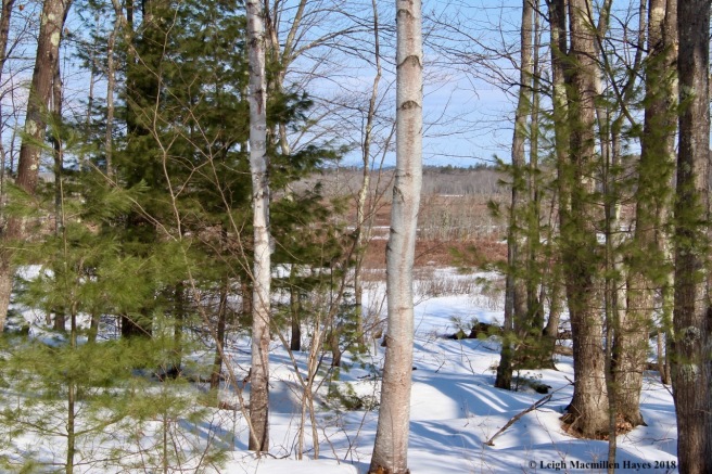
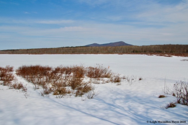
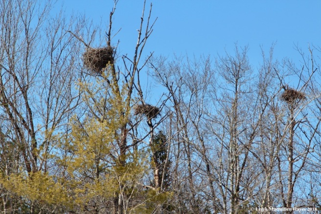
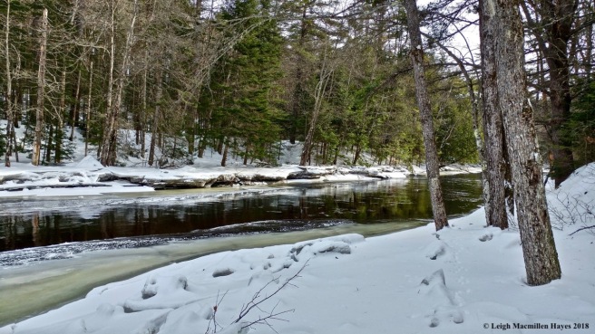
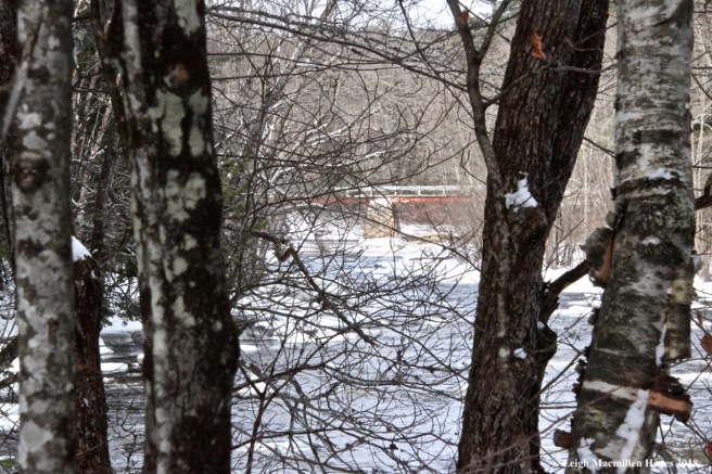
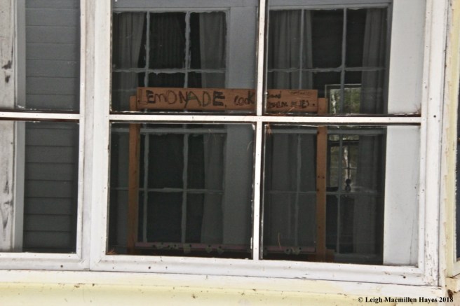
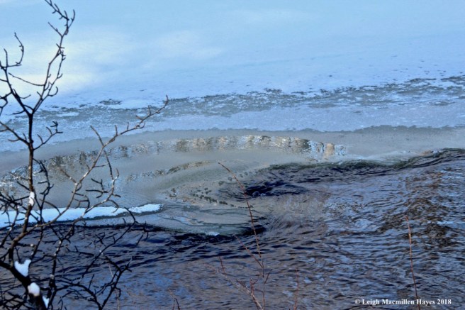
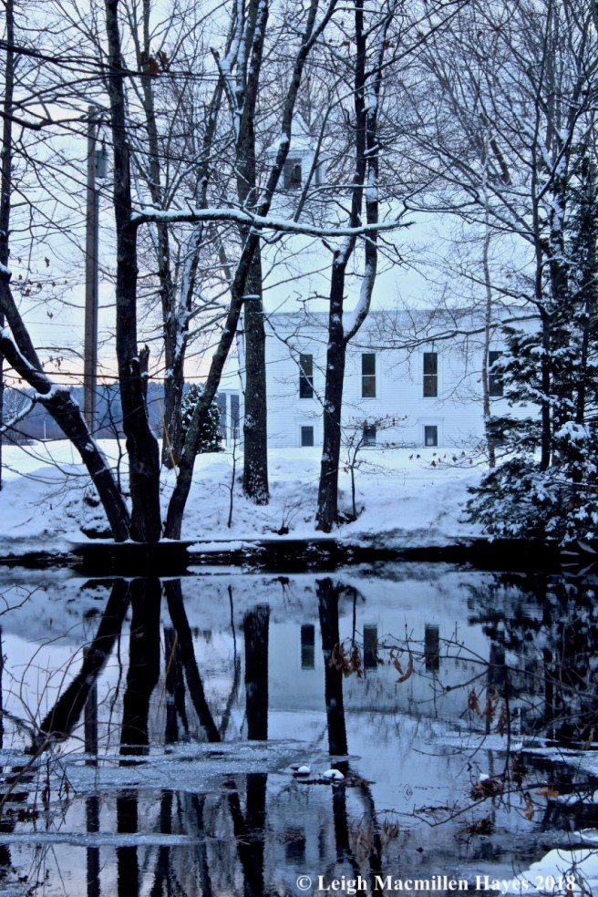
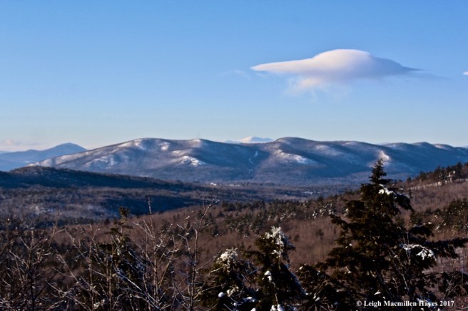
As I drove down Heald Pond Road in Lovell today I wasn’t sure what awaited me. But isn’t that the point? Every venture into the great outdoors should begin as a clean slate and it’s best not to arrive at the trailhead with expectations.

f1-Heald Pond Road barn

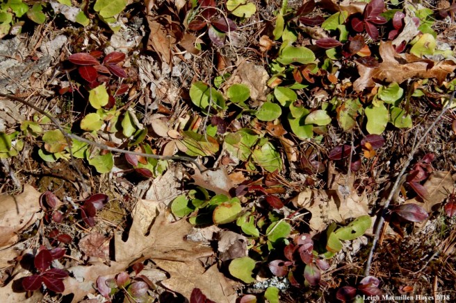
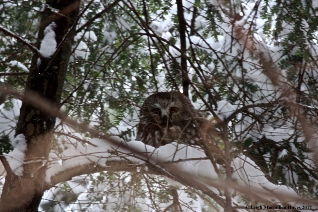
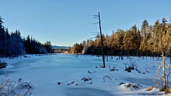
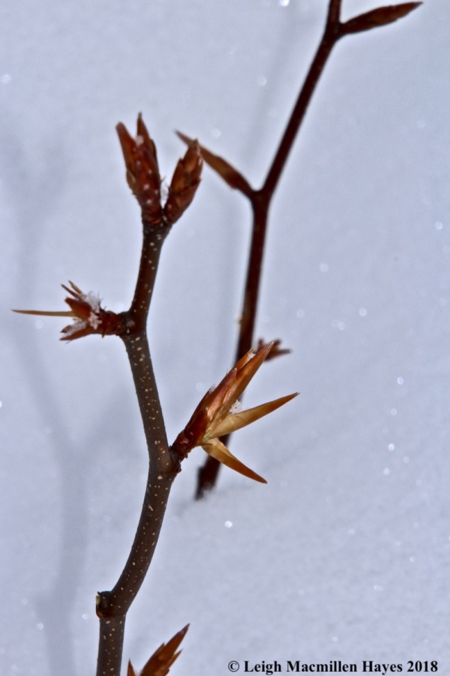
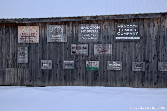
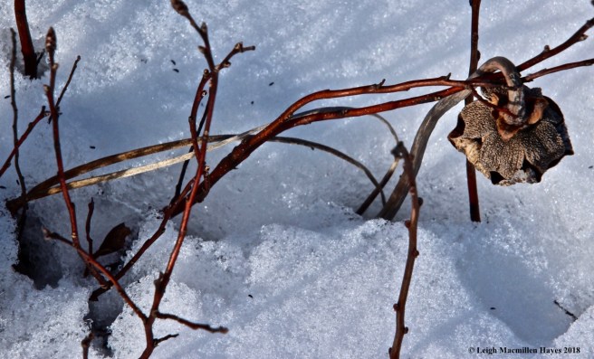
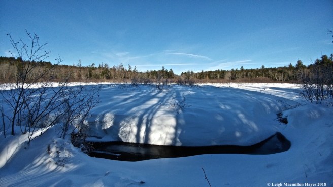
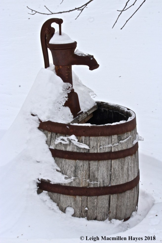
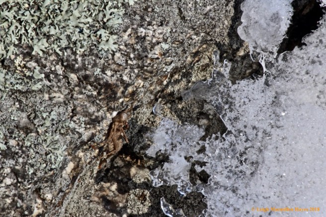
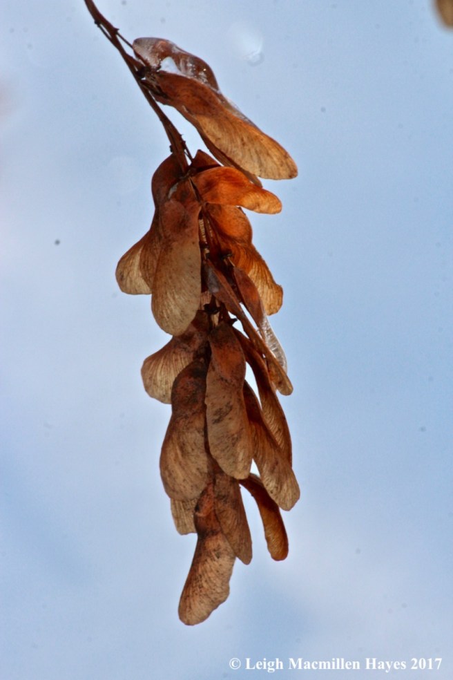
And so I didn’t. Well, sorta. I really wanted to see a porcupine. And maybe an otter. And definitely an owl. But I knew better and so I passed the last barn on the road and then backed up and stepped out, captivated by the colors in the scene before me.

f2-trail signs

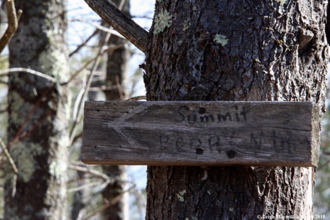
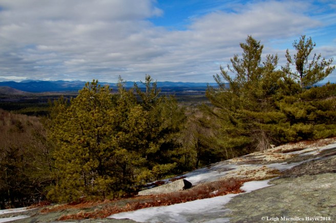
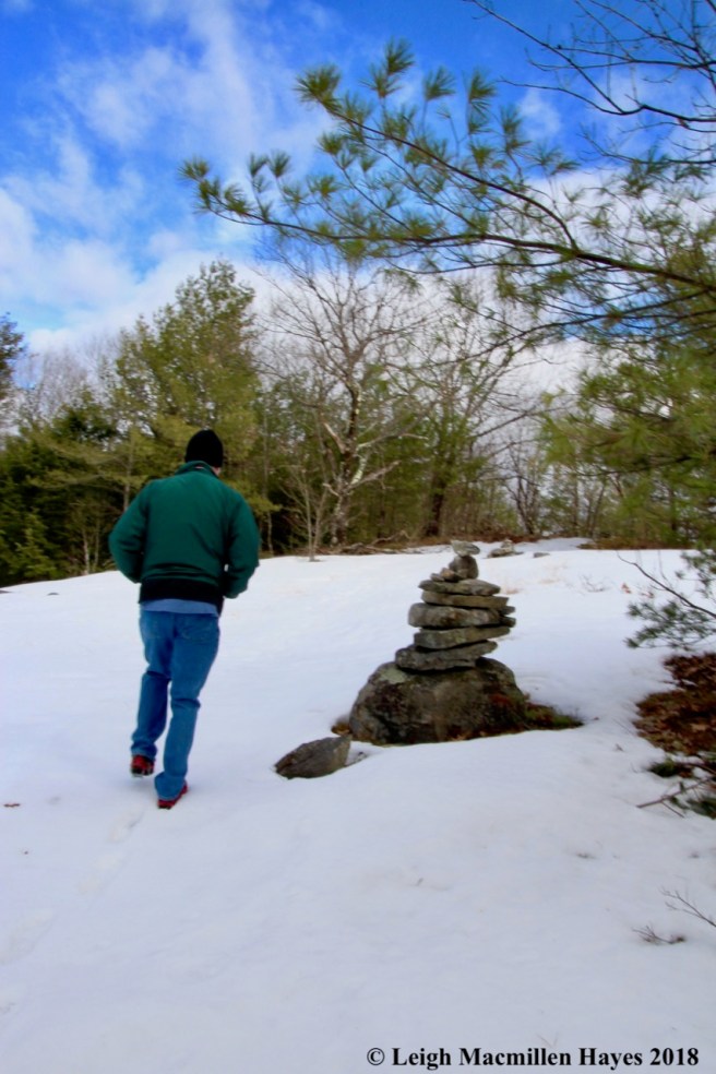
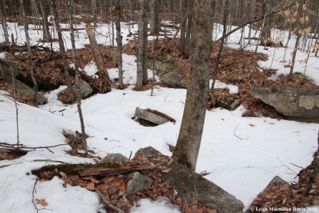
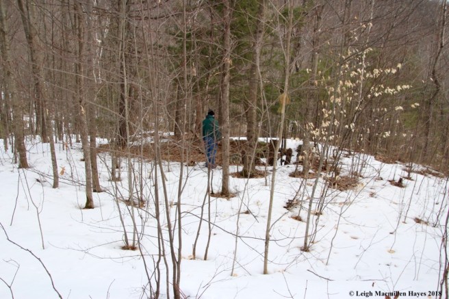
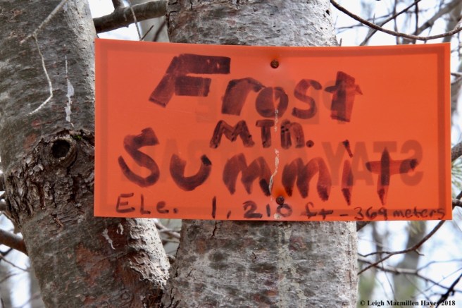
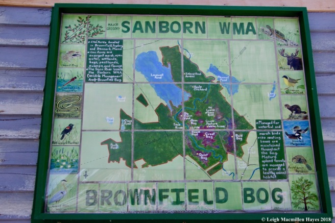
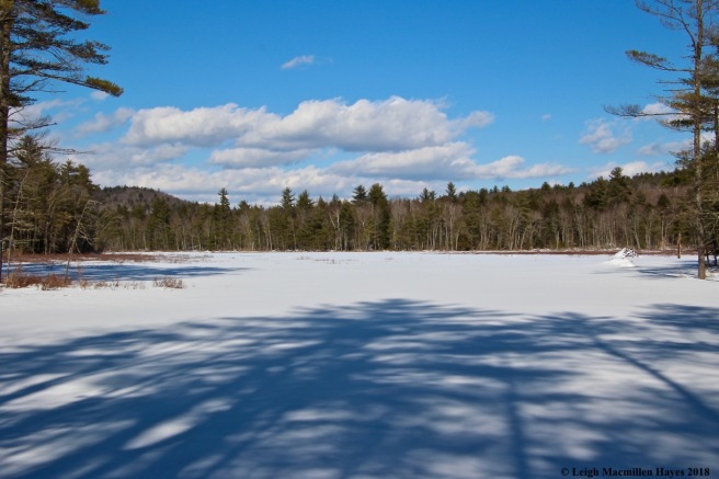
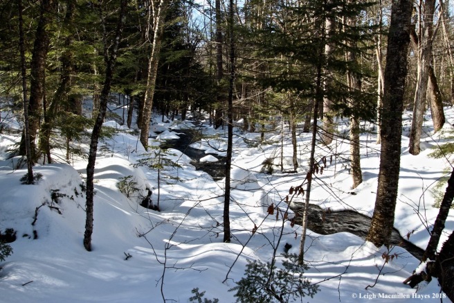
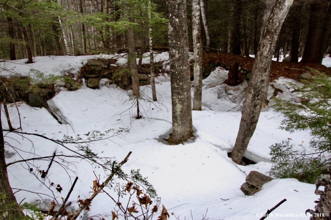
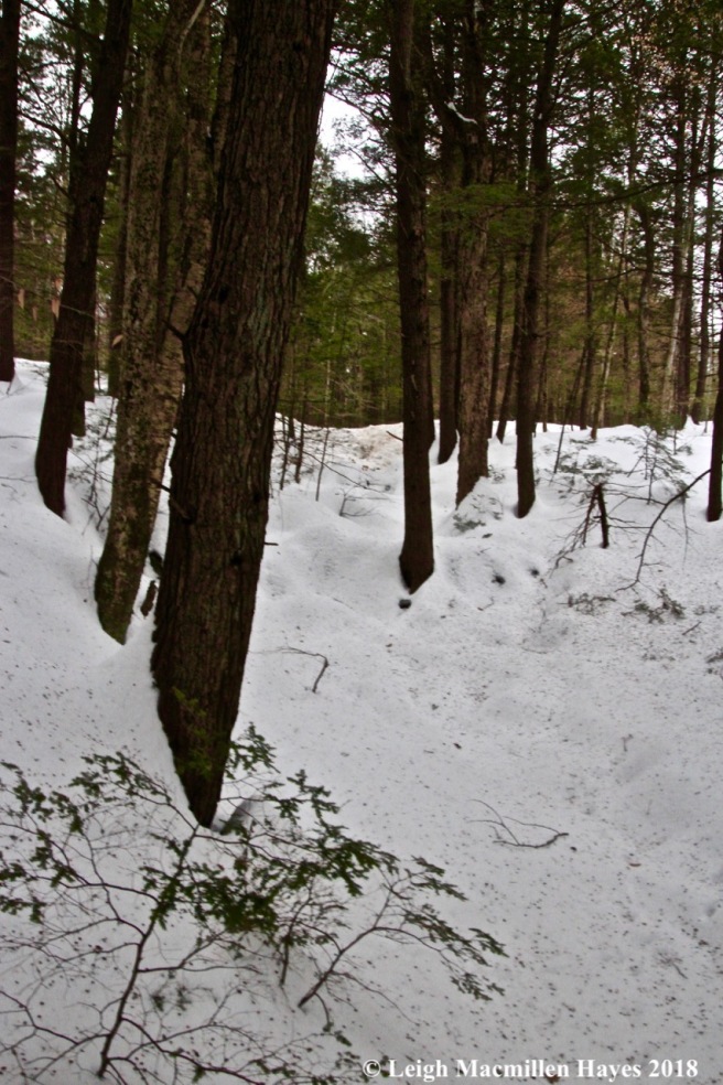
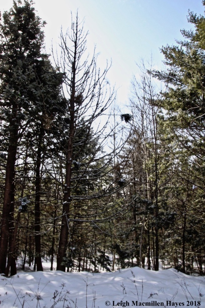
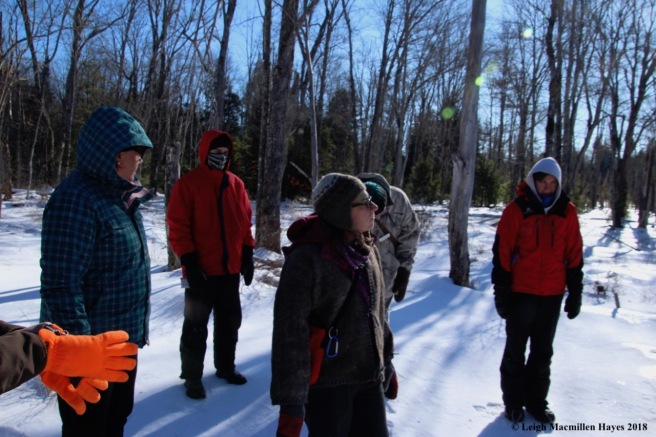
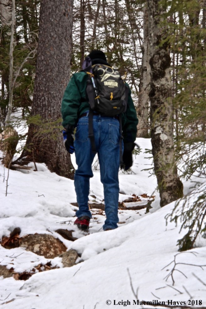
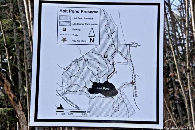
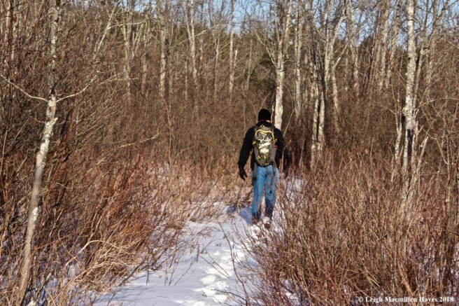
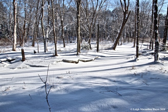
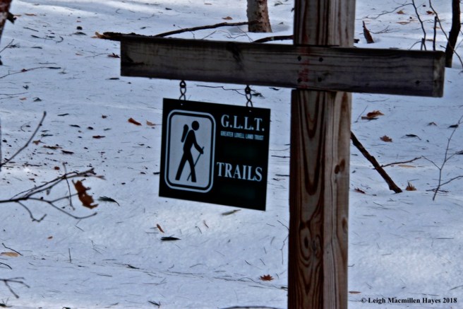
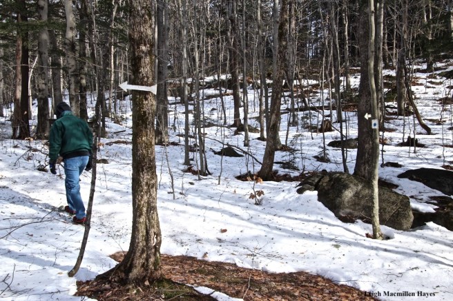
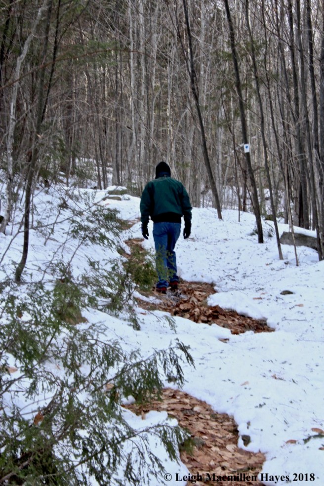
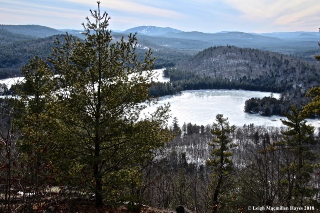
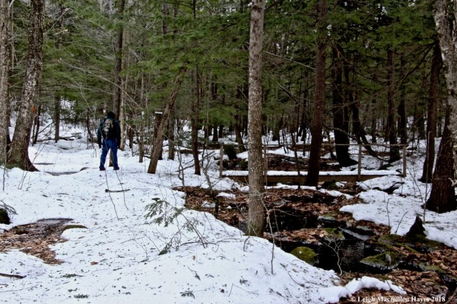
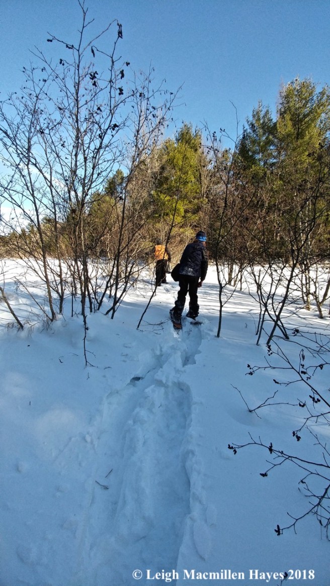
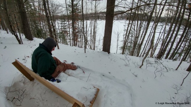
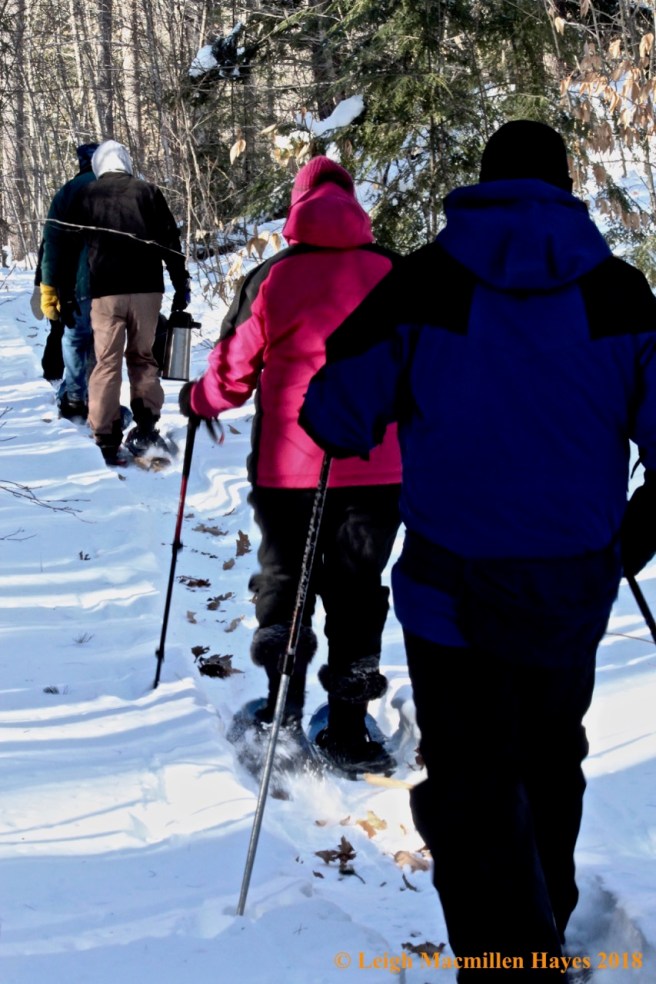
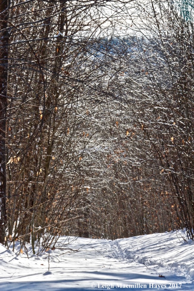
A few minutes later, I strapped on my snowshoes and headed up the trail. My plan–to climb to the summit of Flat Hill at the Greater Lovell Land Trust’s Heald and Bradley Ponds Reserve and then circle around Perky’s Path upon my return.

f3-trail up flat hill

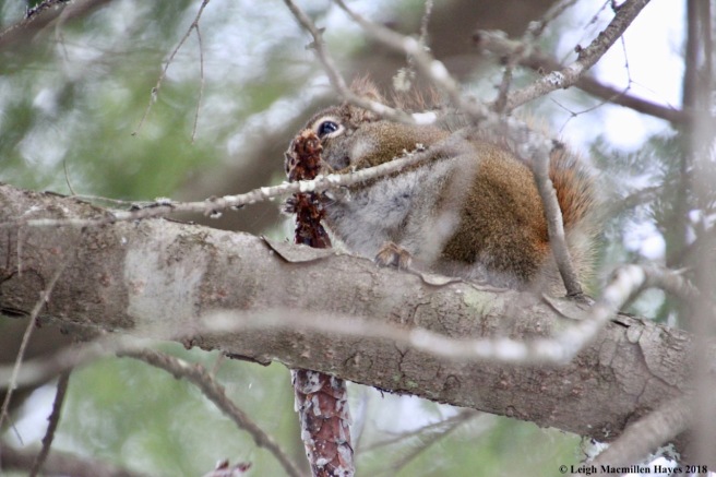
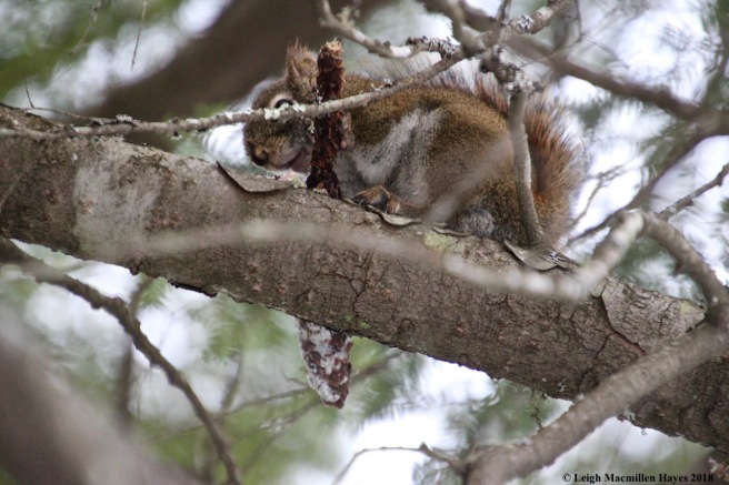
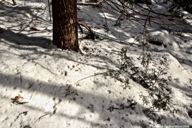
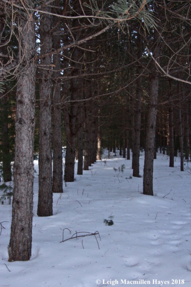
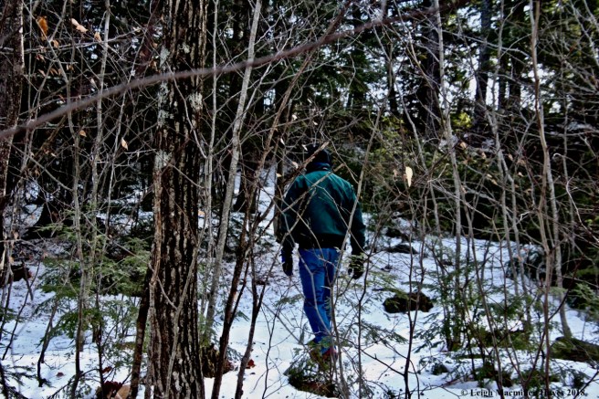
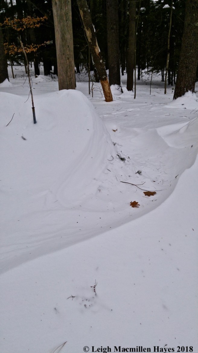
Breaking trail was my job in the rather deep snow given recent storms, but easy to move upon and so I sashayed up. What surprised me, however, was the lack of tracks left behind by the mammals that I know live in these woods.

f4-pine cone bird feeders

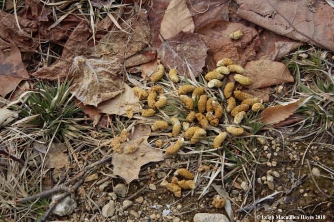
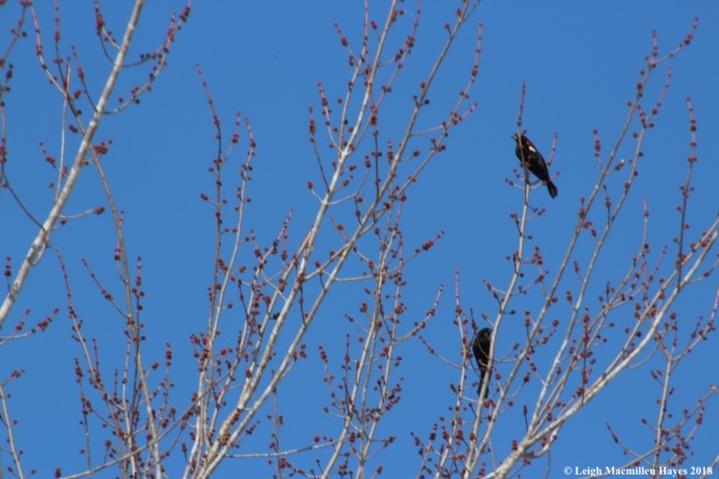
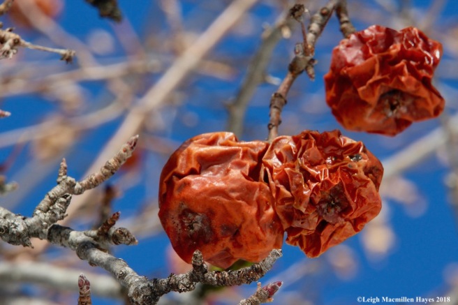
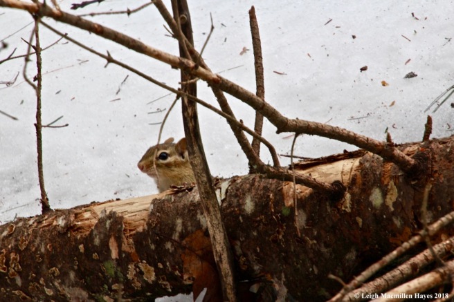
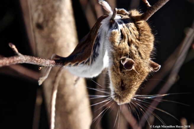
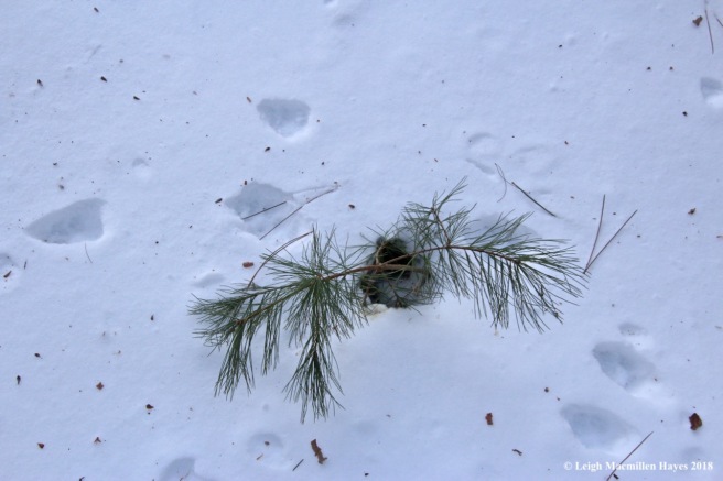
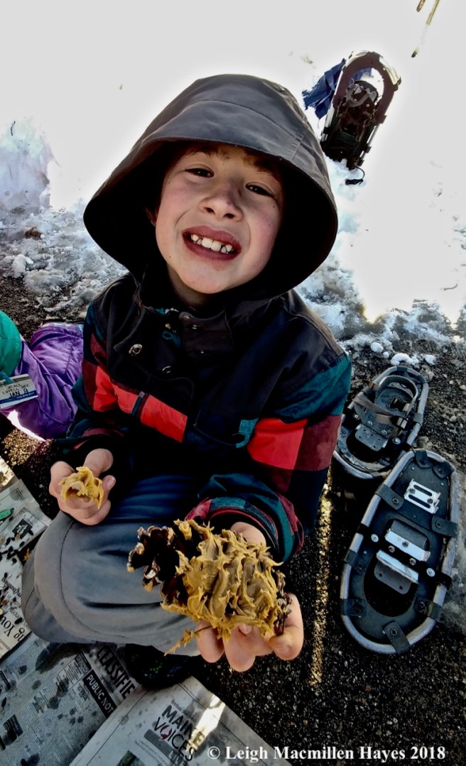
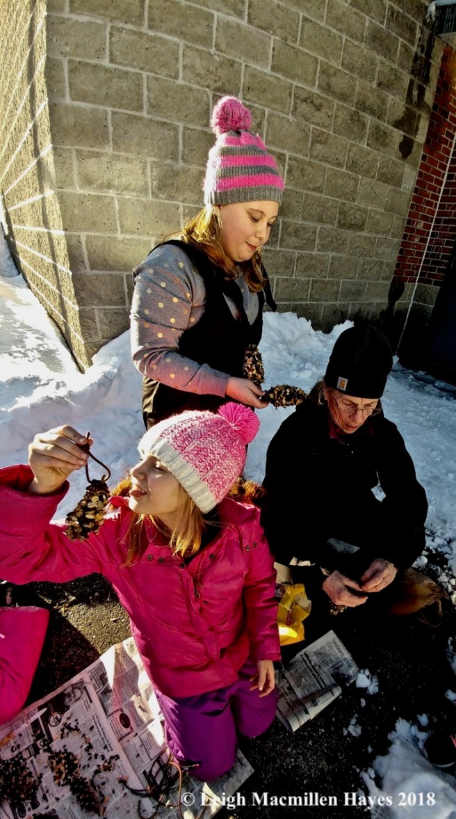
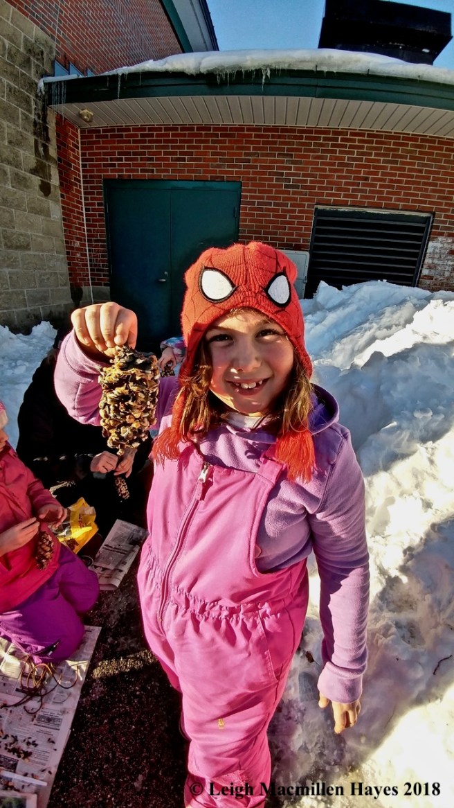
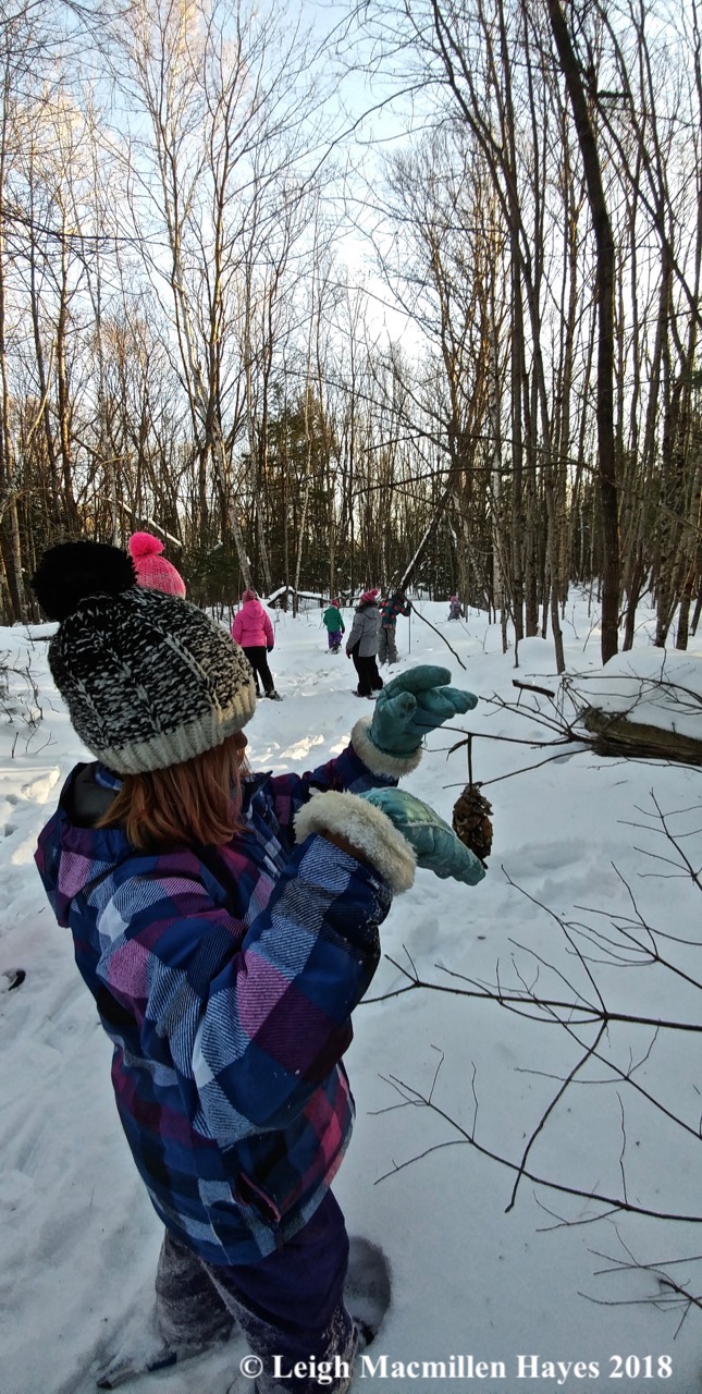
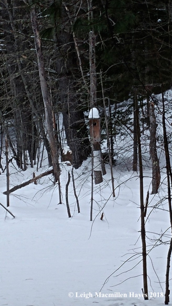
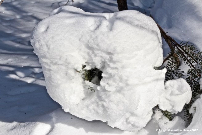
I did stop at the balsam firs decorated by a local 4-H club in December as part of the Maine Christmas Tree Hunt. The dangling pinecones once sported peanut butter and birdseed, but today that was all a memory so I knew birds and deer had stopped by in the last few months.

f5-bobcat 1

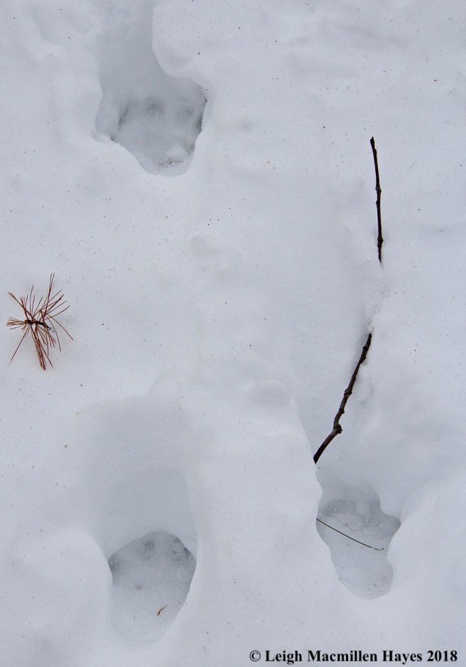
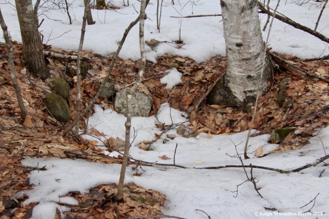
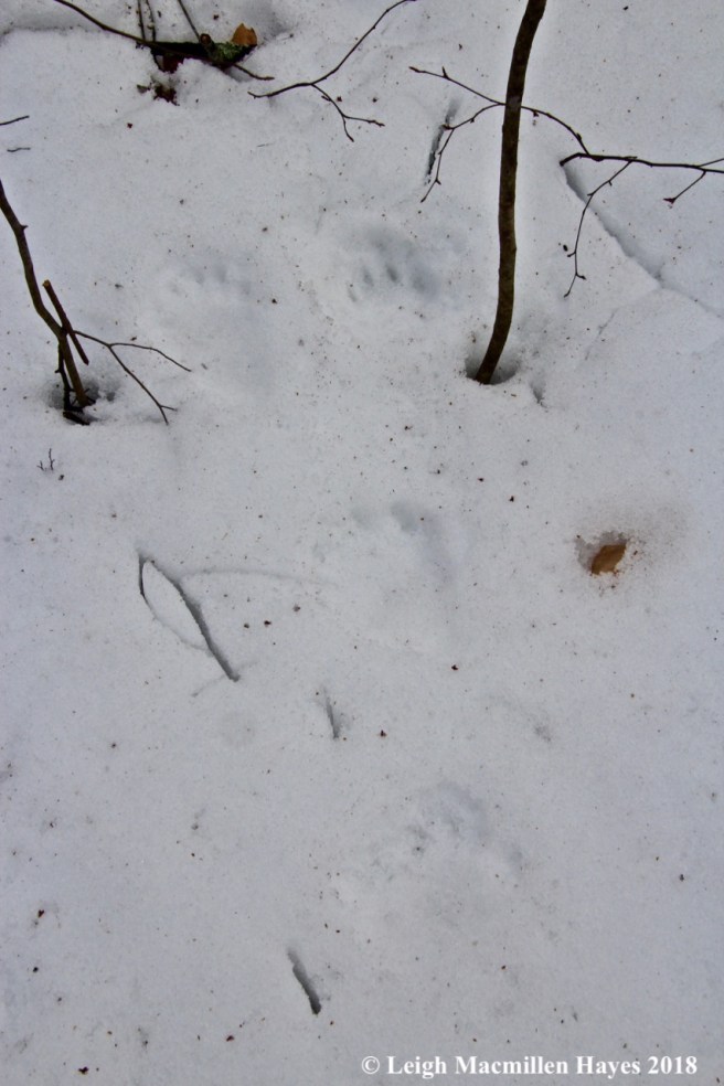
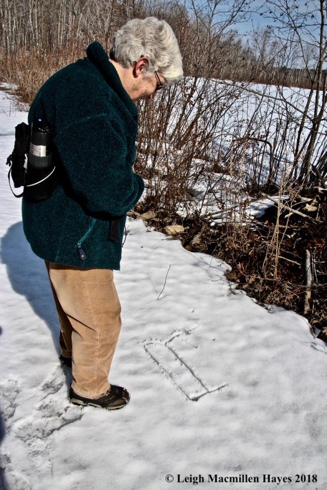
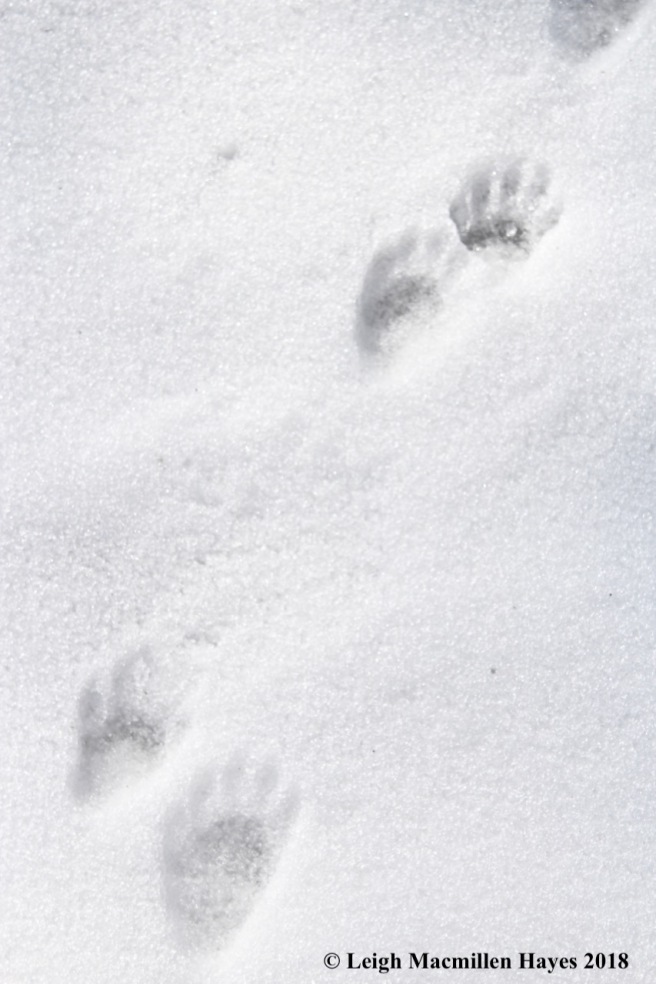
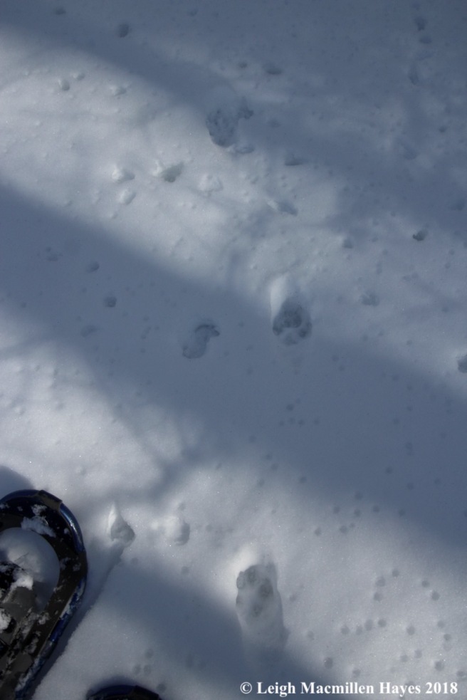
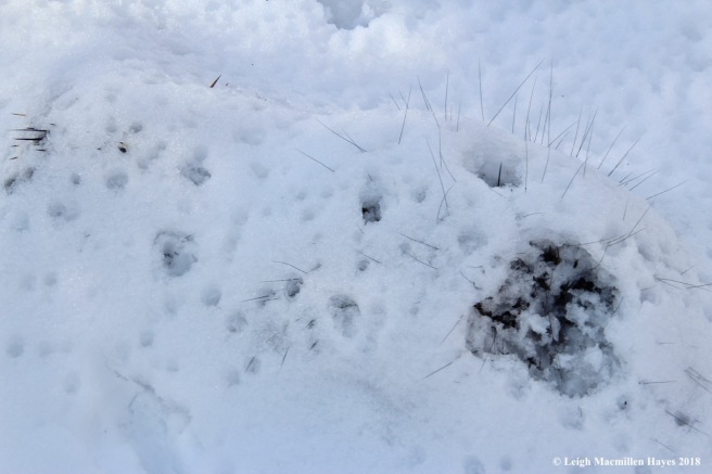
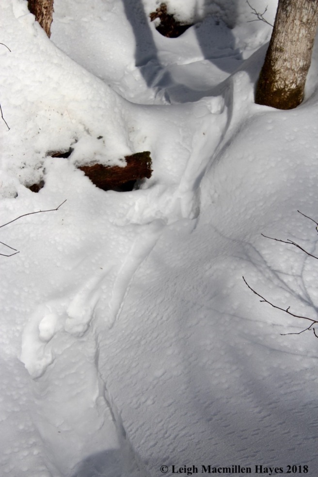
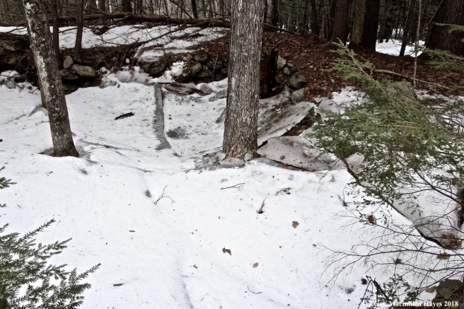
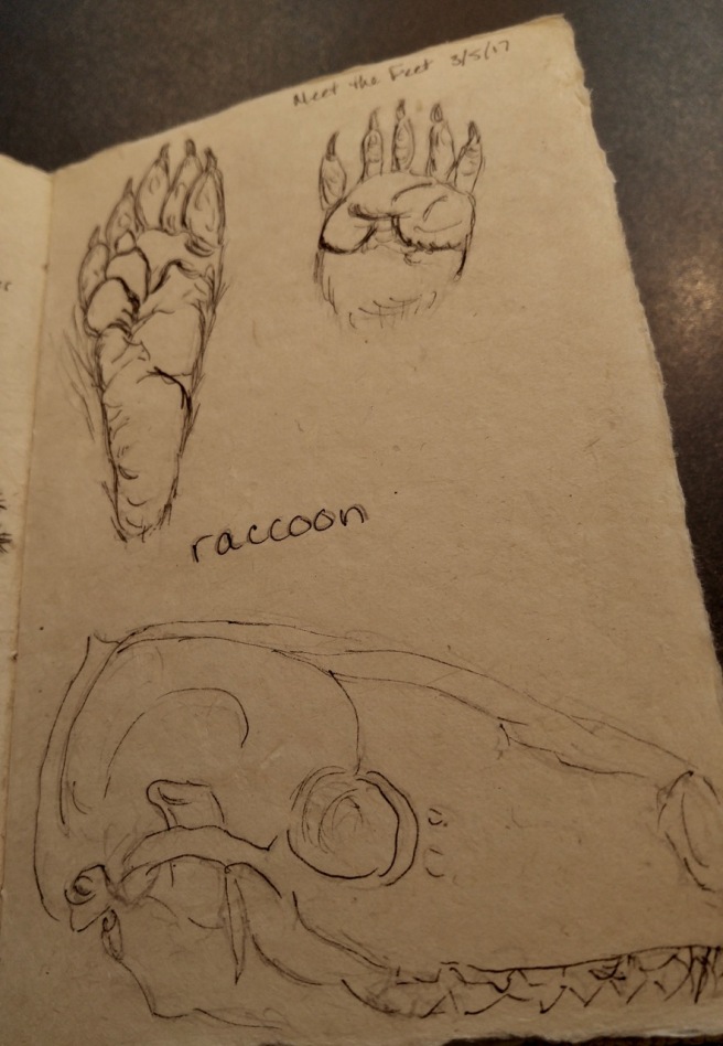
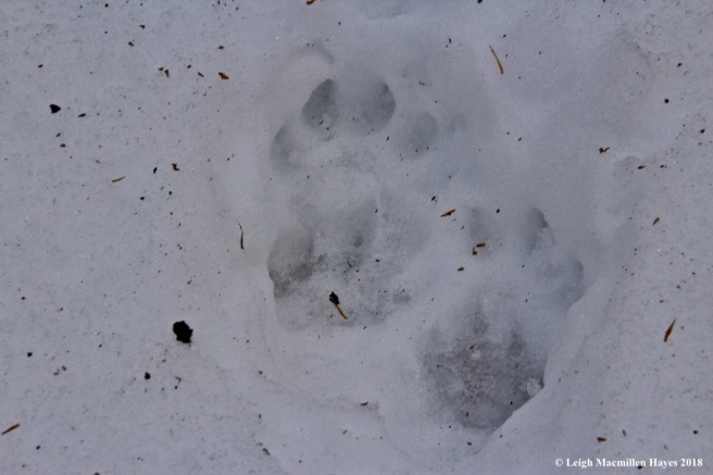
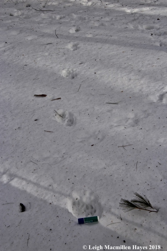
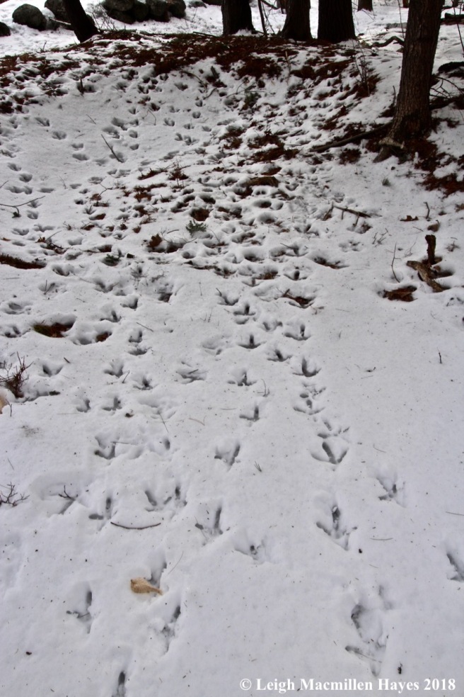
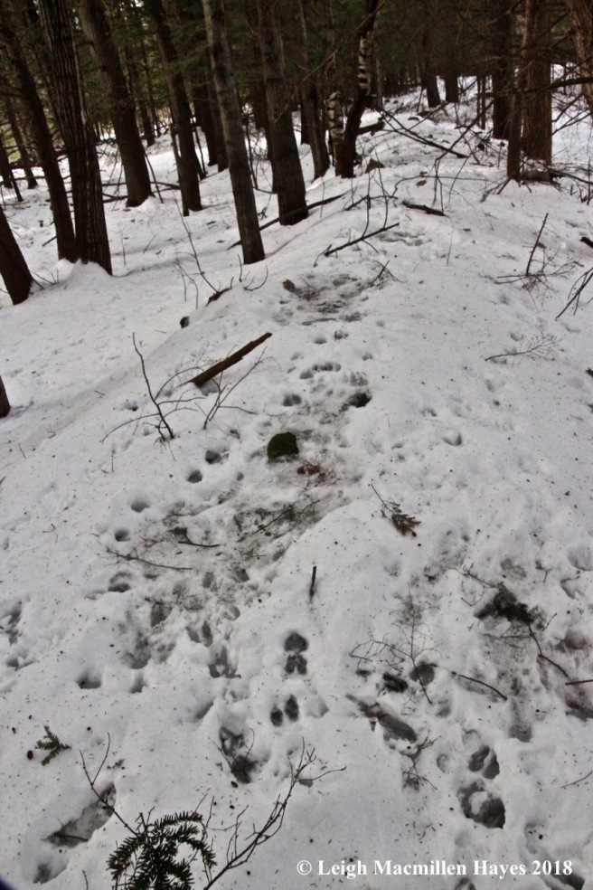
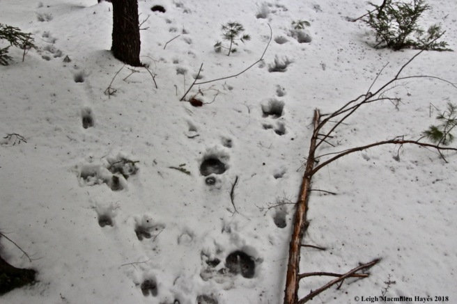
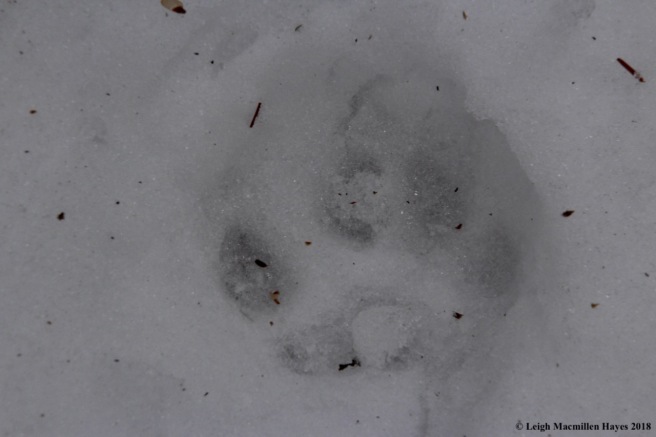
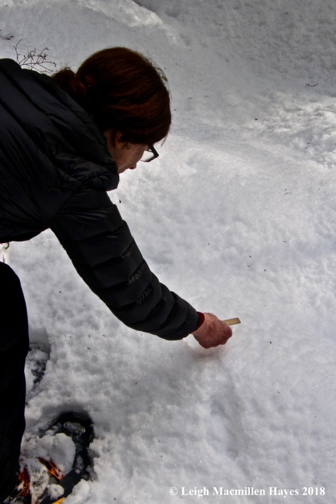
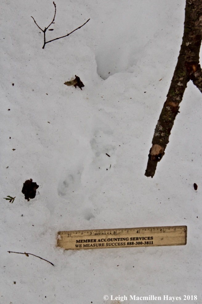
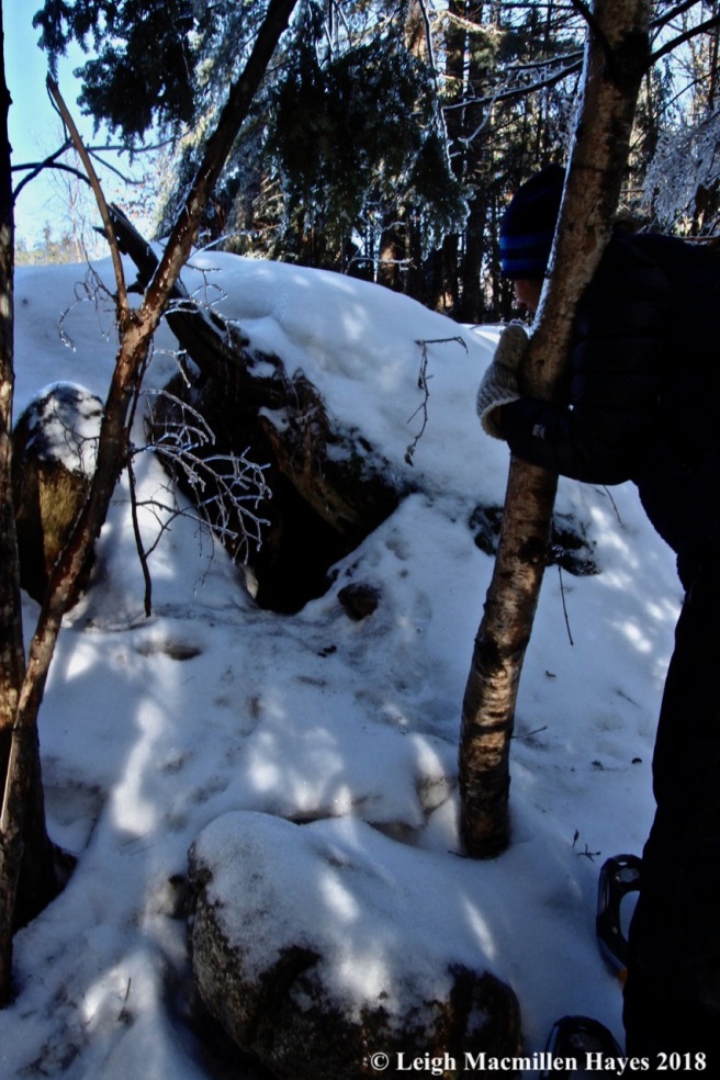
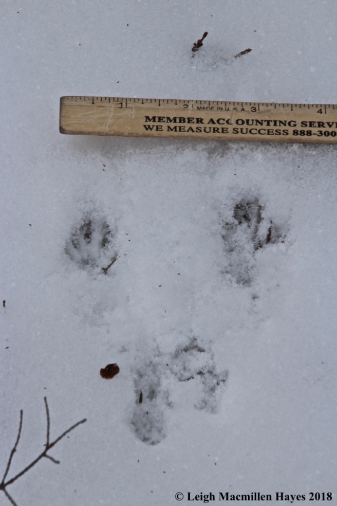
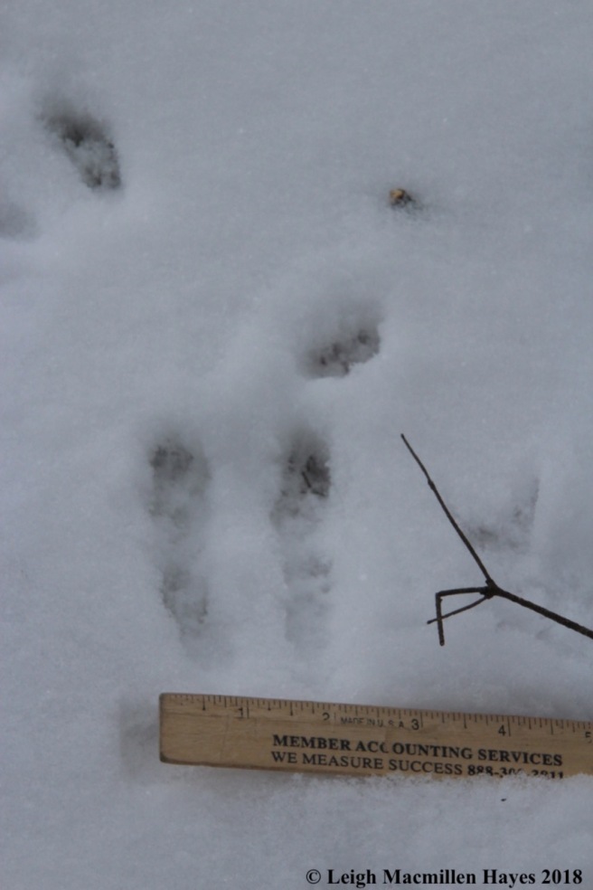
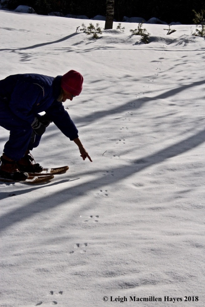
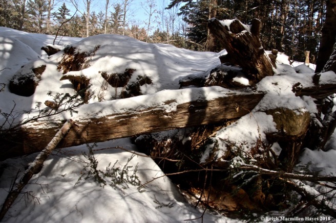
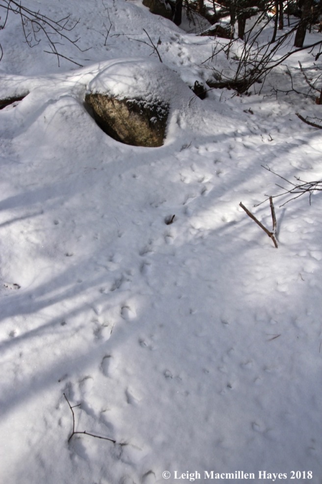
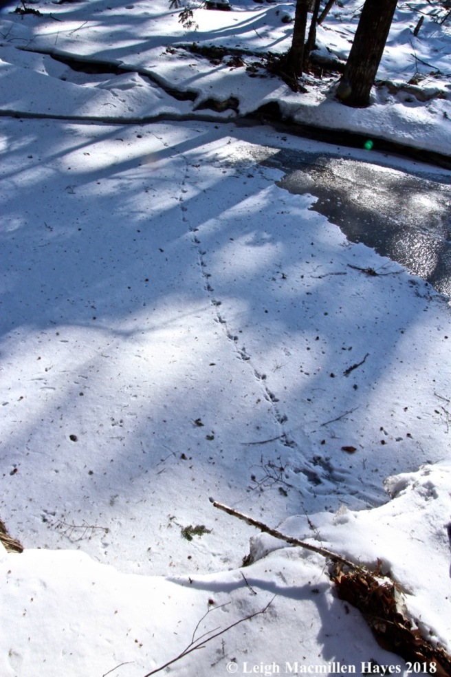
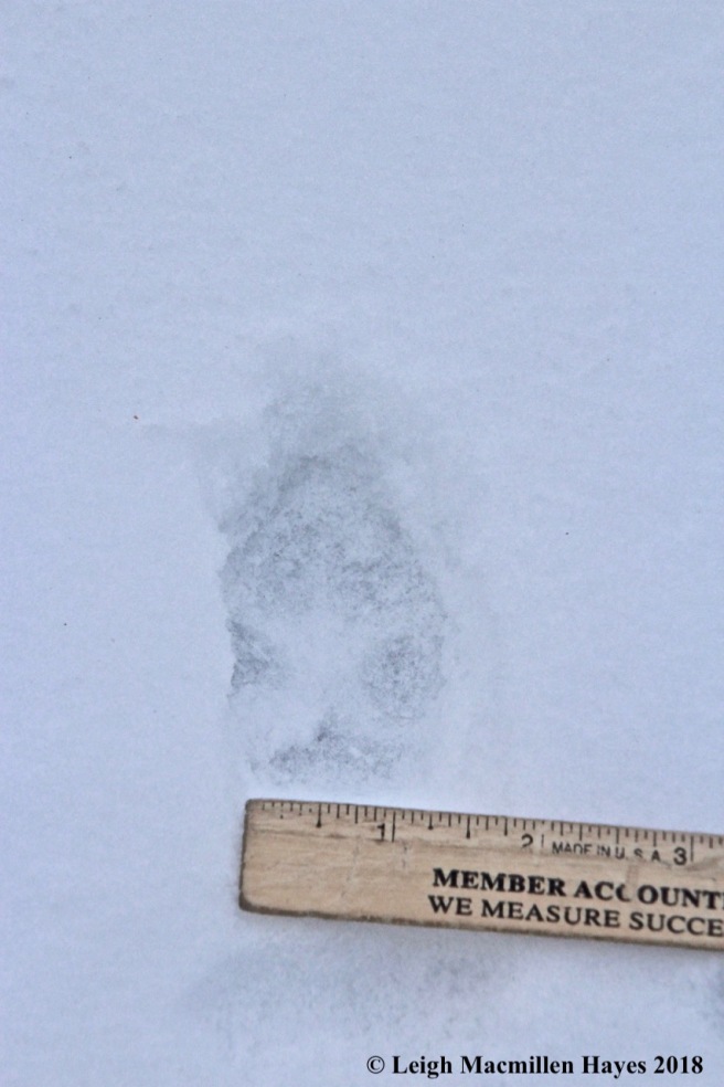
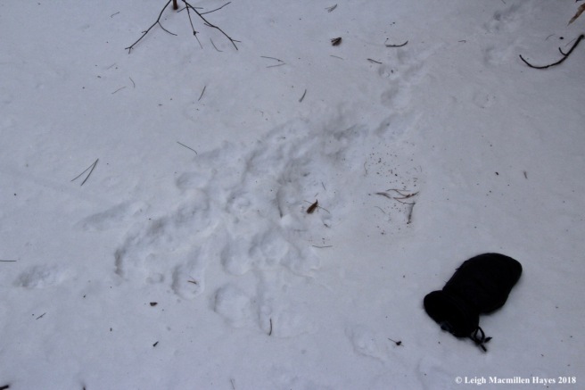
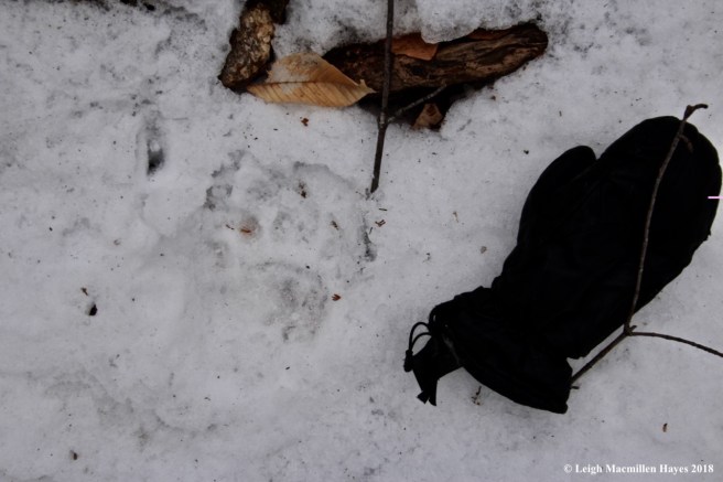
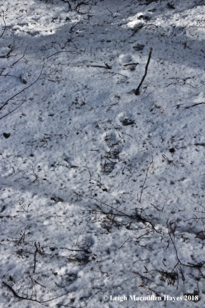
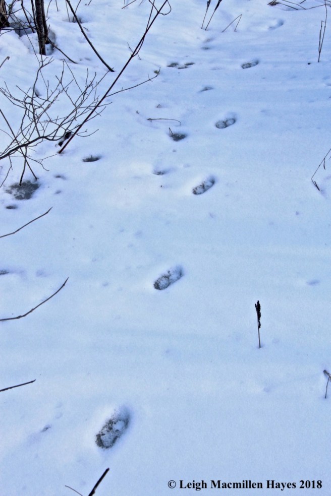
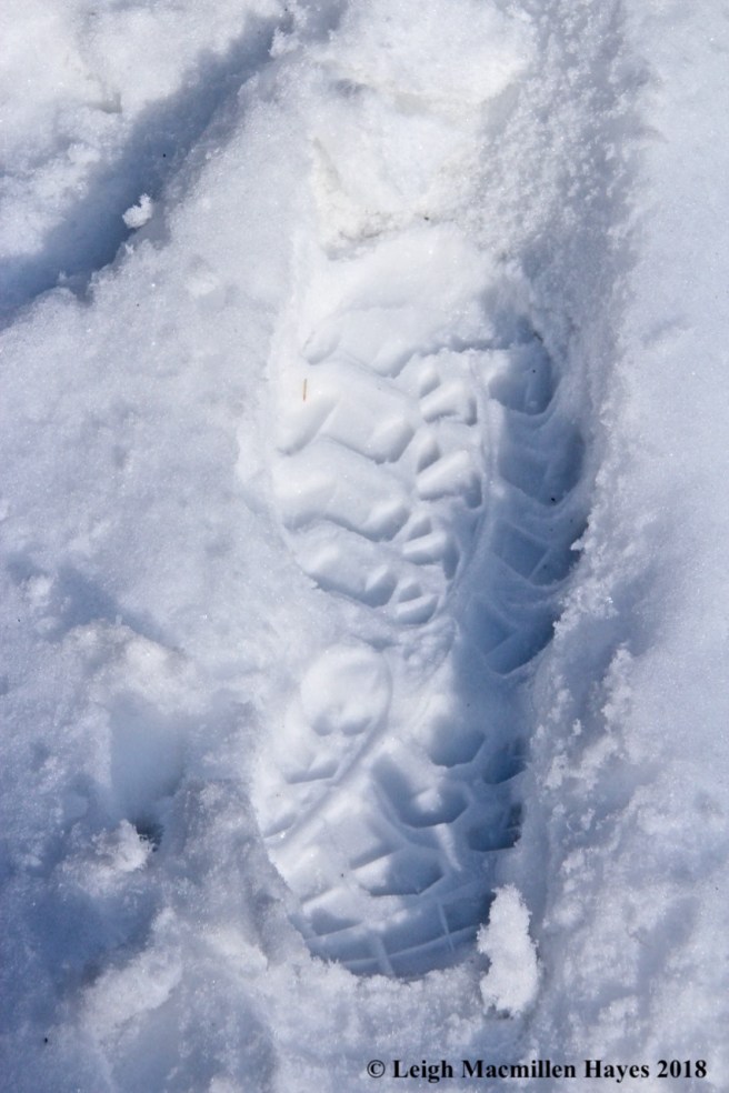
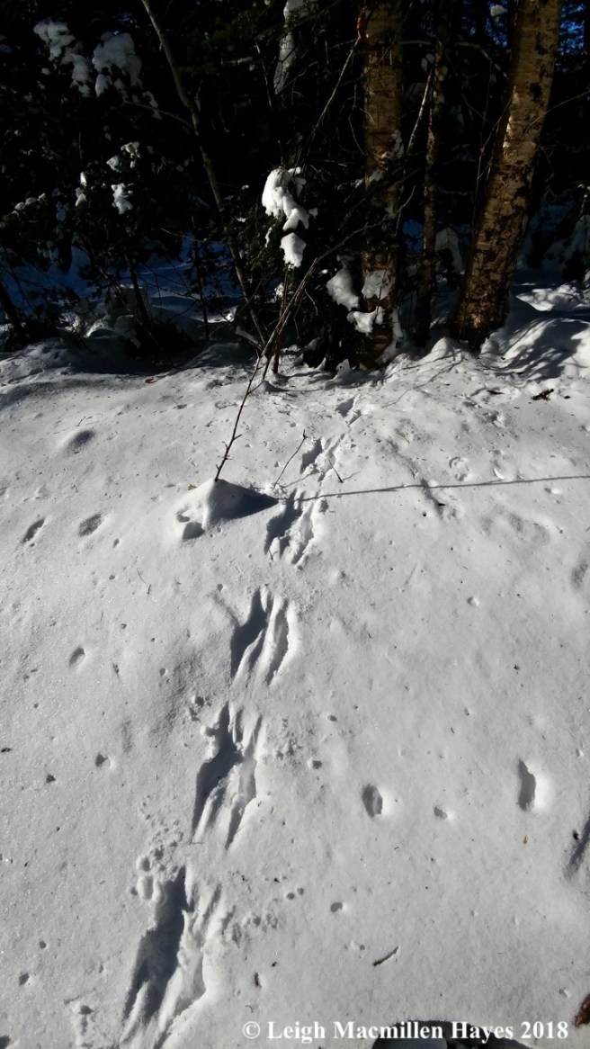
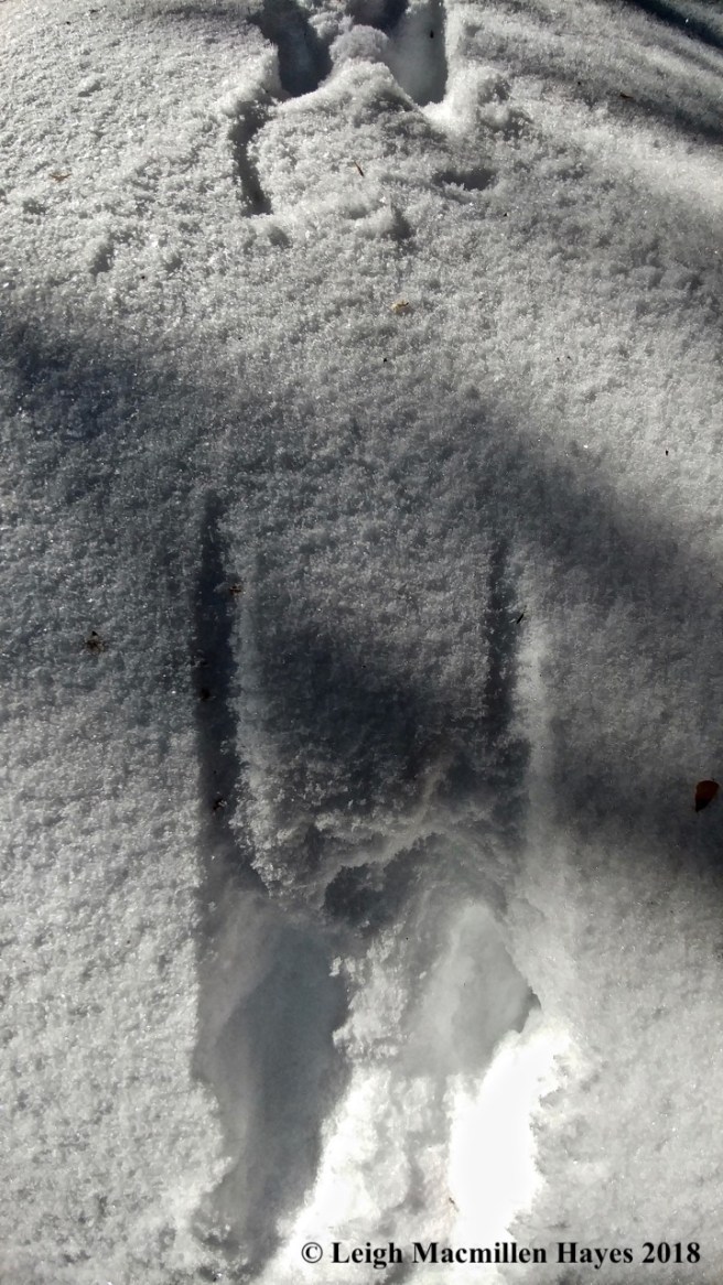
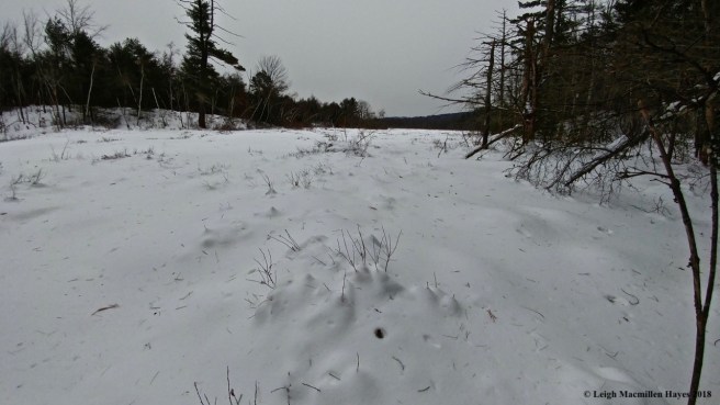
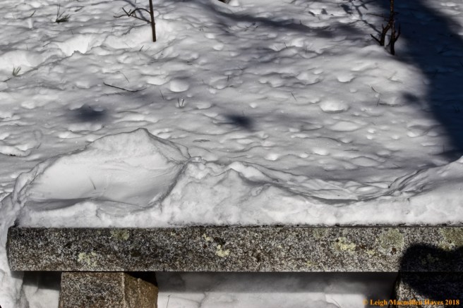
And then, as I neared the flat summit, I found tracks of a mammal that had checked out the base of every tree and under every downed limb. In fact, as I soon realized, it was more than one mammal that I followed as I went off trail. Bobcats. Indeed. Though typically solitary, these two traveled together. It is mating season and males and females will travel together during courtship.

f11-bobcat print

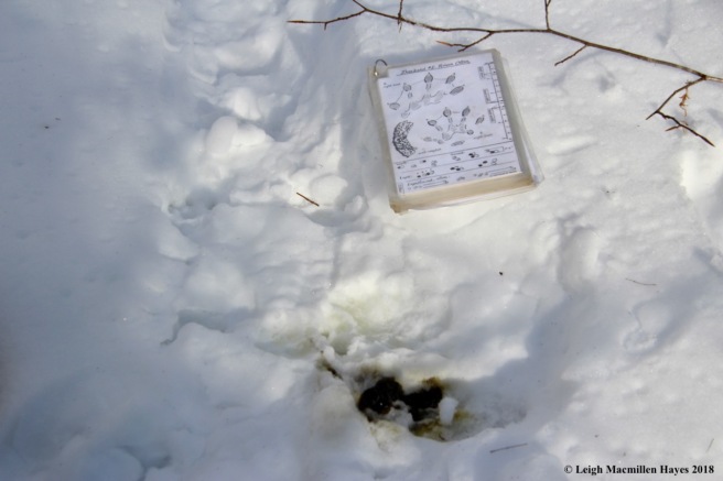
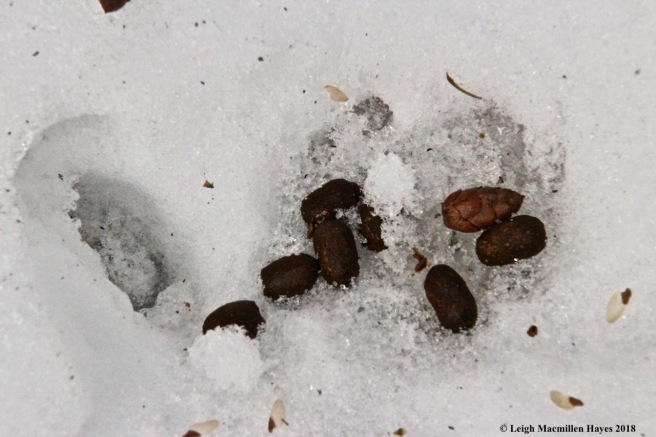
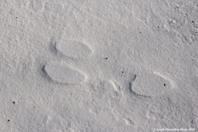
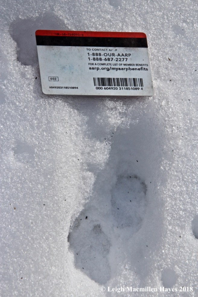
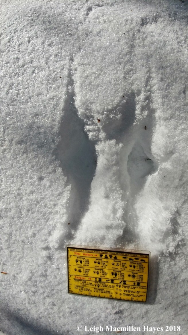
Though the prints were difficult to photograph given the glare, by the toes, ridge and overall shape, I knew them.

f12-bobcat scat and print

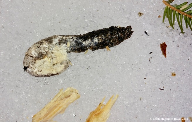
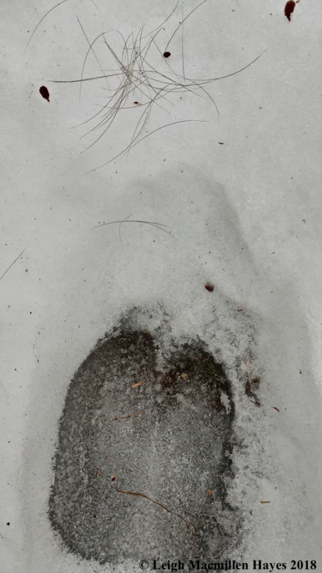
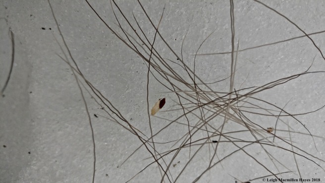
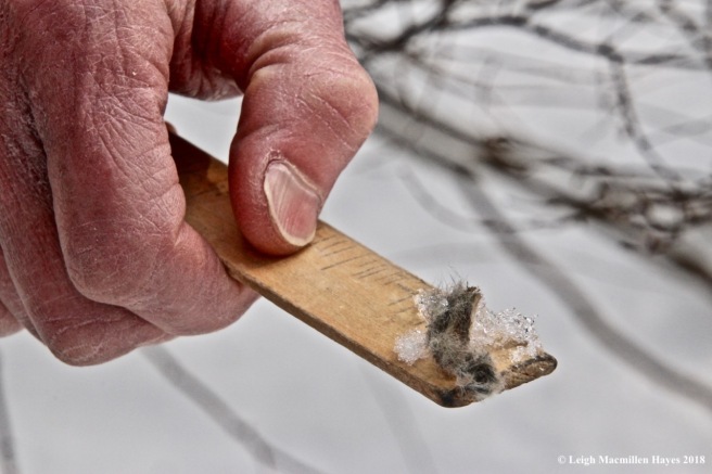
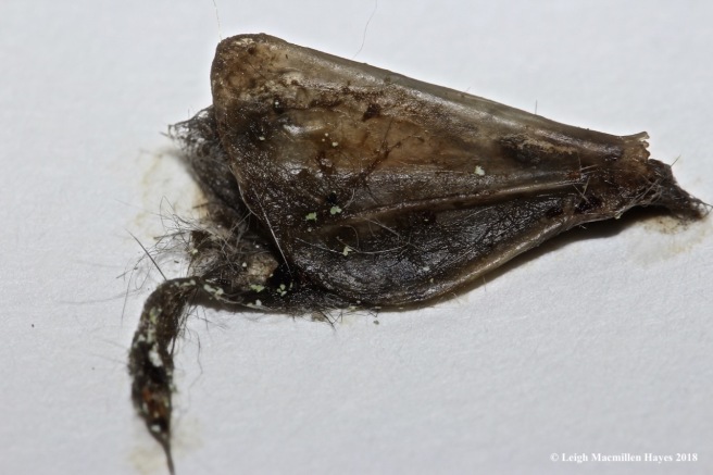
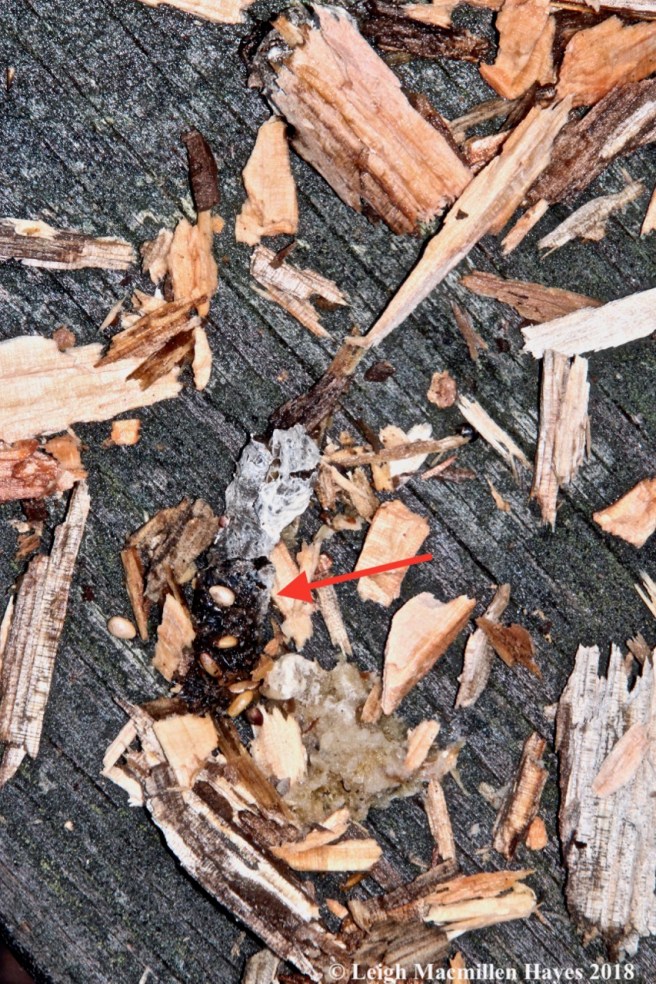
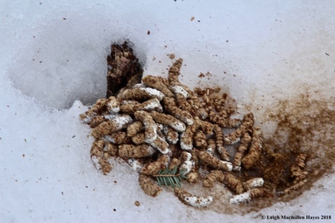
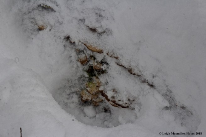
And scat! Filled with white hair. I have close-up views should you choose a closer look, but chose to give those who find scat to be rather disgusting a break. ;-)

f6-porcupine and bobcat

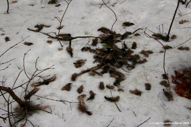
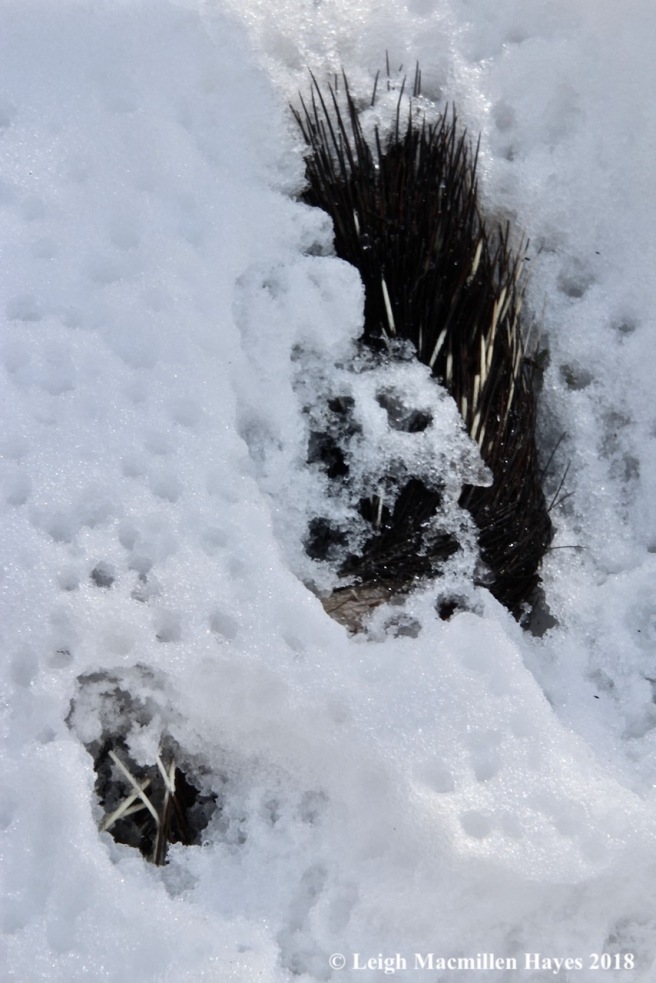
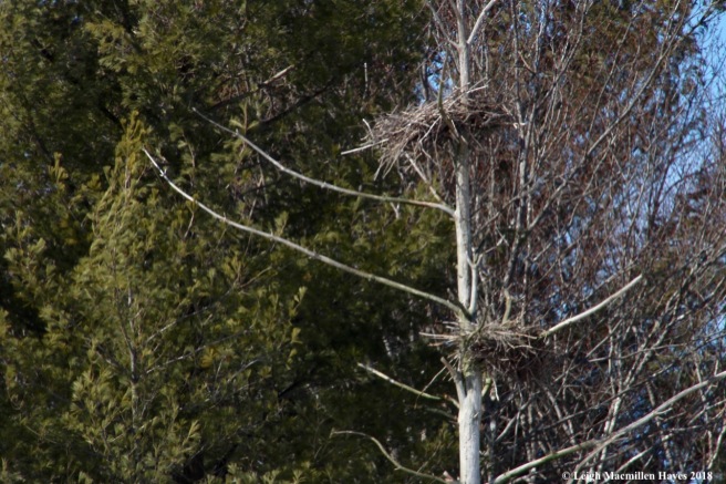
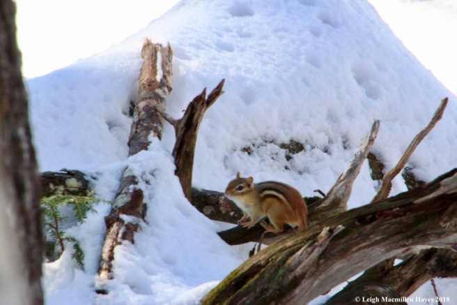
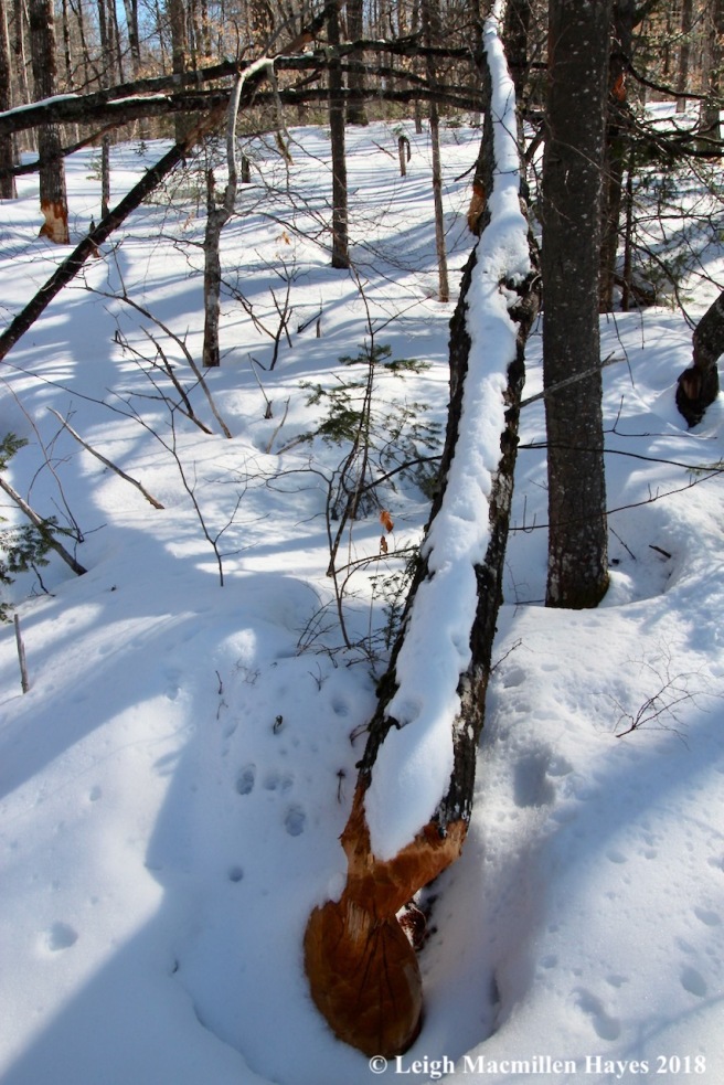
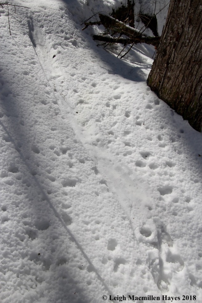
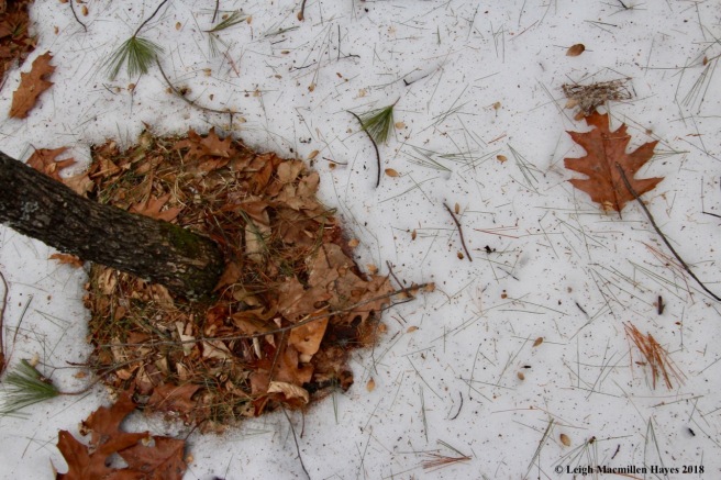
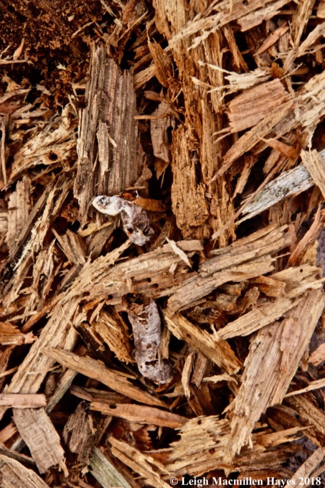
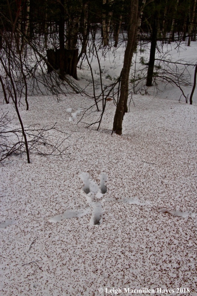
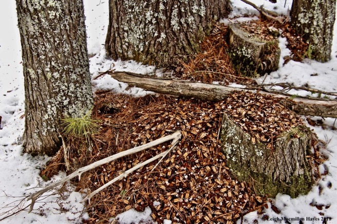
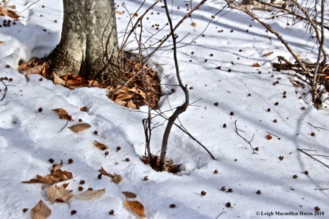
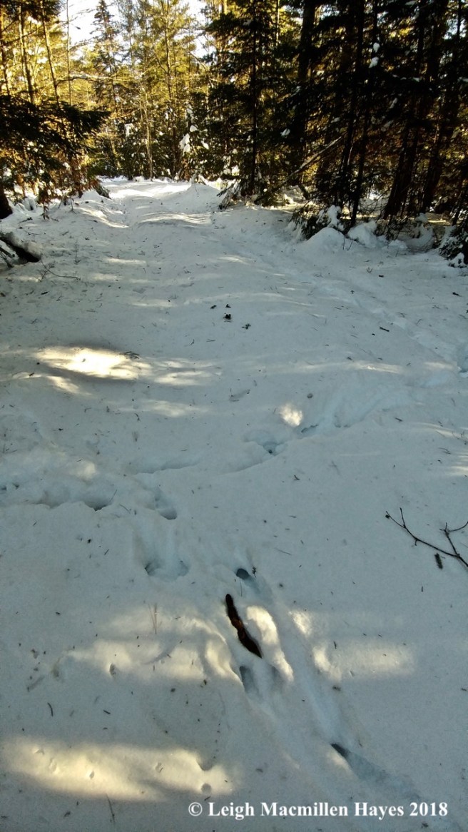
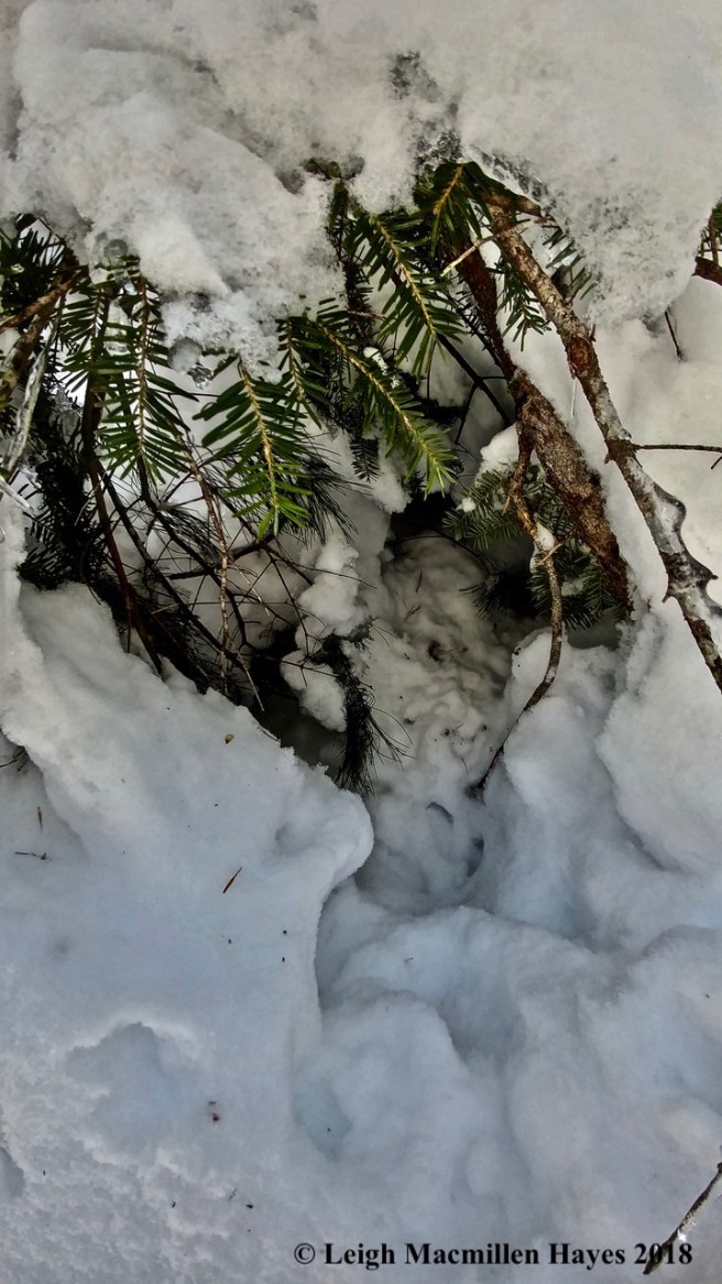
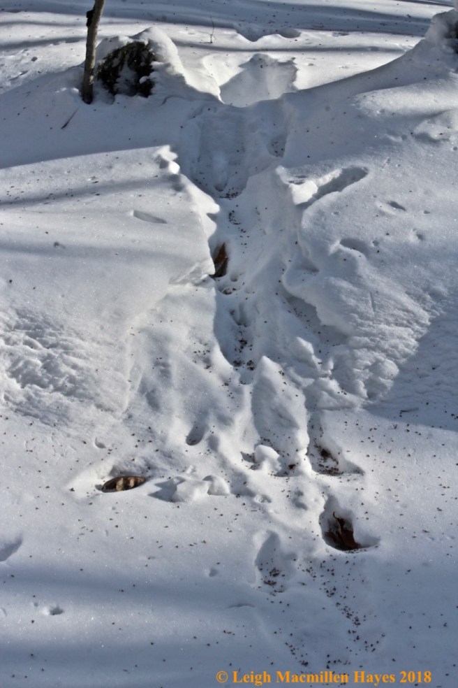
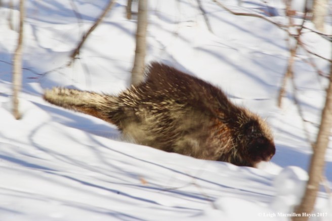
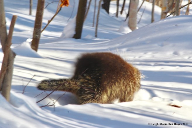
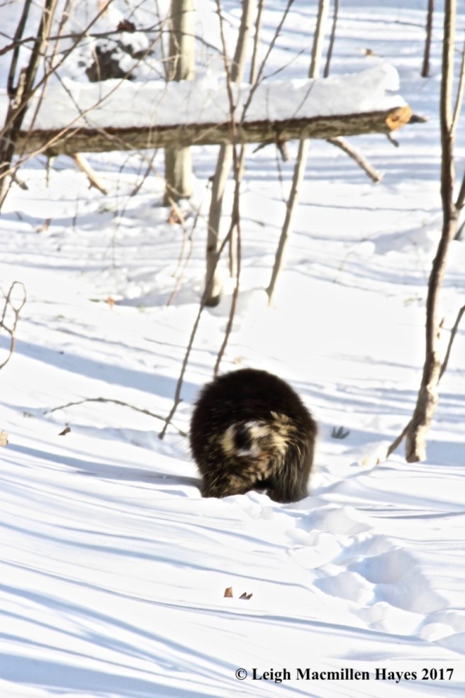
And then I found another set of tracks and knew that besides squirrels and little brown things, the bobcats were also searching for a bigger dinner. On the left–a porcupine trough, and on the right, the bobcat trail.

f8-porky work

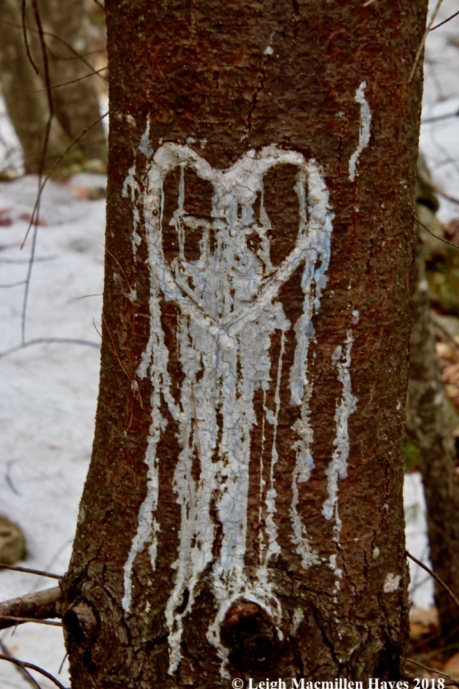
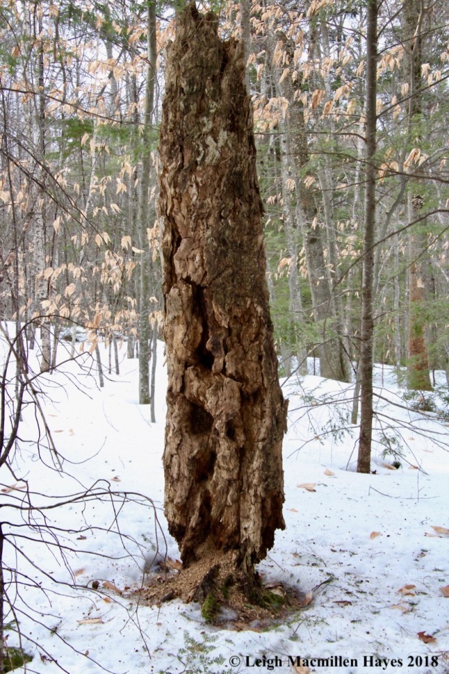
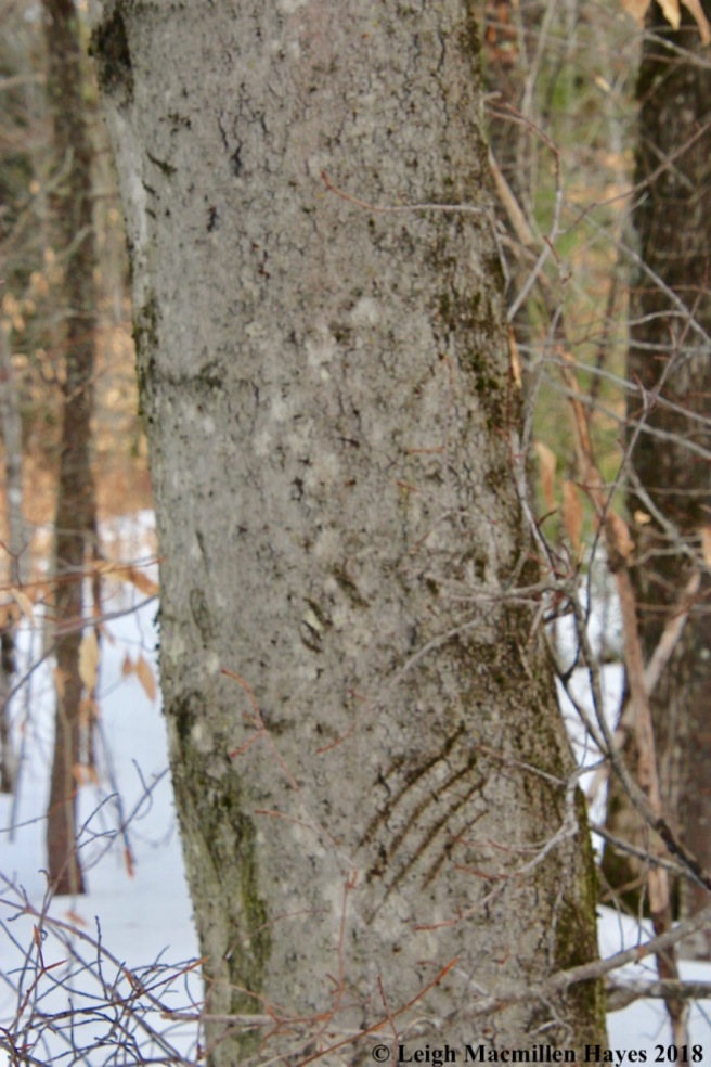
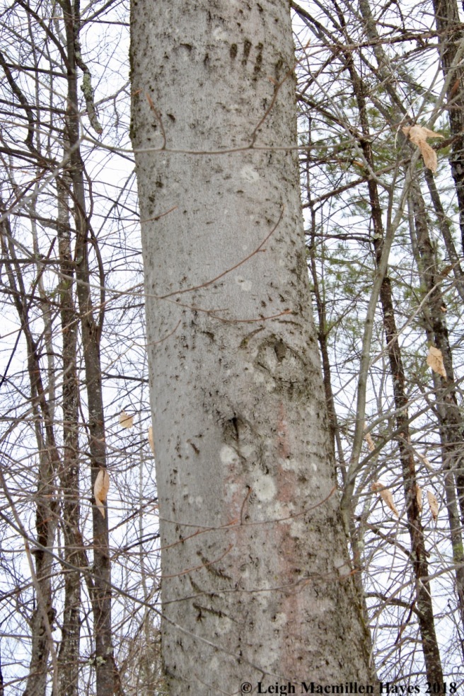
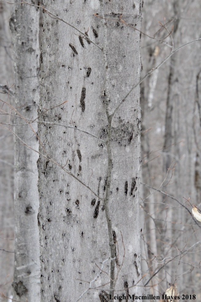
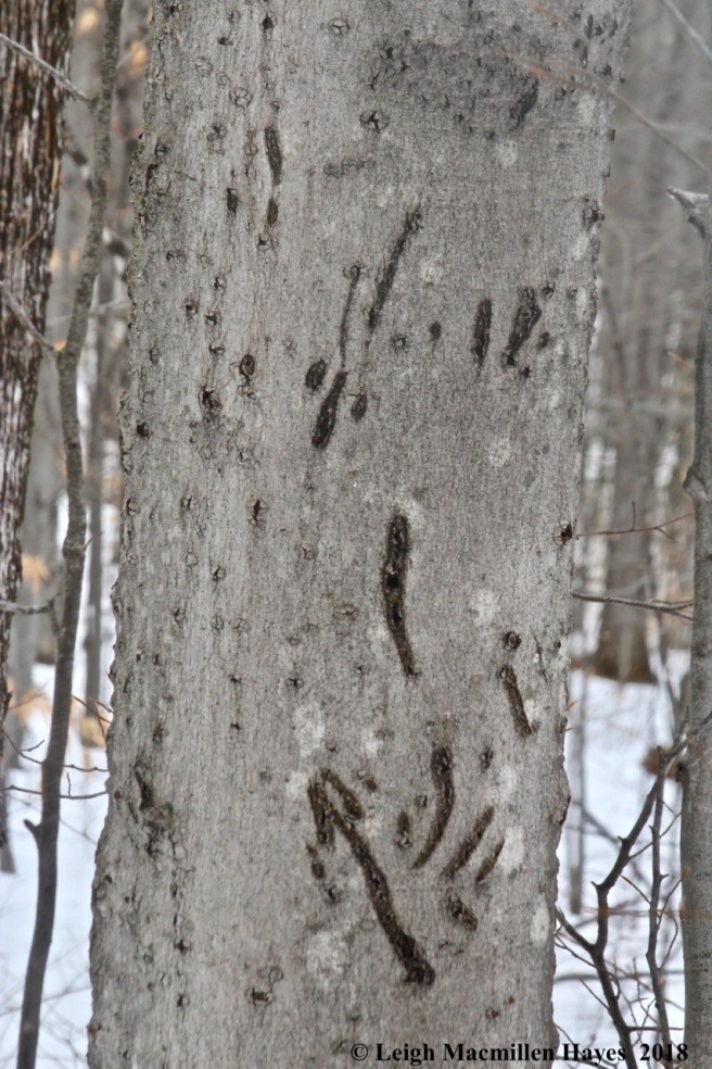
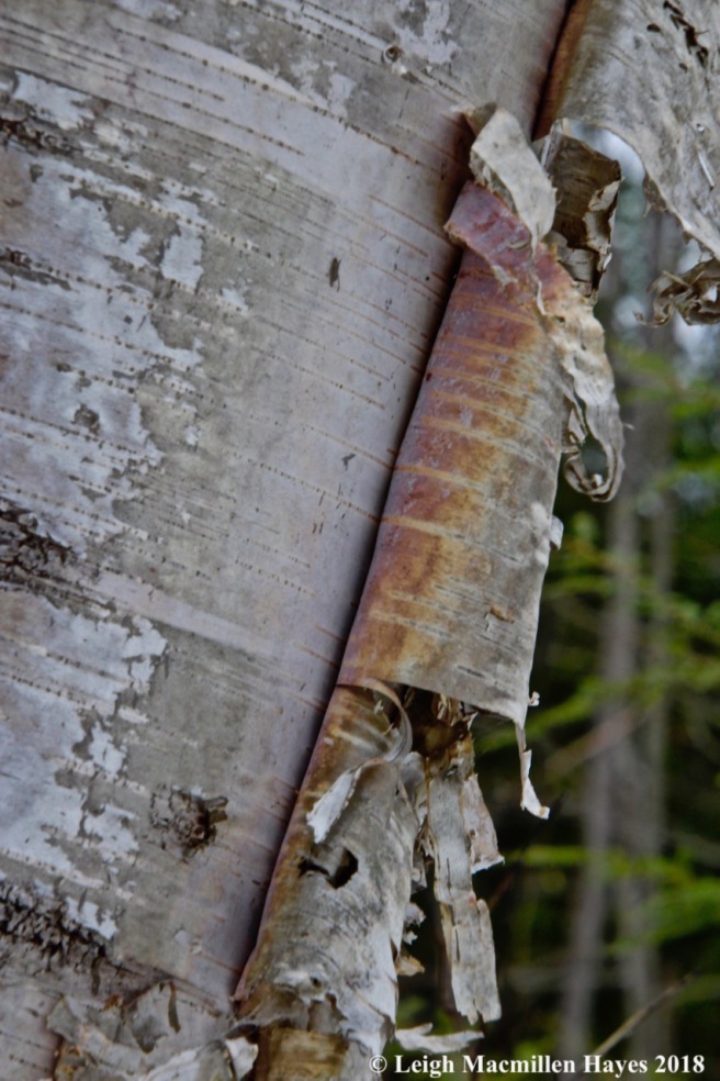
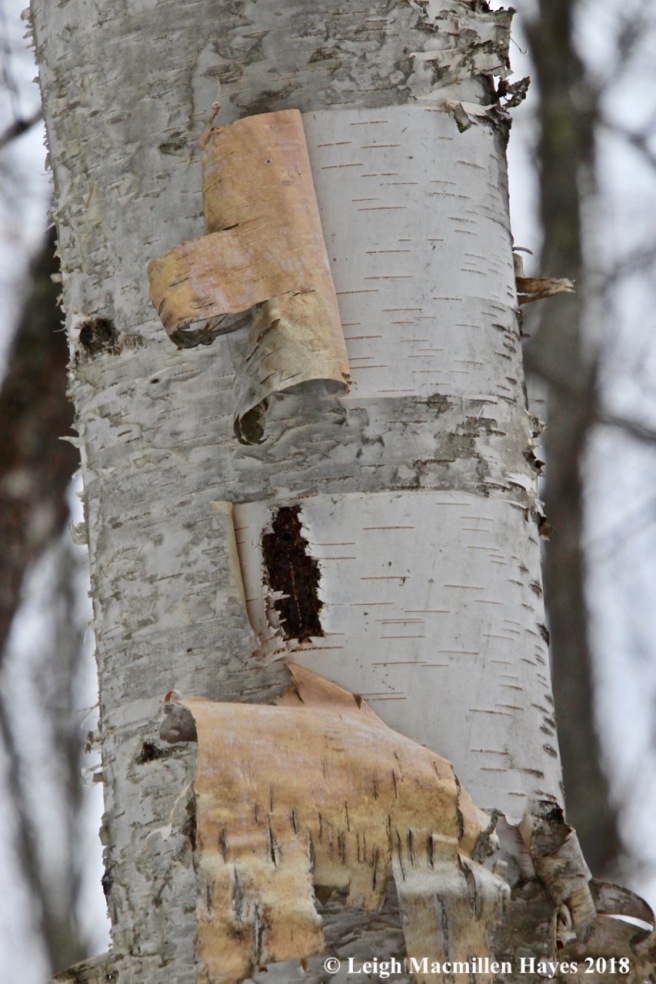
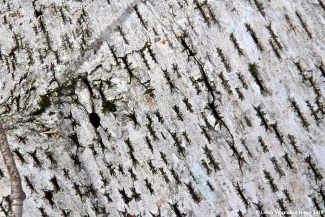
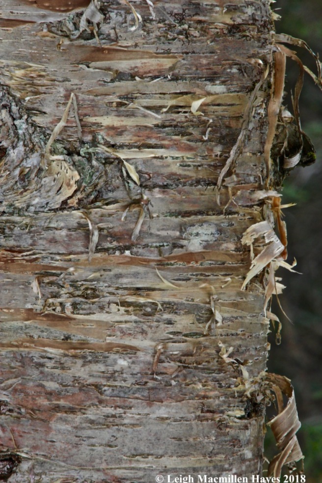
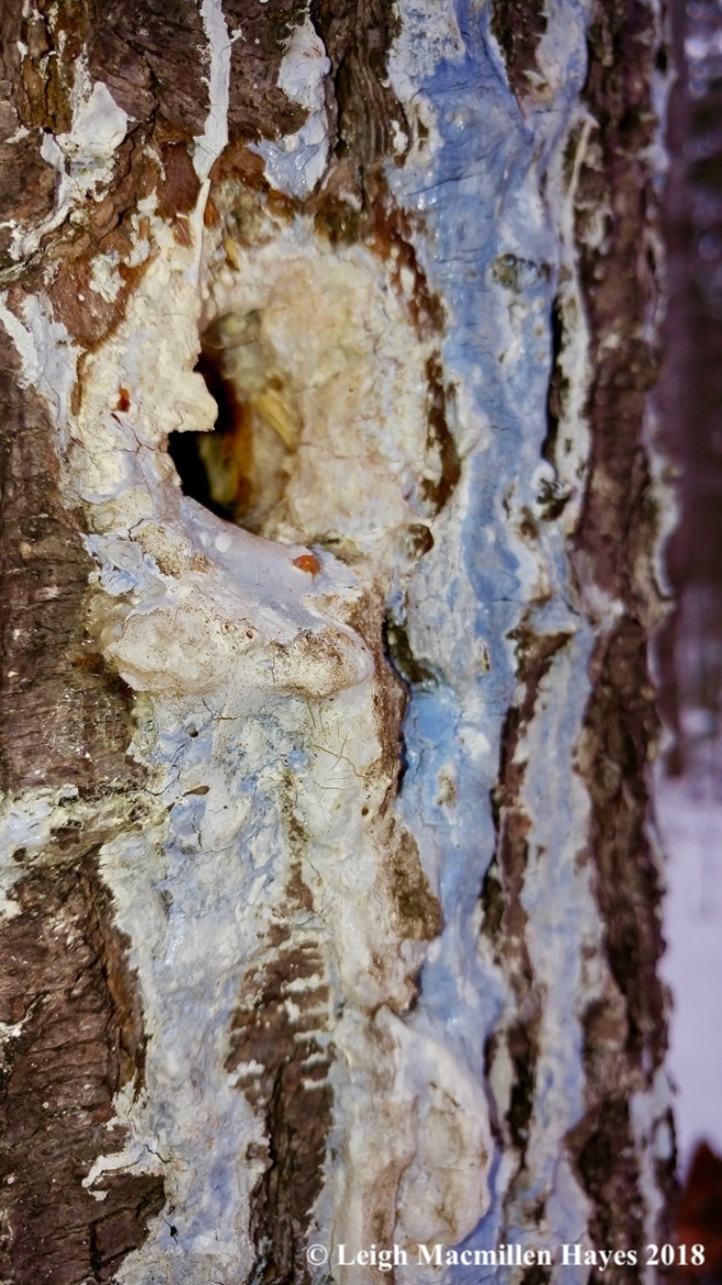
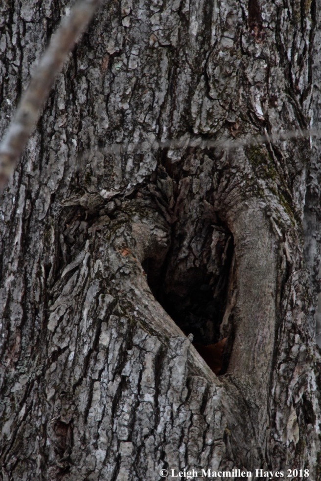
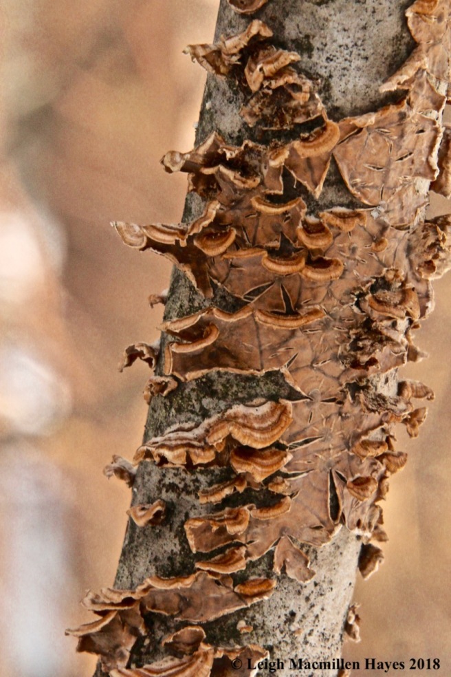
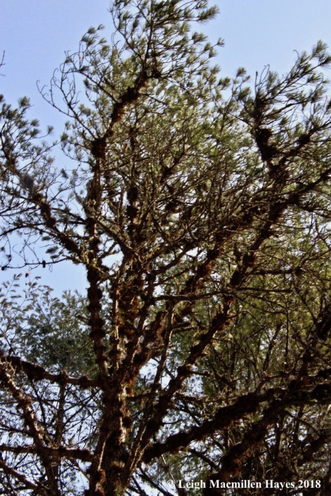
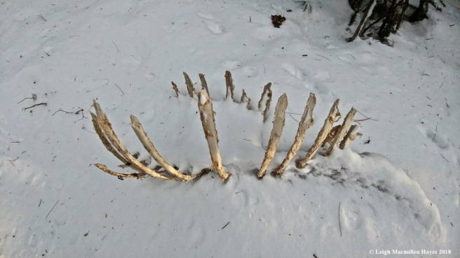
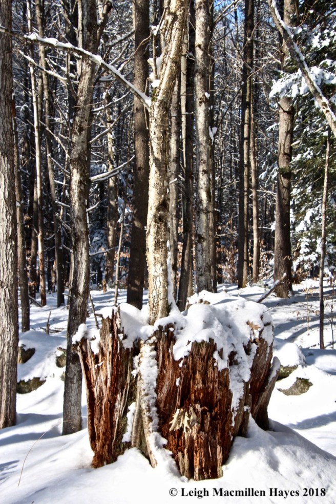
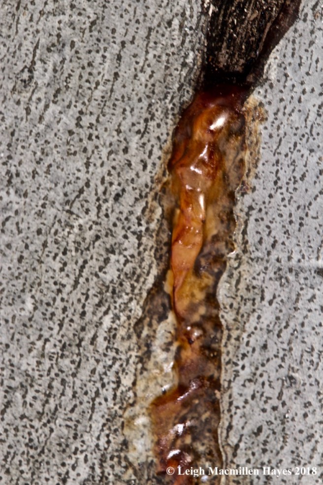
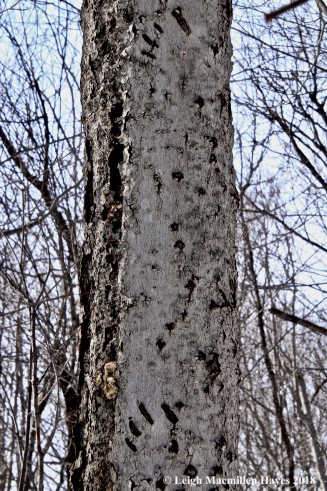
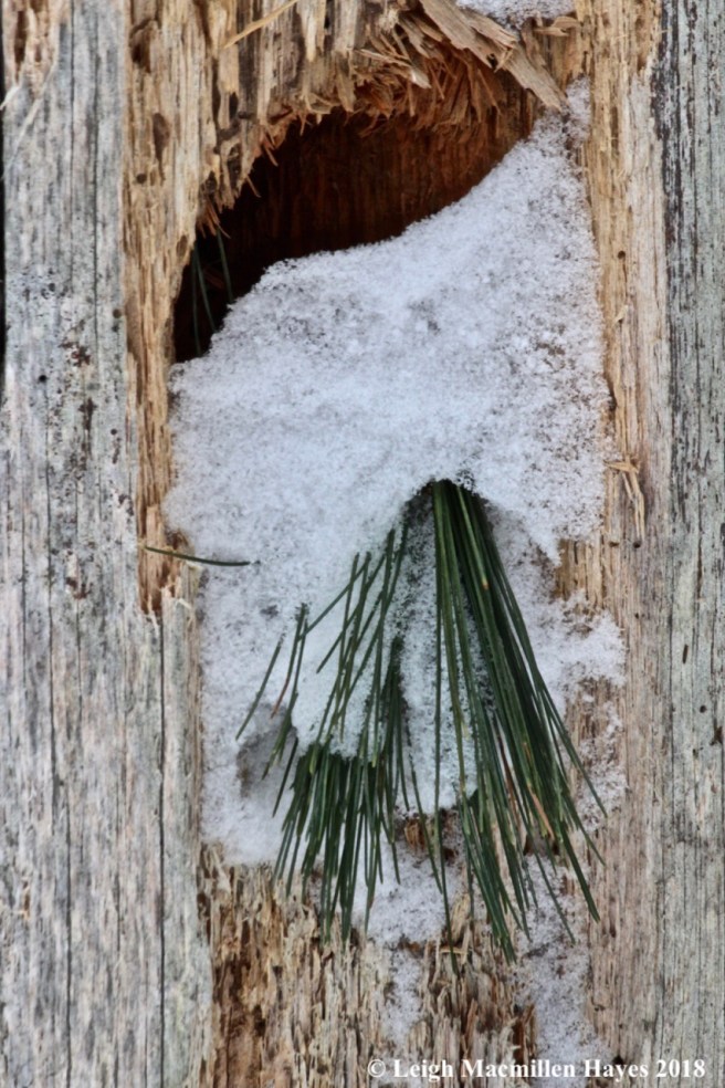
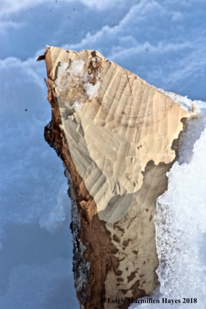
Ever since I’ve traveled this trail, I’ve seen the work of the porcupines at the summit. And sometimes I even get to see the creator. In winter, porcupines eat needles and the bark of trees, including hemlocks, birch, beech, aspen, oak, willow, spruce, fir and pine. And they leave behind a variety of patterns.

f7-porky work

If I didn’t know better, I could have been convinced that this ragged work was left behind by a chiseling woodpecker, but it, too, was porcupine work.

f9-porky work

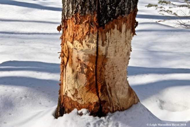
All about the summit, recent chews were easily identified for the inner bark was brighter than the rest of the landscape. And below these trees–no bark chips such as a beaver would leave, for the porcupine consumed all the wood.

f10-flat hill view

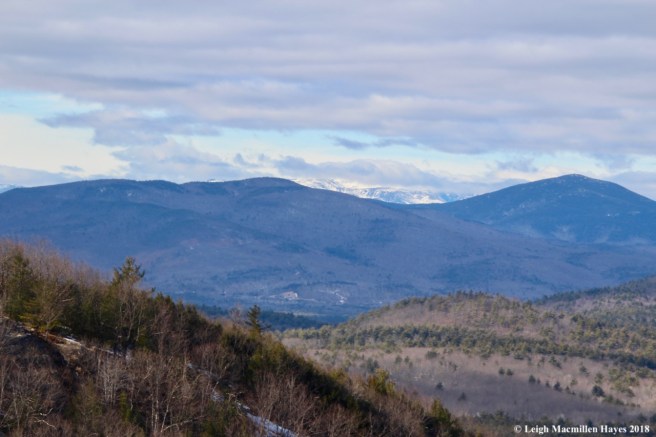
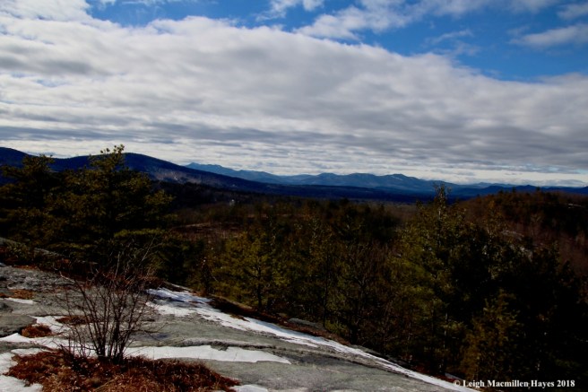
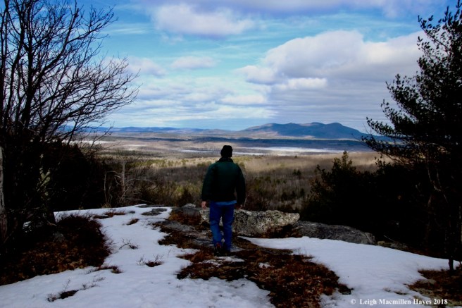
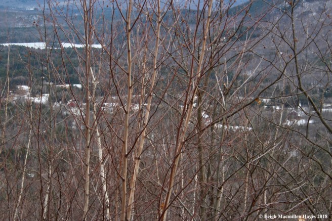
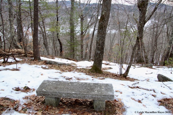
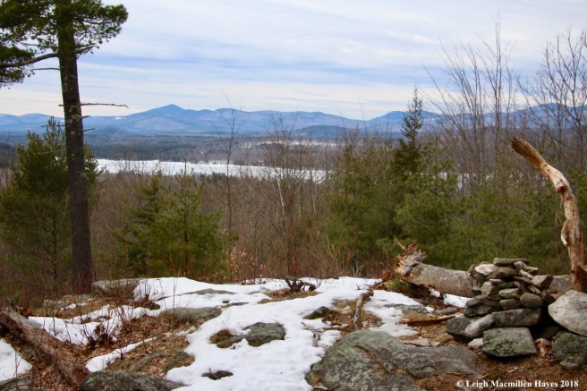
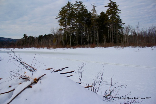
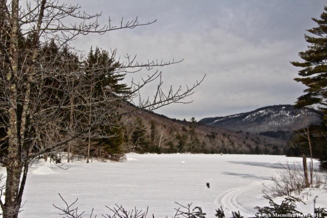
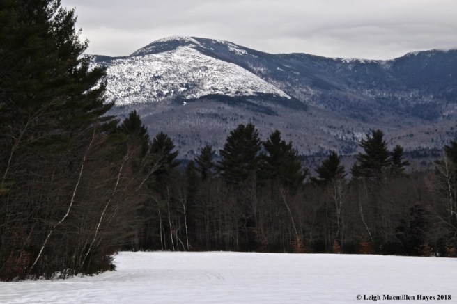
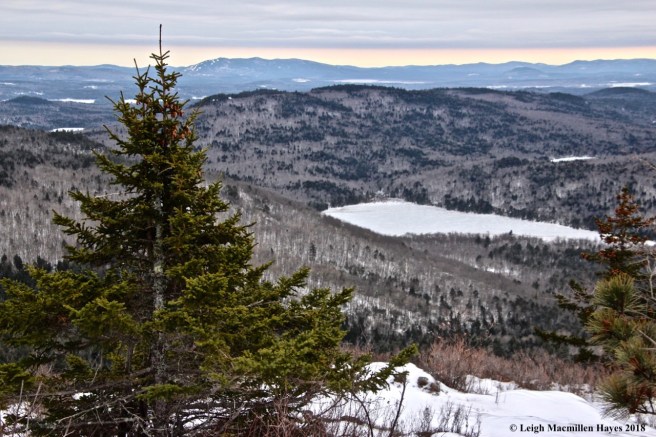
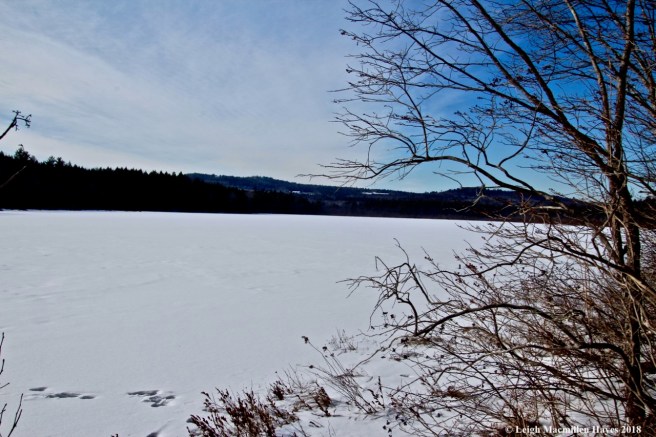
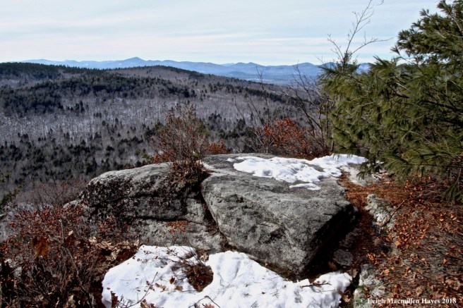
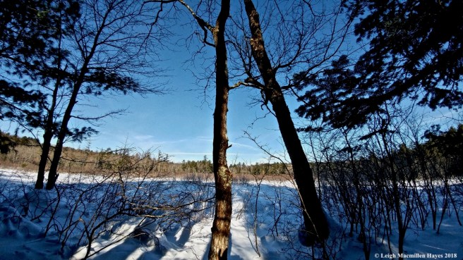
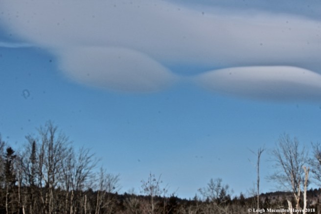
While snow flurries fluttered around me, the summit view was limited and it looked like the mountains were receiving more of the white stuff. (Never fear–we’ll get more as our third Nor’easter in two weeks or so is expected in two more days. Such is March in Maine.)

f13-script lichen between pine lines

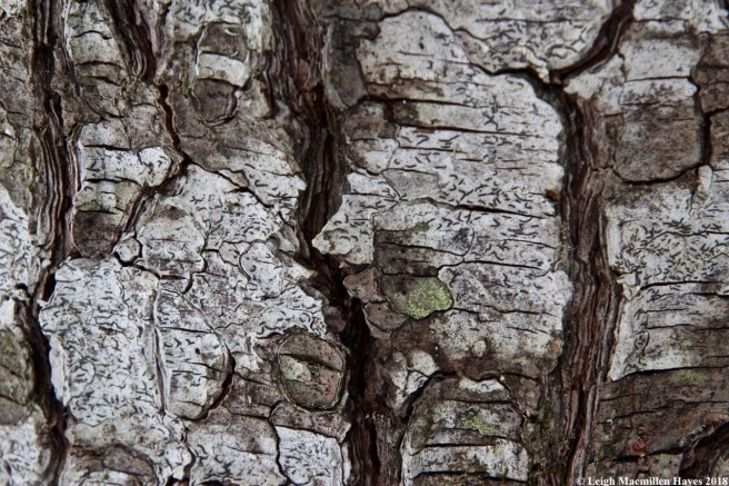
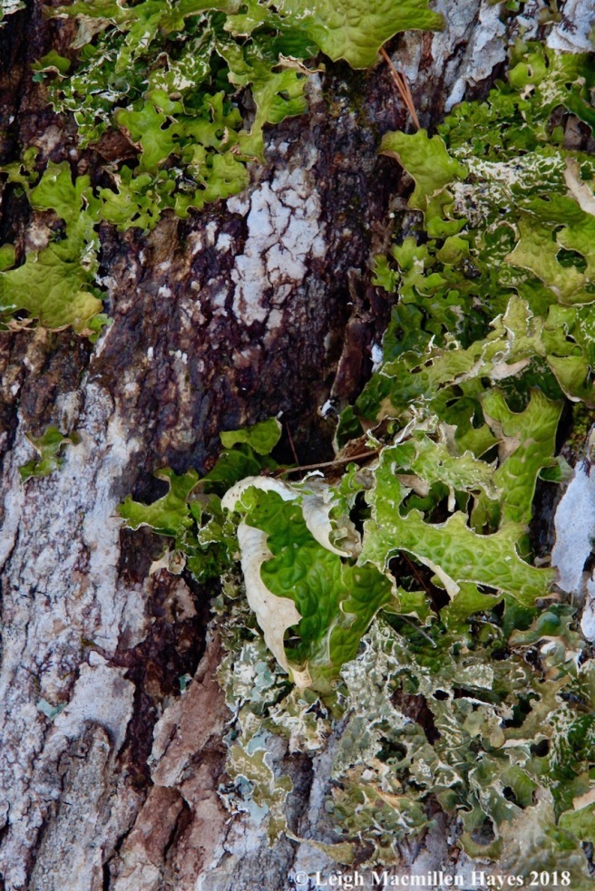
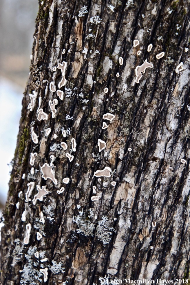
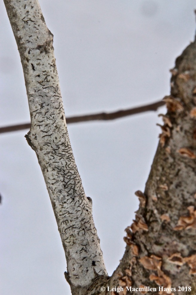
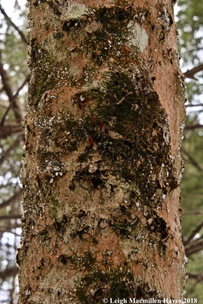
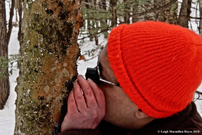
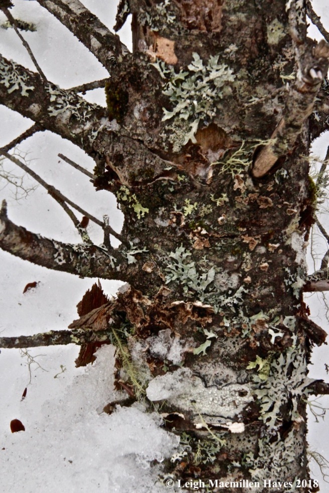
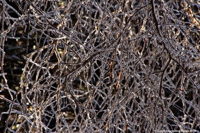
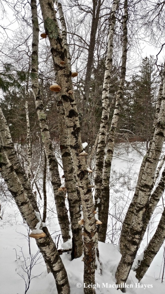
From the summit, rather than follow the trail down, I tracked the bobcats for a while, first to the north and then to the south. I had hoped to find a kill site, but no such luck. Instead, the writing on the page was found upon the pines where script lichen, a crustose, was located between the lines of bark scales.

f14-ulota moss and frullania

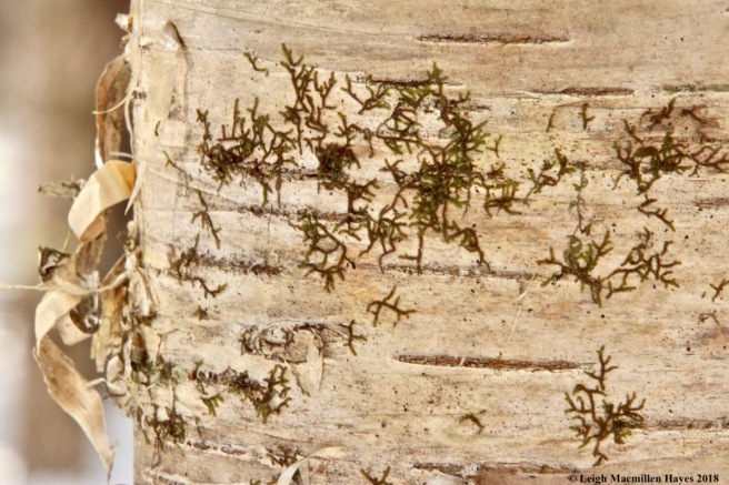
I also found plenty of Frullania, that reddish brown liverwort that graced so many trees. And among it, a moss I’ll simply call an Ulota. As I looked in Ralph Pope’s book, Mosses, Liverworts, and Hornworts , upon arriving home, I realized I should have paid attention to capsules for that would have helped me determine whether what I saw was Ulota crispa or Ulota coarctata. Another lesson for another day.

f15-beaver pond on Perky's Path

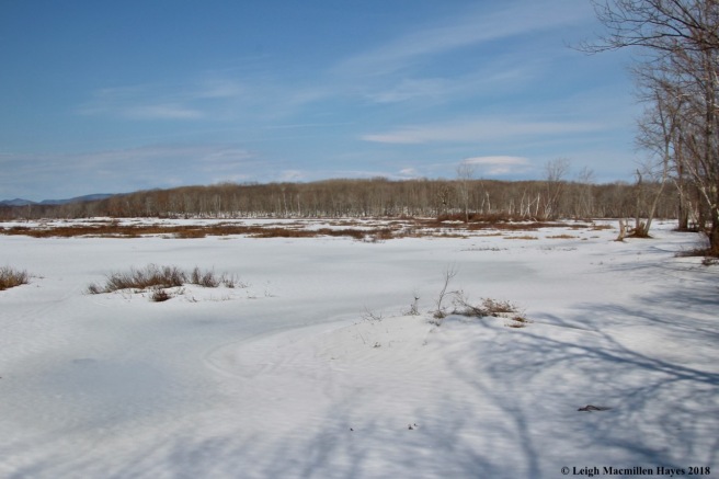
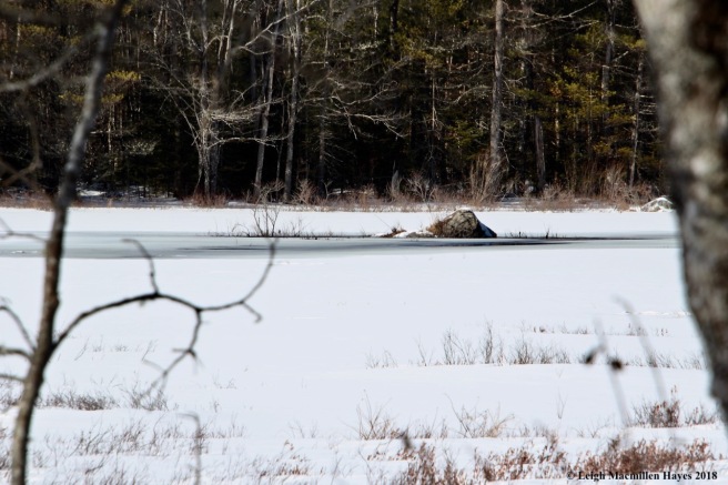
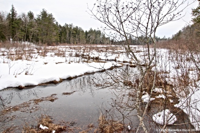
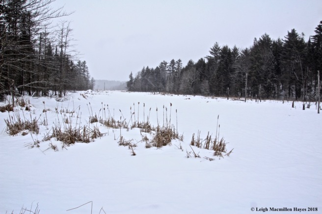
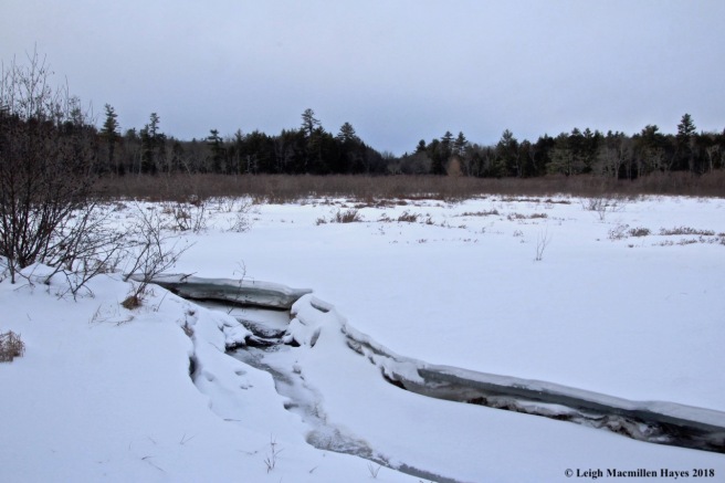
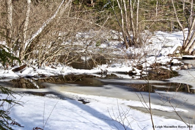
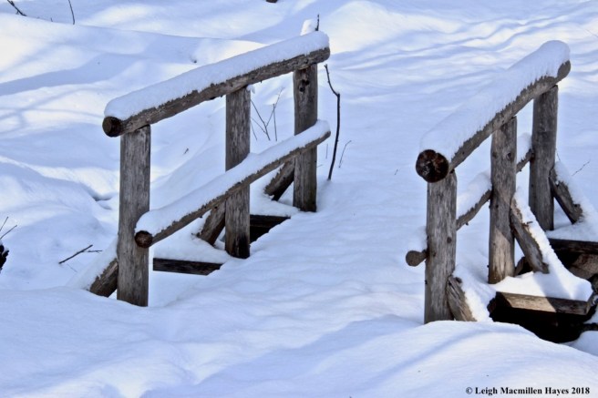
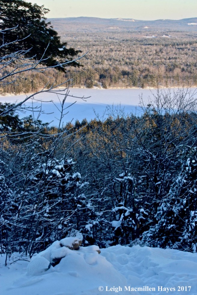
At last I reached Perky’s Path, which may not seem like a major feat if you’ve been there, but actually I’d explored off trail for quite a ways and it took me a while to get down to the wetland.

f16-maleberry

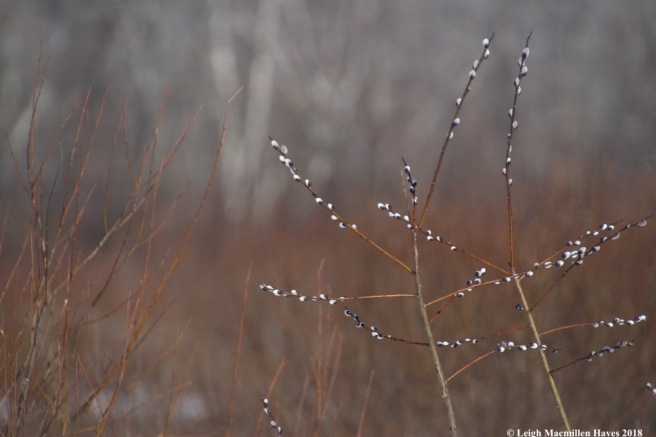
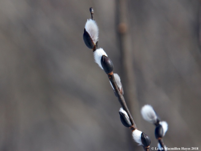
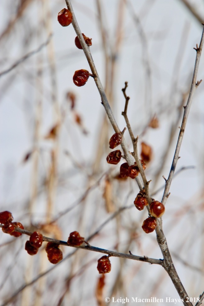
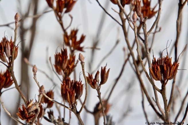
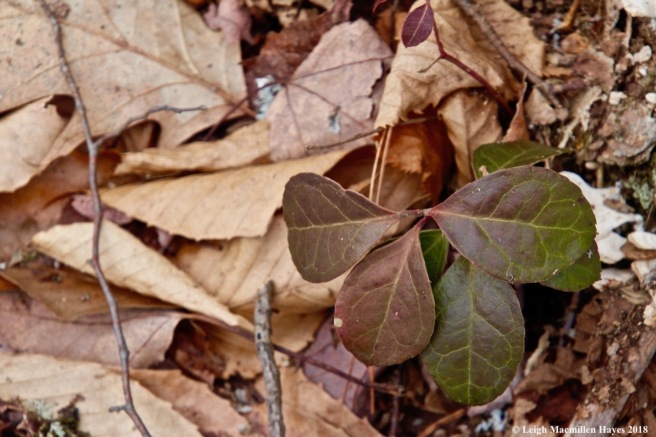
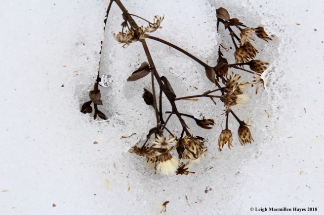
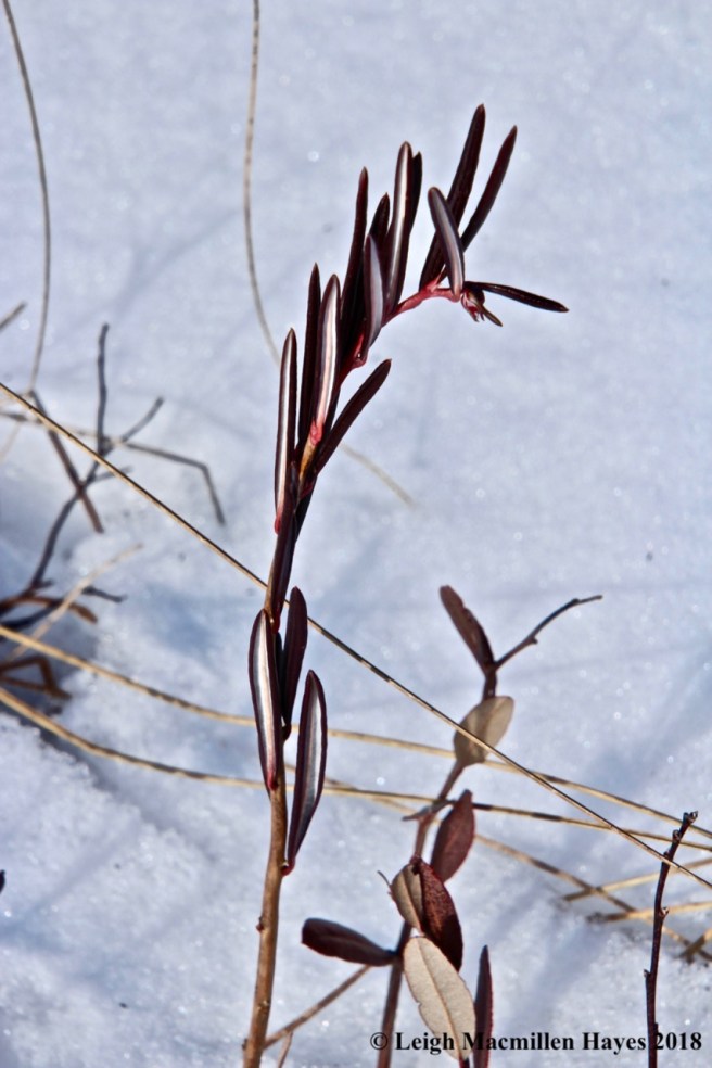
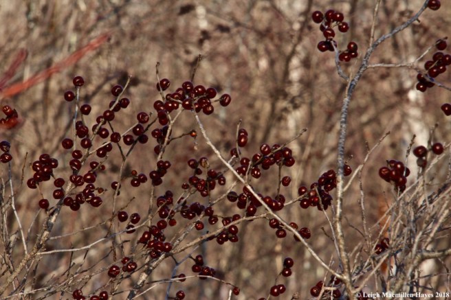
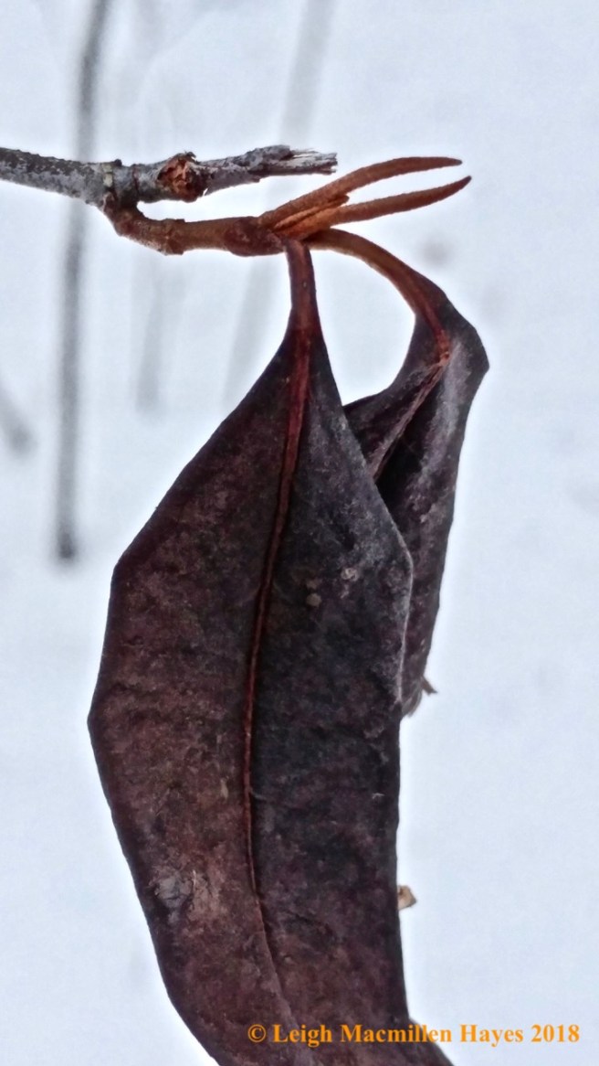
And because I was in the wetland, maleberry shrubs bordered the edge and showed off their bright red buds and woody, star-shaped seedpods.

f16a-bobcat across wetland

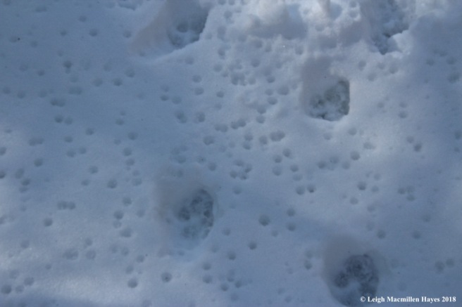
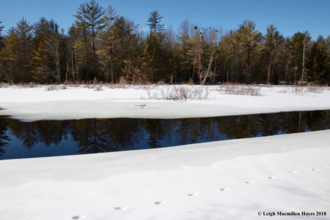
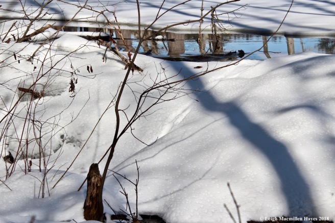
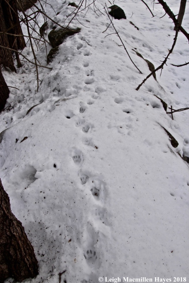
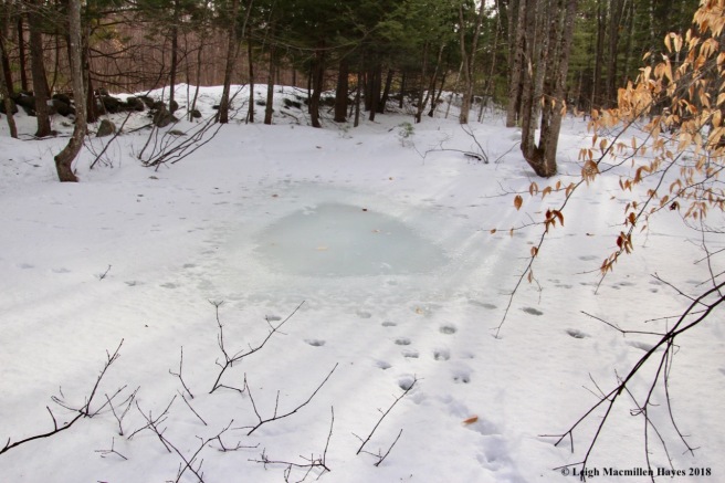
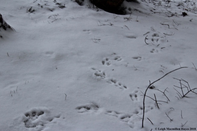
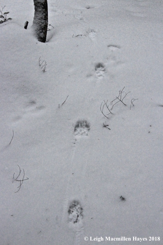
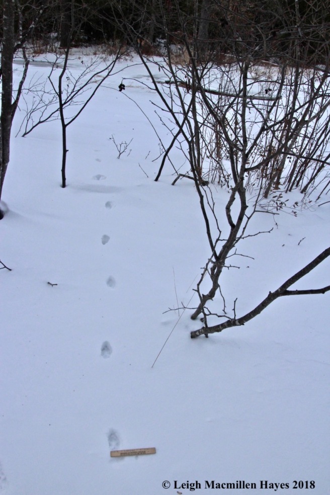
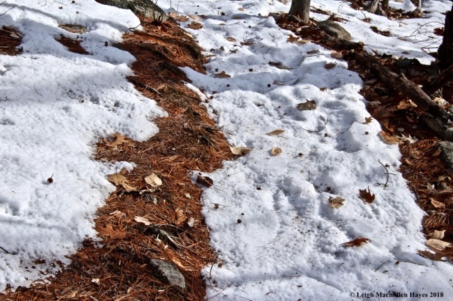
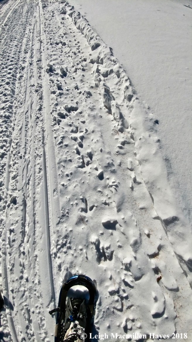
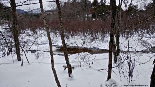
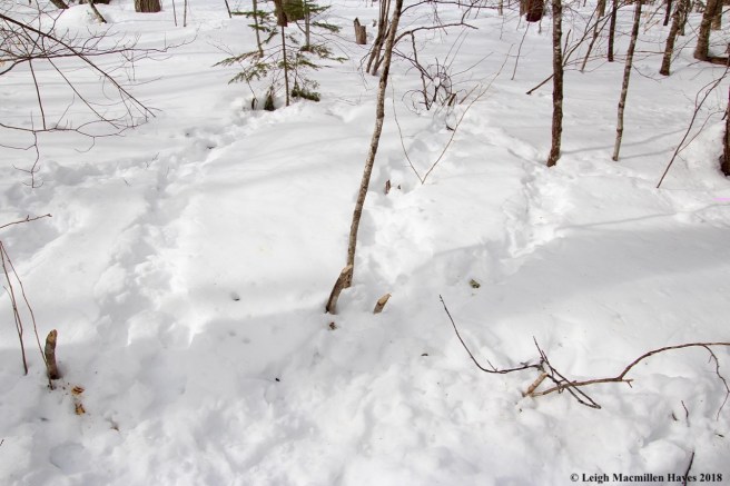
After focusing on them for a while, I looked down at the snow’s surface and the most subtle of prints appeared before my eyes. My two bobcats. The curious thing–at the summit the mammals had sunk into the snow and the prints were a bit difficult to decipher. I assumed those summit impressions had been made about two days ago. But on the wetland, the bobcats walked atop the snow–when conditions were firmer and I suspected they’d been created last night.

f17-brook toward Bradley Pond 1

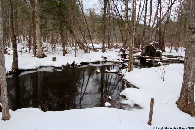
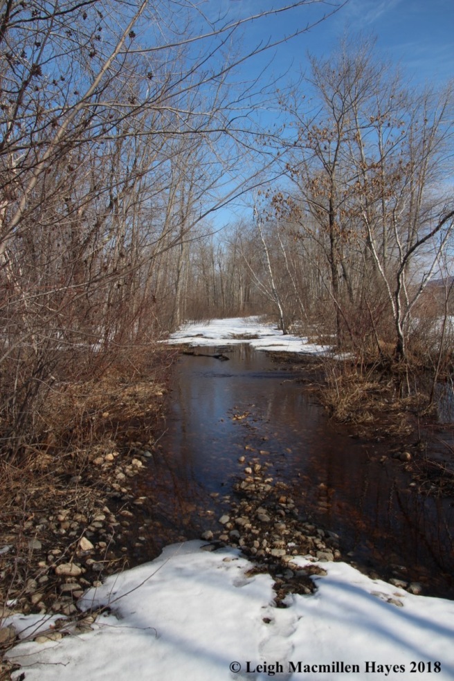
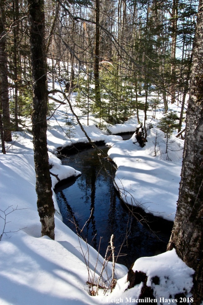
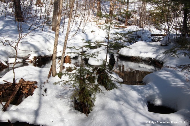
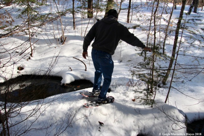
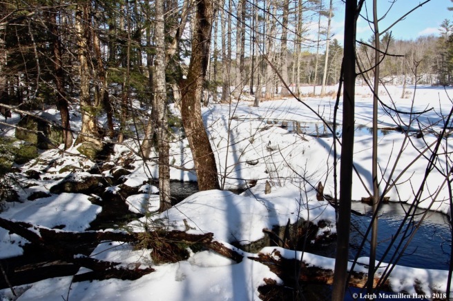
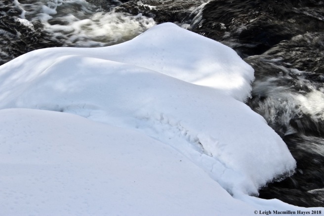
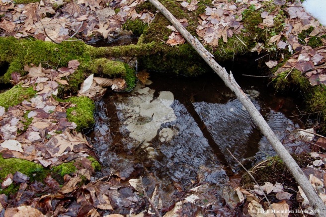
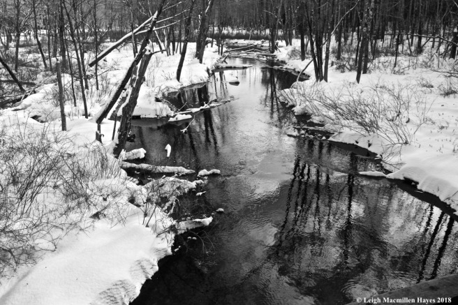
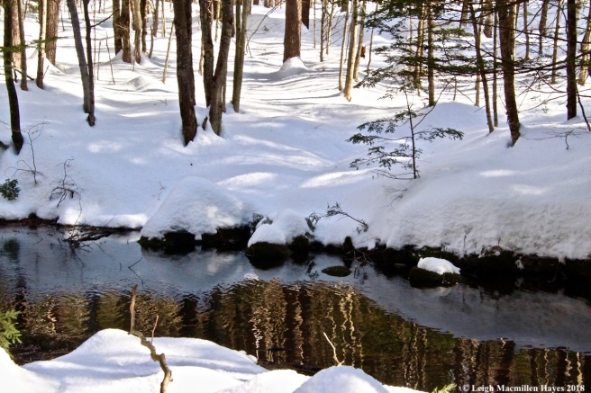
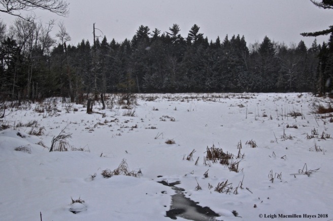
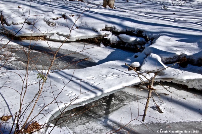
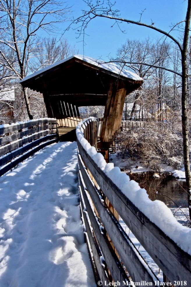
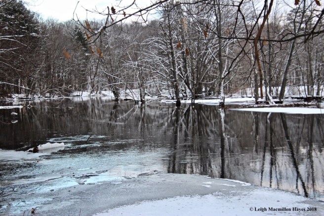
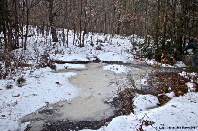
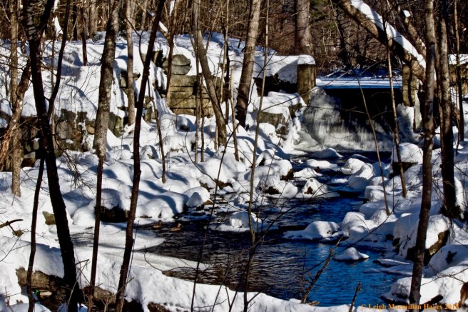
I followed the edge of the wetland to the bridges that cross a brook that forms at the outlet of Bradley Pond, constantly on the lookout for the bobcat tracks again.

f18-more bobcat

And I found them! Beside the brook.

f19-beaver pond from bridge

What had they found on the wetland, I wondered?

f21a-beaver trail

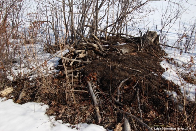
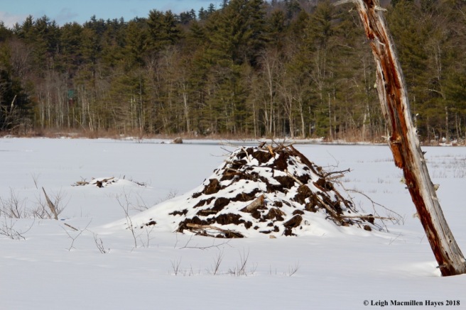
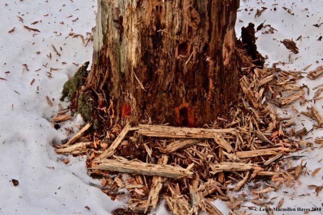
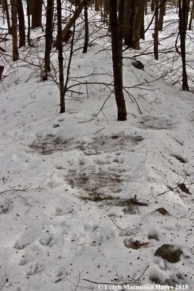
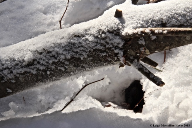
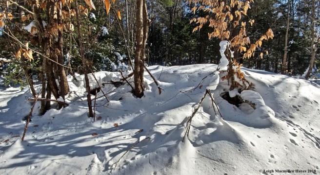
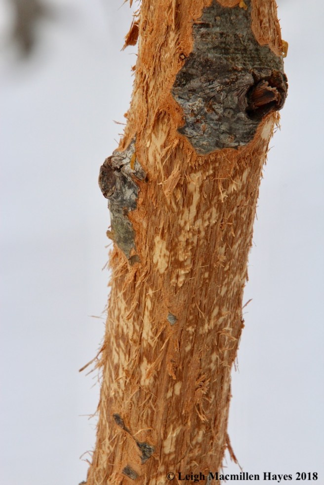
Continuing on, I found that they’d checked on the woodwork left behind by another critter of these woods who had also moved about last night.

f20-beaver works

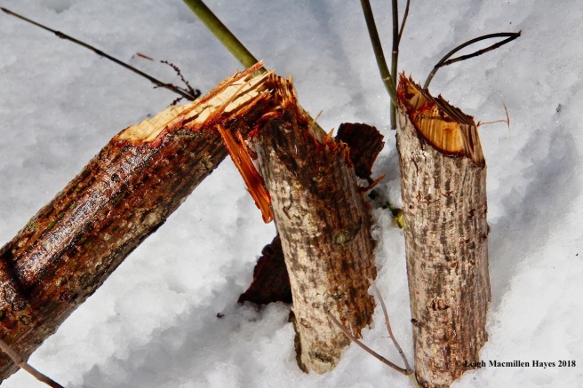
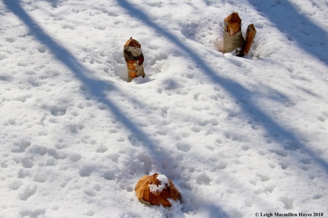
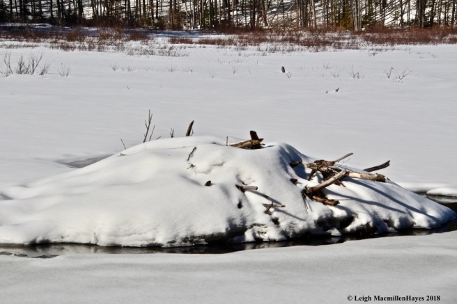
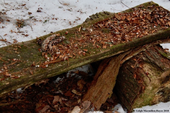
Beaver works. And their piles of woodchips. Unlike a porcupine, a beaver doesn’t eat the chips. Rather, it cuts down a tree for food or a building material. The chips are like a squirrel’s midden of cone scales–the garbage pile of sorts.

f22-beaver trail to water

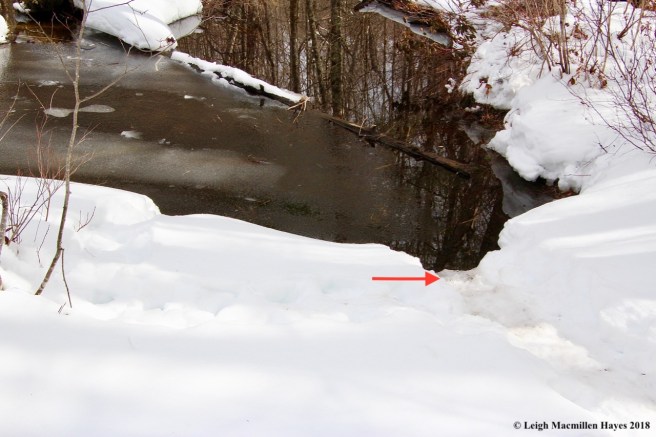
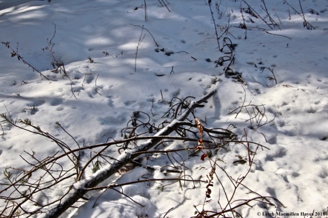
I noted where the beaver had moved into the brook . . .

f23-beaver treats

And left some sticks behind. For future food? Future building? Stay tuned.

f27-brook to Bradley pond

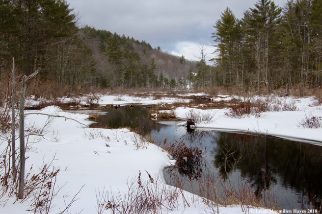
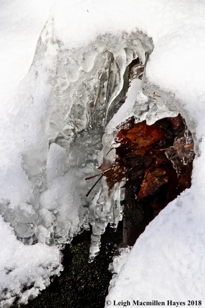
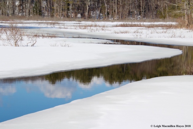
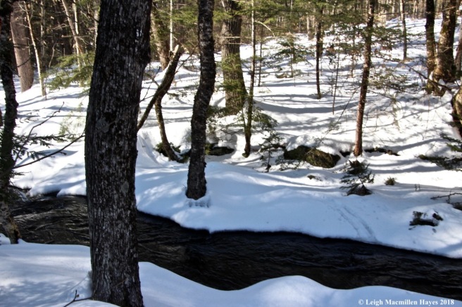
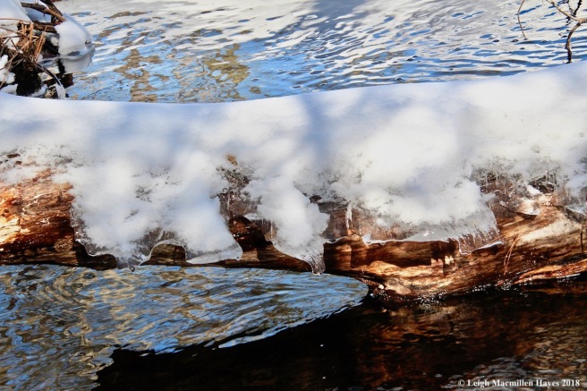
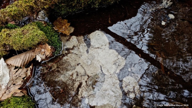
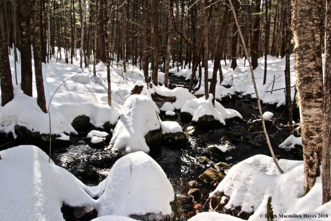
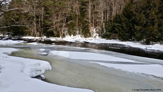
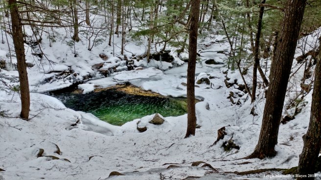
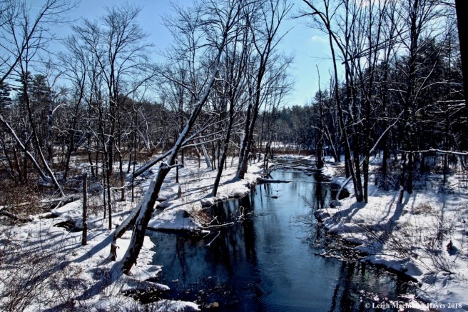
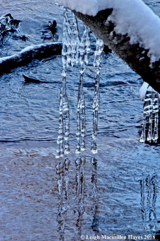
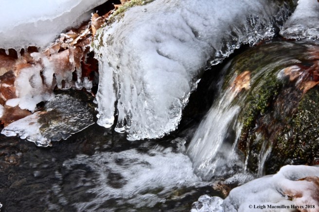
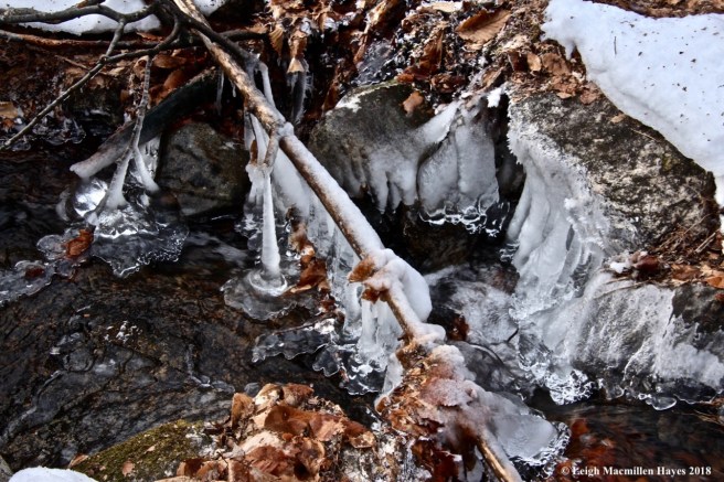
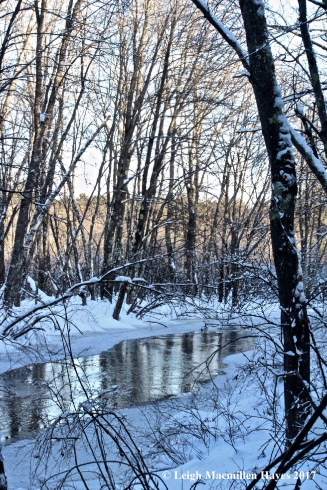
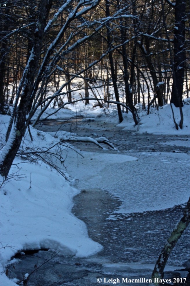
Typically in other seasons I can’t move beside the edge of the brook, but today I could. The lighting kept changing and water reflected the sky’s mood.

f24-Diamesa sp. and snow flea

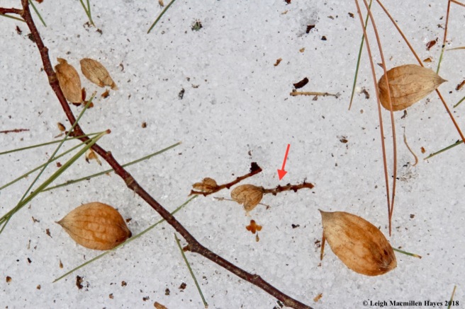
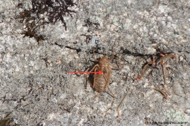
And because I was by the water, I kept noting small insects flying about–almost in a sideways manner. Then I found some on the snow–a member of the Diamesa species, a midge I believe. And do you see the small black speck below it–a snowflea, aka spring tail.

f25-Diamesa sp.:haltere

And do you see the two little nobs on the fly’s back, the red arrow pointing to one? Those are the haltere: the balancing organ of a two-winged fly; a pair of knobbed filaments that take the place of the hind wings.

f29-beaver pond wetland low

Eventually, I followed the eastern edge of the wetland back to my truck, wondering if there was any more action but found none. In fact, the water was low so I knew the beaver works weren’t to rebuild the dam. Yet. Nor did I find any more bobcat tracks. But I’d found enough. And I think I know some of what the bobcat knows.


Connecting the Dots

We thought we were so smart. A friend had drawn a map in the snow last week to show me the location of an alternate trailhead for Peary Mountain in Brownfield, Maine, and spoke of a round-trip hike that would include Frost Mountain. A quick look at a map in our worn and torn Delorme Gazeteer and we knew exactly where we were going–until we didn’t. We soon discovered that the gate and sign I’d been told about didn’t exist and the road turned 90˚ to the left and eventually became impassable and so we turned around and paused again at the sharp turn and wondered some more and drove back out to the main road and continued on to another road and looked for other possible trailheads that appeared on the road map and turned around again and returned to that sharp turn and parked the truck and slipped on our micro-spikes.

p1-Peary Mtn Road sign

It was worth a try we decided. The name was right though it looked less like a road and more like a snowmobile trail. No matter, we figured we’d give it a whirl and if nothing else, at least we’d enjoy exploring.

p2-wetland below mountains

Almost immediately, we spied two mountains above a wetland and wondered if those were the two summits we sought. We’d never looked at Peary from what we considered the back side before, since all of our previous experiences had been from Farnsworth Road off of Routes 5/113.

p3-trail

The road was quite icy and it had been more than a few days since any snowmobiles had passed by.

p5-trail sign

Eventually we came to a snowmobile sign, looked around for a map that I thought my friend had mentioned, and decided to begin with a journey up the Peary Mountain Trail.

p7-trailing arbutus and wintergreen

Conditions were such where previous logging had left the southwestern side open to the sun’s powerful rays and so in places the snow had melted and wildflowers such as trailing arbutus and winterberry basked in the warmth.

p8-Peary Mtn basement

We continued on up, hopeful that we were on the right path, when a familiar foundation confirmed our location. It’s directly across from this foundation that the Peary Mountain trail makes a 90˚ turn–in the past the turn had always been to the left, but yesterday’s turn was to the right. That is, after we noted that my guy should probably encourage the homeowners to purchase a sump pump, so full was their cellar.

p9-trail sign

If you do approach from Peary Mountain Road, you’ll only see a tad of the back of this sign. And if you come from Farnsworth Road, again, it’s not very obvious. But, for both, the turn is located at the height of land . . . and directly across from the foundation.

p10-Peary view 1

The hike to the bald summit isn’t difficult and offers the best of views on any day, but especially in the fall when the tapestry of color stretches forever–or at least to the White Mountains in the distance.

p11-Mount Washington

Yesterday, the view of Mount Washington was obscured by clouds, but we could see that even there the snow was receding.

p13-Mountain view

We stood for a bit, taking in the scene to the west.

p14-Mountain views

And to the north.

p15-across the ridge

And then we followed the ridge, certain that at the end we’d slip onto another trail we’ve never traveled before and begin to make the loop to Frost Mountain.

p16-Pleasant Mtn, Brownfield Bog

Just before slipping onto that other trail, we had one more view to partake–Brownfield Bog and the Saco River were backdropped by Pleasant Mountain.

Well, we followed that other trail for a while, but realized that rather than going toward Frost Mountain, we were moving further and further away from it. And so . . . we backtracked and rose once again to the summit of Peary and retraced our steps down.

p17-another foundation

We were disappointed, except that we knew we would return. And as often happens when following the same trail, we made new discoveries, including an L-shaped foundation.

p19-well

And then I spied a circular sunken formation subtly outlined with rocks and trusted it was a well.

p19-third foundation

Bingo. For behind it was another foundation, the largest we saw.

p20-day 2-red pines

And so late this morning we returned. But first, we looked for maps in our hiking books and online and found only those created by the local snowmobile club. We had a copy that dated to 2011 and decide to bring it along. We also copied a portion of the map from the Delorme Gazeteer–just in case.

Upon our return, we remembered to pause at the beginning of the trail and take note of the red pine cathedral. Brownfield is a town that knew the fury of the wildfires of October 1947. Most homes and public buildings were mere piles of ash the day after the fire. Many stately places including the summer home and laboratory of Dr. Philo Farnsworth, the inventor of television, had burned. Churches, schools, the post office, Grange, library and town hall all went up in smoke–only twenty houses survived. In the end, 85% of the town was destroyed.

Red pines were planted in reaction and today they stand tall in honor of that event of just over seventy years ago.

p21-water flowed

Our plan today was to follow the same route to the turn off for Frost Mountain. And so we did. This time the snow and ice were softer and mud a constant as snow melted and streams formed.

p21-ruffed grouse scat

One of the things we noted yesterday was a lack of mammal prints. But today made up for that and we found plenty of deer tracks in mud and snow. And then, a pile of bird scat–left behind by a ruffed grouse who had probably plowed into the snow when it was a couple of feet thick and spent the night, leaving behind its signature.

p22-kill site

We also found a kill site with no tracks leading to or fro and so we thought a bird had eaten another bird. The circle of life continued in the Maine woods.

p23-fisher prints

A bit further up the trail we spied weasel prints–left behind by a fisher, the meanest of mean. Notice the teardrop shaped toes and diagonal positioning.

p22-sweet fern

We were distracted (or at least I was) by sculptures a many, including those created by sweet-fern.

p24-another foundation

My guy was also distracted and spied an opening in the woods.

p25-fourth foundation

It was another L-shaped cellar. And nearby were what would have been some outbuildings and possibly even a mill. Along most of today’s trail we encountered one stone wall after another, some single and others double.

I don’t know how to decipher stone that’s known fire, but hope one of these days to be able to make that interpretation. In the meantime we wondered–why had these homes been abandoned. Did they burn? I did later note that homesteads in the area belonged to the Johnsons, Grays and other families in the 1880s.

p28-confusing signs

Though we continued on, we really had no idea where we were going and hoped that we had made the right decision with the intention of reaching the summit of Frost Mountain. But, even if we didn’t, we were delighted with our finds. And confused by the signs.

p29-Pleasant Mtn behind us

And then, we started to climb. I turned around as we moved upward and noted our beloved Pleasant Mountain behind us.

p29-summit at lasst

And finally–success. We’d reached the summit of Frost Mountain.

p30-looking toward Peary

About 300 feet below, we had a view from the ledge, but it wasn’t nearly as spectacular as that on Peary Mountain, which my guy looked toward. It was hardly visible from where we stood.

p32-Burnt Meadow Mountain

From the summit, we followed a loop around, pausing to take in the view of Burnt Meadow Mountain.

p33-Brownfield below

And the town of Brownfield below. As the historical society likes to proclaim, “Brownfield’s still here.” Indeed.

p34--my heart bleeds blue pine sap for you

We’d planned to climb Frost and then make our way to Peary, but changed our minds. We’d already climbed Peary yesterday and after finding our way today had a better understanding of the trail system. We also knew that had we made the loop, we’d have walked on Farnsworth Road for over a half mile and then climbed up and down Peary on trails we already knew. Instead, we let our hearts bleed pine blue sap with happiness.

p27-bear prints

Our happiness overflowed when we spied the final set of prints.

p26-bear prints

A black bear. How cool is that? Our second sighting of black bear prints this winter.

We’d connected the dots–even if not literally–and gained a better understanding of the neighborhood and all who live(d) there.

Bogging with Barb

Passing off a copy of the book, From Grassroots to Groundwater, about how two small Maine towns fought Nestlé and won, was the perfect excuse to head to Brownfield Bog. I told Barb I didn’t mind driving to her home or somewhere nearby to give her the book because I’d then go exploring and she welcomed the opportunity to do the same.

b2-Kathy's sign

As we began our journey, I asked if she knew Kathy McGreavy. Of course she did. I mentioned that Kathy walks in the bog daily and we might encounter her. Of course we did. Kathy and “her friend” were just coming out after walking their dogs and so we chatted for  bit. Our discussion included mention of the sign Kathy made last year as her capstone project for the Maine Master Naturalist Program. It’s an incredible piece of artwork and as she’s learned, I’m not the only one who thinks so. Recently, she discovered that a woodpecker had taken to pecking it and so the bottom is now protected with a piece of plexiglass. Crazy birds.

b1-Bog view from the road

Eventually, Barb and I said our goodbyes to the McGreavys and walked down the unplowed road where I did warn her about my obsession for stopping frequently to take photos. It began from the start–when we spied the bog through the trees and noticed the contrast of colors and layers.

b3a-pussy willows

And then–specks of white were ours to behold.

b3-pussy willows

Pussy willows. Was it too early she wondered. No–in fact, I spotted some a year ago on February 23 at Lakes Environmental Association’s Holt Pond Preserve.

b4-red-winged blackbirds

Our next reason to stop–the red and yellow shoulder patch or epaulet providing their name: Red-Winged Blackbirds. Again, Barb asked if it was too early. This time, I referenced Mary Holland for the February 27th entry in her book Naturally Curious Day by Day has this headline: Returning Red-Winged Blackbirds Survive Cold Temperatures and Few Insects. Bingo.

b5-water obstacles

Sometimes our stops were to contemplate our next steps–especially when it came to the water that covered the cobble stones on the road.

b6-Barb charges through the water

But sometimes you just have to go for it. And we did. As the morning continued, we ventured through deeper water and plowed ahead knowing that we would need to dry our hiking boots out when we arrived home.

b7-bird's nest

We found a bird nest and wondered about its creator. We did note some acorn pieces inside, so we think it had more than an avian inhabitant.

b8-beaver lodge

And we paused to look at an old beaver lodge. The mud looked recent but none of the sticks were this year’s additions so we didn’t know if anyone was home.

b9-map in the snow

All along, we’d been talking about places we’ve hiked and other topics of interest to both of us. We even learned that we’d both worked in Franklin, New Hampshire, just not at the same time. But speaking of hikes, with her finger, Barb drew a map in the snow and now I have another trail to check out soon with my guy. Should I forget the way, I’ll just reference this map. ;-)

b10-raccoon prints

Because we were near water, though most of it still frozen, and the temp was high (actually, too high–in fact, it felt HOT as it soared into the upper 60˚s today), we weren’t surprised to find this set of prints created recently by a raccoon. I love the hand-like appearance and opposite diagonal of each two feet. Can’t you just see him waddling through–in your mind’s eye, that is?

b11-the bog

Our turn-around point offered an expansive view of the bog. As much as we may have wanted to head out onto it, we sided with caution and kept to the edge of the shore.

b12-winterberry

On the way back, there were other things to admire as there always is even when you follow the same route: winterberries drying up;

b13-rhodora

rhodora’s woody seed pods and flower buds swelling;

b14-willow gall

and the pinecone-like structure created with leaves by a reaction to a chemical released by the larva that allows a gall gnat midge to overwinter on the willows.

b16-carrion-flower tendrils

And then we stumbled upon a plant neither of us knew. With it’s long stem and curly tendrils, we were sure it was a vine.

b15-carrion-flower

Upon arriving home, however, I wondered about the umbel structure that had been its flower and now still held some fruits. A little bit of research and I found it: Carrion Flower (Smilax herbacea), which apparently smells rather foul when it’s in bloom and thus attracts carrion flies as its pollinator. Now I can’t wait to return and check it out in the next two seasons. Any excuse to get back there.

b17-bog to Pleasant Mountain

At last the time had come to say goodbye to the bog and then goodbye to each other. Thanks Barb, for giving me an excuse to go bogging with you. It was indeed a treat.

Otter Spotter Mondate

Fresh snow. Blue-bird sky. Mid-range temperature. Day off. All the makings for a fine Monday date with my guy.

m1-apples

We weren’t sure if snowshoes would be the right choice as we feared the snow might stick to the cleats and make us feel like we were walking on high heels–hardly our style. But, actually, conditions were perfect. Of course, my guy tried going without at first, but after creating one post hole after another, he strapped his on while I headed over to an apple tree to enjoy the view.

We were on a private property in Lovell that is under conservation easement with the Greater Lovell Land Trust.

m2-coyote track

I’d been on this property only a few days ago and the tracks were many, but with the advent of yesterday’s snow, we found only a few. One set was that of a coyote. And fairly fresh was it.

m4-brook below

We moved quickly (of course we did for I was with my guy–but I was equally anxious to get to two destinations) and in no time found ourselves walking along beside a brook.

m5-brook crossing

As we approached we wondered how open the brook might be and decided we’d cross that “bridge” when we got to it. But really, there was no bridge.

m3-icicles at brook crossing

The ice, however, delighted our sense of sight, understanding, and artistic form. Like the water from which it was created, it flowed in much variety.

m6-one coyote became 2

Without any problems, we found our way to the other side and realized we were in the company of others who had done the same. One moment it seemed we’d followed one, but then realized we were on the trail of two coyotes when their path split.

m8-porky body

And it split for a reason. To check out a previous kill site. But they only seemed to sniff and not partake.

m9-porky tail

Just as well for it was a porcupine. But really, I was surprised they didn’t try to flip it over to get at the stomach. Maybe somebody else had already taken the pleasure.

m10-rookery and coyote track

On we trekked, until we reached water again. And this time we stopped to look around, while the coyotes moved on.

m11-heron nests

High in the trees across the way we spied the heron rookery–one of our reasons for visiting. We knew the nests would be empty, but still, it’s fun to take note.

m13-heron rookery

And they’re easier to see in the winter than spring/summer when this rookery is monitored for the state HERON project: the Heron Observation Network of Maine. I’ve had the honor of visiting this particular rookery in the past and helping to document the number of residents. Though it was active last April, something happened later to upset the neighborhood and so I’ll be curious to see what the status will be in the future.

m14-heron rookery

For today, the nests looked like they were in great shape and even two in the condominium were awaiting the return of the snowbirds who’d spent the winter south of this location.

m16-lungwort

Because we were there, I also turned to check on another tree–which sports a healthy colony of lungwort–photosynthesizing because it had been snowed upon.

m15-mesmerizing scene

We stayed for a while, my guy and I, enjoying the peace and quiet and colors and textures of the afternoon that curled around us.

m18-crossing over

At last, we pulled ourselves away and crossed back over the brook. It was a piece of cake. Well, at least we didn’t fall in.

m19-chipmunk

Our next destination took us past a condo of another sort–one created by a chipmunk who kept an eye on us, then swiftly disappeared. We could only wonder about the inner chambers of its home.

m17-striped maple beaver works

It was after that that we began to encounter the works of another rodent, this time upon striped maple.

m20-beaver works

The art pieces were sometimes large,

m21-beaver works small

other times small,

m23-beaver works mistake

and sometimes mistaken–as in logistics of the felling.

m22--false lodge

But that didn’t matter for their buildings were many. Oops, the first one we spied was actually a boulder.

m24-beaver lodge 1

Further along, however, we found the main building. It was topped with fresh wood and well mudded, so we assumed warm bodies dined and wined within.

m25-beaver lodge 2

There was another nearby, and we could see indentations denoting visitors had stopped by prior to yesterday’s storm. We also noted that the ice had melted all around it. Was someone home? We knew not.

m26-looking back from the dam

On we moved and then turned back to enjoy the view as shadows grew long.

m27-beaver dam

Turning 180˚ again,  we looked toward the beaver dam that stretched before us. I’d last visited in late November and wondered what it would look like today.

m28-below the beaver dam

It looked . . . snow covered.

m30-otter track

But . . . in that snow we spied our critter. Do you see him?

m32-otter moving from brook to land

We followed him downstream–he was on the other side of the brook, but moved in his telltale manner . . .

m33-following the brook

across the landscape . . .

m35-otter again

in and out of the water . . .

m43-otter slide and bound

bounding and sliding . . .

m42-otter slide

and sliding some more . . .

m40-prints, trough, scat

leaving behind fresh scat and prints . . .

m44-ice and tree and water and reflection

for our pleasure. We had the time of our lives watching the otter–did you see him?

Truth be told, we never did actually see him, but in our minds eyes we knew his every motion. When we first spied the prints and trough on the other side, we thought he had moved in the same direction as we did. But when he crossed to our side, and we could get an upclose look, we realized we were traveling in opposite directions. He had moved through not long before we arrived. Was he also checking out the beaver lodges? Probably. And hunting for his next meal.

Though we didn’t get to actually see this member of the weasel family, the signs left behind were enough to tickle our fancy and on this Mondate we were indeed otter spotters.

Spring Erupts–Sort of

Two days ago the thermometer climbed to 68˚ and old records were broken. But then, as it does in New England, we had a low of 15˚ this morning. And now it is sleeting.

w-beech snag in complete decay

Before the sleet began, however, I decided to do a loop hike at the Greater Lovell Land Trust’s Heald and Bradley Ponds Reserve, beginning from the Gallie Trail and climbing up the Hemlock Trail to the summit of Whiting Hill, with a return via the Red Trail back to the Gallie. It’s a perennial favorite that always has some different things to offer, including the skeletal remains of a beech snag. I think what intrigued me most, besides the pileated woodpecker holes, were the lines of the wood, curved in nature.

w-Lactarius deterrimus (orange latex milk cap)?

Similarly curved were the gills of a decaying Orange Latex Milk Cap (Lactarius deterrimus)–at least that’s what I think it was–found beneath a hemlock.

w-bear 1

Part of my love for the Hemlock Trail can be found among the beech trees that also grow there and it is my habit to admire the lines that decorate them as well.

w-bear 2

No matter how many times I visit, I’m filled with awe.

w-bear 3

And wonder.

w-bear 4

For the black bears that left their signatures behind.

w-paper birch bark 2

Other trees also gave me pause, for though some know them as white, I prefer to call them paper birch. The curled-back bark offered hues of a different color reminiscent of a sunrise in the midst of a graying day. As my mother was fond of saying, “Red sky in the morning, sailors take warning.” Today was a day to heed said warning.

w-paper birch bark 1

Others bespoke a setting sun.

w-paper birch bark--stitchwork

And not to go unnoticed, more bark from another paper birch that had fallen to the ground. It too, offered subtle pink hues, but it was the stitchery created by former lenticels (the tree’s pores) that drew my eye. They reminded me of a million zippers waiting to reveal hidden secrets.

w-yellow birch bark

And then there was the yellow birch–with its ribbony bark shedding its own light on the world.

w-wintergreen

Around the base of some trees, the snow had melted and wintergreen plants showed off their transitional colors–winter magenta giving way to summer green.

w-bench over Heald Pond

At last I reached the summit and headed to the east side first, where Heald Pond was visible through the bare trees.

w-Mollisia cinerea--gray cap?

Nearby, still another tree invited a closer look. I love the bark of hophornbeams, but this one sported a growth I wasn’t familiar with until I checked Lawrence Millman’s Fascinating Fungi of New England upon my return home. In the world of mushrooms my knowledge is enough to be dangerous, but I trust my fungi friends will weigh in if I’m wrong on the ID. I’m going out on a limb and calling this one Gray Cup (Mollisia cinerea), for it seemed to match Millman’s description: “With luck, you might find several hundred of these stalkless ascos . . . each fruiting body will be more or less cup or saucer-shaped, but wavy or irregular in age.” And he describes their habitat as scattered or densely crowded under hardwood logs. Well, these weren’t under a log, so that made me question my ID, but they certainly seemed to match the rest of the description and hophornbeam is among the hardest of the hardwoods.

w-hophornbeam

Below another hornbeam I found the ground scattered with little fruits.

w-hophornbeam hops

The common name for the tree derived from those fruits, which when attached to their twig (the arrow points to such) are so arranged that they look like hops. As they fall, each little bladder that contains a single seed separates from the group in hopes of finding the right spot to grow into the future.

w-vole tunnels

As I moved toward the western outlook, half tunnels in the snow let me know that the vole community had been active. It probably still is . . . maybe.

w-Whiting Hill view toward Kearsarge

And then, the view to the west, which encompasses Kezar Lake, Mount Kearsarge and the Whites. The scene changed a bit last October when a windstorm just before Halloween toppled a dead white pine . . . and the cairn that marked the summit.

w-asters in snow

While there, I looked around for evidence of the wild columbine that will bloom in a few months, but found only asters hugging the snow.

I stayed for a few minutes, but the wind had picked up and so I finally turned to head back down.

w-white pine blue sap

For a short link, I followed the same path until I turned right onto the Red Trail. Just prior to that I realized I’d missed a sight on my way up–the blue sap that bled from a white pine. I’ve seen it often over my years of noticing, but have no idea why the color blue, which was really almost periwinkle. In this case, the sap flowed because a pileated woodpecker had been hard at work.

w-pileated scat

And that meant I had to look–and wasn’t disappointed. Woodpecker scat. It was so well packed, that I pulled out my hand lens and got down on my knees for a closer examination. I practically kissed it but can say for certain that insect parts were layered within.

w-heart

A few minutes later, the trail split and as I said earlier, I followed the Red Trail to descend. I had only gone a wee bit when I heard a barred owl call, “Who cooks for you? Who cooks for you all?” It was noon, after all, so it seemed totally appropriate. The call came from somewhere near the summit and I had to wonder if I’d made the mistake of not looking up quite enough, so taken was I with the hops and the view to the west. Perhaps that vole had provided a meal. And then I heard a response somewhere quite possibly along the Hemlock Trail by which I’d ascended. For about five minutes they called back and forth and I thought of the irony, for months ago I’d scheduled an Owl Prowl for this evening, but had cancelled it this morning due to the weather forecast. That decision was the right one, but perhaps the prowl should have been scheduled for an earlier time. No matter–what’s not to love about hearing an owl hoot at any time of day or night? Especially if one happens to be standing near a tree sporting a heart.

w-lunch bench

Continuing down, another critter made me scan the forest constantly for I saw bobcat tracks and smelled a musky cat odor that I’ve previously associated with this trail. But . . . all I saw were gray and red squirrels scampering from tree to tree and signs of lunch consumed on benches.

w-chipmunk

At the bottom, I switched back and forth between the Gallie and Homestead Trails. It was along the Homestead that another sign of spring’s advent being around the corner showed its face as a chipmunk darted in and out of a hole in a stonewall and watched me from the safety of a fallen tree.

w-foundation filled with chunks of ice

Because I was there, I decided to pay a visit to the McAllister family spirits and told them of my great finds. Of course, what I shared was nothing new to them for they’ve been keeping an eye and ear on this property since the mid 1800s.

w-foundation 2

I also let them know that I was impressed they’d stacked up on ice blocks in the root cellar–certainly their produce had remained fresh throughout the season.

w-spring 1

I was almost back to my truck when I detoured by a certain yellow birch. All along I’d been walking on tracks others had made, so packed was the snow. And even when I went off trail, which was frequently, I didn’t sink. But . . . up to my knees I went as I approached my final destination–the light colored sand in the middle of  the water.

w-spring 2

It was well worth the wee challenge to get to it for the action of bubbles and sand flowing like lava was ever mesmerizing. At last I’d reached a spring that erupts in all seasons.


Wondermyway Celebrates Third Anniversary

Three years ago this journey began as a quiet entry into the world of blogging, of sharing my finds and questions found along the trail. And ever so slowly, you joined me to wander and wonder.

So really, today is a celebration of you, for I give thanks that you’ve continued to follow and comment and wander and wonder along, whether literally or virtually.

I absolutely love to travel the trail alone and do so often. But I also love hiking with my guy and others because my eyes are always opened to other things that I may have missed while hiking on my own.

I’m blessed with the community of naturalists with whom I’m surrounded–and this includes all of you for if you’re following along and taking the time to actually read my entries, then you share my interest and awe. And you may send me photos or I may send you photos and together we learn.

t6-cecropia cocoon

Just yesterday, while tramping in Lovell, Maine, with fellow trackers, I spotted a cocoon  dangling from a beech tree. My first thought–Cecropia moth, but I contacted Anthony Underwood, a Maine Master Naturalist who has great knowledge about insects, and learned that I was wrong. He said it looked more like the cocoon of a Promethea moth. “They hang down whereas Cecropia are usually attached longitudinally,” wrote Anthony. And there you have it.

Now I just have to remember it, which is part of the reason I value my post entries. The information has been recorded and I can always plug a key word, e.g. Promethea, into the search bar and today’s blog will come up–jogging my memory.

And so, without further ado, I present to you my favorites of the past year. It’s a baker’s dozen of choices. Some months, I had difficulty narrowing the choice to one and other months there was that one that absolutely stood out. I hope you’ll agree with my selection. I also hope that you’ll continue to follow me. And if you like what you read here, that you’ll share it with your families and friends and encourage others to follow along.

February 23, 2017:  Knowing Our Place

h-muddy-river-from-lodge

Holt Pond is one of my favorite hangouts in western Maine on any day, but on that particular day–it added some new notches to the layers of appreciation and understanding.

March 5, 2017: Tickling the Feet

CE 3

I don’t often write about indoor events, but while the rest of the world was out playing in the brisk wind of this late winter day, a few of us gathered inside to meet some feet.

April 22, 2017: Honoring the Earth

h-spotted sallie 2 (1)

It would have been so easy to stay home that night, curled up on the couch beside my guy while watching the Bruins play hockey. After all, it was raining, 38˚, and downright raw. But . . . the email alert went out earlier in the day and the evening block party was scheduled to begin at 7:30.

May 21, 2017: On the Rocks at Pemaquid Point

p16-fold looking toward lighthouse

Denise oriented us northeastward and helped us understand that we were standing on what is known as the Bucksport formation, a deposit of sandstone and mudstone metamorphosed into a flaky shist. And then she took us through geological history, providing a refresher on plate tectonics and the story of Maine’s creation–beginning 550 million years ago when our state was just a twinkle in the eyes of creation.

June 9, 2017: Fawning with Wonder

p-fawn 2

Though fawning is most oft used to describe someone who is over the top in the flattery department (think old school brown nose), the term is derived from the Old English fægnian, meaning “rejoice, exult, be glad.”

July 3, 2017: Book of July: Flying on the Wild Wind of Western Maine

d-skimmer, yellow legged meadowhawk, wings

My intention was good. As I sat on the porch on July 1st, I began to download dragonfly and damselfly photographs. And then the sky darkened and I moved indoors. Suddenly, and I mean suddenly, the wind came up. Torrential rain followed. And thunder and lightening. Wind circled around and first I was making sure all screens and doors were closed on one side of the wee house and then it was coming from a different direction and I had to check the other side. Trees creaked and cracked. Limbs broke. And the lightening hit close by.

August 6, 2017: B is for . . .

b-bye

Our original plan was to hike to the summit of Blueberry Mountain in Evans Notch today,  following the White Cairn trail up and Stone House Trail down. But . . . so many were the cars on Stone House Road, that we decided to go with Plan B.

September 15, 2017: Poking Along Beside Stevens Brook

s22-cardinal flower

Raincoat? √

Notecards? √

Camera? √

Alanna Doughty? √

This morning I donned my raincoat, slipped my camera strap over my head, and met up with LEA’s Education Director Alanna Doughty for our reconnaissance mission along Stevens Brook in downtown Bridgton. Our plan was to refresh our memories about the mill sites long ago identified and used beside the brook.

October 5, 2017: Continued Wandering Into the World of Wonder

i-baskettail, common baskettail 1

May the answers slowly reveal themselves, while the questions never end.

November 24, 2017: Black Friday Shopping Extravaganza

b8-the main aisle

At last, I’d raided enough aisles. My cart was full to the brim and my brain overwhelmed. I guess I’m not really a “shop-til-you drop” kind of gal. It was time to wind along the trail and end my Black Friday shopping extravaganza.

December 29, 2017: Oh Baby!

s-screech owl 2

We shared about ten minutes together and it was definitely an “Oh baby!” occasion. But there was more . . .

January 21, 2018: Sunday’s Point of View

p17-Needle's Eye

We arrived home with ten minutes to spare until kickoff.

February 8, 2018: Hardly Monochromatic

p18-Stevens Brook

My world always takes on a different look following a storm and today was no different.

To all who have read thus far, thanks again for taking a trip down memory lane today and sticking with me these past three years. I sincerely hope you’ll continue to share the trail as I wander and wonder–my way.

And to wondermyway.com–Happy Third Anniversary!


Did You See What I Saw?

Aimless wanders are among my favorite and today was such when I headed out the back door. Rather than follow any trail or even in my own former footprints, my direction changed with many a whim.

p-pileated woodpecker holes

Porcupine tracks first caught my focus and I followed them to a hemlock that is slowly being consumed–on a nightly basis. Just beyond, I noticed a dead snag that was once a healthy pine had some fresh wood chips surrounding its base. A pileated woodpecker had worked above, but there were also two new holes near the bottom. I’ve watched pileateds work from the ground, but it still seems amazing that they’d take such a risk. And they do–frequently.

p-pileated scat

Scat left beside those particular excavations were filled with insect body parts. A while later I came upon another well-drilled tree and discovered scat filled with bittersweet seeds.

p-fisher prints

Right near the pileated works, I spied a set of prints that made my heart flutter. Might I find a kill site? Did a porcupine meet its demise?

fisher track

The five tear-drop shaped toes and diagonal of paired prints, plus great strides between sets informed me that I was following a fisher. I thought perhaps it might lead me to a porcupine den other than under our barn, but no such luck. Instead it led me to another set of tracks and then disappeared into thin air. I’m not sure how the fisher’s story ended. Then again, I rarely read a complete chapter for any of the mammals I track.

p-raccoon track 2

That’s okay, for where the fisher left me hanging at the end of a page, a raccoon picked me up. And along a double-wide stonewall I traveled with it.

p-turkey hens and tom

The raccoon tracks led to turkey tracks and I felt as if I knew the creators for I was probably a quarter of a mile from home and they’ve been spending the nights high up in the white pines of our woodlot and part of their days consuming bird seed in our yard. Ten hens and one tom are they.

t-vernal pool

The turkey tracks led me to a favorite spot–the vernal pool, where I noticed deer had also paid a visit. I crossed over, thankful that the ice was still frozen, and followed the deer.

p-bounding deer 2

They led me to a grove of gray birches that grow among the pines, beech and red maple. And in one opening below a bent tree, catkins had rained seeds and scales shaped like fleur de lis upon the snow. And a snowshoe hare leaped.

p-deer beds 1

The hare led me to more deer and turkeys. Again, I climbed a double-wide wall and while reflecting on the size of the field this plot formerly was for it had been plowed many moons ago, I noticed the deer had also paused. To my left were four beds, those icy looking impressions left behind by their warm bodies.

p-deer beds 2

And to my right five more. There was actually one at my feet, making a total of ten. I find beds all the time, but I’m not sure I’ve ever found them upon a wall before–all in a row.

p-deer scat and hemlock cone

The wall is located under a hemlock grove, and so it was no surprise to discover hemlock cones beside deer scat. Deer dine on hemlock bark and buds and their scat mimics the size, shape and color of a cone, often with a dimple at one end and nipple at the other. That the color should be similar makes sense, but I’d never thought about the similarity with the size and shape. As my guy would say, I’m overthinking.

p-squirrel 2

I continued to follow the deer’s lead when I thought I heard a slight noise above. It wasn’t the chatter I usually associate with a red squirrel. This one was so busy pulling scales off a pinecone to get to the two seeds imbedded within each, that it hardly noticed I stood watching.

p-squirrel 3

For about ten minutes he allowed me to watch him work.

p-squirrel cache:midden

A glance around and I knew that time and again he’d dined in the same area, turning a fall cache of cones into a winter midden of scales and cobs.

p-vole tunnels

It was near the squirrel haven that I began to notice vole tunnels–a sight I didn’t expect to see so soon. Voles spend the winter mainly in the subnivean layer–between the snow and ground. Under the hemlocks, the snow depth was shallow and the vole’s travels revealed.

p-moose and deer intersection

Of course, I was still following deer tracks, for really, this is their home site, aka yard. The place where they eat and sleep, with well packed runs leading from one to the other. And secretly (though it’s no longer a secret since I’m about to reveal it) I hoped to find an antler. Or two! I found none–yet this year. But . . . I did spy a track of another sort. A couple of moose also passed through, their prints so much larger than that of the deer.

p-moose print and hair

Consequently, I found a shed of a different sort for by some of the moose prints I noticed hair. It may have felt a bit wintery today, but tomorrow the temperature should rise into the 40˚s. Spring is on its way.

p-moose hair

I wasn’t the only one who wanted to take a closer look at the hair–a couple of spring tails, aka snowfleas, were also checking it out.

p-bobcat

I let the moose be my turnaround point and followed a different route home. And had the pleasure of discovering bobcat prints. I also saw fox tracks. The only prints I didn’t find for the perfect walkers were coyote, which surprised me. All in all, it was an extremely successful wander.

p-spectacles on ice

Made even better when I realized I wasn’t the only one looking. “Did you see what I saw?” asked the bespectacled ice goddess. “Indeed, I did,” was my reply.


Distracted by Nature

A morning message from my dear friend Carissa set the tone for today. Her Lenten devotional is based on the poetry of Mary Oliver and she thought of me when she read “The Summer Day.”

The Summer Day
Who made the world?
Who made the swan, and the black bear?
Who made the grasshopper?
This grasshopper, I mean-
the one who has flung herself out of the grass,
the one who is eating sugar out of my hand,
who is moving her jaws back and forth instead of up and down-
who is gazing around with her enormous and complicated eyes.
Now she lifts her pale forearms and thoroughly washes her face.
Now she snaps her wings open, and floats away.
I don’t know exactly what a prayer is.
I do know how to pay attention, how to fall down
into the grass, how to kneel down in the grass,
how to be idle and blessed, how to stroll through the fields,
which is what I have been doing all day.
Tell me, what else should I have done?
Doesn’t everything die at last, and too soon?
Tell me, what is it you plan to do
with your one wild and precious life?
~Mary Oliver

A perfect beginning, indeed.

w-Horseshoe Pond

A short time later I joined a couple of other friends and we traveled together to the Greater Lovell Land Trust’s Wilson Wing Moose Pond Bog Preserve. Our snowshoe journey began beside Horseshoe Pond where we paused to enjoy its beauty and recall trips up Lord Hill, whose face was obscured to the left.

w-hemlock cones and seed below

Once we got onto the trail, it was the little things that we noticed, like the hemlock cones with partially opened scales, their seeds all released. One tiny seed sits atop my name in this photo, but we wondered together why we’ve always seen the cones only in their closed up formation, whether fresh or old. Had they always looked like this one in late winter and we just never realized it previously?

w-frullania liverwort with new growth

And then we paused beside yellow birches where the liverwort Frullania eboracensis grew in abundance. Again, a new realization for us. We knew it to have brown stems, but today spied the green. As it turns out, in his book, Mosses, Liverworts and Hornworts, author Ralph Pope begins his description with this: “Plant dark green to brown . . .” Our eyes were opened.

w-crowded parchment laterally fused

Next there was the Crowded Parchment fungus that threw us off momentarily. We recognized the cap, but were unsure about the part of the fungus that was spread out flat like a crust. It turns out, the flat parts or fertile surfaces of this mushroom laterally fuse or join together at the dark ridges. This behavior certainly spoke to its name of crowded. In Fascinating Fungi of New England, Lawrence Millman refers to it as “One of the most common fungi as well as one of the most crowded in New England . . . It’s not unusual to see several hundred gregarious fruiting bodies laterally fused or in dense clusters on a single branch.” Common or not, we were wowed.

w-script lichen

And because we stopped to gain a better understanding of the Crowded Parchment, another gift was offered in the form of script lichen writing its own story on an adjoining branch.

w-nectria fruiting bodies?

Nearby, there was a similar cinnamonish color on beech bark. This particular beech was dotted with the waxy exterior winter coating of the beech scale insect. As I’ve noted before, the scale insect or more technically, Cryptococcus fagisuga, is a tiny insect that sucks sugar and other nutrients from beech trees only.

Soon, the beech scale insect will molt into its second, legless nymph stage and emerge. Immediately, it will start sucking sap through its tubular mouthpart or stylet. That instar stage doesn’t last long, and quickly it will become a mature female. For the rest of its life it will remain sedentary, but repeatedly remove and reinsert its piercing stylet, wounding the tree and providing entry points for fungi to enter. An interesting fact about beech scale insects–its a world of females who reproduce by parthenogenesis; there are no known males.

w-closer look

But what about that cinnamon color? Was it a fungus? Or was it related to the insects? Yes and yes. As some further research revealed, two species of nectria fungi are associated with beech bark disease, Nectria coccinea var. faginata and Nectria gallengiaIt is now my understanding that what we examined was a large area of the former’s fruiting bodies. Oh my.

w-lichen garden1

We also paused frequently beside gardens dominated by lichens. Crustose, foliose and fruticose varieties completely enveloped the bark of this toppled tree, their individual colors and textures adding to the visual display.

w-mink 1

And then . . . and then . .  . as we looked, a motion captured the attention of one in our group. I only wish my focus had been better, but still, it was enough.

w-mink 2

We were blessed with the opportunity to spend a few moments with a mink as it bounded down the hill before realizing it had an audience.

w-mink measurements

Of course, after it disappeared down a hole into a stream and we’d waited a bit, we checked out the tracks it left behind. The size of the prints and length of the straddle or measurement from the outside of one print to the outside of the other confirmed our ID.

w-mink prints

From that point on, we continued to find evidence that the mink had traveled to and fro over the course of several days. Our hearts were grateful to have shared such a moment.

w-hairy, bony find

And as we took measurements, we spotted something else on the snow. Something hairy and bony found about three or four inches from the fresh mink tracks.

w-hairy, bony--scapula

A scapula from a little brown thing, possibly a vole. Dropped from the mink or from above by a bird? We’ll never know. But we do know that someone consumed someone else–as it is in the natural world.

w-Sucker Brook

Seeing the mink made perfect sense because we traveled on and off trail beside Sucker Brook.

w-hobblebush flower and leaf buds

It was there that the naked but hairy hobblebush leaves and flower buds reminded us that spring isn’t far off. The three of us don’t necessarily want winter to end for we love how it forces us to notice other things such as the nectria’s fruiting bodies. And we love to track. But . . . we also love the other seasons, so we’re happy exploring at any time of the year.

w-suds

Beside the water, the icy formations kept calling my name and I honored many by snapping a photograph. But, then we met the suds. Water foam is caused by the decay of twigs and plants and occurs naturally in streams and brooks. As they release compounds, the interaction breaks the surface tension, allowing air to mix in and create bubbles. And just as we found the Crowded Parchment living in a large community, we also found this congregation of bubbles–creating a design all its own.

w-Wilson Wing Moose Pond Bog

Despite the short trail, it took us forever to reach the point where the brook becomes Moose Pond Bog, but we did.

w-stream with rattlesnake liverwort

And then we beelined (sort of, for still we kept stopping) to the final stream crossing on the trail for we wanted a glimpse of the rattlesnake liverwort we’d discovered growing there last year. Alas, it was buried under snow. And that means we’ll have to return again. Darn.

w-sucker brook reflections

In the end, it was a morning well spent as we dillied and dallied over the littlest of things. And watched a mink. We got to see a mink!

No, it wasn’t a summer day. But . . . we were distracted by nature. As Mary Oliver asked, “What else should we have done?”


Satiating Our Curiosity at Long Meadow Brook Reserve

Two weeks ago I traveled the trail at the Greater Lovell Land Trust’s Long Meadow Brook with several friends and much of our wonder was captured by intermingling lines.

l-ice lines

All felt quite magical on that crisp January day as the encrusted twigs and buds offered a brilliant display.

l-snowbirds in the ice castle

It was made even more special because two of the three with whom I tramped were snowbirds who experienced the awe of our winter world. Despite all their layers, they  felt like royalty living in an ice castle, glass slippers and all. (Don’t be fooled into thinking those are snowshoes strapped to their boots or winter hats rather than crowns.)

l-Long Meadow Brook 2

We made our way to the dam by the brook as the sun shifted lower and shadows lengthened. It didn’t matter for the sky was clear and we celebrated exploring the winter world of Lovell.

l-porky den 1:25:18

And then we backtracked a bit before crossing a property under conservation easement with the land trust and visited a porcupine condominium located in a large stump dump. The porkys didn’t let us down and we found prints leading into and out of seven or eight entry ways, along with downed hemlock twigs and scat. All perfect porcupine sign.

l-squirrel 1

Since then, we’ve experienced a variety of mixed winter weather, but this past weekend a couple of inches of snow fell, making for great tracking conditions, such as this group made by a red squirrel, the two smaller feet being its front feet, which landed first, before the larger hind feet swung around and landed in front–the typical pattern left behind by a hopper or leaper. Its toes pointed toward my ruler, thus indicating the direction of travel.

l-chipmunk prints 1

Because it had been warm over the weekend, chipmunks made a brief appearance–rather than being true hibernators, they are light sleepers and will move about in the chambers within their tunnels. Occasionally, during a thaw, they’ll even venture out to forage for fresh seeds.

l-chipmunk prints 2

Notice how the straddle is about two inches, while the red squirrel above exhibited a straddle of about three inches. Straddle being the measurement from the outside of the left hind foot to the outside of the right hind foot. In case you are wondering, the measurement for gray squirrels is about four inches.

l-coyote track

And then I came upon tracks so fresh that I was certain I might spy the two coyotes who traveled before me, but as is most often the case, I didn’t see them.

Following the snow, we had another downpour and everything changed. But then the temperature dipped again.

l-few Tuesday Trackers

And so today when the GLLT’s Tuesday Trackers took to the trail at Long Meadow Brook Reserve, we were sure we’d find a plethora of well-made tracks. Only two problems. One: by the time Kathy, Dick, Mary, Russ, and I arrived, it was snowing lightly. And two: not too many mammals had been on the move in the last day or so. At least not in that neck of the woods.

l-Long Meadow Brook 1

We beelined (sort of, for we did stop to look at deer tracks) down to the old beaver dam hoping for otter sign or that of other weasels. Nada. Instead, we took in the view to the north.

l-Long Meadow Brook south

And then to the south.

l-beech leaf 2

And headed toward the porcupine condo. But along the way, a couple of other things caught our attention, including a beech tree getting a head start on the next season.

l-pitch pine 3

And a pitch pine that was the gnarliest any of us had ever seen. Pitch pine needles, in bundles of three, grow on the branches but may also sprout on the trunk–a unique feature making for easy identification among the evergreens. But so many? On branches?

l-junco

At last we reached a field where we welcomed sunshine to warm us up and noticed a few feathered friends. More than one junco scratched some bare ground in search of seeds.

l-squirrel pattern

As we crossed the field we rejoiced to have the track pattern of a gray squirrel to admire. Small things made us happy.

l-lorax tree

And then, at the top of one of the stump dumps we stood in awe of the Lorax tree. Only several branches had small fans of needles left; all the rest having been devoured by the local residents living below.

l-porky hemlock twigs

As we made our way into the hemlock grove to take a closer look, we spied what we believed to be a bobcat track based on straddle and stride, the latter being the distance from the toes of one print to the toes of the next print in the zigzag line. The overall impressions were a bit diluted indicating they were a few days old, but we’ve seen the same in this area before and the measurements led us to that conclusion. We also spotted downed hemlock twigs featuring the characteristic 45˚angled cut made by a porcupine.

l-porky tracks?

By this time, our group had increased by two when Alice and Saranne joined us for the trip into the porcupine haven.

l-porky den:stump dump

We peeked into holes, but suspected the homemakers had entered inner chambers.

l-porky tracks 2

We did find telltale tracks filled with the morning’s flurries, but still demonstrating their pigeon-toed pattern. And we saw that the bobcat had checked the holes as well before it moved on.

l-porky hole:hoar frost

We decided to move on as well, climbing up onto the stump dump, but with a word of caution to watch out for steam holes. Hoar frost surrounded the holes and gave us further reason to believe that indeed the condo was occupied.

l-porky tracks around downed limb

The very branch under which we saw one hole had fallen from a white pine. All around it were more porcupine prints.

l-porky chews

As for the white pine’s needles–think of them as dinner. The same was true of a bent red oak branch and its buds. A little variety in the diet.

l-bench

We too were ready to eat and so we headed out.

Another three hour tour and our curiosity was satiated at Long Meadow Brook Reserve and the adjacent property.  A couple of benches await at Long Meadow Brook should you want to pause and take in the wonders yourself.


Endowing the Future

The morning began with a Greater Lovell Land Trust guided hike into the wetland of the John A. Segur West Preserve on New Road in Lovell.

w-shrike kill still in tree

Despite the cold temp, there were eleven of us along for the journey. To stay warm, we made a sort of beeline to the wetland, but stopped a few times, including to measure the straddle of mink tracks, and then to see if a shrike’s deposit we’d spotted a few weeks ago was still pinned to a tree in the log landing. It was, which wasn’t a surprise. As Dave, one of our docents commented, shrikes are not all that common here so it may have left this  dinner behind before it moved on. But, we wondered–why hadn’t a blue jay or another bird taken advantage of the free meal?

w-ruffed grouse tracks

From the landing, we moved on toward Bradley Brook, where we spotted tracks left behind by ruffed grouse, mink, deer, and a kazillion squirrels. But, other than the mink, no predator tracks, which was curious.

w-snowshoe hare print

Out on the wetland, we noticed where a hare had packed the substrate and yesterday’s wind blew any soft snow away creating a raised impression.

w-Dave channeling his inner deer

It was there, also, that docent Dave, bent down in the background,  demonstrated how a deer rubs its forehead against tree bark–leaving behind information about its health and wealth.

w-squirrel bridge

Our plan had been to venture further into the wetland to make more observations, but ice conditions were such that we didn’t dare. Instead, we returned to the brook and followed it back, noting ice bridges that none of us dared to cross. We left that action to the squirrels.

w-Robie Meadow 3

The John A. Segur West property was a new one on my guy’s list, and so we went with that theme and after lunch I dragged him to two other land trust properties. Our first stop was at Western Foothills Land Trust’s Robie Meadow on Scribner’s Mill Road in Harrison.

Again, given the brook that we’d have to cross, we paused and decided to enjoy the view from the edge.

w-fox track to brook 2

Throughout the property we did note the usual squirrel tracks and red fox. As we walked beside the brook, I hoped for others that weren’t to be, but at a spot where last week on a walk co-hosted by the GLLT and WFLT, we’d noted a pathway to the water created by either coyote or fox and a bobcat traveling back and forth to the water. Today–fresh red fox tracks.

w-red fox print

The size of individual prints, fuzzy appearance due to a hairy foot, and chevron feature of the foot pad all spoke to its maker.

w-deer ribs and fox track1

As we made our way back to the road, we stopped by a kill sight discovered last weekend. The ribs and backbone of a deer reached toward the sky. And right behind–more fresh red fox tracks. The fox had paused briefly before journeying on in search of a new food source.

w-red pine plantation beside Crooked River

Our final destination was across Scribner’s Mill Road to Loon Echo Land Trust’s Crooked River Forest Preserve-Intervale.  Neither of us had ventured forth on this property previously. While no true trails yet existed, the logging roads were easy to follow and we chose that route because we wanted to get down to Crooked River. As we approached the river, we realized we had traveled through a red pine plantation.

w-white pine at LELT

Right by the river, we discovered a white pine that had lost its terminal leader, thus allowing lower whorls to reach skyward. As my guy said, it looked like a great climbing tree–had we been so inspired. Blame it on the cold. Blame it on our age. We passed up the opportunity.

w-Crooked River 1

The river, so named Crooked for its meandering nature, offered a mixture of ice and open water.

w-fox prints and pee

And everywhere throughout the property we found evidence of red foxes, including prints and pee.

w-coyote bed

We also noted a spot where a coyote paused for a bit, so smooth and indented was the impression left behind. I threw a mitten down temporarily to give a sense of the bed size.

w-Crooked River 2

Though we eventually crossed over the LELT boundary, we had followed a snowmobile trail, and so we decided to see where it would lead–hopeful we wouldn’t find ourselves in someone’s back yard.

w-Scribners Mill bridge

Our worries were squelched when we spied the Scribner’s Mill bridge in the distance.

w-mill:blacksmith shop

And soon came up beside the old blacksmith shop.

w-mill sign

The mill complex was built in 1847. Three generations of Scribners operated it continuously until 1962.

w-mill

In its heyday, the mill produced clapboards, shingles, barrels, and lumber. The Scribner’s Mill Preservation, Inc. formed in 1975 with the mission to transform it into an accurately reconstructed saw mill powered by water.

w-mill:signs

As we stood and looked at the ads of local businesses on the long shed (including one we know intimately), we wondered about the annual “Back to the Past” Celebration that used to be held each August. During that weekend, we recalled how we’d watched the machinery at work. The lathe workshop and the blacksmith shop were also open. Tours of the homestead included exhibits and demonstrations of traditional crafts such as weaving, spinning, rug-hooking and quilting.

w-mill from bridge 2

Today, all was idle. Except for the water.

w-mill from bridge 3

It swirled by, carrying memories of the past into the future.

And we gave thanks for the opportunity to visit properties owned by three different local land trusts who do the same as they carry memories of the past forward for future generations.

Land trusts work with community members to acquire land for permanent conservation through purchases and donations. They also create legal and binding conservation easements that allow residents to protect land holdings in perpetuity, while retaining private ownership. Scenic views, wildlife corridors, flora and fauna, and topography remain, subject only to the whims of nature itself, which is ever-changing.

Conserving the land doesn’t mean it can’t be touched. The organizations develop management plans and steward the land. Timber harvesting, farming, residency and recreation continue, while specific wildlife habitat, wetlands, unique natural resources and endangered or rare species are protected. And in the process, they strengthen our towns. Ultimately, they give us a better sense of our place in Maine and opportunities to interact with the wild.

Our local land trusts offer numerous hikes open to everyone, providing a great way to explore and learn more about the diversity of the natural communities.

Even though we can’t all endow the future of our properties, we can get involved to ensure that these organizations continue to protect land for future generations of humans and wildlife.


A Special Mondate

Our plan was to hike up Blueberry Mountain and continue on to the summit of Speckled in Evans Notch today, but as we drove toward the White Mountains I mentioned that a friend had shared a photograph of ice inside a mine near the Basin on Route 113. And so in an instant said plan changed.

b1-sign

We parked near the iconic Welcome to Beautiful Maine sign and ventured off in search of the mine. Of course, I’d forgotten where exactly it was located, so we walked about a mile on a snowmobile trail until we spied private land in front of us. That was our turn around point, but . . . me thinks we should have continued because I later learned that the mine sits between public and private property.

b2-gray birch

We didn’t mind for we knew we’d return with more accurate directions. It wasn’t the first time we’ve erred. And besides, the gray birches were beautiful.

b3-lemonade stand

After we’d covered about three miles, we headed back to the truck and drove to Stone House Road, where we parked near the trailhead for the Leach Link Trail. We could have continued toward the Stone House since for the first time ever, it was plowed, but the lane was narrow and had we met another vehicle, it would have been a challenge to back up. Besides, I love to walk the road for there’s always something to see . . . like the lemonade stand. Who knew?

b5-Pole #15

My other favorite sight along the road–telephone poles. In the past year the poles had received more attention–from black bears. Last year it seemed that any number with a 5 in it drew the most attention. Smart bears around here.

b6-pole 17 1

But it appeared that the bear(s) had added a new number to their count–#7, or in this case, #17.

b7-pole 17 2

I didn’t have my macro lens with me, but found bear hair attached to some of the scrapes. It was light colored, indicating it had bleached out in the sun.

So why telephone poles? It’s my understanding that males rub their shoulders and neck to leave a scent and may also claw and bite a pole during mating season. Bites leave nearly horizontal dots and dashes–can you see them? Think of the bear’s upper and lower canine teeth meeting. How cool is that?

Eventually, I promised my guy that I’d stop pausing to check on and photograph them, but he noted that I couldn’t resist every time we passed by one. I was just looking.

b9-Stone House Road

To my guy’s relief, we soon reached the gate, where the power line went underground.

b10-balds

Near the airfield, we turned and paused to enjoy the view of the Baldfaces, and promised ourselves a return to those trails in the late spring or summer.

b11-gorge 1

Our choice of trails today was the Stone House Trail. And no hike up is complete without a stop at Rattlesnake Gorge. First we looked north.

b11a-water racing

Ice and water, ice and water–I couldn’t get enough of the freeze and flow.

b11d-gorge 3

And then we looked south–with continued awe.

b13-pool view

We’d thought about eating lunch at the gorge, but moved on up the trail. From lunch log, where we dined on peanut butter and blueberry jam sandwiches, we took in the view of  Rattlesnake Pool.

b12-rattlesnake pool

Any time of year it’s a magical place, but on a winter day–ah . . .

b12-emerald pool

that emerald color.

b14-rocks in brook

The brook above offered its own touch of wonder.

b17-hiking up

After lunch, we continued our climb on conditions that ranged from ice to snow to bare rocks. But mostly ice and snow. Microspikes served us well.

b16-Caribou sign

At last we crossed from the Stone House property into the White Mountain National Forest as denoted by a rustic sign.

b16-arrow

All along we searched beech bark for bear sign. And found one–a very smart bear had left a sign indeed–indicating the way of the trail. We kept climbing.

b20-cairns

At last we reached the summit. It was later in the afternoon than we’d intended when our morning began because of our mine mission, and so we decided to skip Speckled Mountain, but were happy to check out the views from Blueberry. On the Lookout Loop we did get off trail for a bit as we missed a cairn buried under the snow. At that point we did a lot of post holing, sinking as we did to our knees and above. But finally we found the right trail.

b19-spruce

It’s there that the red spruces grew–their yellow green needles pointing toward the tip of the branches and dangling reddish-brown cones seeping sap.

b21-view 1

And then we found the view that stretched from Pleasant Mountain (our hometown mountain) on the left to Kearsarge on the right.

b22-Shell Pond and Pleasant Mountain

Below us, Shell Pond on the Stone House Property, showed off its conch shell shape.

b23-Kearsarge

We took one last look at the mountains and valleys under a blanket of clouds before following the loop back to the main trail and retracing our steps down.

b24-bear tracks

It was on the down that I got my guy to stop and examine a mammal track with me. I’d noticed it on the way up and he’d been ahead, but we both remembered that it was located at the point where the community switched from hardwoods to soft. Do you see the large prints? And distance between. It had been warmer yesterday and those prints looked like they’d been created then.

b18-bear print

Black bear prints! Oh my!

It was the five large toes that first drew my attention as we climbed up. Was I seeing what I thought I was seeing? The pattern of the overall track was a bit different than what I’ve seen in the past where the rear foot oversteps the front foot because in snow black bears tend to direct register like coyotes, foxes and bobcats–one foot landing on snow pre-packed by another foot.

Bears are not true hibernators and this guy or gal must have been out foraging during yesterday’s thaw.

We didn’t find any bear paw trees or see the actual bear, but we were thrilled with our telephone pole signs and the prints left behind.

Indeed, it was a beary special Mondate on Blueberry Mountain.

(Corny humor comes with teacher training)


Clockwise Circumnavigation of Holt Pond

Though we were headed to a place we frequent, we thought we’d change up our trek by hiking in the direction that is opposite our norm along the trail system.

h14-trail map

And so for us, 12 o’clock was at the point where the trail was closest to Grist Mill Road. As we stepped on to it, I wore micro-spikes and my guy just his hiking boots. Within about fifty feet, I’d already banged snow off my spikes twice and decided they’d serve me better by being in my backpack.

h1-Following the boardwalk

It meant being aware of the boardwalks, most of which were covered with ice and snow, and post holing occasionally, but even if we’d worn snowshoes, we’d have ended up taking them off for the temp was in the 40˚s and snow not too deep.

h2-bear

One of the things I love about visiting a place often is that each time it has something different to offer. As we made our way to one and two o’clock on the map and passed through a hemlock grove, we discovered a bear den. Bears don’t always hibernate in caves and this one chose an old tree stump to spend the winter.

h3-quaking bog

I was with my guy, so it was no surprise that within no time we were at 3 o’clock, where we had to shuffle across the ice covered boardwalk in the quaking bog.

h4-bog rosemary

On the way back to the main trail, I mentioned that I’d be a bit slower, for there were reasons to take notice, like the bog rosemary leaves . . .

h5-pitcher plant flower pod

and dried pods of a pitcher plant.

h6-snowshoe hare tracks

Moving on toward 3:15 on the map, we began to notice snow lobsters everywhere. This particular hare, whose pattern reminded me of our marine crustaceans, had come from the quaking bog and passed into the red maple swamp. Do you see the pattern I’m referring to? The snowshoe hare had hopped toward the point where I stood, its front feet landing on a diagonal first, while its larger back feet swung around and landed in front. Consequently, the front feet served as the lobster’s tail, and the hind feet its claws.

h7-through the red maple swamp

Through the red maple swamp we journeyed to 3:30 with my guy obliterating more snowshoe hare prints as he went. Notice how his tracks were rather sloppy–he was again trying to keep from slipping off the icy boardwalk.

h9-two lodges

At about 4:00 by following the map, we stepped precariously onto the boardwalk that led to the Muddy River. Where once stood one beaver lodge, there were two–and both looked active.

h10-river to pond

In the opposite direction, we looked out to Holt Pond, from which the frozen river formed.

h11-canoe

The canoe launch, further along the river, is located at 4:30. The only ones using it recently were some red squirrels who had created a midden beneath. But should you choose to venture out, bring your own pfd and paddle.

h12-beaver dam

As we moved on toward 5:00, we began to encounter beaver dams–at least three of them, for so active had been this community of large rodents.

h13-mink tracks

And at 5:30, as we followed the river out to Chaplins Mill Road, we started to encounter tracks on a diagonal that spoke of their creator–a mink. Notice how one print in each pair is just ahead of the second. That’s a typical characteristic for all members of the mustelid or weasel family.

h16-southern end of Holt Pond

Lunch stump was at 6:00, where the trail veered back off Chaplins Mill Road and returned to the pond. As we ate, we realized we weren’t the only ones who chose to dine in this spot, such were the pinecone caches under every white pine and hemlock.

h17-mink

Continuing on toward 7:00, we spied more mink tracks. I didn’t have my usual tracking gear with me, but the AARP card measured about three inches, the trail width or straddle of a bounding mink.

h18-mink

For straddle, we typically measure the distance from the outside of one foot to the outside of the other within a set of prints. Stride, or the distance from one set of prints to the next, varies greatly with bounders like a mink, so that’s not important. But that diagonal orientation–rather consistent.

h21-snow and ribbon lichen

As we made our way toward 8:00, a hemlock tree gave me pause–for the intersection of lines and color upon its bark–the vertical white snow enhanced the horizontal green ribbon lichen.

h22-fisher tracks

By 8:45, we had reached the northern end of the pond, which was to our right. It was there that we realized another traveler had joined the dance–as evidenced by its larger prints. A fisher.

h23-fox

And then we kept encountering a red fox from 9:00 on. Well, not the fox exactly, but its own telltale prints.

h24-water obstacle

All along, we wondered what we’d encounter at our 10:00 point, the trail intersection closest to Fosterville Road. We could hear the water before we saw it. And then my guy met it up close and personal, breaking through ice and coming up with wet feet. I, too, had one wet foot for one of my Sorel boots had a blowout and the upper split from the sole–a major disappointment for though the boots are old, they have plenty of traction left.

h25-water over boardwalk

Anyway, we contemplated the underwater boardwalk and knew we had an escape route behind us, for we could have walked up to the road. But . . . we didn’t. The water was about four inches deep and we went for it, figuring we were already wet and we only had about a half mile left to cover in the five mile journey.

h26-pileated tree

On the map, we were at 10:15 when my guy noted fresh pileated woodpecker works.

h27-pileated scat

I had to look. And wasn’t disappointed. Several scats were visible, filled with seeds and insect body parts.

h28-northern end

We moved on to 11:00 and passed through another red maple swamp . . .

h27-winterberry

where the color of winterberries had changed from bright red to wine,

h28-frozen mink tracks

frozen tracks spoke of an earlier journey by a mink,

h31-yellow warbler nest

and a yellow warbler nest remained attached in the crouch of a shrub.

h29-northern end of Holt Pond

Our last look at the pond was through the shrub level and though we couldn’t actually see it, we knew it was there, outlined to the south by the evergreens.

h33-my guy's print

At last I followed my guy out. We’d reached 12:00, the beginning and ending point of our clockwise circumnavigation around Holt Pond.


Winter Reflections

My world is always transformed during a snowstorm and even the day after. So it was that yesterday about four inches of the fluffy white stuff drifted down and created a wonderland effect.

a1-snowflackes on Queen Anne's Lace

Even this morning, the individual snowflakes were still visible in their crystalized form (and I kicked myself for not packing my macro lens.)

a2-coyote and red fox tracks

I began the day with a slow journey from home to Pondicherry Park, with the intention of meeting a hiking group. Along the way, I realized that others had trekked before me. Two red foxes and a coyote had crossed paths, forming an X that mimicked the X pattern in their individual footprints. (The bigger prints from upper left to lower right being the coyote; and the smaller prints from lower left to upper right being the two foxes.)

a3-red fox with chevron

In almost direct registration, a hind foot of the fox landed on snow previously packed down by the front foot, so what you see are the two prints. The top print was a bit fuzzy in formation for so much is the hair on the fox’s foot. Despite that, toe nails, toes and the chevron pad at the back, plus the X formation between toes and pad seemed obvious.

a4-Stevens Brook

As I made my way through the park, the morning light on Stevens Brook drew me off trail to the frozen edge. And ice along the bank indicated the change in water levels since the heavy rain of a few days ago.

a5-Bob Dunning Bridge

At last I reached the gateway to town, which is also the gateway to the park–the Bob Dunning Memorial Bridge. I have a great fondness for this bridge on many levels, including memories of Bob who passed away suddenly at least ten years ago, the barn-raising community effort to build it, and the fact that each beam represents a different tree, bark included. You can learn more about it by reading my previous blog post: Barking Up A Bridge.

a6-snow on bridge

And each time I walk across it, it seems to offer up something different. This morning, it was how the snow coated the railing. I think the artistic side of Bob would have approved.

a7-AMC group at bridge

On the other side, I met up with a group of seven women. Led by AMC volunteer JoAnne Diller, our intention was to tramp through the park following all the outer loops, including a link on the Lake Environmental Association‘s Pinehaven Trail at the Maine Lake Science Center. Along the way we visited with each other, enjoyed the beauty that surrounded us, and got some exercise.

a10-Stevens Brook

And then we returned to the bridge and parted ways. I choose to follow the inner trails home, pausing first to enjoy the color of Stevens Brook from the bridge’s center.

a8-mallards

And no winter visit to the park is complete without taking time to watch the ducks–and listen as well.

a8a-mallards

They gather by the dozens, some to rest while others seemed to be in constant motion.

a12-ice skirt

Before following the trails leading west and toward home, I returned to the scenic overlook where ice skirted a tree–again indicating that the water was recently much higher.

a13-eddy

In the same spot I watched water swirl in a small eddy and am amazed that I’m not still standing there–mesmerized as I was by the action.

a14-yellow birch sculpture

But my stomach was growling and so I continued on–stopping to admire another of nature’s wonders–a yellow birch that germinated atop an old pine stump and today stands as a sculpture of one member of the community supporting another despite their differences. Hmmmm.

a15-bench awaiting visitors

The trail I followed home was less traveled than the others and the snow a bit deeper because it hadn’t been packed down. When the park was first created by Lakes Environmental Association and  Loon Echo Land Trust, the AMC did some trail work and part of their offering was this bench. Though it hasn’t recently supported a weary traveler or one who just wants to set for a time, I trusted that day will soon come again.

a16-AMC bridge

I crossed the bridge near the bench, which was also built by the AMC crew. And from there, I headed home to lunch, but not without offering a smile of gratitude to JoAnne for continuing to volunteer to lead walks for the AMC and giving us all an excuse to enjoy the company of each other in this beautiful place.

a17-Saco Old Course

Later in the day I found myself in Lovell for a quick errand and the light was such that I felt the need to spend a little time beside the Old Course of the Saco River just down the road in North Fryeburg.

a18-Saco Old Course

The scene is never the same, nor is the light. What may have seemed monochromatic was hardly that.

a19-church

As the sun began to set, the water still harbored reflective moments.

a20-setting sun

And it transformed some reflections from crisp representations into impressionistic paintings.

a11-ice chimes again

At the end of the day, however, my favorite reflection of all was one spied along Willet Brook in Pondicherry Park by Eleanor, a member of our morning AMC trek.

a9-ice chimes

Winter chimes. Winter reflections.


Finding Our Way at Back Pond Reserve Mondate

One of my favorite winter hikes upon property owned by the Greater Lovell Land Trust is at Back Pond Reserve in Stoneham. And so this morning I convinced my guy that it was the perfect trail for us to explore.

b1-the mountain trailhead

We parked on the Five Kezar Ponds Road near the trailhead for Ron’s Loop and then walked back to The Mountain Trail to begin our ascent. The reserve is a 259-acre property, with all but ten acres located on the north side of the road. The other ten south of the road will remain forever wild. Those latter ten acres were purchased in 1980 by twelve families who owned properties on Back Pond. Eighteen years later, they deeded the land to the GLLT. And then the Five Kezar Ponds Watershed Association generously helped the GLLT acquire the 249-acre piece through two purchases made in 2006 and 2010.

b2-poles at kiosk

At The Mountain Trail kiosk, plenty of information is available, including trail maps and walking sticks. The latter brought a smile to my face for it spoke to the continued generosity of those who know and love this land best.

b3-oak and beech leaves

Given the recent rain that drained our snow pack significantly and was then followed by another blast of arctic air, the trail was well packed. We could tell that a few others had traveled this way either with snowshoes or without–such were the impressions left behind. And within some of those impressions, beech and oak leaves gathered–speaking to the forest we were passing through.

b5-big toothed aspen

Not to be left out was the occasional big-toothed aspen leaf.

b6-beech leaf and husk

But really, it was the beech that we saw most often.

b6a-beech husks litter

And scattered everywhere–beech husks empty of seeds indicating it had been a mast crop year for this species. How viable the seeds were will remain to be seen.

b11-beech sap

In old wounds on several of the beech trees, amber sap had flowed and reminded me that not all sap comes from maples.

b9-trail conditions varied

Where the sun had reached the trail, conditions varied.

b7-microspikes

As the lay of the land began to get steeper, my guy decided to don his micro-spikes. One of the thoughtful efforts found periodically along the way–benches provided in the name of Ron Gestwicki who had longed served as president of the Five Kezars Watershed Association. A perfect place to rest, take in the surrounding beauty, or slip on micro-spikes.

b8-microspikes

I wore mine from the get-go and have found them the easier way to travel the past two days. It’s kind of like adding chains to the tires of a plow truck. With the spikes digging in, though I had a pole attached to our backpack I didn’t need to use it.

b10-trail makrers

The Mountain Trail is blazed with blue dots and someone used ingenuity to attach a fallen sign to a twig.

b12-turn onto old jeep road

It didn’t take long to reach the old jeep road that led to the summit. We made the left hand turn, but had a mind to go off trail for a bit.

b13-bear tree

Our first turn was to the left for we knew that bear trees stood tall there–at least for now because some looked like they were in rough shape given the beech scale disease that affected them.

b14-sidetracked to right

And then we headed off to the right, bushwhacking our way to a bit of a ledge where we hoped to find signs of a bobcat. I’m forever hopeful, but once again we came up empty handed. Previously, we had seen tracks and scat crossing the trail in numerous places, so we probably weren’t too far off with our speculation.

b15-ledge view

What we did find, a first view of the ponds below . . .

b16-trailing arbutus

and a certain sign of spring recently exposed in the form of trailing arbutus.

b17-back on trail

Finally, we headed back to the main trail and continued to climb toward the summit.

b18-porky prints

Though in general, tracking conditions weren’t great, we did find one expected customer–porcupine. It seems any time we travel this trail we find porcupine evidence.

b20-5 Kezars 1

At last, we reached lunch rock, where the view stretched from a few of the ponds across to Shawnee Peak Ski Area at Pleasant Mountain.

b22-Kearsarge and beyond

The Presidentials came into sight.

b23-Mount Washington in mix

And, of course, Mount Washington, which also displayed less of a snowpack.

b25-orange trail

From the summit, rather than hike back down the same trail, we turned to the backside and followed the orange connecting trail.

b26-swampy area

It’s fun for the community switches from hemlocks, pines and spruces to a small boggy area that offered a challenging crossing and finally back to beech and oak.

b27-beech sap again

And among those beech trees, another that had fallen and leaked sap from its butt end, plus . . .

b28-bear trees

more bear trees.

b29-brook crossing

On the downslope, we heard water running and wondered what our first brook crossing would be like. In the past, we either used a rickety old bridge, or tried not to use it.

b31-old bridge

Today, my guy went across first, and found pieces of the old bridge buried in snow. We knew we were better off without it.

b30-ice and water

I, of course, needed to stop and admire the flowing water and ice.

b32-more ice

Again and again.

b33-orange lichen

Much to our surprise, we found one more cool feature of this trail–the rare orange paintitous (is that a word?) crustose lichen. :-)

b35-turning onto Ron's Loop

Not far from the rare find, we turned left and then right as we crossed the bridge and found ourselves on Ron’s Loop.

b36-brook and wetland

Below the bridge, the wetland bespoke more of the melt down efforts. In the past, we’ve found plenty of otter prints and slides in this area. But today, it was difficult to distinguish anything.

b37-ruffed grouse scat

We did, however, find a pile of ruffed grouse scat!

b39-H is for Hemlock

And proof that H is for Hemlock. (And Hayes)

b40-new bridge

Finally, we reached the second bridge that took us back across the brook. The bridge was built this past summer by the GLLT interns and Back Pond Reserve stewards. We truly appreciated it for many a times during the winter, the crossing had been to wide and we’d gotten wet.

b41-which way should we go?

After completing the loop, we once again gave thanks for all those who had preserved the land and created the trails so that the mammals that call this place home and folks like us could journey there.

With ease we thoroughly enjoyed this Mondate as we found our way at Back Pond Reserve.


Land Trust Trailblazers

This morning found me joining two fellow Maine Master Naturalists for a reconnaissance mission along a property I’d never explored before–nor heard of until about a month ago.

r0-Robie's Meadow

Robie’s Meadow is located on Scribner’s Mill Road in Harrison and owned by the Western Foothills Land Trust.  Our plan was to explore the meadow in preparation for an upcoming WFLT/GLLT guided hike planned for Saturday, January 27 from 9:30-12:30. For the GLLT, it’s rather like a pop-up event, since we had planned it after our regular winter schedule was published. But, that’ll make it more fun because it will be an unexpected opportunity to explore in a neighboring town.

r1-trailhead tracks

Once we climbed up over the snowbank this morning, we were immediately greeted with tracks. And then, we spied something else on the snow.

r2-scat

Scat! Rather large scat. By the size of it, we surmised coyote. But . . . a few measurements of prints and . . .

r3-sniffing red fox pee

a sniff that consisted of a musky, skunky odor made us rethink our conclusion. A red fox had most definitely left its calling card behind.

r4-fox pee everywhere

In fact, as we continued on, we realized that it had left many calling cards–in hopes of attracting some attention. The size of that scat, however, continued to haunt us for it was much larger than fox scat should have been. Perhaps we misread some of the fox tracks, for we thought two had traveled the same route, but was it really fox and coyote? We do know that they were made about the same time, given the snow conditions. And so, our best guess was that the deposit was made by a member of the Canidae family. With that conclusion we felt safe.

r5-western foothills sign

We were so distracted by the tracks we kept finding and following, that it took us a while to cross the right-of-way to the actual land trust property, but at last–success.

r7-Robie's Meadow 1

The meadow opened before us, covered as it was with morning shadows.

r8-Meadow and Russell Brook

As much as we wanted to explore it, Russell Brook was open in spots and the snow deep, and so we decided to follow the brook for a bit instead.

r9-following Alice

Breaking trail wasn’t always easy, given the depth of the snow, but Alice persevered for she knew the way, and Joan and I followed.

r10-tracks across the brook

Finally, we reached a point where we could cross and just beyond our reach we spied tracks. How we wanted them to be otter or some other member of the weasel family. Alas, when we reached the other side, we discovered it was the red fox yet again. It always amuses me how a critter becomes “our” critter when we begin to encounter signs of it with frequency and so this was “our red fox.”

r11-squirrel tracks

We were a bit disappointed that though we’d seen weasel tracks toward the beginning of our adventure, no other members of the mustelid family shared their presence. Instead, it was to red squirrels that we next turned our attention.

r12-batman 1

And Alice gave us a new insight. I’ve always said that snowshoe hare prints remind me of  lobsters. Well, today she pointed out the fact that squirrel tracks look like Batman’s mask. I will never look at squirrel tracks the same again.

r13-batman 2

Batman indeed.

r14-squirrel home

We found squirrel homes tucked under logs and trees.

r15--squirrel condo

And one very fancy squirrel condo with plenty of openings on different levels. It reminded Joan and me of a certain porcupine condominium (aka stump dump) on a property under conservation easement in Lovell.

r16-porcupine trough

Speaking of porcupines, I kept commenting that we were in porcupine habitat and hadn’t seen any signs. Until . . . we did. And when we return, we’ll do some backtracking in search of its den or feeding tree(s).

r17-turkey tracks

We continued our journey, seeing much the same along the way. At last, we turned right onto a snowmobile trail where we followed turkey tracks out to the road. Our time together had drawn to a close, but we’re excited about the possibilities for the hike on January 27th. Check out both land trusts’ websites soon for more details.

r18-pinecone bird feeders

After saying goodbye to Joan and Alice, my outdoor experience continued, this time with an after-school nature program the Greater Lovell Land Trust offers to kids at the New Suncook School. Today, Kathy M. joined me and showed the kids how to create pinecone bird feeders using pinecones, peanut butter and bird seed. Both Meg, the Lovell Recreation Director, and I were excited because our group had swelled to nine. And the next time we meet, we believe we’ll have one more young naturalist join us, bringing our number to its limit.

r19-got peanut butter?

O. smiled as he showed off the peanut butter he’d slathered onto the cone.

r20-finishing their creations

C. looked ready to eat hers, while Kathy patiently helped tied string around D.’s cone.

r21-pinecone birdfeeder by K

K. proudly showed off a finished creation.

r22-heading out to the trail

And then we headed off into the sunset via snowshoes and skis.

r23-walking beside deer tracks

And on a trail behind the school playground, fresh deer tracks made us happy. We showed the kids how to look at the heart-shape of the cloven toes and know that the bottom of the heart indicated the direction of travel.

r24-hanging pinecones

As we tramped along the trail examining tracks, we took time to hang the bird feeders. We’ll be curious to look at them when we meet again in two weeks. Today we wondered about who, besides birds, might visit them. Many bets were on deer and squirrels.

r26-exploring

The trail behind the school leads out to the power line and snowmobile trail, where again, we found many deer tracks.

r26-happy trailblazers

We’d gone a ways when we realized we needed to turn around and head back to school. But first, it was time for a group photo of happy campers.

r27-dramatic trailblazers

With smiles from all levels.

r28-Trailblazer Sign

Our after school group is called the Trailblazers. And K. took the time to illustrate what we’d done last week. Note the square with the tall person standing up and two smaller people on the ground with their snowshoes in the air. Last week, snowshoeing was a bit of a challenge for them, but this week they embraced the concept.

From beginning to end, my day was bookmarked by land trust trailblazers. How happy am I? Extremely. Perhaps the happiest camper of all.


Tenmile Mondate

I’d never heard of the trail system my guy and I hiked this afternoon until my friend Marita introduced me to it about a week and a half ago. And then, the temps were frigid and our time limited, so we only snowshoed to the Kettle Hole Bog. But . . . that, in itself, was well worth the journey on December 28, 2017.

t-kettle bog

It blows my mind to think that kettle holes are unique features formed over 10,000 years ago when big chunks of ice became stranded and partially buried in glacial outwash or other coarse ice-contact deposits. Eventually, the ice chunks melted, leaving ponds in holes in the ground, with no inlets or outlets. Among the vegetation variety in such a bog is black spruce that stood tall like church spires.

t-spruce caps

Because our initial visit followed the ice and snow storms of the previous weekend, most of the spires donned winter caps.

t-rhodora's winter look

And in the low shrub level, rhodora and other heath shrubs offered their winter form.

t-tenmile 2

We were traveling in the Tenmile River Demonstration Forest and within a few minutes of the kettle bog, Marita and I reached the river.

t-tenmile 1

It was late afternoon when we visited that day and the low temps meant lots of ice had formed.

t-ice on oak leaf

Of course, the ice storm of Dec 23rd added to the frozen display.

d-oak stained glass

And so, when my guy and I visited late this afternoon, I was curious about our finds. Some trees still sported icy sculptures, but much of it had blown down in recent winds. Instead, we looked through a different stained glass window as we traversed the property.

d-sign

The Tenmile River Demonstration Forest was donated to the Oxford County Soil and Water Conservation District (OCSWCD) in 1950 by Frank Merrifield, three years after the Great Fire of 1947.

Back in October 1947, catastrophic wildfires erupted throughout Maine during what became known as “The Week Maine Burned.”

It hadn’t rained for 108 days and the dry woods were like tinder. Here in western Maine, Fryeburg, Brownfield and Denmark thought they had a fire under control, but overnight a strong wind blew and gave it new life. About 2,000 acres burned by the next night as the fire spread to the edge of Brownfield.

With the winds continuously shifting, town folks began to panic. Farmers either turned their livestock loose or herded them to neighboring towns. Others packed as many belongings as they could and evacuated.

By morning, most homes and public buildings in Brownfield were mere piles of ash. Stately places including the Farnsworth Place where Dr. Philo Farnsworth, a pioneer in the field of television, spent his summers, had burned. Churches, schools, the post office, Grange hall, library and town hall all went up in smoke–only twenty houses survived. In the end, 85% of the town was destroyed.

This past fall, I had the honor of listening to storyteller Jo Radner honor the stories of Brownfield residents with her rendition of Burnt into Memory. If you ever have the chance to be in her audience, I strongly encourage you to attend and listen. Jo not only shares the stories, but also the voices.

d-kiosk

According to the property brochure available at the kiosk, “The District Supervisors replanted the property with red and white pine.” The replanting took place between 1950 and 1960. The brochure states: “It was their plan to turn the land into an example of wise and sustainable forest management and to use it as an education resource area to demonstrate good conservation management practices.”

d-whites and reds

Immediately behind the kiosk the whites and reds were obvious–white pines to the left and red to the right.

d-wetland trail

As we set out today, we found ourselves breaking trail for it seems not many wander this way in the winter. Our intention was to traverse several loops along the land of rolling hills.

In 2012, the pines that had been planted back in the ’50s and ’60s were harvested with the intention of creating an open forest to allow sunlight to reach the forest floor. The overall goal was to encourage new growth and regeneration.

d-wetland view 1

Our journey along the Wetland Trail led to a shrub bog and . . .

d-wetland 2

a marshland above Round Pond. Where’s Waldo? Or rather my guy? I didn’t realize it at the time, but he had found a branch and was headed to the wetland to check on the ice. Meanwhile, I stood on it.

d-hemlock samara 1

As we broke trail, we noticed others who had done the same, including junco foot and wing prints.

d-hemlock samara

And by those footprints, we kept seeing Eastern hemlock seed samaras–minus the seed. How cool is that? While the seed depends on its wing to fly to a new home, our winged friends only care about the seeds.

d-porky trail

A porcupine had also traversed the property and as time would tell, it knew much of the over-200 acre forest.

d-snowshoe hare trail and scat

Snowshoe hare also traveled here. We were thankful for their teachings of packing trails to make movement easier, especially since we were taking turns breaking trail today. Note the touches of scat along the runway of this particular hare.

d-Round Pond overlook

As a demonstration forest, the Oxford County SWCD received a grant in 2012 from the Maine Outdoor Heritage Fun to not only show how a forest harvest can be carefully planned and carried out, but also to install interpretive signs that point out special features and describe best management practices.

d-clearing the bench

Also installed at key points, benches offering views. If you go soon, you can thank my guy for clearing the seat overlooking Round Pond.

d-pitch pine

Continuing on, we noted how well marked are the trails. And sometimes such marks made us notice other things, like the fact that this chosen tree was a pitch pine, an important fire adaptive tree. Such adaptations allow it to establish and/or regenerate on burned sites through a variety of options offered by the tree and its buds.

d-beaver lodge bench

Our continued journey took us to the bench and signage for a beaver lodge, though with another foot of snow you’d hardly know it.

d-beaver lodge

Before the bench, we could see the old lodge, though it seemed abandoned given no sight of a vent on it or any new cuts nearby.

d-beaver lodge signage

But still, a sign once cleared, describe the activity and what one might expect to see within such a home.

d-gray birch

Behind the bench, a family of gray birch stood taller than most given that December ice storm had causes so many of them to bow down with the weight of the world.

d-Tenmile River

From the lodge, we went in search of a couple of beaver dams along Tenmile River, and finally spied some open water. Apparently we weren’t the only ones to see it. Do you see the trail beside the river? How I wanted it to be that of an otter. But, reality struck and it was a deer run.

d-beaver dam1

As the day darkened, we did find an old beaver dam, but again, not recent works.

d-wood duck box

And just above the dam, a wood duck box. As the brochure notes, “A harvest was carefully panned and carried out to show how forestry, wildlife habitat conservation, recreation and water resource protection could all be taken into consideration.”

d-witherod bud and leaves

Not far from the river, I found a shrub I immediately recognized for it is a wee bit different from others–witherod or wild raisin.

d-white pines laden with snow

As we continued on our way out, for there was more to discover but the night was drawing close, white pines sagged with the weight of the recent bomb cyclone.

d-red pine laden with snow

And as it should be along this trail, red pines on the opposite side showed that they, too, had bowed to the burdens.

d-gateway between red and white pines

But what struck me about these two species, red pine to the left and white pine to the right, with my guy’s tracks between, was the fact that the Oxford County SWCD had had the foresight to acquire this land and follow up on its purpose as a demonstration forest.

Our journey on this Mondate was only about four miles along the Tenmile River loops, but already, we can’t wait to return and learn what else this property has to offer.


The Day After the Bomb Cyclone

We survived yesterday’s blizzard, but I wondered about our neighborhood. Last night the winds howled and we watched snow blow from north to south on a horizontal plane.

b-snow cloaked well

As I headed out to check on the situation this morning, I noticed the cloaked well, so had the snow swirled about its structure.

b-stone wall

The pattern repeated itself in so many places including the gap in the stone wall.

b-pine needles in pileated woodpecker hole

And in the aftermath came new ornamentation in unexpected places, like pine needles in an old pileated woodpecker hole,

b-witch hazel leaf

a single witch hazel leaf standing upright,

b-maple seed atop hemlock needles

and a maple seed resting upon a hemlock twig.

b-snow fort 1

There were snow forts in various forms–some with arches . . .

b-snow fort 2

and others with turrets.

b-ice march

Though much ice had finally fallen, some continued to march across twigs . . .

b-gray birch new catkin

and coat new catkins with an extra layer of protection against the frigid air.

b-gray birch catkins

Scattered about on top of the snow most everywhere I looked, however, were the scales of the fleur de lis and miniature seeds of various birches and cones scales and seeds of evergreens. Somehow, and perhaps its because the ice still held them in place, many catkins still hadn’t sent their tiny seeds flying. For the birds and mice who dine on them, a slowed dispersal might mean food security.

b-red squirrel hole and prints

I wondered about the mammals and saw only red and gray squirrel tracks, in this case a red who left its tunnel to bound across to another below a tree. Later, one gray squirrel hopped slowly through the deep snow. Eventually it climbed a tree and moved with much more agility across its branch highway.

b-deer bed

Deer were the only others that had moved. One had found the southern side of a tree to bed down for the night, such is the form you may see here, with the smooth side of its back being to the left. I could imagine the snow swirling about it, but trust that at the same time, the depth added an insulating quality.

b-deer fed on fungi

I wondered what the deer had been foraging since the acorns were becoming more difficult to acquire. Curiously, I found that several downed trees I knew had been covered with fungi were freshly excavated and harvested.

b-deer feast 1

Red maple bark . . .

b-deer feast 2

also showed signs of a recent dining experience.

b-common milkweed aphids

Back home after a few hours spent trudging through snow so deep that at times I was up to my knees despite my snowshoes, I made a point to visit one more spot beside the front door–where the milkweed grows. Do you see the two insects atop the pod? Those were Oleander aphids who fed on the plant previously.

b-common milkweed 1

Despite all the wind of yesterday and last night, I was surprised to discover that the seeds hadn’t all yet floated on to new homes.

b-common milkweed 2

Like so many others, they remained huddled together.

The day after the bomb cyclone or bombogenesis storm, so named because of the steep drop in atmospheric pressure that occurred, I discovered that most of the world was still curled up. With more wind and frigid air in the forecast, hunkering down is a grand idea.


Tracker Tales

When I pulled into the Charlotte Hobbs Memorial Library parking lot this morning I didn’t expect any of the Greater Lovell Land Trust’s Tuesday Trackers to be waiting for me given that the temperature was at least -20˚. But, Jo Radner was ready and waiting. She joined me for the drive to the John A. Segur West property on New Road.

Standing in the small parking lot was Stephen Lewis, another diehard participant. And as  Jo and I fiddled with our snowshoes, Heinrich Wurm pulled in.

And so, we four intrepid trampers took off over the snowbank and immediately met some tracks. A little back tracking and attention to details helped us determine a bobcat had crossed the trail. There were red and later gray squirrel tracks, deer, and mice. Most were old for the animals, especially the squirrels and mice seemed to be hunkered down in their holes–certainly a good choice.

j-junco tracks and wing marks

By the time we reached the old log landing at the end of the trail, we noticed lots of junco tracks and their small wing impressions. Seeds aplenty were scattered across the snow. Our conversation soon turned from the little birds to an experience I had this past week when a saw-whet owl flew into a thick stand of hemlocks I was crashing through like a bull in a china shop. I had just finished saying that much to my surprise the bird flew in as I broke through the branches when one would expect a bird to quickly depart, when Steve pointed at something in our midst.

j-mouse discovery 1a

We all moved in for a closer look.

j-mouse discovery 2

A dead mouse splayed on the branch of a gray birch. My brain played with that sight over and over again. Yes, we’d seen numerous crazy mouse tracks left behind by either deer or white-footed mice–it’s difficult to determine which, for both have long tails that leave drag marks between their footprints. Jumping mice hibernate so they could be ruled out.  Jo asked if I could tell which of the other two it might be. I’m happy to say that even well-respected tracker Paul Rezendes, author of Tracking and the Art of Seeing, has this to say, “There are more than 120 different species of North American mice, and about half of them fall under the general rubric ‘white-footed mouse.’ The deer mouse is a type of white-footed mouse, and to me there is not perceptible difference in tracks. There are several anatomical differences, but these change from habitat to habitat. The white-footed mouse measures up to about seven and a half inches long (including its three-and-a-half inch tail) and weighs one-half to one ounce. Its color is gray or light brown to dull orange-brown above, with a white belly, throat, and, as its name implies, feet. The deer mouse is gray to reddish brown on its upper parts, including its tail, and white below, with longer hind feet and a tail usually longer than its body. Both animals have bicolored a bicolored tail.”

j1-mouse 1

Our next question was, “How did it get there?” My mind immediately went to a December 13 entry on page 419 in Mary Holland’s Naturally Curious Day by Day about butcher birds overwintering. Mary discusses how northern shrikes preferred food sources are other birds, mammals and insects. “This tundra-nesting bird comes as far south as New England in the winter, where it preys mainly on mice, voles, and small birds.” She goes on to explain that the bird often kills more than it can consume and leaves some food in the freezer for future feeding adventures. “The manner in which it stores this extra food is what gives it the nickname ‘butcher bird.’ It often impales prey on a thorn, broken branch, or even barbed wire, or it wedges prey into narrow V-shaped forks of branches, where it hangs until reclaimed by the shrike.”

Bingo! I think we figured out what we were seeing and in Mary Holland’s book we have my dear friend, mentor and former LEA and GLLT Education Director, Bridie McGreavy, PhD, to thank for the photo.

We could have turned around then, so thrilled were we, but we hadn’t even reached the wetland. And so, a quick check to make sure everyone was comfortable and on we trekked.

j-deer crossing Bradley Brook

When we found more deer tracks, we decided to follow them in search of beds. At that point we found no bedding areas, but did see that the deer had crossed Bradley Brook.

j-Bradley Brook frozen

It was the first time I’d ever seen the brook frozen over and we took advantage by making our way to the other side.

j-water on lungwort 1

We continued looking for tracks, but found other things as well, including dried lungwort. I mentioned that lungwort, like other bryophytes, will immediately photosynthesize when water is added. Jo wanted proof and so I had her pull out my water bottle and pour it over the leafy structure.

j-lungwort turning green

Within minutes . . .

j-lungwort magic

magic.

j-beaver works 1

As we crossed the wetland, we searched high and low for evidence of wildlife. Up high, chickadees and goldfinches sang from treetops. Down low–not a single track. We did find a few examples of beaver works.

j-beaver works 2

And we thought perhaps the lodges were active.

j-beaver works 3

We hoped.

j-checking the beaver lodge1

But our hope was dashed.

j-beaver lodge 2

No vent hole above and no evidence of life anywhere nearby. Perhaps they’d abandoned this for a second one we spied.

j-stone lodge

Only thing is that the second one also supported no mammal life at the moment, for it turned out not to be a lodge after all, but a boulder covered with snow.

j-beaver dam

Just beyond the boulder lodge, however, we found the old dam, which still stood strong.

j-sharing smiles at the dam

Our smiles were equally strong as we acknowledge what a fine day it had been and this would make the perfect turn around point.

j-Heinrich looking skyward

Jo and Steve took one last look at the brook below and Heiner turned his eyes skyward.

j-heading back

Heading back, we all did the same for we heard military planes flying overhead and could see their contrails.

j-looking north

But it was the cloud formation that really drew our attention.

j-clouds 2

Steve mentioned lenticular clouds and it seemed the perfect explanation given that these lens-shaped structures probably formed after the flow of air encountered Mount Washington.

j-mouse in tree crotch

Our journey back found us going off trail again, and we did find a couple of deer beds, but what will stand out in our brains for this day’s tramp–the mouse with the very long tail and tiny white feet. How it got there, we don’t know for sure, though the shrike story does make sense. What I am sure of is that it will become part of our tracker tales.


Celebrating First Day 2018 Lovell-Style

In the name of tradition, today the Greater Lovell Land Trust hosted a hike up Whiting Hill at the Heald and Bradley Ponds Reserve to welcome the new year. Last year’s inaugural hike attracted eight of us and the temp was so comfortable that we began to shed layers as we climbed. This year, six of us made the trek and conditions were a bit on the cool side–um, that would be an understatement.

f-Heald Pond dam

But . . . the crisp air enhanced the beauty all around us and we began with a brief stop to appreciate the dam. What we didn’t realize until a minute later was that we’d also startled some wood ducks who immediately flew off.

f-snowshoe journey up Whiting Hill Trail

Though our group was small, old friendships were renewed and new ones formed as we shared the trail.

f-otter trough 2

Periodically, we stopped to admire others who had carved their own trails. We read the stories of many mouse journeys, a fisher chasing a red fox, red and gray squirrel adventures and these–an otter bounding through the landscape.

f-otter trough 1

Otter troughs are about 6-10 inches wide, this one being the larger size. And in what can seem like two by two format, their front feet touch down as back feet rise, coming forward to land where the front feet had been just moments ago for they are bounders. Occasionally, this fun-loving critter chose to slide down on its belly.

f-summit achievement

By the time we reached the summit sign and turned right, we weren’t sure what to expect. Would it be so cold that we’d take a quick peek at the view and retreat? Would we be able to toast Lovell as planned?

f-who said it was cold?

As it turned out, a few in our group found their hands getting too warm, so welcomed a chance for a mitten break.

f-sit a minute

Others sat for a moment on the bench and left behind impressions.

f-hot water carafe

One of our docents had made pumpkin bread to enhance our toast and we brought a carafe full of hot water for cocoa or tea.

f-Heinrich filling cup

The water was very hot indeed and warmed us right up.

f-enjoying the summit and each other

And so it was with big grins that we shared camaraderie at the summit, enjoyed the view and noted the fact that it wasn’t too windy and the cold air was tolerable.

f-red fox print and pee

When we did finally pack up to make our descent, we snowshoed first over to the bench on the Heald Pond side of the summit, where last year we found a sacrificial squirrel upon the altar. Prints left behind indicated a fox had dined there. Of course, a few of us got excited about the kill site and perhaps scared others away from joining us again this year. But . . . we just like to know what the mammals have eaten.

Today, an offering of another kind at the same bench. We found more fox prints all around it and as is typical on a raised object, a hint of pee–its skunky scent indicating it was a red fox. (Yes, I sniffed the pee. By the way, deer pee smells rather piney–just saying.)

f-deer trail

On the way down, more fox and mouse prints everywhere we looked, some old, others fresh. But also, deer tracks a few days old and filled with beech leaves that had recently blown down. It was much colder on our descent given that we were on the eastern side of the mountain and for the most part out of the sun.

f-John Fox Homestead

But that didn’t stop us from making a quick trip to Otter Rocks where two members of our party told us they had the great joy of watching a couple of otters frolic last summer.

f-dragonfly exuvia, lichen and ice:snow on otter rock

We stepped onto the ice and looked back at the large, erratic boulder that marks the point, and reveled in the sight of lichens, dragonfly exuviae and ice displayed.

f-dragonfly exuvia 2

We always check the area for dragonfly exoskeletons but now that the ice has frozen, we can visit the rock’s backside for a change. A few remain, and it was easy to see the hole from which the dragonfly had cast off its external covering during last spring/summer’s moult.

f-Toasting Lovell

The temperature dropped drastically by Heald Pond and wind picked up, so we soon made our departure and headed back to the parking lot.

We were, however, tickled with the knowledge that we’d taken the opportunity to hike on this First Day of 2018. And while at the summit of Whiting Hill, on the count of three, we’d shouted Happy New Year to  Lovell, Stoneham, Stow and Sweden. Did you hear us?

The Sun Sets On 2017

Go without expectation I told a friend the other day. But I hardly take my own advice and so as I set out to snowshoe along the trails of Loon Echo Land Trust’s Bald Pate Mountain Preserve today, I silently hoped I’d spy a snowshoe hare or bobcat. Of course, both would have been over the top, but the possibility existed for their tracks were everywhere.

b1-Moose Trail sign

My first trail of choice was the Moose Trail. Maybe it was the snow cap atop the sign that helped me choose, but really, I like it because it circles halfway around the base of the mountain and then joins the South Loop Trail to complete the journey and ascend to the summit. Plus, it isn’t well traveled, except by critters. And so I went.

b5-q for question

Immediately, I saw a snowy Q and questioned what I’d see.

b2-spring is on the way

Despite the cold, there were signs of spring in many forms. One referenced a former use of the land.

b3-striped maple samaras

Another bespoke future offerings.

b4-water feathers

And a third bubbled up and created wispy feathers.

b6-nature's cathedral

Overhead, so much ice continued to cling to trees and jingled like a series of wind chimes along every path I traveled.

b8-porky 1

At last I was in an area of erratic boulders and certain that a bobcat was watching me. But . . . to my surprise a porcupine quickly waddled down its own well-packed trail.

b9-porky 2

In my excitement, I could barely focus.

b10-porky

I did hear other people approaching and so called ahead to warn them. Turns out that was a good thing for they had a dog companion. Porky actually crossed the man-made trail and continued on its way.

b11-porky trail

The other hikers and I stood and watched it and then examined the trail left behind by this pigeon-toed mammal. I’ve always thought that the tail left a swish, but this big guy held its tail high. I’m more inclined to think its toenails and quills are responsible for the lines between prints.

b13-Peabody Pond

At last I climbed upward and Peabody Pond came into view.

b14-Pebody and Sebago beyond

And in the distance Sebago Lake, not yet covered in ice, though I read in this morning’s paper that forecasters think this might be the year that it finally freezes over again.

b25-Hancock Pond

From the summit, I could hardly see the bald pate for which this mountain was named. But, the views outward included Hancock Pond.

b16-Mt Washington

And then Pleasant Mountain with Mount Washington in its saddle.

b18-trail to outlook

Rather than follow the Bob Chase Trail down, I chose the scenic overlook trail to the Foster Pond outlet.

b20-Foster Pond cairn

Shadows were growing longer and I didn’t stay long. At that point my camera battery began to die and so I placed it inside my mitten to take advantage of a hand warmer. And took it as a hint–my cheeks were also beginning to feel the cold.

b17-subtle signs

It was time to follow the subtle . . .

b22-home sign

and not so subtle signs home.

b23-sun setting

After all, the sun was setting on 2017.

b24-following porky

Tomorrow will dawn a new day and a new year.

Thanks to all who have wandered with me this past year. Here’s to a wonder-filled 2018.

Happy New Year!